National Parks Count: 25
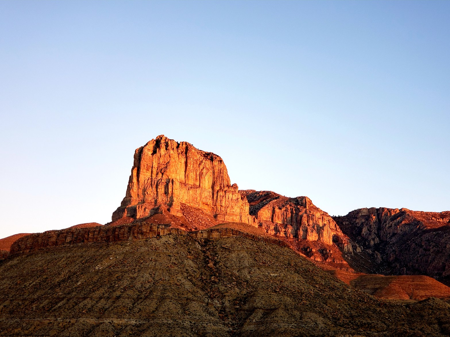
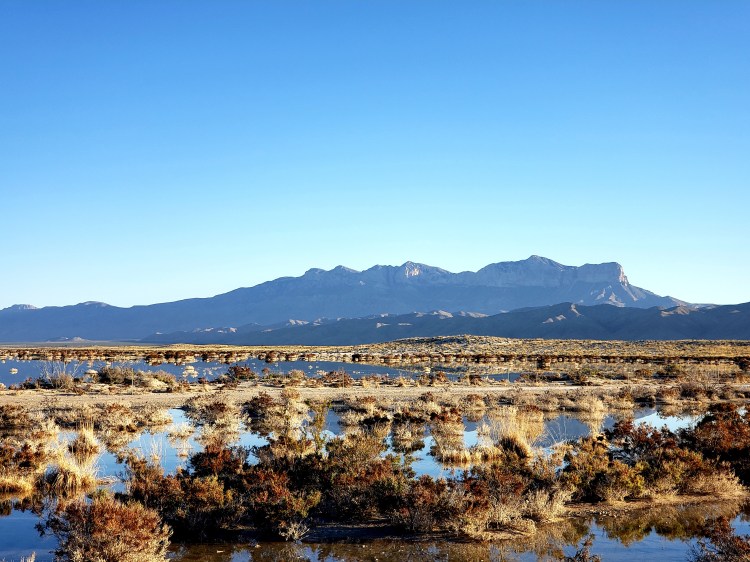
The second national park of my recent El Paso loop was Guadalupe Mountains National Park. Found about 90 minutes east of El Paso, in the middle of nowhere extreme western Texas desert, this park has been a National Park since the early ’70s. This park features the highest points in Texas and also the iconic El Capitan, Texas style. The mountains here are the leftovers of an ancient reef when this entire area was at the bottom of the sea.
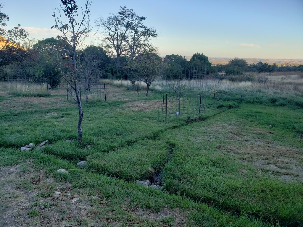
Historically the area that became this park was utilized by the Apaches up until about the US civil war when the area became a part of a mail route and some very small settlements were made. Logistically, this is the most remote park I have visited so far. There are basically no roads running through this park, just the one that runs on the edge of it. There is running water found in the two different visitor centers and one bathroom at a trailhead. There are two campgrounds. The one I stayed in is called Pine Springs, it has space for 20 sites, no fires are allowed, there are no lights, and the shitter is a composter. There are a limited number of RV spots nearby as well. There is one more campsite but it is found on the other side of the park and it is even MORE remote. Cell service is extremely spotty but the main visitor center does have wifi, surprisingly. That is it for any services. The closest gas is about 45 minutes away and the closets store is probably closer to an hour. If you plan on making a trip of this one, you need to bring everything you need with you!
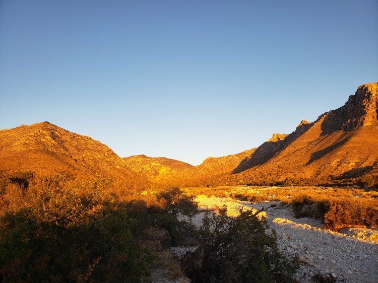
I arrived to the park and my campsite after dark. I had hoped to get there a bit sooner and do some exploring, but it was not to be. In any event, I got myself situated and chilled at my site with some beer and just sat and watched the gorgeous array of unfiltered stars above my head! The campsite is actually not far from the visitor center and is also the near the trailhead for several trails and from that spot you can access every trail in the park, but most people use it to summit Guadalupe Peak or El Capitan. The following morning I did attempt the summit trail. I was fully intent to complete the hike, however, I was on the fence about it until the night before due to some timing considerations. This is an 8.4 mile round tripper with a 3000 some feet elevation gain. Alltrails said the hike should take a little under 6 hours. I was needing to be 6 hours for sure from when I started (a little late admittedly), so I rushed the start. Oops. The first 1 km saw a 1300 feet plus elevation gain. I was blaming myself for lack or prep, but all trails says the same spot is only 500 or so feet of gain, totally inaccurate. Anyway, I gassed myself and it still took me 35 minutes to do that. There was no way I would get up and down in the 6 hours I needed. I turned around and went back down.
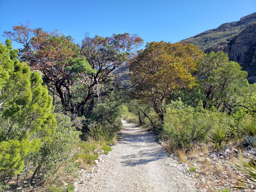
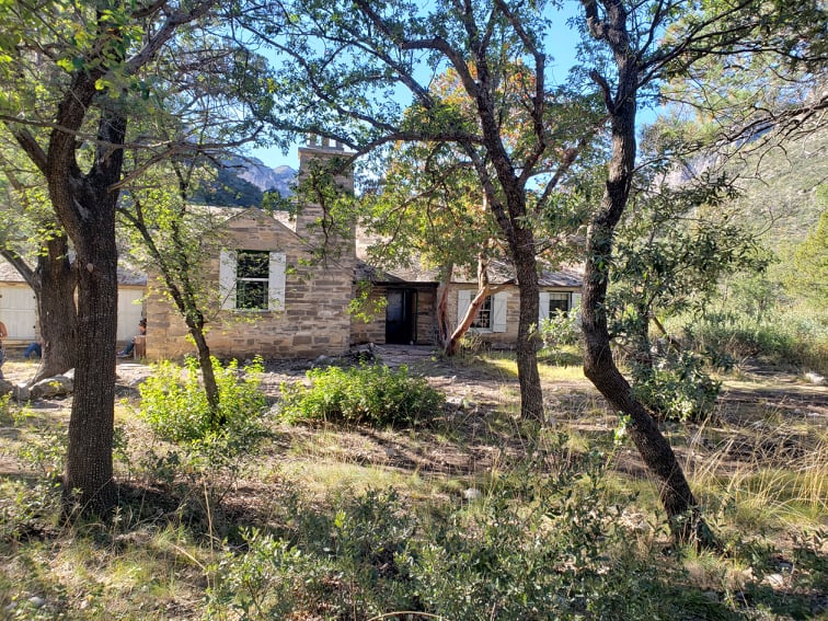
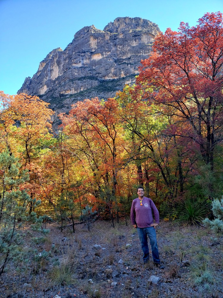
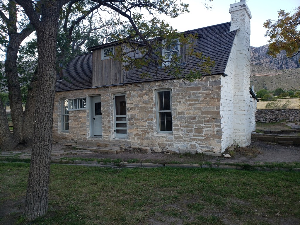
Despite the desert mountain type terrain there is a hidden world in this park. A couple of them actually. I got to experience one of them. The one I did not, is referred to as the “bowl.” If you hike up to the 8000 feet feature you can find a forest that is apparently similar to a Colorado type forest. After changing up my hiking aspirations for the day I did get to enjoy one of the other “hidden worlds” here. I had no idea at the time that my Sunday morning hiking plans actually were not going to work out either. With the change in my hiking plans I was able to make it to a spot called McKittrick Canyon. This other hidden world here is found deep within the canyons of the park. This hike can be as long as you want it to be, with measured lengths to certain spots. I had intended a Sunday morning early hike before getting back to El Paso for a noon check in at the airport thinking what I wanted to see was only a couple miles round trip though it turned out to be a lot longer. Although this trail starts in the desert, the hidden world here is a world devoid of desert once you get into the canyon proper. There are streams and special maple tree forests that were changing colors! I actually did not know about this when I initially booked the trip. Quite by accident I was there during prime time leaf season. Although this year the peak was a little later, I still got to see some gorgeous colored trees! I had thought the colors would be closer to the trailhead which is why I had planned for Sunday morning. However, the rangers there informed me that I was going to have to go at least to the old homestead (right?) tucked away in the canyon. This was 2.6 miles in, so 5.2 round trip. The hike started like everything else, hot, desert-y, and with the sun beating down. I chilled with a tarantula for a bit and made my way through the canyon and experienced the very extreme change in environment. Once I got to this house I found out that apparently at one time the trail I was on, which was very rocky, but mostly flat, was actually the way this guy named Pratt actually DROVE to his house in the early/mid 1900s. There was some foliage color on this stretch but not much. RATS! However, the ranger stationed at the house told me that there was some good color happening toward the next point on the trail, the “Grotto.” This spot was at 3.4 miles. I had time, so I did it! While definitely not peak, there was still some beautiful spots in the section of the canyon! I made it to the Grotto, stopped for a beer and snacks, and then made my way back. The entire trail is flat, so I made really good time. Even with a snack break at the Pratt Lodge, the snack at the Grotto, several picture breaks, and my visit with the tarantula, I made the nearly 7 mile hike in right about 3 hours.

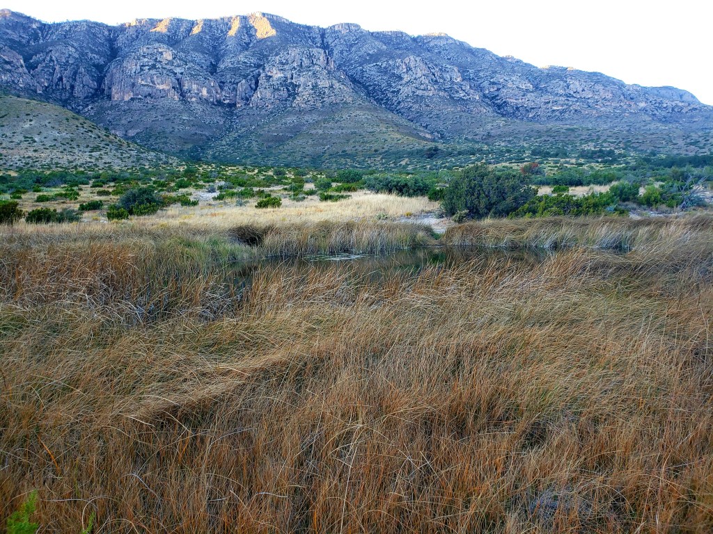
Later in the day I found another hidden part of this world: The springs. Obviously, I knew there were springs. My campground was called Pine Springs. That being said, there was no spring that I could find near my campground. However, there was any area called Frijole Ranch where there was a settlement that included a house, a barn, a spring building, and even a (very) small school! This was the place to be 150 years ago! Again, this was a consequence of the mail route going through here. The families that lived here would actually grow crops using the handful of springs in the are and drive them to markets dozens of miles away! Pretty neat! I saw a couple of these springs along the Smith Spring Trail, and they really aren’t impressive compared to the massive springs we have in here in Florida; however, out in the middle of the desert they were essential to early settlers’ lives!

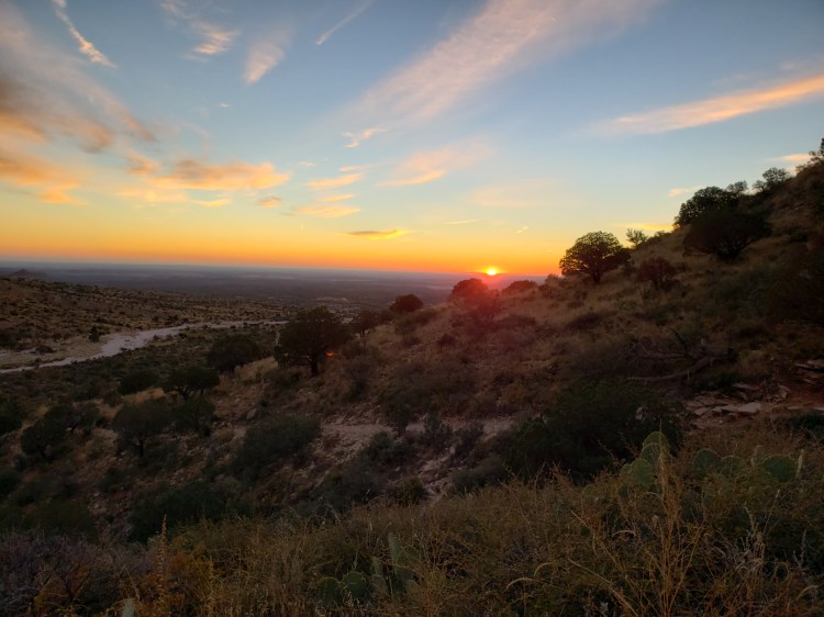
Bookending this evening and the next morning, I found a spot to catch the sun setting on El Capitan, and also the same spot for a sunrise…I guess the orientation of the mountain and the time of year made it a good spot for both times of day. It is definitely a super neat icon in the desert here! Before I departed the following morning I explored some ruins of the old mail stop facility, and headed back to El Paso. Along the way I found a cool spot, these salt flats in the approach to the mountains. Water is standing in the middle of the desert here, for some reason! Beautiful spot to view the landscape! And then I went WAY out through a sand road for about 10 miles and came up to another spot that gave a great view of the mountains rising out of the sand. This was not worth drive time to be honest! I think it took nearly an hour off the road to get to this point and then the parking spot was a mile or so from the actual dunes out there…I was on a time crunch, so I couldn’t go any further. On a plus, I got to chase cows out of the road, which I haven’t done in years and years :). And that was a wrap on this trip!


Overall impressions: Pros: Beautiful night sky. Really quite stunning. If I lived in El Paso I would be out here every moonless night! Great hiking opportunities with great variety in topography. I personally find the history of the area to be interesting as well! Cons: The only cons I can think of is the park is not very accessible other than by hiking, but that’s ok to me. My biggest gripe would be the fact that there is a smallish visitor center that is loaded with souvenirs, but not much for anything else. Really, everything must come with you!
The Adventurer Final Word:
4.5 Stars! Really awesome spot. Great for hiking and stargazing. If I am ever back in the area I would definitely stop back and do at least one other hike!

I can say I’ve been here, but it was really only to that visitor’s center you mentioned! I started collecting the parks coins a few years back, and I need to get my coin and check this one off the list! …but we were on our way over to Carlsbad Caverns, so we did have an awesome adventure 😊 Clearly there was a TON we missed at this park. However, although we are adventurers, I’m thinking this may be a bit more that we’d commit to. Beautiful photos!! Now I know what we missed!
LikeLike