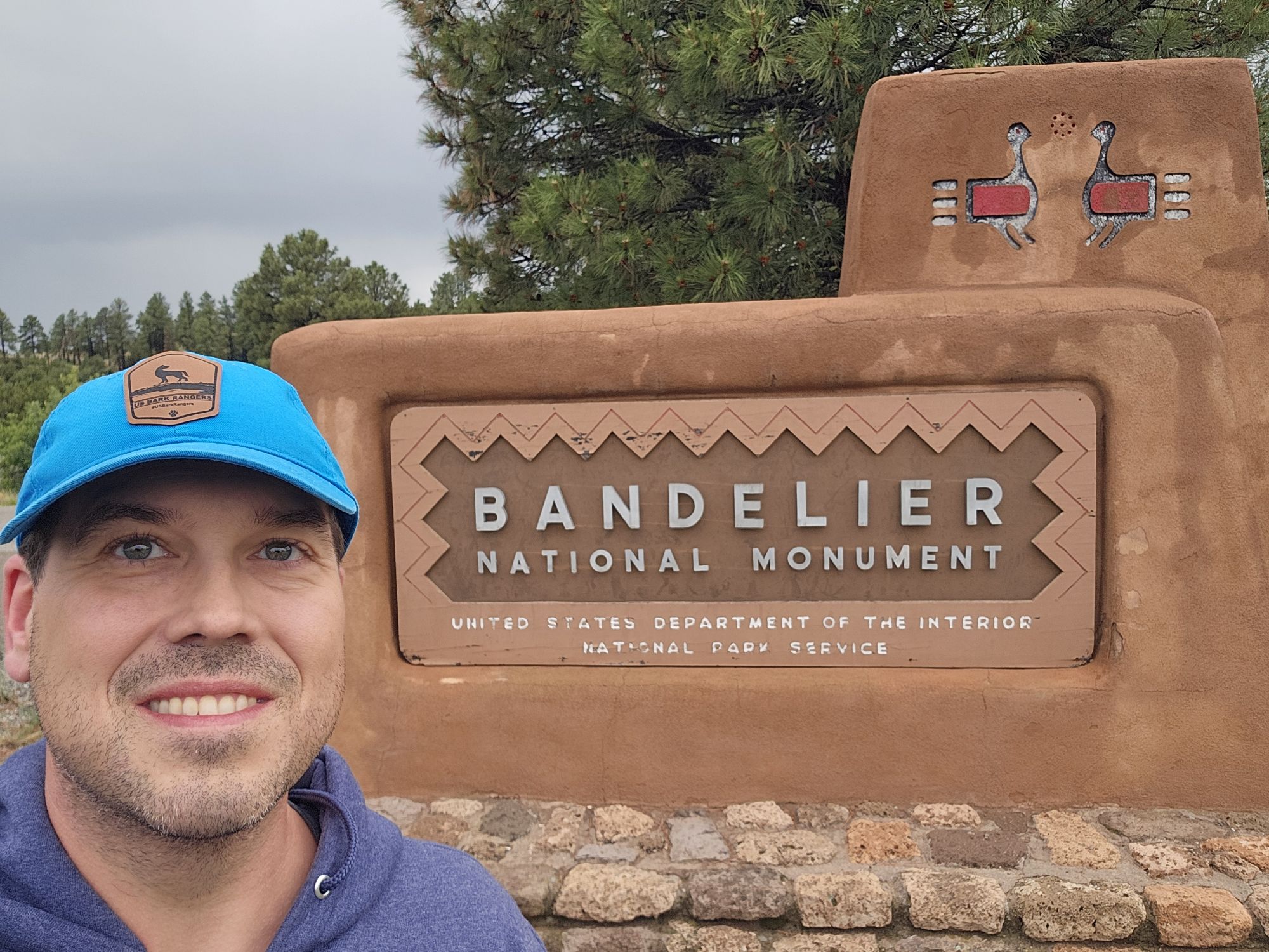
Hey there Adventurers! Continuing my New Mexico/Colorado June 2025 exploration, I found myself at Bandelier National Monument in the higher elevations of north central New Mexico. I stopped in before the visitor center closed to get stamps and souvenirs, but it was raining and would be for a bit, so I made the decision to drive about an hour up the road to Valles Caldera National Preserve for a very brief and incomplete visit. I doubt I will ever come back, so it’s getting included here!
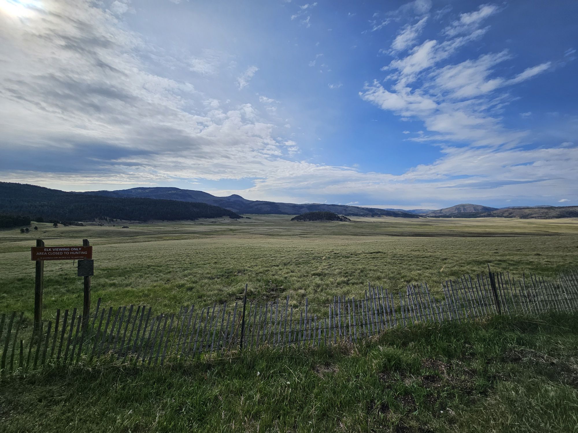
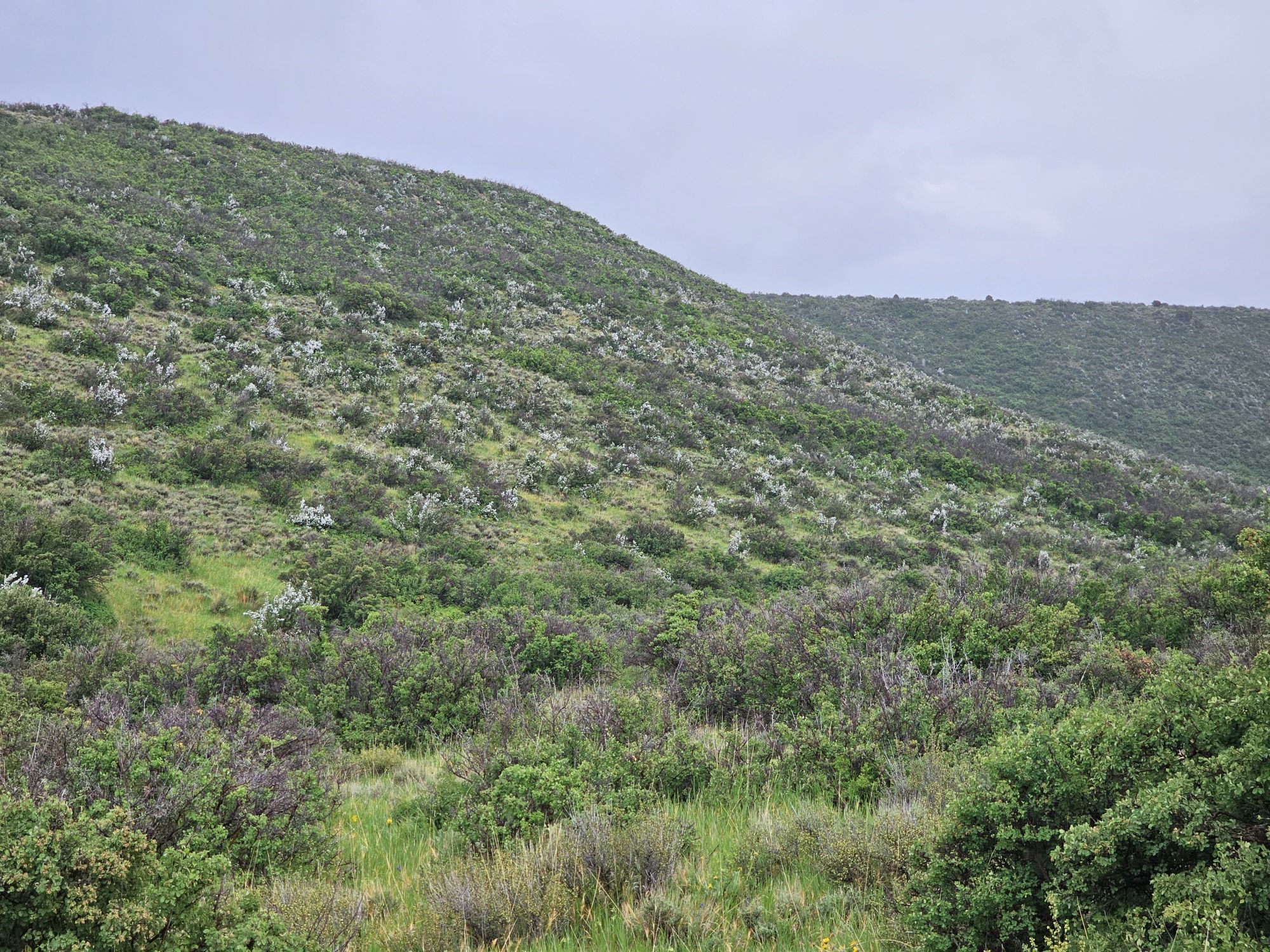
To start with, I want to throw a shout out to the state of New Mexico! Yes there is a lot of desert, but it is a really neat state with a TON of stuff to do and explore! And it isn’t all desert! Valles Caldera National Preserve is a really cool looking spot that definitely does not look like what you think New Mexico looks like! I did not make any type of real visit, the park closes with a gate and I was getting there right about at closing time so I just basically stopped at the entrance and explored the area there from the road. The caldera itself is about 14 miles wide and was the site of a huge eruption about 1.2 million years ago. It is large enough that you really lose the scale of what you are looking at! The area is geologically active, but now is mostly used for recreation. There is a large grassland in the middle of the caldera along with several lava domes, some of which are visible from the road.
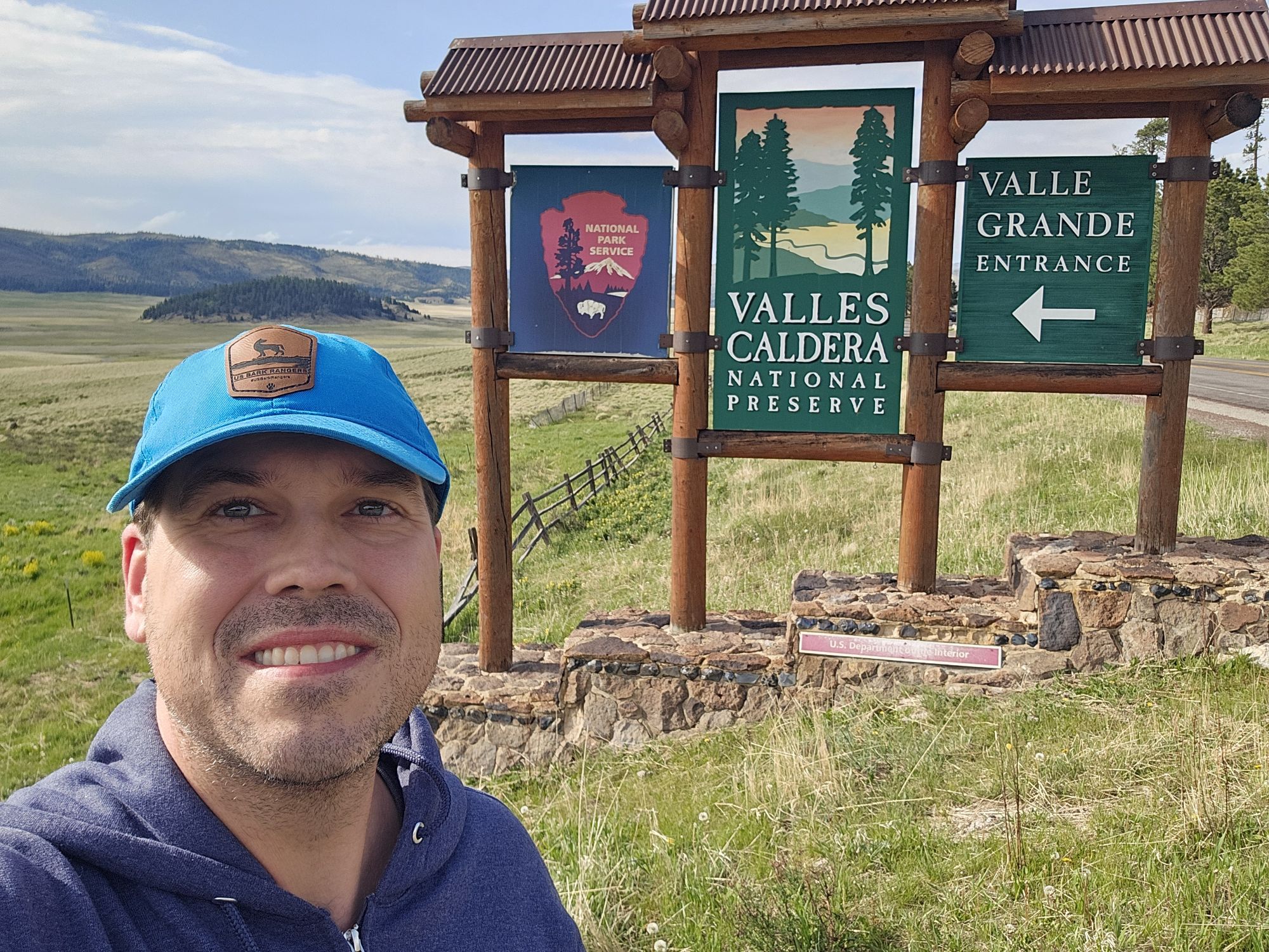
Got the sign pic!
This is a large caldera! This is definitely not the usual image that comes to mind when thinking of New Mexico! That little bump in the middle of the picture is a lava dome.
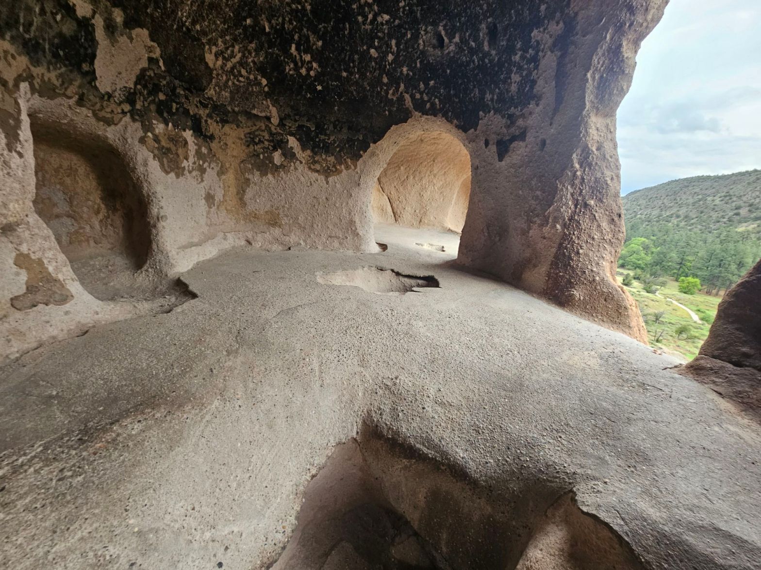
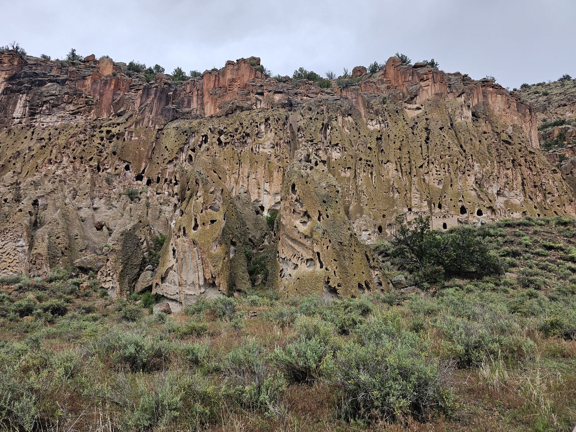
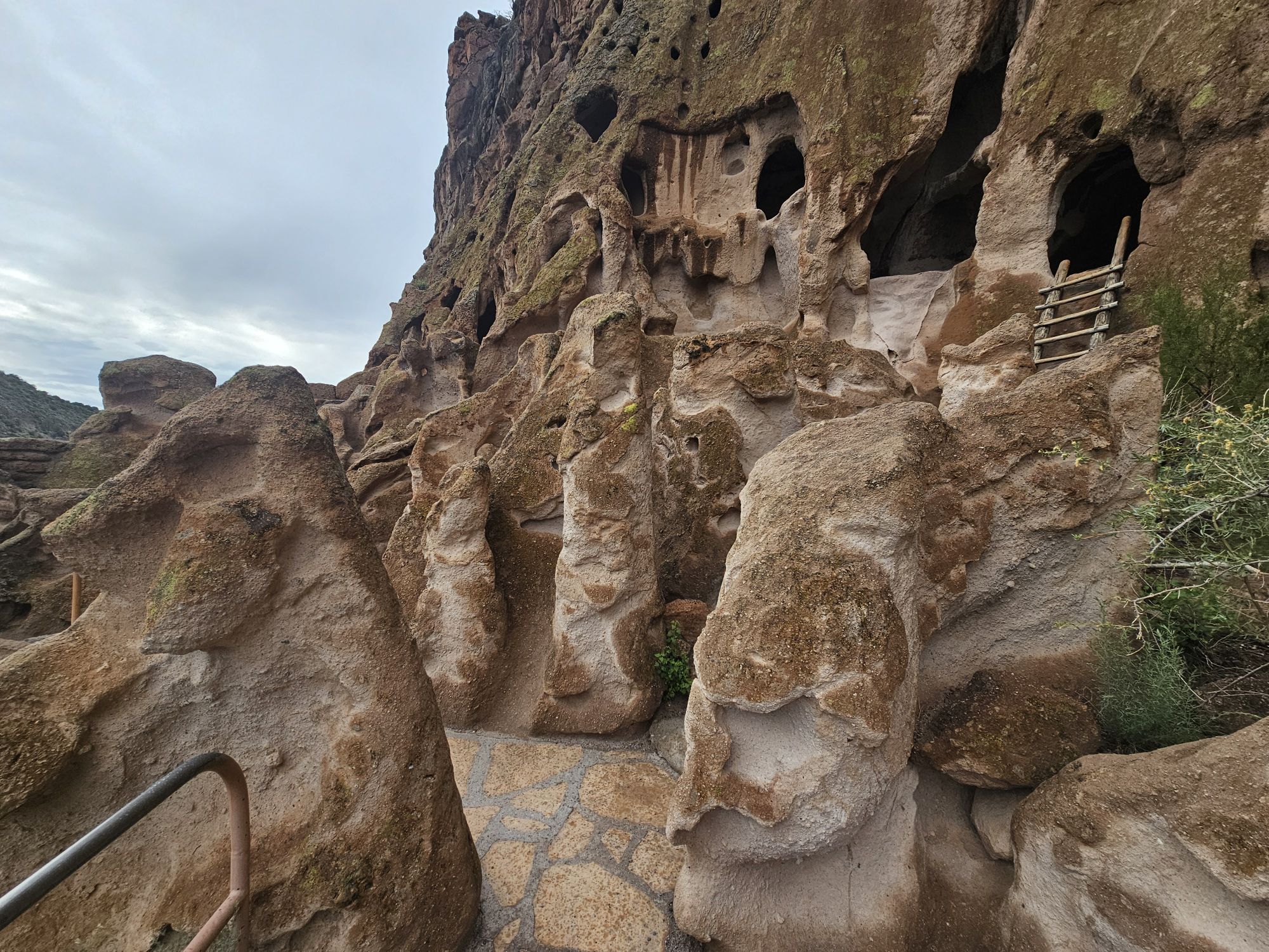
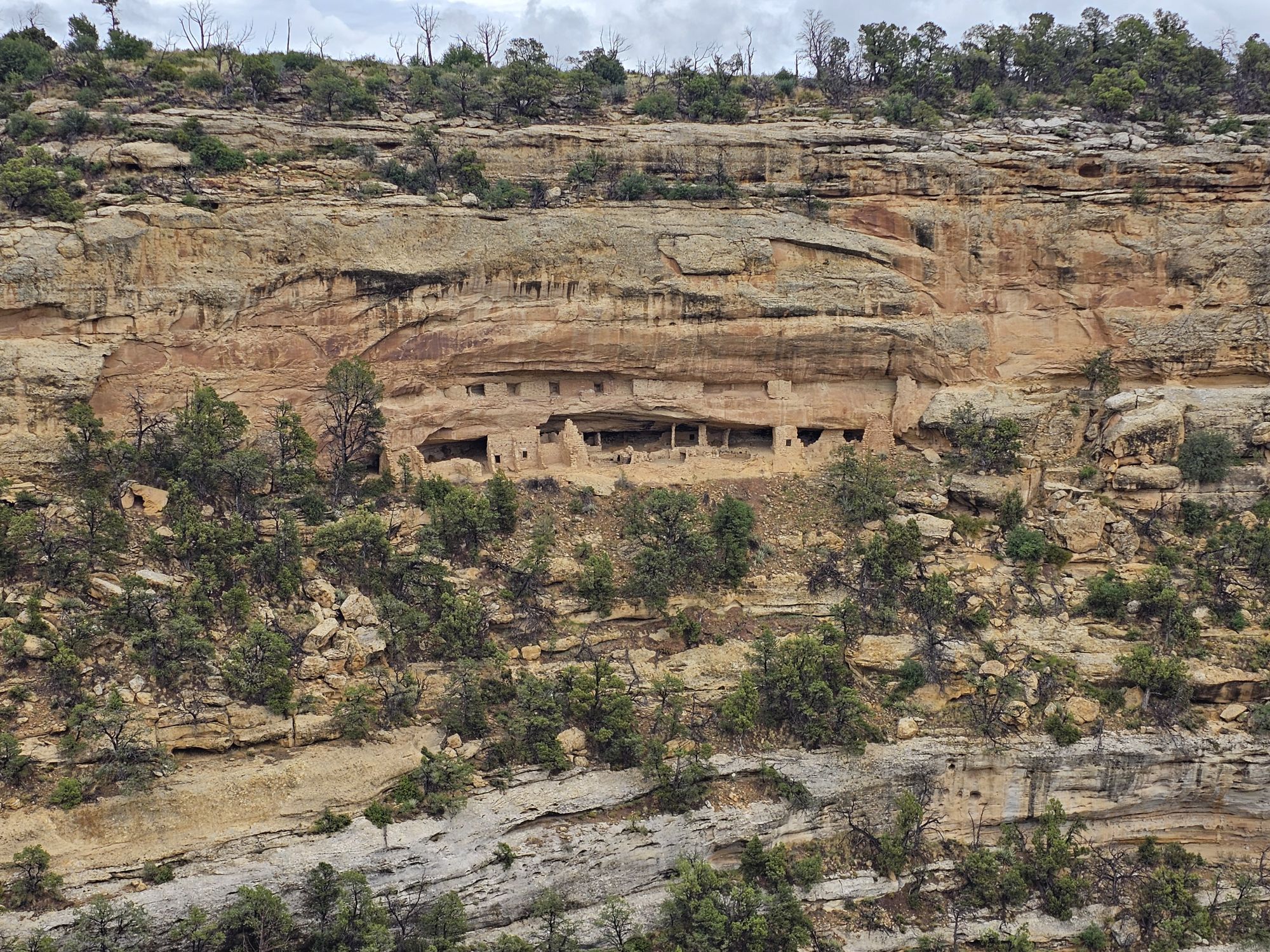
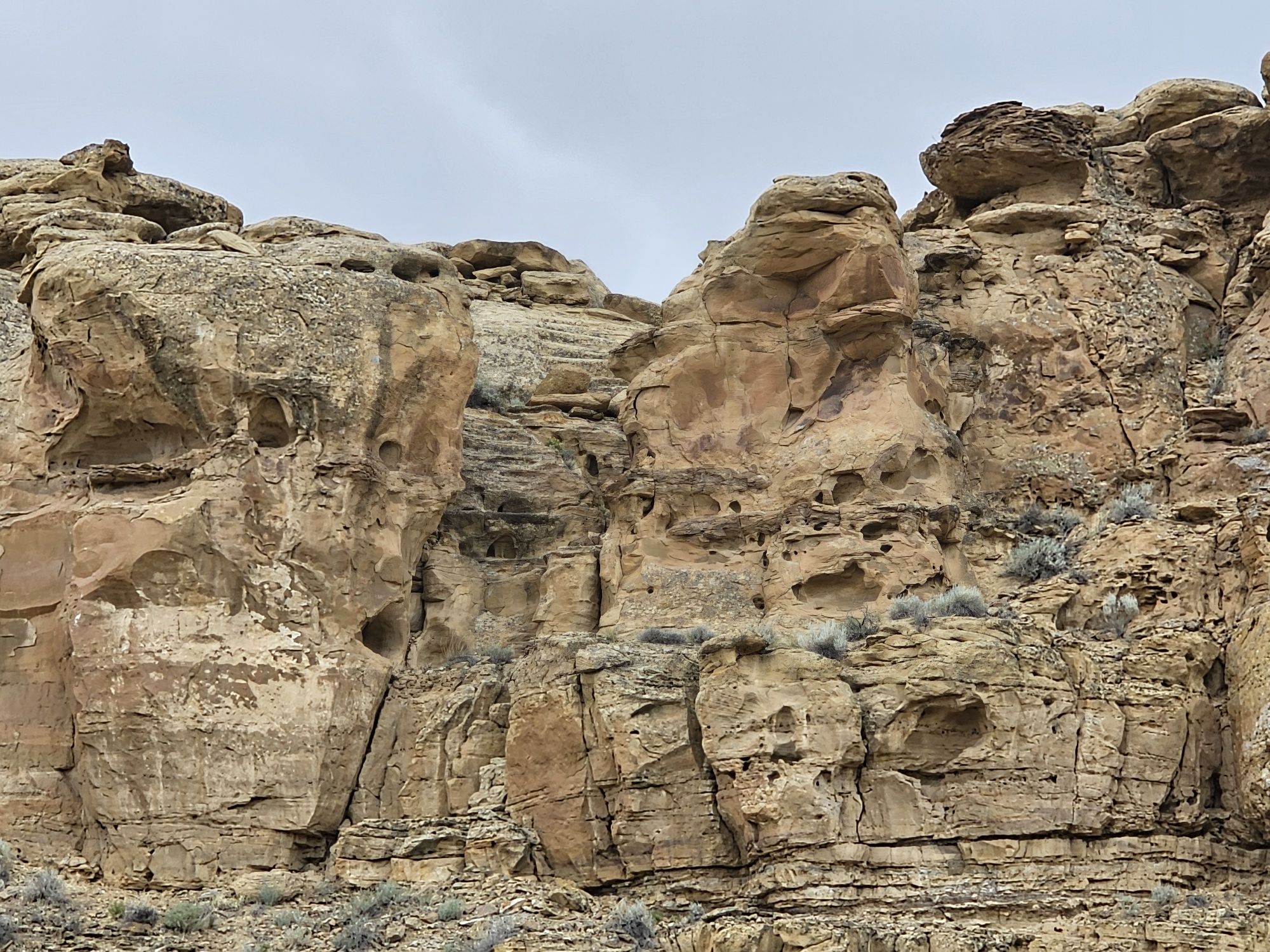
Soon enough, I figured it was time to head back down to Bandelier. This is a really neat park! The main feature that brings people here are the homes that the ancient Puebloans built into the volcanic rock of the canyon here, called cavates. Compared to the dwellings I visited in other sites on this trip, these are unique. The cliff face looks like a honeycomb of sorts with numerous holes in the cliff face, and many were dwellings of some type once upon a time long ago! Land note: this area is home to sacred lands of at least 23 different tribes.
I really like this style of sign! Matches the area quite nicely!
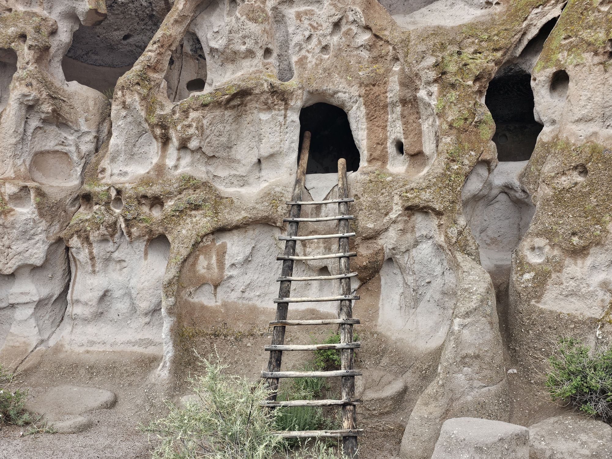
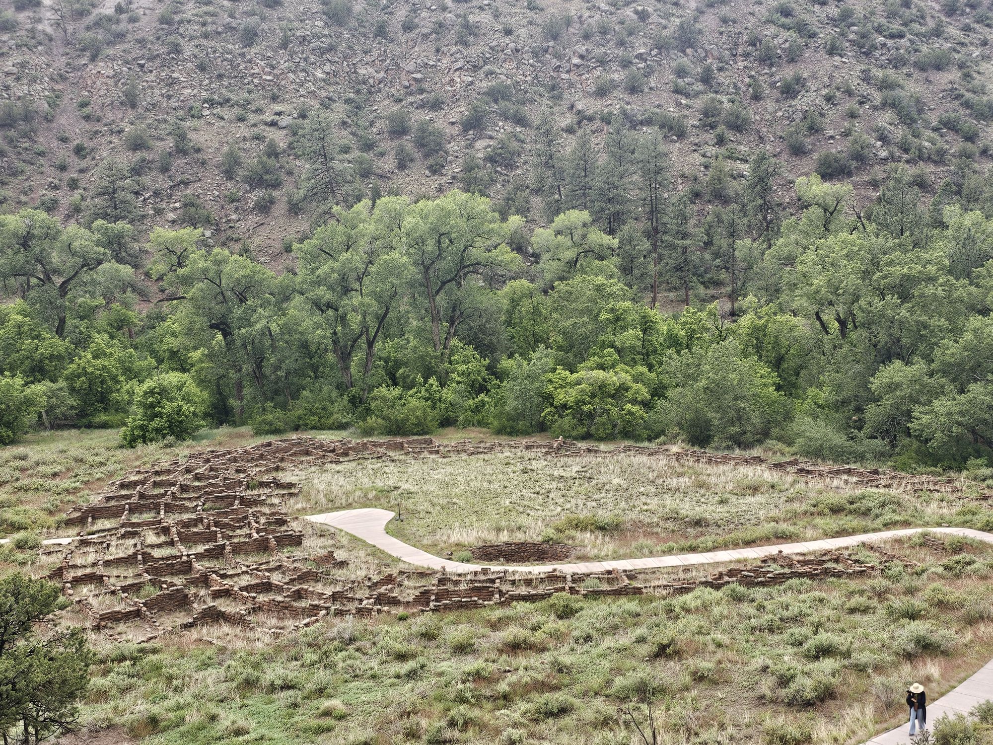
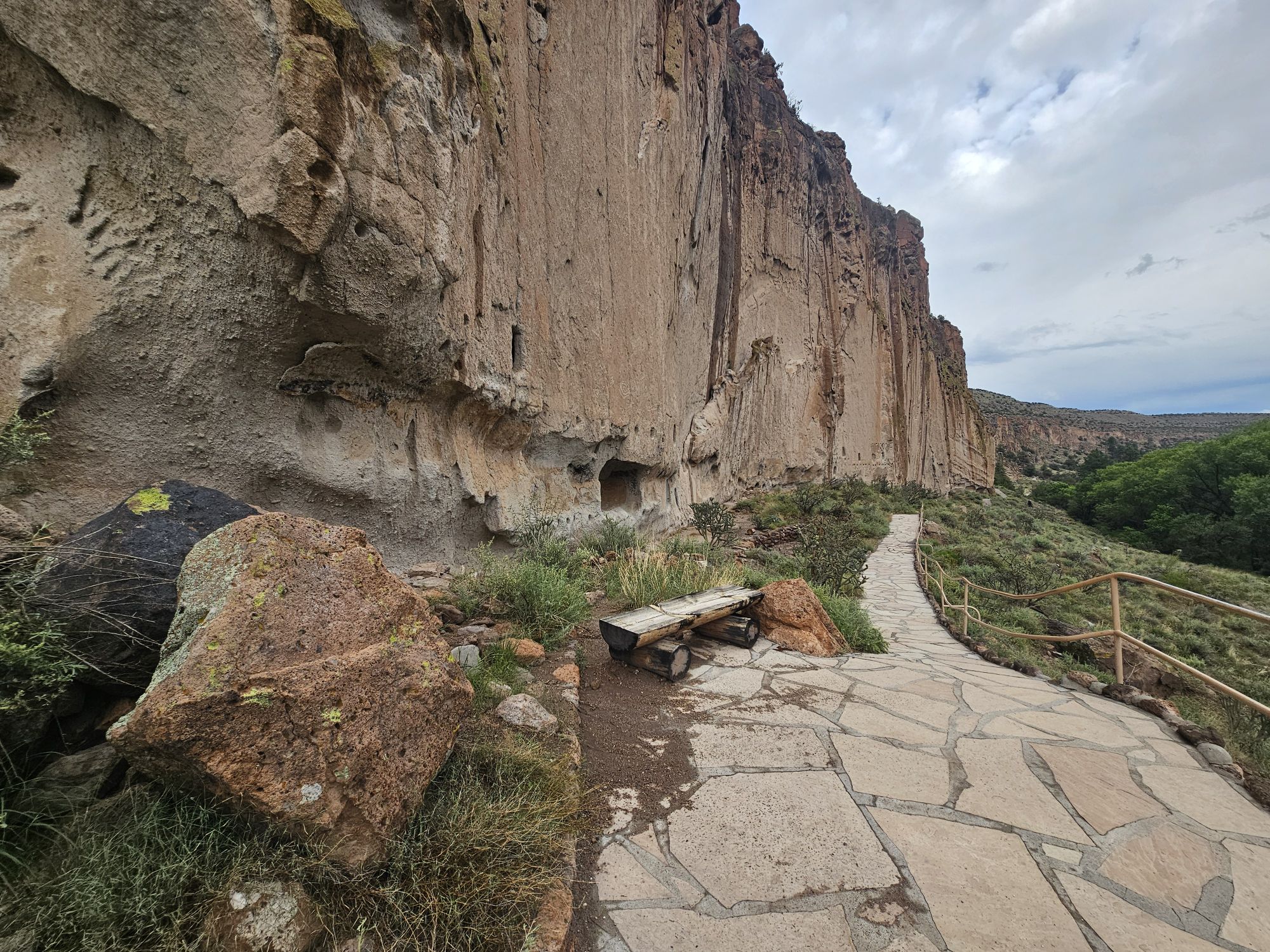
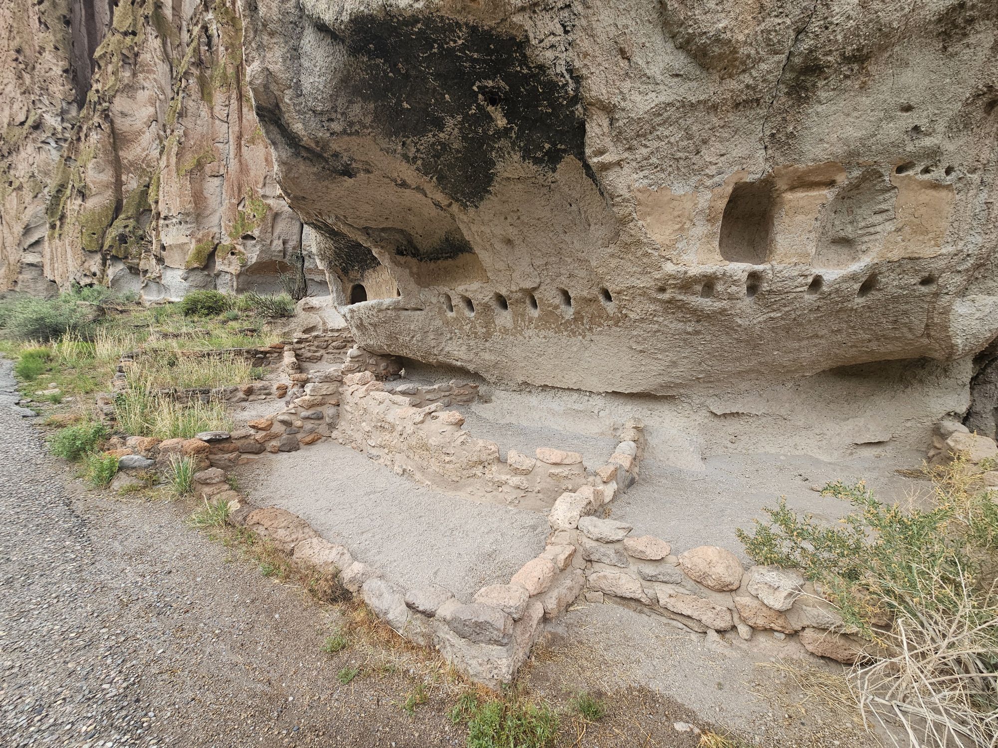
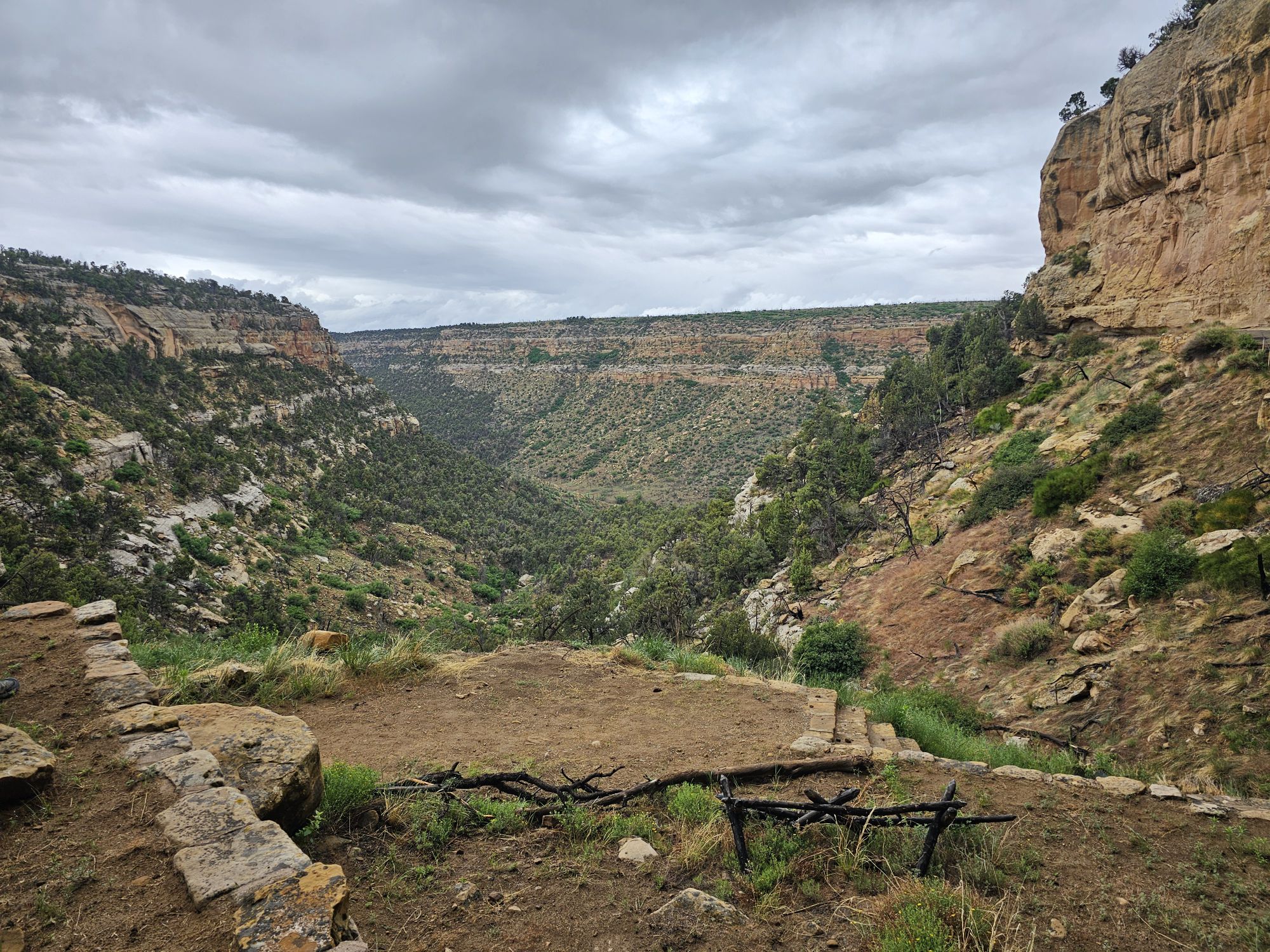
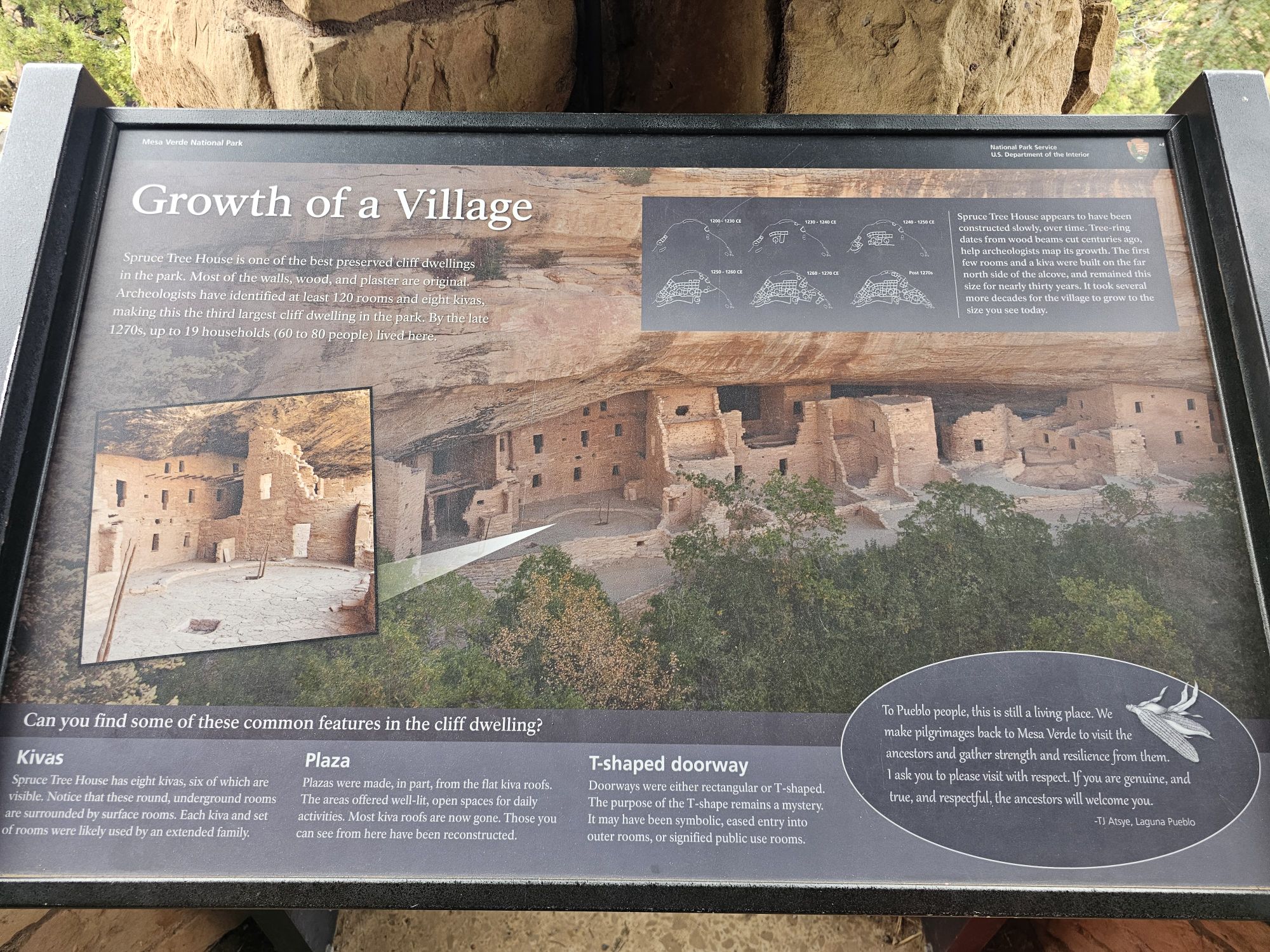
Upon leaving the visitor center you can take the Pueblo Loop Trail which will take you into Frijoles Canyon, alongside and into the areas you want to see. The trail is about 1.5 miles and is mostly flat. You first pass the great kiva. Then you continue through ruins of Tyuonyi, and up to the cavates at the the base of the cliff. You can climb up into the cavates where the NPS has provided ladders, which provides the neat opportunity to get into them! I didn’t know at the time they were called cavates, and the NPS says that they are actually carved. I am not usually one to dispute scientists, but most of those holes looked just as natural as the natural holes in the cliff, unless the people carved every single hole in that wall! The place looks like a spot that we all would have had a blast as a child!
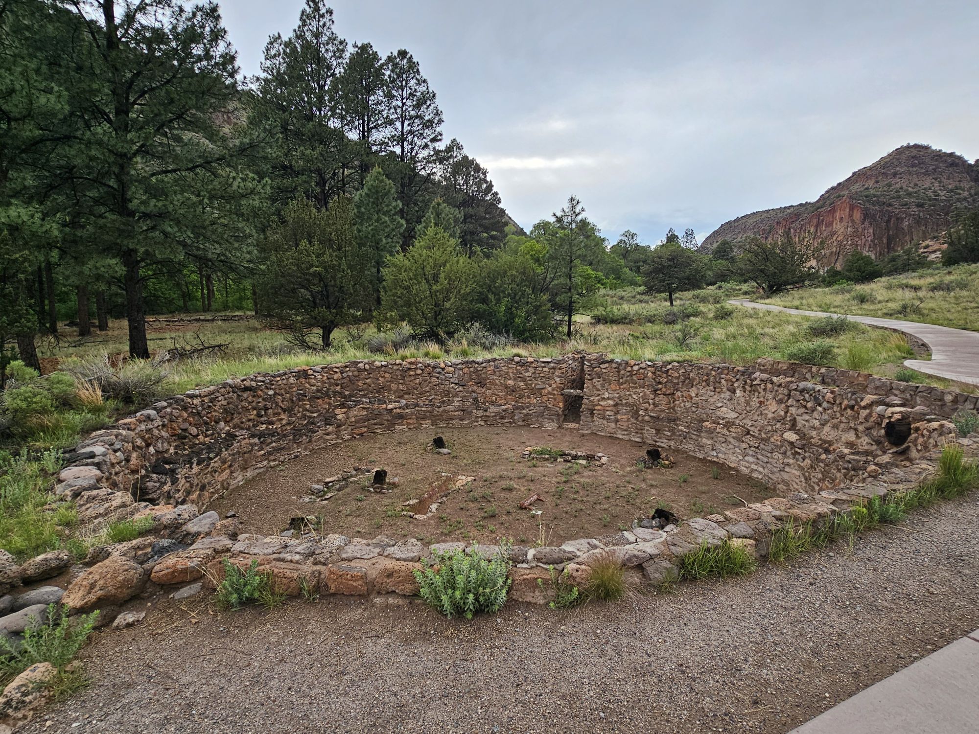
This is the great kiva, the first site you come across on the trail. Taken by me.
If you look closely at the middle right of this picture you will find the talus house. The trail winds up to that spot to get into the cavates area which is more or less behind the set of triangular rocks in the middle. If this were a 3D picture it would be easy to visualize. As it is, those rocks blend in with the cliff behind, really hiding the cavates. Taken by me.
I took this ladder to get into this cavate. Taken by me.
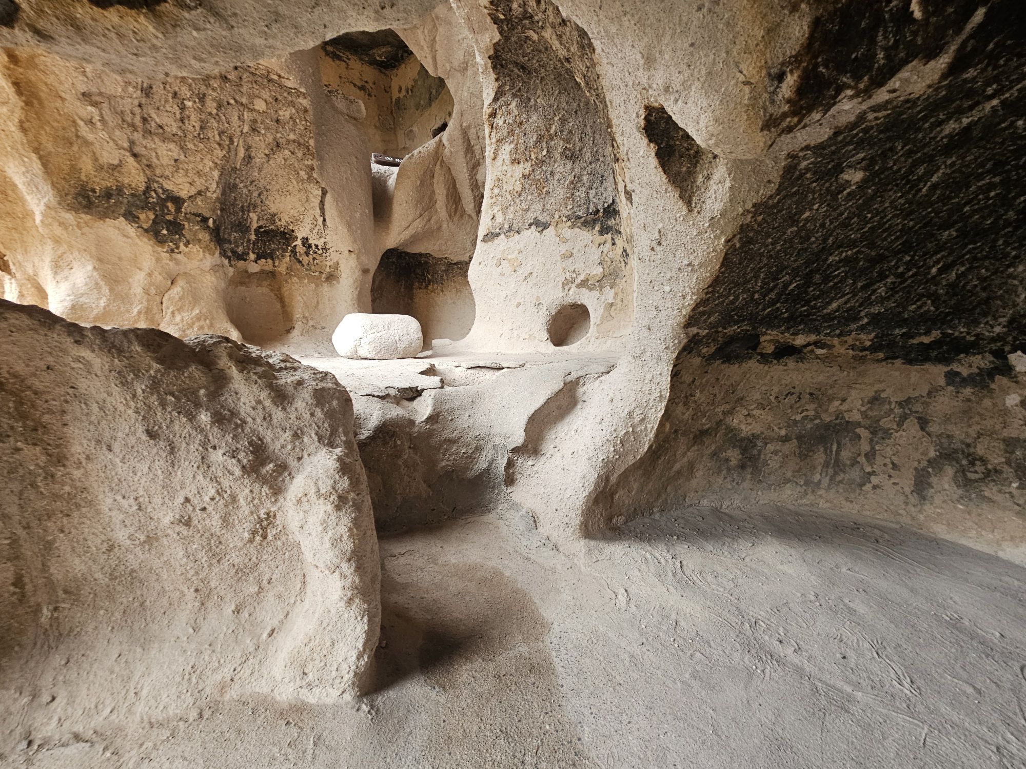
Inside a cavate. Tall people take notice! Taken by me.
This one did have quite a bit of real estate despite the short ceiling! Taken by me.
This just shows a bit of the cavates area. That ladder is not the same one as the other picture. Taken be me.
The trail ascends up a bit to those cliffs and from up there you get a great view of the canyon floor and also of the large D shaped Chacoan ruins of Tyuonyi, pronounced qu-weh-nee, and an excavated kiva. My well trained eyes also scoped out a non excavated kiva. I am an expert now, after all!
Tyuonyi from the cavates area. An excavated kiva is visible next to the pathway in the middle. The unexcavated one is not exactly hard to spot, and in fact, there is ANOTHER one next to it, so 3 in a row right there. Taken by me.
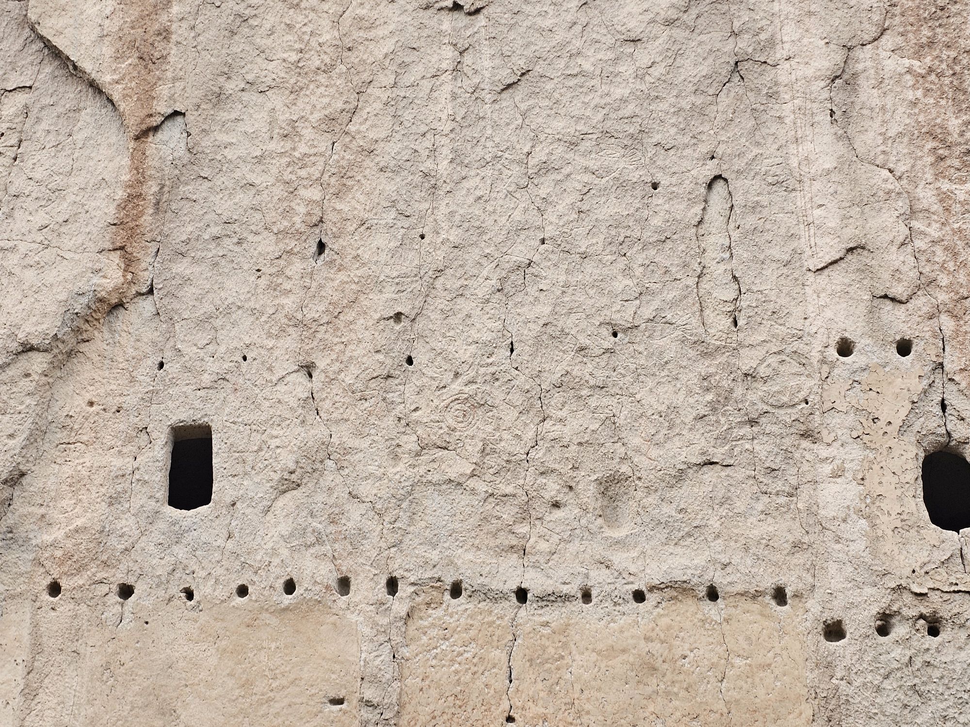
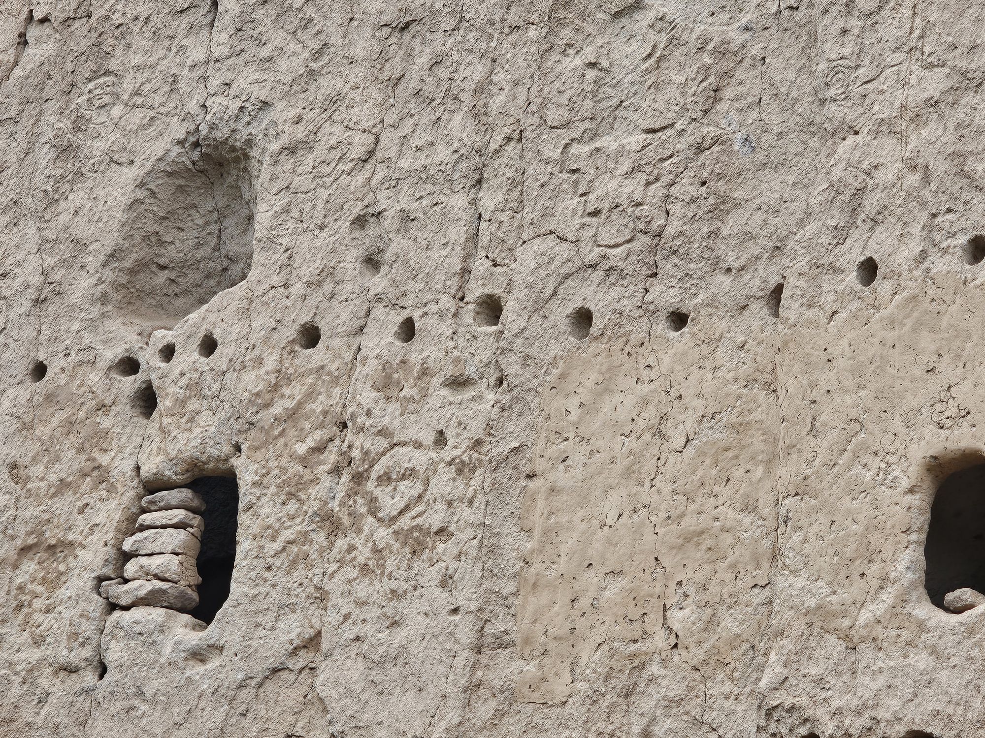
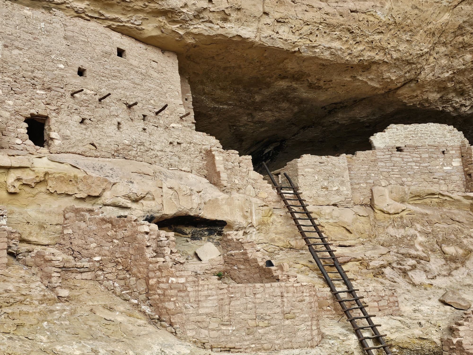
After leaving the cavates area, you proceed up the trail and come alongside the ruins of the Long House…and oh boy it is long! It’s about 100 yards in length, along the base of the cliff. When the site was intact it would have stood 3 or 4 stories tall as indicated by the holes in the cliff that held the wood beams of the roofs. The house would have been narrow it seems, as the strip of land between paved trail and cliff was maybe 30-40 feet at most. In addition to the stone ruins, there is a large amount of wall art and petroglyphs throughout the site. Many of the cavates still contain the soot left over from ancient fires. I am including 2 videos, each about 6 to 7 minutes long. If you can tolerate my poor narration skills, it might be worth a watch! If not, I am providing some pictures!
This was the far end of the Long House site. You can see all the notches in the cliffs where the structure used to be attached. Taken by me.
Another section of the Long House. Taken by me.
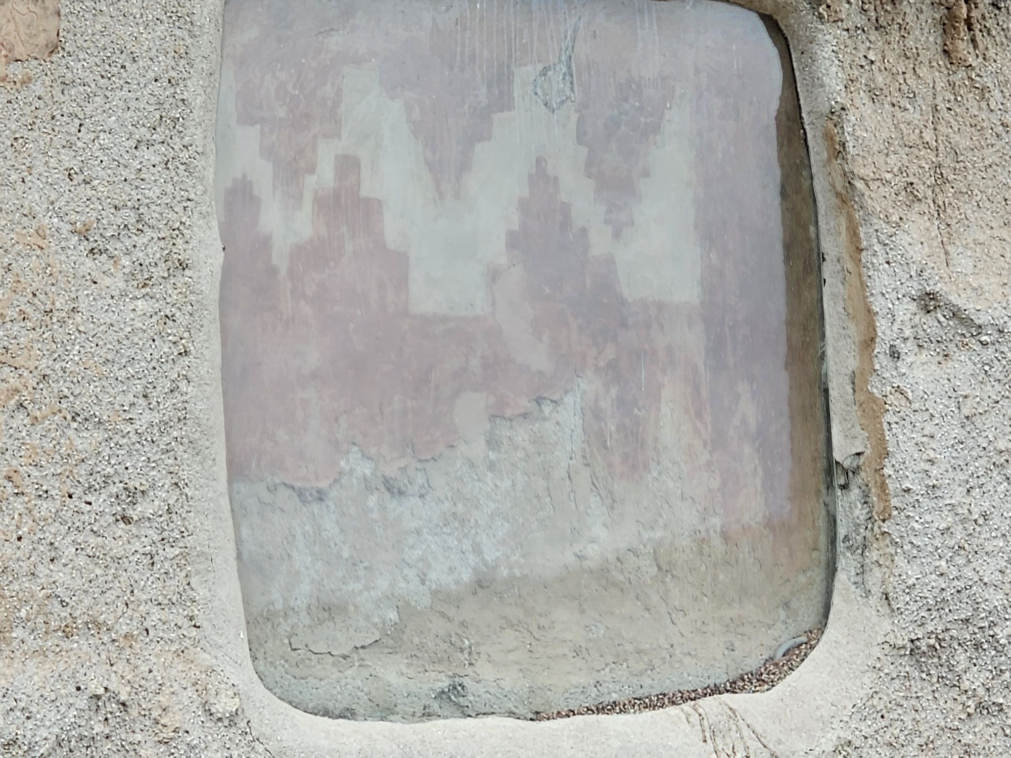
A protected image in the Long House. This was the only thing I saw physically protected in Bandelier. Taken by me.
There are several petroglyphs in this picture. Middle right, dead center of the picture, and a few of them above and to the left of the middle one. Taken by me.
There’s an alien petroglyph here in the middle. Seriously. Taken by me.
There are many more trails in the park. Notably, there is a really cool looking area called the alcove house, which requires ascending several tall ladders to reach, but it was closed when I visited. So this was it for me as it was getting late in the day and I still had to return to Albuquerque for the following days adventures! Bandelier is definitely worth your time if you are in the Santa Fe/Albuquerque area!
Hey Adventurers, I just wanted to plug, for any interested parties, that our 50k plus Facebook group #USBarkRangers is having a limited time apparel store sale open through May 17! Go here to check it out! We have shirts, hoodies, and several different kinds of hats for sale! Check it out!
If you are interested in Tags, Stickers, Magnets, Bandanas, please check out our Ebay store!
And of course, be sure to follow us on FB and we also have a growing presence on Instagram and baby YouTube and TikTok accounts! Would love to have you all follow to keep up today one all the great Bark Ranger Happenings around the country!
Hey there Adventurers! Thanks for joining me on my trip through Mesa Verde, Colorado, and the New Mexico National Park Units! After departing Aztec Ruins National Monument, my next stop was Pecos National Historic Site. This site was out of my way, but it once had a Bark Ranger Program and I wanted to stop in to introduce myself and pass out some #USBarkRangers cards in case they decide to restart again. On that note, the site is very dog friendly, minus the usual visitor center restrictions and the R of respect the wildlife (snakes…I saw none!)
Pecos is a small site but has significant historical and cultural importance. The main part of the site actually protects two distinctly different people tied together by history. There is also a Civil War Battlefield (I learned that day that New Mexico was indeed involved in the civil war) and a protected farm. I did not visit those, only focusing on the main part of the site.
The required sign pic!
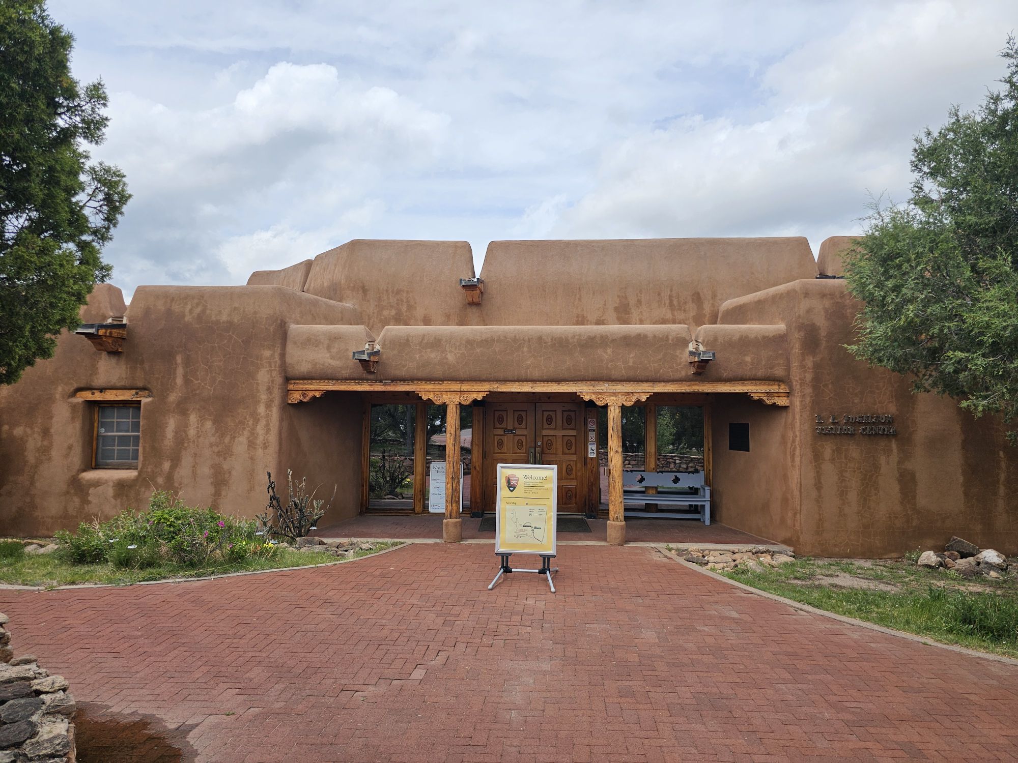
The park’s visitor center.
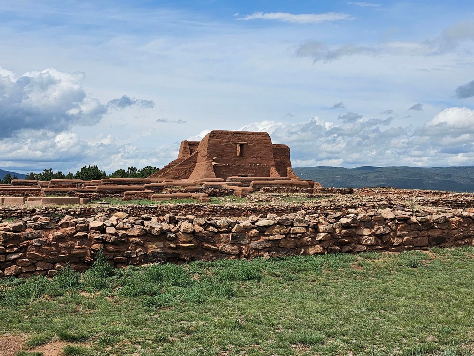
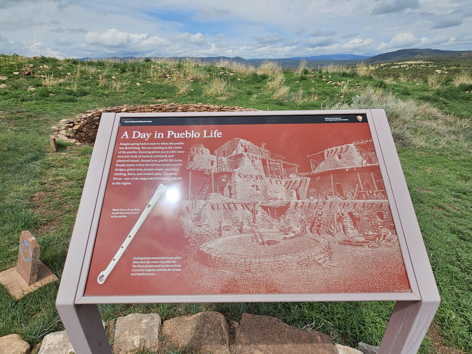
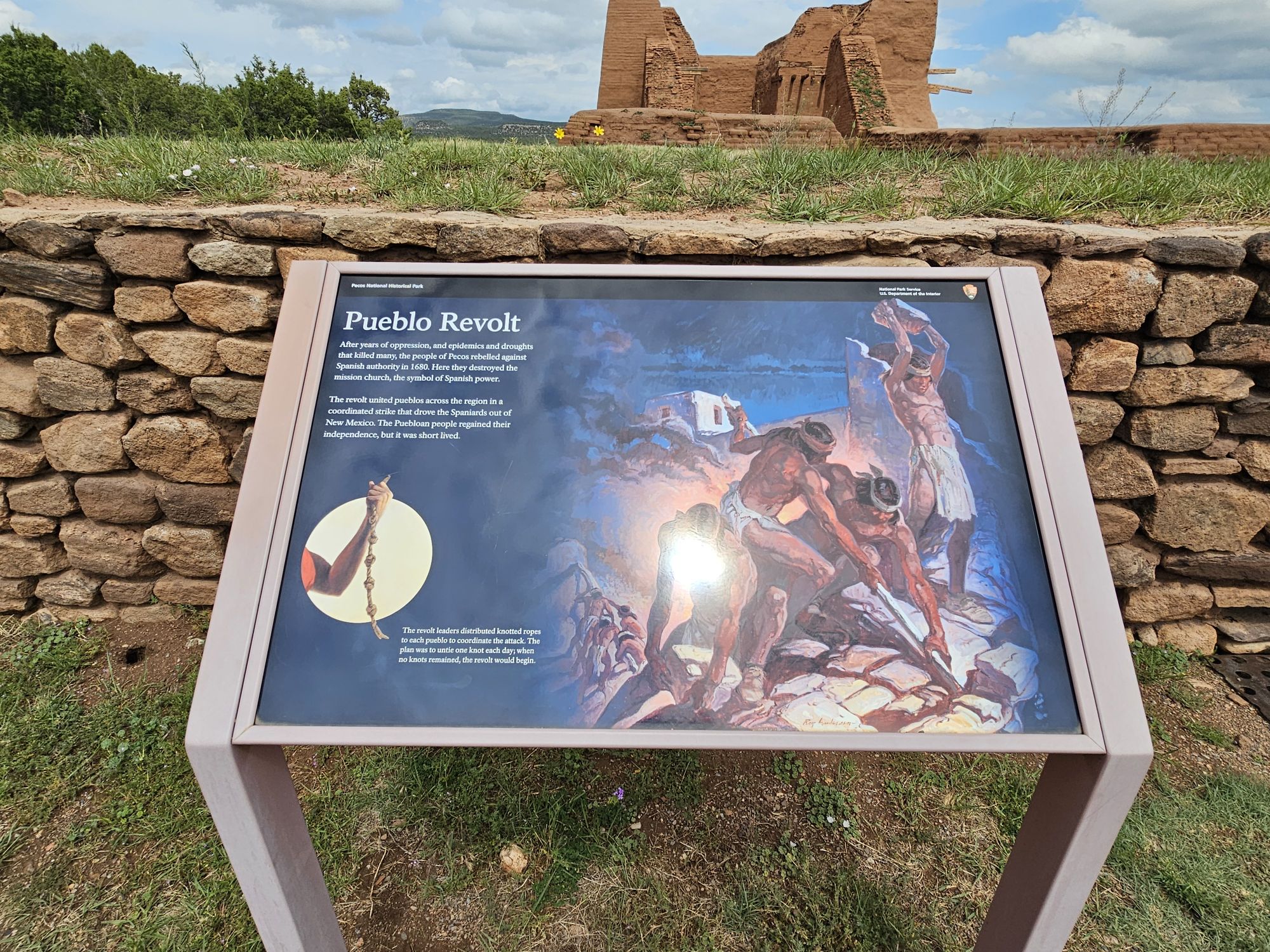
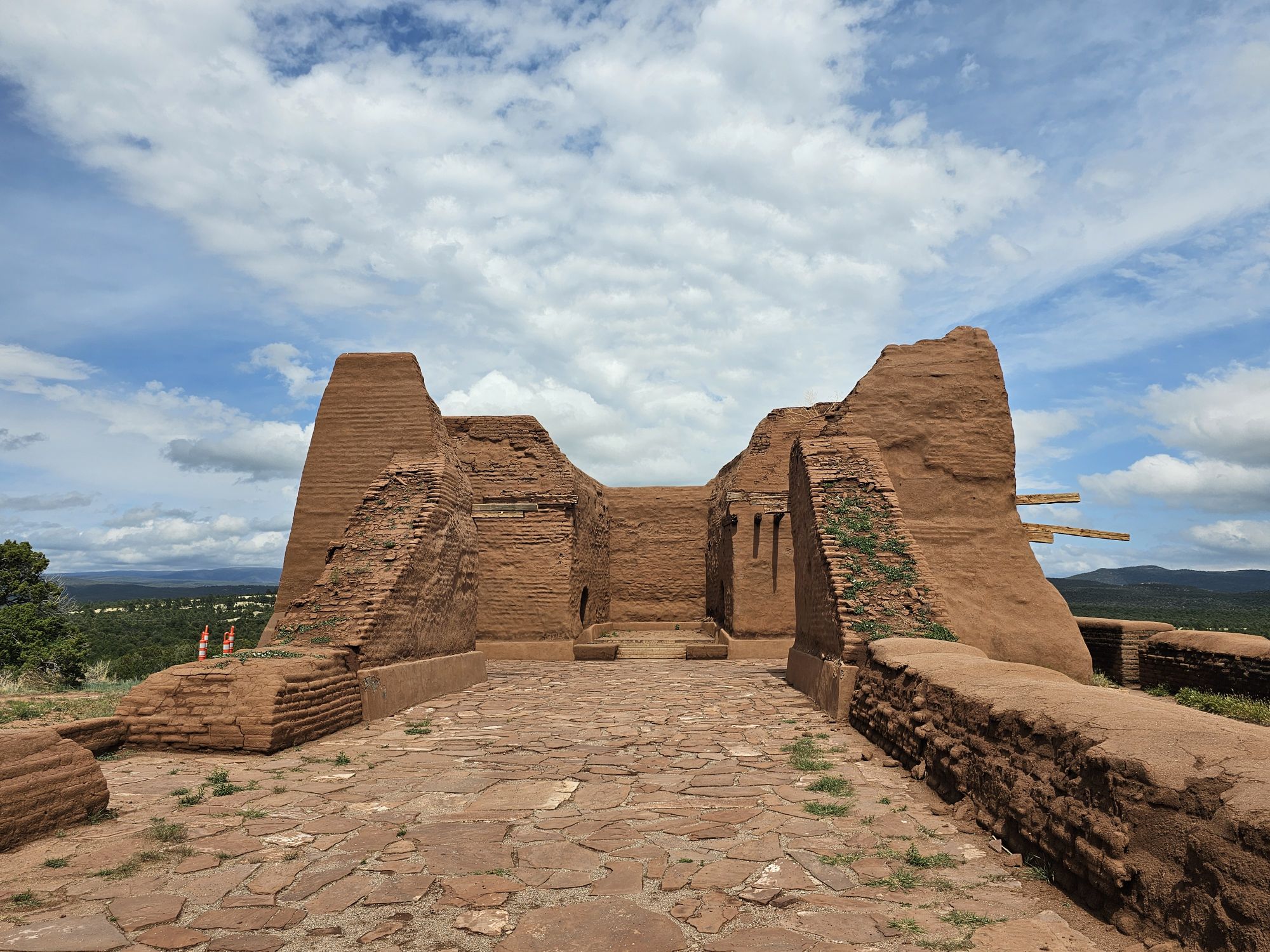
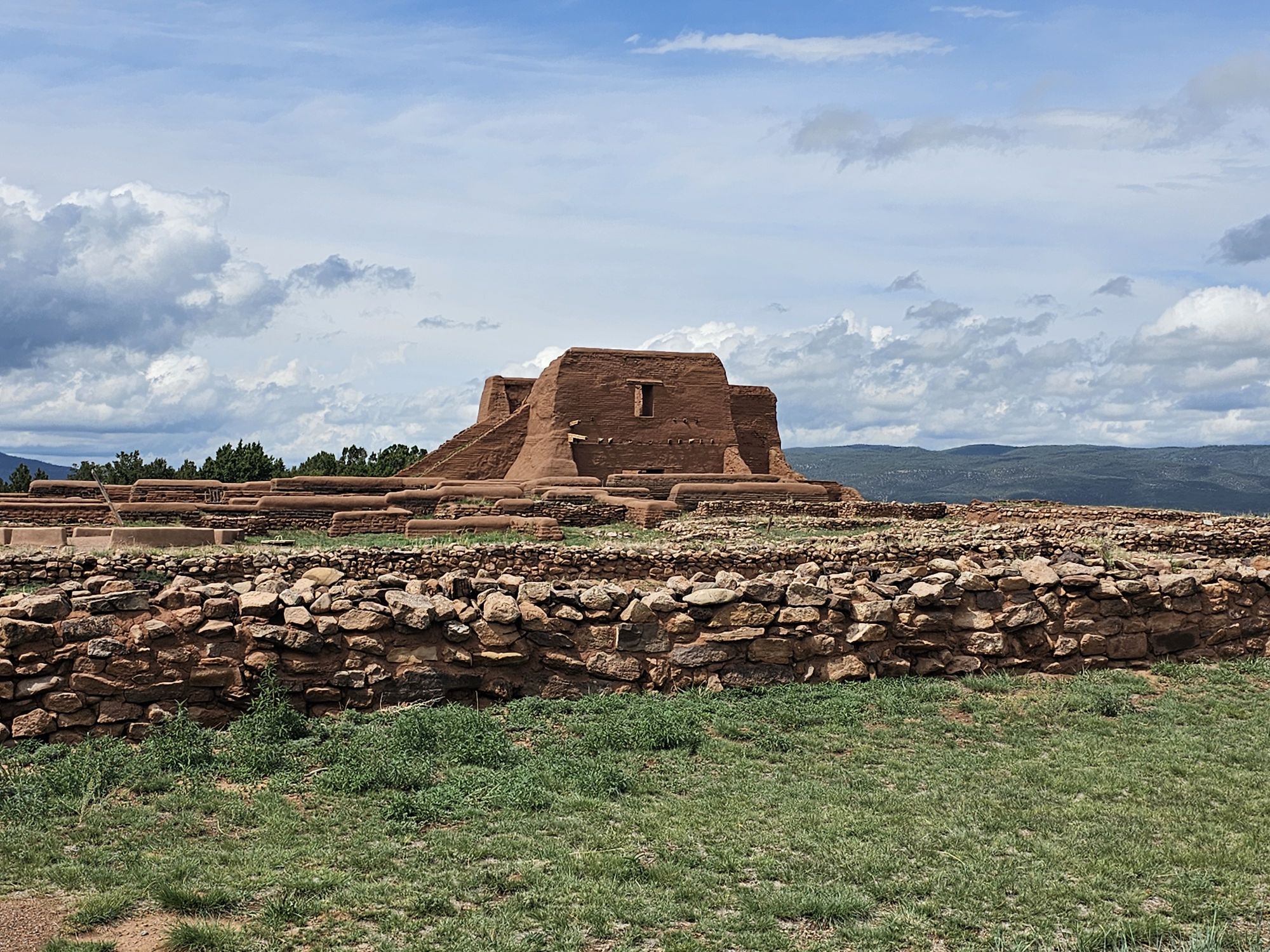
The original people in this area arrived around 1,000 years ago. They were called the P’aékish which became Pecos. As the years progressed the pueblo here grew to become a regional power, and by the time the good ole Spanish arrived in the 1500s, there were 2000 Pecos people living here. The Spanish did Spanish things: built a mission, did the whole conversions and colonialism thing, did that all over the area, and soon after came the Pueblo Revolt in 1680. In that revolt the Puebloans kicked out the Spanish and destroyed the large mission, but this was a short lived respite. The Spanish returned about a dozen years later. Interestingly, the pueblo people in the region seemed to embrace this return, and maintained friendly relations with the Spanish. By 1720 there was a new, but smaller, church built atop the old church’s foundations. This newer mission is the one that remains in a ruined state at the Pecos site, with its walls standing on top of the older church’s foundation.
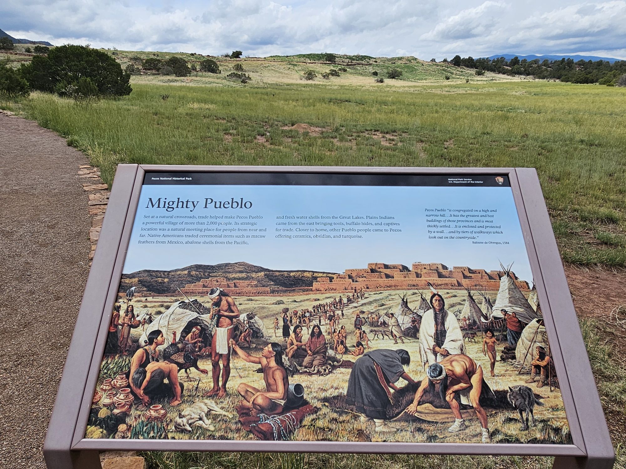
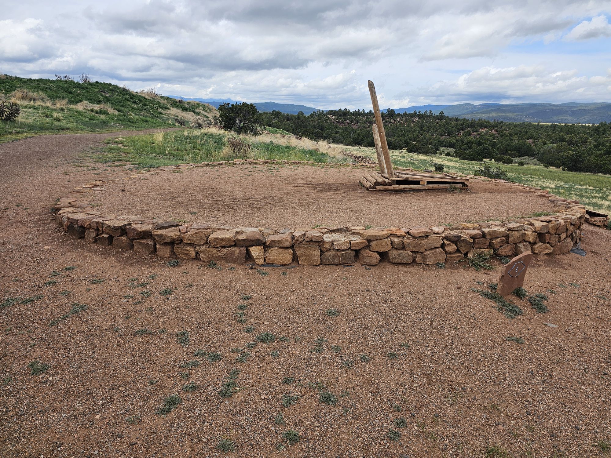
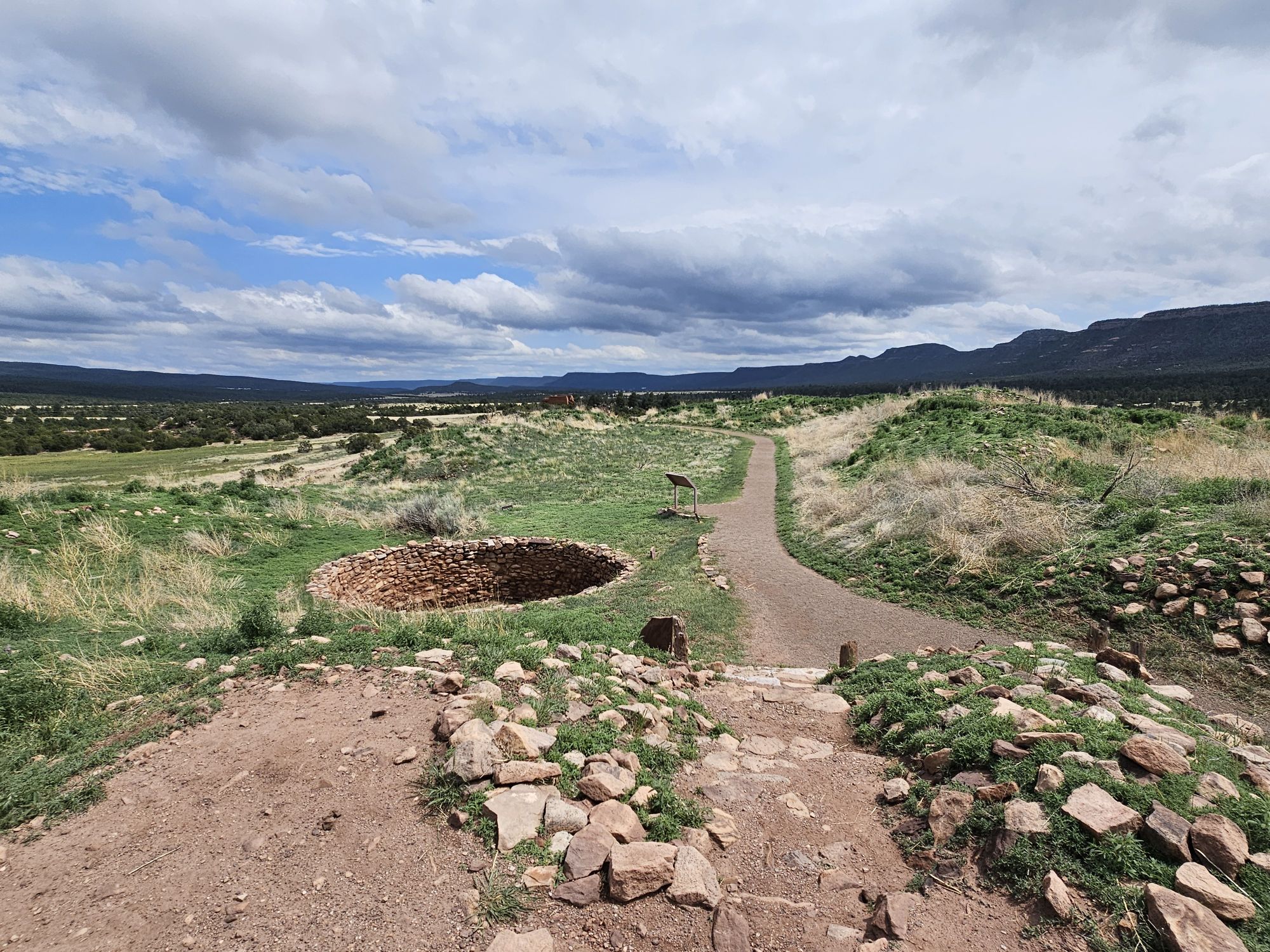
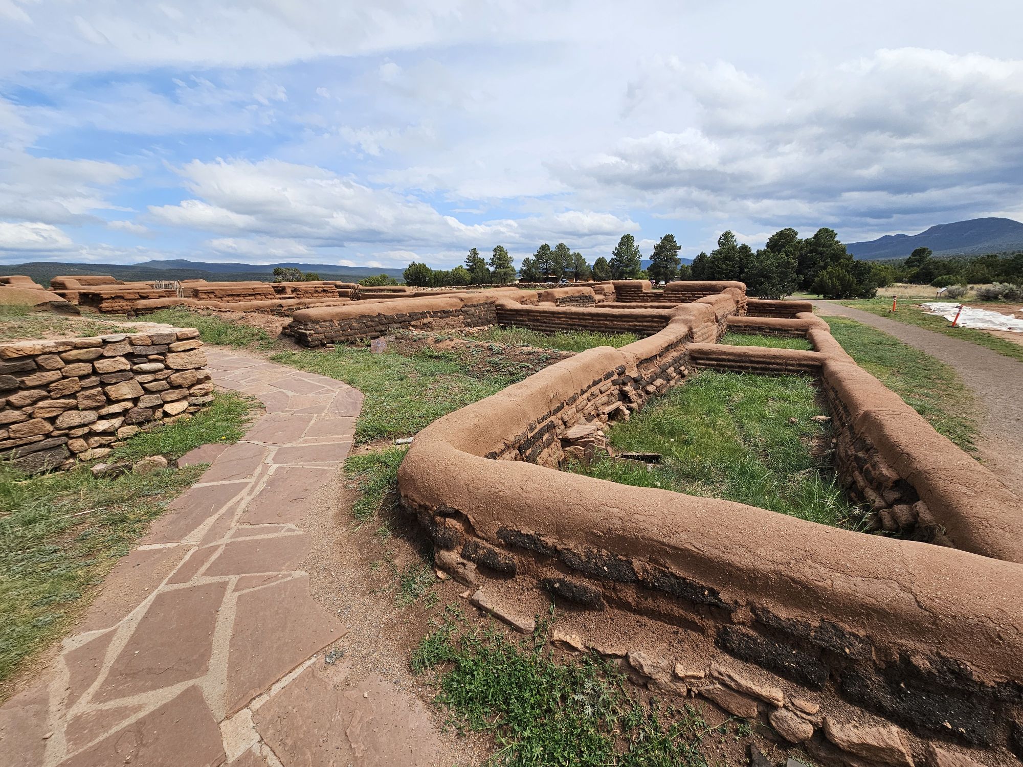
The whole site in this area near the visitor center hides the ruins of a large pueblo.
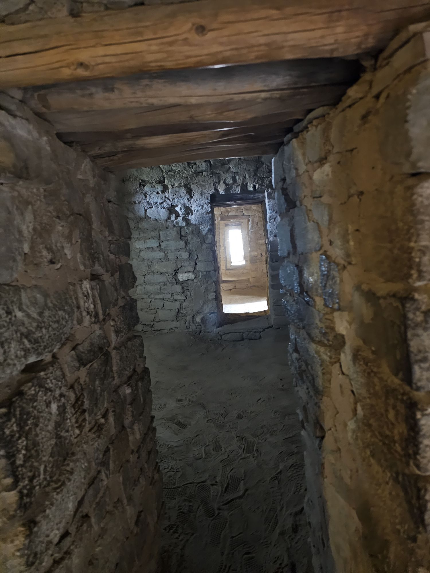
If you have been following along, you should know this is a kiva! Taken by me.
How cool! Almost everything here is an unexcavated part of the pueblo! Taken by me.
Click to read the info on the ancient pueblo. The kiva shown in the sign is directly behind the sign. Taken by me.
Click to read about the revolt!
The remains of the most recent mission on the site. Taken by me.
A view of the grounds of the mission ruins. Taken by me.
A view of the mission grounds from a far. The old pueblo would have been behind the mission from this vantage point. Taken by me.
It was nice to see a different take on the history around here as this was the first site on the trip that had more “modern” elements highlighting history that moves into the the beginnings of the US era, both in the Spanish influence, and also the civil war info. If you are in the area, stop by, it’s a neat historical spot!
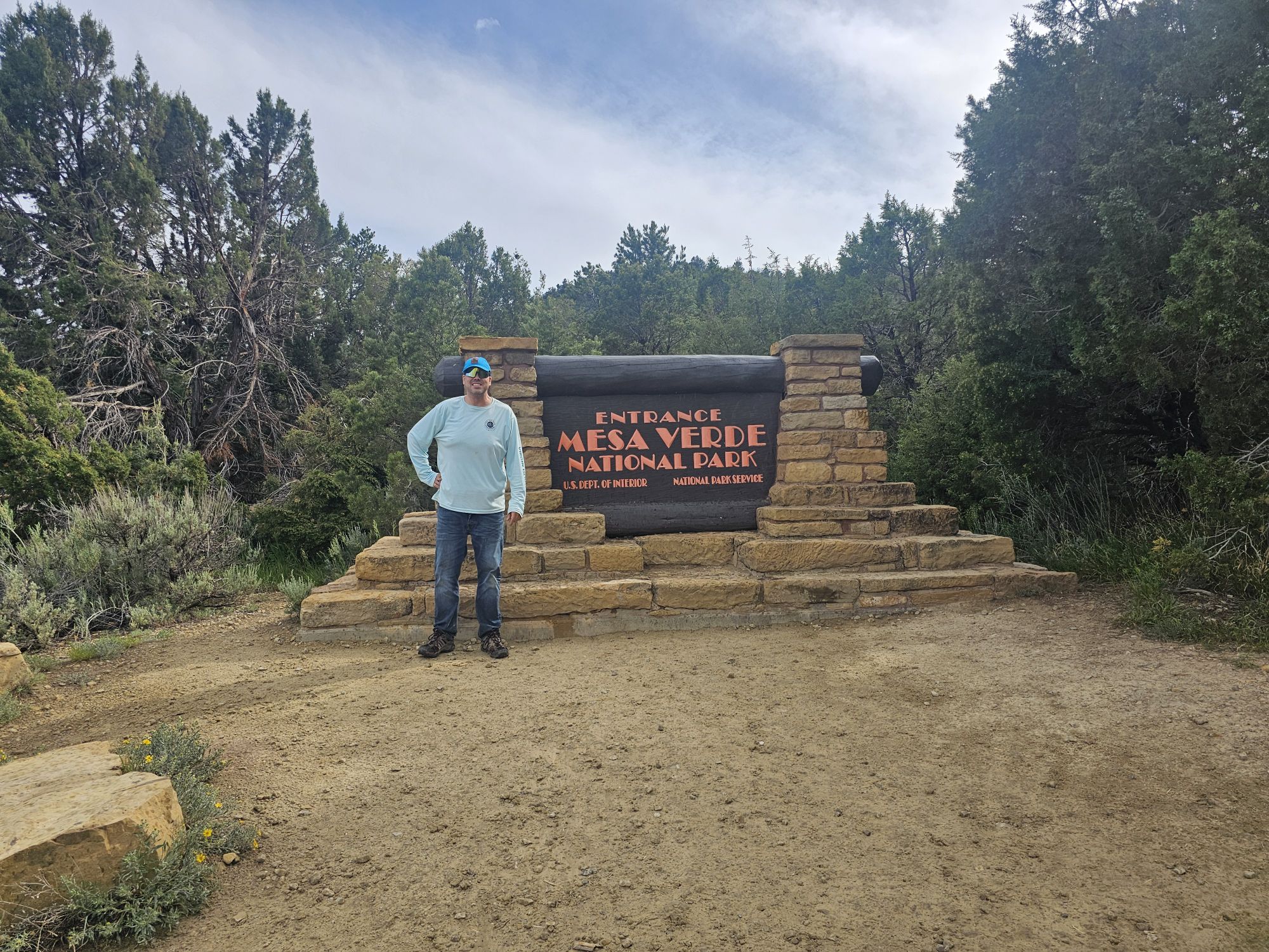
Hey there Adventurers! After departing Mesa Verde early in the morning, I was off, headed back in the direction of Albuquerque. I had 2 more full days left to this southwest adventure and I had plenty more to see! The first stop up: Aztec Ruins National Monument, about 2 hours away from Mesa Verde, back in New Mexico.
Sign Selfie!
Except I covered up the World Heritage mark.
Aztec is a part of the Chaco Culture Historical Park World Heritage Site. So cool!
A native! There were many of these little guys hanging around in the area! Taken by me.
First, one thing to get out immediately is that there is nothing “Aztec” to do with the site. In the 19th century explorers believed the Aztecs had migrated to this part of the continent and so named many sites accordingly. Though there is no Aztec history here, the site is notable for many reasons. It is considered part of the Chaco Culture World Heritage Site. It is a very sacred site to the indigenous southwest peoples. Originally, the structure included over 400 rooms and was 3 stories tall, and much of the structure still remains. And, lastly, the site is easily accessible as it sits on the Animas River near downtown Aztec, New Mexico. The town of Aztec may not be a thriving city (6,000 or so population), but it does lie on a US Highway. It should be noted that you are probably a local, or doing what I was doing, to actually be in this neck of the woods in New Mexico. There isn’t a lot going on in this area, but the history is certainly amazing!
A view of the entire site. Taken by me.
Part of the site, including the reconstructed Great Kiva, taken by me.
Another angle of more of the site, taken by me.
At this point, if you read my previous posts, you should know what this is. Taken by me.
Inside the site. Taken by me.
Another are inside the site, taken by me. I continue to be surprised that visitors are allowed inside these ruins!
This site was built between 1000 and late the 1200s CE to support the Chacoan Culture in Chaco Canyon, only 50 miles away. However, Aztec may have become the primary center of importance as Chaco Canyon declined. The entire site itself is pretty small, not atypical for many of the “smaller” NPS units. The visitor center is standard: gift shop and interpretive museum. You will want to pick up your trail map at the visitor center and download the audio tour app to accompany you on the self guided tour of the site. You can pretty much wander through the entire site, the big rule being to stay off the walls. Most of the site is original, however there is a nicely reconstructed great kiva that allows visitors to enter and see what such a structure might have look like from the inside. This was the only reconstructed kiva I saw, and it was quite informative!
The Great Kiva from outside. This is a reconstruction. Taken by me.
A couple views in side the reconstructed Great Kiva. Taken by me. It was neat to see what they think the inside might have looked like!
Although Aztec Ruins National Monument is not nearly on par with what I had already seen on this trip, it was a worthwhile stop! You would not want to make an entire cross country trip to visit this site, but if you are visiting other sites in the area, or live near enough, you will want to spend an hour or two here learning about this site’s history!
Hey there Adventurers! Be sure to check out part 1 here!
I awoke very early the next morning to be sure to get to my tour of the Square Tower House. This was the really hard one to snag. According to the Ranger, this tour is only once a day and it was small…10 people or so, and that’s all they take. It would soon become very apparent why those restrictions exist. I had stopped by the overlook the previous afternoon and was skeptical of how one got down to this dwelling and the answer to this is that it is treacherous! The tour begins with a very thorough safety talk, and a confirmation to the ranger that you are able to to undertake this tour. The ranger explained that any issues ends the tour for everyone and it is very difficult to get an incapacitated person back up to the road level. The hike begins with a ladder descent, followed by walking along the cliffs edge, with relatively new barriers to prevent falling, only to find yourself needing to descend quite a bit down further down the cliff using ladders, fashioned to replicate the ancient ones, and also the original handholds carved into the cliff. To make matters more complicated, there is an awkward transition from handholds to ladder steps, but that’s how you had to do it! The ranger explained that this was how the ancient Puebloans did it! One of the neat things our ranger guide shared was when they lead modern Puebloans down to the site and the elders do a ceremony, essentially asking the spirits for permission to enter the home. So neat!
Square Tower House from above. Taken by me.
The first descent down to Square Tower House. Taken by me.
This fence is fairly new we were told, and was only put there because people were frightened. Ha! Taken by me.
A view of the carved footholds to go between sections of the descent. We were told those are original to the time of the building of the dwellings. Taken by me.
And this is how you get from the footholds to the next ladder. Eek! Taken by me.
And at long last, at the bottom of the descent! Taken by me.
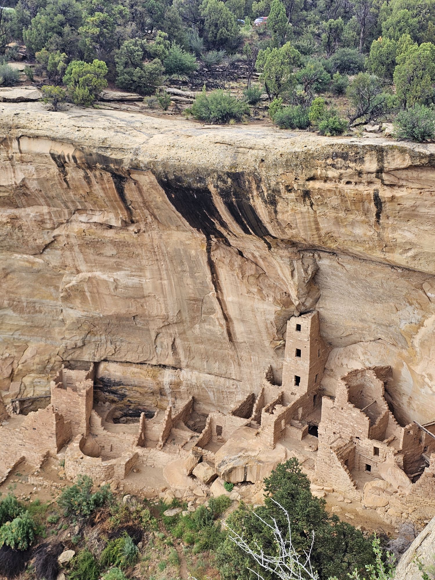
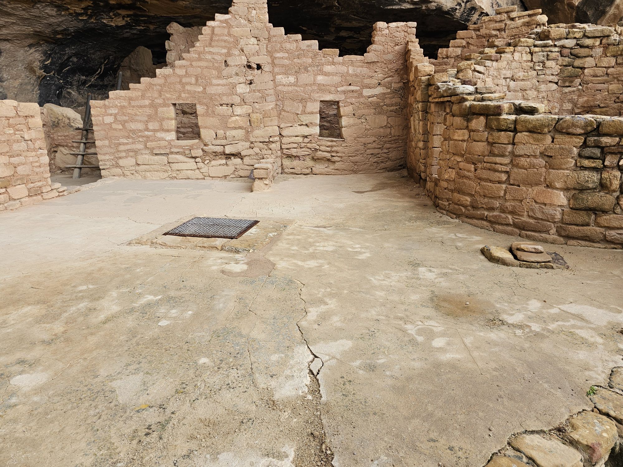
Square Tower House is smaller in terms of area that it covers, but contains the tallest structure in the park, a section that rises nearly 30 feet and 4 storeys tall! There are painted murals and petroglyphs found through out the site, and the site is 90 percent original! There is an intact original kiva roof, and we also found pottery that was then dug back into the ground. After about an hour and a half of touring the site and learning about it, we were back topside and I was off to the next adventure! Next up was the Balcony House Tour.
Square Tower House. It is important to not that while these ruins are mostly original, much of the original structure is no longer present. There would have been roofs and other ladders and ledges with ladders to allow access throughout the levels of the entire structure. Taken by me.
Some of the pottery we found on the grounds of the Square Tower House. The ranger displayed it for us, then dug some small holes and deposited the pieces back into the earth. Note the distinctive black and white patterns. Taken by me.
If I remember correctly, this is one of the only, if not ONLY remaining intact original kiva roof in the park. Taken by me.
I should point of that the park and Rec.gov make it clear that its difficult to do all three of the Chapin Mesa tours in one day. I did not find that to be remotely true at all and even had time to do stops at other mesa top sites between tours. The only thing that I goofed, and I think there was a reason I had to do it, but cannot remember anymore, was the order of the tours. You would want to go from Square Tower House (which has to be the first one) to Cliff Palace, and then to Balcony house. But I arranged for Balcony House to be first, then Cliff Palace. Due to the road being a one way loop this meant I had to pass by Cliff palace to get to Balcony house, then I had to essentially do the loop again to access Cliff palace and then get out of the loop. Even with that, it was no problem getting all three of these tours in!
After departing Square tower house I headed down the one way Mesa Top Loop. I stopped at some pit house excavations sites along the way as well as viewpoints for other cliff dwellings. I also made a stop for some delicious Ute Indian fry bread! There is an interesting oddity along the Cliff Palace loop road. Between Cliff Palace and Balcony House the park road actually abuts Ute land and and there is a small area where native Utes have set up a fry bread stand and a couple art/trinket shops. If you are really interested, there is complicated history between the Utes and the NPS that you can research. The Utes also have many cliff dwelling ruins on their land and it possible to book tours with Ute outfitters. In any event this road is an amazing tour of the history of the land. There are numerous mesa top sites to explore and numerous cliff dwellings to view and read about along the way!
Pardon the 3 minutes or so. This was a 6 minute video I took along the Cliff Palace Loop Road. You should watch!
The info card for the Oak Tree House. See picture below.
The Oak Tree House. Taken by me from the overlook on the Cliff Palace Loop road.
This a view of the Sun Temple from an overlook opposite it on the Cliff Palace Loop road. Taken by me.
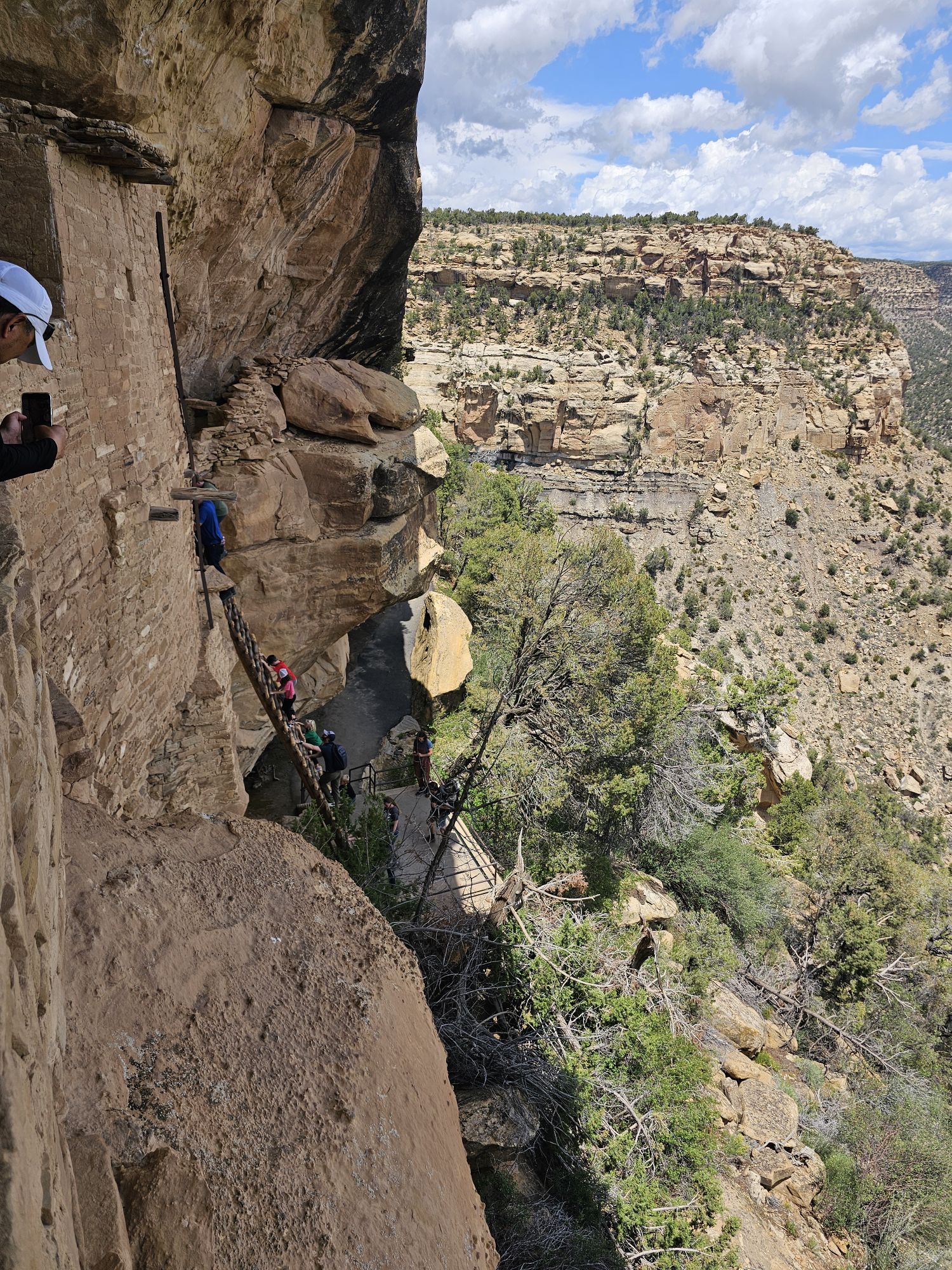
The Balcony House is notable for several things. The park service calls this tour the most adventurous one in the park. Of course, the house is totally unseen from above. There is a short hike to descend down the cliff. Then there is a pretty serious 30 plus foot ladder to get up into the structure, and then there is a pretty small tunnel to climb through. Once you have done those, then its exploration time! There are plenty of rooms and kivas to explore, watch your step (!), and other small tunnels to traverse through the dwelling. You will find spectacular views out of the dwelling. There are spots of the original paint, and more wall paintings and petrogylphs. Upon the conclusion of the the tour, getting back up requires more 20 foot ladders to access the path to the parking lot. This was a really neat experience!
After a short downhill hike you find this ladder to take you up to the Balcony House. Taken by me.
Here is the above view of that same ladder. Taken by me.
An example of how precise the ancient people’s construction was! Taken by me.
From here you can really see how protected these sites are from the elements! Taken by me.
This shows how big the kivas were in this house. Taken by me.
I took this picture to show some of the original plaster, paint, and designs on the wall here. It’s amazing how this has survived the centuries!
Here is my video of getting into The Balcony House.
And this is how you get out!
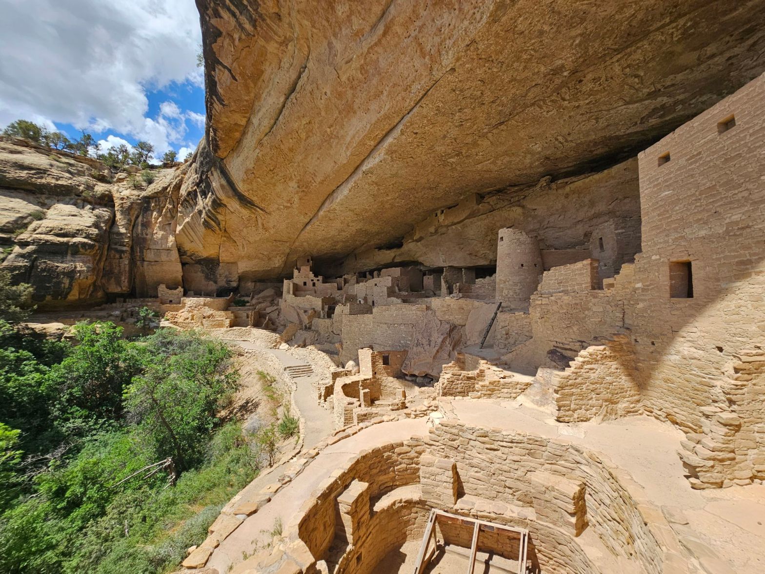
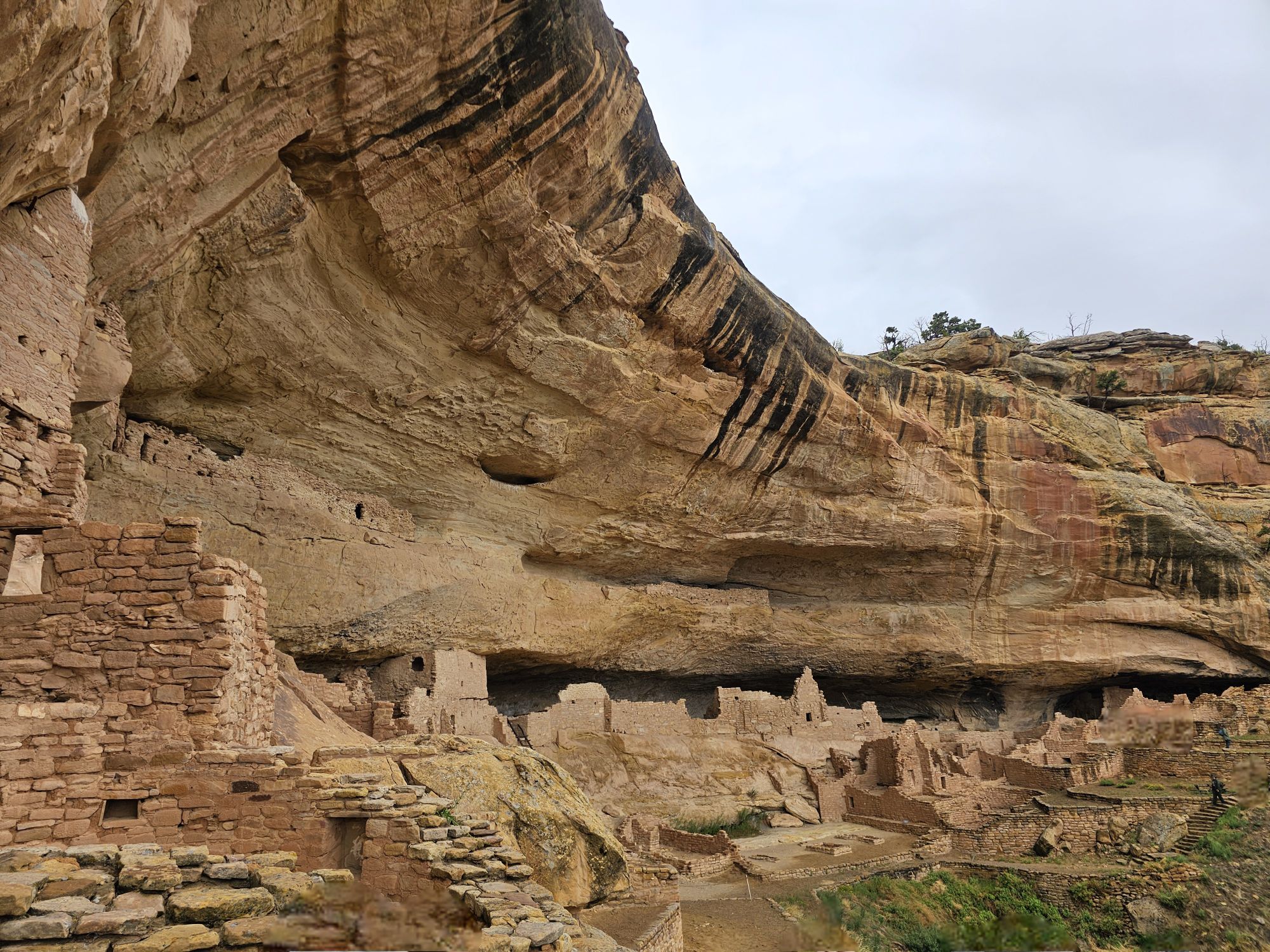
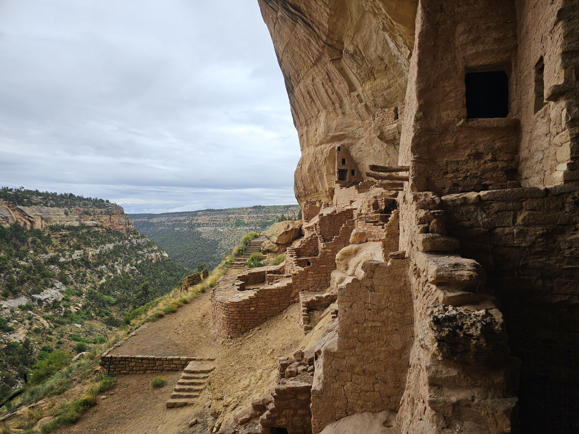
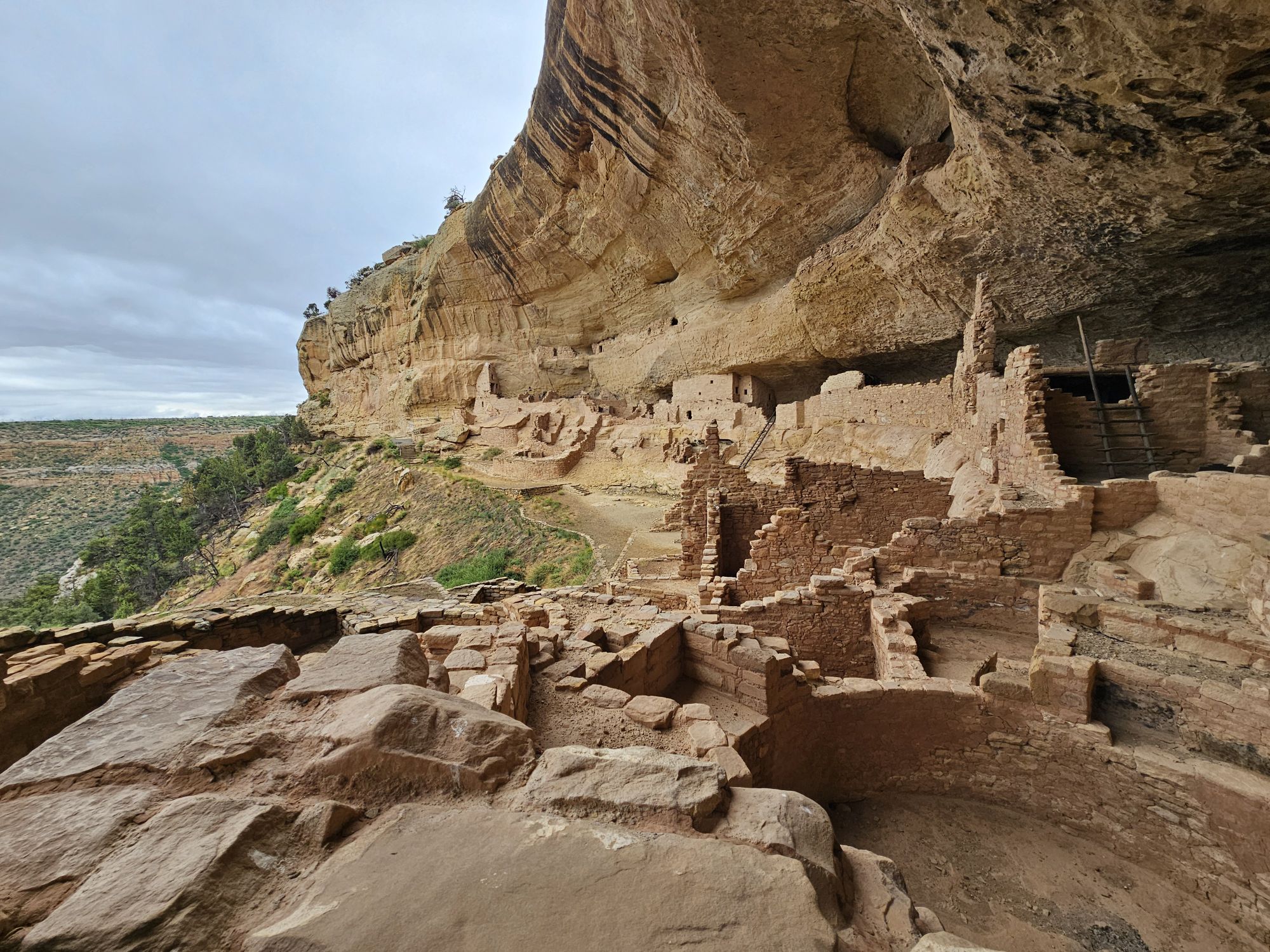
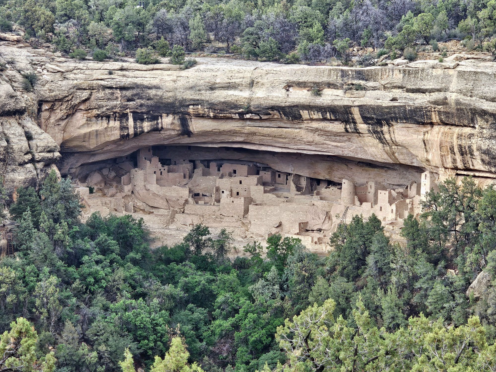
It was time now to head to Cliff Palace. This site is the largest known cliff dwelling in all of North America, containing over 150 rooms, 23 kivas, and housed approximately 100 people. Like all of the other cliff dwellings in the park, this one dates back to the 1200-1300s and was abandoned, like the rest not long afterward. Many National Parks have their “main draw” and this is it for Mesa Verde. There are many tours each day during season, and they are fairly large. Again, you have to secure a reservation ahead of time. Getting down to the dwelling is pretty pedestrian but does require some downhill hiking. Getting back out however is much more difficult and requires some ladders and hand holds to ascend up the cliffs topside.
Cliff Palace selfie!
Since the tours are timed, there is a (very) brief opportunity to snag a people free picture if you position yourself correctly! Taken by me.
View across the Cliff Palace from opposite side. Taken by me.
This was my last first hand experience with the cliff dwellings. To review, there are over 6 HUNDRED of these sites in Mesa Verde. They were all built in the 12-1300s and were abandoned for unknown reasons pretty soon after they were built. However, the cliff dwellings are only a small part of the history of the ancestral Puebloans and this land! Especially on the Chapin Mesa, you will come across MANY mesa top excavation sites. These pit houses date back much further than the cliff dwellings, many as far back as 600 CE. The interesting part about these sites is that they were often reused, some times many times over, as if the people had a recorded history of the sites. The sites were even buried between habitations. Even during the times of the cliff houses, people were still living on the mesa tops. In fact, if I recall correctly it is not even entirely known whether people actually “lived” in the cliff dwellings or not. The national park service is aware of thousands of these sites, but most of them have been left filled in and covered as that actually protects the sites. Very interesting!
Apologies for the angled picture, but this gives an example of what the mesa top homes looked like 1400 years ago!
One of the mesa top excavation sites. Most, if not all of these, are actually covered like this and protected. Taken by me.
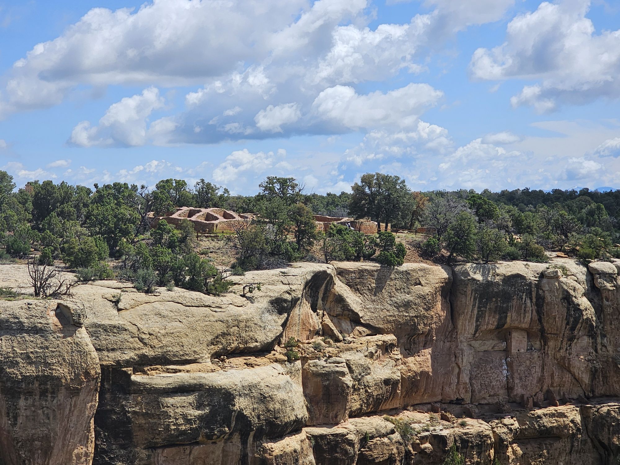
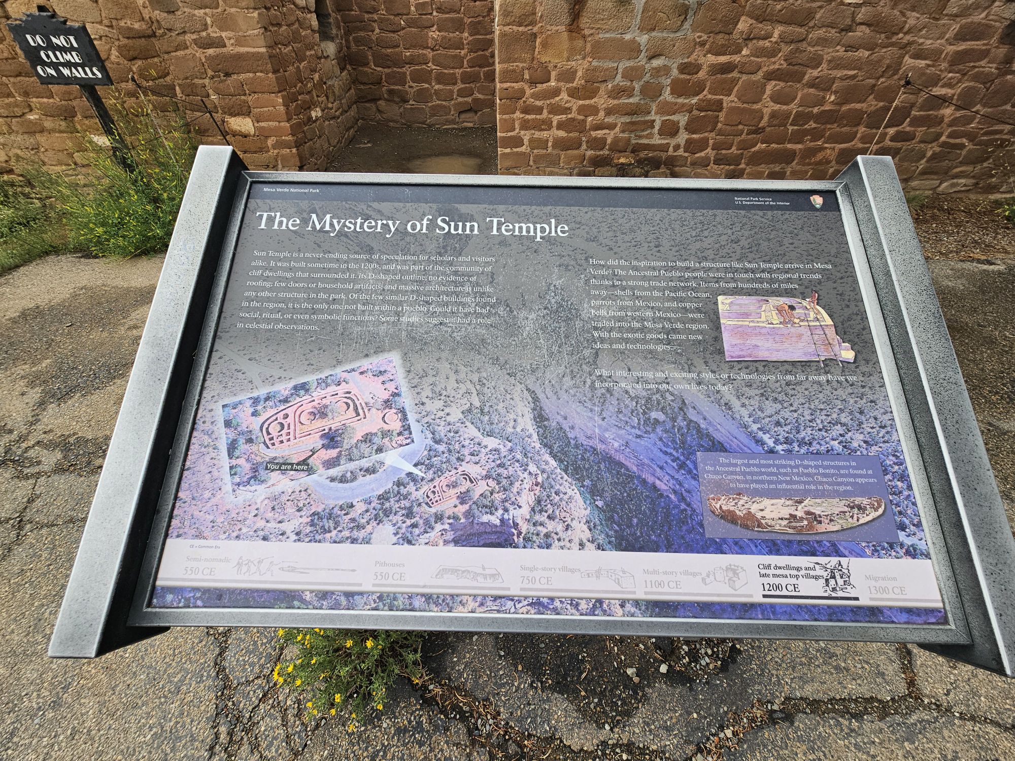
In addition to the pit houses, the unique Sun Temple sits atop the Mesa Top Loop directly across from the Cliff Palace. This site is vastly different from any other site in the park, and indeed the entire Puebloan community. It was constructed in a D shape, and perhaps never finished. It has no evidence of any roof, or habitation, is aligned with the cardinal directions, and as the name suggests, may have been an observatory or involved in tracking the seasons.
The Sun Tempe from a distance. Taken by me.
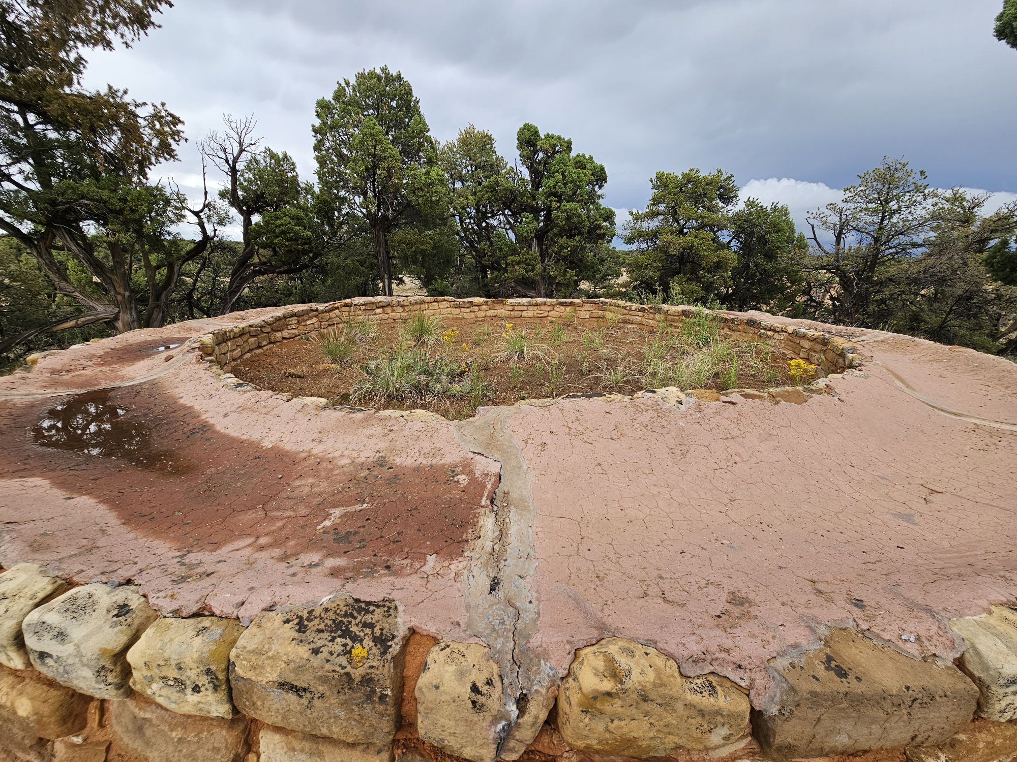
The Far View area, where the lodge is, contains some really neat ruins as well. This area was one of the most heavily populated areas in the mesa between 900 and 1300 CE. Hundreds lived here, in dozens of villages in the small area. Interestingly, people continued living here while the cliff dwellings were occupied. Of I stopped in and hiked around. The weather quickly turned poor and I got caught in a hailstorm and had to run back to my vehicle and hunker down for a bit! Once the hail subsided I finished exploring this interesting area. There are many structure ruins and even whats left of an ancient reservoir, although there seems to be some disagreement on the actual purpose of the reservoir, including if it even WAS a reservoir at all. Some research lends support that the site would not have functioned well, if at all, as a water reservoir and it might have been used for rituals.
A large ruin at the Far View site, taken by me.
This picture was taken not long after the one above and you can see how the sky changed so quickly. It began hailing soon after and I had to run for cover! Taken by me.
Another part of the Far View site. This carved stone was literally the only carved stone I saw in the entire park. Taken by me.
Reservoir or ritual site? You decide! Taken by me.
As you get closer to the park entrance you will find the highest point of the park, Park Point Overlook, at about 8500 feet elevation. My last afternoon I found myself up there, but the weather was a fright. The temps were upper 30s and rainy which turned into ice. There is an old fire tower up there that seemed abandoned to me, but may still be used at times. I did return the next day for better weather. Between this area and the park entrance you will find the park campground. There are many trails in this area if you are interested (I wasn’t). I stopped at the visitor center once more to get a morning view and that finished national park 43!
A view from Park Point. Taken by me. You can easily see why this was named ‘green table”!
A view to another direction from Park Point. Taken by me.
The Mesa Verde Visitor Center is a really interesting one! Taken by me.
Overall Impressions: Mesa Verde National Park is amazing, and high up on my list of favorite National Parks, maybe top 3 or 4! You should definitely go, it’s important. Do it!
National Park Number: 43/63 NPS Unit Count: 81/430 US Unesco World Heritage Sites 15/24
Hey there Adventurers! June 2025 saw me finish the Colorado national parks! If you read the previous entry, this trip involved many stops in New Mexico for #USBarkRangers purposes, but the trip focus was Mesa Verde. A quick aside, this park is more dog friendly that I thought. They are allowed on all trails in Wetherill mesa save for the trails to the two big houses and are fine at all the overlooks and paved areas in Chapin Mesa, save for ruins sites. There is no Bark Ranger here though. To my surprise I found Mesa Verde to be one of my favorite national parks! The scope of this park, even in the short 2 plus days I was there, is both intimidating and impressive. As such I have decided to make this a 2 part entry. This part is more an intro of the history of the area, and my first day experience.
Mesa Verde is not exactly remote, but it’s not easily accessible. If you are flying, the nearest airport that handles large commercial traffic is a few hours away, either Albuquerque or Montrose, CO. The park is situated in the 4 Corners region of the Southwest, in the southwest corner of Colorado. There isn’t a whole lot around the area, however, the history here is awesome. In addition to stunning views and the ancient history, Mesa Verde was the site that pretty much shaped modern archaeology in the United States, evolving from looting and profiteering, to preservation and study. There are nearly 5,000 archaeological sites in this national park, encompassing the famous cliff dwellings as well as excavated and un-excavated pit houses and ruins on the mesa tops.
Taken in a friendly photo exchange.
Created in 1906, Mesa Verde is one of the first National Parks established in the United States, number 7, and the first created to protect manmade structures. If you are totally unfamiliar with Mesa Verde, the easy description is: it’s the national park with the old adobo houses built into the cliffs. A bastardization, but that’s the gist of it. Most of the cliff dwellings are only for viewing from the opposite side of a canyon, but there are a handful that can be experienced on a ranger led tour. These have to be reserved ahead of time and they go quickly, especially one of them. It should be noted that this park is high desert (up to 8500 feet elevation) and winter lasts longer than you would expect for the southwest desert. The tours are not available until later in the spring. Luckily I had secured reservations to all four dwellings available last year (it seems that at least one of them rotates yearly).
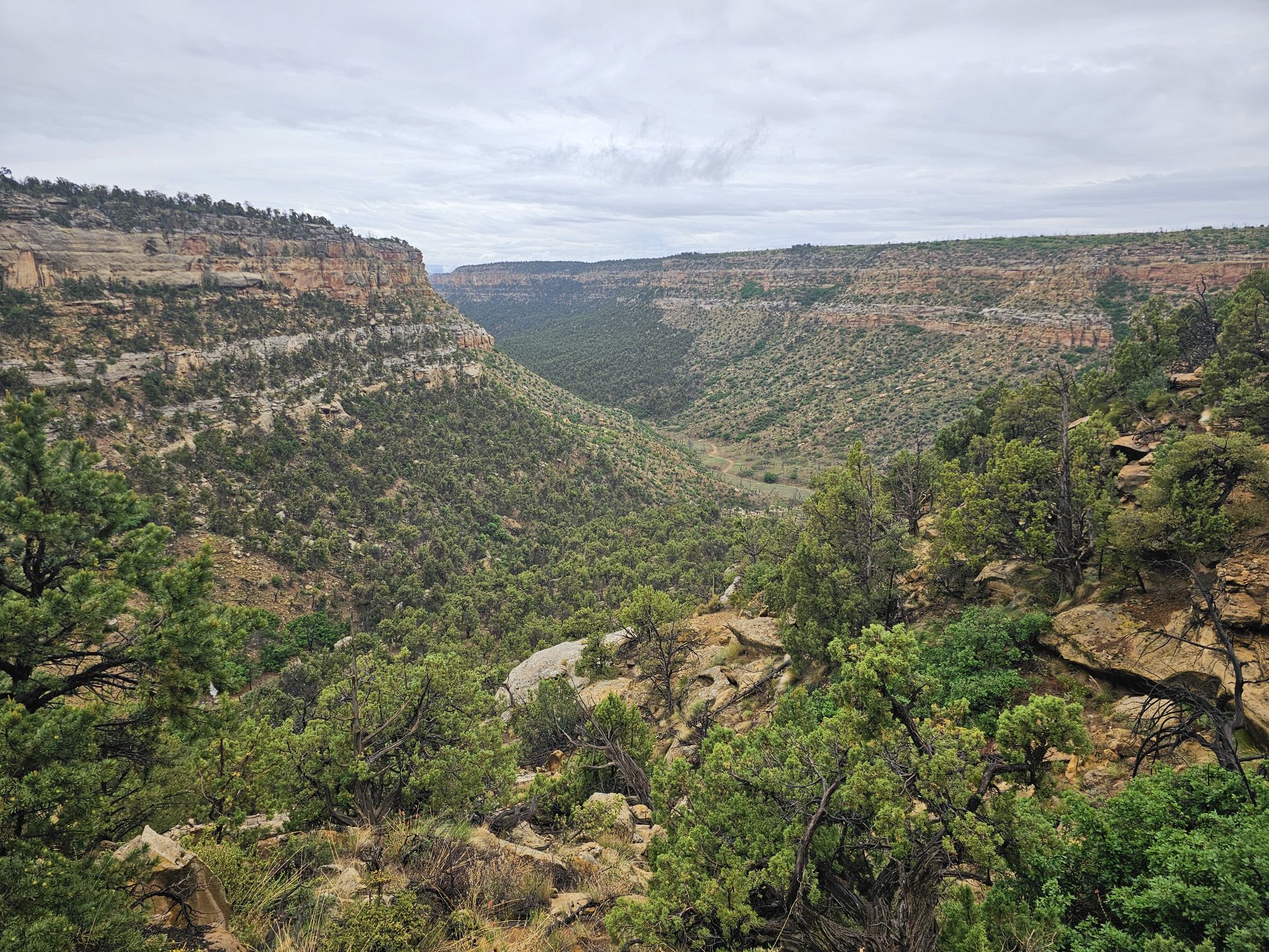
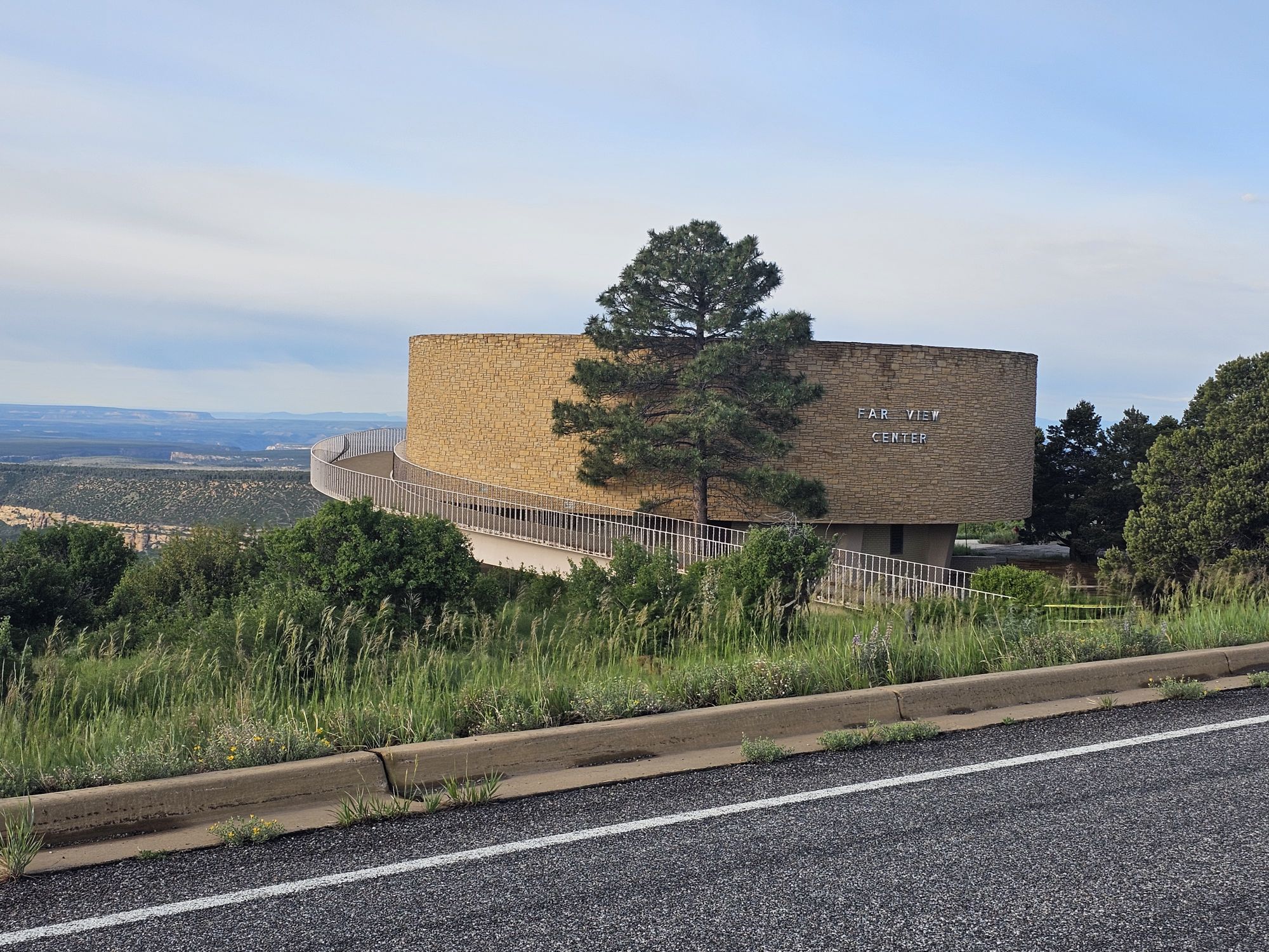
Now a little geography lesson is needed. Mesa Verde is literally the “green table.” This national park is a mesa, a large area that is flat, higher that the surrounding land, and has steep sides. They are formed by erosion, are mostly found in the SW United States, and usually have spiritual importance to the native communities. Mesa Verde is actually slanted as bit which makes it not a true mesa, but the southern slant actually led to the creation of the alcoves that house the cliff dwellings. In addition, there are many canyons here, so the park is a cumulation of many mesas (technically cuestas) between many canyons. The two main areas of the park are the Wetherill Mesa and the Chapin Mesa. The Chapin Mesa is the main area that tourists will visit. Wetherill is a lesser visited section of the park. It is only accessible seasonally, and then only certain days of the week with limited hours. Wetherill and Chapin are connected by road at an area called Far View, which is also the location of the park lodge I stayed in. Going straight takes you to Chapin Mesa, and making 90 degree right turn takes you to Wetherill Mesa.
I believe this canyon is called Rock Canyon, and Wetherill Mesa continues on the left side of the photo, with another mesa leading off on the right side. Taken by me.
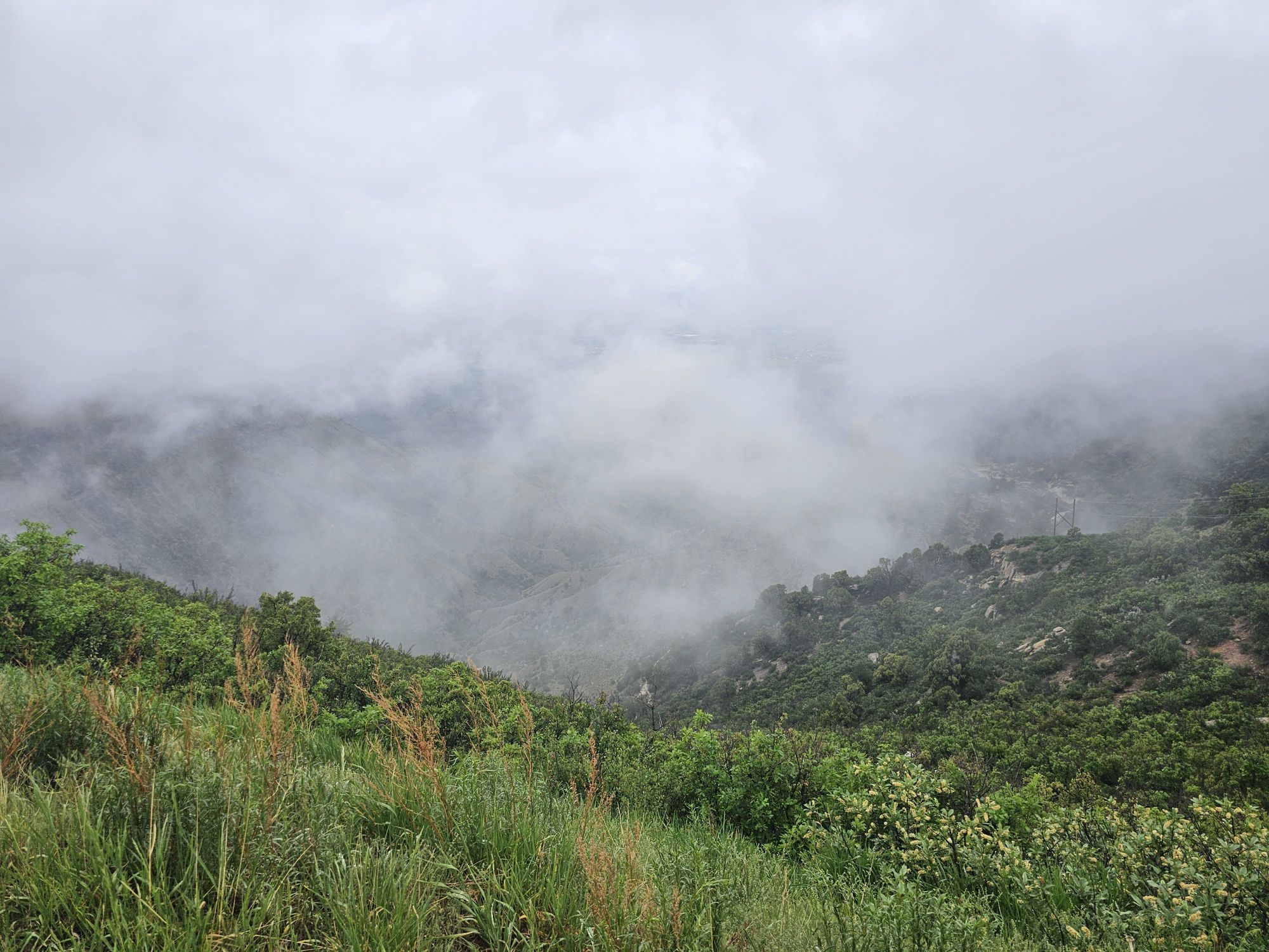
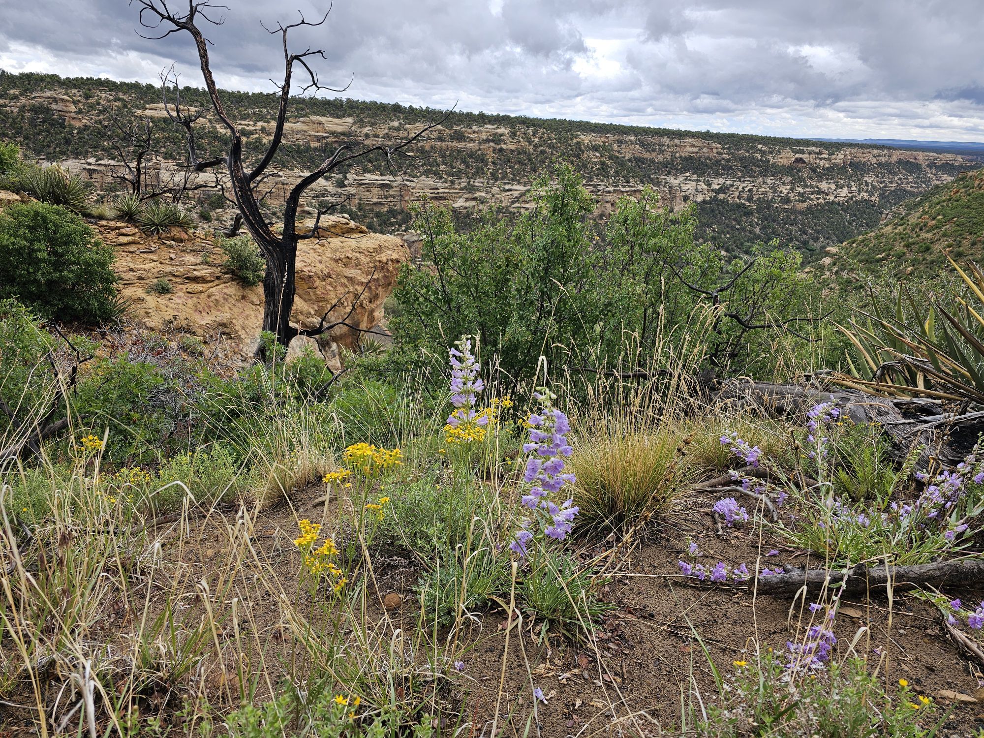
The Wetherill Mesa is considered the quieter side of Mesa Verde and for good reason. This area of the park is only open for 4 months of the year and then only 5 days a week, closed on Tuesday and Wednesdays. The area is only open from 8:30 to 4. And by 4, that means you must be out by 4. They only allow visitors in until 2 PM. The day I visited I found this side of the park to have a certain beauty that the other side did not. It was foggy, and there were beautiful white wildflowers all over the cliffs and canyons. The drive in is very scenic, but there are not many sites here. Two or the notable exceptions are the Long House and the Step House found at the end of the road. There are no services in this section of the park other than a restroom and an open air ranger station. I understand that a wildfire took the visitor center here a while back. I had tickets for the Long House tour so I followed the paved trail down to the meet up spot and joined the tour there.
As I came down the road on Wetherill Mesa I was treated to a lot of view like this…..
…and this. These two pictures are not particularly noteworthy or interesting, other than to highlight that this section of the park is very green with beautiful wildflowers, and definitely doest not give out a desert vibe at all!
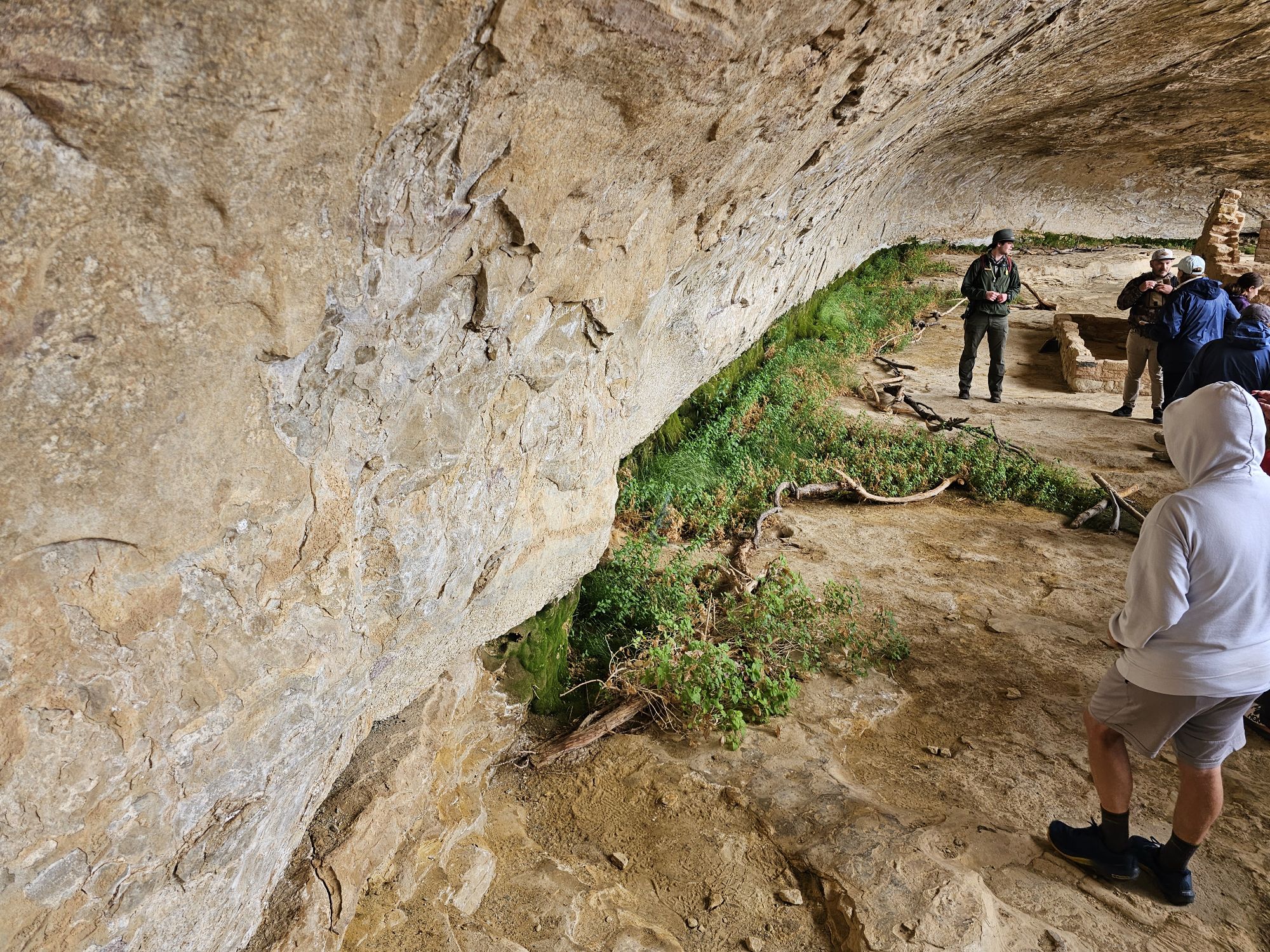
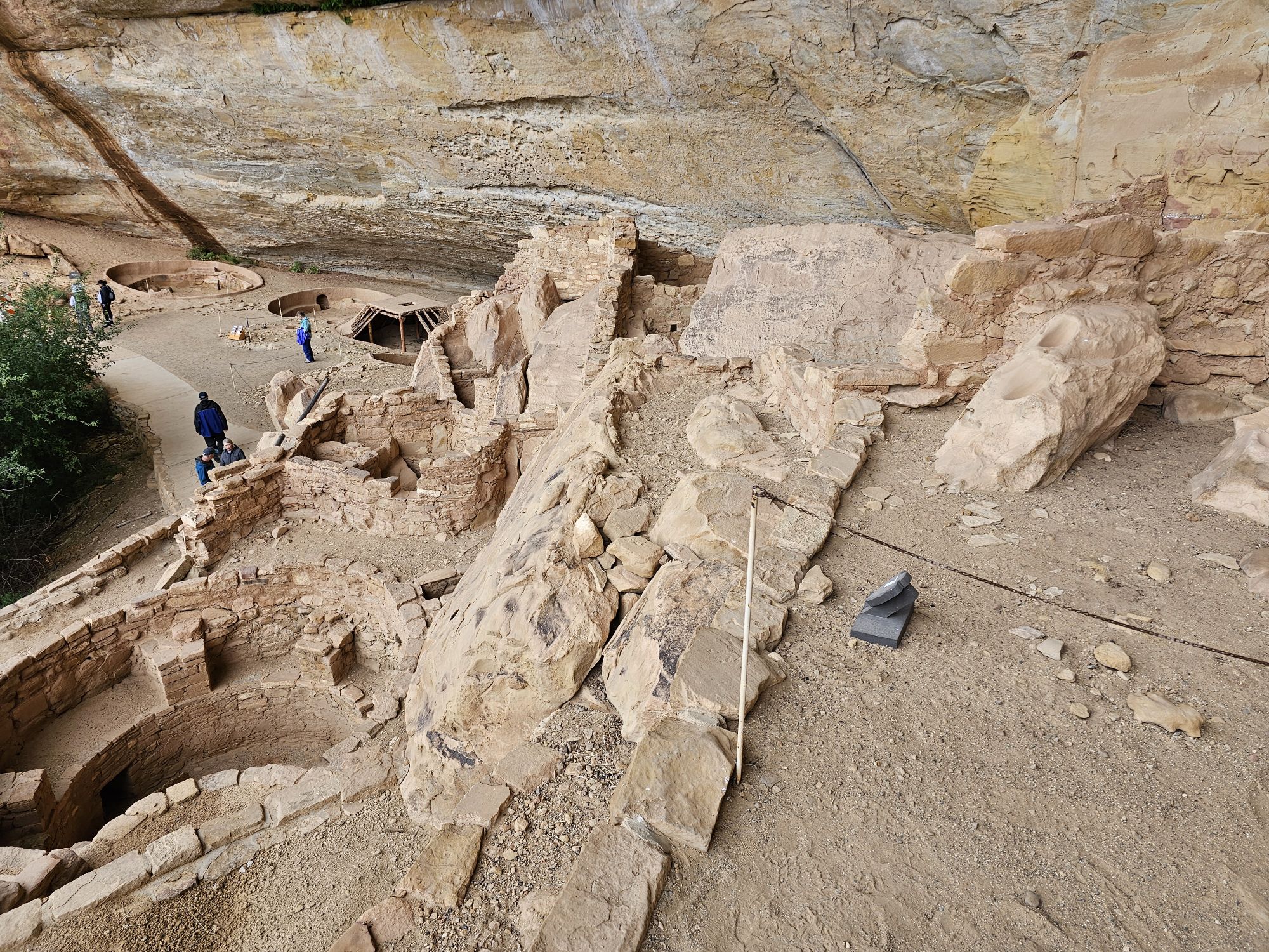
From the tour meet up area you cannot see the cliff house at all. It was cool and rainy, with temps maybe in the mid 50s. It had been raining pretty good about an hour before the tour but it started to abate at tour time. Remember the elevation here is pretty high, so even being June, the weather is a consideration! Anyway, I joined the tour and we began the descent down the cliff. From the parking lot the trail is about 2.2 miles round trip. The distance from the tour starting location to the house is only a tenth or two of a mile, but with 250 foot descent, some of which is exposed and on cliffs edge. It is not long before the Long House opens up before your eyes!
This is the path that leads to the Long House trail. Once again, notice the green. Also, there are extensive wildfire scars throughout the mesa top here. At the time I took this photo I was unaware that there is a a cliff dwelling somewhere under this area! Taken by me.
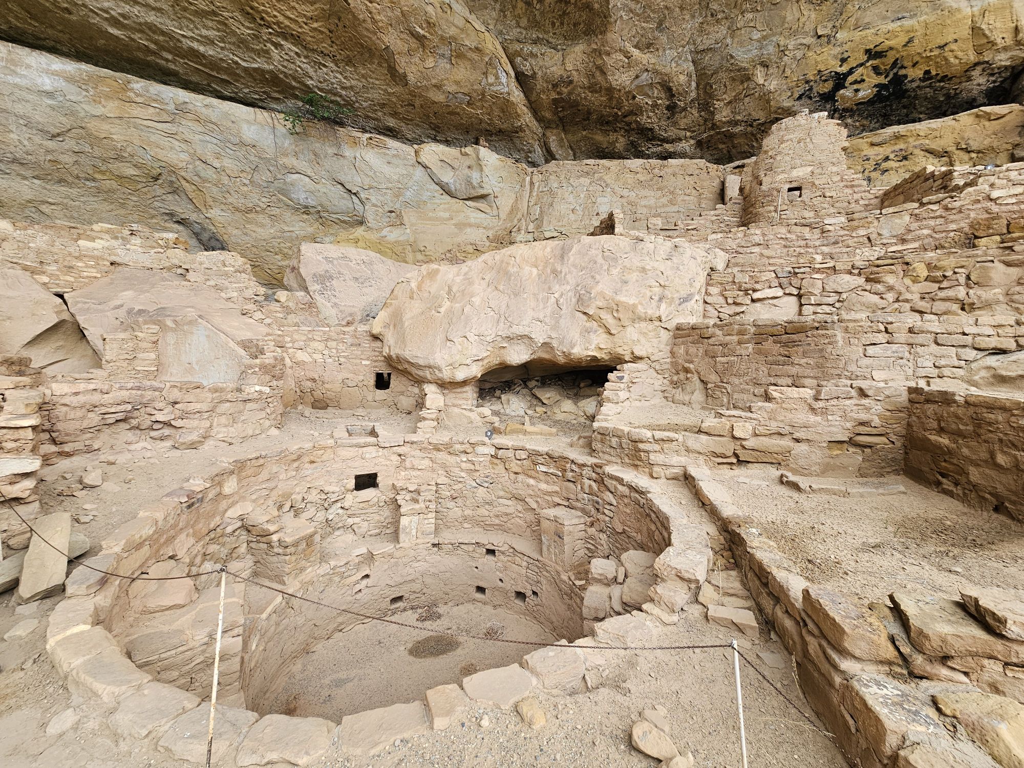
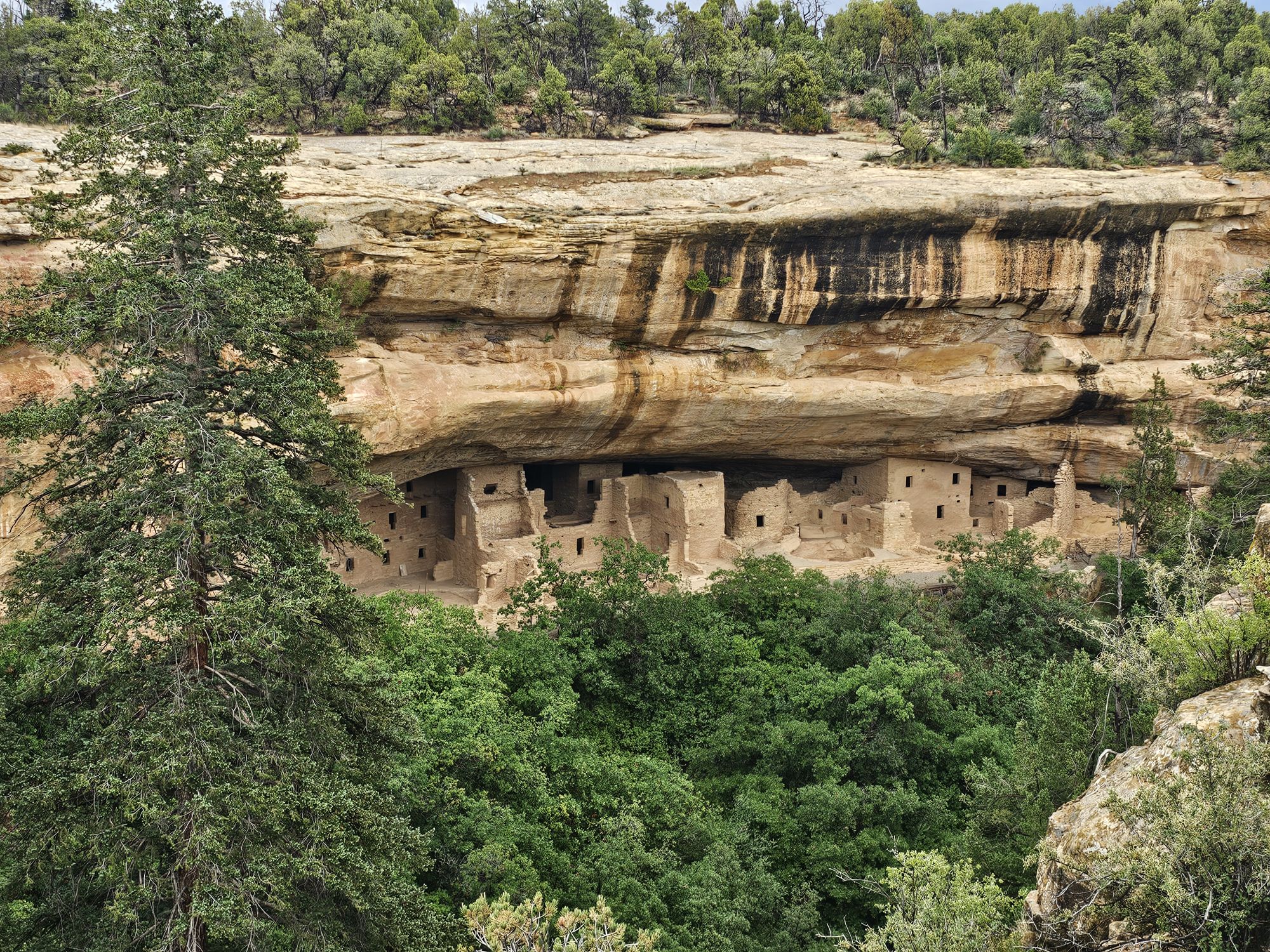
The Long House is the second largest dwelling in Mesa Verde with more than 150 rooms, a plaza, and several kivas. This was an amazing first look at what Mesa Verde is about. I had seen the pictures of course, but seeing it up close was an entirely different experience! We saw the seep spring, still running, that essentially carved the alcove protecting the dwelling. This spring was used for water for the house. These seep springs were the life blood of a cliff dwelling. The cliff dwellings are all found in an alcove and the slant of the mesas contributed to the the formation of those alcoves. The seep springs are not really springs but rather water seeping through from the mesa top until it meets rock it cannot permeate, then travels along that slant. The water works its way out of the side of the cliffs and eventually formed an alcove that the ancient Puebloans used to build these homes. The cliff dwellings in the park are all dated to almost the exact same years, roughly 1200 CE, they are also built on top of previous pit houses that date back 600 years earlier, which is very interesting! One other thing that I learned that was extremely interesting is that these cliff dwellings were not hiding. They were not for built for protection from other peoples. The peoples in the area all knew about them. Most of the peoples in the area were friendly. The dwellings were even painted in bright colors specifically so they WOULDN’T be hidden. Some of the paint can even be found to this day on some of the sites throughout the park. So there’s some history for you! Also, it was here that I learned that the NPS is no longer excavating theese sites. A member of our tour found a piece of pottery. It was black and white striped and absolutely period to the Long House. The ranger talked to us about it and then dug a bit in the ground and put it back and buried it. It was explained that they feel they have excavated enough (especially up top on the mesa top) and at this point it is better to leave all the sites and artifacts they know about buried to keep them protected for future generations. That’s a neat conservation approach that I had not considered.
The Long House. I somehow managed to sang this picture with only a couple people! Note that there is a walled off section pretty far up on the cliff face on the left side!
This is the view the people who lived here would have had everyday! Taken by me.
You need to ascend this latter to take the tour. A consideration if you have a problem with heights. Of course, if you made it here you probably already overcame any fear on the trail down! Taken by me.
Here is the reason this house exists. That plant life is thriving off of the seep spring that carved this alcove. The water still makes its way here today. Taken by me.
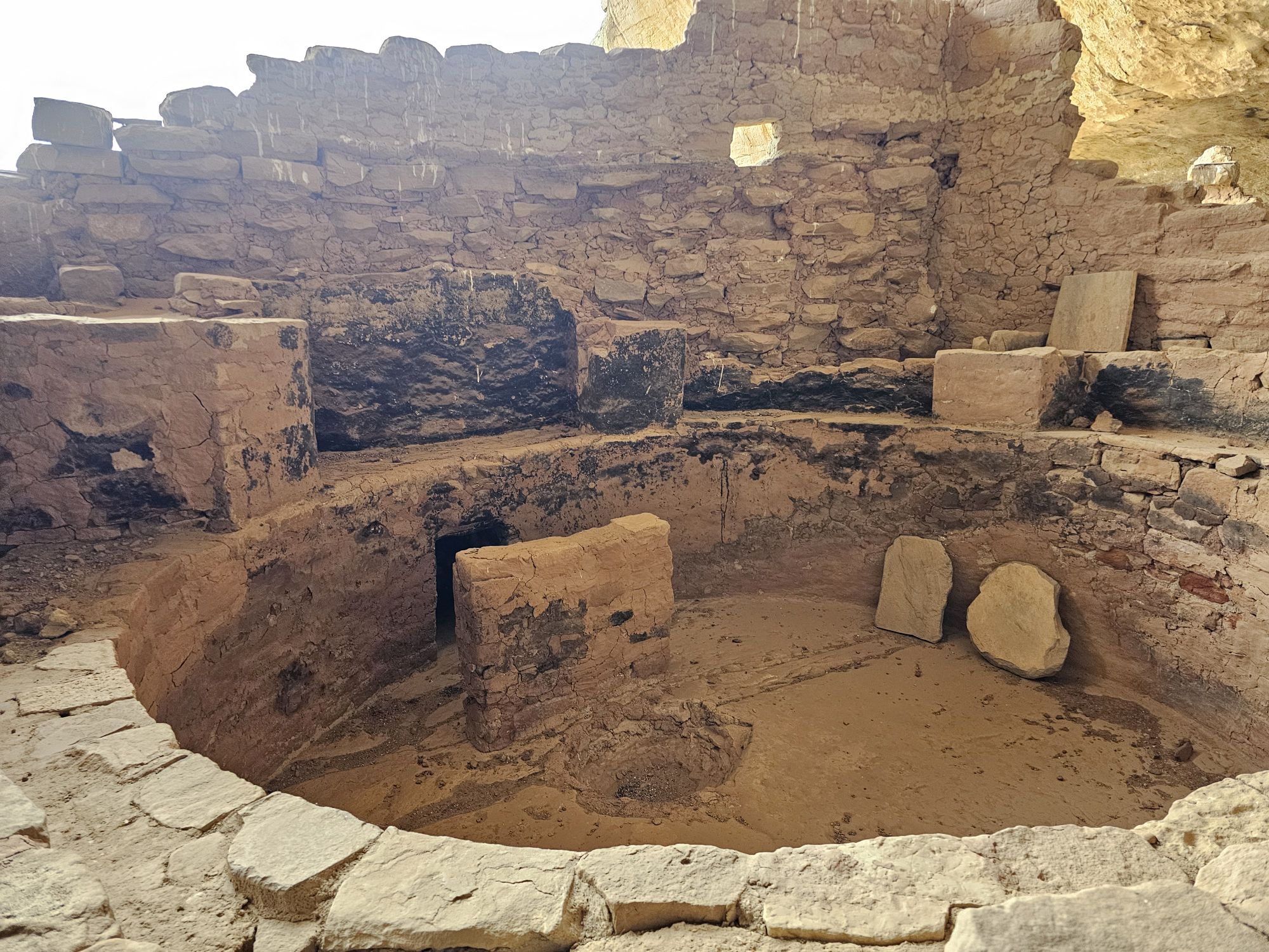
I think that this is when I first understood what a kiva really was. The roof, obviously is no longer here. But the rock wall in the middle is actually a deflector stone that would direct the smoke up and out. The people would have entered and exited the same way. The hole behind is the ventilation shaft that brought air in for the fire. Taken by me.
This is a kiva. The ceiling is here, and I am pretty sure this one is reconstructed. The grate is where people would enter and exit, as well as the smoke. The stones on the right are covering the ventilation shaft that brought air into the kiva. The roof was strong enough to support people using is as a plaza! Taken by me.
The angle of the Long House from the opposite side where the tour enters. Taken by me.
Just a thousand year old piece of pottery lying on the ground here! I would learn more about that black and white pottery later. Taken by me.
After finishing the Long House tour I had some time still before the rangers would chase people out of Wetherill Mesa. I took a self guided tour of the Step House not far away. The access to the Step House is a pretty steep walk down from the parking area. The site is interesting in that it highlights another feature of the cliff dwellings. Most/all of them started life as pit houses/dwellings/storage areas dating back 600 years BEFORE the cliff dwelling structure was built over them. In the Step House there are features of both the much older pit houses, and also the cliff dwelling architecture. This is the only cliff dwelling site in the park that you can tour without a ranger guide. There is a ranger on site to answer questions and explain what you are looking at, which was very helpful! The walk up was tough with the altitude being over 7,000 feet, so bear that in mind!
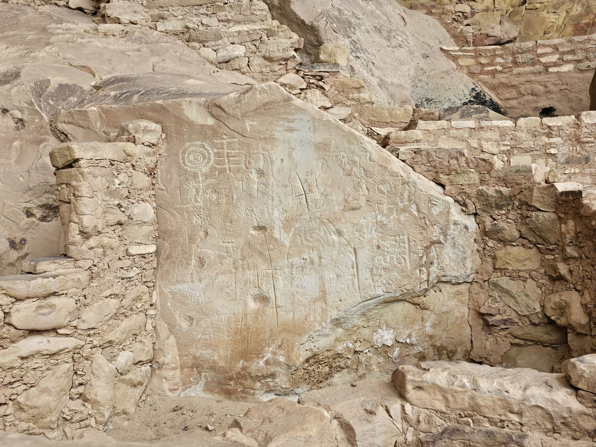
Ancient petroglyphs in the Step House. Taken by me.
This picture shows the “newer” section of the step house. Like the other cliff dwellings, this section’s architecture dates back to the 1200s. Taken by me. I was quite surprised by how accessible the ruins are in this park! From up here you can see the cliff dwelling structure and the old pit houses in the top left. Those date back 600 or so years BEFORE the structure I am standing on was built! Taken by me.
Another site, seen from the Step House trail. This one didn’t even get a sign, or a name as far as I know.
Using the ever trusty Guide Along tour, I learned more about the rather sophisticated real history, and the not made up history, of the peoples of this area. First of all, the term Anasazi is a misnomer for the people in this area, and most of the indigenous people don’t like it being used as it was. It’s a Navajo term for “ancient enemy” and that’s not what the ancestral Puebloans were. While this was being explained the guide also mentioned the words Dineh and Athabascan. Now as someone who loves Alaska, my ears perked up at those words and I had to restart that portion of the narration to make sure I was not crazy, after all I was in Southwestern Colorado, and not central Alaska! But, lo and behold, the Navajo actually go by the name Dineh and they do indeed speak a form of Athabaskan, as they originally came from that area in the far north! How cool!
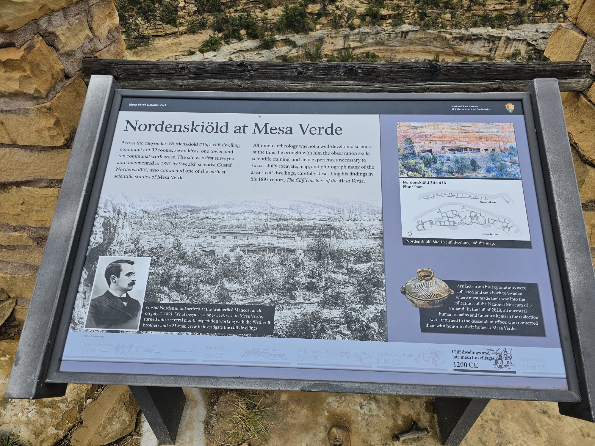
The other fascinating history I learned involves Richard Wetherill, the man who acquired the land and “re-discovered” the cliff dwellings. (The local peoples apparently were quite aware of the ruins.) Oddly enough I had seen the cemetery he is buried in, the previous day at the Chaco Culture site! I should have stopped to look around, but I didn’t! Anyway, Wetherill was wanting to farm the area. After rediscovering the cliff houses he pivoted to excavating and selling artifacts. Wetherill eventually hired a Swedish archaeologist named Gustaf Nordenskiöld to excavate the sites. Nordenskiöld taught Wetherill more proper techniques to excavate and to document all the sites and artifacts. A couple things sprouted from this. Despite his more modern archaeological approach, Nordenskiöld was sending artifacts back to Sweden, which infuriated Americans. This led to the creation of the National Antiquities Act, and the creation of Mesa Verde National Park in 1906. Additionally, Nordenskiöld taught Wetherill so well, that despite his lack of proper education, Wetherill advanced claims that were initially dismissed, but are now considered accurate! All of this may seem dry, but I found it quite fascinating!
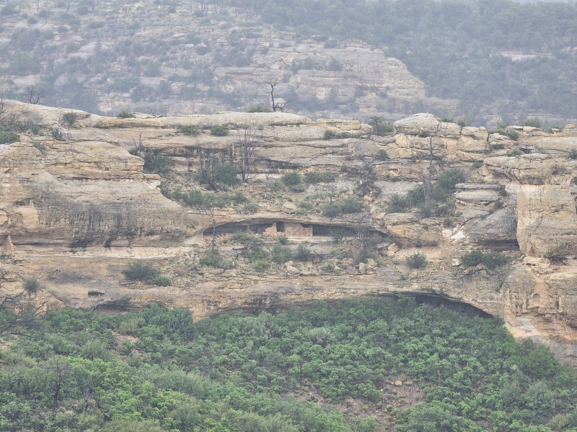
Nordenskiöld did a lot of remarkable exploring of the area. He numbered the sites, and the numbers can still be found to this day. Additionally, there are numerous trails in the park that he created. Back up on top of the mesa you can find many of these trails. I hiked Nordenskiöld Number 16, the trail to site number 16, of course. This trail is accessed off of the walking path to the Long House trail. It was super cool to get to the end of that trail and have a view of another cliff dwelling off in the distance (at this point I was unaware of how many of these there are!). But, in this case, the distant dwelling was actually RIGHT UNDER the trail I had just taken to get to the Long House tour! HOW COOL! I had just literally walked on top of one of these structures without a clue!
Infographic of Nordenskiold and site #16.
SIte #16, taken by me. The top of the cliff here is where the walking path to the Long Houses trail is located! Taken by me.
There were a lot of pretty wildflowers to be found. Taken by me, on the trail to site 16.
Upon Leaving Wetherill Mesa I headed further into the park to do some recon of the Chapin Mesa area. This is the are that most people will explore and contains the 3 other Cliff Dwelling tours, as well as the Museum. In case you are wondering, the Visitor Center is actually way back at the park entrance about 45 minutes away. You cannot miss it, but if you think there is another one deeper in the park, there is not. In any event after a decent drive, you come to a turn that takes you to the museum, park offices, and a cafe with a delicious Navajo taco on the menu! There is also a spectacular cliff dwelling, the Spruce House, to view. Like all the others a person will see, you are opposite a canyon from it, but this one is much closer and visitors used to be able to visit but conditions have led to its closure. Still, worth a peak, for sure!
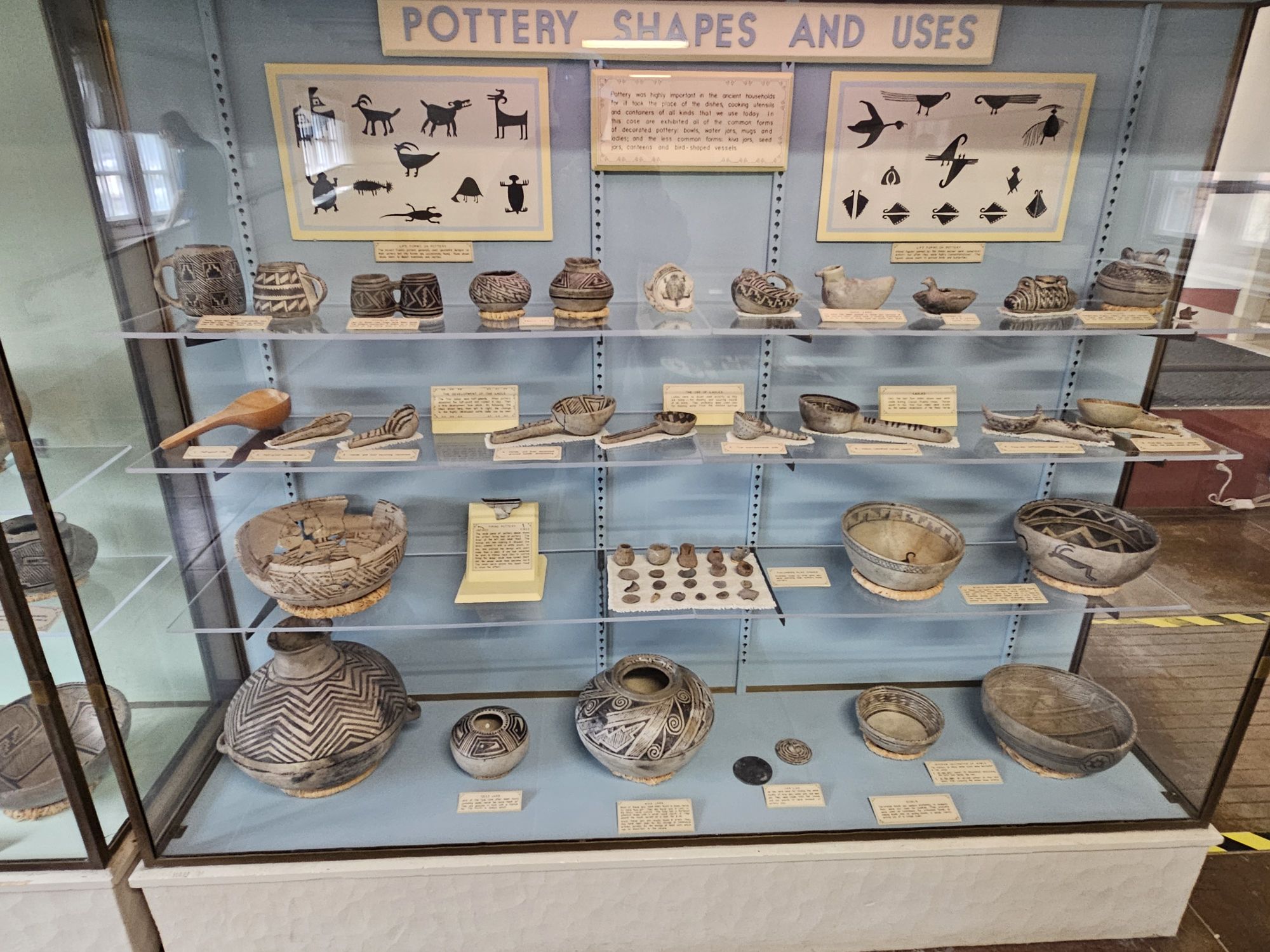
Some of the pottery in the Museum. Note the black and white coloration.
I gather the trees were the inspiration of the name of the Spruce House. Taken by me.
Worth a read. Click on picture for a clearer view.
The museum is pretty great, and shows off the many artifacts, including all the pottery and highlights the importance of that black and white pottery I mentioned earlier. After checking out the museum, I headed back to explore! Once back on the road, you are soon given a fork. Going to the right leads to the Mesa Top Loop and the left leads to Cliff Palace Loop. Mesa Top Loop provides access to a number of excavated pit houses on the top of the mesa, mostly dating back to the 600-900 CE era, and to some great views of Navajo Canyon. At one overlook, though I could not find them all, the Guide Along tour mentioned that something like 30 cliff dwellings were visible! This loop also provides access to the Square Tower House. The loops are one way, so once finishing this loop, I took the Cliff Palace Loop. This loop provided many more extensive views of the numerous cliff dwellings that are visible in the park. I was pretty stunned by the shear number of these dwellings throughout the park. There are over six hundred of them! They are were all built at roughly the same time, and abandoned at the same time as well. And even more, there are at least more than FOUR THOUSAND sites on the mesa tops. The majority of these sites are NOT excavated, and will not be, to protect them.
One notable mesa top site is the Sun Temple. This site is directly across the canyon from Cliff Palace, offering great views of that huge site. The Sun Temple is unique among all the sites. It is a D shaped structure which is rare enough, and it is the only one not found within a pueblo. Another notable D shaped structure in the are is Pueblo Bonito in Chaco Canyon. This one was built with no roof. Speculation is that it was an observatory. It was built the same time as the cliff dwellings, so was definitely connected to the cliff dwelling peoples.
Worth a click to read!
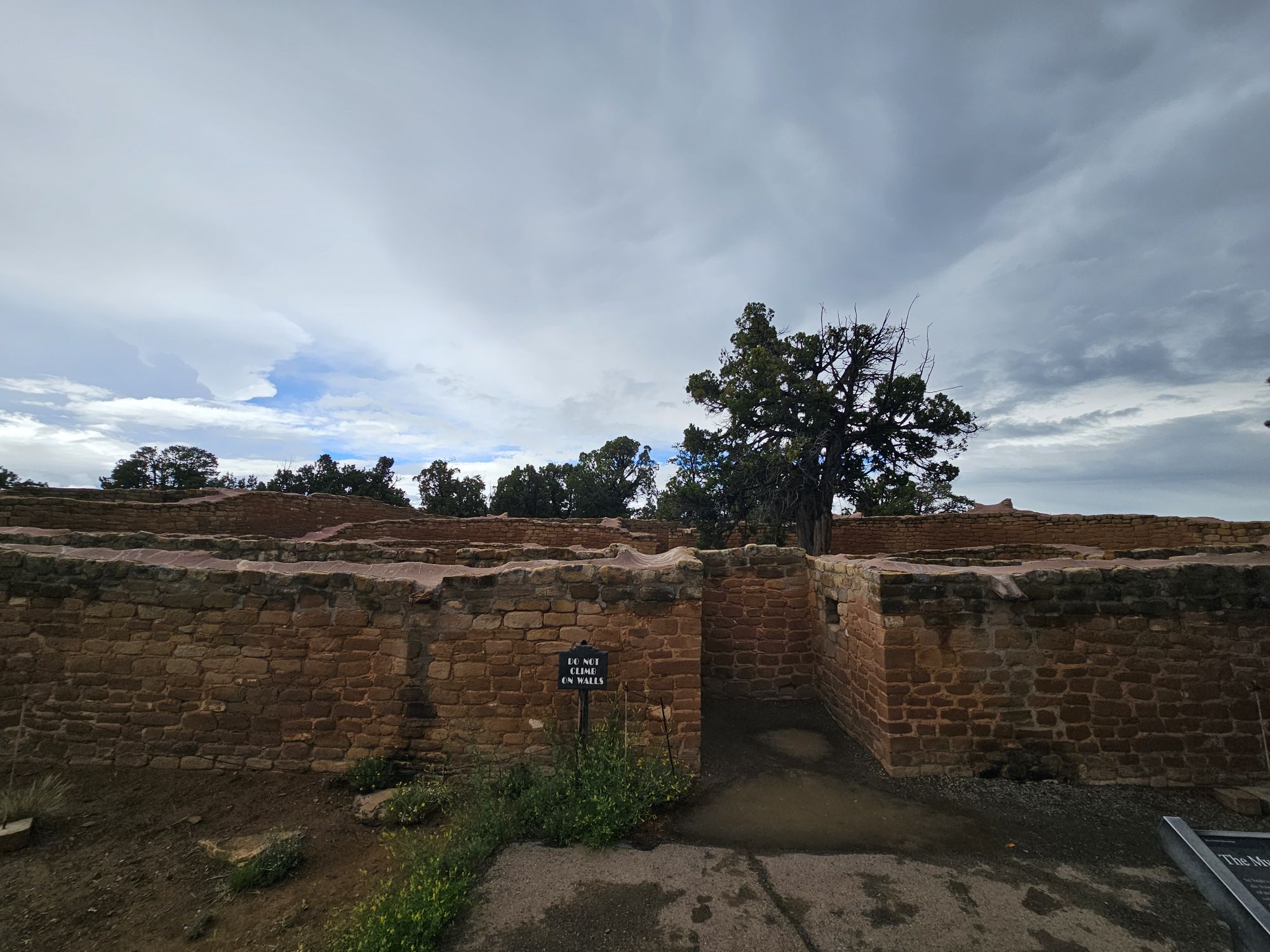
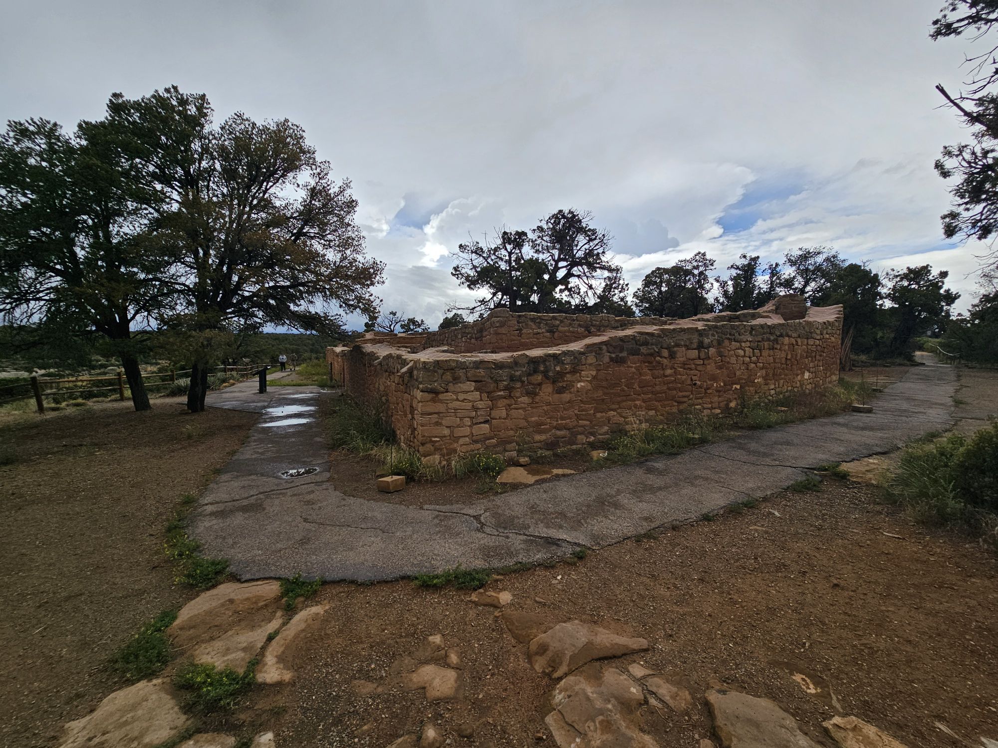
The exterior of the Sun Temple, taken by me.
Another part of the outer walls of the Sun Temple. Taken by me.
Another part of the Sun Temple. Taken by me.
The Sun Temple gives a pretty killer view of the Cliff Palace! Taken by me.
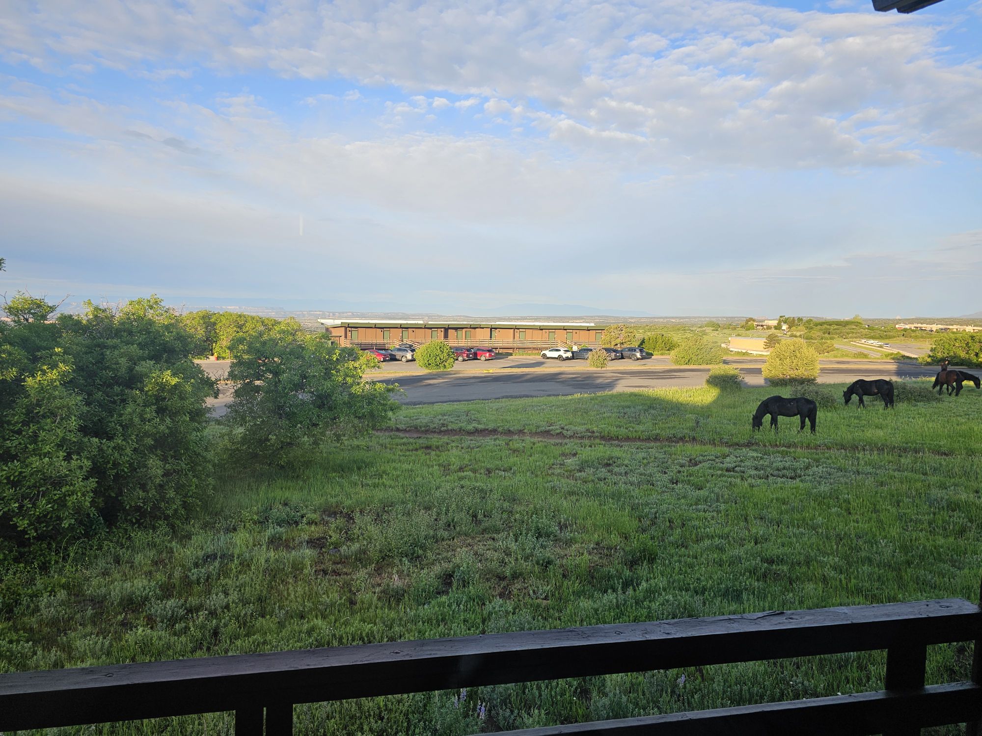
After leaving the Cliff Palace Loop I headed back to the Far View area to settled into my room for the evening. The lodge is simple but the bed was comfy and there is a restaurant, store, and bar on the property. You will find wild horses as well, though signs warn they are not friendly. Also, there is an iconic, but closed, visitor center right across the road. This one was open from 1970 to 2012. It seems the building is still in quite good shape and the park is actively pursuing a repurposing of the structure. Here’s hoping they are successful, because it looks like a neat place that offers killer views of the park! And with that, it was time to turn in the for the night.
The old visitor center. Taken by me.
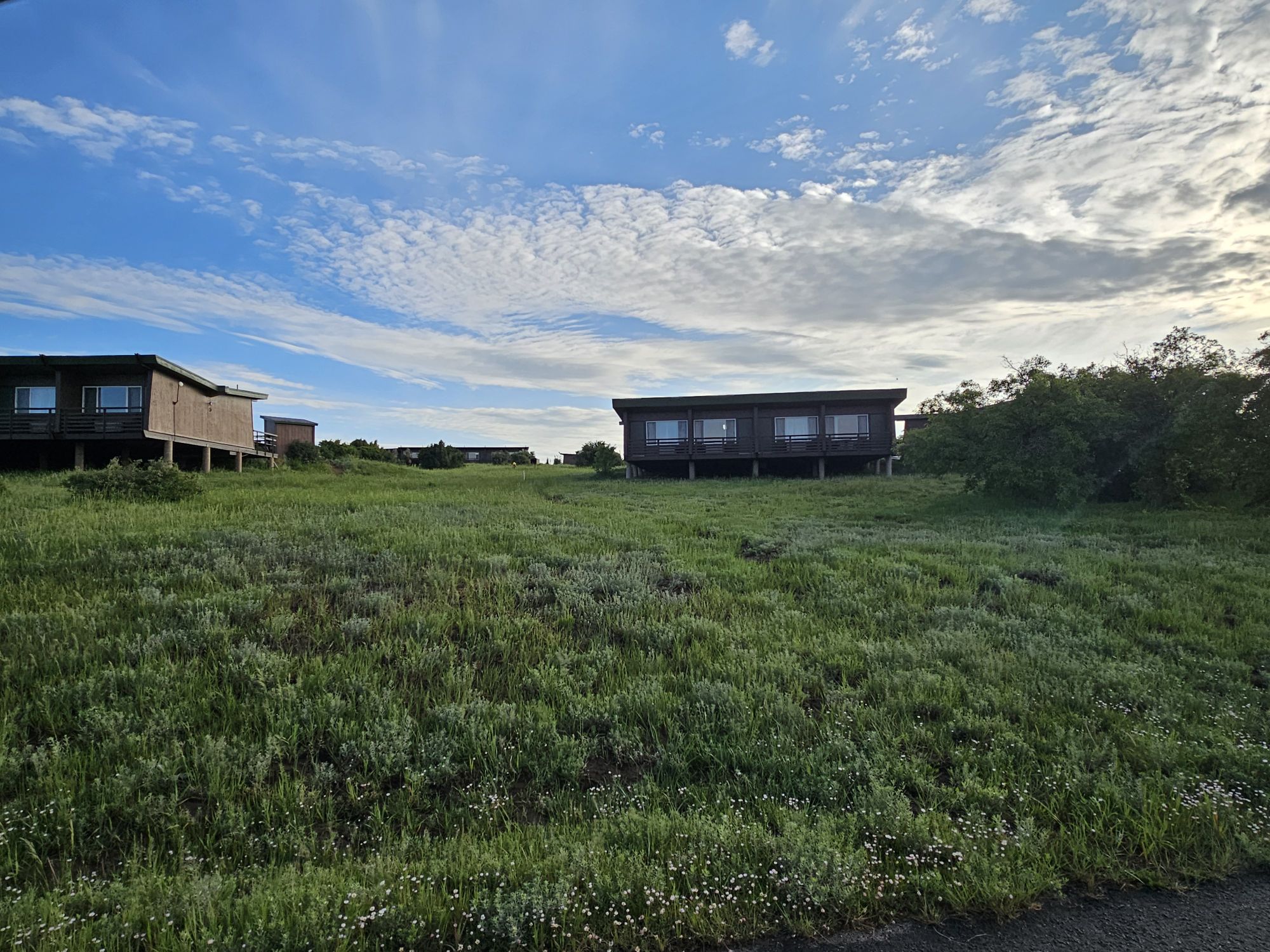
The building with my room at the Far View Lodge. Taken by me.
The view from my balcony in the mornings! The horses are not friendly!
Like is I mentioned in the opening, this is a park very large in scope and history, so I hope you at least looked at the pictures and read the captions! Stay tuned for part 2, where I share tours of the Square Tower House, Balcony House, Cliff Palace, and other mesa top sites!
NPS Unit Count: 80/430 US Unesco World Heritage Site: 14/24
Hey there Adventurers! I have to say I am super excited to recount the next many posts for you all! This trip in June was to check out Mesa Verde National Park in Colorado, but there are many national park sites in New Mexico including several #USBarkRangers sites, so I planned a week loop from Albuquerque to do some cool shit! I had been to far southern New Mexico once before, but I left this trip with a new found reverence for a state I didn’t really think about too much. I feel like these sites that I visited should be visited by every single American. And, I also felt like I came back with a degree in all things native southwest!
If you choose to follow this “series,” which will encompass stops to Chaco Culture, Mesa Verde, Aztec National Monument, Pecos National Historic Site, Bandelier National Monument with a short stop at Valles Caldera National Preserve, Petroglyph National Monument, Salinas Puebo Mission National Monument, and Valle de Oro National Wildlife Refuge, you, too, are going to learn about kivas, Pueblos, the Puebloans, missions, etc! Also, since at this point we all know I can be a little long winded, other than Mesa Verde, this will probably be the longest entry of the series! (and it is mostly pictures and videos!)
After I landed in Albuquerque I headed out toward Chaco Canyon and Chaco Culture National Historic site! I took a minor risk on this part of my trip. I had booked a hotel in Farmington, NM, which is all the way up near the NM/CO border, for the evening and Chaco is geographically in between, sort of, but not really, due to the lack of access. But, luckily flights and weather were on my side and I managed to make it to Chaco as planned! It should be noted that merely getting to Chaco is no small task. There is a very large chunk of North/Central New Mexico that is the middle of nowhere and that is where Chaco Canyon is. The GPS will lie to you. The website for the park says as much and they were not incorrect. I wrote down what the park said for directions, but even with that I still had to call en route to clarify. Cell phone signal does not exist, and the gps tries to do its damnedest to take you through small communities where the roads are actually not roads or are blocked off by Native communities. Once you do manage to make the right stop off the highway the NPS has done a good job with signage. But the road is remote bumpy, gravel and dirt, and there is a whole lot of nothing for 20 miles. But in any event I arrived at Chaco at about 3 PM local time.
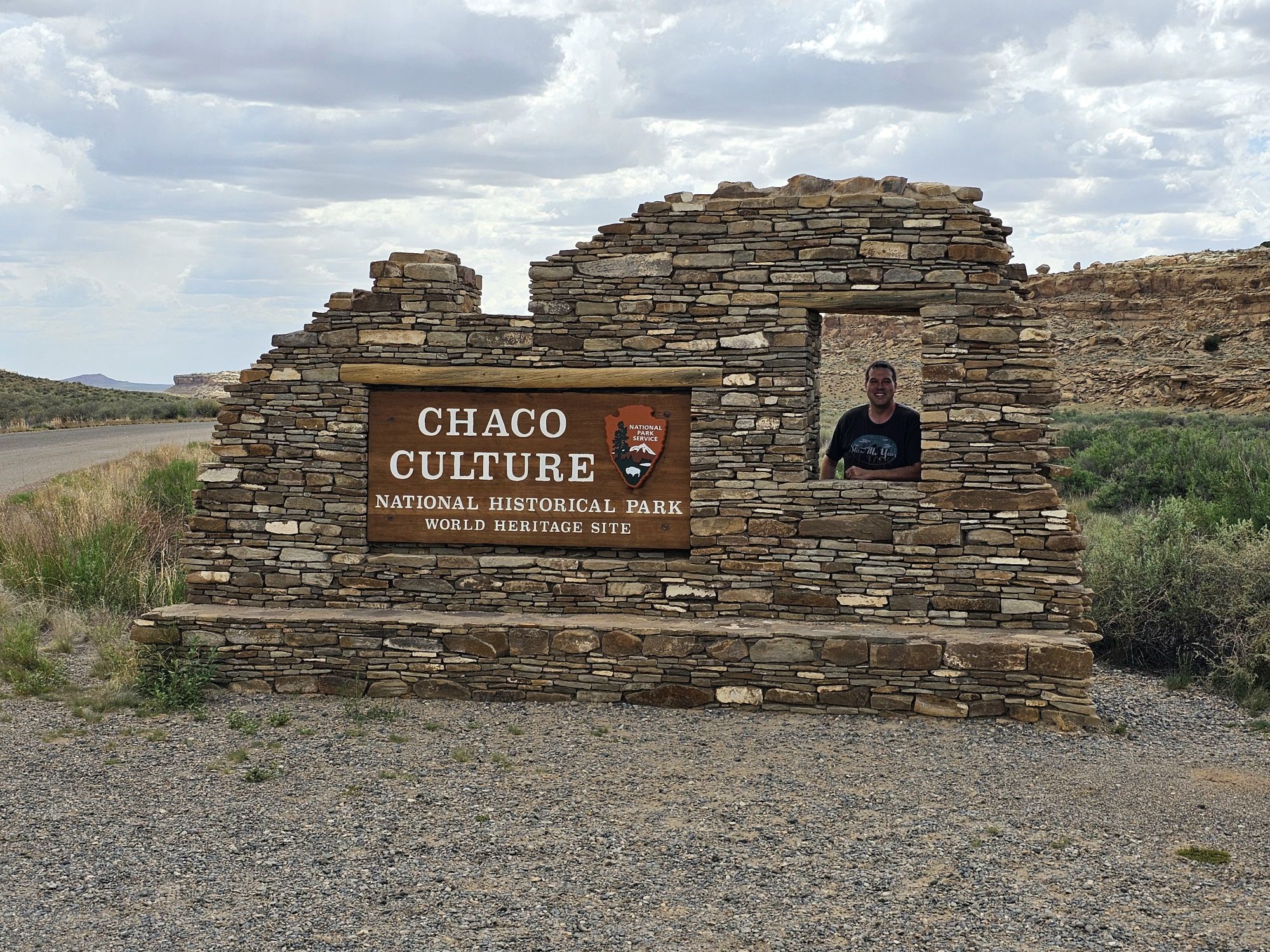
Surprisingly, there was someone coming down the road behind me and we exchanged picture taking! This is probably one of my favorite signs now!
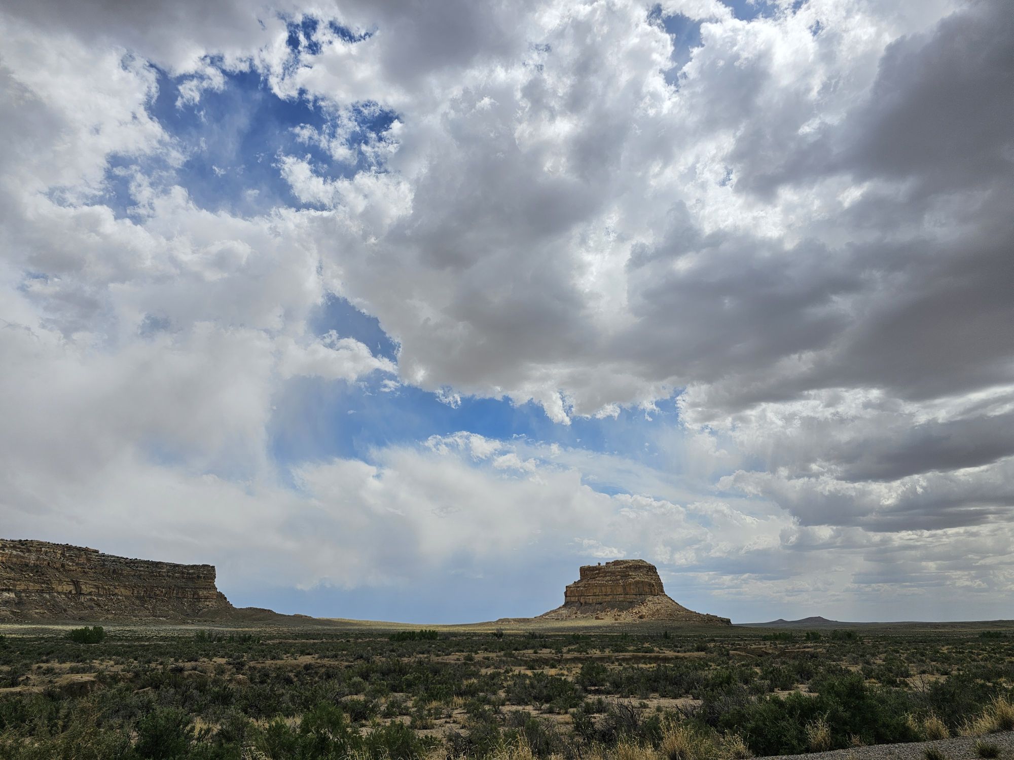
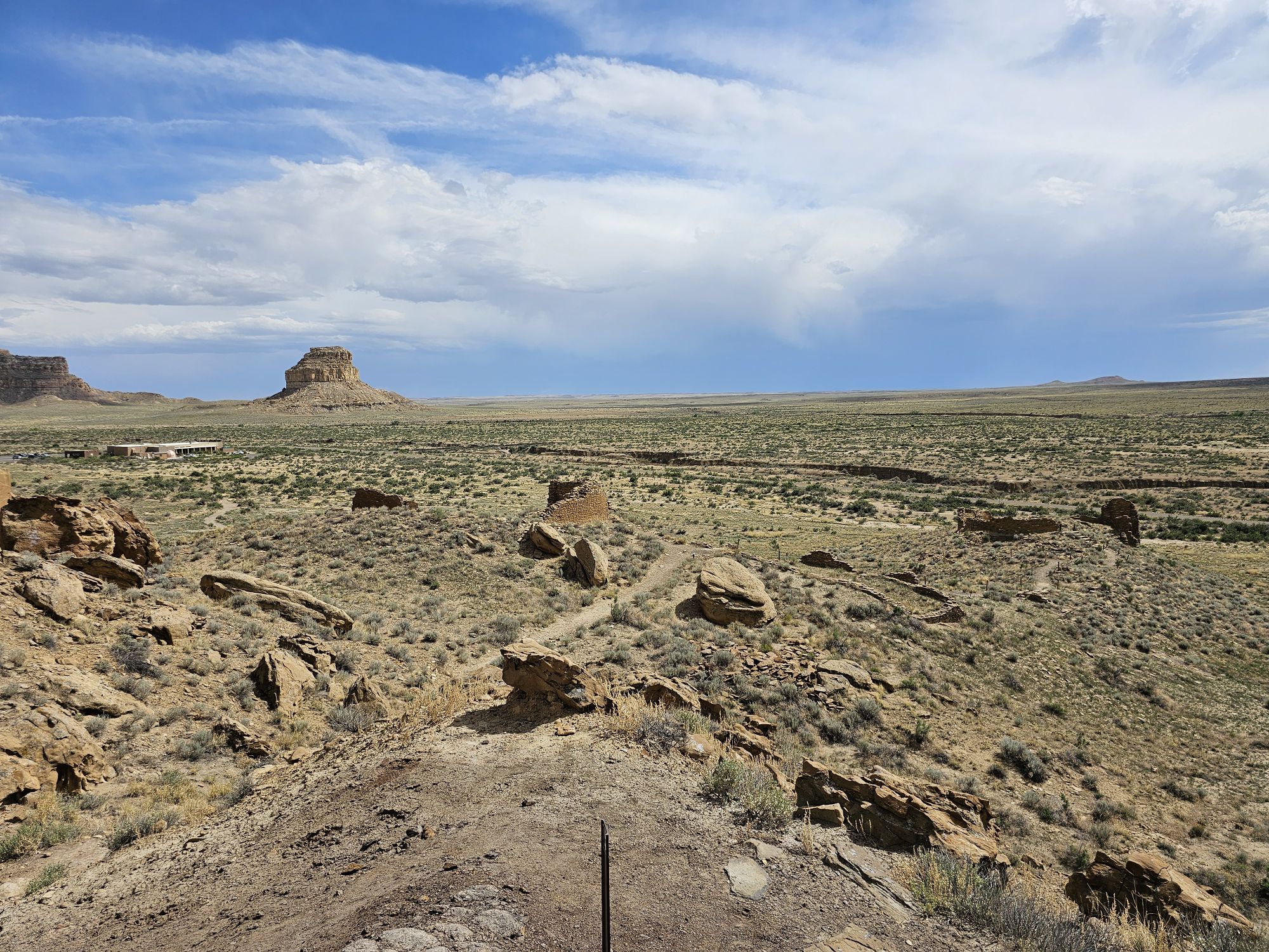
This is Fajada Butte a towering part of the landscape here, at around 450 feet tall.
Chaco Culture Historical Park is a Unesco World Heritage Site (I am starting to rack up the US ones, so I have now added a counter for that as well!) and let me tell you…this is a very important place to visit. In fact every single one of these sites I visited on this trip are super important and encompass things that are not really taught in schools, and I think every American should visit.
I would say that the first thing everyone needs to know is that the native tribal populations in North America a thousand years ago were neither primitive, nor “savage”. The ancient Puebloans maintained a network of roads, trade and culture that extended as far as Mexico and central America during the the 800 to 1200s CE. This site does have evidence of human habitation dating back nearly 10,000 years as well! Most of what is left in these sites here at Chaco is original, with little to no restoration! Many sites are now being left unearthed to protect them for future generations and hopefully better archaeology techniques. This site is in Chaco Canyon and was the major center of the Ancient Puebloans, is one of the largest native sites north of Mexico, and is one of the most important cultural sites in the United States. The Hopi and modern day Puebloans consider this site their ancestral homelands. That is all I will share, but you could probably spend years learning about this site, so go visit and get started!
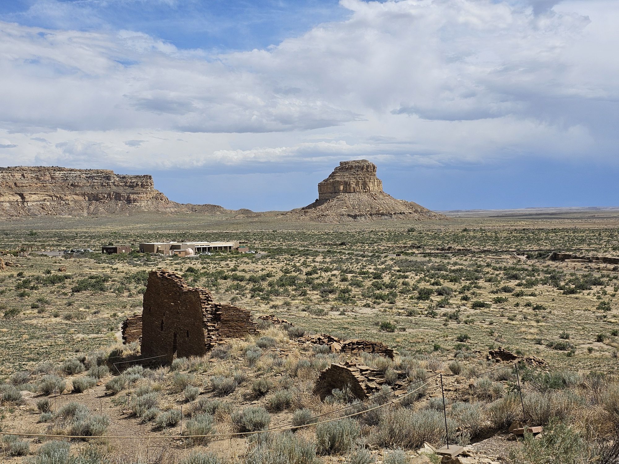
Upon entering the park area you will first pass the cool sign, then the campgrounds, then you will come to the visitor center. From the visitor center you immediately have access to hikes that go to some of the ancient ruins as well as ancient petroglyphs. Pretty cool! This area is called Una Vida and I was quite impressed with this area by itself! This is high desert, so altitude, water and exposure are the prime concerns for safety. Upon leaving the visitor center the road through the park is a several mile loop that stops at several key sites.
Fajada Butte from the Una Vida ruins. Taken by me. The visitor is visible in the middle left.
There is more to see here than is easily visible. There are at least three distinct ruins in this area of Una Vida in this picture. . Click on it to see the better view! Taken by me.
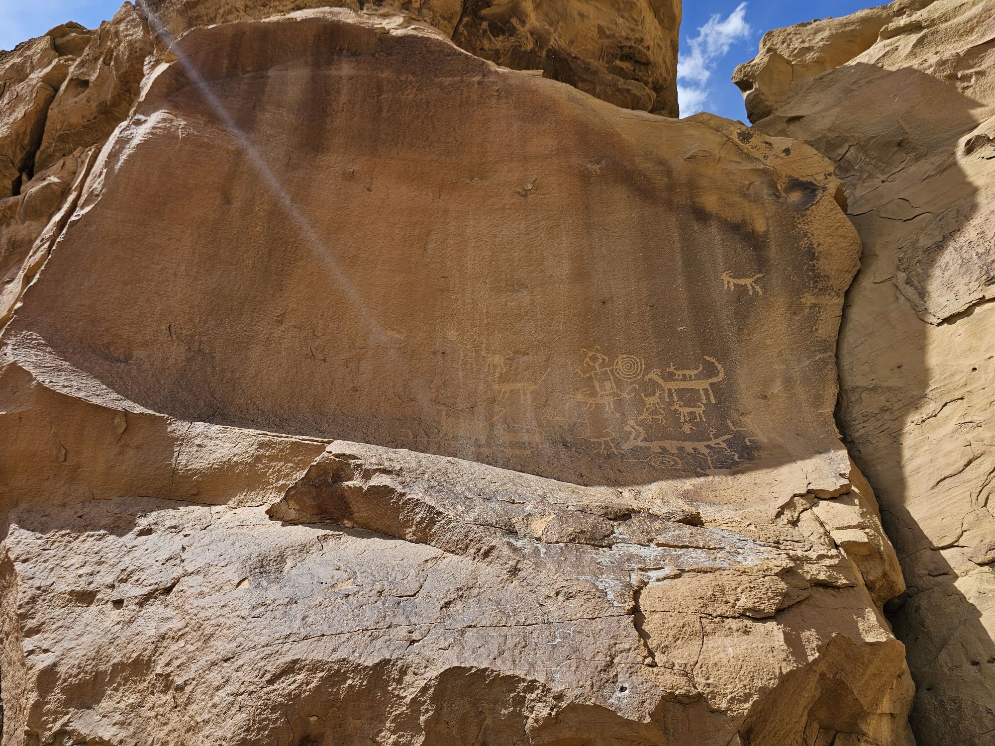
Some of the petroglyphs visible near the Visitor Center. There are many more in this area and indeed, through out the park. However, a good eye is needed for many of them.
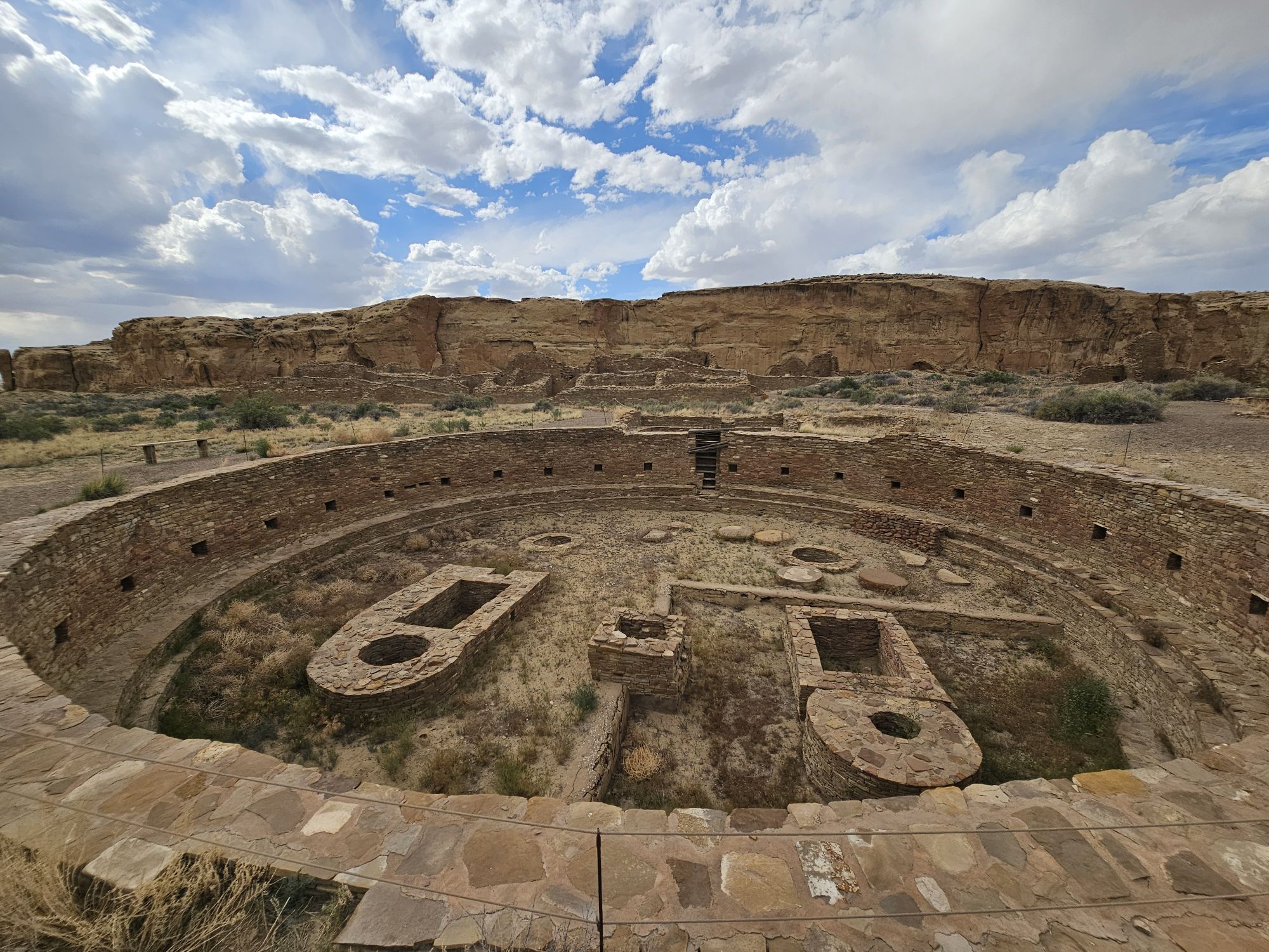
At some point on this stop I realized that I was woefully unprepared for the educational side of things that this site was going to provide (and, indeed, ALL of the sites to come!). I had no idea what the hell a kiva was. I had a vague generalization of what pueblo meant, and I had no idea about the connection of all of these peoples throughout the now southwest US. Puebloans are basically people who use bricks with mud (no small feat considering the desert environment) to created their villages. And yes this is an obscene generalization, but that’s how I can most succinctly characterize these people. They all spoke/speak a similar type of language but it’s not exactly the same. Their descendants are still actively participating in the Pueblo culture in the Southwest. A “kiva’ is a sacred community center that is usually built into the ground, is round or square, has a roof that is able to support people actively doing people things on top. The entrance is through a ladder from a hole in the top and there is fire inside the kiva where the smoke is diverted up and out of the same hole in the ceiling by means of rocks set up to do this job. If you watch any of my videos, you can tell that I was ignorant because I reference the big round holes in the ground as pits, and I even speculate as to whether they were grain or water storage! Oops! I had no idea of any of this going out on this trip. Bad me. I got lazy, didn’t research, and didn’t know what I was getting into!
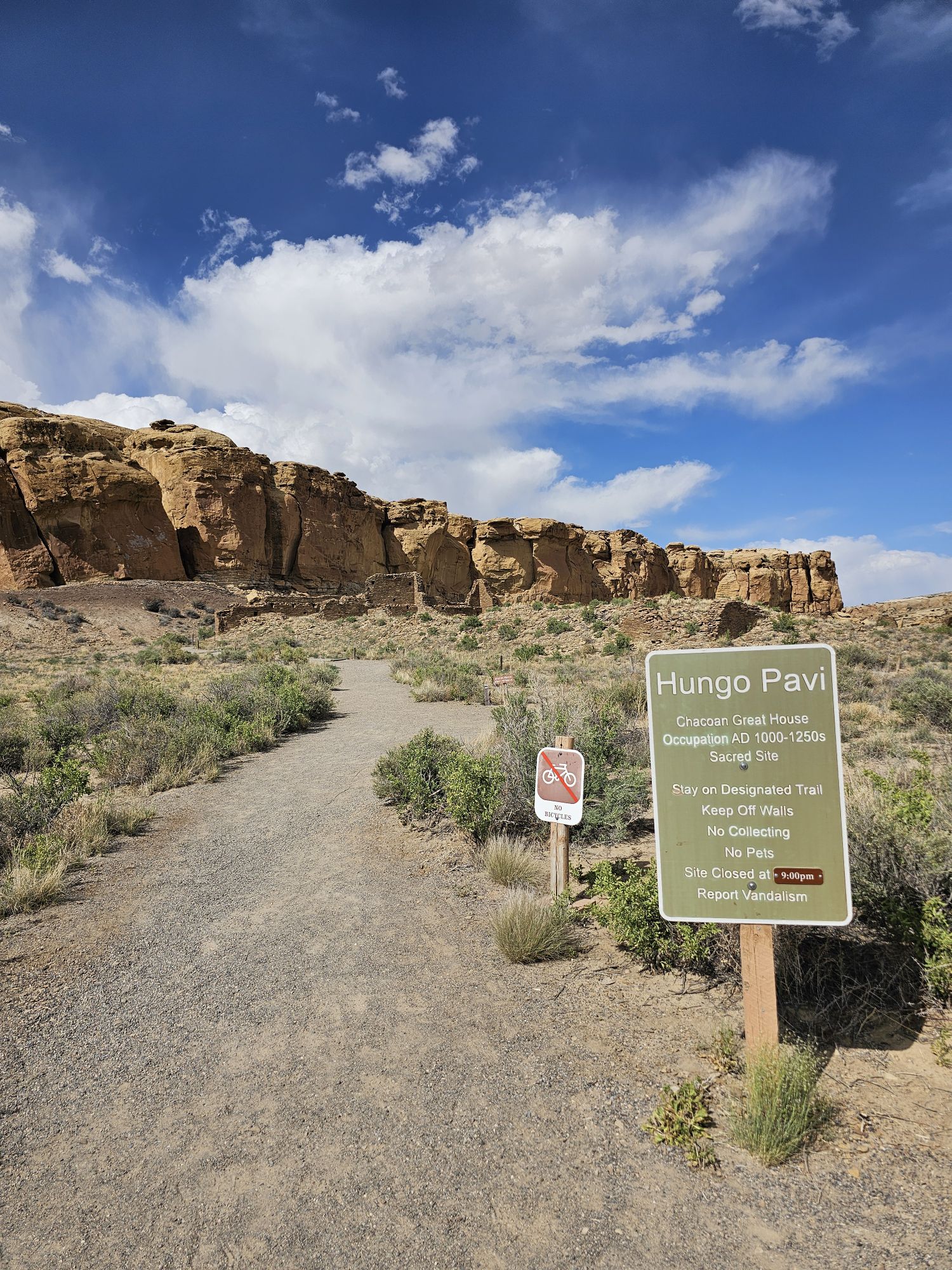
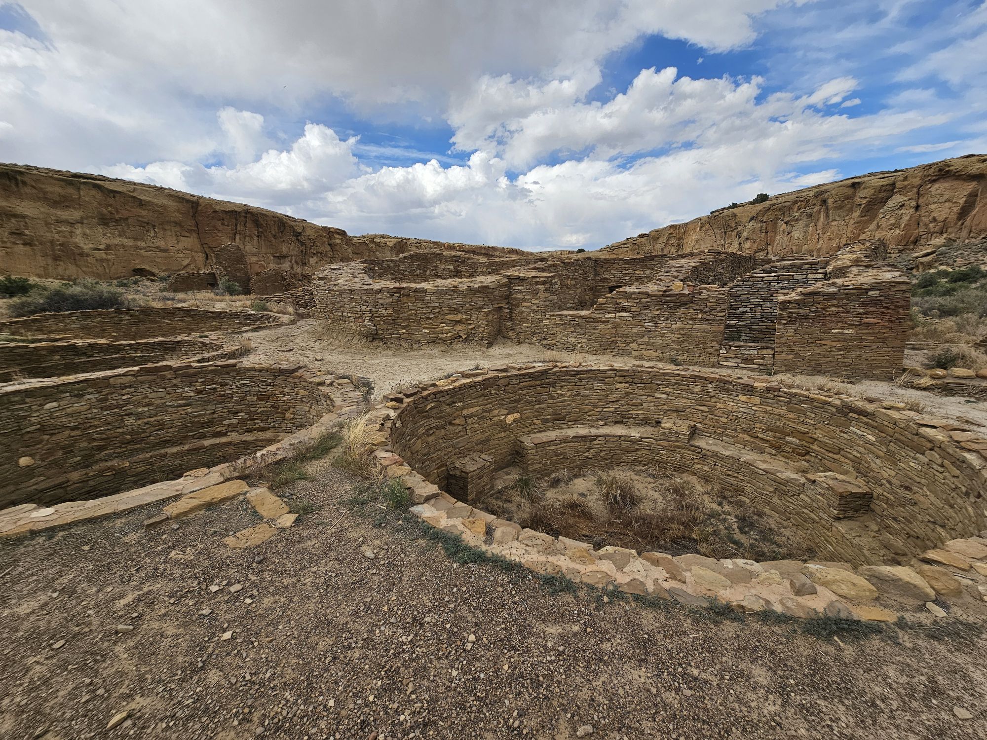
In any event, the surviving ruins here at Chaco are amazing in size and complexity. After checking out the sites near the visitor center I headed further into the park. I was amazed at the extent of the preservation of the sites and the limited work the NPS has had to do to preserve these sites. I was also surprised at how accessible the sites are. You are allowed to walk into the ruins, through the doorways, and if you aren’t watching your step you could fall into the kivas! (don’t do that!) Most of the large sites are along the north side of the loop. The first stop is called Hungo Pavi . This is an unexcavated site that contains a Great House with 150 rooms (yes 150), a great kiva and a plaza. What unexcavated means is that the ruins are still partially covered by wind blown sand and vegetation, which actually protects the site. The policy of not excavating would come up more at Mesa Verde and was surprising to my ignorant self.
The entrance to the Hungo Pavi site.
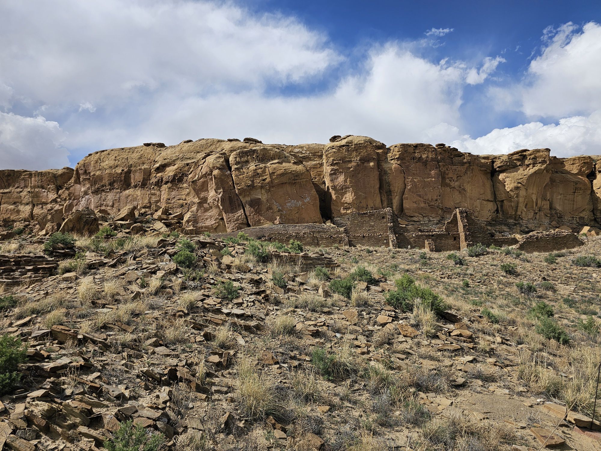
These are the first ruins of Hungo Pavi that you will see upon starting the walk to the site. Taken by me.
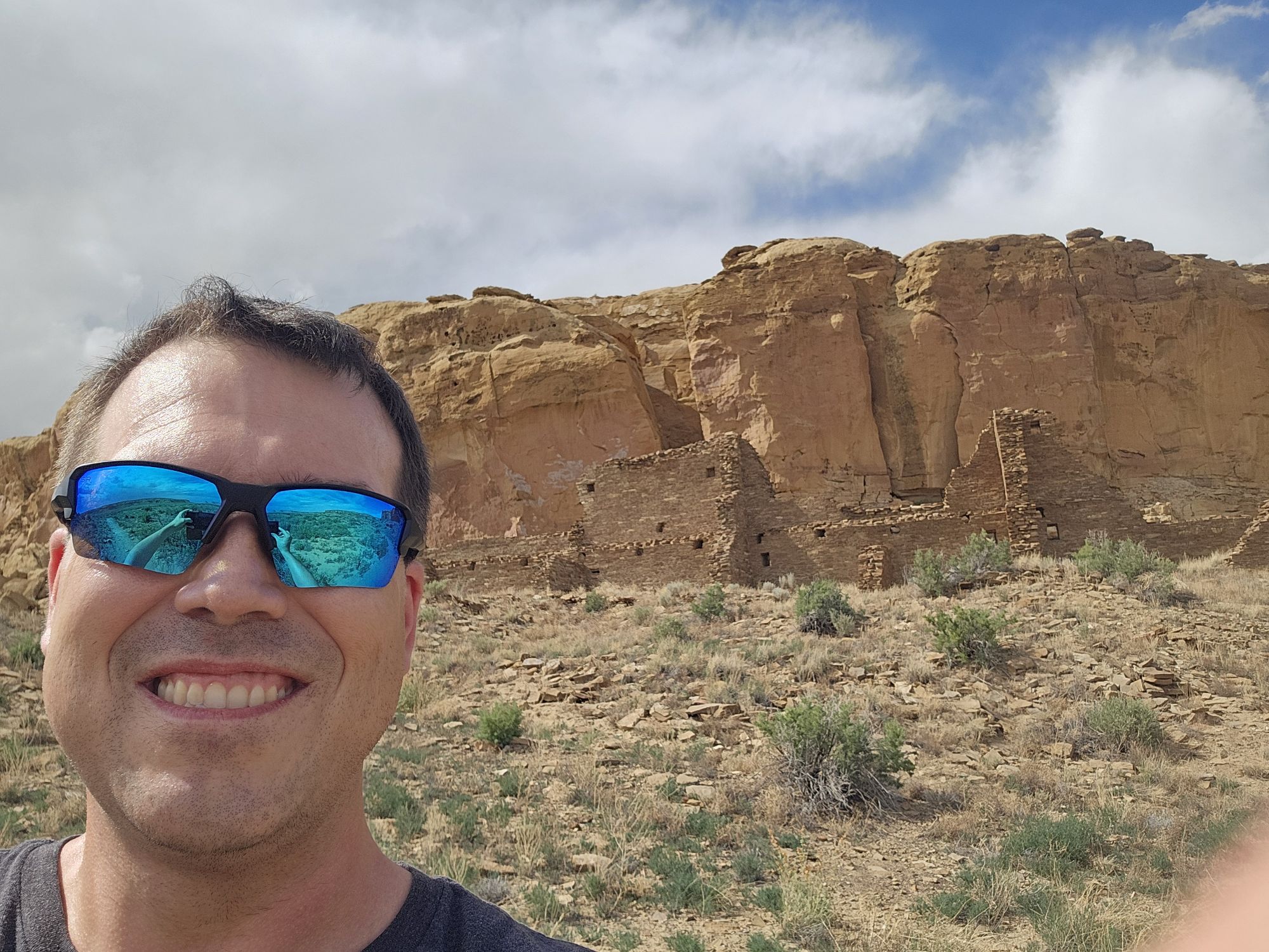
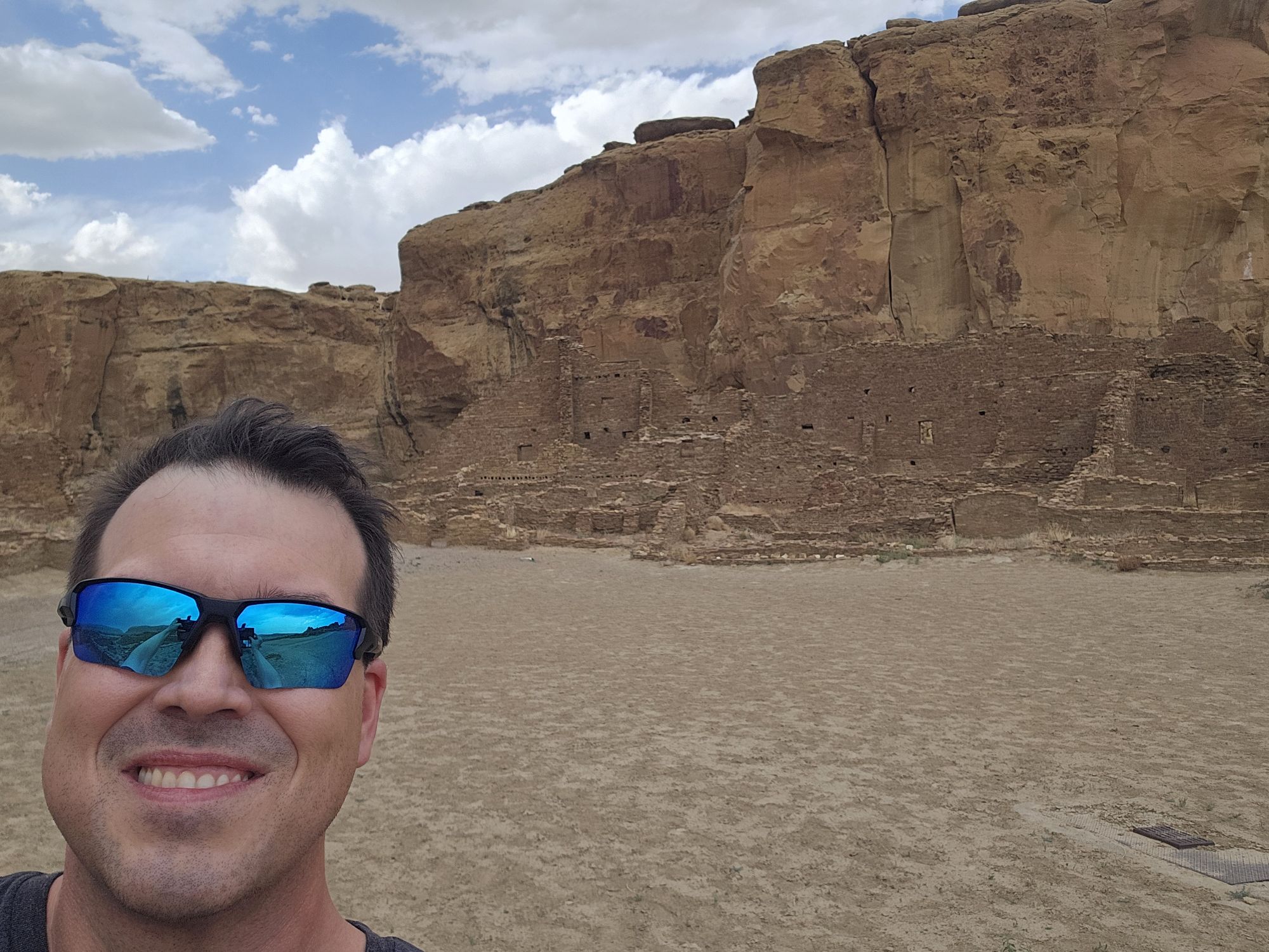
Selfie in front of that same site.
Hungo Pavi. Taken by me.
Pretty amazing craftsmanship for a thousand years old! Taken by me.
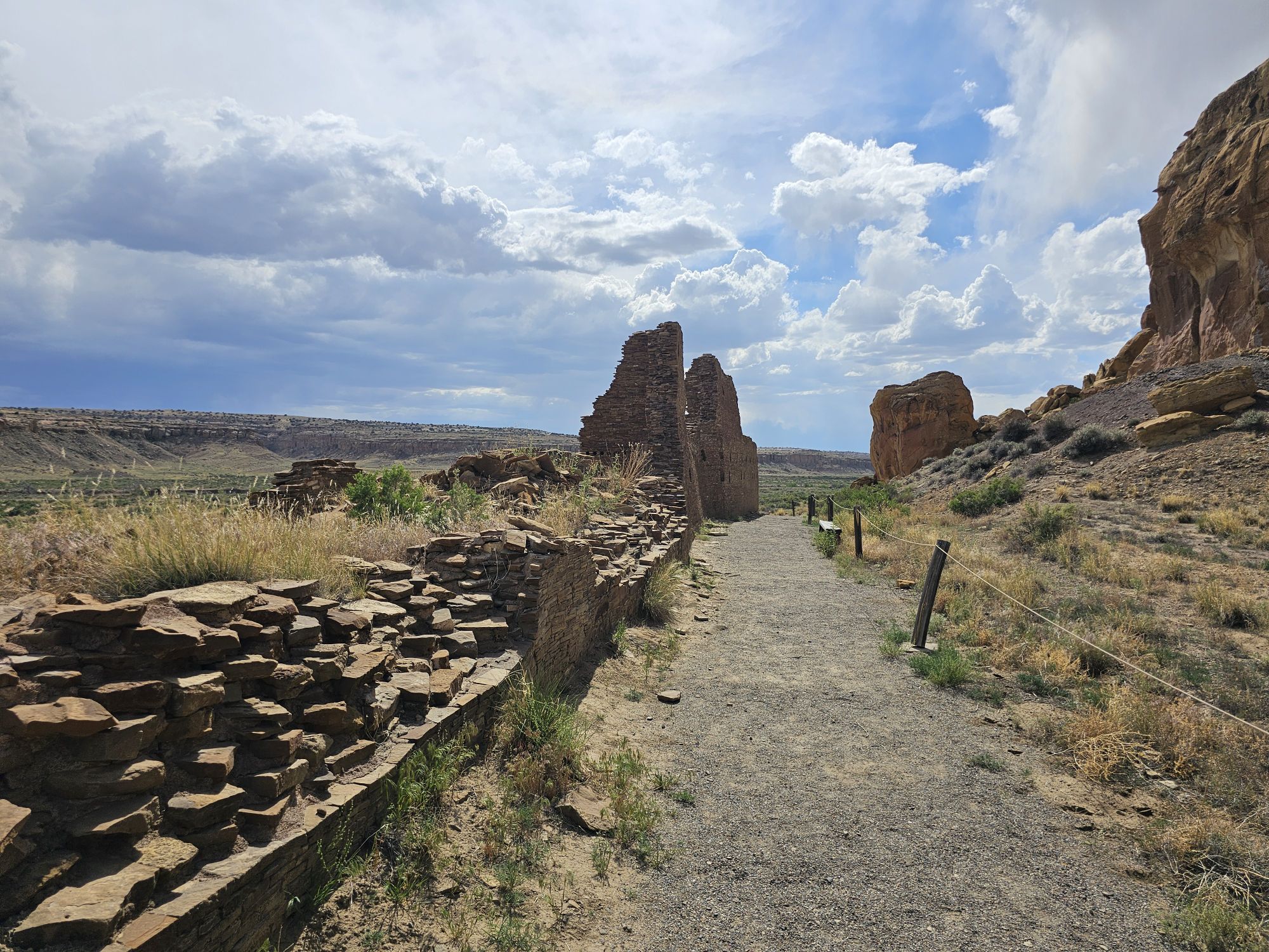
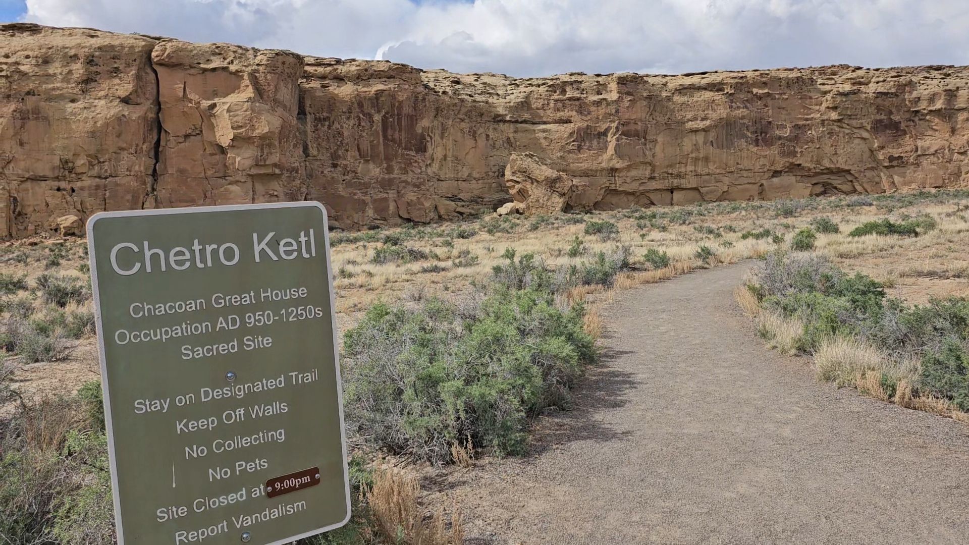
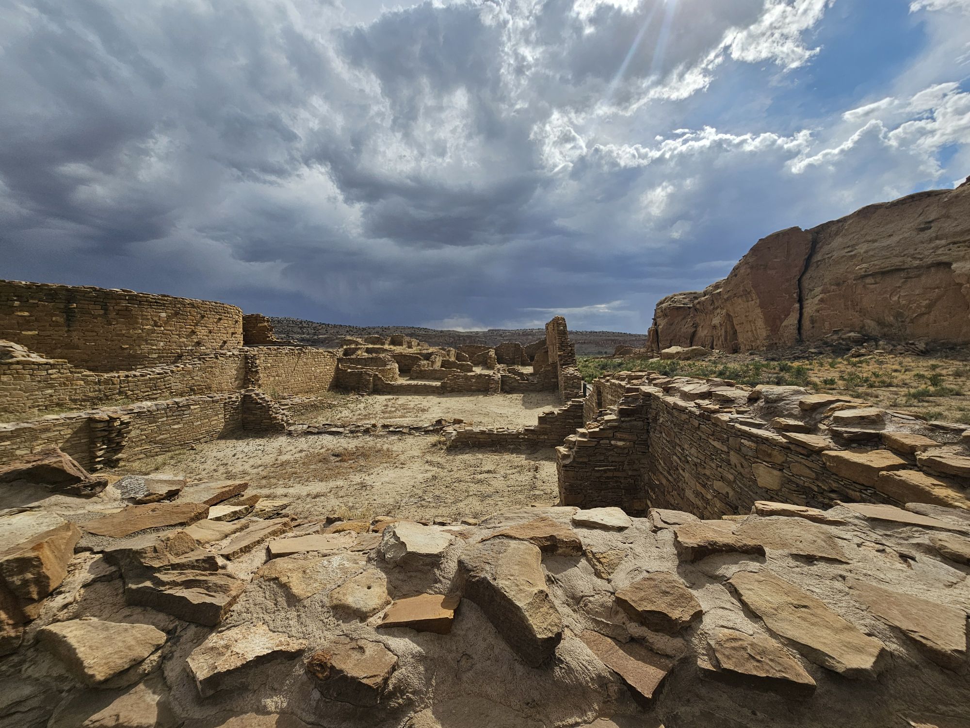
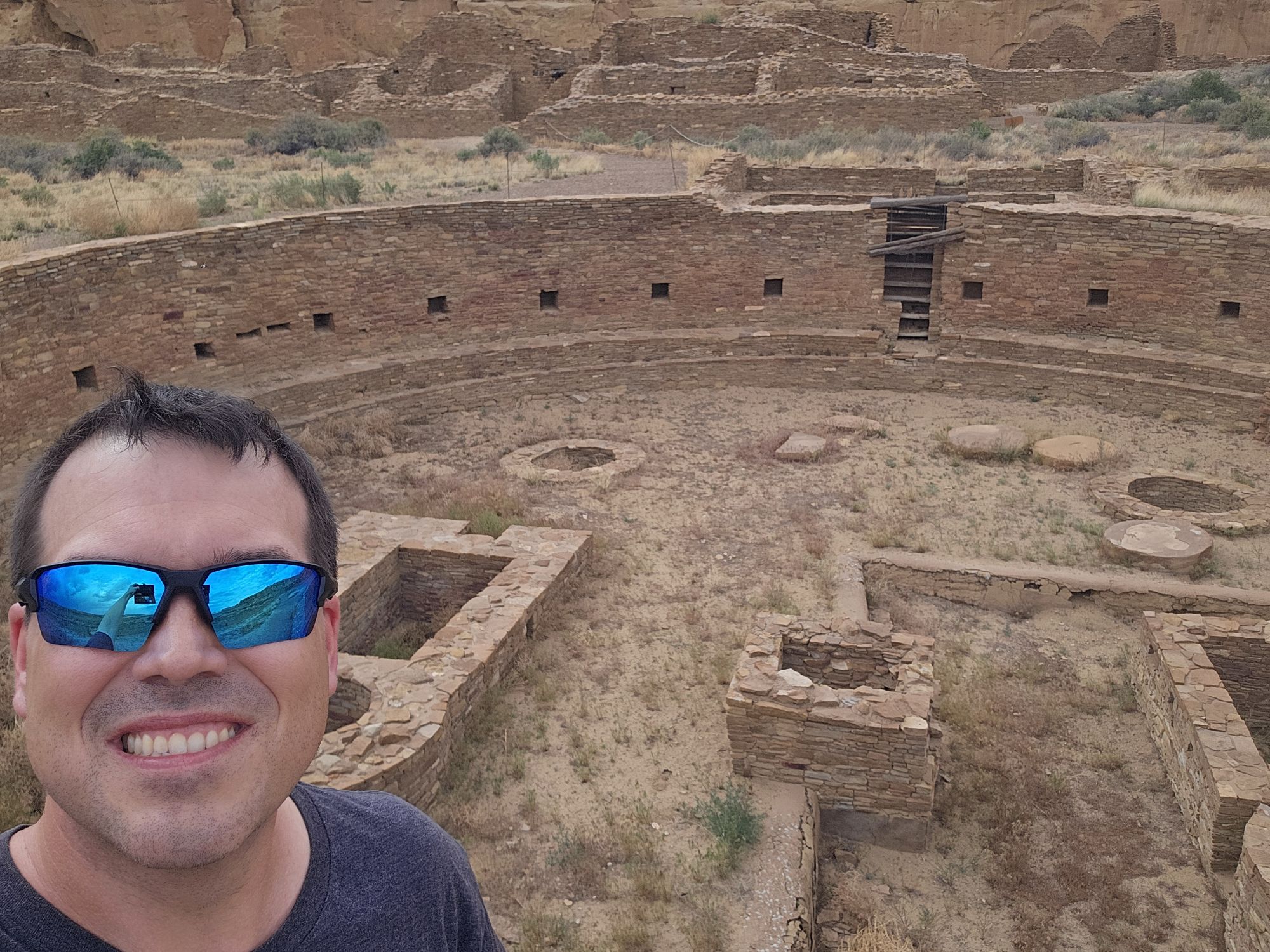
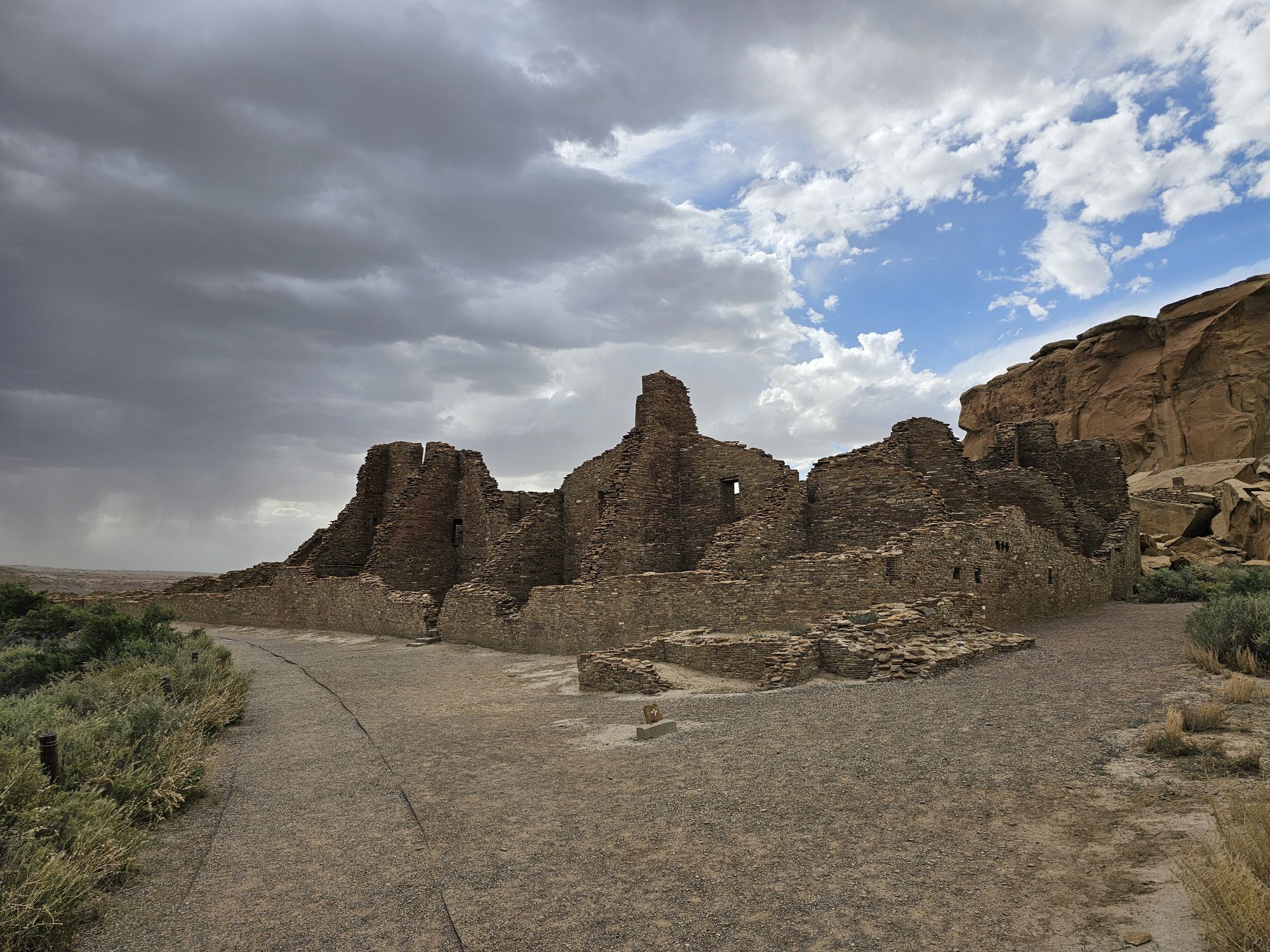
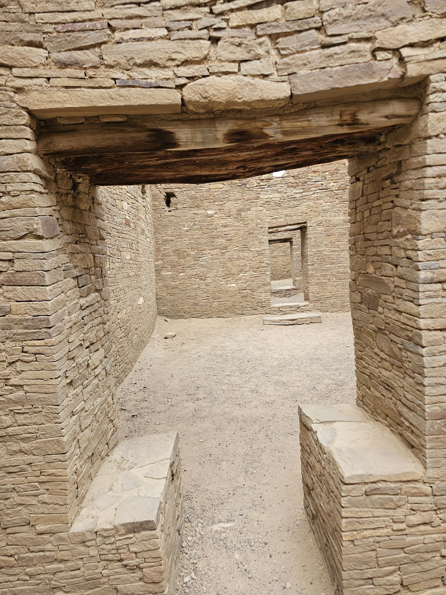
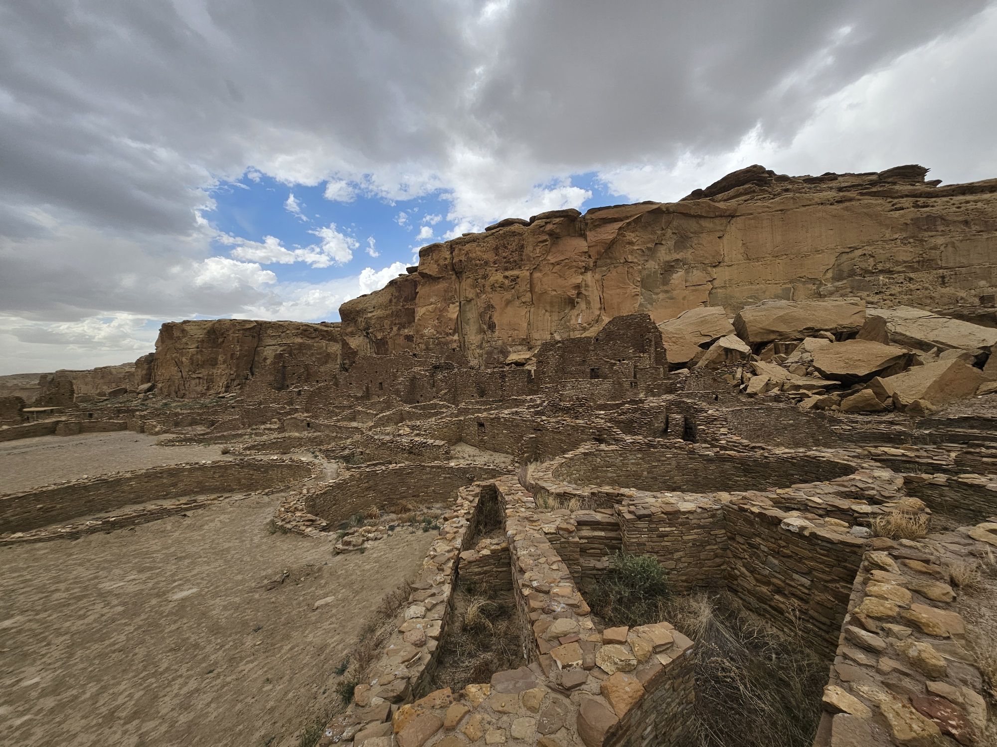
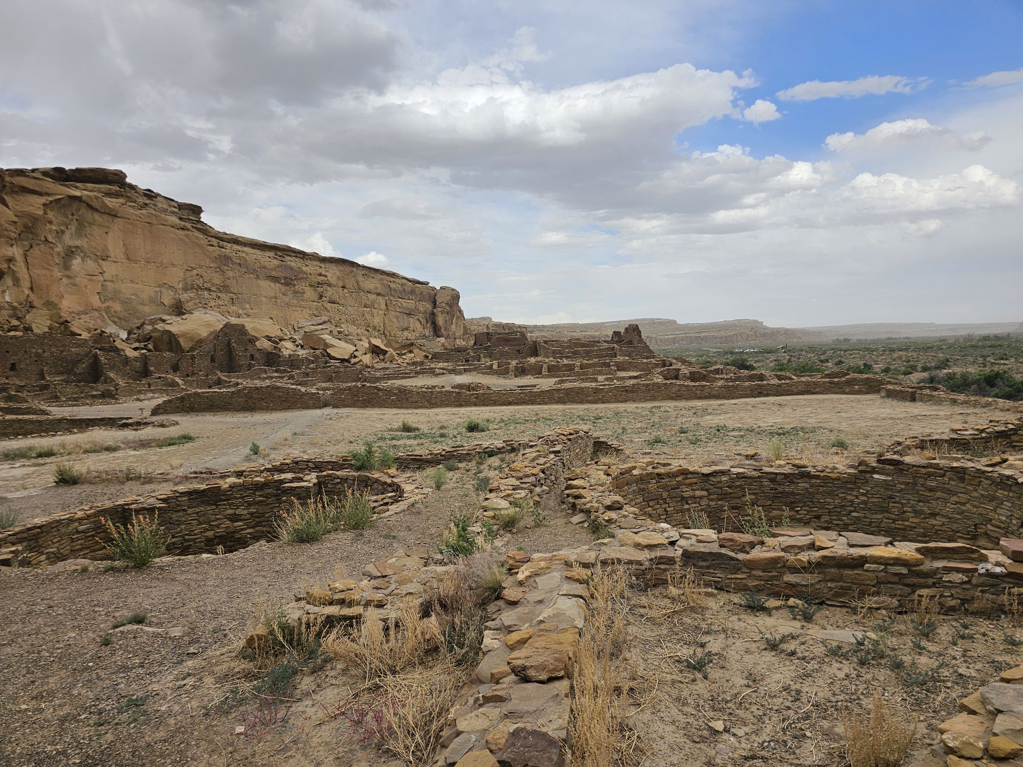
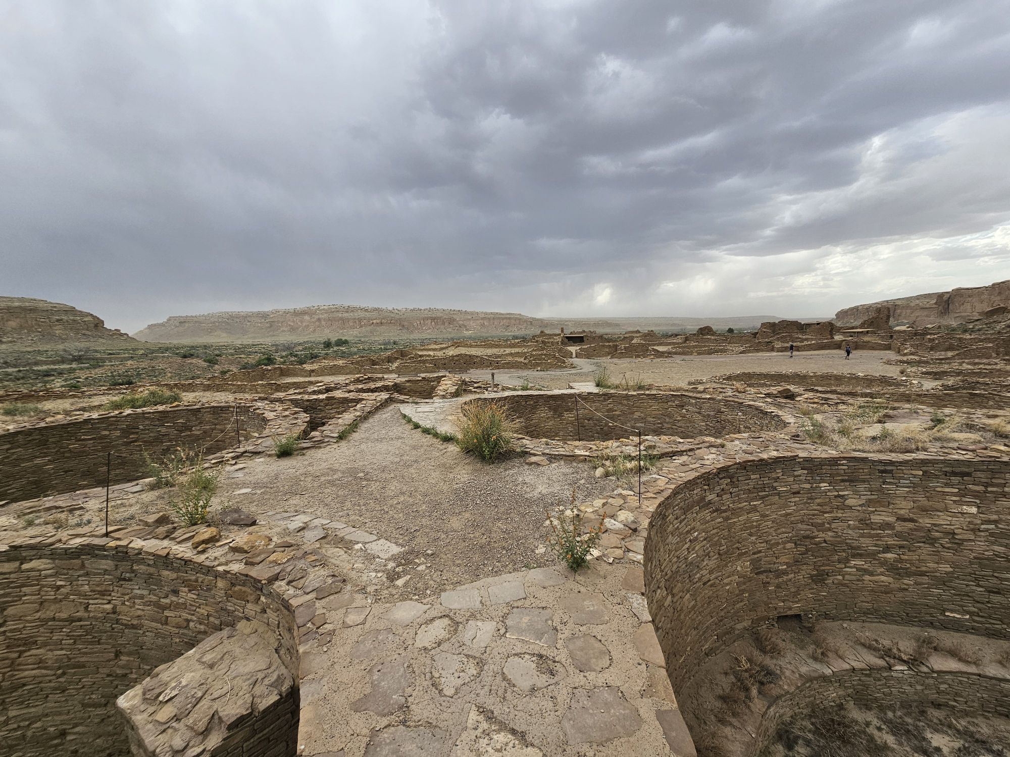
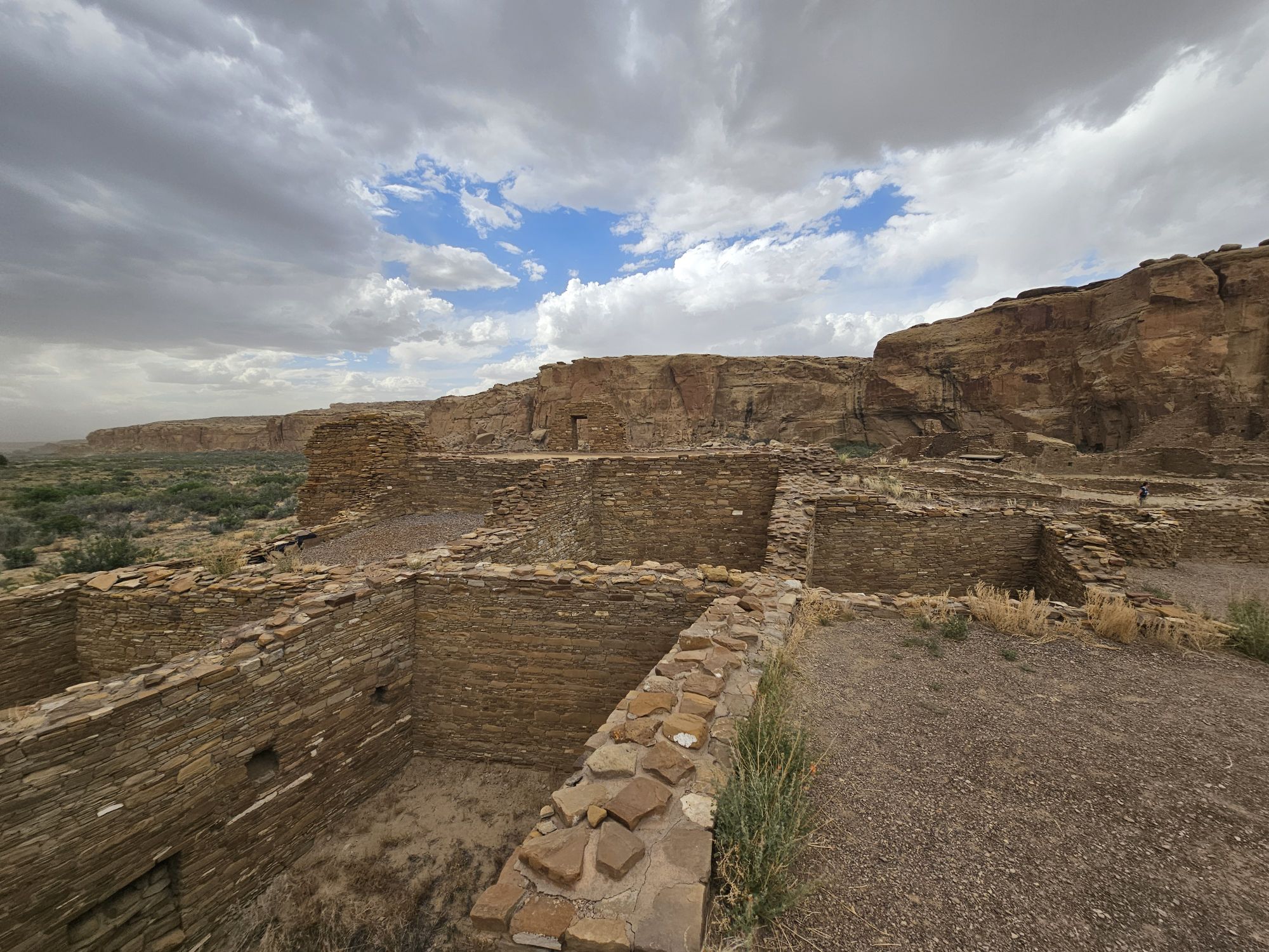
The next stop is Chetro Ketl which is the 2nd largest Great House here and included a 2nd and a 3rd storey. To get to Chetro Ketl one takes a path from the parking lot to the right, and if you go to the left you arrive at Pueblo Bonito. Chetro Ketl was a step up from Hungo Pavi and super impressive. But despite the impressiveness of Hungo Pavi and Chetro Ketl, well, Pueblo Bonito is why people come here. This pueblo is huge. It was the most important site here with 800 rooms. The site was built between 850 and 1150 CE and was the center of the Chacoan world. Cacao from 1200 miles away in Mexico has been found in jars in the site. Unforunately, the weather started to look suspect and the wind really picked up, so I decided to expedite.
Entrance to Chetro Ketl.
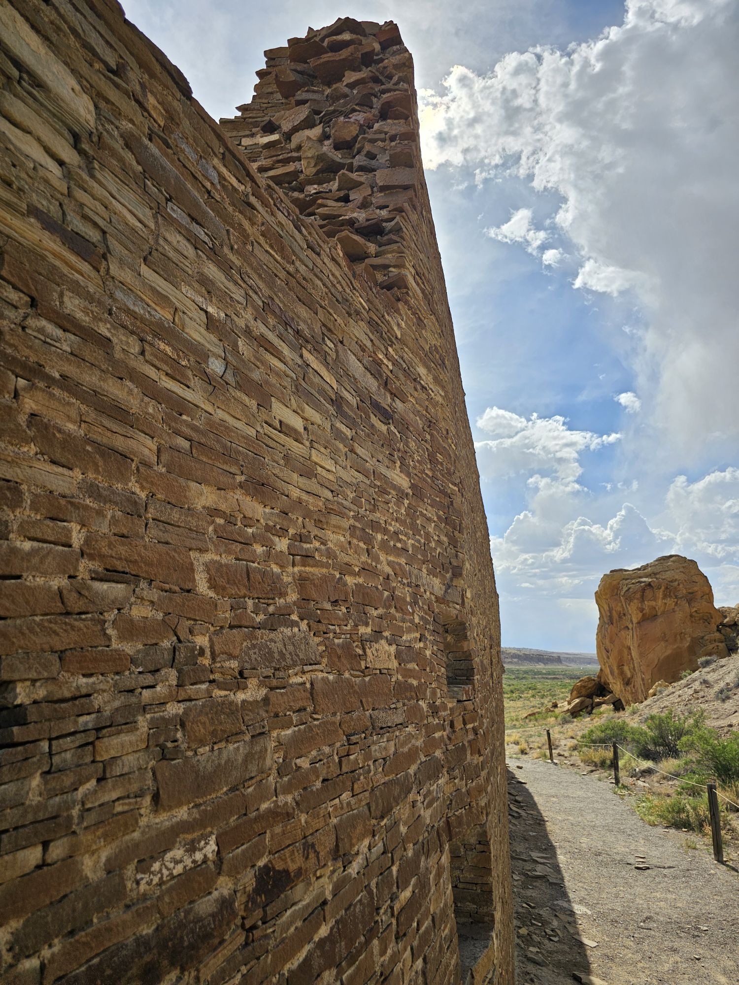
Some of the ruins at Chetro Ketl. Taken by me.
Video of Chetro Ketl.
A kive in Chetro Ketl. Taken by me.
Several kivas seen here. Taken by me.
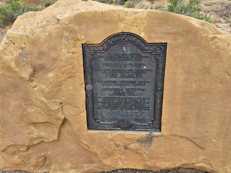
National Geographic Society plaque for Pueblo Bonito. Take by me.
Approaching Pueblo Bonito
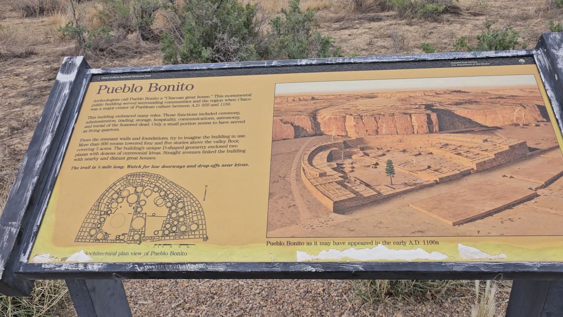
The Placard here gives you an idea of what the site would have look liked in ancient times and also what the site looks like now from above. Being at ground level really does not do any justice to this area. Taken by me.
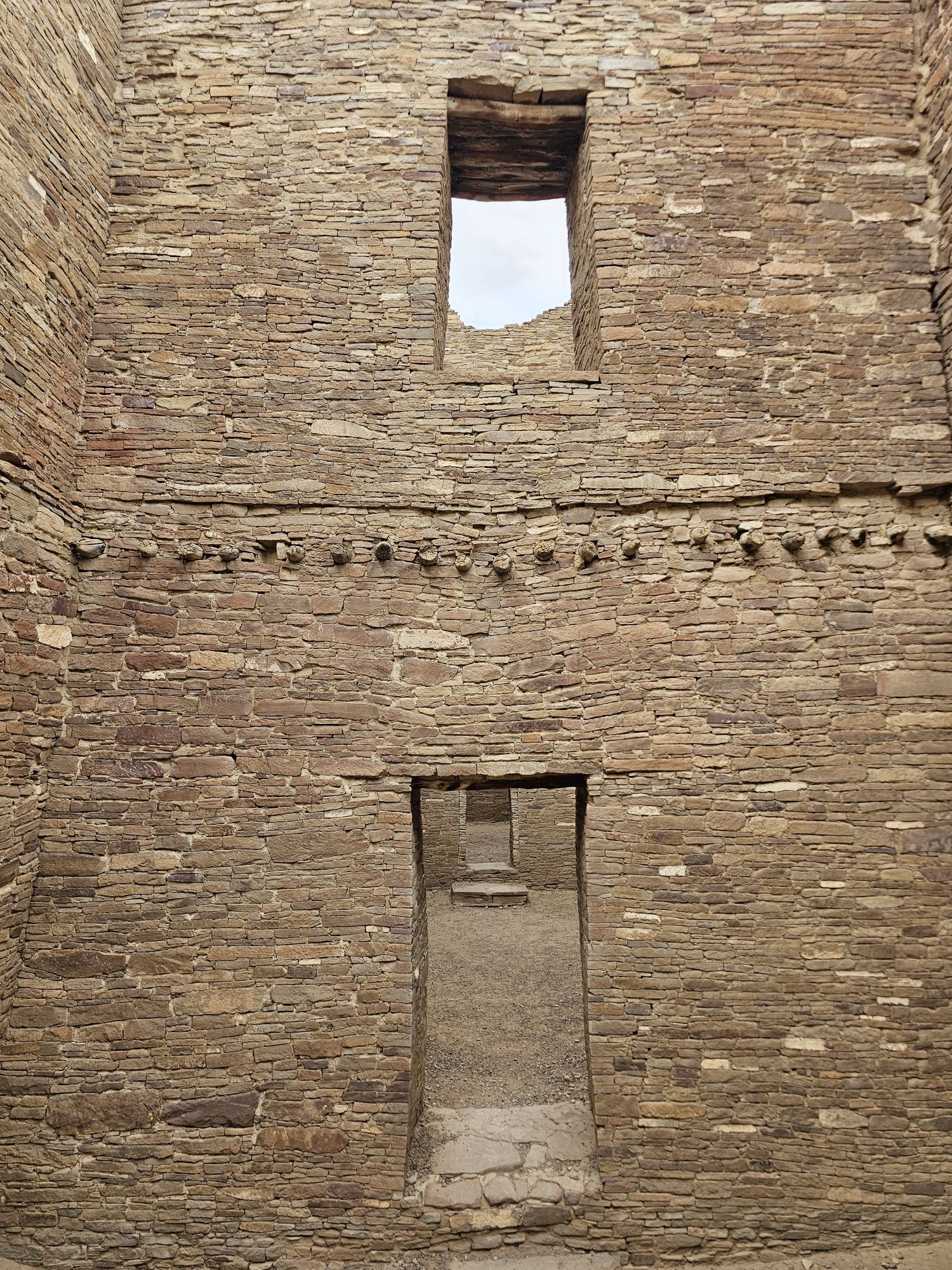
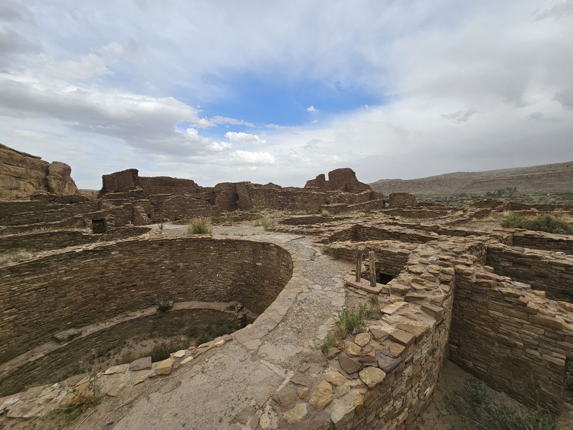
1000 years old and as far as I known, not restored in any way. Taken by me. The next several pictures are all from Pueblo Bonito.
More of Pueblo Bonito. Taken by me.
Check out this video from Pueblo Bonita!
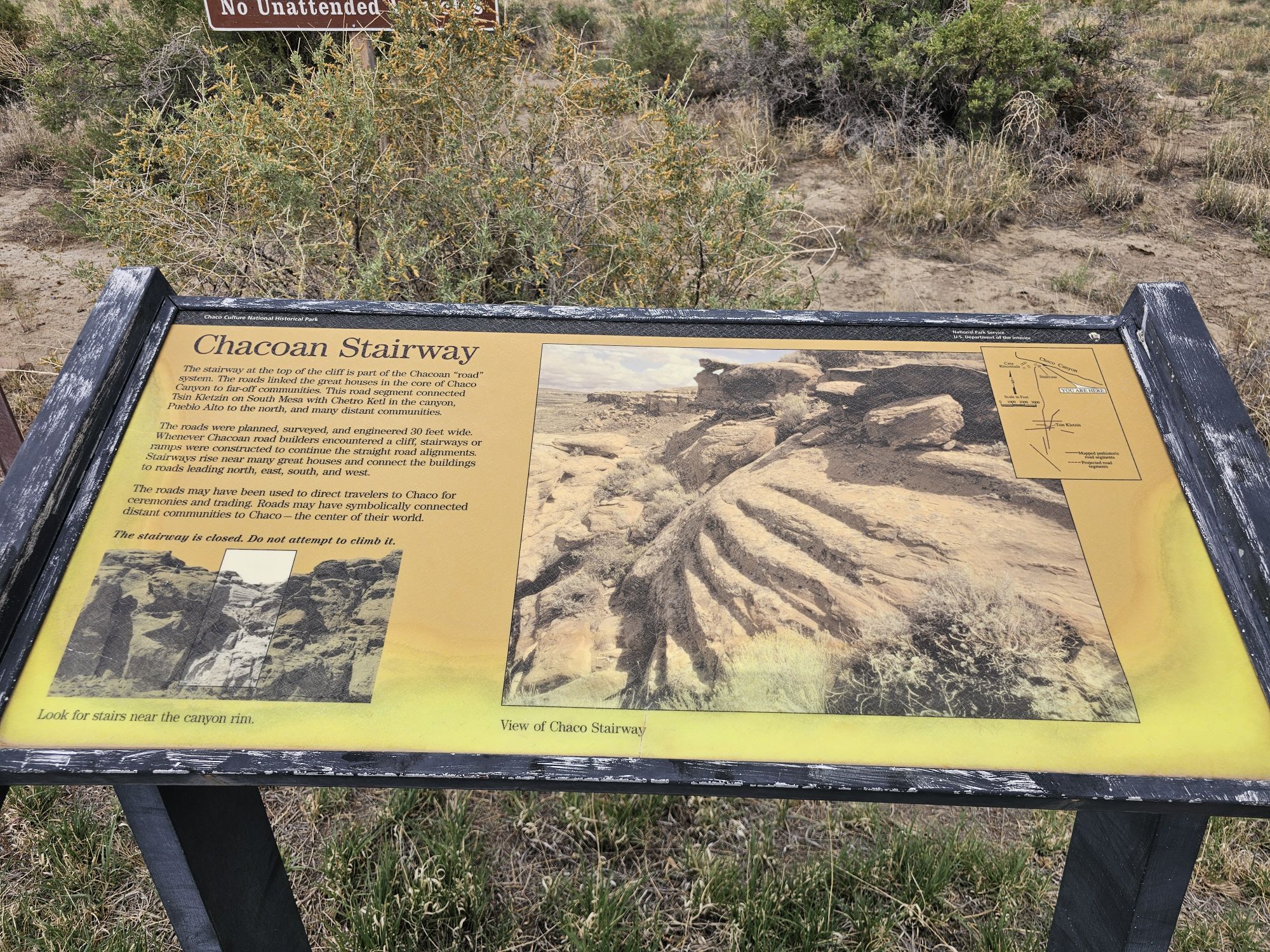
There were other things to do and see but I was concerned about the wind, which at this point was quite strong…and carrying sand, not pleasant, and the clouds coming in. I surely did not want to get caught in any kind of rain on the road getting out of here. But, the last thing I saw and will mention is the ancient Chacoan roads. This entire area was connected though a very functional and extensive road system. In Chaco Culture the roads are not easily seen other than from above, however, at many of the sites the “stairways” can be seen. Essentially these people built very straight roads and did not like curving or going around, so when it came to elevation changes they essentially built stairways down the cliffs to continue the road in a straight fashion! I stopped to check one out as the weather came in and did it in a hurry and got on my way. It was quite difficult to see, but what cool history!
This is not the only stairway in the park, but it is the one the park highlights. The stairway is right in the center of the picture. It looks like its actually paved. Any it took a minute to see it. Taken by me.
This was a very incredible place to visit if you can make it. Coming in I expected a canyon and some ruins. It was that and so much more! The history in this place is outstanding. You should definitely go, 100 percent! I only spent 2 hours here and could have easily spent an entire day, if not more. Next up will be Mesa Verde National Park!
Hey there Adventurers! We just started 2026, but I am just now catching up on my trips from 2025! First up was a spring break road trip the sidekick and I took to D.C. in March! This was a crazy trip idea to begin with. We drove. In one car – a Toyota Corolla. With two dogs. And we left Thursday morning and came back Sunday. The goal of this trip was to facilitate a #USBarkRangers meetup at the start of the Cherry Blossom Festival in D.C. As we only had two days in town it was a short trip but definitely worth sharing!
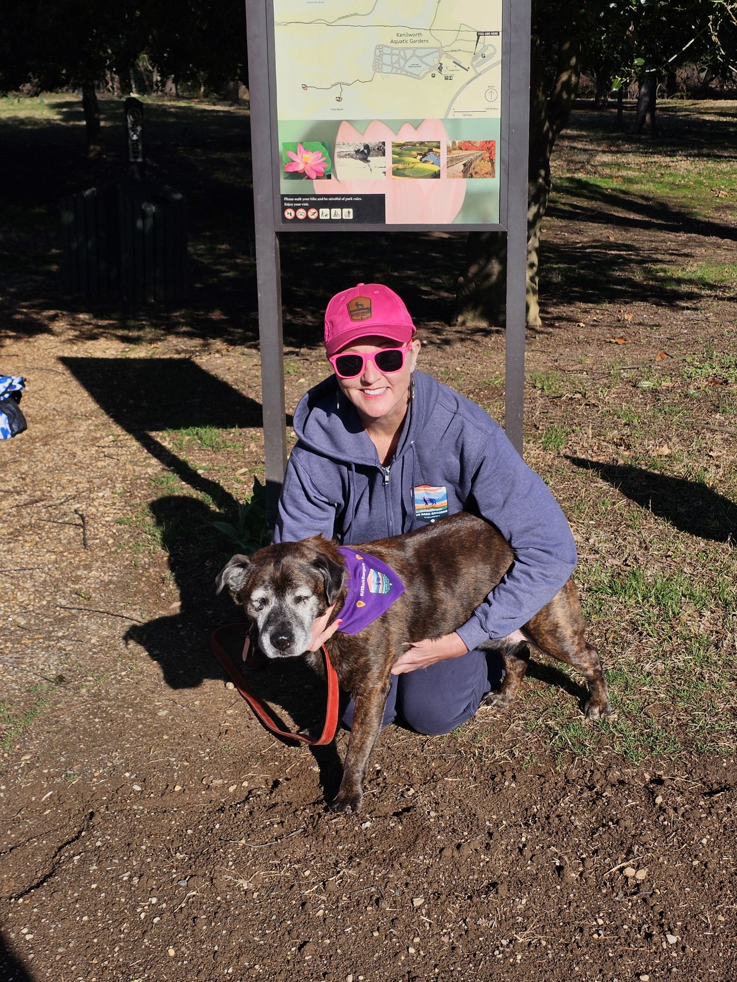
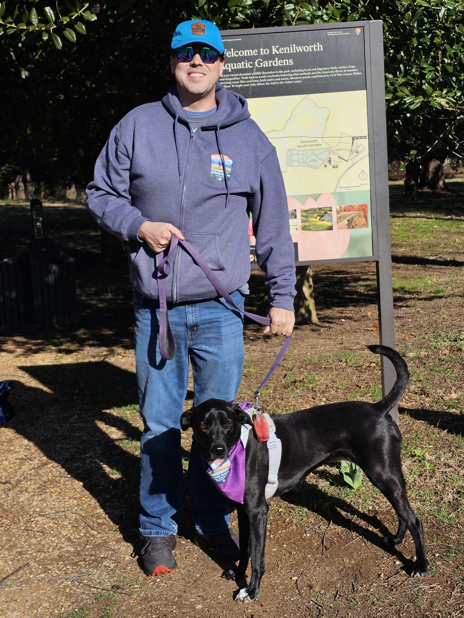
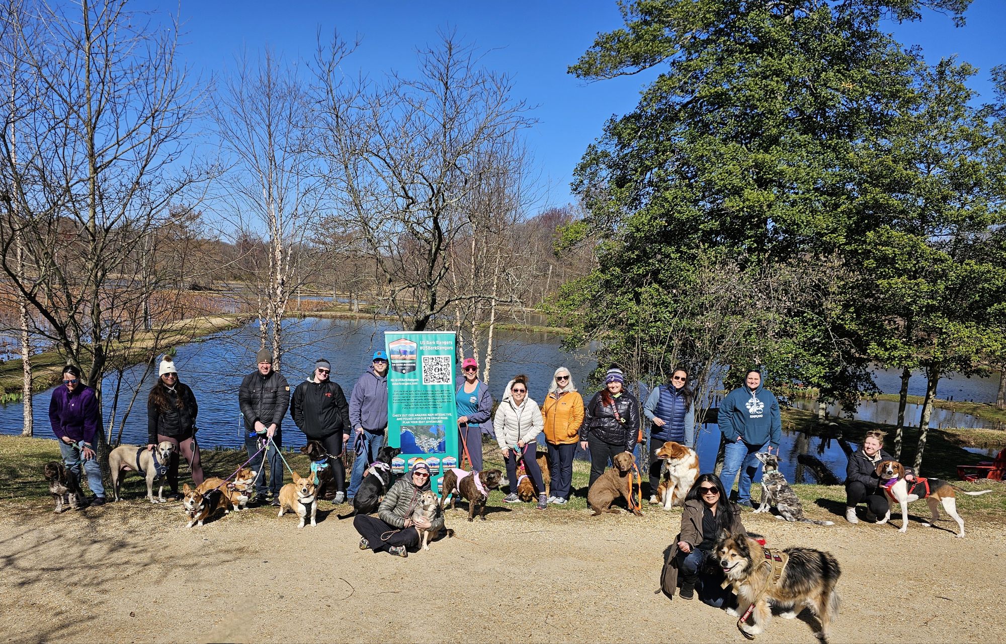
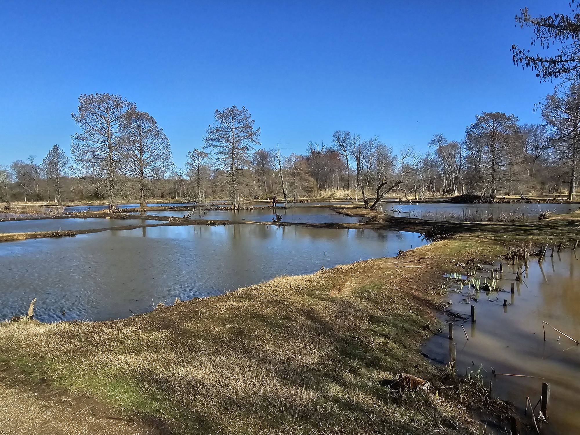
The first morning in town we met up with a group of our crew at Kenilworth Aquatic Gardens. This is an NPS unit that has a Bark Ranger program and a neat Bark Ranger tag, which is why we scheduled an event at this location. This is a really neat area to escape to in D.C.! In summer, the gardens are gorgeous, but it was still quite cool in March so the park itself was not spectacular, but the meet up event was great! We had maybe 15 members and their dogs attend and we did some pack hikes and had a large group swearing in with the Park Ranger! So cute! Later we met up with another group of a half dozen or so members of our group for pizza before calling it a night.
The sidekick and her Bark Ranger Lily!
Me and Bark Ranger Maisy.
The whole Kenilworth #USBarkRangers group! Taken by the nice park ranger!
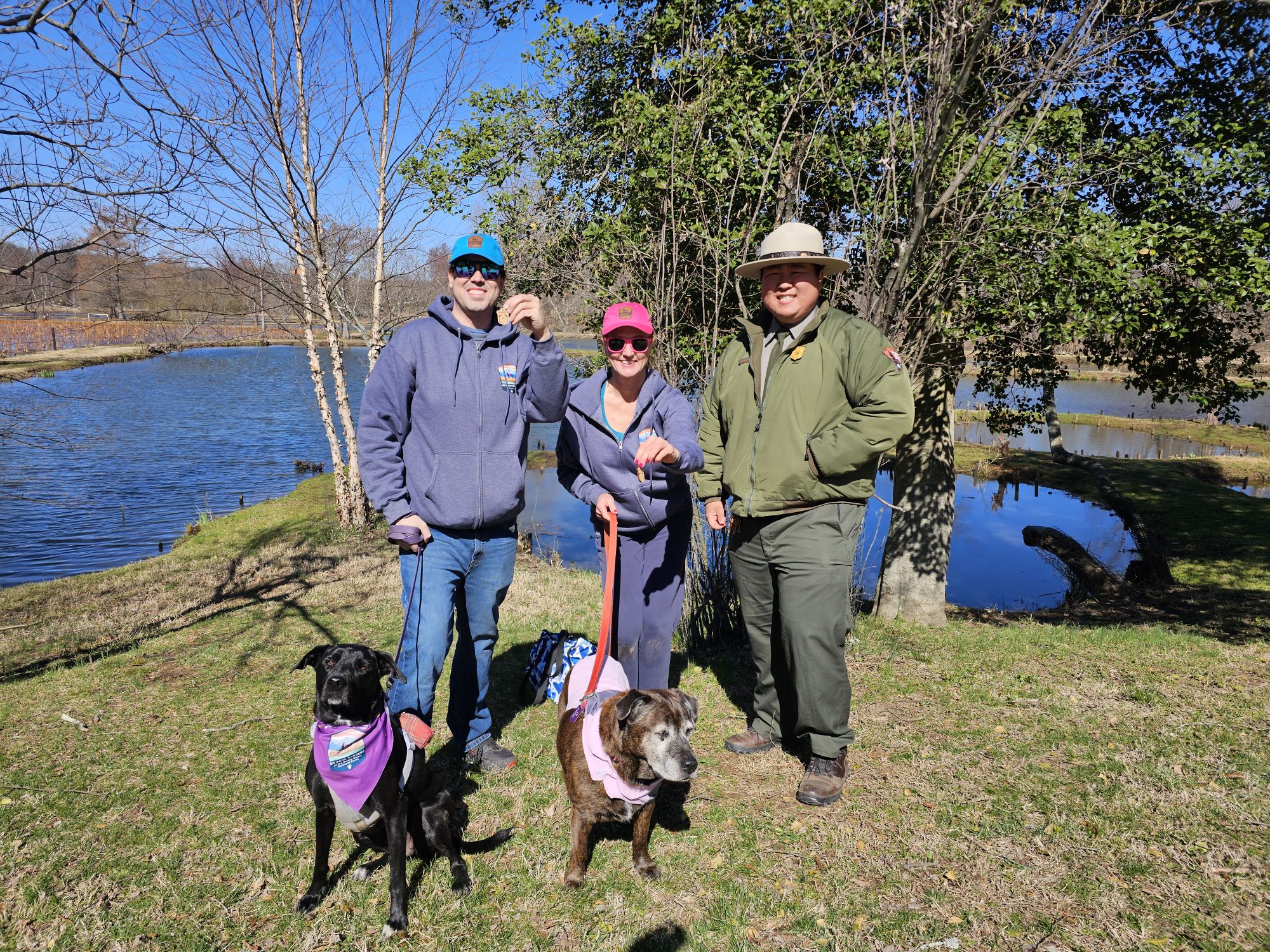
Nicki and me with our Bark Rangers, and the Ranger who did all the cool NPS stuff for us!
This is the gardens area. It was march and obviously the pretty flowers were not ready yet!
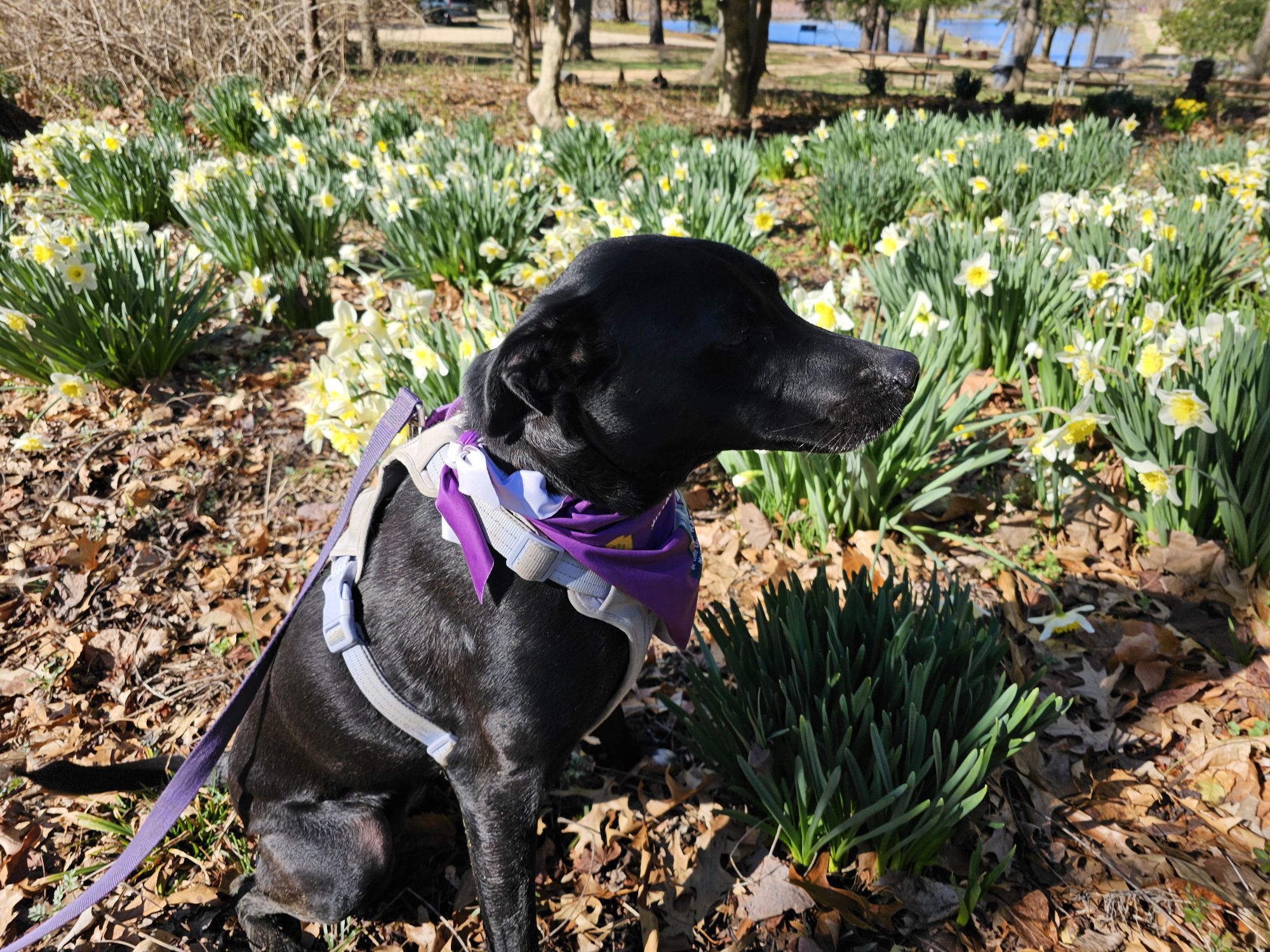
But some flowers were starting to come in!
The struggle getting this dog to act right for a picture is real.
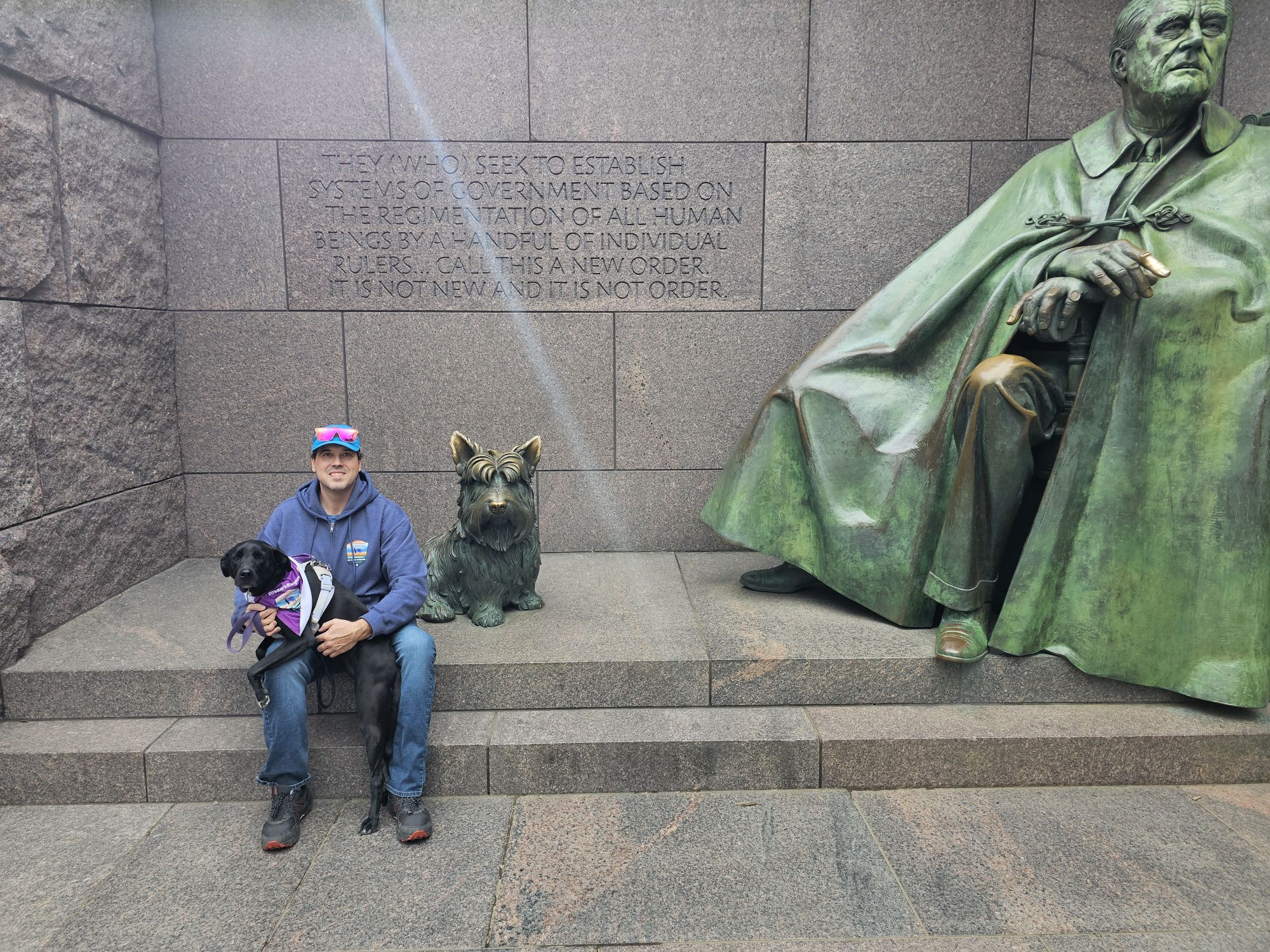
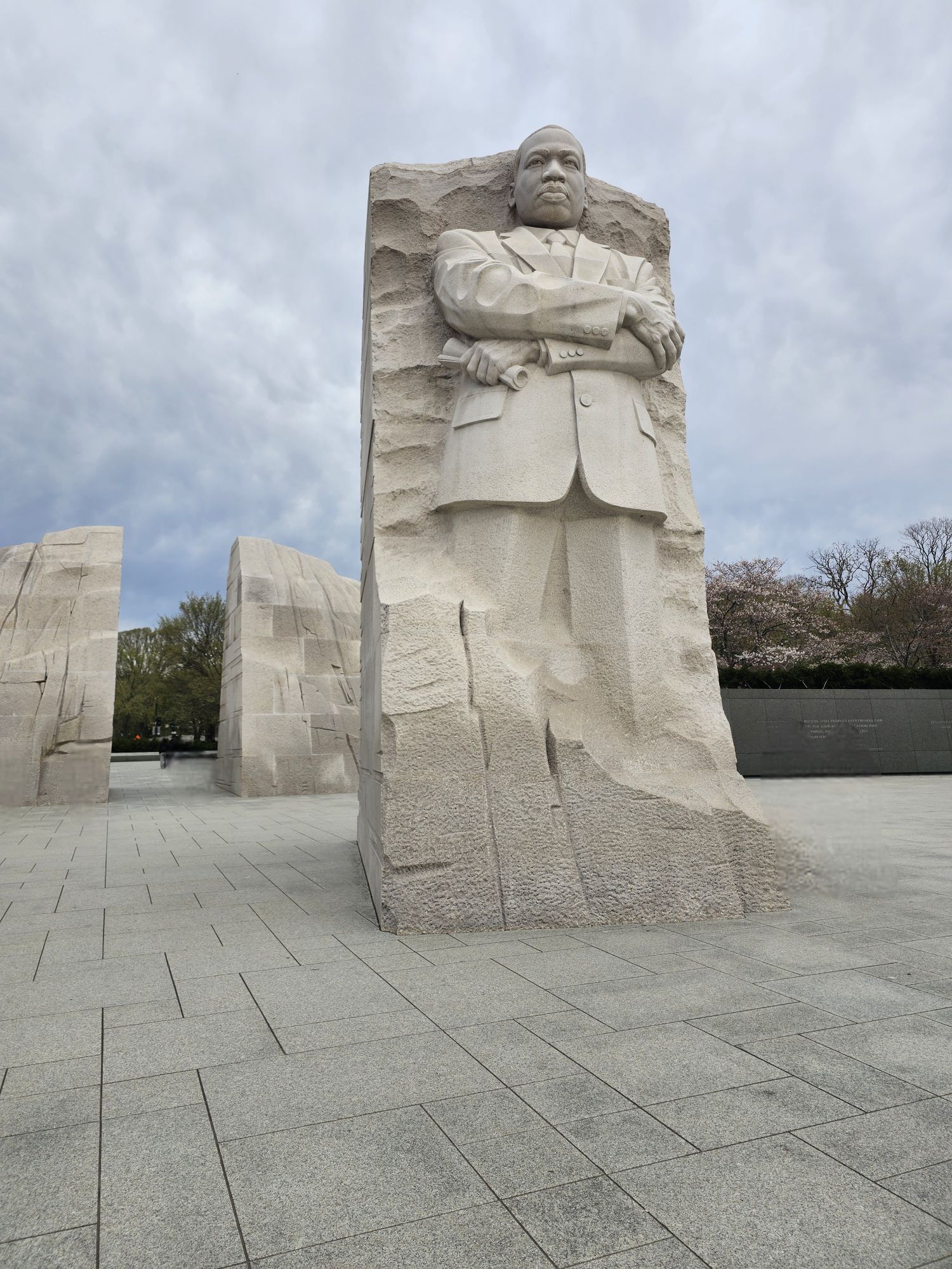
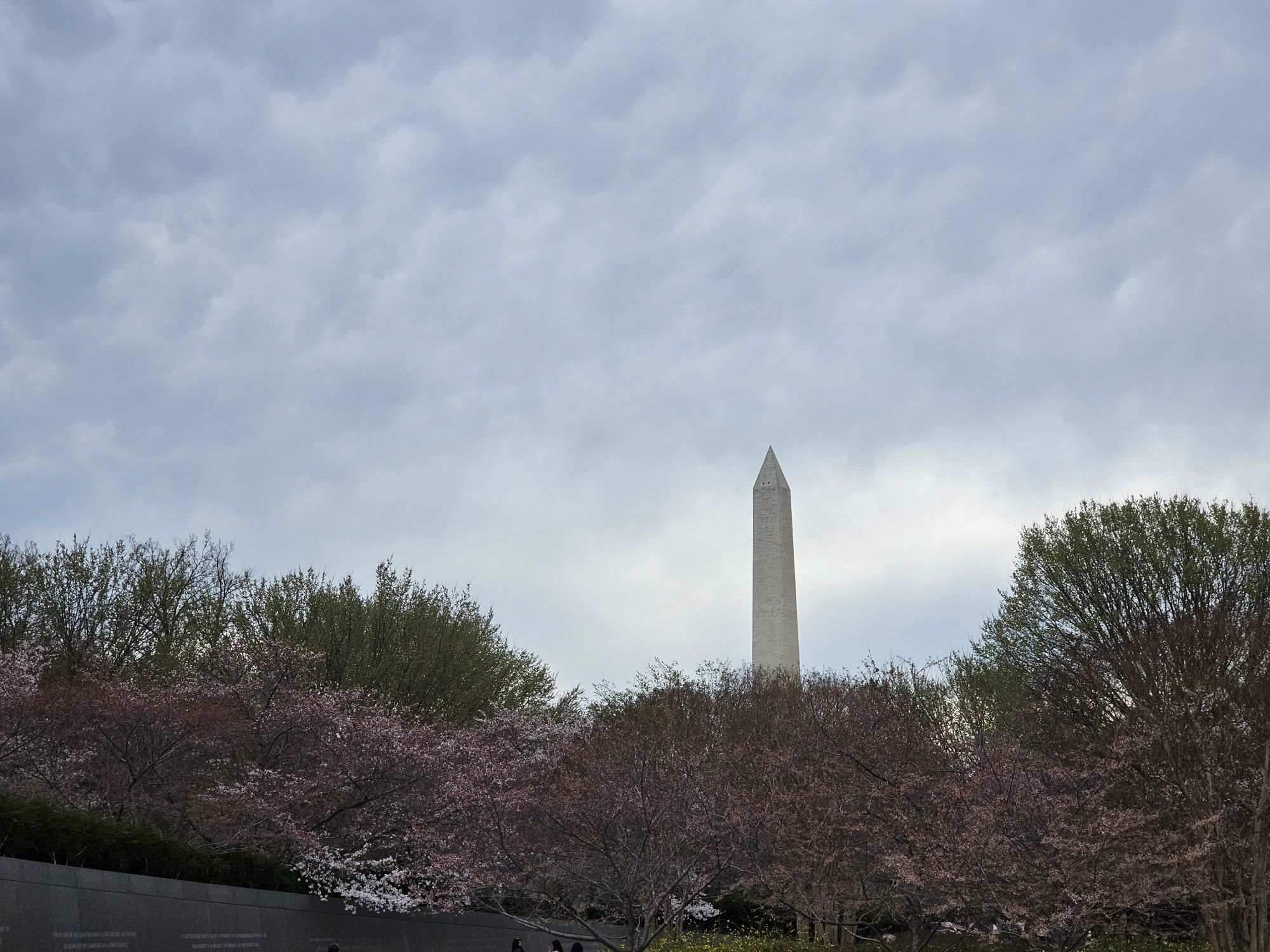
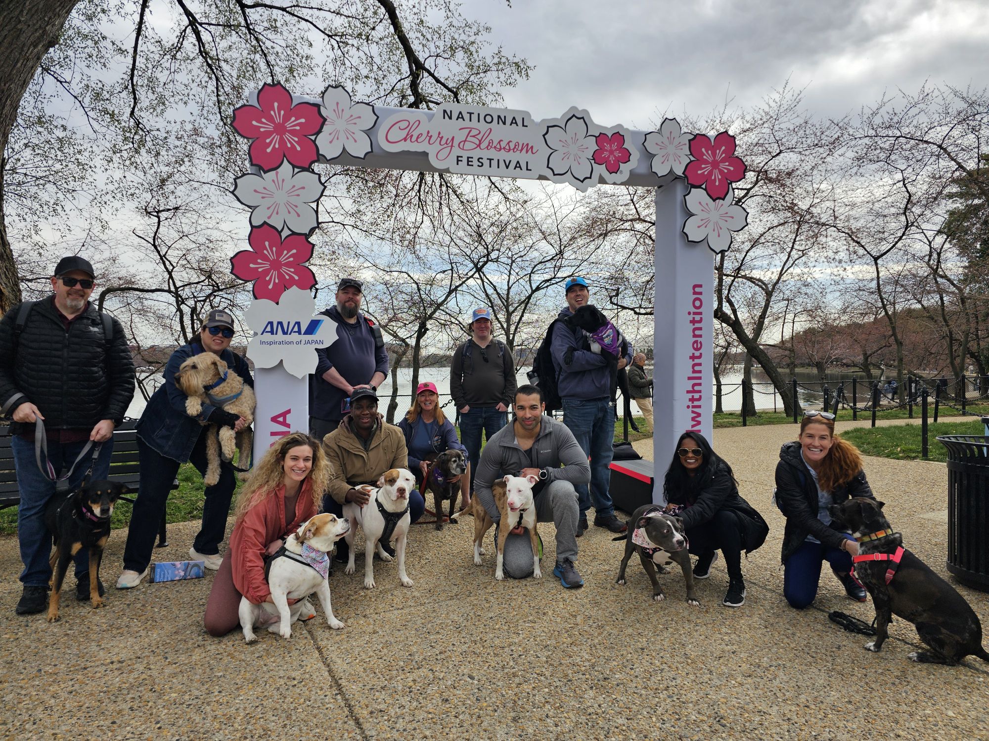
The next day we got up early and met up with another large group at the MLK, Jr. Monument in the National Mall. Nicki and I got down there early to park and went to the FDR memorial first to get in some brief sight seeing. Afterward, we met up with our crew and went to the Cherry Blossom Festival location. This event is actually put on by the National Park Service and they did a big group swearing in for us as well! Super cute! The trees were just starting to put out the blossoms, so it wasn’t great for that, but the events were great for our group!
Nicki took this picture…it’s hilarious actually…Maisy never has her ears down like this! But she was NOT having it with FDRs dog, Fala! This is the FDR monument.
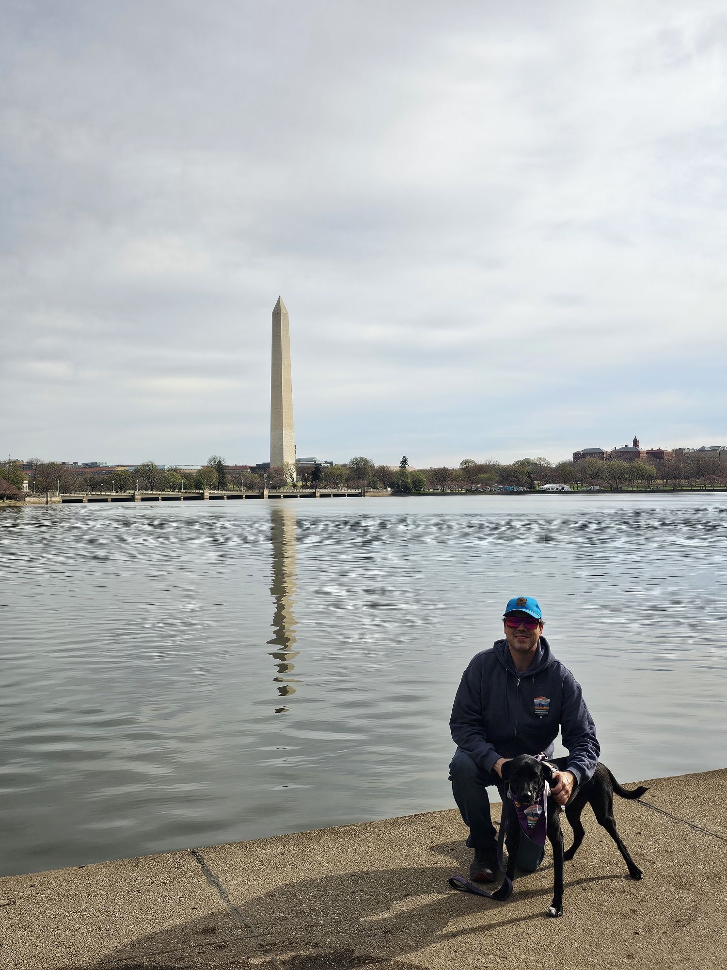
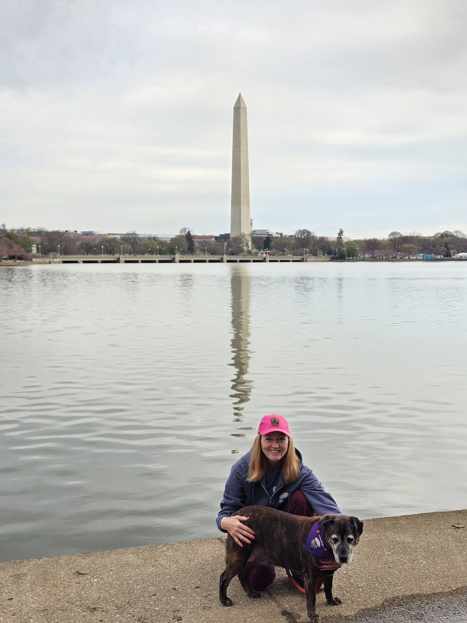
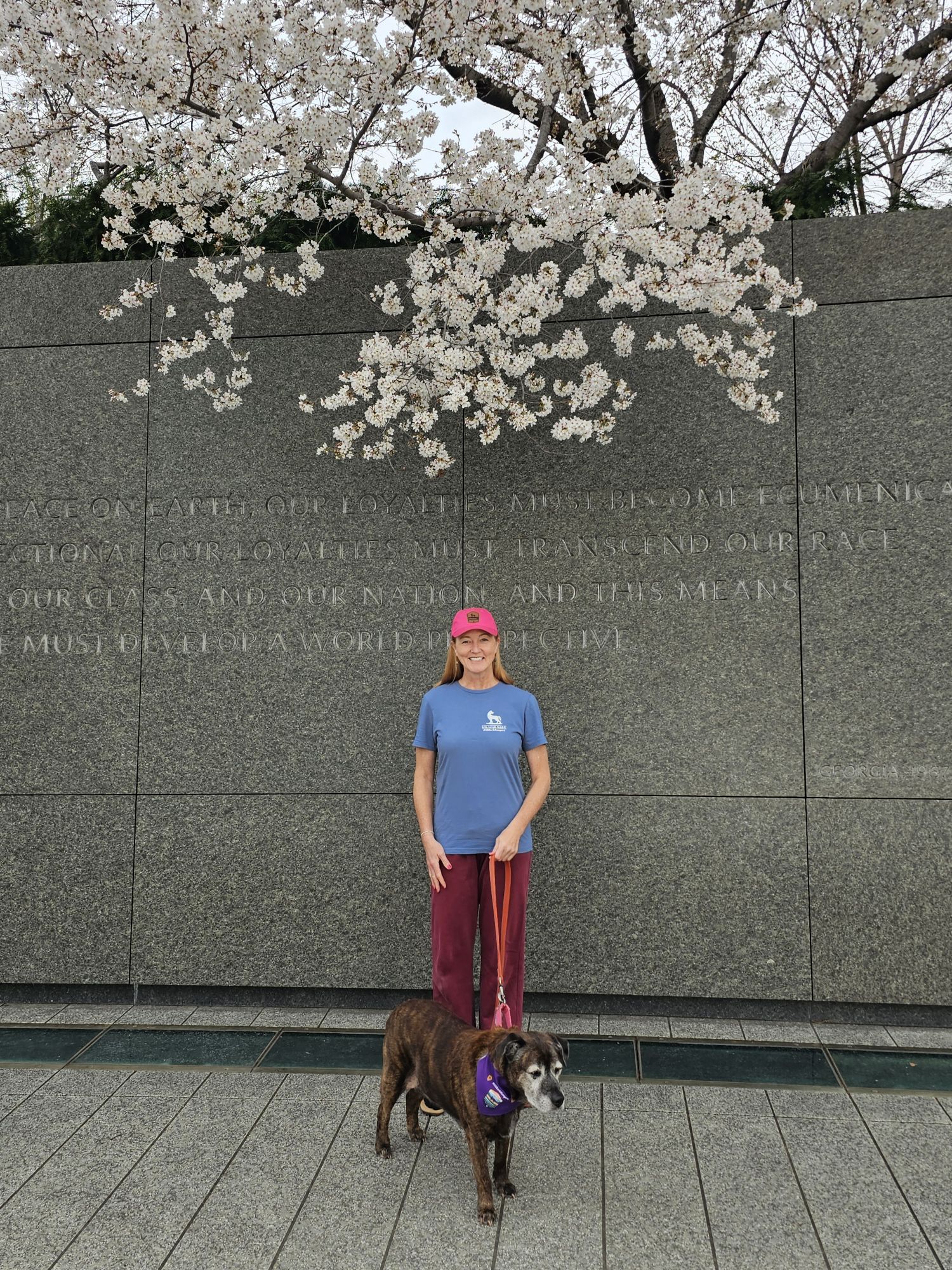
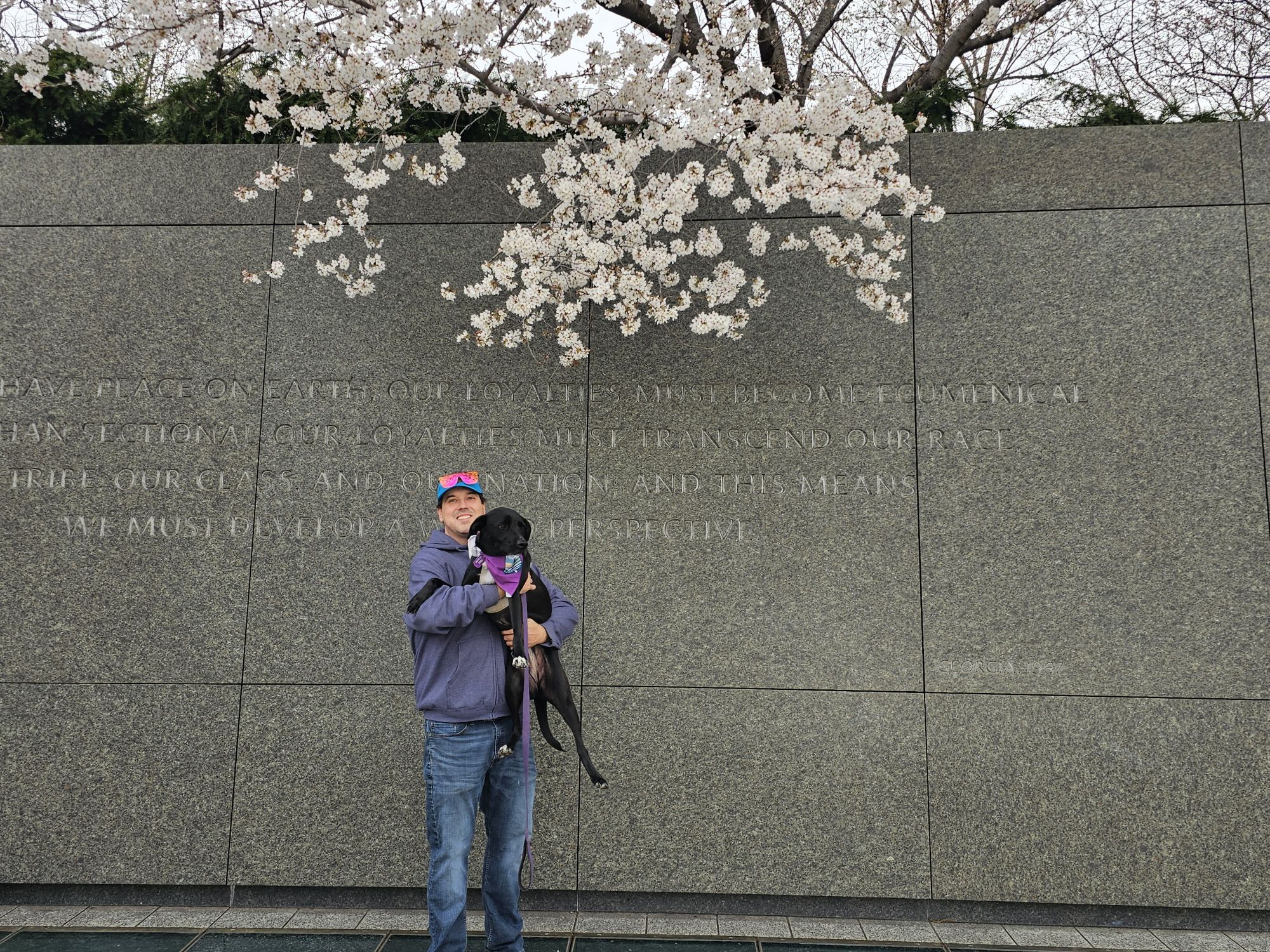
The sidekick snagged this of us in front of the Washington Monument.
And her and Lily got the same from me!
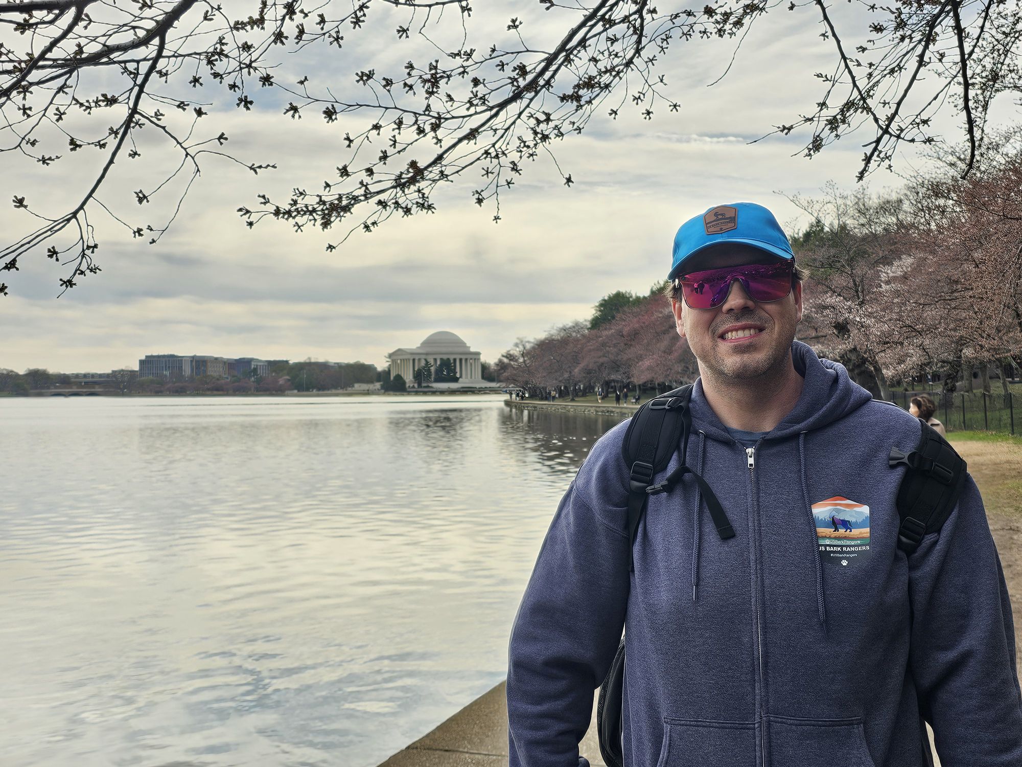
The cherry blossoms were just getting started when we were there. Jefferson monument is in the background.
At the MLK monument.
Trying to get this Bark Ranger to pose…
MLK monument. Taken by me.
Some of these trees were trying! They are not all cherry blossoms, but some are. Taken by me.
This was part of the group that came out to get sworn in as Cherry Blossom Bark Rangers.
Check out this super cute group swearing in the Park Rangers did for our group at the Cherry Blossom Festival!
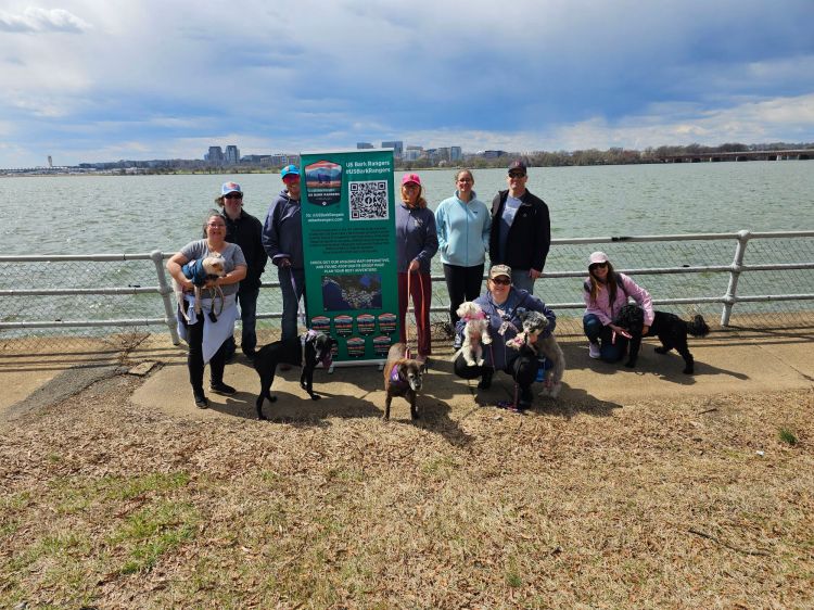
Afterward we actually met up with yet another group of people, some who were not part of either of the two previous events, down in the Potomac Park Area. We set up some chairs and socialized for a couple hours. Overall these were all super chill and fun events for our #USBarkRangers group! Because of the timing of things there was not a lot of D.C. exploring to be had…so I made a decision that I would be coming back. I didn’t really know it at the time, but I would come back just 6 months later, so stay tuned for that post!
This was the first of two official Bark Ranger Events we did in 2025 and I actually met up with another member to do Bark Ranger stuff over the summer. It was really amazing to actually get to do events with people from our amazing group! My next post is going to feature a sequence of parks in New Mexico including Colorado’s Mesa Verde, so stay tuned!
Hey there Adventurers! If you just read my Puerto Vallarta post you may have noticed I mentioned it was my last trip of 2024. That’s true, it was. However, I forgot this brief visit in Indiana earlier in November!
George Rogers Clark NHP is probably the very first NPS unit I ever visited. I grew up in Indiana only 45 minutes from this park, and everyone took a field trip there in elementary school! I already have this in my NPS unit count which is why there is no new count at the top. That being the case the last time I was here the internet did not exist, nor did cell phones, digital cameras, or any such sorcery! I found myself in Indiana in the early part of November and took a quick couple hour trip up from Evansville to Vincennes, IN.
There is a lot of history here. I will give a brief account, and you can fill in the rest. This area was settled before the Revolutionary War (our native bothers and sisters, of course, where here before then). Once the war broke out G.R. Clark was in charge of the Virginia Militia in Kentucky. He was instrumental in the US forces taking Vincennes from the British during the war. This entire area was know as the Old Northwest and part of British Quebec. This weakened the British positions and they ceded all the land to the US in the Treaty of Paris. Essentially, G.R. Clark was the reason we gained the land that would lead to the modern day states of Ohio, Indiana, Illinois, Michigan, Wisconsin, and parts of Minnesota.
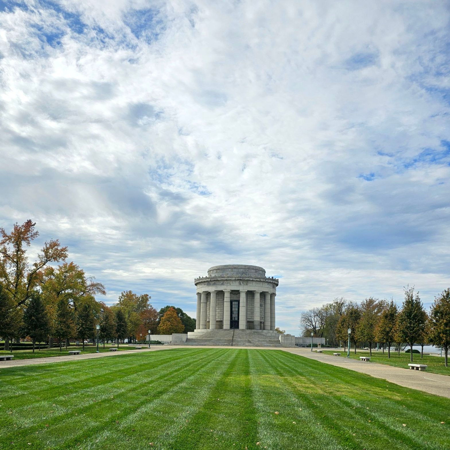
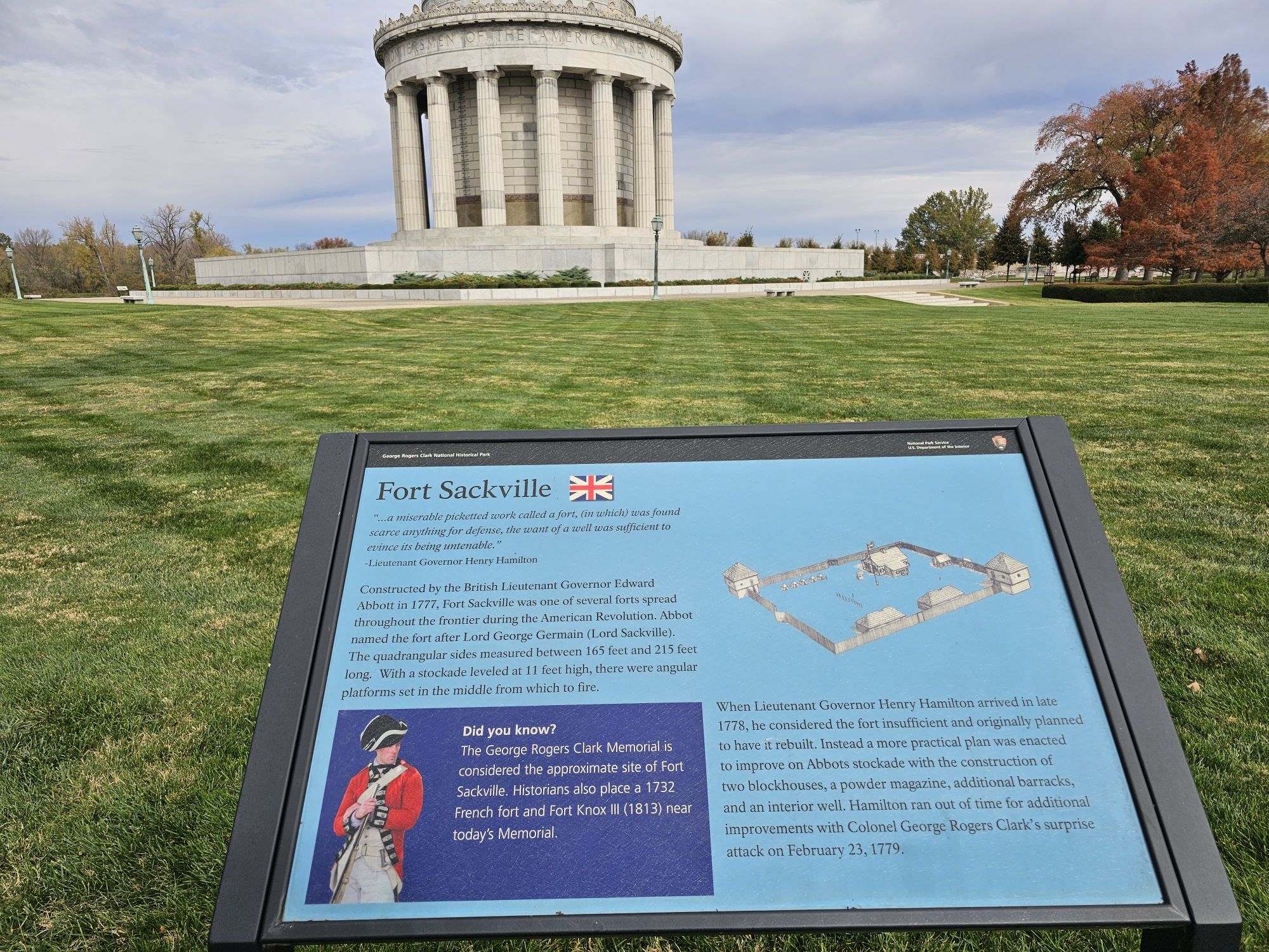
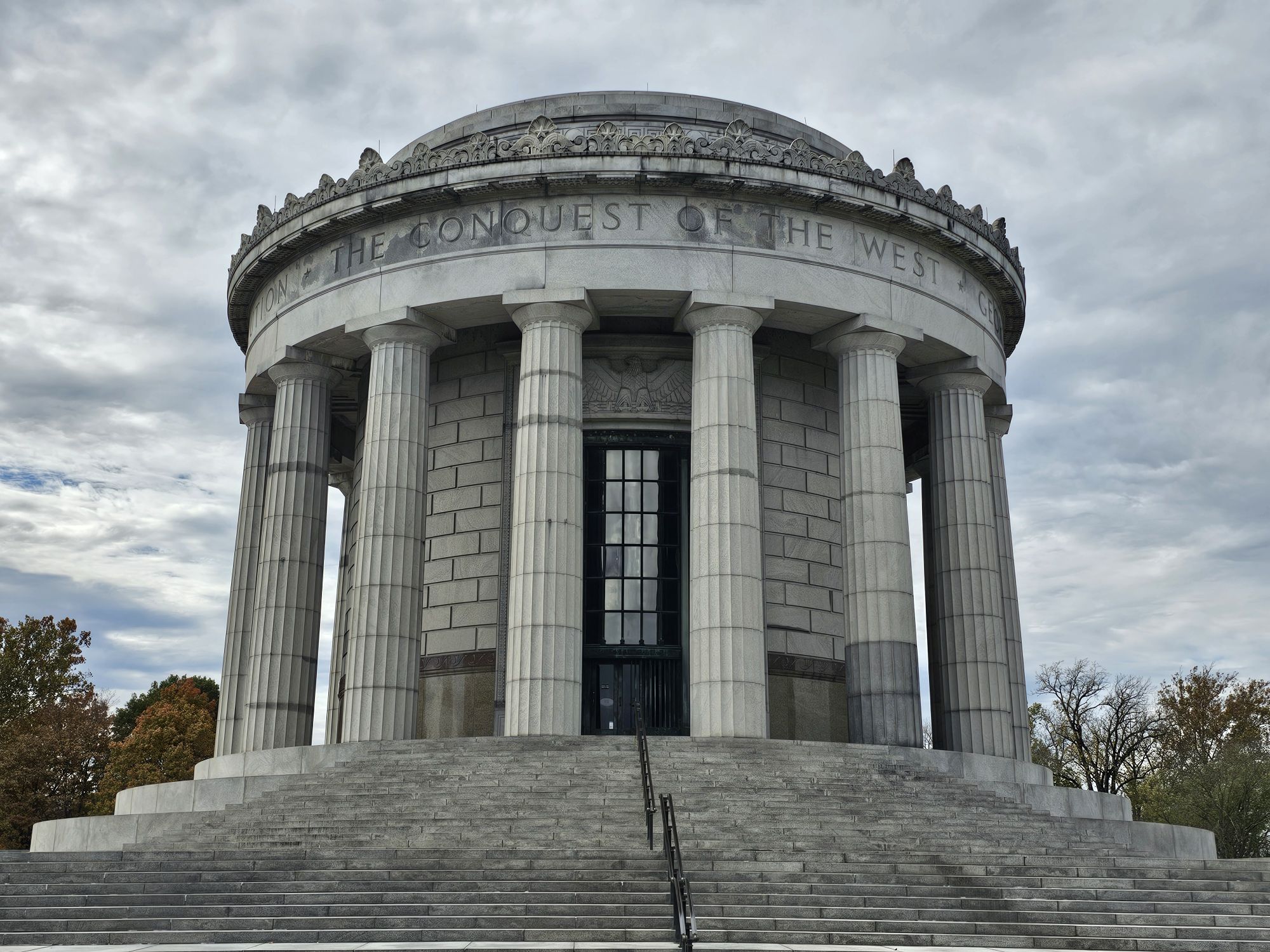
The monument here was built nearly 100 years ago and honors the man. The site of the fort is the approximate location of a fort called Sackville, but that exact location is unknown. At the end of his life he was broke and had a tarnished reputation for being a drunkard. The entire site in Vincennes is quite nice and pays homage to his history despite the rough end to his life. This is not a site you would go out of your way to visit. There is no Bark Ranger program here either, but if you DO catch yourself in southwest Indiana, this is a worthy couple hours detour for sure!
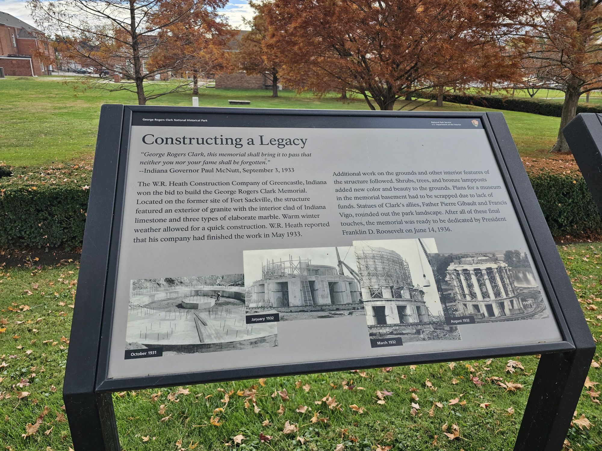
It’s really a beautiful monument. Taken by me,
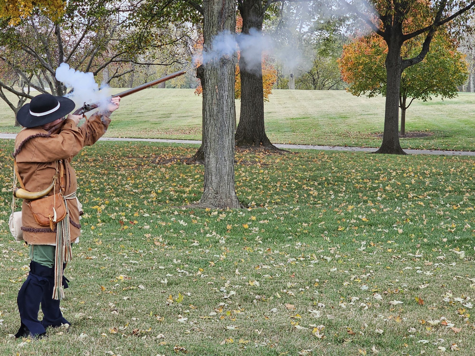
The do live interpretations here, always neat to see! Taken by me.
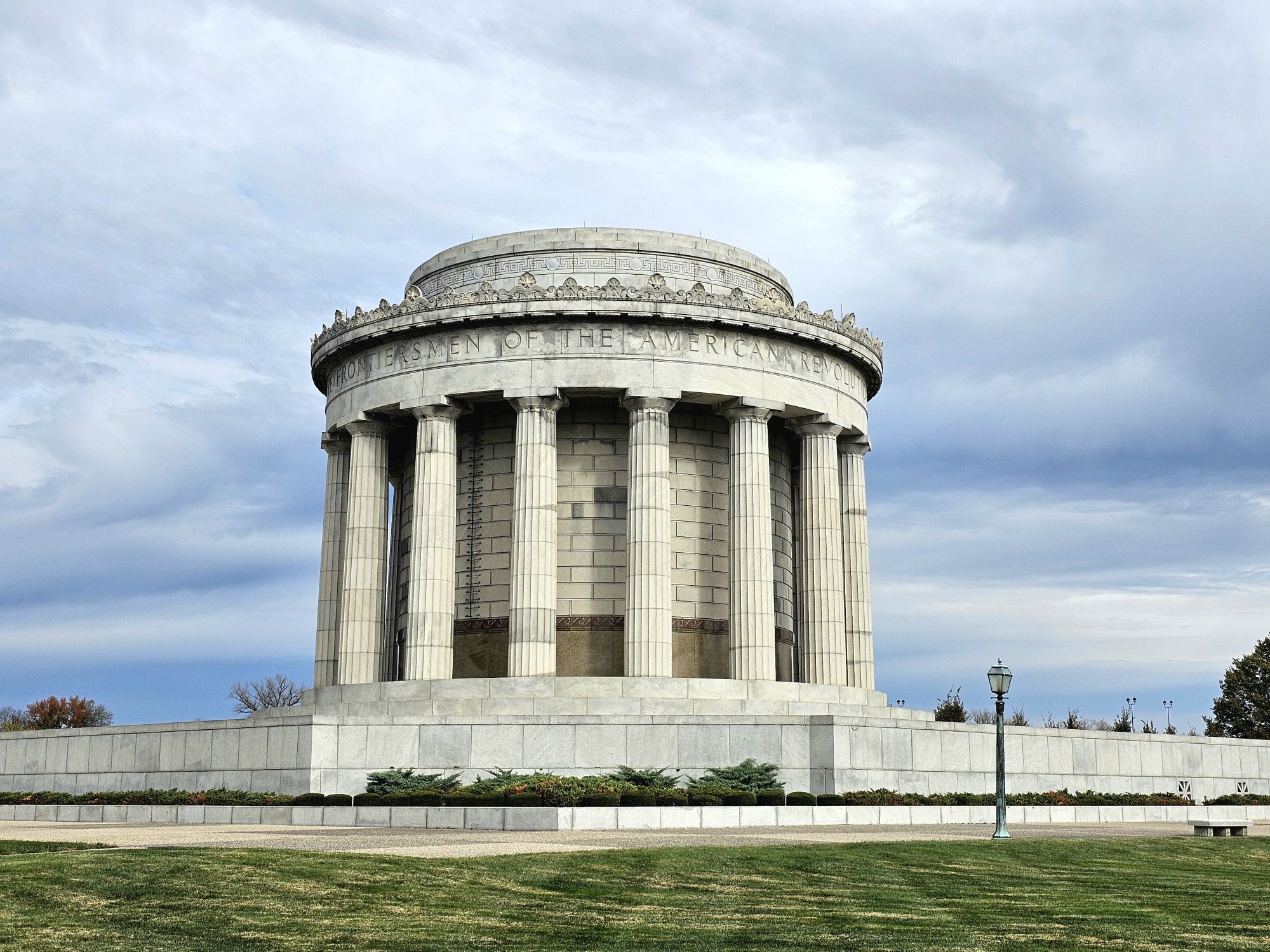
Another side of the monument and the way inside. There are a decent amount of steps and no way around them either. Taken by me.
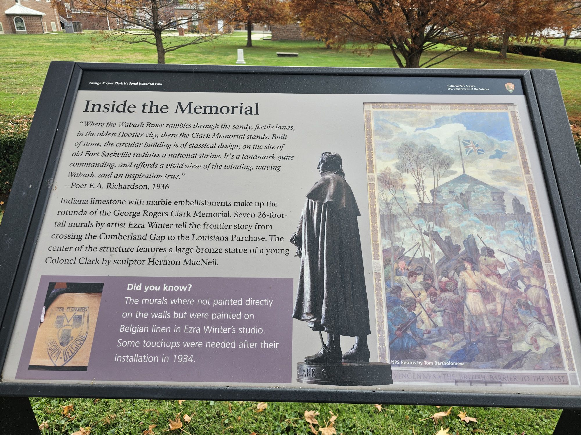
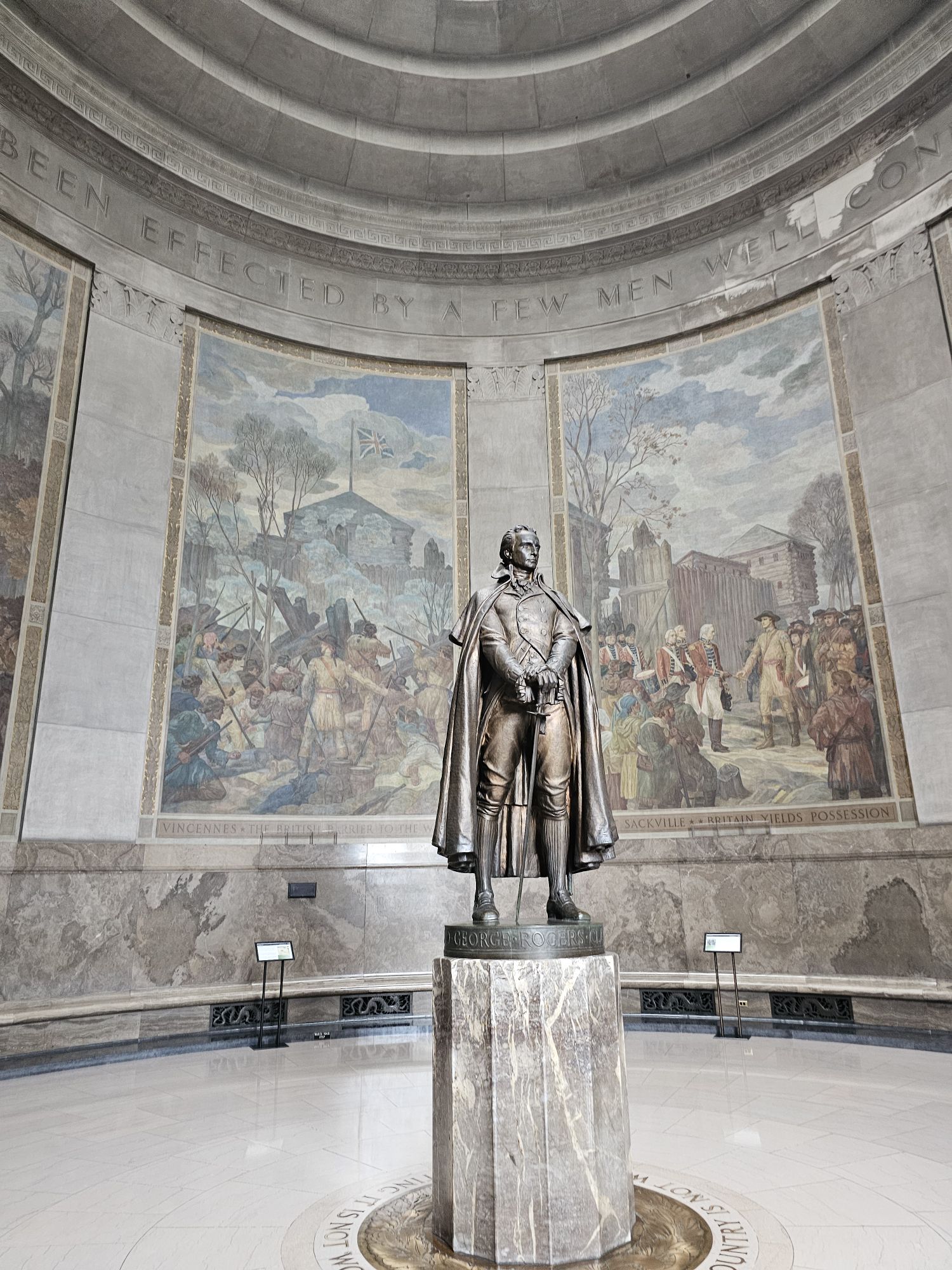
The statue of G.R. Clark inside. Taken by me,
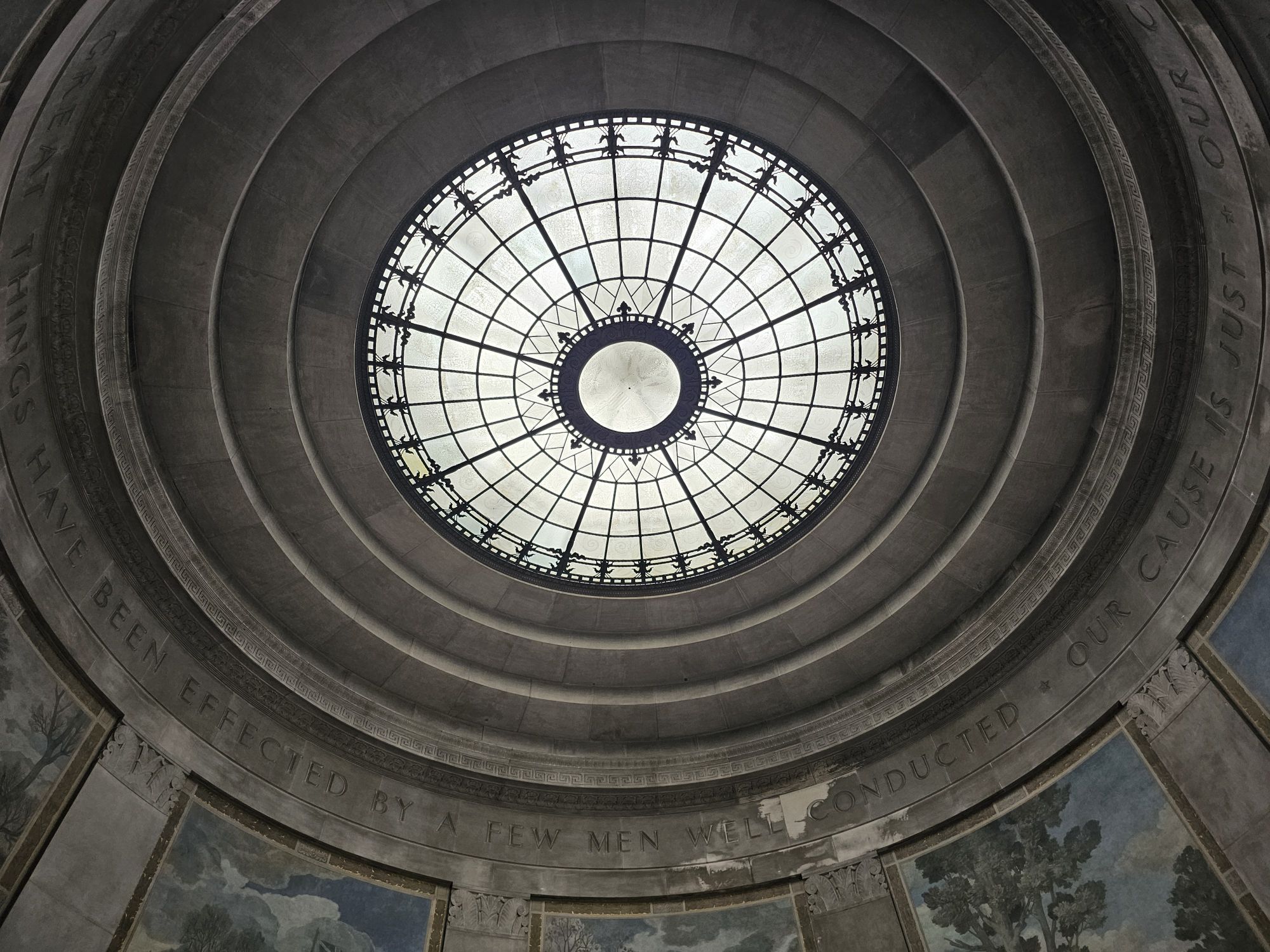
The oculus at the top of the monument. Taken by me.
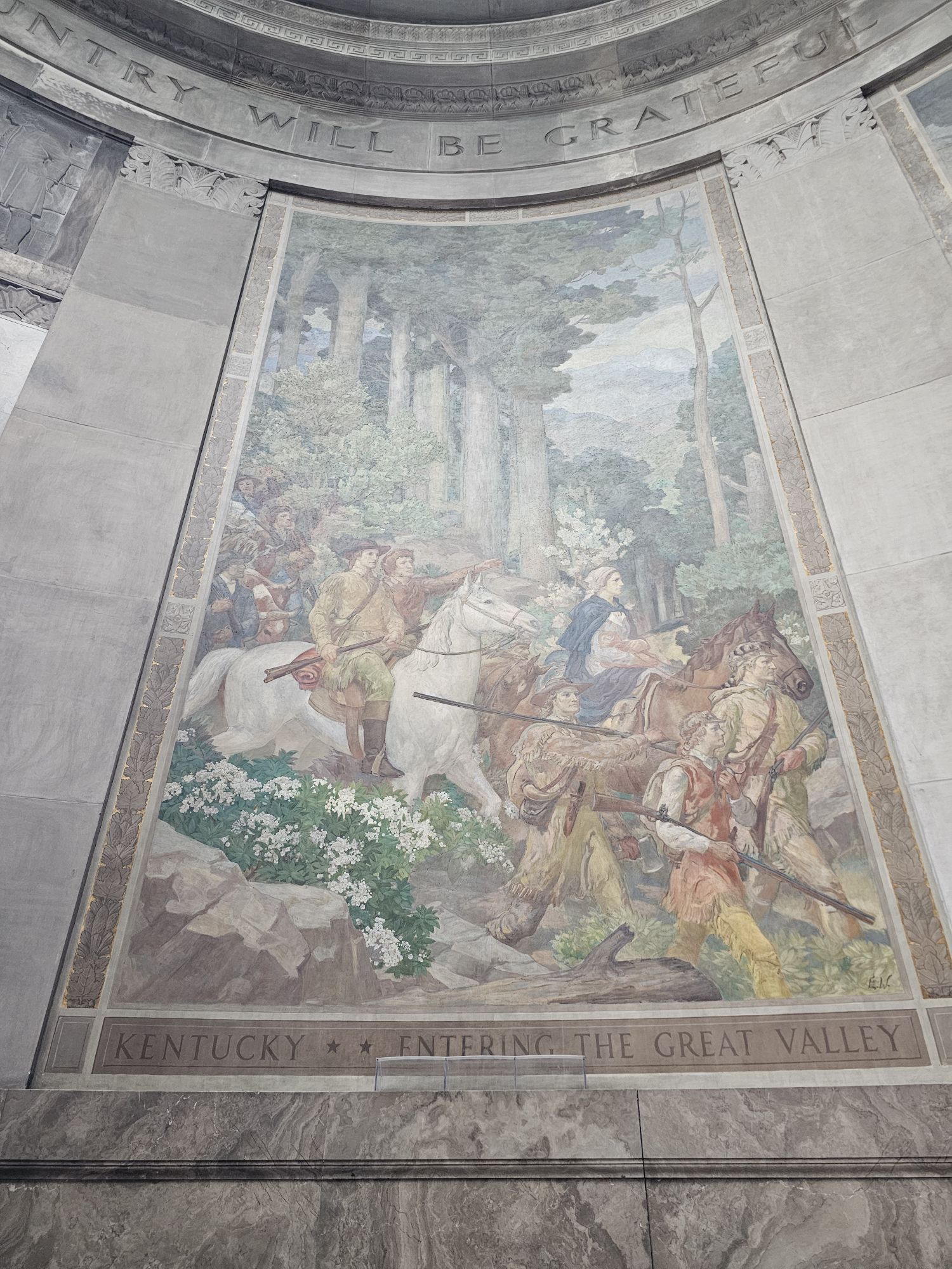
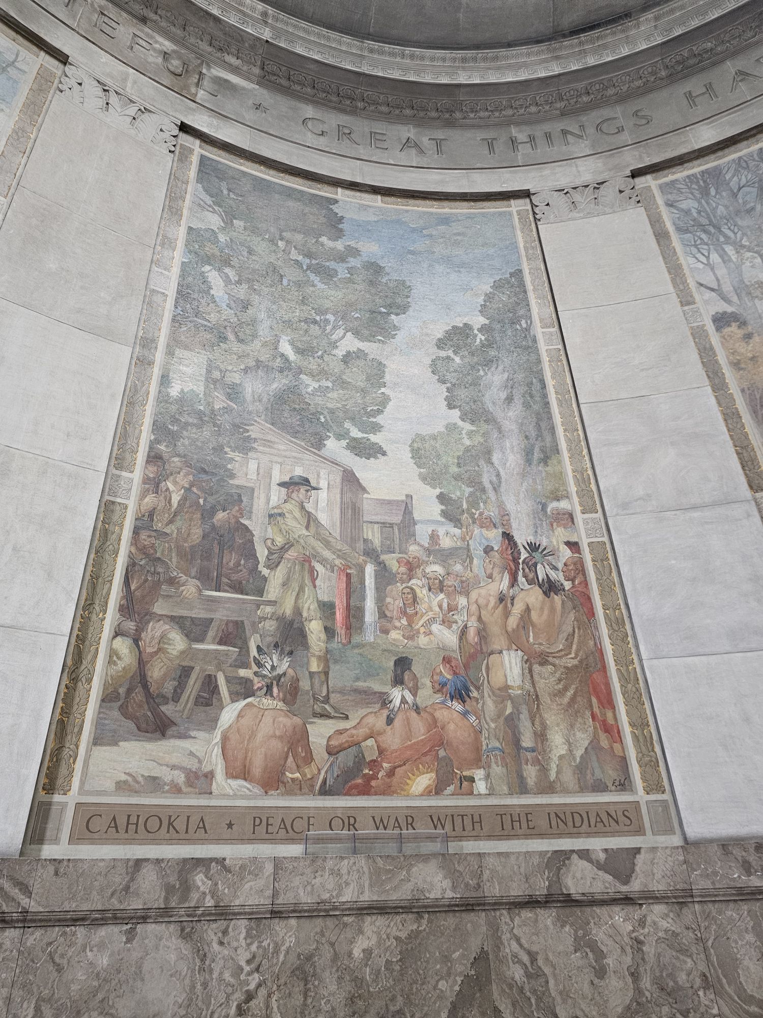
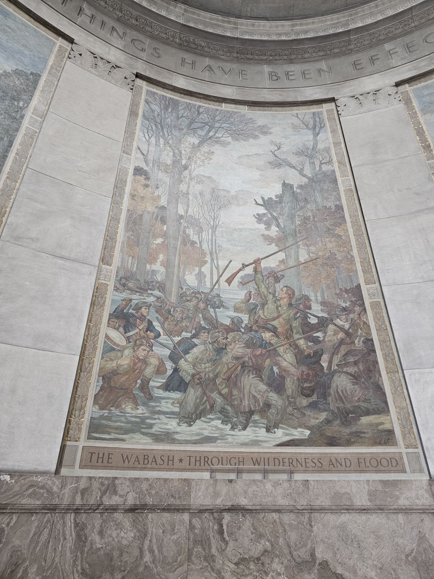
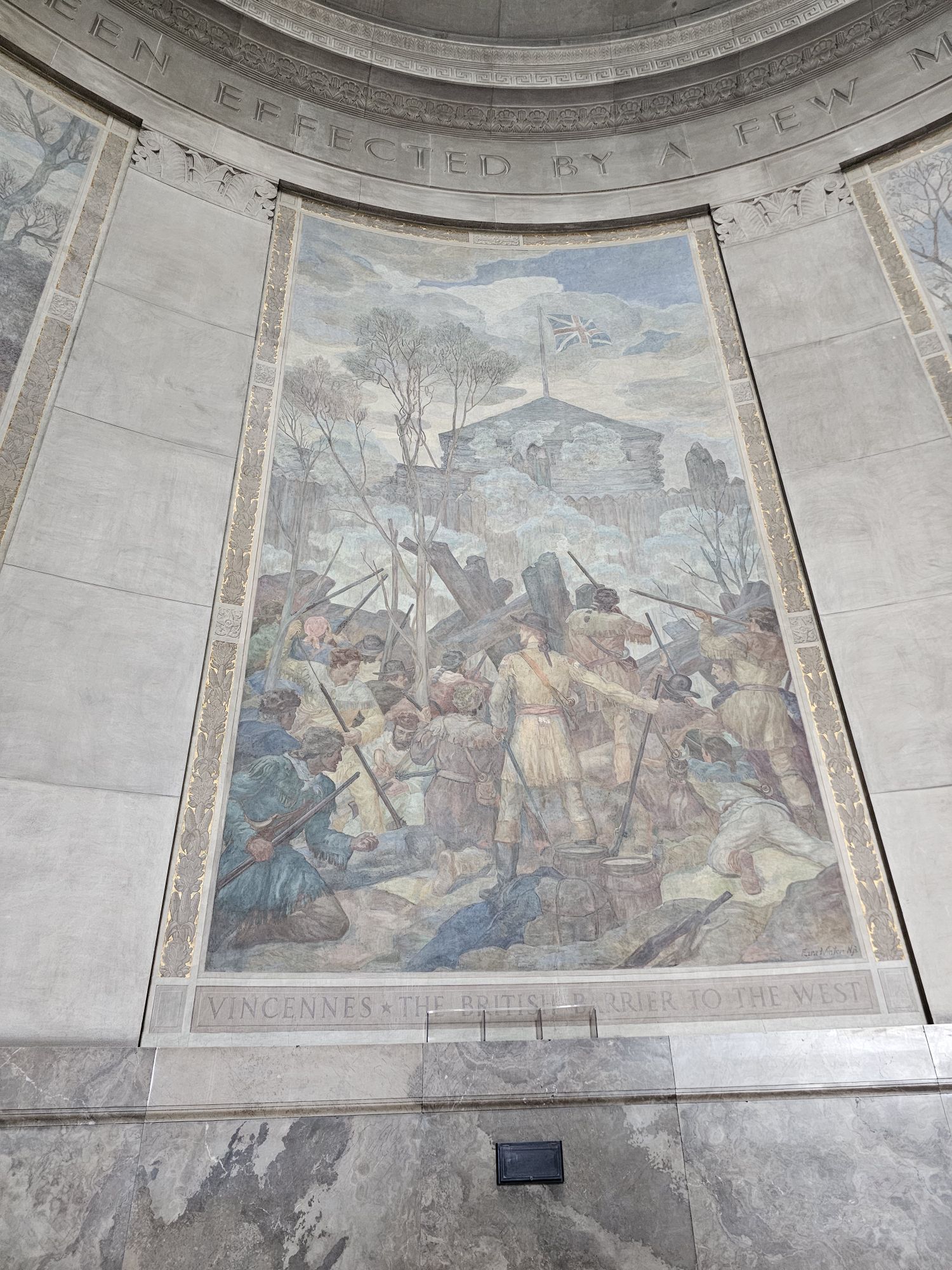
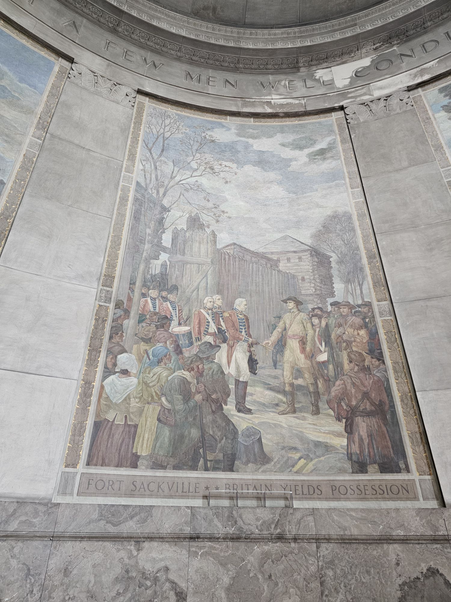
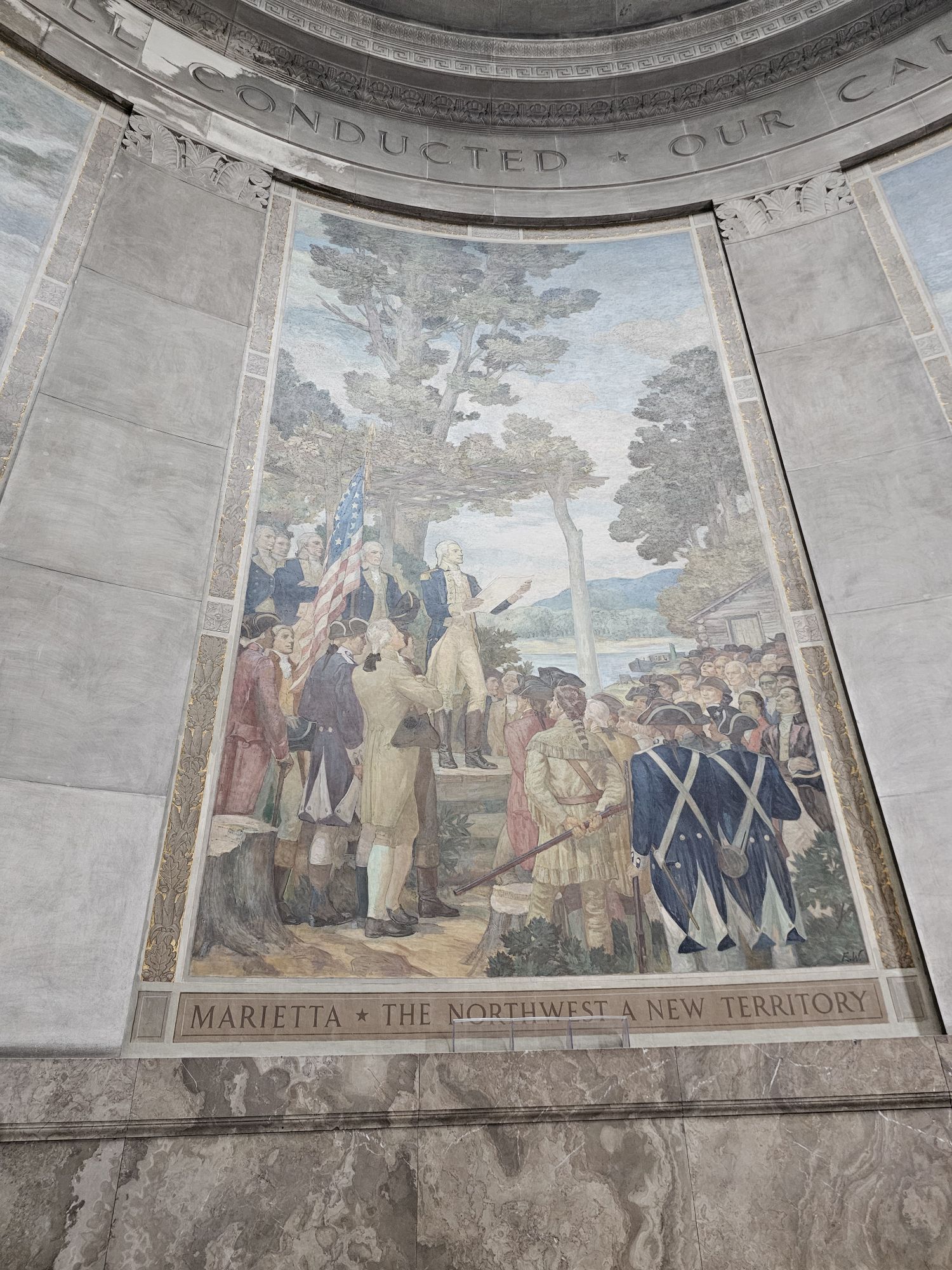
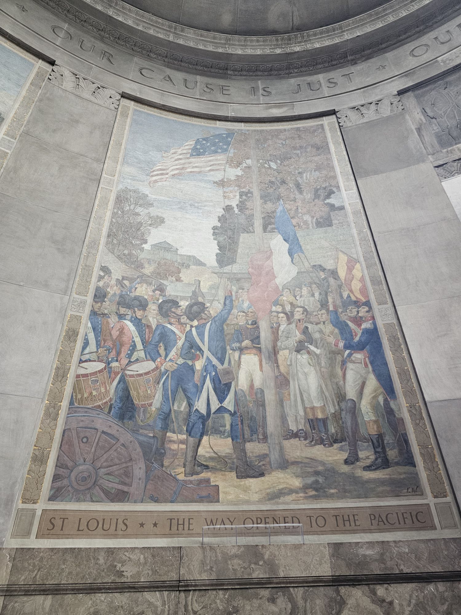
There are several of these beautiful murals detailing the history of the area. All taken by me.
Hey there Adventurers! My last trip of 2024 took me to Puerto Vallarta, Mexico, for a few days around Thanksgiving. The Sidekick was doing another one of her volleyball vacation trips and I was tagging along for a a few days (I guess I was actually the sidekick?). If you managed to get through my last post, cheers! This one will be much shorter!
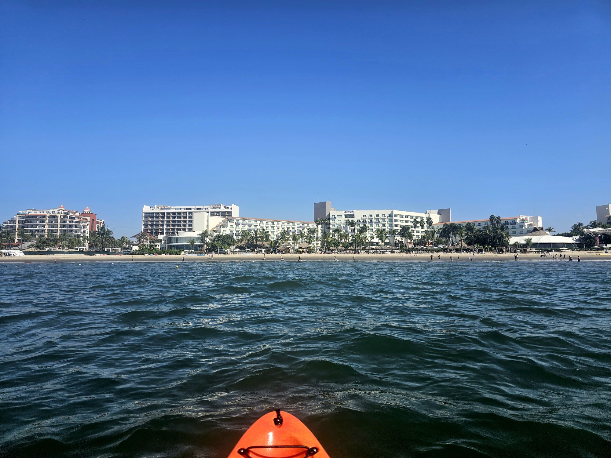
This was my second trip to Mexico and my first to P.V. We had a room at the Hard Rock, technically in Nuevo Vallarta, and it was great because it was all inclusive! It was a definitely a nice place to stay and it wasn’t terribly expensive either, considering. The company that hosts these trip is called SOB South of the Border. We got in on a Friday, and the ball stuff didn’t actually start until the next day, officially, so it was a chill day of resorting and beaching. The previous one of these trips I tagged along on was to Ixtapa/Zihuatanejo. This was much, much nicer (see: more Americanized). I ventured out into the market spaces outside of the resort, and even managed to negotiate prices on goods at the market, all in Spanish! I would not have tried that in Ixtapa. But, as in Ixtapa, there is a level of care and maintenance of their beautiful beach that we seem to lack here in the states.
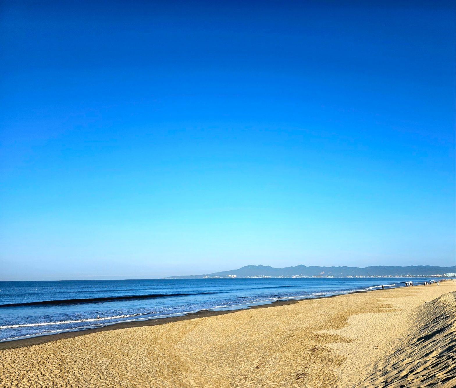
Taken be me. No trash to be found on this beach. None.
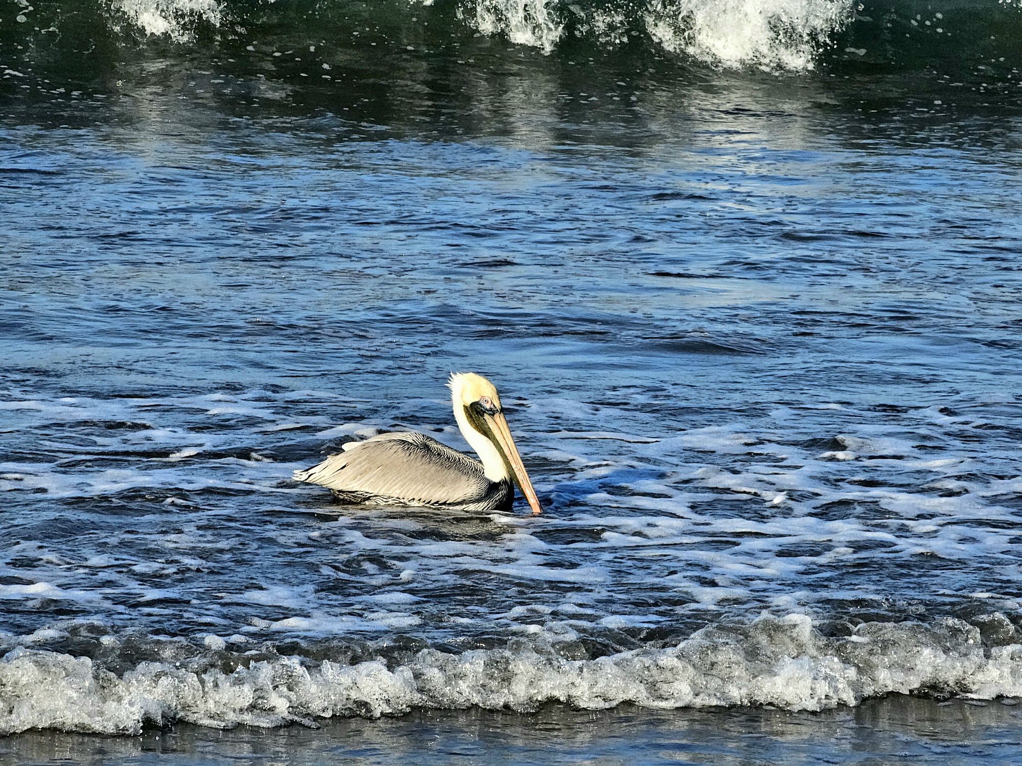
I mean….I can get these pictures every day of my life, but hey…it’s a Mexican pelican! Taken by me.
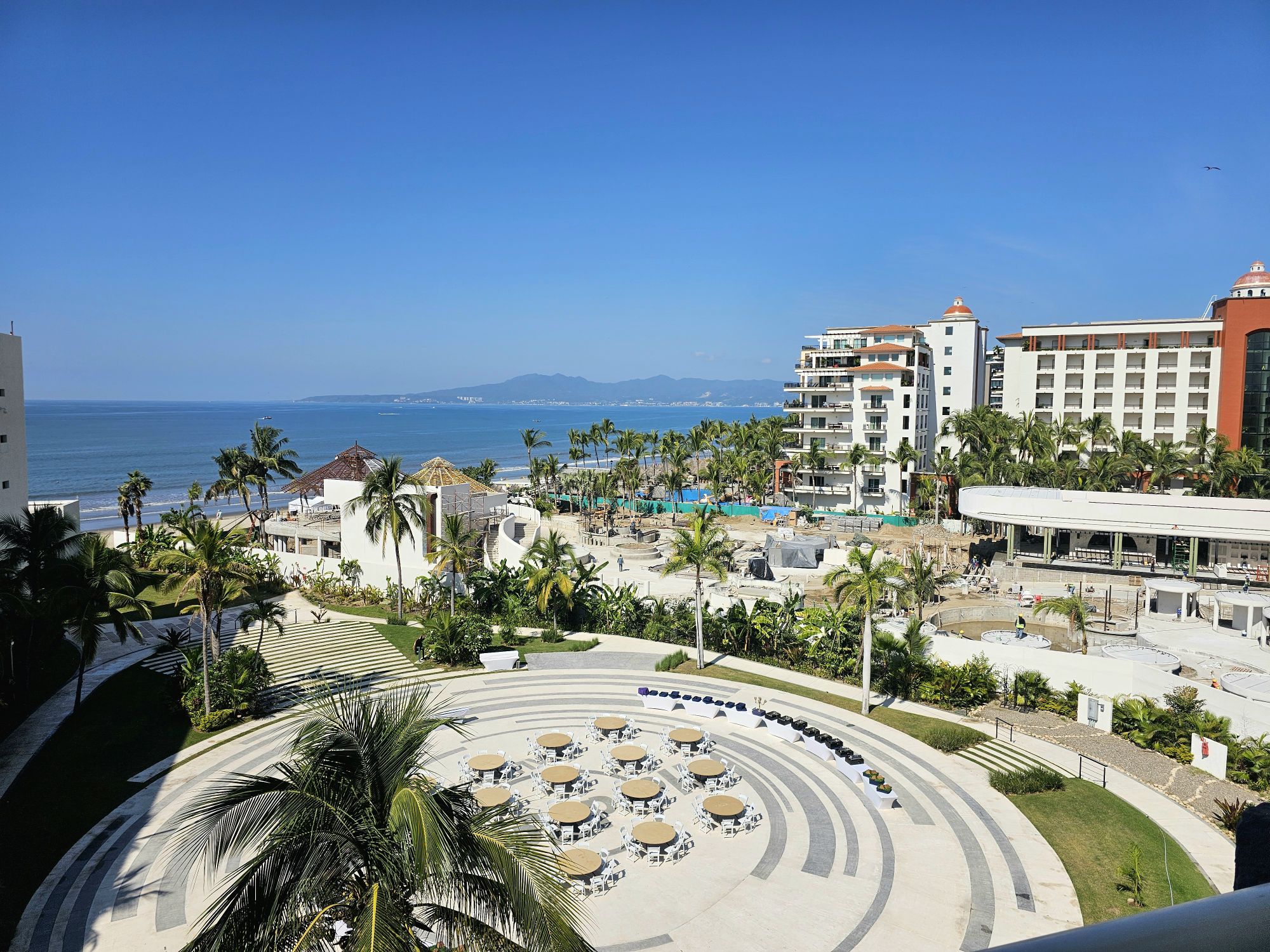
The view from out room! Not to shabby! Taken by me.
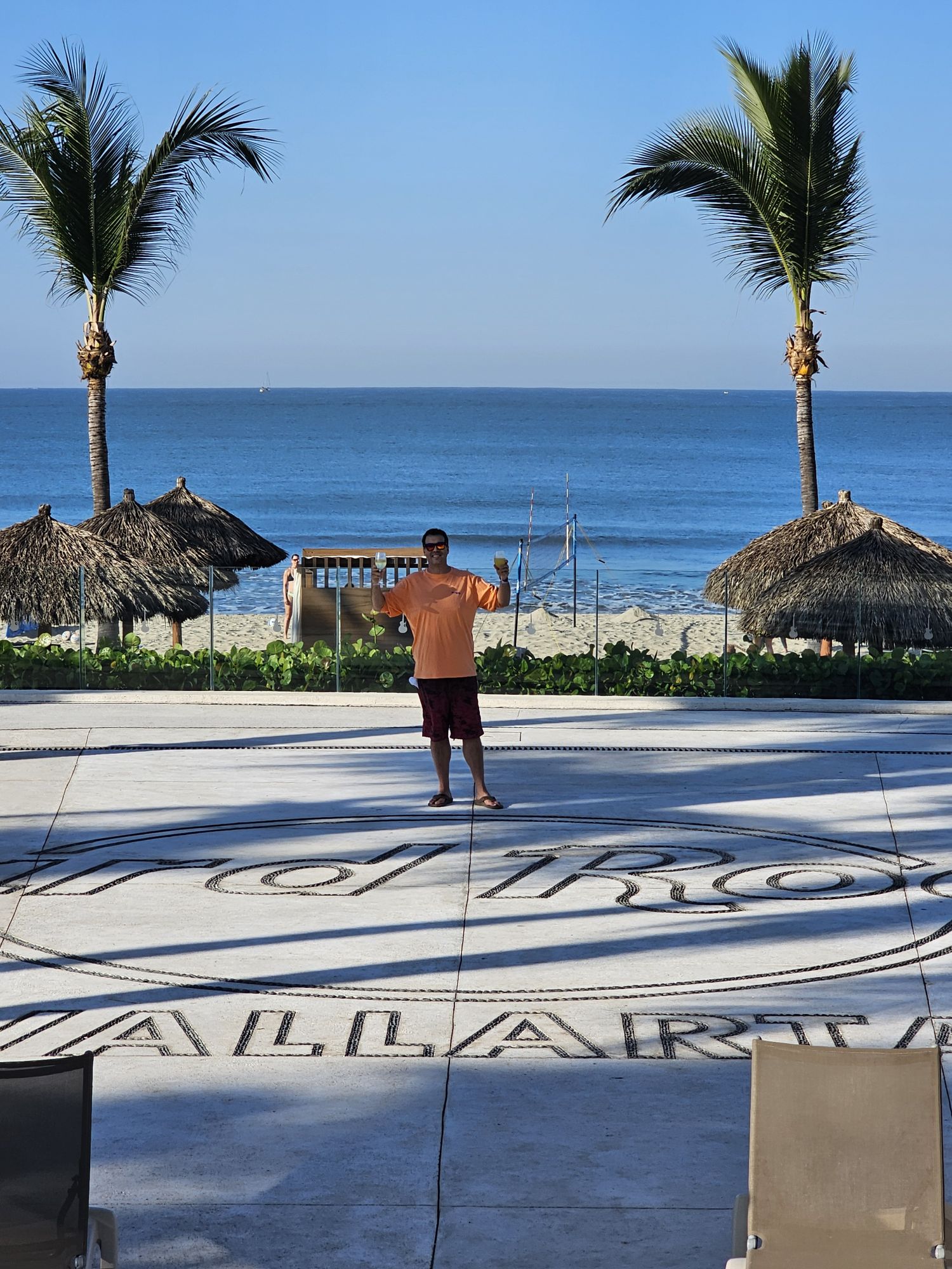
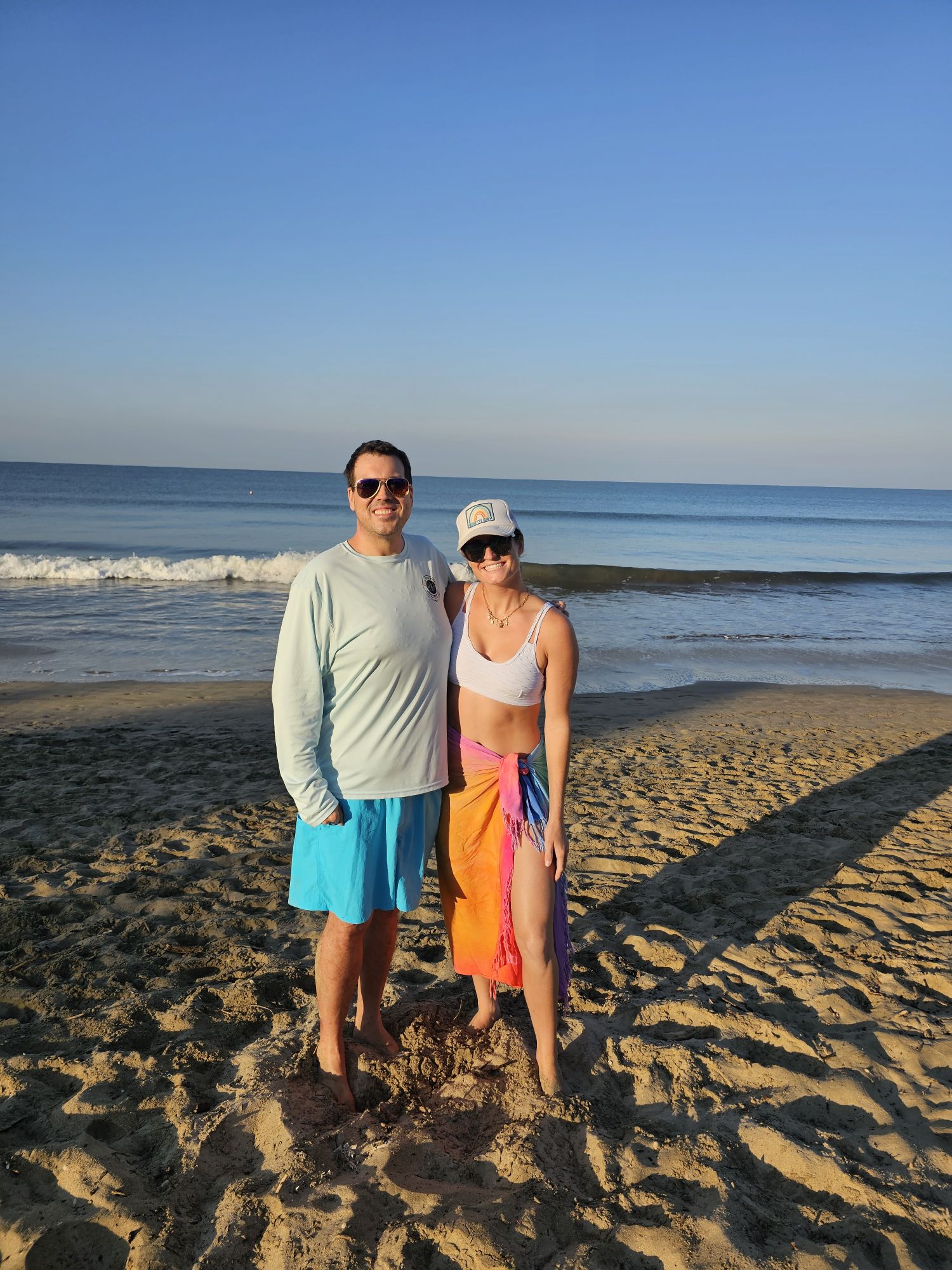
I guess I was technically the sidekick on this adventurer! But anyway, she snapped this of me on the cool concrete marker of the resort!
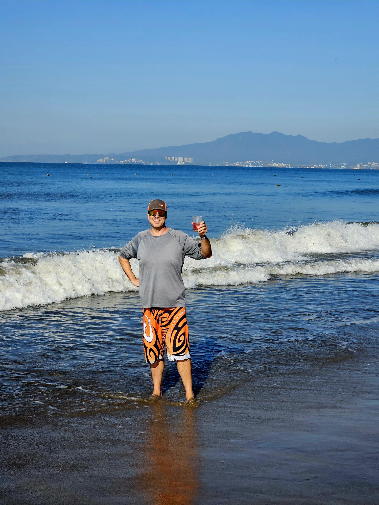
Taken by the sidekick.
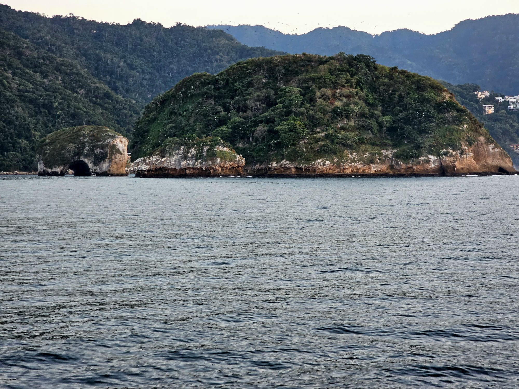
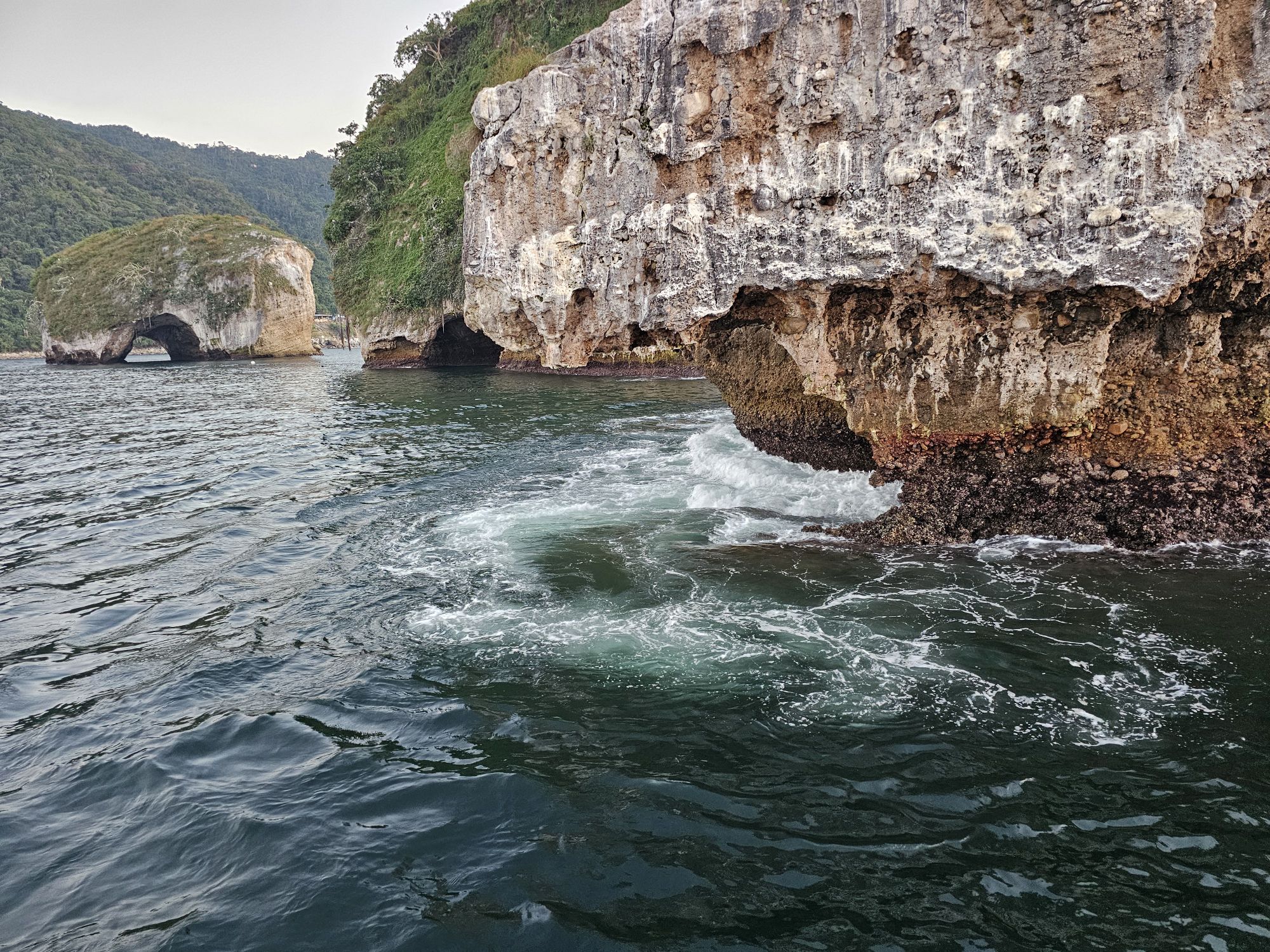
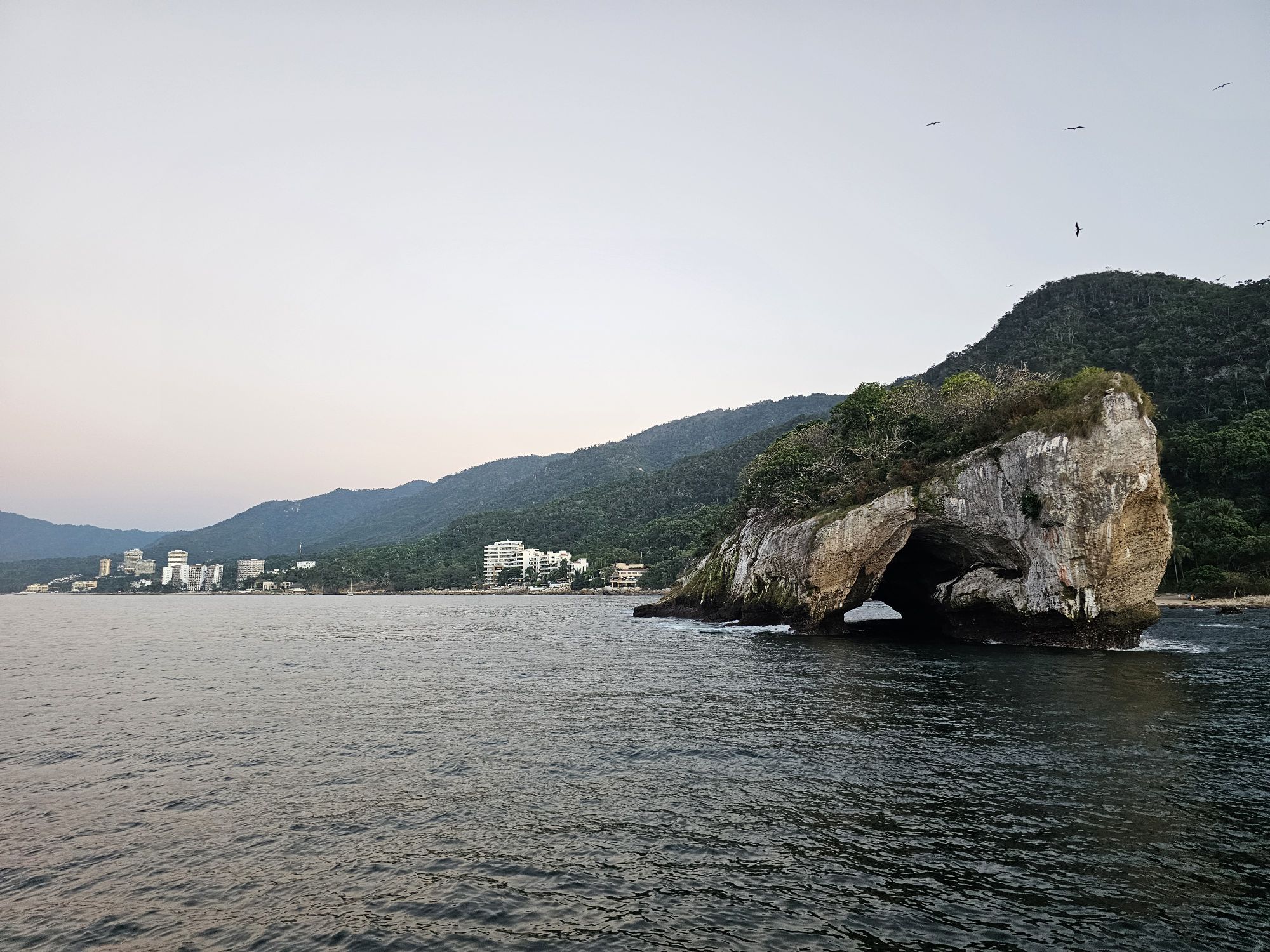
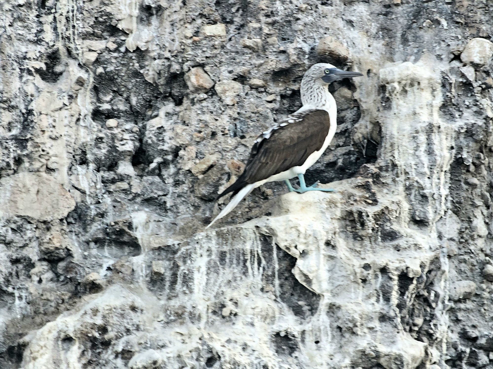
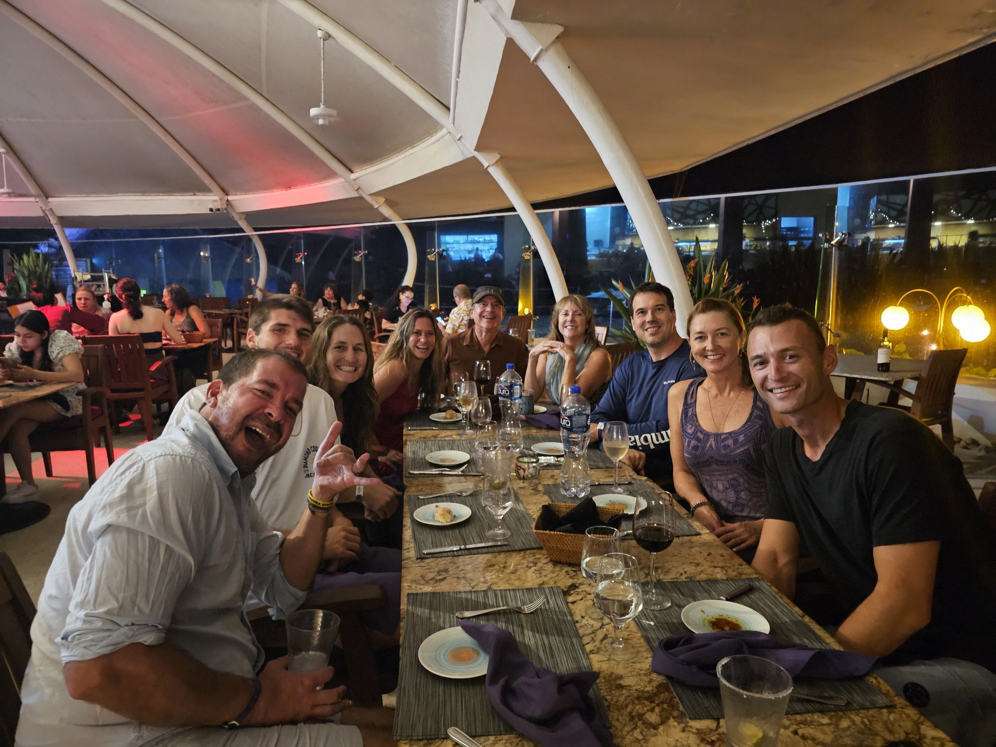
The trip was really chill and mostly hanging around the volleyball events but there were some other big highlights. Although the water was warm, it was quite rough, but I was still able to take a couple hours to go kayaking. We took a super fun afternoon/evening cruise out to my first foreign national park. That cruise was great with cool fruits, all you could drink Modelo and wine, and a return trip featuring the crew really showing out, acting like bad American rockers. It was delightful! The Parque Nacional Marino Los Orcos del Mismaloya is off the coast to the south of Puerto Vallarta. The arches in the name are the main attraction, the Mismaloya Arches. Small boats can cruise through one of the arches, but our vessel was too large, though the captain did take us in as far as possible. The big rock island is a huge bird habitat including the blue footed booby. This is one of the few places on earth you can see these birds and I did manage to snag a picture of one! It’s not great but I will include it! There was also ample opportunity to hang with professional volleyball players, including a few that I have already hung out with a few times prior to this trip, and a new Olympian. And of course, there were some volleyball shenanigans with some old friends from the previous trip!
Great Volleyball Player Savvy Simo. Nicki has known her a couple years now, and I first met her in 2022 and also again in Ixtapa. She’s a great player and a great person!
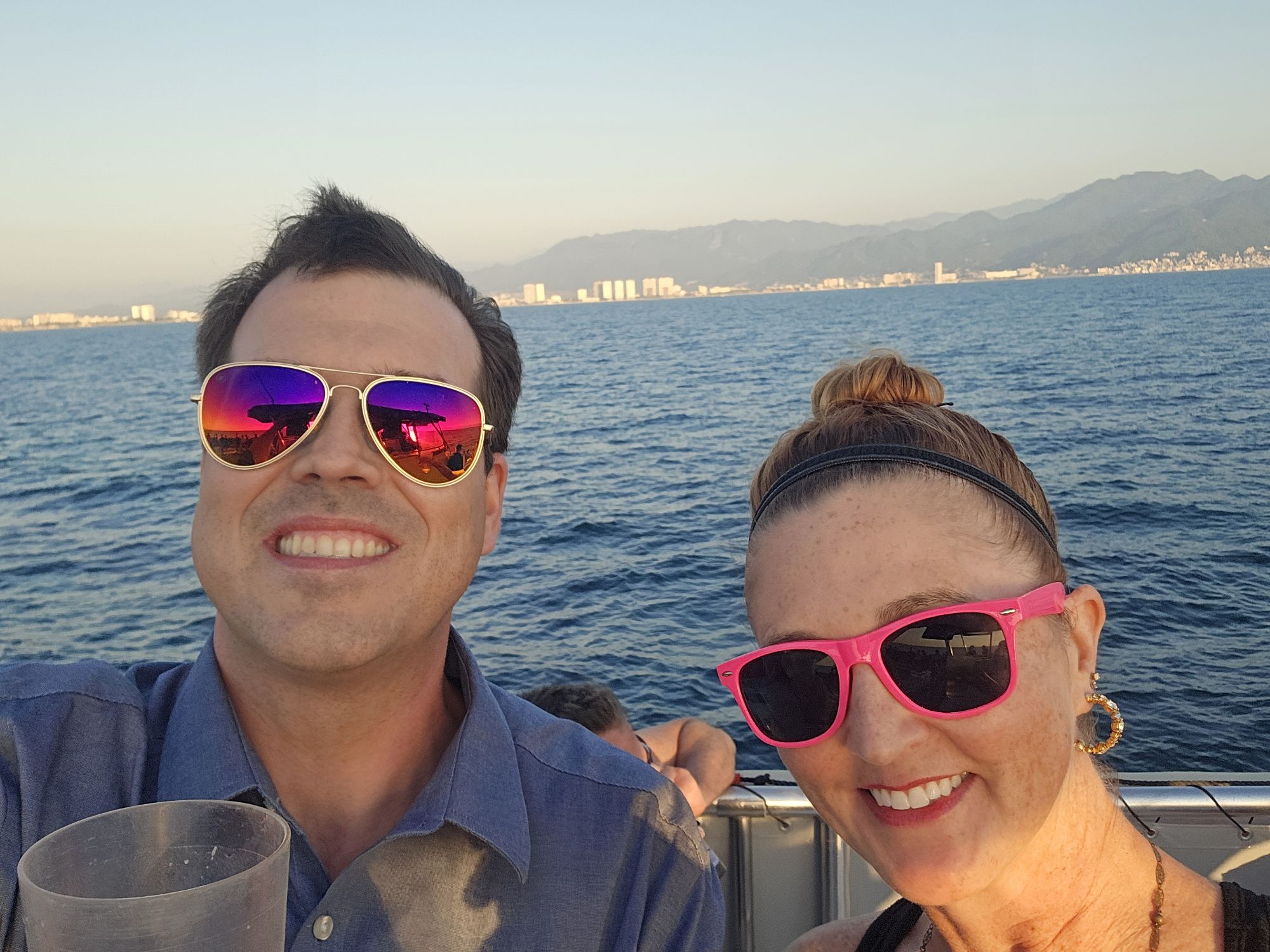
Selfie on the fun cruise out to the park.
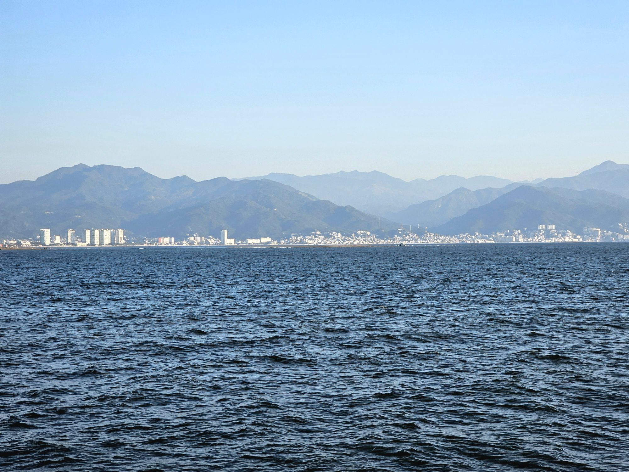
Puerto Vallarta from the Pacific! Taken by me.
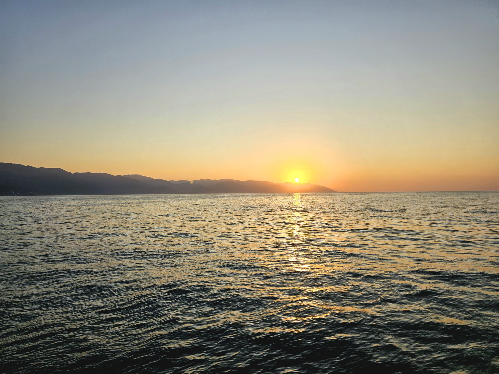
Sunset from the cruise. Taken by me.
The National Park. You can see one of the arches on the left. Taken by me.
Another view of the rock formations. Taken by me.
One of the arches.
The blue footed booby! How cool! Taken by me!
Super fun crew on our trip back! Taken by me,
Boat captain took us in pretty close! Taken by me.
Some of our Vball friends! The near right side is an Olympian, on the left are two other amazing pro volleyball players I have known for a few years now! Taken by our server.
I rented a kayak for a while….pretty hard paddling with some big wind and waves, but fun! Taken by me.
So that is all I am going to write about this 4 day trip as it was obviously more of a relax, chill, and enjoy the playa more than anything else! Fun trip: Puerto Vallarta was definitely a cool place and there is a ton more fun stuff to do than I did. I would go back! That was my last trip of a fun 2024! I am really trying to make an effort to get through my 2025 trips in the next month or two. As a preview: my 2025 featured two DC trips; one trip to St. Louis; one to Chicago/Michigan and a brief return stop to the Dunes; a stop at Mesa Verde National Park, which is now maybe landing at number 2 or 3 of my favorite parks, plus many amazing sites in New Mexico; a long visit to Washington State including Olympic, North Cascades, and a very brief afternoon at Mt. Rainier; and a long trip to Australia/New Zealand! And in case you are wondering, I have spring break planned but nothing else yet. Look forward to seeing Big Bend National Park! I am also going to try (again) to summit Guadalupe Peak in Guadalupe Mountains National Park, and I am trying to to get to Chiricahua National Monument in Arizona ahead of it possible being made National Park 64 (that legislation is in the works, but who knows)!