
National Park Count: 32
NPS Unit Count: 55
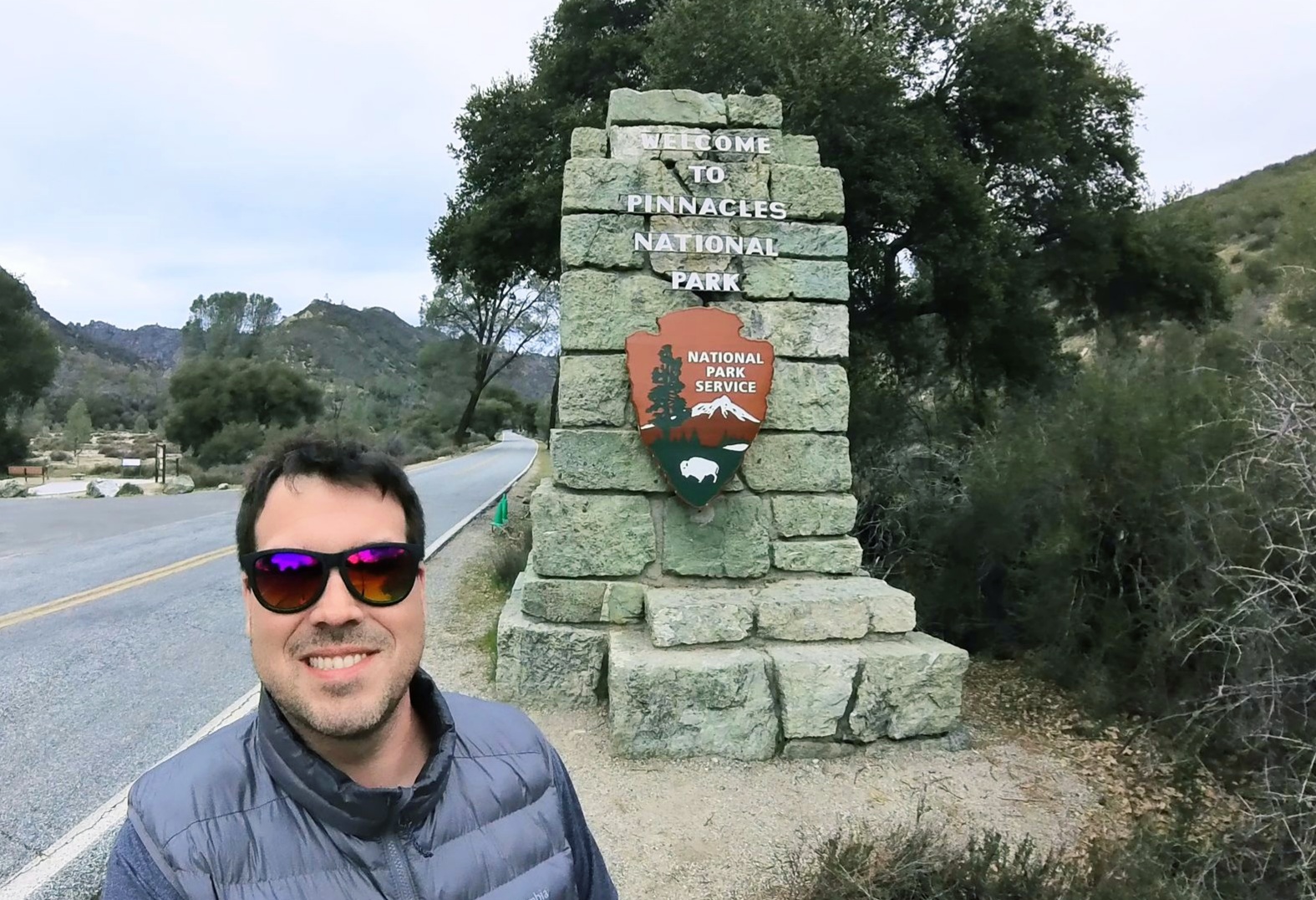
Hey there fellow Adventurers! It has been 9 months since I have logged a new National Park! I was able to pull another “Ben Special” National Park visit in February. I am calling the short “go go go” trip in a ridiculously short amount of time, with very little sleep, a “Ben Special!” This time I found myself exploring remote central California: Pinnacles National Park.
First, the Pinnacles facts! This park was named a National Park in 2013, so it is relatively new. However, it was a National Monument for 100 years prior. It is also pretty small and has a fairly low number of annual visitors. Pre-pandemic the yearly visitor count was under 200,000! As such, the park has fairly limited facilities. This is NOT a free park and at a 30 dollar entrance fee (for a week, at least!), this is one of the more expensive parks! It is also very remote, so plan accordingly for lodging, if staying overnight. The park is named after the part of the rock formations left over from the erosion of a long extinct volcano that used to be much further south than it is now. The San Andreas Fault runs through here and has drug this part of that extinct volcano hundreds of miles along with it. This park is also a huge draw for rock climbers, more so than anything else it seems! The park “drive,” if you will, is very short and also does not go through the park: This is a hiking park! There is a second side that also offers some must sees. It is an hour and a half drive around the south end of the area and back up. Alternatively, one can hike to the other side as well. One other awesome thing about this park is that it was part of the condor reintroduction plan many years back. There are something like 500 California condors now, and 300 of them live here, part time!
I spent a full day on the more popular east side of the park. This side provides the more convenient access to the campground and store, plus the easiest access to three of the more notable features of the park. The day began with stopping at the visitor center to get some good info. This is always a good first stop! I got my stamp and visited the camp store and then off to my first (and only) hike of the day! The trail system in Pinnacles is very easy to follow and if you are on a trail somewhere, you can literally get to any other trail in the system. I started my hike from the parking lot at the East Side Visitor Center. This visitor center was closed, I presume due to some of the bad storms that rolled through central California a month or so earlier, and flooded this area.
The trail I took made a nice long loop hitting some of the big highlights on this side of the park. All Trails refers to the entire hike as The Condor Gulch Trail to High Peaks Trail Loop and rates it hard at 5.5 miles with 1630 feet of elevation gain. The start of this hike is the Condor Gulch trail which then meets up with High Peaks Trail. This section of trail is pretty mundane, but scenic, and pretty empty. The noteworthy part of this hike was watching the condors flying overhead!


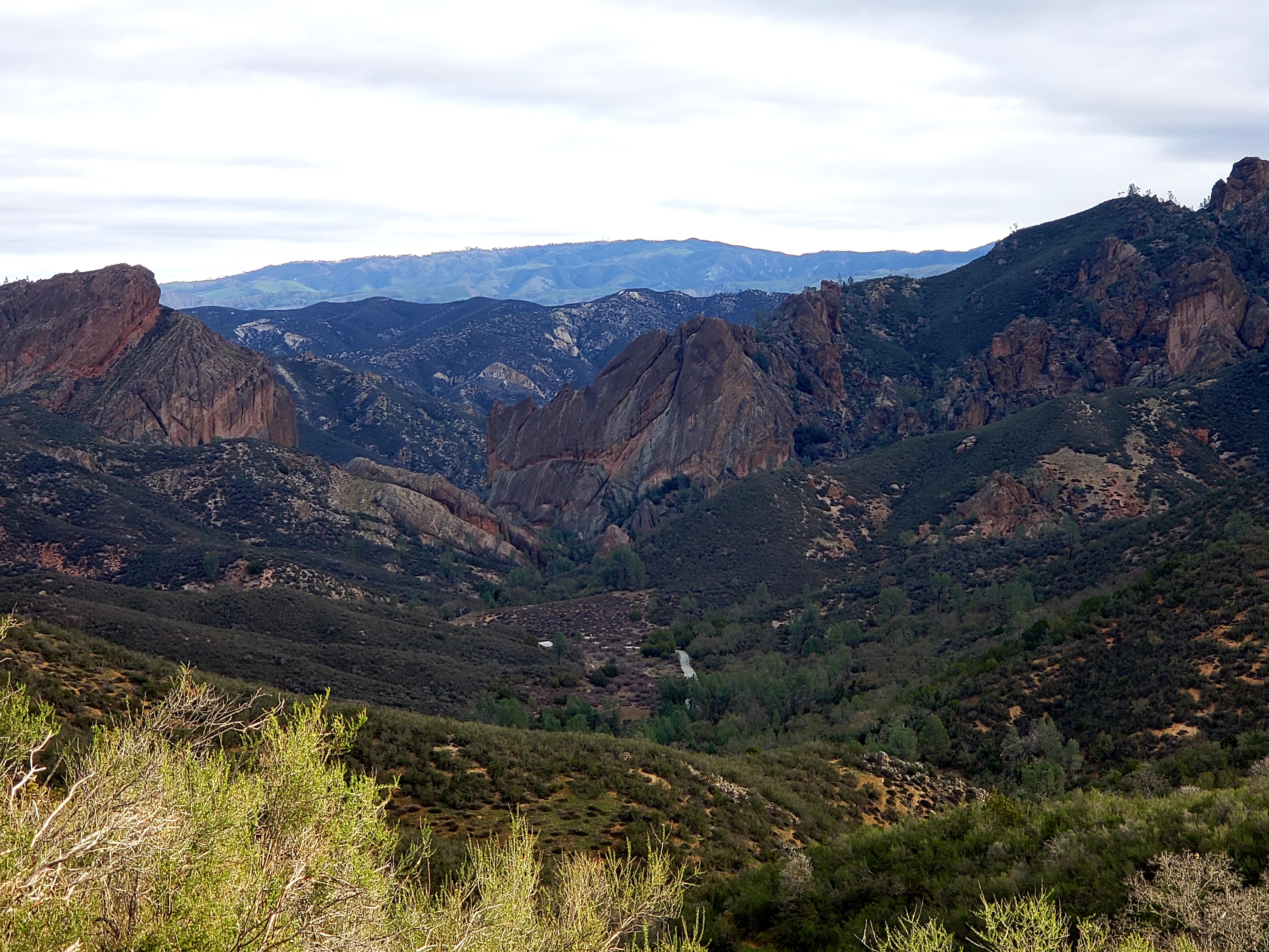
One and three quarter miles, and 1500 feet of elevation gain later, I ran into the High Peaks trail. Here begins the long part of the trail that leads to the big sights! The next mile or so took me through the “Pinnacles” part of the park, the leftovers of the old lava fields produced millions of years ago. This part of the trail is some up and down, so there is only about 200 feet of total elevation gain…but part of this section is pretty intense! This is where you find the “Steep and Narrow” section of the trail, and the name is well deserved! This section is basically climbing straight up and down. The park has chiseled out footholds up the cliffs and installed a metal rail to grab ahold of. Once you clear one section of this, there is a section where a 6 foot person has to stoop way over to fit under an overhanging cliff, and then there is more! In only 500 or so feet you ascend nearly 200 feet! Once you get to the highest spot, then you have to reverse this going down with the same process of footholds and rails.


The next junction was 1.7 miles later at a downward descent the whole way. From here the next trail, called the Rim Trail, heads toward the Bear Gulch Reservoir. This section is about half a mile. The reservoir is the only body of water seen during the hike, and was a welcome change of scenery. At this point though there are options. One is to go back to the previous junction and continue to the end. The other is to take a rock staircase down the to the bottom of the dry side of the reservoir dam. This section leads into the Bear Gulch Cave. The caves here are talus caves. That is, they were formed by boulders falling into cracks and leaving passageways beneath. The caves are home to bats and are sometimes closed for their protection. The caves are also sometime closed due to flooding. I was able to enter this cave, climb through using a flashlight, and come out on the Moses Spring Trail which then reconnects to the High Peaks trail at a different spot. This then connects to a nice pedestrian trail that leads back to the parking lot. All Trails says this hike is 5.5 miles, however, my app clocked it at 6.5 miles and 3.5 hours of hiking time. I am not entirely sure if either of those are accurate, but there it is!

The drawback to this park is definitely its size. After my hike it was only about 4 or 4.30 and I was not interesting in any more hiking since I had already done the “big one.” The park road here is just a short drive, and there is nothing, and I do mean, NOTHING, anywhere close to this side of the park. The nearest place to get food/drink/gas was about an hour away and I was in no mood for a 2 hour round trip, so I just saddled up to my campsite and got myself prepared for the night. A cool campground find though: apparently the resident turkey vulture population likes to roost in the trees in the campground!

The next morning I headed out nice and early to the west side of the park. This was an hour and a half drive around the bottom of the park and back up to the other side. This area is still a pretty remote part of California, but at least there were some signs of civilization! It should be noted that while the east side of the park has 24 hour access, the west side has a gate that doesn’t open until 7:30 AM and closes at 8 PM. I arrived just about at opening time.

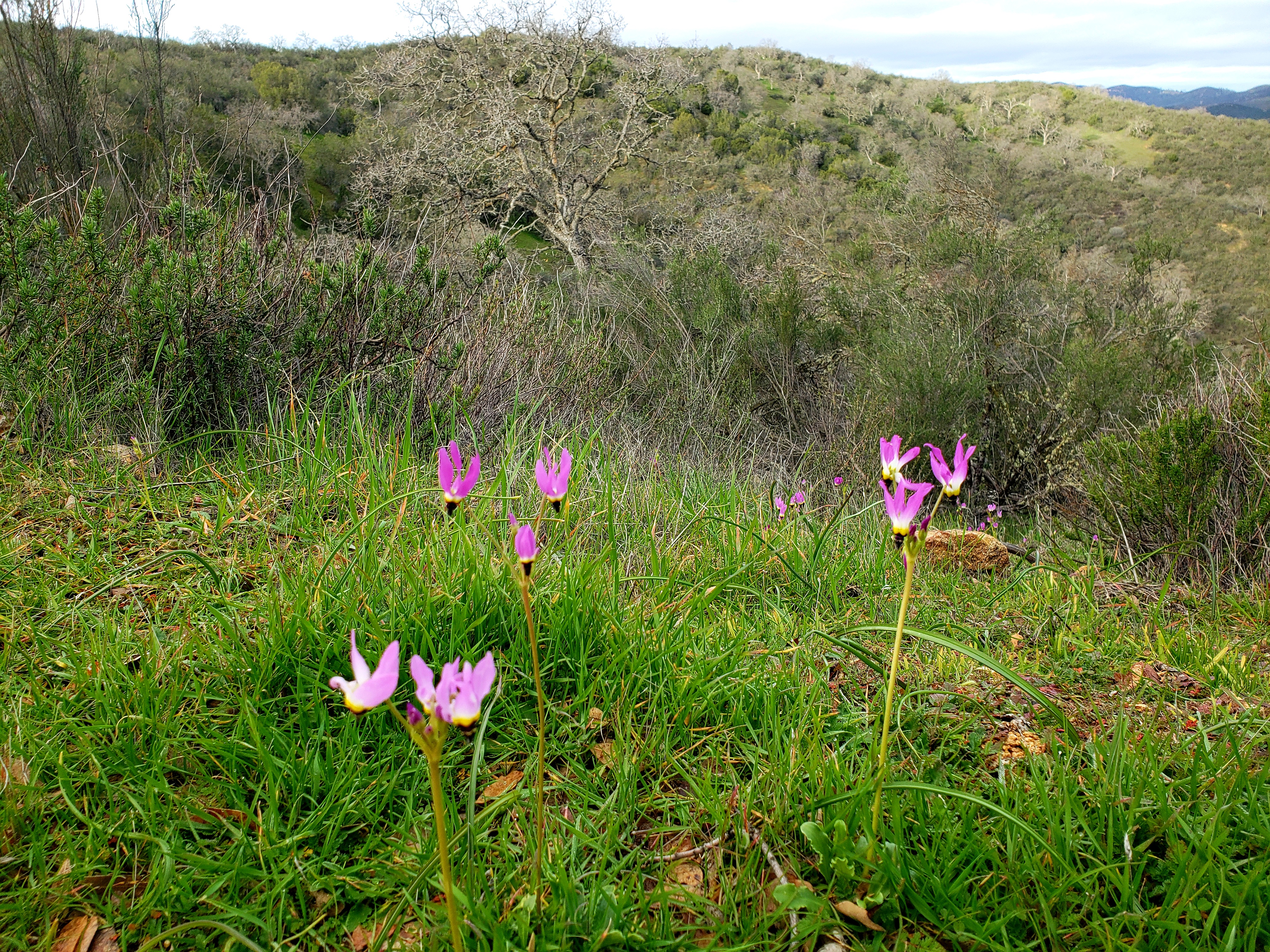
The first hike I did was the hike behind the visitor center, the Prewett Point Trail, an easy, paved, 1 mile hike that travels through an area that used to be a pioneer homestead in the late 1800s. There is not much there now, but some really good views of the Pinnacles. As an aside, this trail connects with another trail called Jawbone, which itself connects to the trails in the middle of the park that joins the two sides together. This trail is a very polite and accessible for anyone type of trail. Also, though I didn’t mention this before, this park is a big wildflower park, but I was there a little too early for that. However, this trail did afford some very small wildflower glimpses along with some different plants not found in the east side.


The main draw here in this section is a trail for arguably the most well-known feature in Pinnacles, the Balconies Trail, which includes the Balconies Cave. This is a moderate rated trail, about two and a half miles and does feature a lot of up and down. The trail is about half a mile until it meets a loop. At this point one can go directly to the Balconies talus cave, which is only a few minutes away, and then come out and do the long stretch of the loop back, or one can do it opposite. The rangers I spoke with strongly suggested the opposite route with the cave toward the end. There are a couple good reasons for this! Number 1: This cave is pitch black, involves climbing in the dark, and is generally a lot trickier than the Bear Gulch Cave, it was also partially filled with VERY COLD water, and doing it at the end means only a half mile cold and wet hike back to the parking lot. Number 2: as I told myself, doing it at the end forced me to not back out! The hike is generally pleasant with some nice views of this large rock formation that is the namesake of the trail, and also another rock formation called Machete Ridge. Machete Ridge is where the cave formed, while the Balconies offer condor watching and also rock climbing opportunities. Upon coming around the back side of the trail I approached the cave. The dark gaping hole in the rock did not look especially inviting! I had a flashlight on my hat, and I had put on sandals since I didn’t want my hiking boots to soak. I ran into a guy exiting the cave but he was actually turned around due to not having a proper light. Good start. The water was FRIGID on my bare feet, and yes, it was pitch black inside! It also was not a simple flat walk through the cave either. There is some wiggling through rocks and a lot of climbing up rock ledges to get out. And then, once exiting back out to the light, you find out that the reprieve from the darkness is short lived as there is another section of cave. Generally, other than right at the entrance, I was able to avoid most of the cold water. But, once leaving this second section though, walking through 2 feet of water was unavoidable and my feet quickly were half frozen! But, soon enough I was out to dry a bit, warm up, and have a snack! Just a bit later I was back at the car and headed out of the park. This trail was not hard at all, and actually quite pleasant. The cave on the other hand, although only like a tenth of a mile….well, that thing is almost a tap out, and I might have done that had I not went the long way around, and I am glad I forced myself to do it!


After departing Pinnacles I had my eyes set on a nice glass of wine! There is a winery just on the doorstep of the National Park’s western entrance: Chalone Vineyard. I highly recommend – the wine was great, and the views are pretty awesome too! And, when I said it was on the doorstep of the Park’s entrance, that is literally true – just about a mile away! From there it was on to Monterrey. I had spied a spot on the coast I wanted to check out. Unfortunately, the weather turned rotten, so the situation wasn’t ideal. Soon after, I began the trip back to San Francisco.

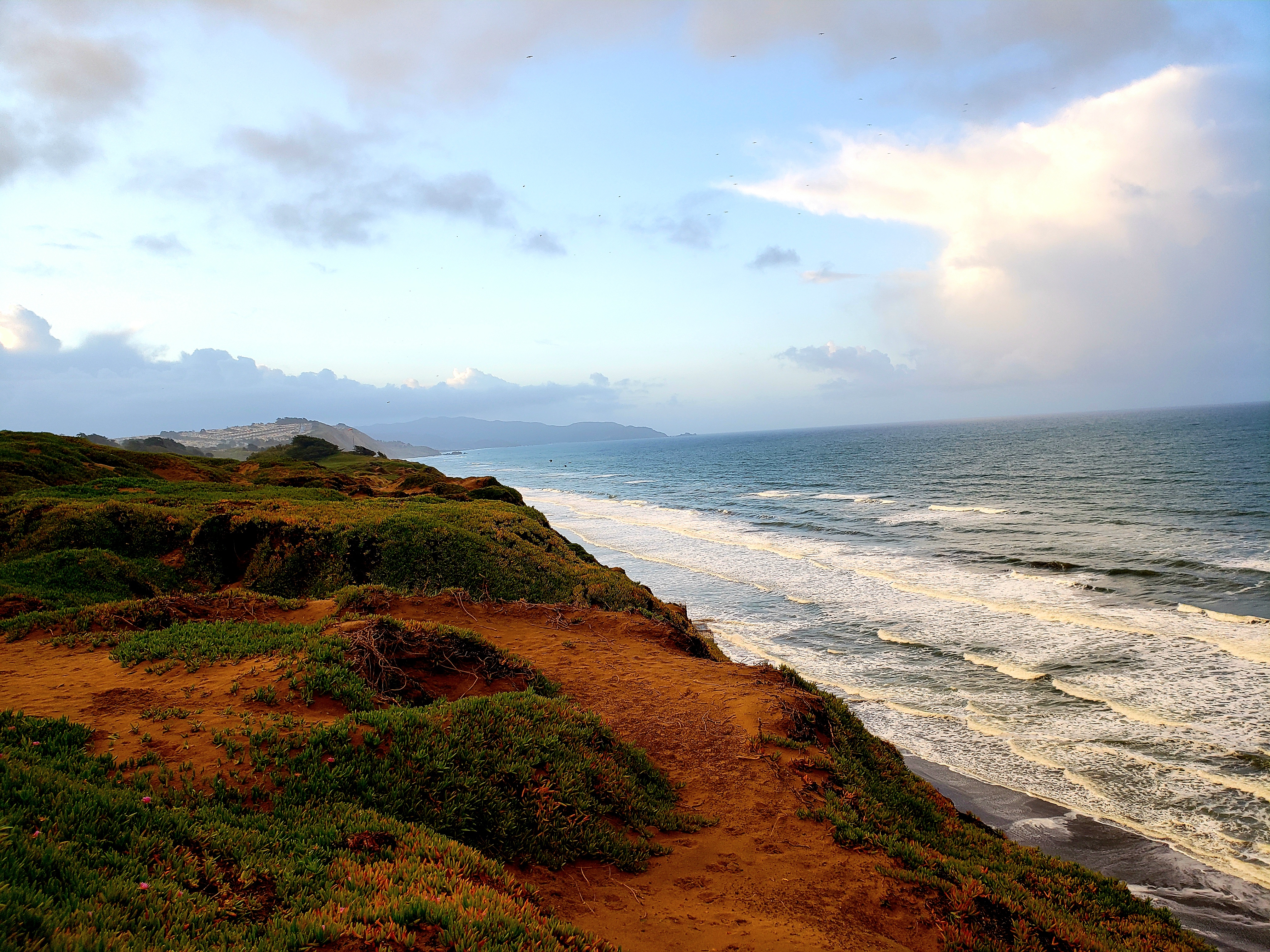
I only had a couple hours the following morning, but I still had some adventuring to do! I quite literally stumbled on Ft. Funston, on the western coast of the Bay Area. This is a part of the Golden Gate National Recreation Area! So, another NPS unit checked off! There is no visitor center here, and really it’s just some sandy hiking along the cliffs dropping off to the ocean. It’s a VERY dog friendly and popular. at least when I was there!


After strolling a bit through the Ft. Funston area, I started making my way back to the airport, but with a stop at San Bruno Mountain State Park. This is a really nifty little urban park! There are several miles of trails up this mountain. I did not have much time, but I did get in about a mile or so on the Eucalyptus Loop Trail which gives some awesome views of downtown San Francisco! There was very little fog so I had pretty good views! Then, it was off to the airport and this trip was finished!

Overall Impressions: I think this is an awesome gem of a place for people living in Central California! It is much more remote than I expected which was good (few people) and not so good (nothing to do outside the main area of the park when finished with the daily adventuring). The hiking was great and the couple cool spots are really pretty unique and iconic! If you are into rock climbing, I am sure that’s great as well. Getting a chance to view condors in the wild is also a super plus! Unfortunately, if that’s not enough, or not what you are looking for, you might be disappointed. Even the park drive(s) are short, so if you are the “drive through park-goer” it will be underwhelming for the amount of time to get there and do both sides.
The Adventurer’s Rating: 4 Stars!

Thanks for the park tour! The hike looks very adventurous! We are loving national parks since my husband retired, but we have to keep them to the more moderate to easy hikes. But, getting out in nature is amazing!
LikeLiked by 1 person