
NPS Unit Count: 66
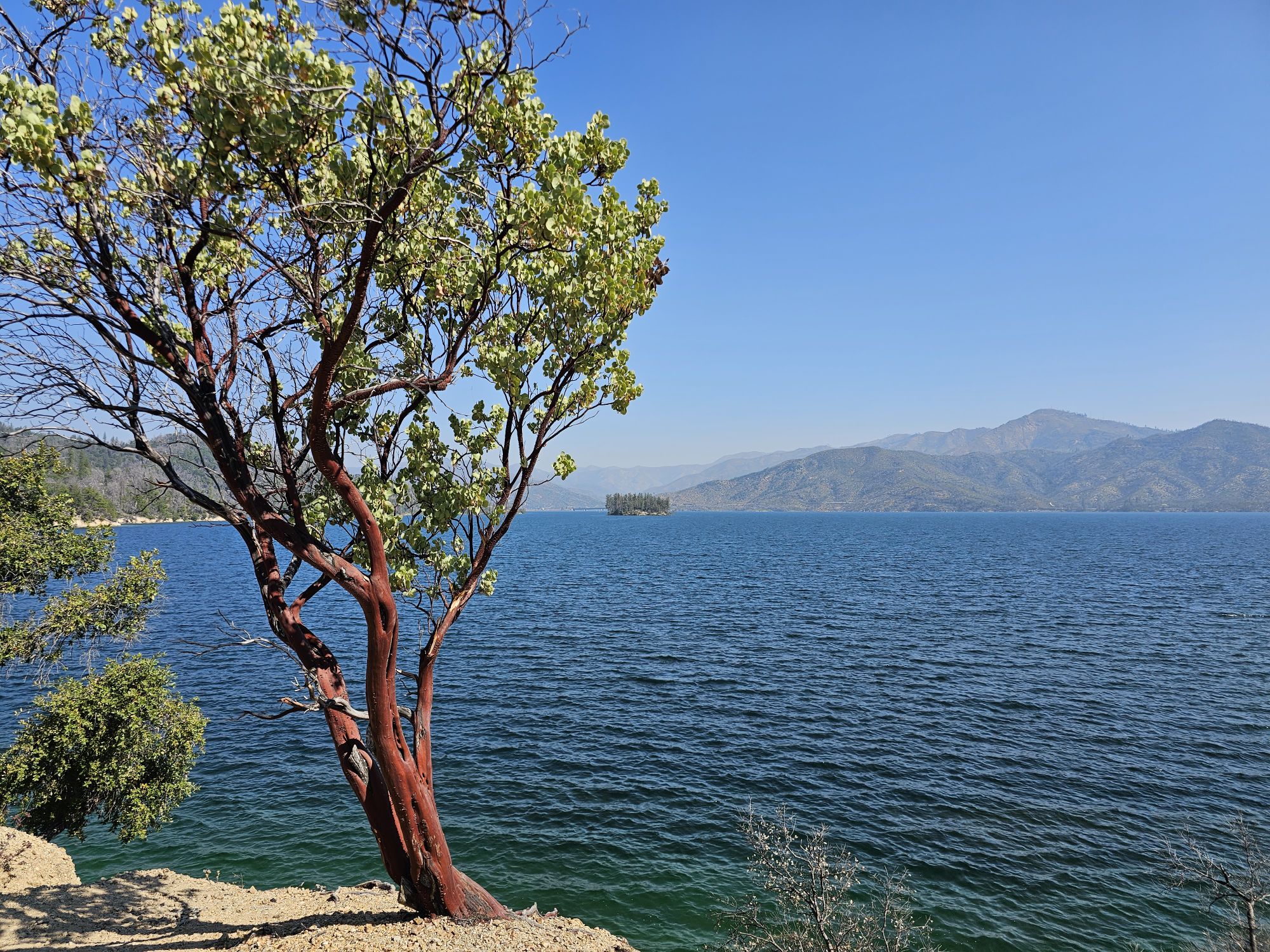
Pictured above is Whiskeytown Lake, Whiskeytown National Recreation Area.
Hey there Adventurers! As part of my July trip to northern California national parks, I also made a couple smaller visits, one to Whiskeytown National Recreation Area (an NPS unit) and also to Lake Tahoe’s Nevada side. The caveat being these were super short visits (hours each), here are my brief thoughts on these two lakes!

Whiskeytown NRA is located just to the west of Redding, CA and directly on the path from Lassen Volcanic National Park to the southern end of the Redwood National and State Parks. Once upon a time Whiskeytown was a gold mining town. How did it get that name? Well, there are two theories! One is that a miner was hauling supplies to his mine and dumped a barrel of whiskey into the creek, thereby leading to the name of Whiskey Creek and Whiskeytown. The other thought is merely that the miners drank a lot at the end of the day! Anway, in the early 1960s, a dam was constructed on a creek here and the valley where the town sat was flooded. This was part of a large project to move water to other parts of California. The government bought up most people’s land and structures, and what structures were not purchased were moved down the road or up above the water line. President Kennedy dedicated the dam as his last official stop in California in 1963. I have read that it was unusual, but that he may have made the trip simply because of the name! Who knows, but it seems reasonable! From an ecological point of the view, the engineers created a special “curtain” of sorts to preserve the cooler water needed for Chinook Salmon eggs to survive. The salmon used the old creek to spawn and when it was dammed that led to the water in the lake being to warm for them, so this curtain forces incoming water to the lake bottom rather than mixing, thereby preserving the Chinook’s spawning ability! Pretty cool!

I only explored a bit of this area but what I saw looked great. The lake is beautiful and can be used for boating, swimming, fishing, etc. There are trails and a nice waterfall to find. Some of the remaining buildings are available to see but most of them seem to be for NPS housing, maintenance, or administrative uses now . I found out later that there is a unique cemetery that people like to visit (weird). It was moved from its original site as well. And, the best part? There is a Bark Ranger program here as well! The entire area is dog friendly and I saw humans and dogs alike swimming in the water (it looked cold!). I would say the best use of this area for tourist is doing what I did – if traveling between Lassen and Redwood and looking for maybe a relax chill day in Redding, this would be a great place to relax and enjoy for a day. Indeed, my initial plan for this trip included an overnight in Redding for this very reason, but for timing reasons I just drove straight through with this brief stop to .

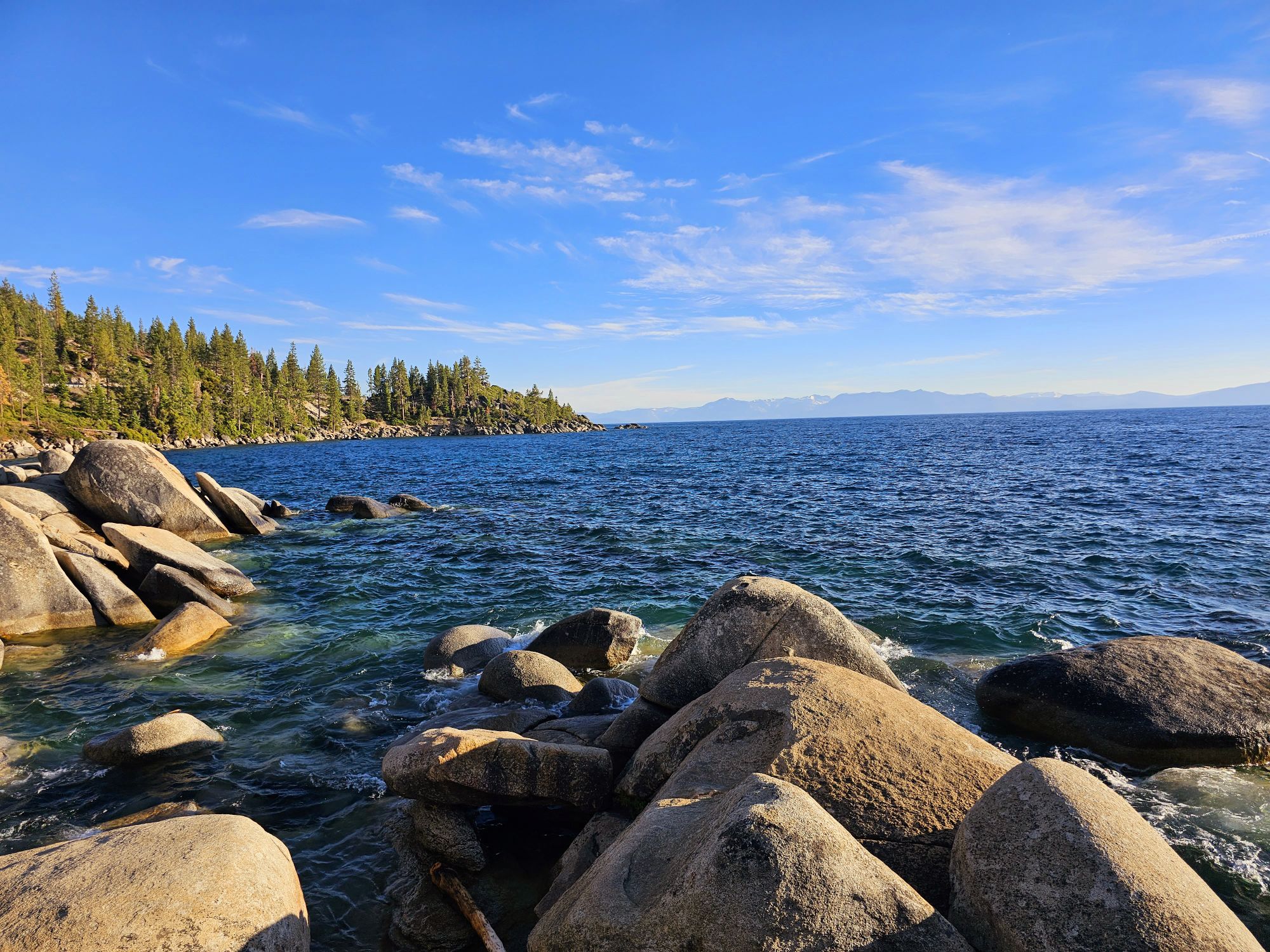
At the conclusion of my Northern California trip I decided to make my way south from Reno to check out Lake Tahoe. If you are not familiar with the lake, it is the largest alpine lake in North America and the 2nd deepest lake in the US. It is exceptionally blue due in part to algae in the lake. Despite that, the lake is exceptionally pure, almost as pure as commercially distilled water. It is also very clear, but not as clear as it used to be, which has led to intense conservation efforts. The lake never freezes, and rarely warms above 70 degrees. It was nearly 110,000 degrees in Reno the afternoon before I flew out and a escape to the lake seemed like a great idea! Now, all that education I dropped on you a few sentences ago I did not know prior to my visit. I was very surprised that the lake sits at a high altitude, about 6200 feet. Even more fun was the road I took reached the summit of Mt. Rose at nearly 9000 feet. It was a cool drive for sure. And that was about the last cool thing for quite a while….

I entered the lake area at a town called Incline Village and talk about a mess. This area is super crowded. Even trying to get a view of the lake from here is a daunting task. There is very little public parking to be found and it took nearly 45 minutes to find a spot. I sat down at a restaurant on the main strip here that had an outdoor second floor and got two tacos, chips and salsa, and a beer….that was a 40 dollar bill after tip. And the only view was of the street and the rental homes on the lake shore blocking all view of the lake. I found some spots that led down to the lake but they were inaccessible for belonging to resorts. To be fair, this was a scorching hot Sunday afternoon, so being busy was to be expected. That being the case, I never imagined such a huge lake would be so hard to even see!
I got in the car and headed south along the east side of the lake and did manage to finally get some views but parking was a persistent issue. For instance I found a spot that features an overlook, a restroom and trail access down to the rocks of the lake shore but parking is restricted to 20 minutes! At least it was free…and I finally got an obstructed lake view at water level, however briefly! I will add that if you are biking it appears the experience is much different. There is a bike trail that runs parallel to the road here that probably makes the whole experience a lot more convenient. My drive continued past a popular beach called Sand Harbor Beach. I would have stopped…but parking was full … and was like 20 bucks even if it wasn’t full! This spot did seem to be that point where people decide not to go any further though so from here on the drive was much less crowded and thankfully finally gave some good views of the lake without worrying about traffic! In hindsight, I would have came straight down here to begin with and skipped the Incline Village altogether, but honestly, I was not planning on going even this far down the lake. But, here we were, so I kept going and continued a bit . I continued down a ways still to a spot called Cave Rock. The road steers considerably away from the lake here, but eventually finds the shore again before arriving at Cave Rock. This is actually a tunnel for the road but mercifully I found a mostly empty parking lot. It was advertised as a pretty high cost to park as well, but the lady working the both let me in for 2 bucks since it was nearing the end of the day. This was definitely a nice spot to catch a bit of the late day sun. As I headed out I very nearly timed it perfectly to get sunset from the spot I took my first picture of the lake, but I missed it by a just minutes!

I think Whiskeytown has some great fun opportunities, but I do not foresee myself getting back out there again. I definitely think I enjoyed the low key and less populated nature of Whiskeytown versus Tahoe. However, I think Tahoe would be a place I would be interested in returning to. In my thoughts of Lassen Volcanic National Park I concluded that a return visit might be in store. If I do so, via Reno, I may very well try to spend some more time at Tahoe now that I know some better areas to visit and what to avoid!
