National Park Count: 40 NPS Unit: 70, 71
Hey there Adventurers! It’s April 2025, and Facebook sent me a memory of this trip a couple weeks ago, which is now a year old, so I figured I better get on with catching up! This trip was a tandem park trip with Joshua Tree. Be sure to check out that entry if you’d like!
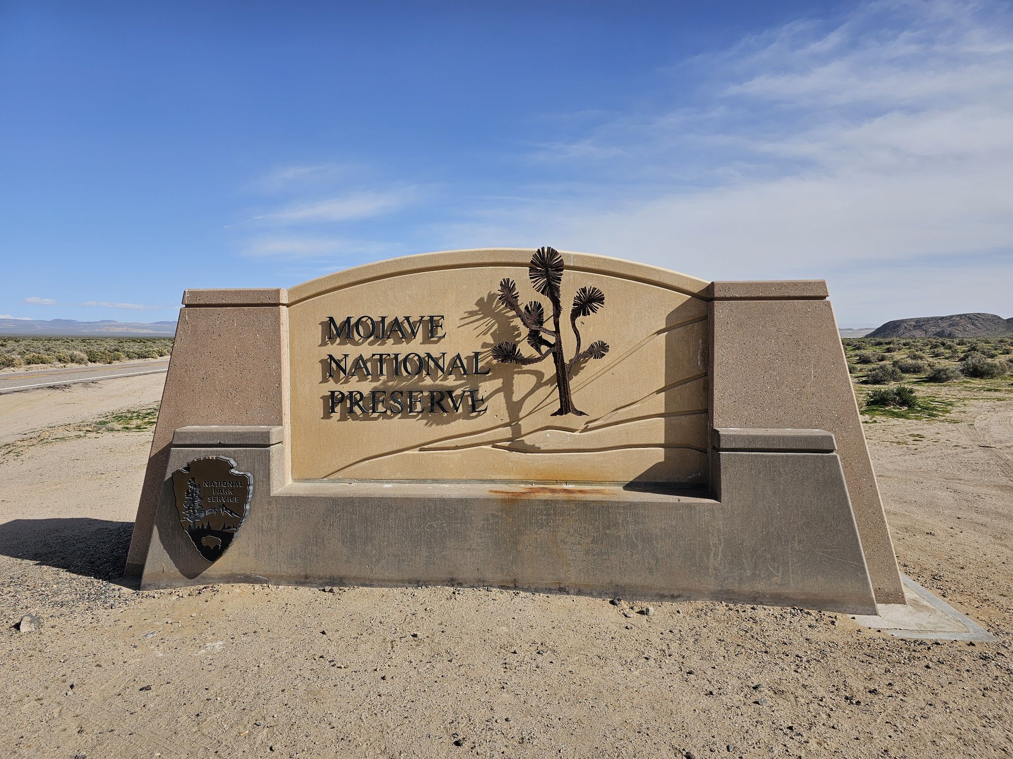
After wrapping up our Joshua Tree visit, we headed north toward Death Valley. It’s a decent little haul between the two, at about 4 hours, with a whole lot of nothin’ in between. We did technically enter Mojave National Preserve and took a sign picture, but between the two there is not a whole lot going on…if you like brown, dry, and desert, this is your jam! But don’t mess around here. Once you leave Baker, CA…its about 60 miles through the desert before you run into anything! This being March, it wasn’t hot, but I can imagine if you came during the summer it could be brutal!
I know I have mentioned this before in a couple other posts, but it is more accurate here than anywhere else: This place looks like another planet. You could tell me Death Valley was Mars and I would 100 percent go with it. But you didn’t have to tell that to George Lucas! He filmed several landscapes for the Original Star Wars Trilogy in Death Valley National Park, when that was allowed. We did not make it to all of them, but I will point out the locations we did stop at that were used in the first and third movies!
Before getting into the trip, a brief bit of logistics is needed. Death Valley is the largest of the US national parks outside of Alaska. It is actually quite a bit bigger than Yellowstone. If you are in a traditional vehicle, there is relatively little road access. Think of the park’s paved road system as a big x, with the cross about right in the middle.

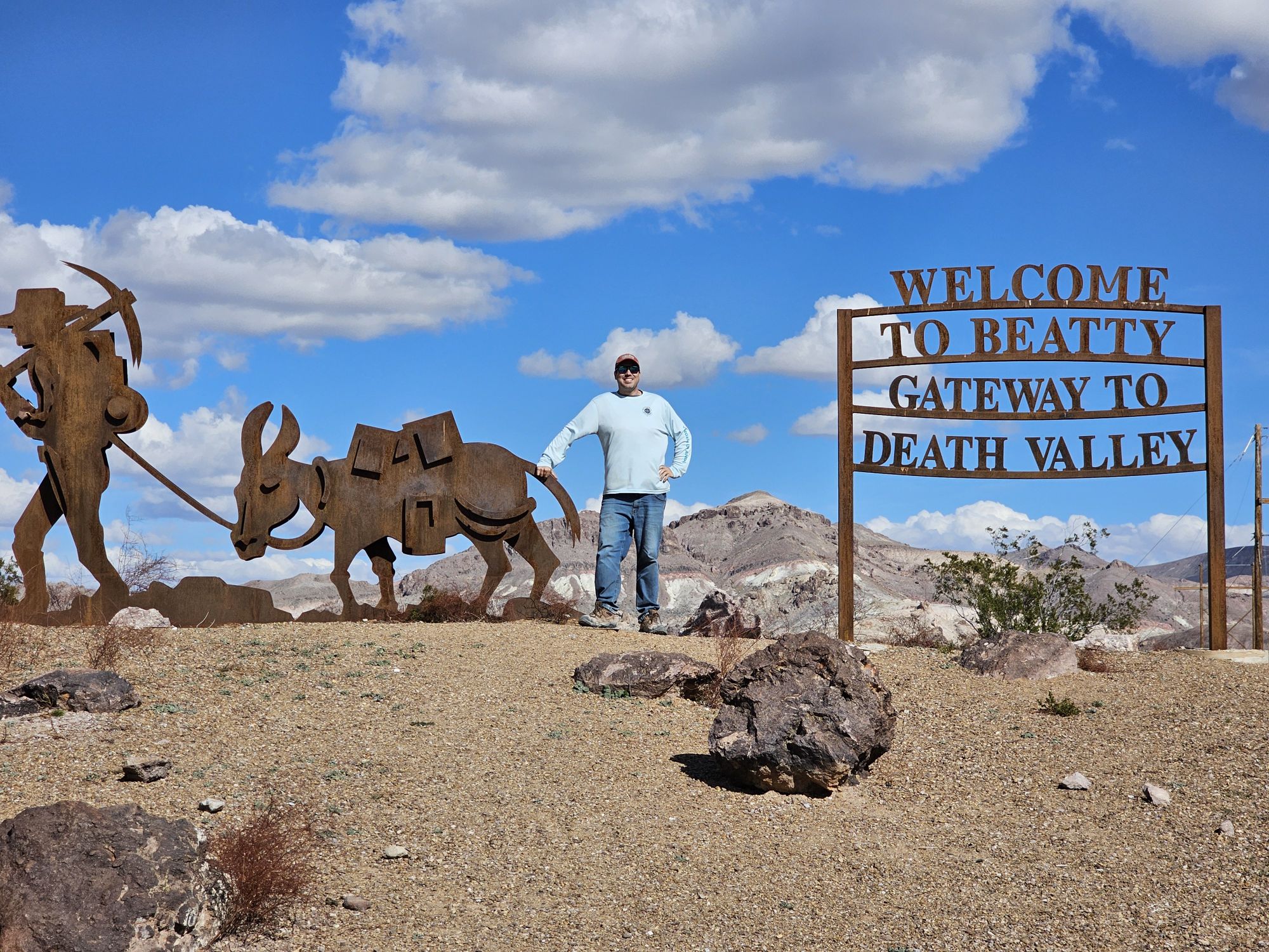
The top left of the X is very remote, but it is a nice paved road that leads up to the volcanic area of the park. If you have the proper vehicle and want to tackle the full day drive to get to the famous sliding rocks, you would go that direction (we did not). Just be sure not go off the road if you do not have the proper vehicle! (More on that later – didn’t affect us!) The top right of the X goes through to Beatty, NV, where we stayed. The bottom right goes to the section of the park that most people will drive as it goes to some of the big attractions, most notably Furnace Creek and Badwater Basin. You can barely see that road in this map. That road is also paved. There is a paved shortcut not seen in my map, that connects Beaty Junction, almost due north to the upper right of the X, bypassing the middle. The bottom left part of the X leads out past the sand dunes, to Stovepipe Wells, and out to Panamint Springs. If you were to draw a straight line from the heart on that map to the west to intersect with the left of the X, you would also come across another road that leads to the old kilns and the Telescope Peak area. It seems this road is often closed due to snow, and it was when we were there. I will reference the roads/parts of the park by their quadrant of this X. As for lodging, you can find expensive and limited availability lodging near Furnace Creek, Stovepipe Wells, Beatty, and Panamint Springs. Beatty was our choice due to is being far cheaper and still pretty close. Despite being the gateway town to park, which hosts over 1 million annual visitors, this town is a wreck. More on that later.
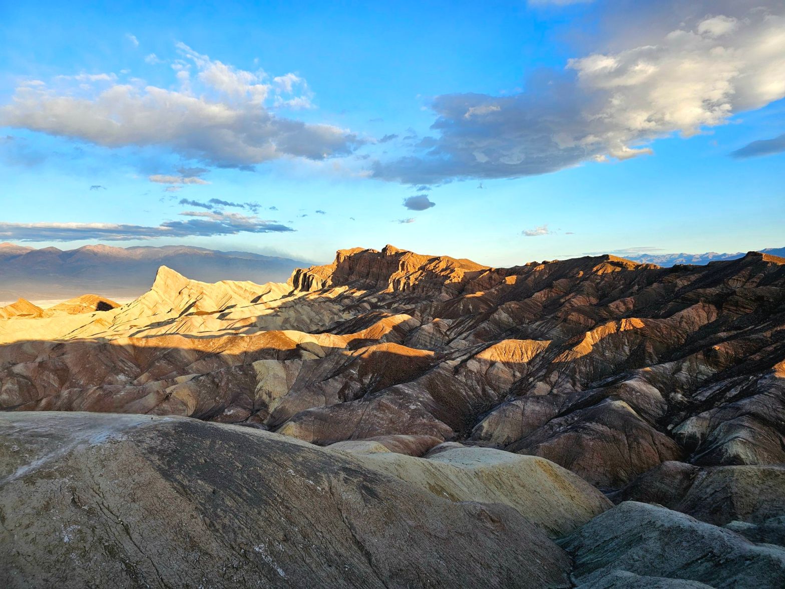
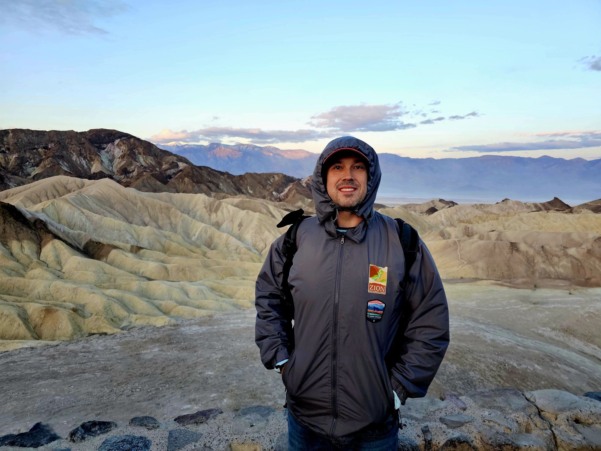
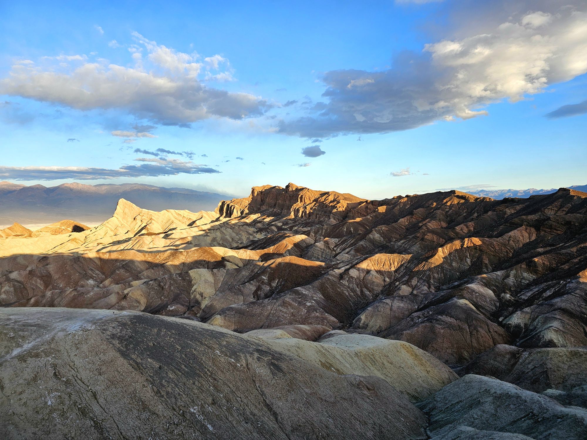
We happened to pick a weekend in Death Valley that saw cold, and very windy weather, with snow! Who’d have thought? Come to the hottest, driest place on the planet and be freezing and driving through snow! After fearing the very bouncy AirBnb RV we stayed in the first night would flip over in the wind if the windows didn’t blow out first, we got up and drove in to the park from the top right of the X while it was still dark. We wanted to catch a sunrise at Zabriskie Point, noted to be among the best sunrise spots in the park. It was about 45 minutes from Beatty to the point, which is found a little past Furnace Creek off the lower right part of the X. It is a really neat spot for sure. You are not really catching the sunrise per se, as much as you are catching the sun coming up on the opposite mountains, across from Badwater Basin, and continuing up on the rocks near the point. You definitely want to catch this if you are in Death Valley! Bear in mind its a pretty popular spot and the parking lot is limited.


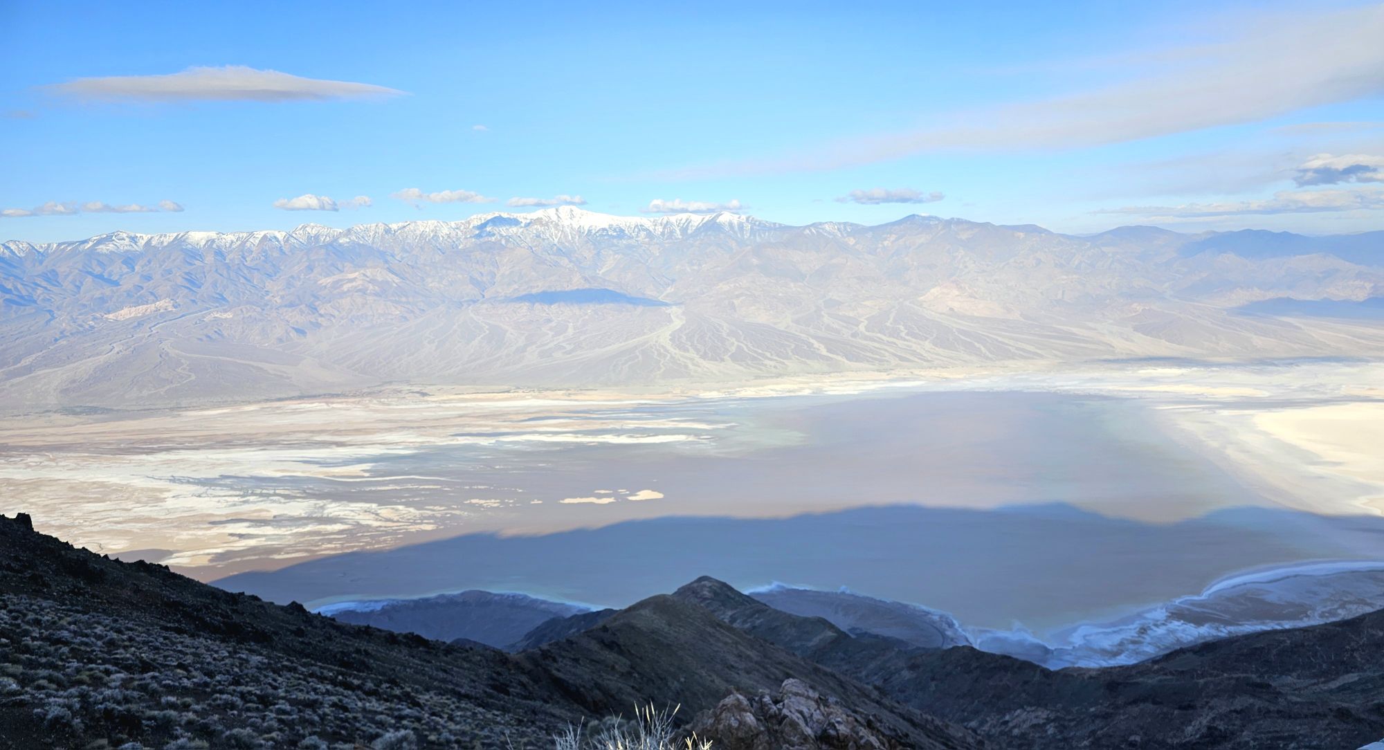
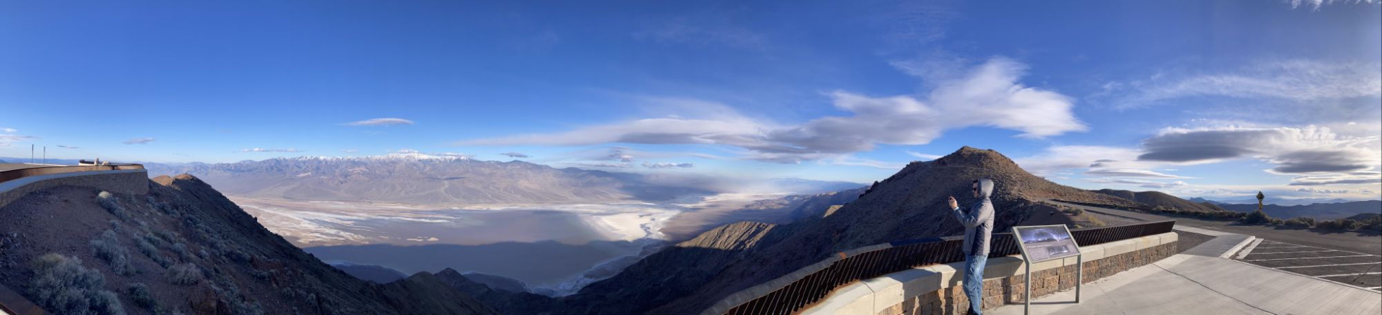
After sunrise, we headed further down this branch of the X until we found one other small paved road that went up to Dantes View, a spectacular view point of Badwater Basin sitting at 5500 feet elevation. On a clear day there are views of Mt. Whitney, which means one can look at both the lowest spot and the high spot in the lower 48. While we were there it was 30 degrees and extremely windy – we did not stay too long! In the original Star Wars, this is the Mos Eisely overlook!
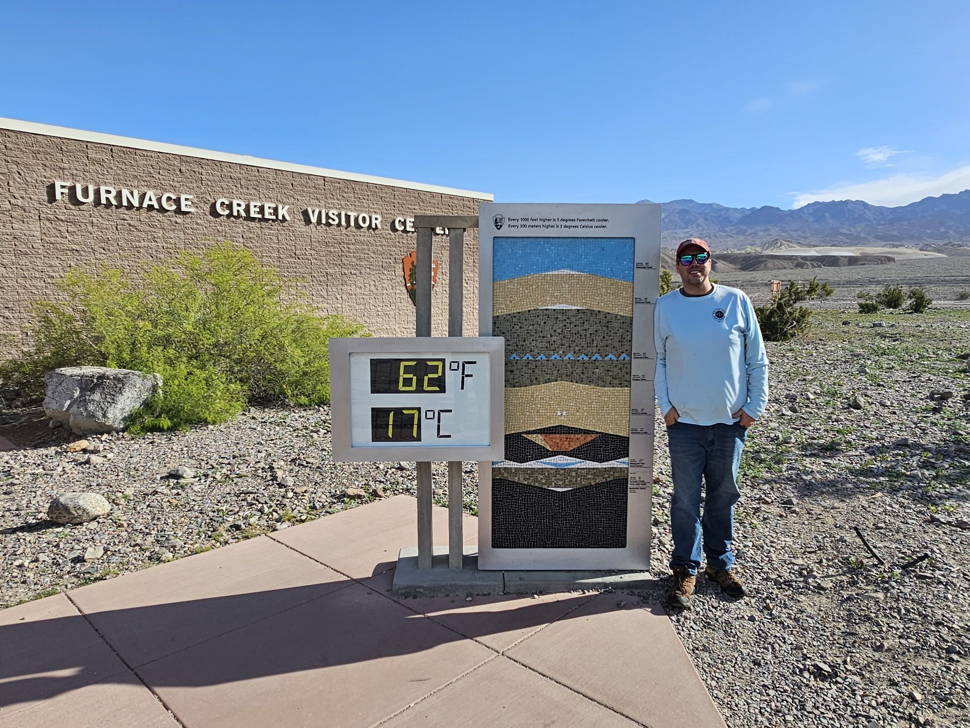
From Dantes View we headed back toward the Furnace Creek area and stopped at the visitor center to get the required thermometer picture: it was a very pleasant 62 degrees! Then, we took the road down to Badwater Basin. This is the lowest spot on the continent at 282 feet below sea level! This is usually a super dry salt flat type of area, but we were lucky enough to be able to dip our feet into Lake Manly, the lake that forms there rarely, when conditions are right – a super neat thing to see!


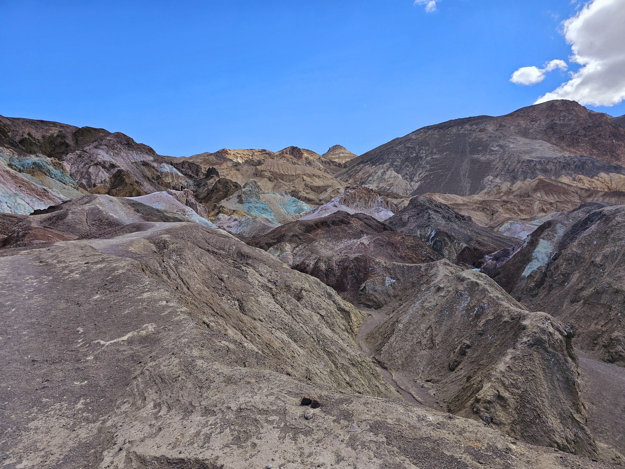
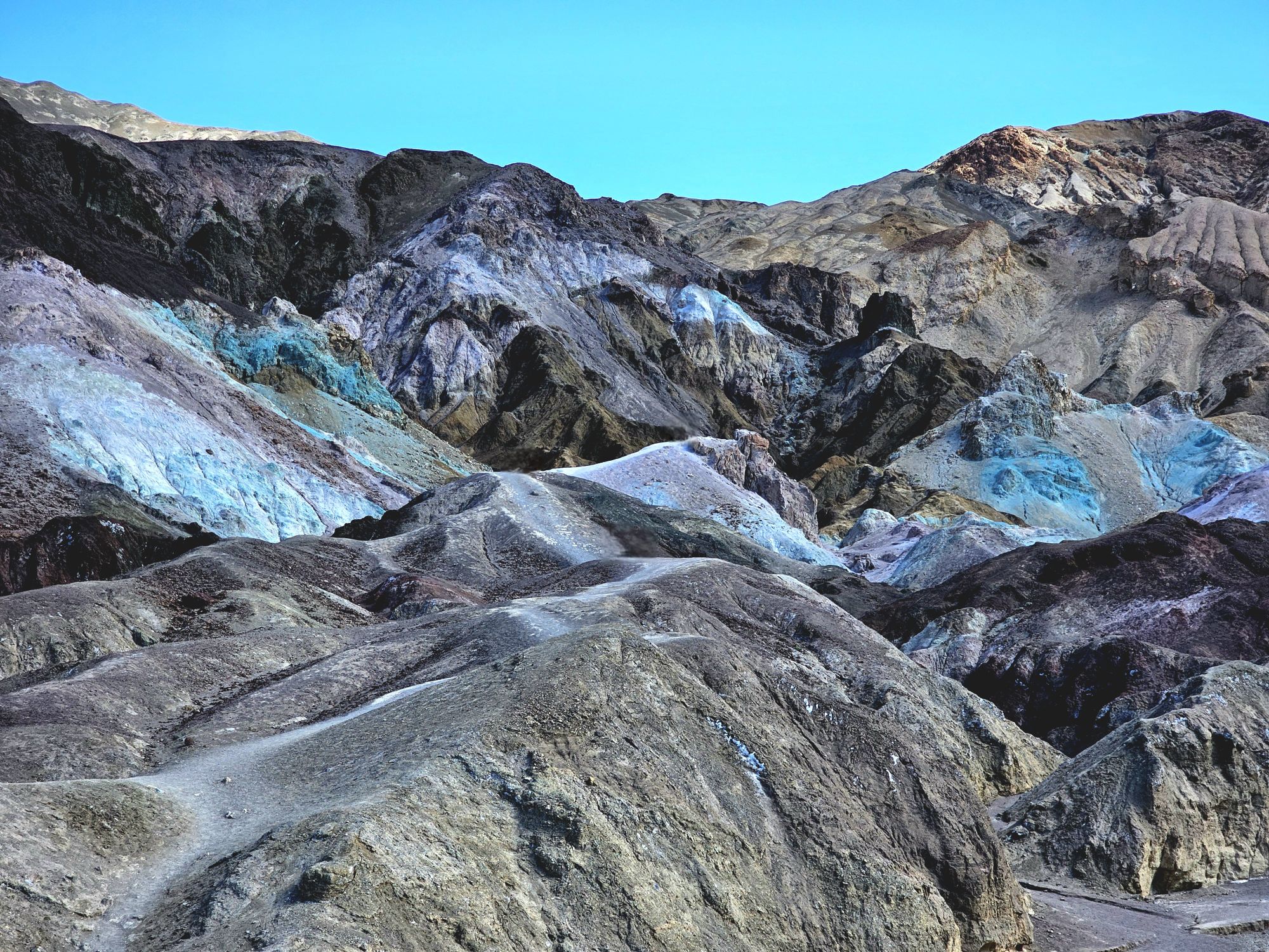
On the way out of Badwater we made our way for the small paved, one way road up to Artists Palette. There is a nice spot at the start of this road that gives some decent higher elevation views of the rocks in front and the basin behind. It was incredibly windy here! Then we made on to Artists Palette proper. This is a really interesting area. There are many lower canyons and access to the tops of them. None of these are deep or anything like that, but you can see the beautiful blues and pinks in these rocks. This is a really pretty area! I suggest staying high to see the best views. Going down into the canyons is interesting, but you could probably get lost pretty quickly! This location was used in the original Star Wars for several shots at the beginning of the film.


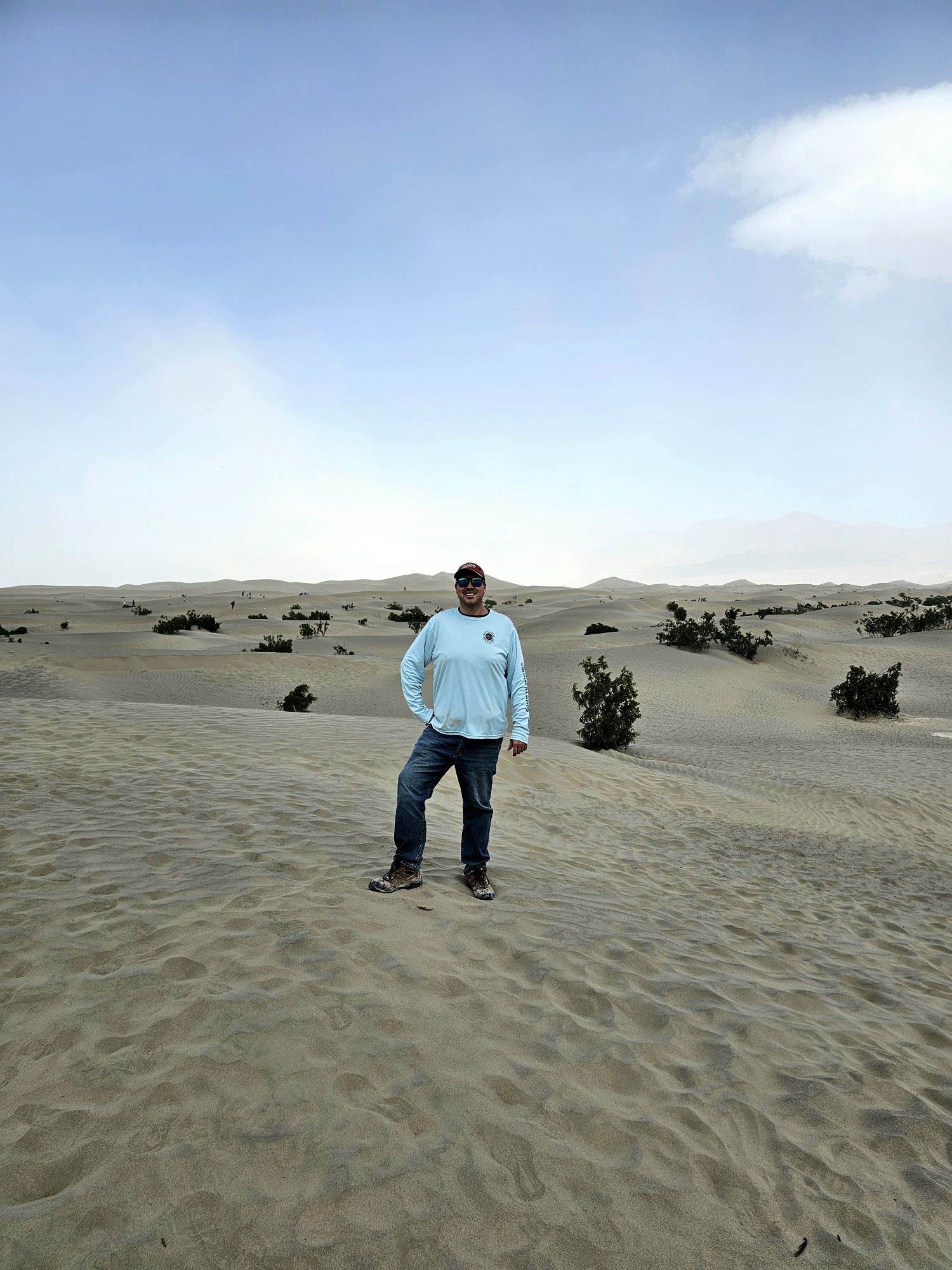
We headed on back to the middle of the park and a bit on to the bottom left of the X. Here, we found several neat areas! First up was a stop at the Mesquite Flat Sand Dunes. This is a pretty popular area near Stovepipe Wells. This was also a shooting location for the original Star Wars film. We didn’t spend a lot of time here as it was…well…sandy. And windy.
After a stop at the nearby Stovepipe Wells we headed to do one of our bigger hiking opportunities at Mosaic Canyon. With an elevated chance of rain during the day (right?) we scaled down hiking plans for fears of flash floods through the canyons. But at this point is was beautiful and sunny out, so we decided to take a very rough and rocky 2 mile or so road out to the Mosaic Canyon trail. This is a nice hike. Not hard, but an interesting canyon trail clocking in at 3.5 miles out and back. The name comes from the composition of the canyon walls being very mosaic! The trail “ends” at a boulder jam, at least for us. There is more trail to be found behind if you


After finishing our hike we trekked back toward the general direction of Beatty. Note that this was all in one day, and coming in from Beatty was in pitch black, so this was a new visual on the way out and was quite interesting to see how one gets into/out of the valley. There is a very significant temperature change you experience on that road between Beatty and Death Valley. I do not remember exactly, but I think there was a 20 or 30 degree drop on the road. I remember we stopped to get the necessary sign picture, the last time we were outside was quite warm, but for the sign it was quite chilly! Not far past the sign was the ghost town of Rhyolite, where we stopped next to explore.

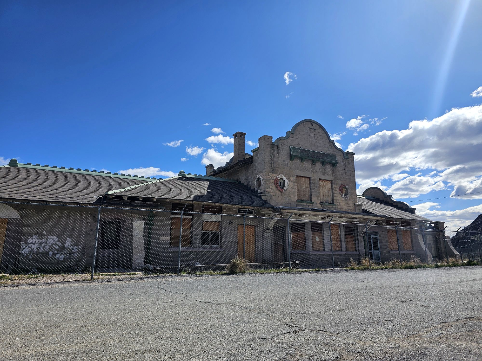
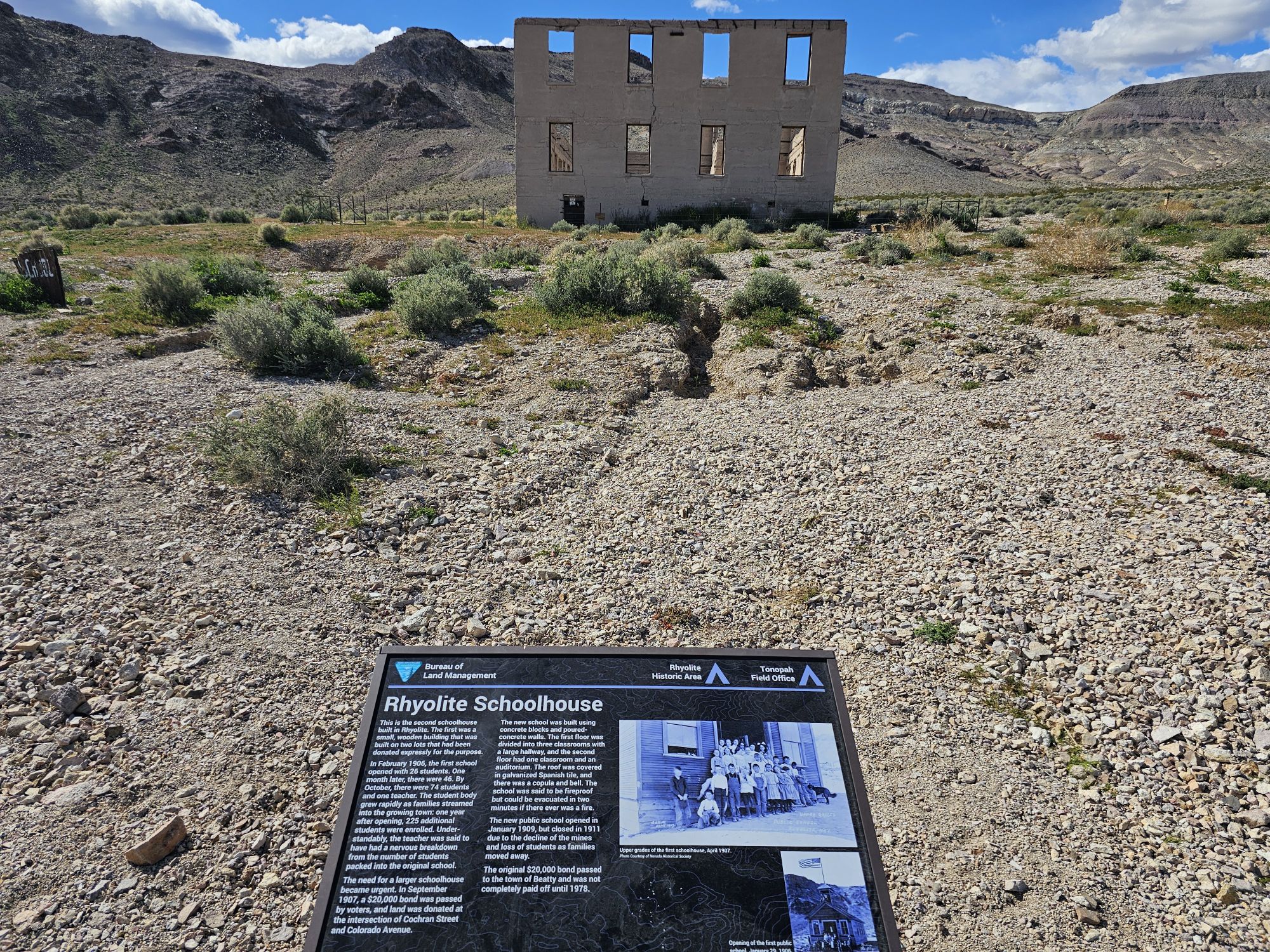
Rhyolite by itself is a pretty cool place to visit. This is a ghost town, and I believe the first I have ever visited. The town ruins are on a mix of BLM and private lands, not in the park proper. Being that is definitely a must stop off the road into Death Valley I felt it prudent to add here. The place got its start in the early 1900s and was abandoned not long after. There is a weird, quirky “museum” and several outdoor art installations at the front of the drive into the ghost town. Check out the link for more info on the art. It is quite interesting, if weird. We stopped in and then explored the town a bit. It was really interesting to see that this place was actually a pretty populated place with schools, homes, stores, post office, etc, only 100 or so years ago. Most buildings left are in a very minimal state. The exceptions are the train station and the bottle house. The bottle house is very interesting. Apparently building houses using glass bottles with mortar was a thing where wood was scarce. Afterward it was back to Beatty!


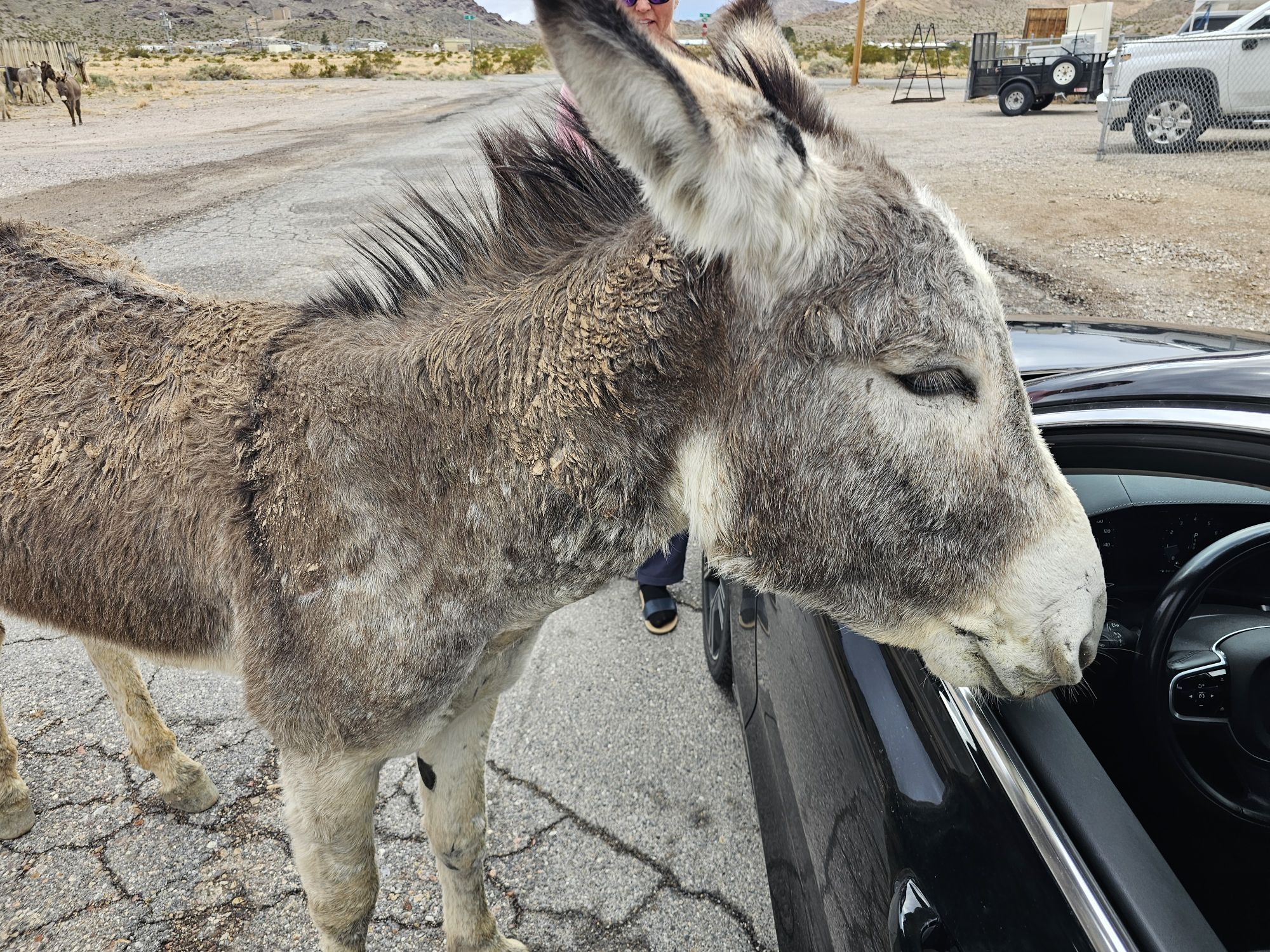
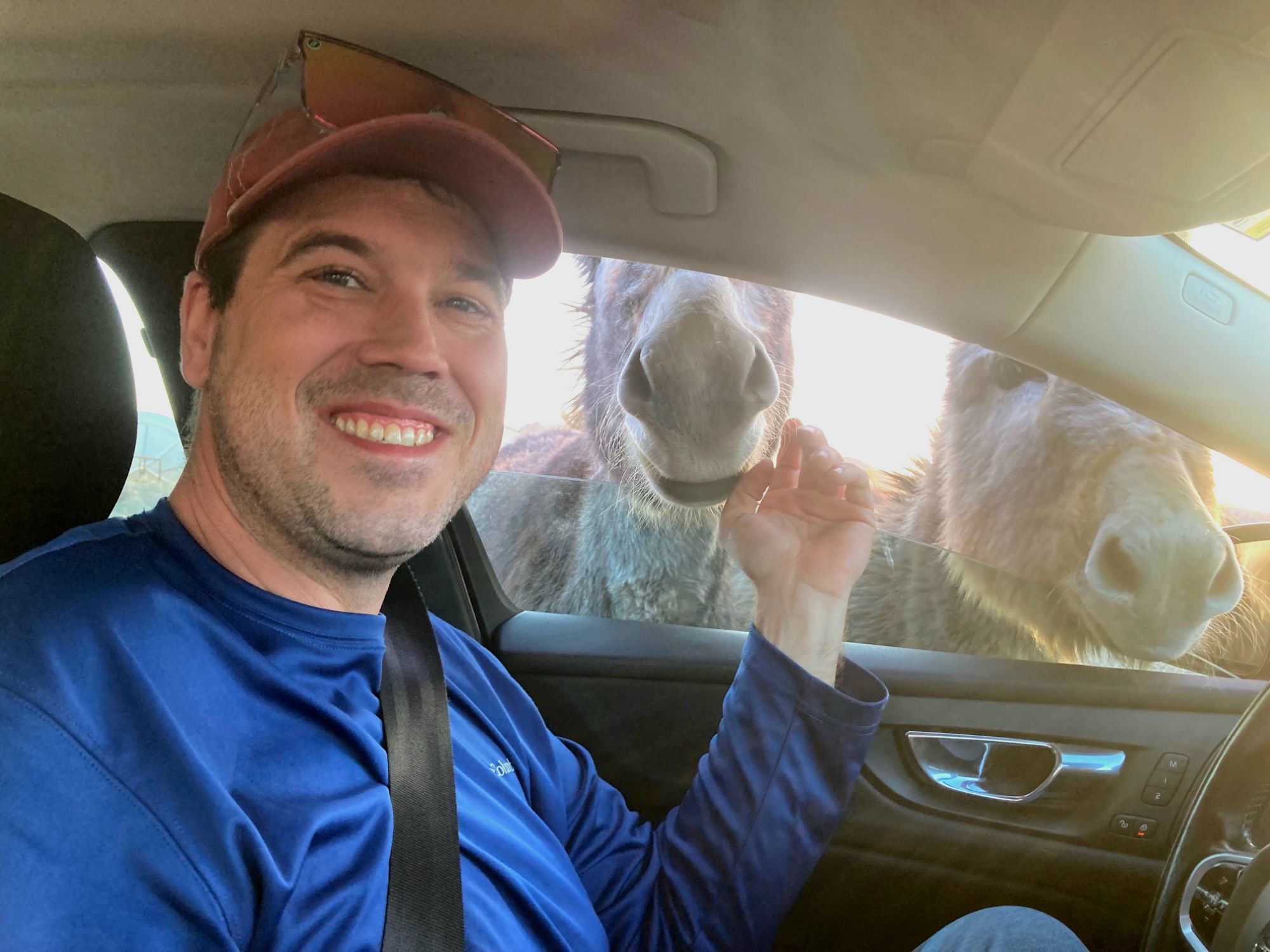
So here we are back in Beatty. I have generally tried to be overly positive about the gateway towns when they have had obvious challenges. Beatty is a disaster, that to me, is lacking an excuse. The town is essentially the best place to access the park, and should be thriving with 1 million visitors a year. The first night the sidekick and I “explored” a bit. We found a really smoke infested (sorry smokers) casino, a newer seeming BBQ place with 0 veg options other than mac n cheese, a really grungy and smoke filled bar, and one seemingly ok place that was not open that night. That place was open our second night. It had a non smokey bar, and even though it had a decent sized menu, almost everything was out except the frozen Walmart French bread pizza…. And that was it for hospitality in the town. We saw no gift shops, no excursion operators, nothing. It is almost as if the town doesn’t realize it is next to one of the planet’s most unique spots. And yes, it is a bit remote and only around 700 people call Beatty home, but Las Vegas is only 90 minutes away, and everyone driving from Vegas to Reno has to pass through. One of the positive things Beatty is known for is a population of wild burros that like to hang around the town and that was super cool! We found them, got out to take some pictures with them, and some of them even came up to the car to let me pet them from inside the car! Now THAT was cool! Like, seriously, one of the most unique memories of my trips!

After a blessedly less eventful night in our bouncy Airbnb trailer we were off again but first we needed breakfast. We found the one gem in Beatty, a great breakfast spot called Mel’s Diner. There is no website or social presence I could find, but the food was great and was not expensive! Then it was back into the park. This time we began our day by heading up the remote upper left arm of the X. There are many warnings about not messing around in Death Valley. This day we saw the truth to that. After making the turn down that road, we stopped at a lonely restroom and ran into a park ranger. He asked us in a roundabout way what our plans for the day were. The road here is actually pretty new looking and in perfect condition. However, this road goes up to Ubehebe volcano crater, which is 40 miles up the road. Obviously, not knowing the condition of the road I asked, and the ranger said the road was fine, don’t go off the road. He also informed us that there was a lady up there stranded with a flat. I got the general impression that the Park Service wasn’t going up there to help out. So don’t mess around. The drive up there was simple and easy. There is nothing for that 40 miles or so. Near the “end” of the road there is an unmanned ranger station which has a phone. We actually came across this lady. The ranger station had a sign up with a phone number for tire repair in Beatty…I am pretty sure the sign had a price tag for that service which I am pretty sure was more than 1000 bucks. Someone can fact check me on that, I am surprised I didn’t photo the sign!
As a side note, there is another attraction up here that has been closed for some time and who knows if it every reopens. There is a large house called Scotty’s Castle. From the ranger station you make a right and the road here goes all the way out to the highway that runs out of Beatty, making another entrance in to the valley. But several years ago flashfloods damaged the house so it is closed. Also, the floods damaged the road and it is not open to the public anymore. Anyway, heading to the left takes you down through this really interesting and vastly different section of the park, that has a volcanic history. This is the Ubehebe volcanic fields and where we found the Ubehebe Crater. As an aside, we found the stranded car, it looked to me like the lady tried to take her sedan down one of the jeep roads and destroyed a tired. Don’t do that.
The Ubehebe crater is merely one of many, but it is the largest and youngest of them. It is only 2000 years old, about a half mile across, and 500-700 feet deep. It was incredibly windy, and the trail around the rim is very exposed and steep… parts that are visible look very narrow as well, so we decided to nix hiking. There is a second crater adjacent called the Little Hebe. Fun name! This area is sacred to the Timbisha Shoshone, which is where I gather the name comes from.


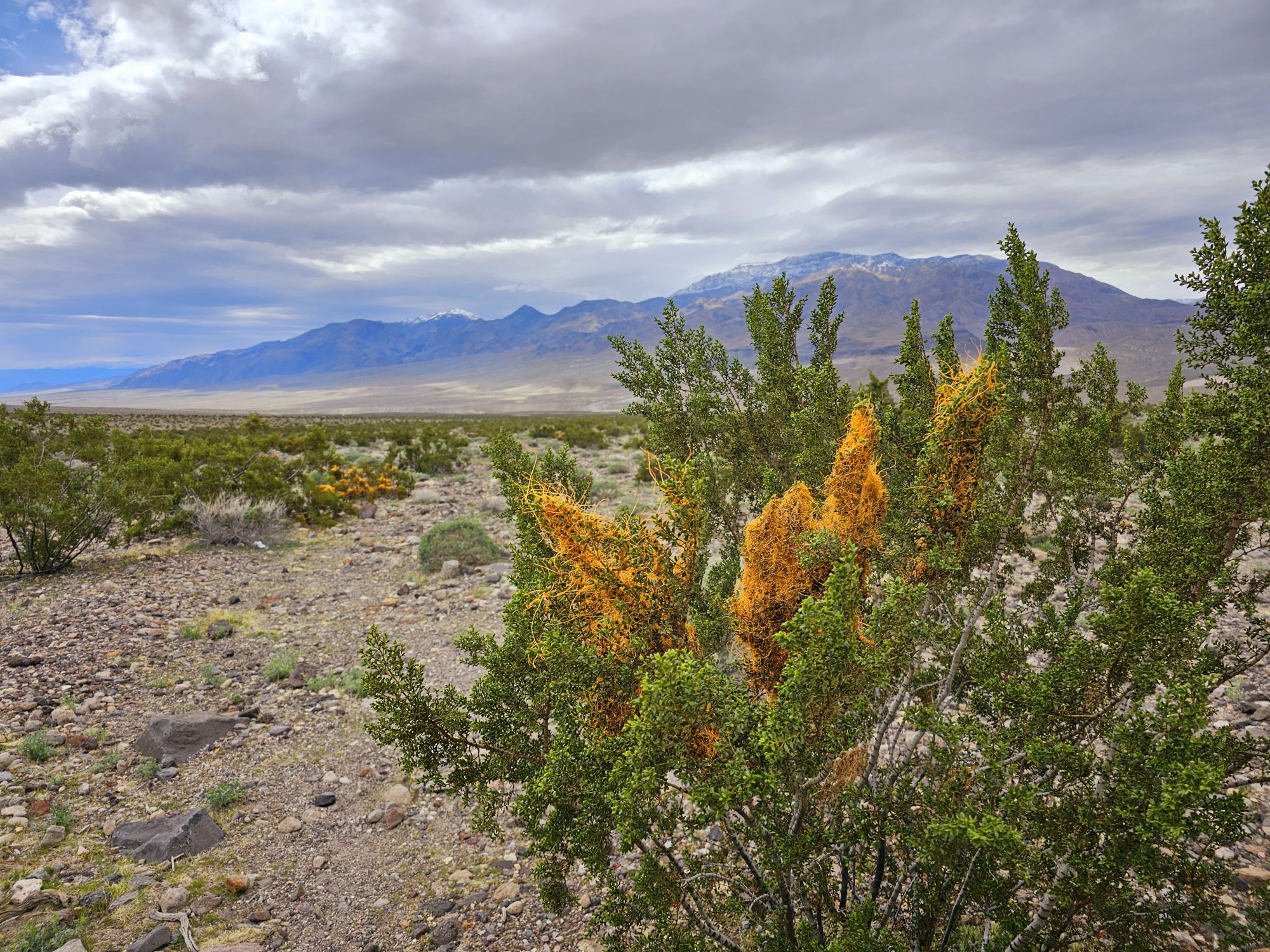
We actually found some great wildflowers in this area. Death Valley can occasionally have a superbloom. If you look up those pictures, it’s gorgeous! We were not there for a superbloom, but there was a lot of rain the previous fall (see Lake Manly, for instance) so there were plenty of beautiful wildflowers to be found!

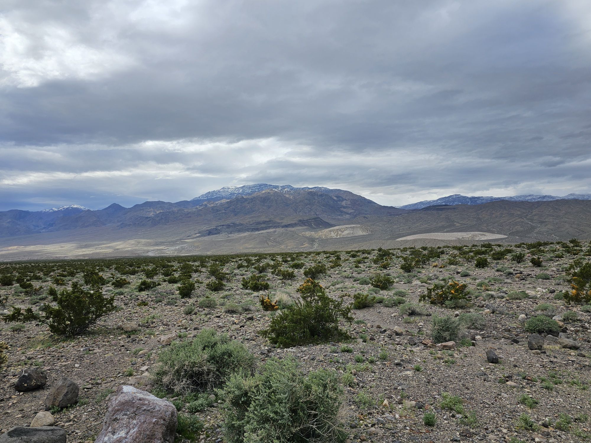

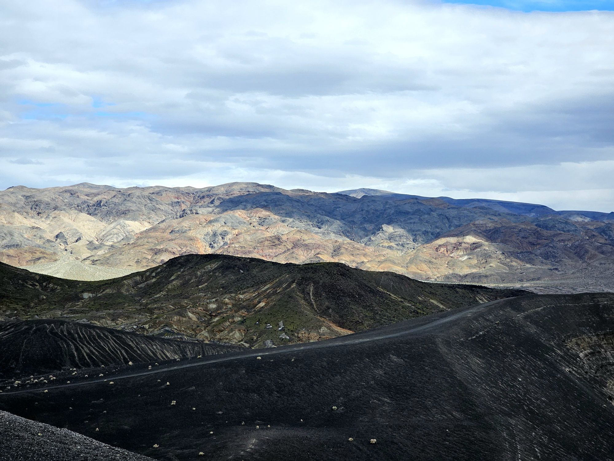
Forty miles up to the crater meant 40 miles back down to the middle of the X. We still had the length of the southwest part of the X to explore. Although we had made it to Mosaic Canyon the day before there was more to check out! There is a road over here that I really wanted to take called Emigrant Canyon Road. The road was damaged from flooding the previous fall from one of the Pacific hurricanes (!!!) and it was unavailable at a certain point, but snow had closed the open portion when we visited. Snow. In Death Valley. Anyway, obviously we couldn’t even go down any of the road, so we decided to trek to the far western side of the park, an area called Panamint Springs.
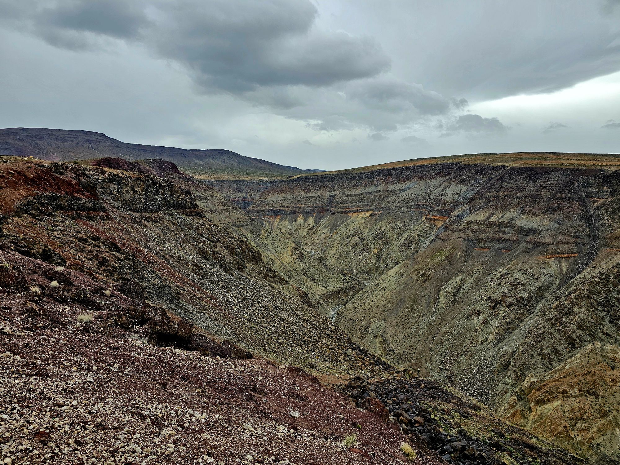
If you wonder how close the national parks are to each other and how VASTLY different the landscape is in such close proximity, the western entrance to Death Valley is only 70 miles from the main entrance of Sequoia National park. Which of course is all forest and those gorgeous huge trees! Honestly, there wasn’t a ton of things to do out here other than stop at the “Resort” for a snack and a drink. Nice stop to be sure. There was one other hiking spot I was looking into, but it was washed out and closed. Bummer. Anyway, we kept going on and made spot called Father Crowley Point our terminus. This was not quite to the western exit/entrance, but pretty darn close. This spot gives a view of what is called Rainbow Canyon. This canyon used to be a military test flight site until recently, but there are not more fighter jets going through the canyon. And…it was here, that at a mere 4500 feet elevation, that it began to SNOW. Talk about a surprise! A serious surprise! Come to the hottest and one of the driest places in the world…find a rare lake, rain, and snow! Anyway, driving back down toward Panamint was an adventure. It is a very windy and fairly steep road. Of course there was a semi trying to drive up this in the snow. As we made out ways back down to the Panamint Valley there is a great opportunity for a very long road picture which was cool. After this it was time to head out and getting out of Panamint brought an awfully hazardous situation that we were not expecting. The drive up and out saw snow and very slick roads.

Overall Impressions: This is a huge park with a ton to see and do. That being the case, we were there probably about the prettiest time of the year, and rocks and sand have their own beauty, but it isn’t necessarily my favorite terrain. There is a harsh beauty here, to be sure! This is a park I would probably consider coming back to, because there were some cool things to do with an off road vehicle if one has the ability to do them and I would enjoy exploring those.
The Adventurer’s Rating: 4 Arrowheads!

Amazing photos! We visited this NP a few years ago and were really impressed. I wish I had known about Rhyolite though – we would have most definitely stopped to check out this ghost town. Thanks for sharing!
LikeLiked by 1 person
Thanks! Yeah it was super cool! A friend told me about it. There are signs, but if you don’t know what Rhyolite is you probably wouldn’t pay it much mind! We were there for maybe an hour or two. I think you could easily spend several hours hiking around. The history there is really neat, especially considering it was only 100 years ago! Thanks for reading!
LikeLike