National Park Number: 43/63
NPS Unit Count: 81/430
US Unesco World Heritage Sites 15/24
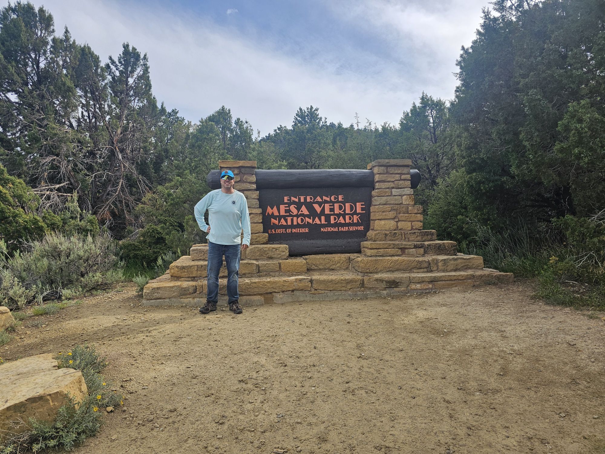
Hey there Adventurers! June 2025 saw me finish the Colorado national parks! If you read the previous entry, this trip involved many stops in New Mexico for #USBarkRangers purposes, but the trip focus was Mesa Verde. A quick aside, this park is more dog friendly that I thought. They are allowed on all trails in Wetherill mesa save for the trails to the two big houses and are fine at all the overlooks and paved areas in Chapin Mesa, save for ruins sites. There is no Bark Ranger here though. To my surprise I found Mesa Verde to be one of my favorite national parks! The scope of this park, even in the short 2 plus days I was there, is both intimidating and impressive. As such I have decided to make this a 2 part entry. This part is more an intro of the history of the area, and my first day experience.
Mesa Verde is not exactly remote, but it’s not easily accessible. If you are flying, the nearest airport that handles large commercial traffic is a few hours away, either Albuquerque or Montrose, CO. The park is situated in the 4 Corners region of the Southwest, in the southwest corner of Colorado. There isn’t a whole lot around the area, however, the history here is awesome. In addition to stunning views and the ancient history, Mesa Verde was the site that pretty much shaped modern archaeology in the United States, evolving from looting and profiteering, to preservation and study. There are nearly 5,000 archaeological sites in this national park, encompassing the famous cliff dwellings as well as excavated and un-excavated pit houses and ruins on the mesa tops.
Created in 1906, Mesa Verde is one of the first National Parks established in the United States, number 7, and the first created to protect manmade structures. If you are totally unfamiliar with Mesa Verde, the easy description is: it’s the national park with the old adobo houses built into the cliffs. A bastardization, but that’s the gist of it. Most of the cliff dwellings are only for viewing from the opposite side of a canyon, but there are a handful that can be experienced on a ranger led tour. These have to be reserved ahead of time and they go quickly, especially one of them. It should be noted that this park is high desert (up to 8500 feet elevation) and winter lasts longer than you would expect for the southwest desert. The tours are not available until later in the spring. Luckily I had secured reservations to all four dwellings available last year (it seems that at least one of them rotates yearly).
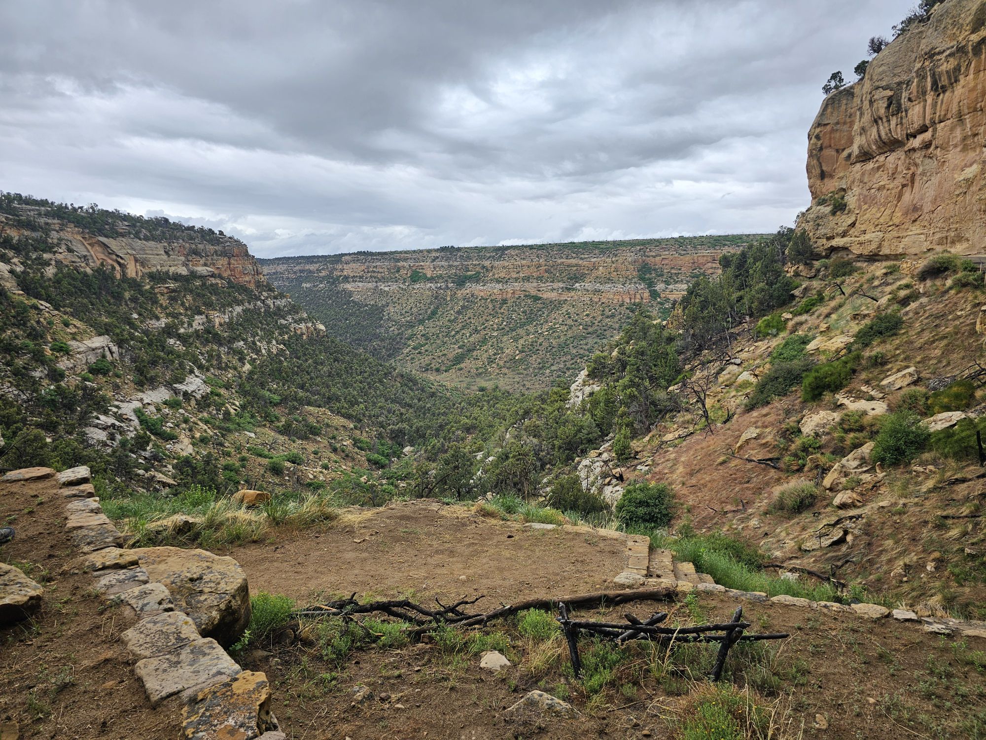
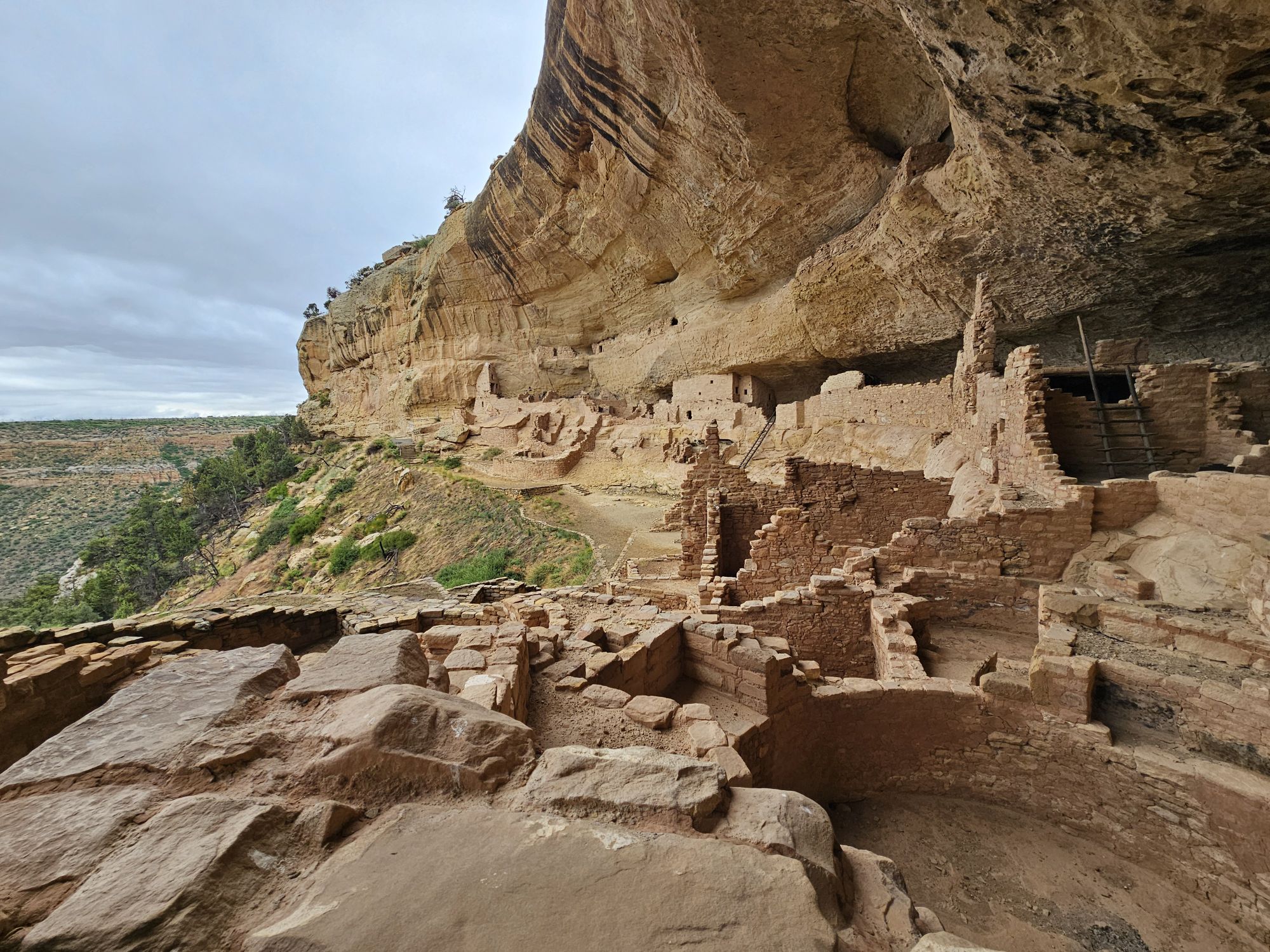
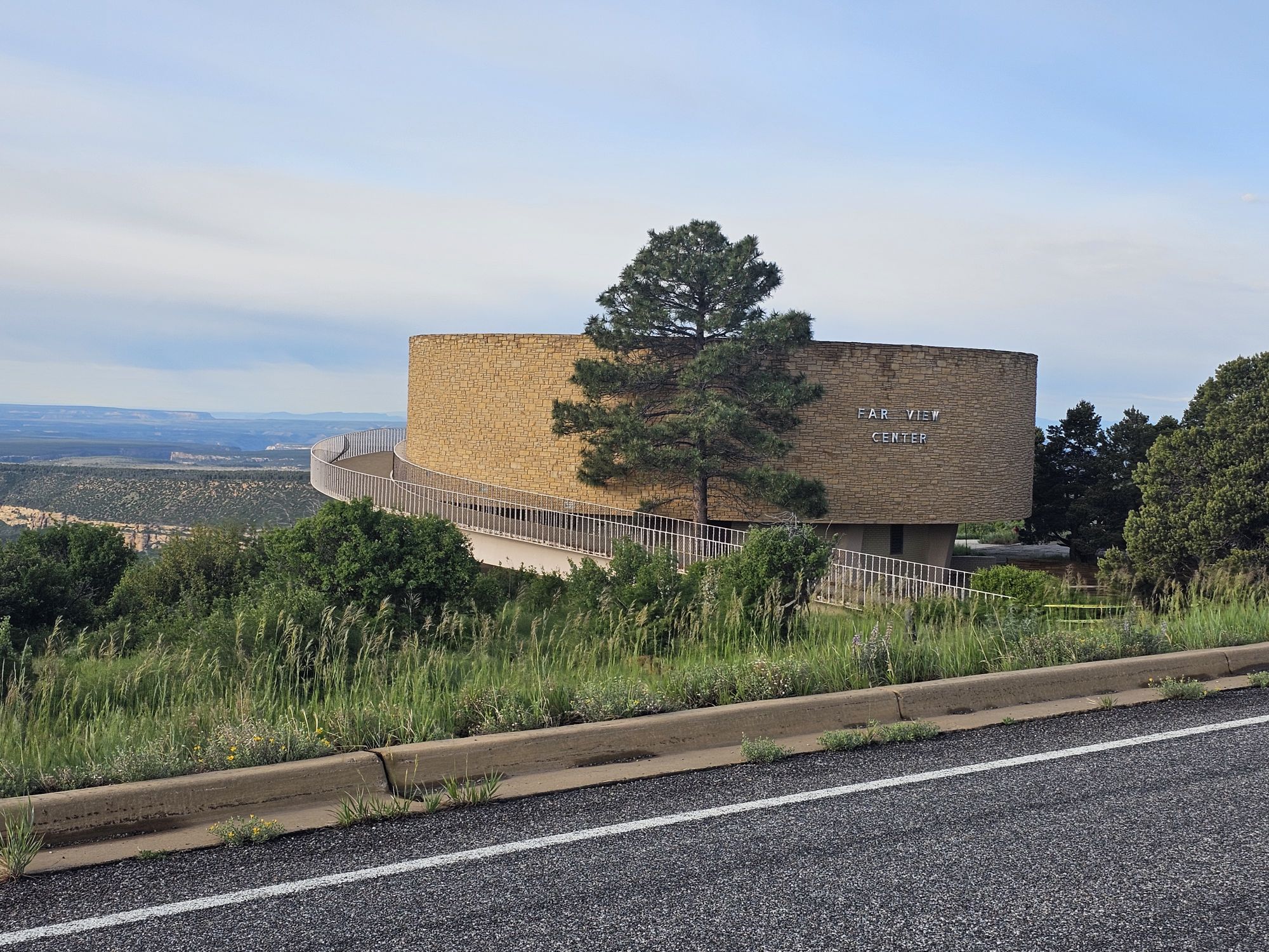
Now a little geography lesson is needed. Mesa Verde is literally the “green table.” This national park is a mesa, a large area that is flat, higher that the surrounding land, and has steep sides. They are formed by erosion, are mostly found in the SW United States, and usually have spiritual importance to the native communities. Mesa Verde is actually slanted as bit which makes it not a true mesa, but the southern slant actually led to the creation of the alcoves that house the cliff dwellings. In addition, there are many canyons here, so the park is a cumulation of many mesas (technically cuestas) between many canyons. The two main areas of the park are the Wetherill Mesa and the Chapin Mesa. The Chapin Mesa is the main area that tourists will visit. Wetherill is a lesser visited section of the park. It is only accessible seasonally, and then only certain days of the week with limited hours. Wetherill and Chapin are connected by road at an area called Far View, which is also the location of the park lodge I stayed in. Going straight takes you to Chapin Mesa, and making 90 degree right turn takes you to Wetherill Mesa.
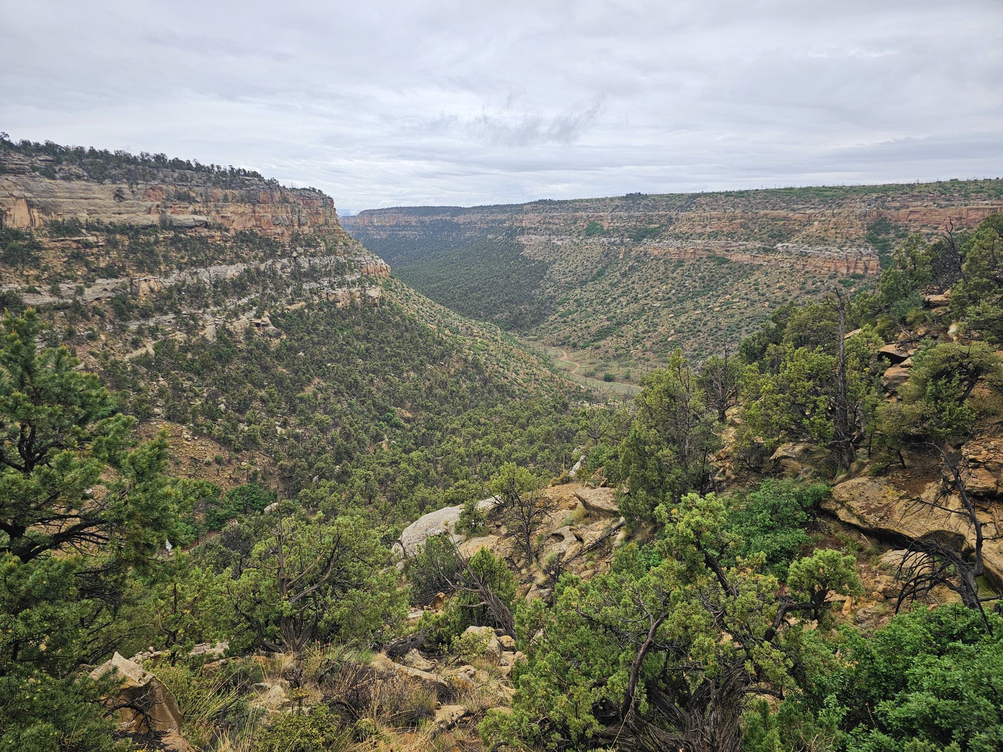
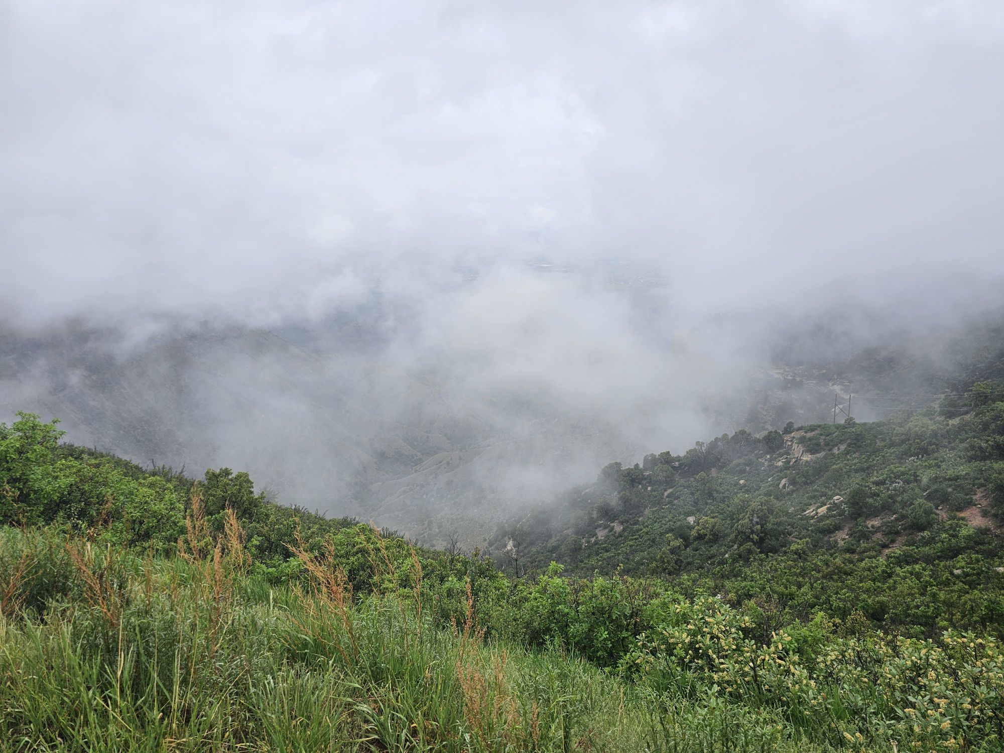
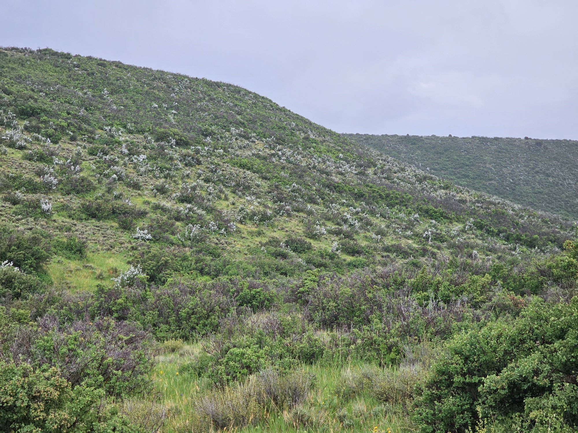
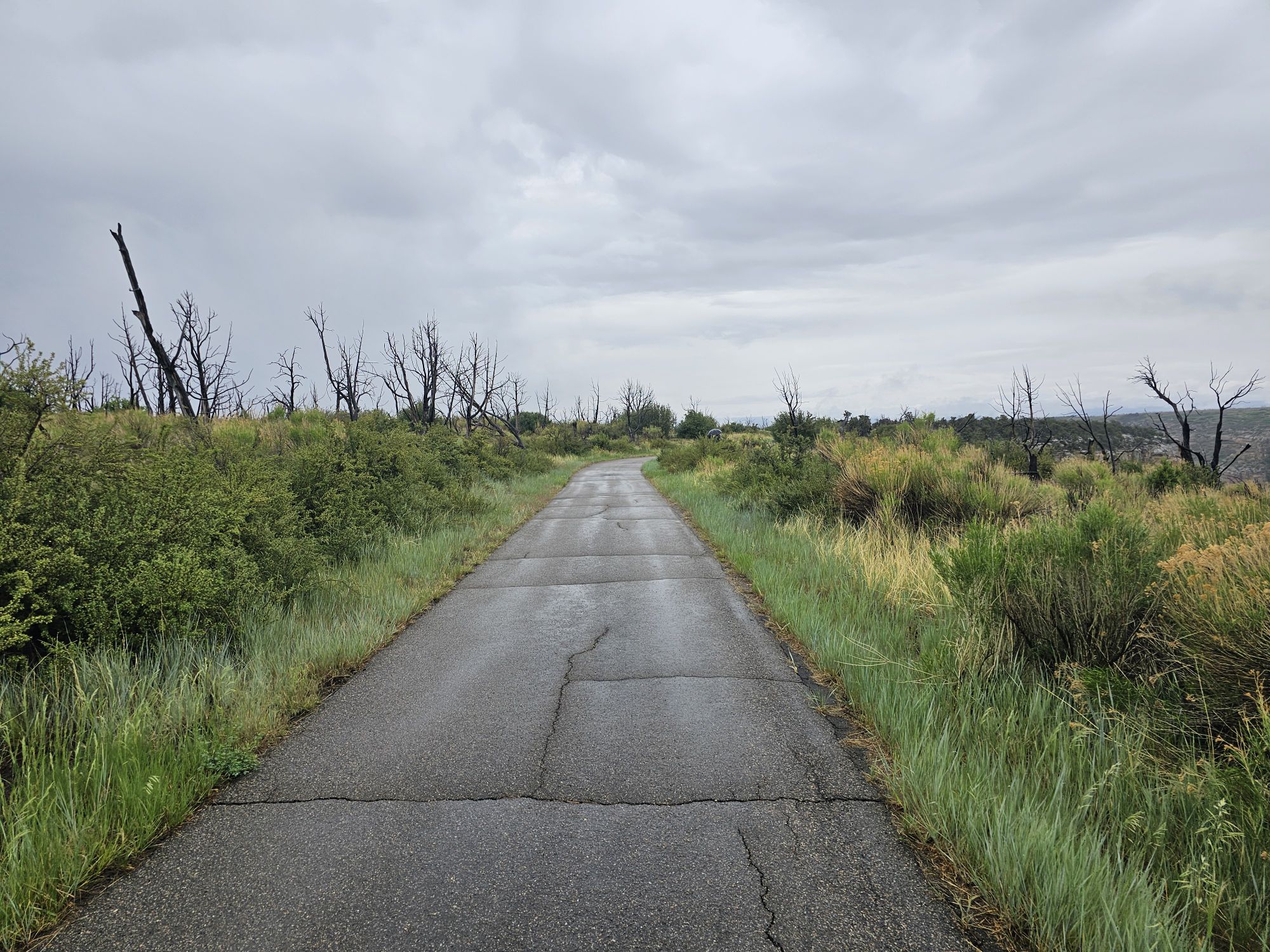
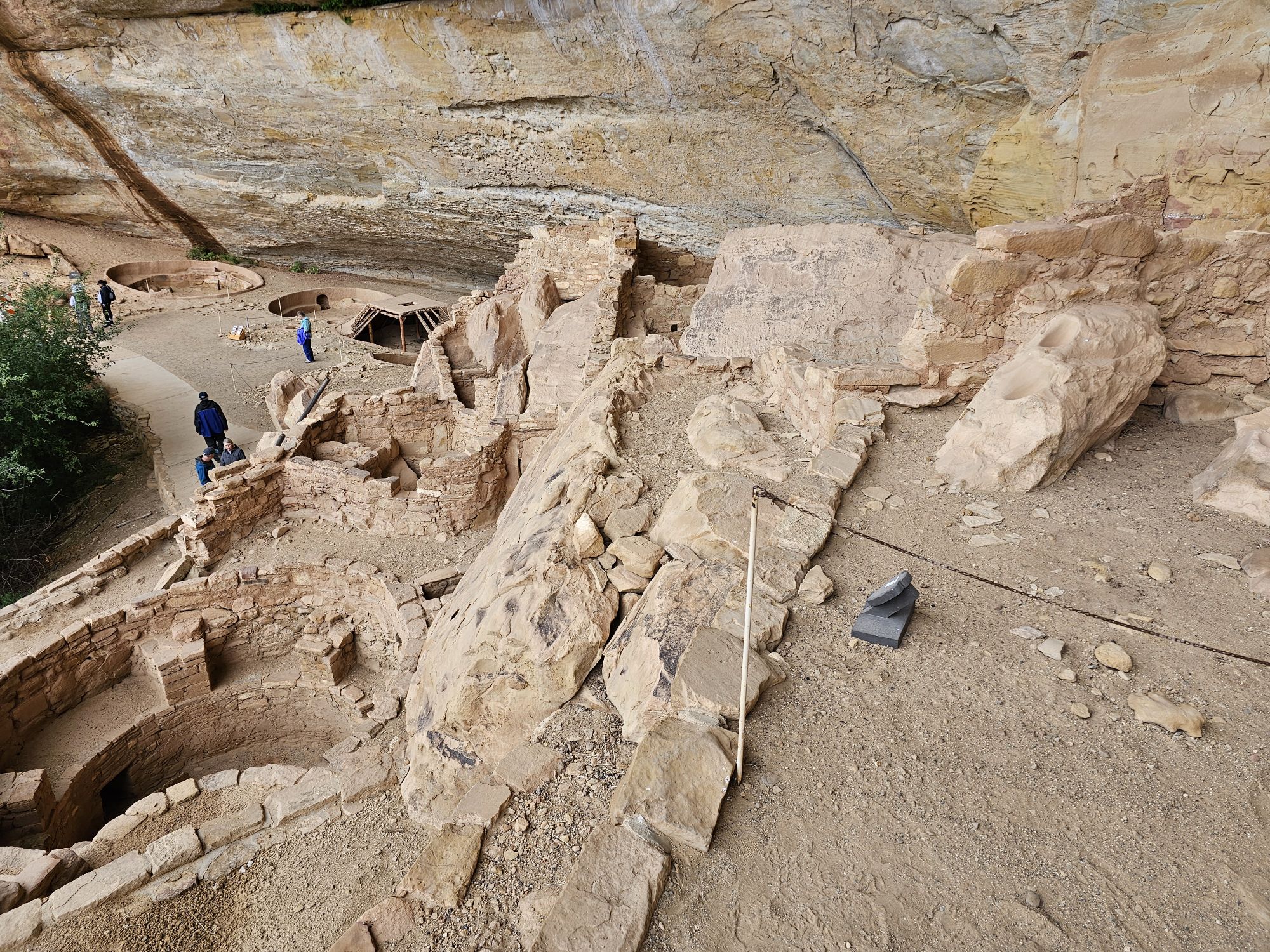
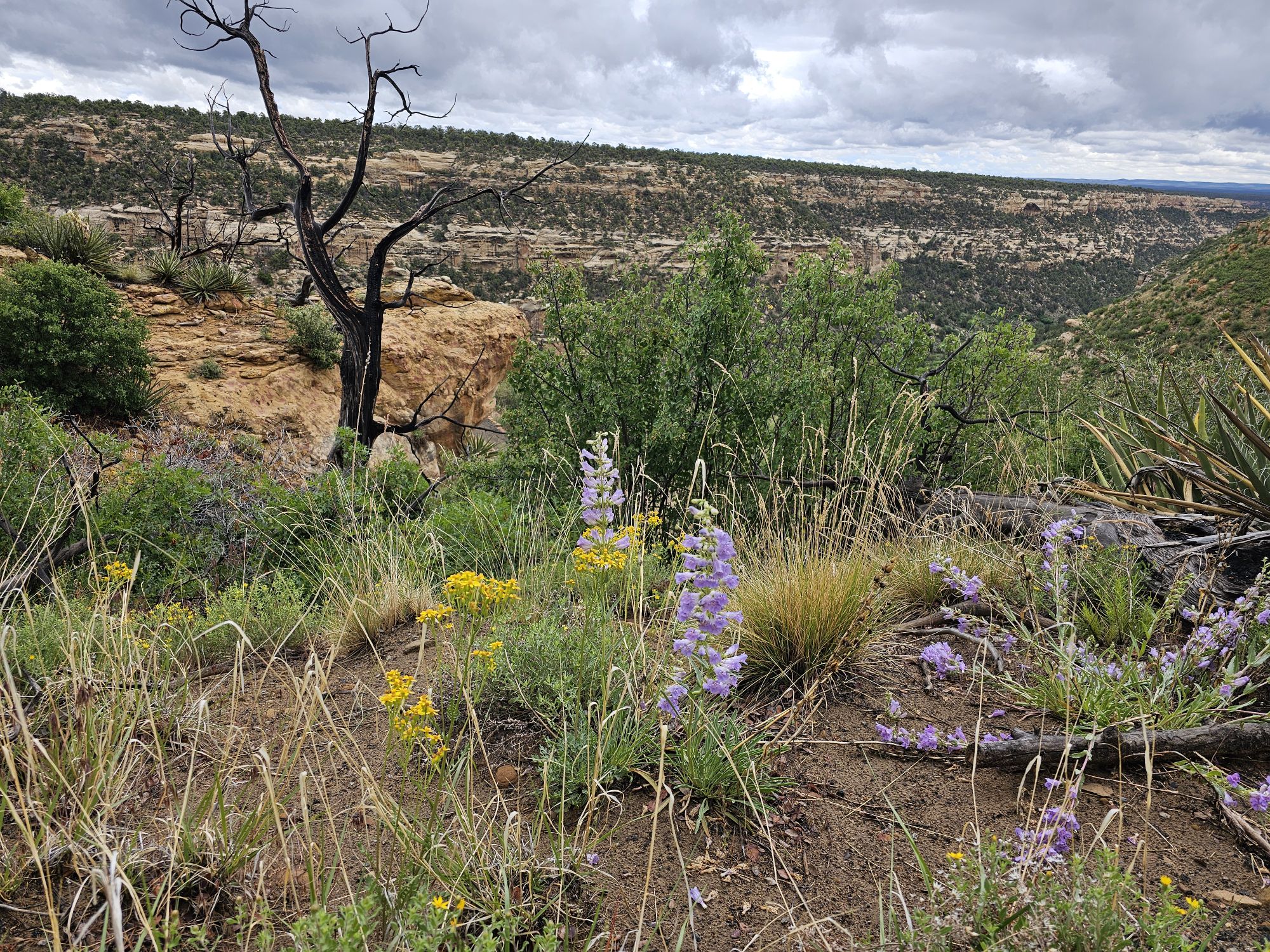
The Wetherill Mesa is considered the quieter side of Mesa Verde and for good reason. This area of the park is only open for 4 months of the year and then only 5 days a week, closed on Tuesday and Wednesdays. The area is only open from 8:30 to 4. And by 4, that means you must be out by 4. They only allow visitors in until 2 PM. The day I visited I found this side of the park to have a certain beauty that the other side did not. It was foggy, and there were beautiful white wildflowers all over the cliffs and canyons. The drive in is very scenic, but there are not many sites here. Two or the notable exceptions are the Long House and the Step House found at the end of the road. There are no services in this section of the park other than a restroom and an open air ranger station. I understand that a wildfire took the visitor center here a while back. I had tickets for the Long House tour so I followed the paved trail down to the meet up spot and joined the tour there.
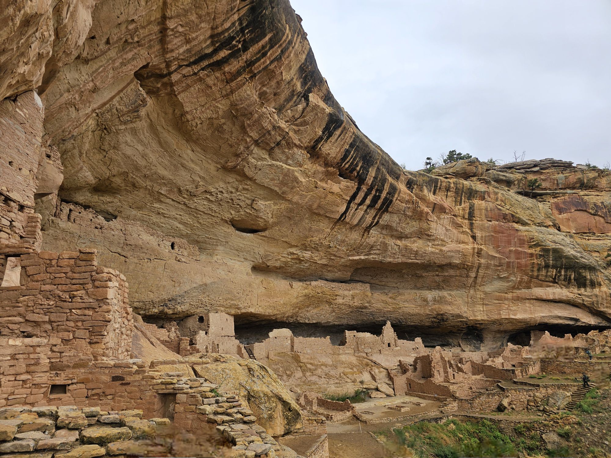
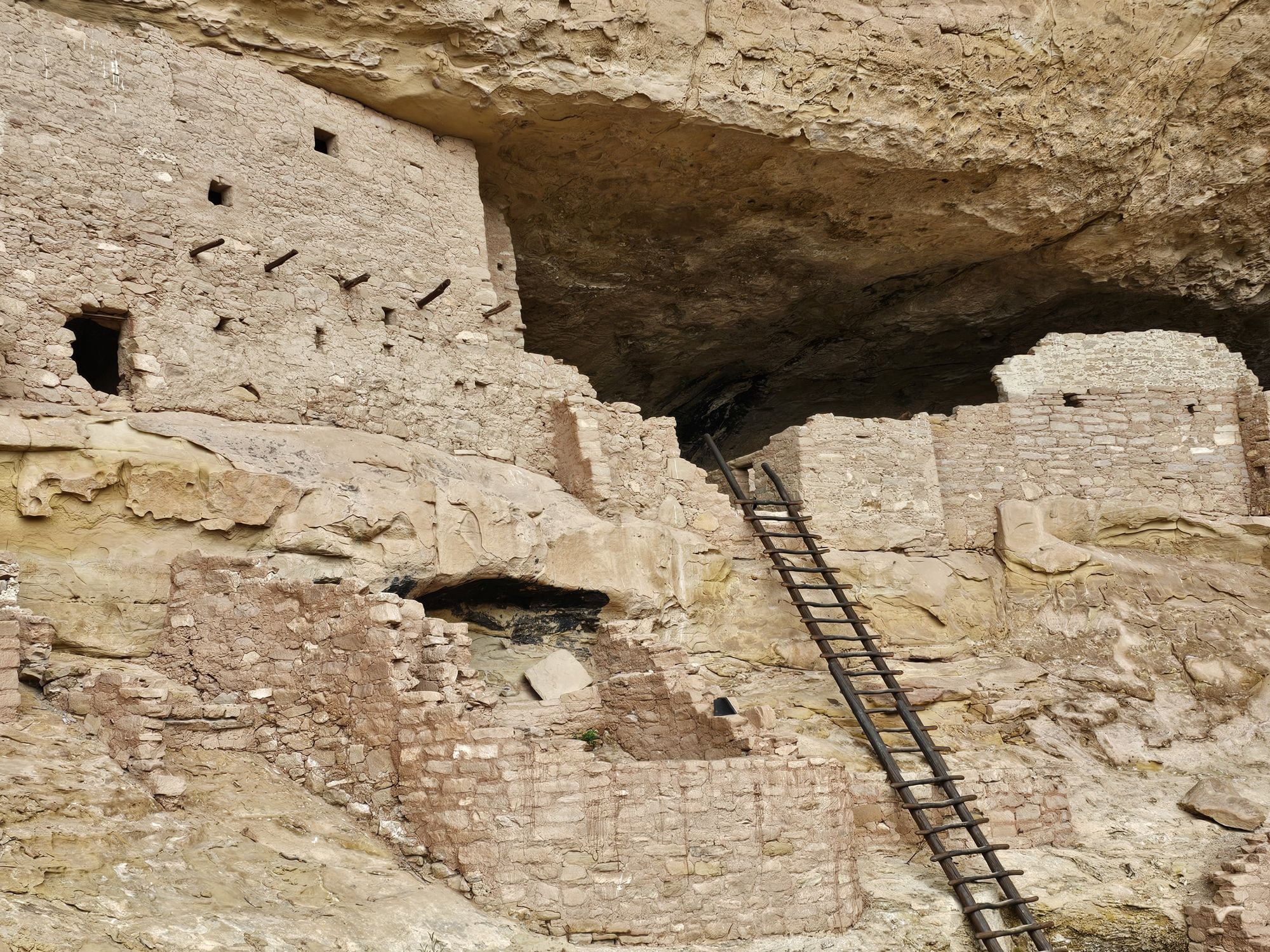
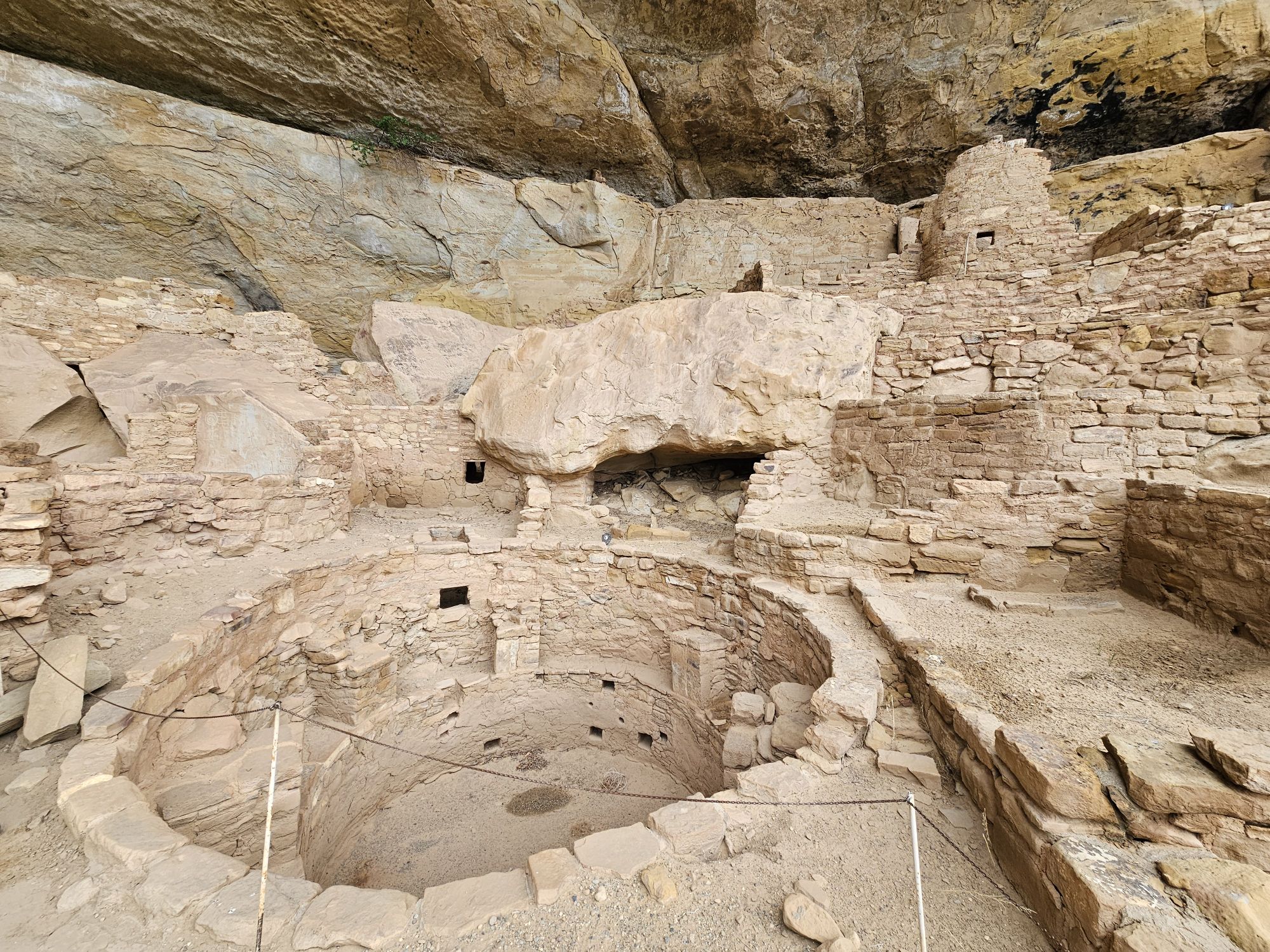
From the tour meet up area you cannot see the cliff house at all. It was cool and rainy, with temps maybe in the mid 50s. It had been raining pretty good about an hour before the tour but it started to abate at tour time. Remember the elevation here is pretty high, so even being June, the weather is a consideration! Anyway, I joined the tour and we began the descent down the cliff. From the parking lot the trail is about 2.2 miles round trip. The distance from the tour starting location to the house is only a tenth or two of a mile, but with 250 foot descent, some of which is exposed and on cliffs edge. It is not long before the Long House opens up before your eyes!
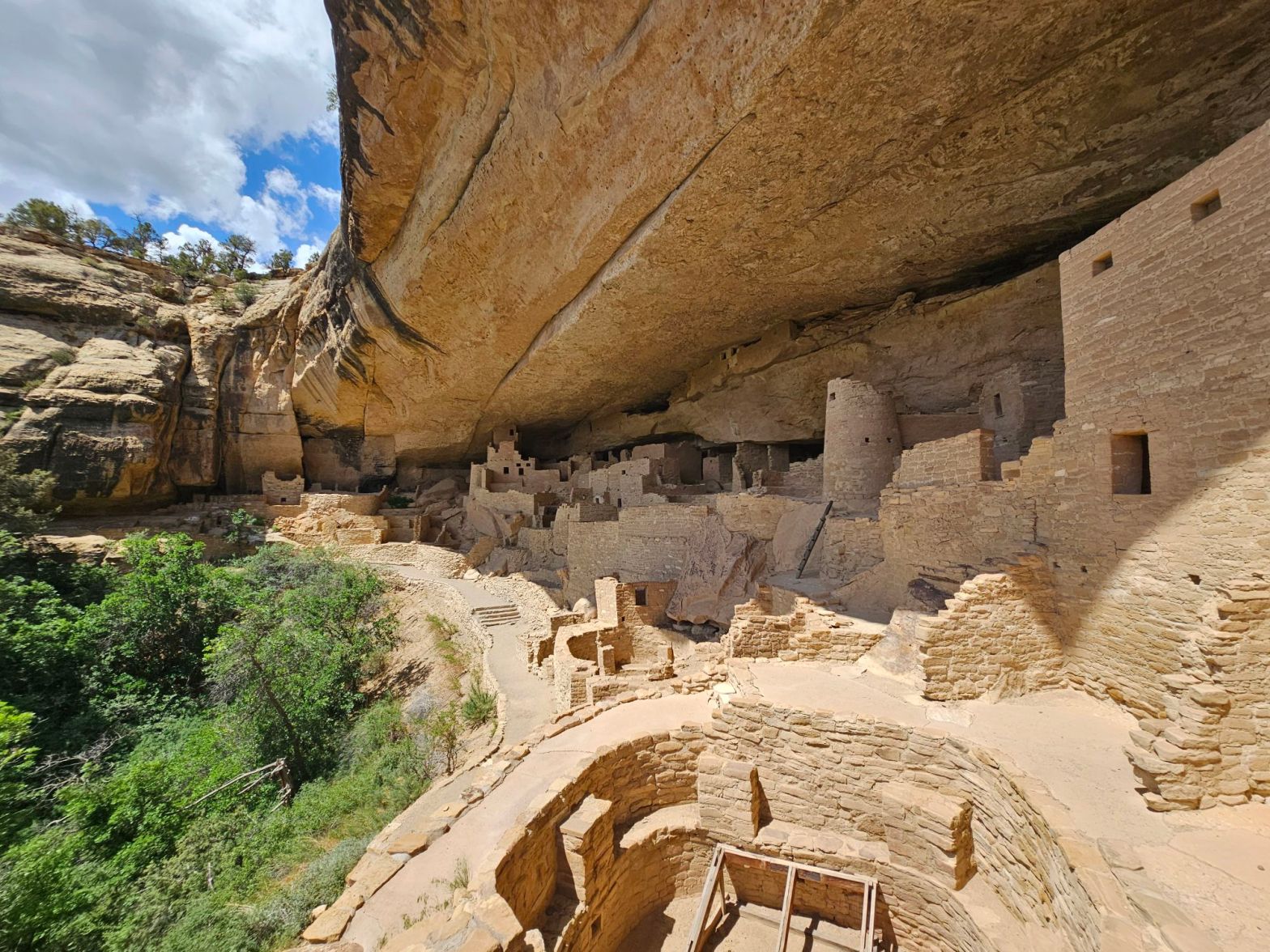
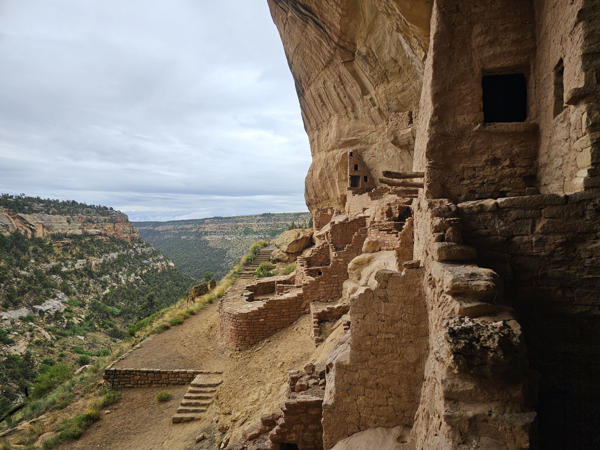
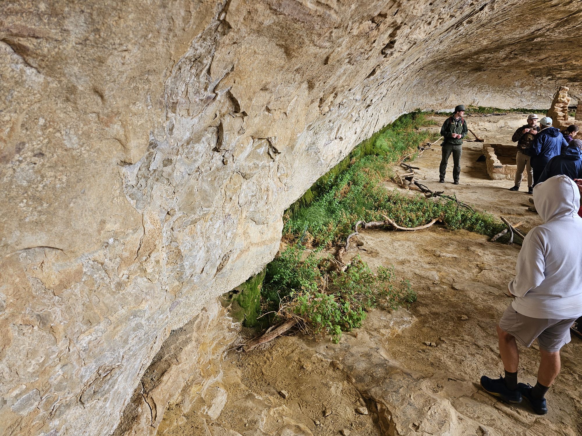
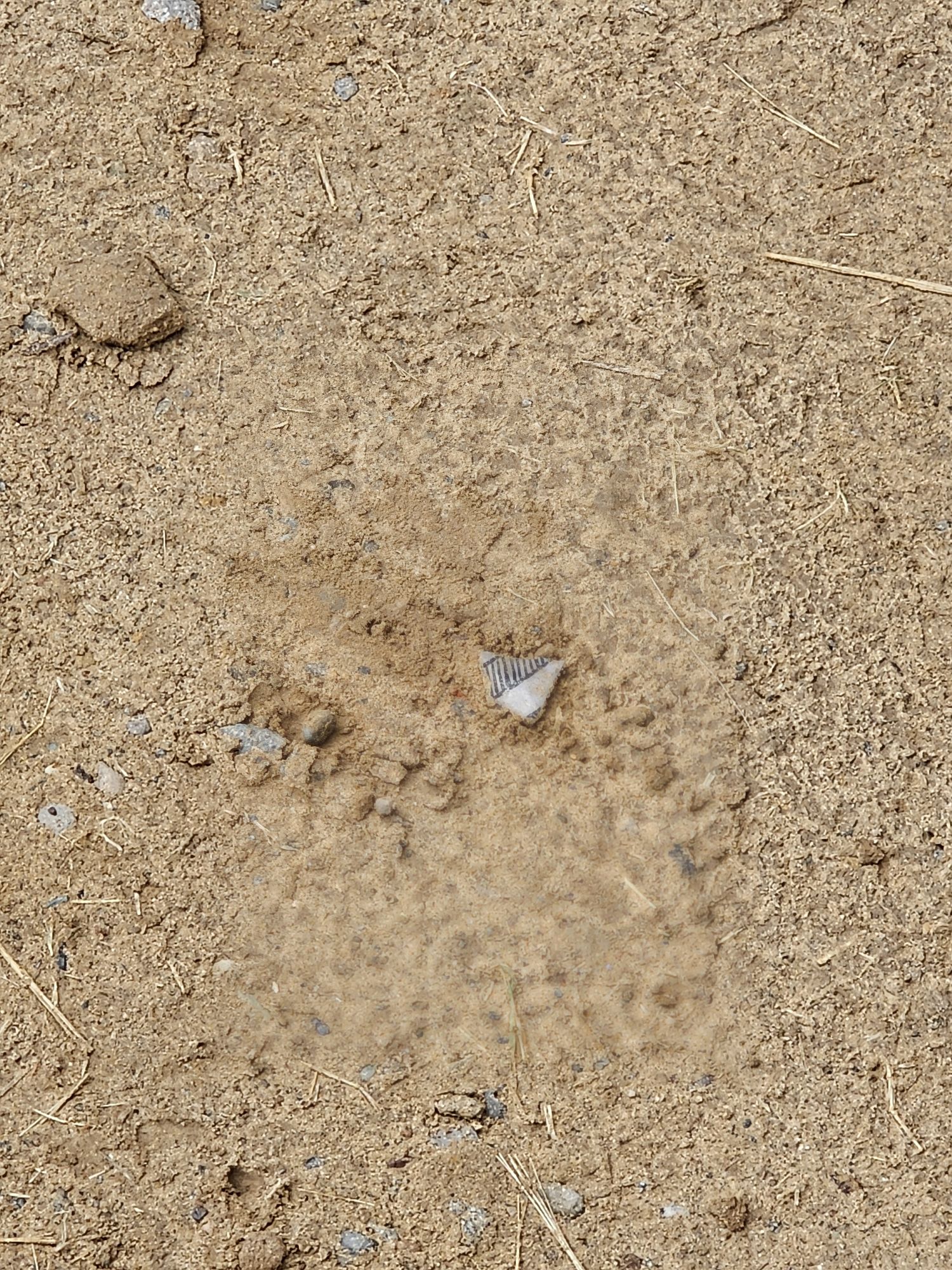
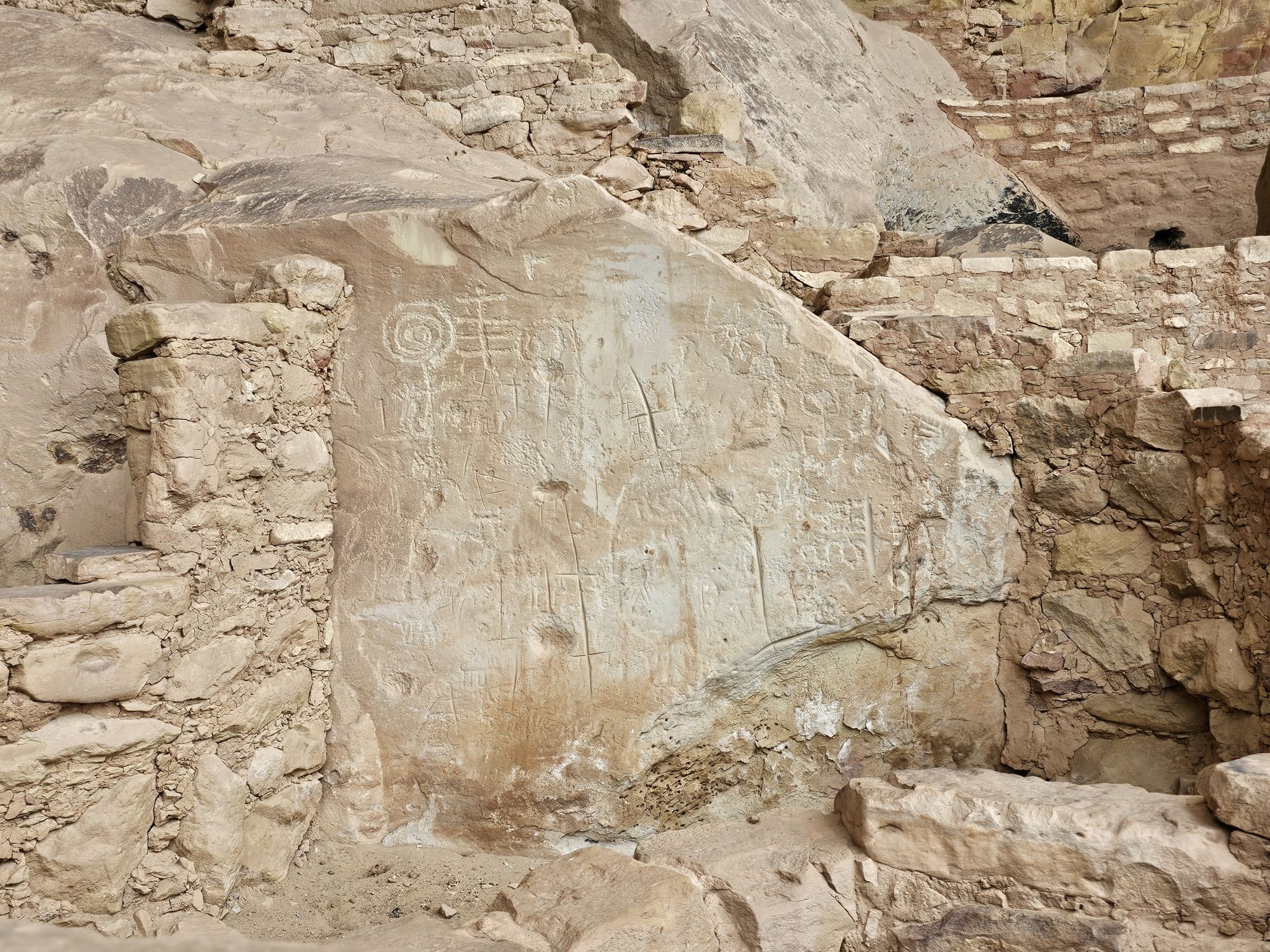
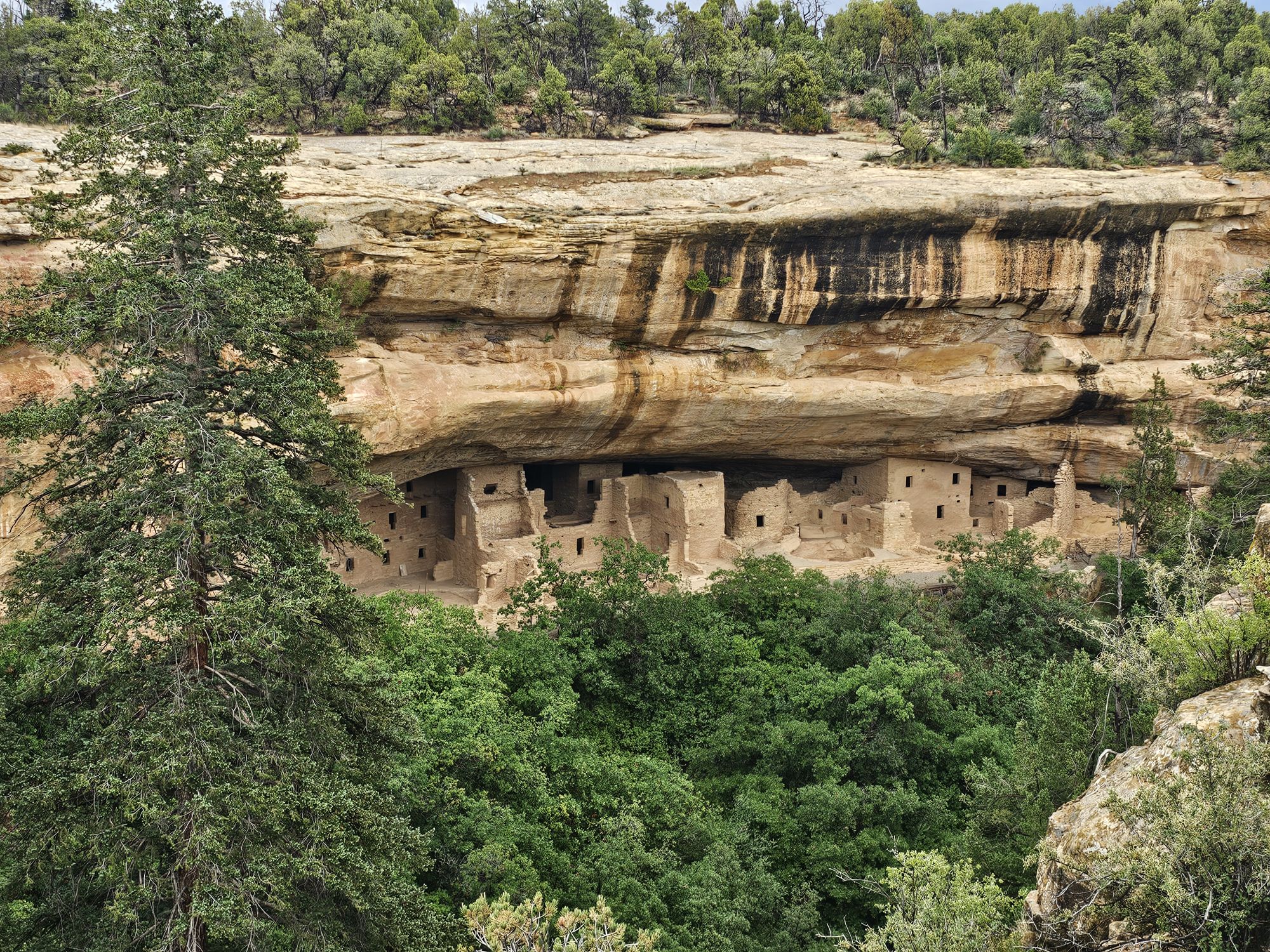
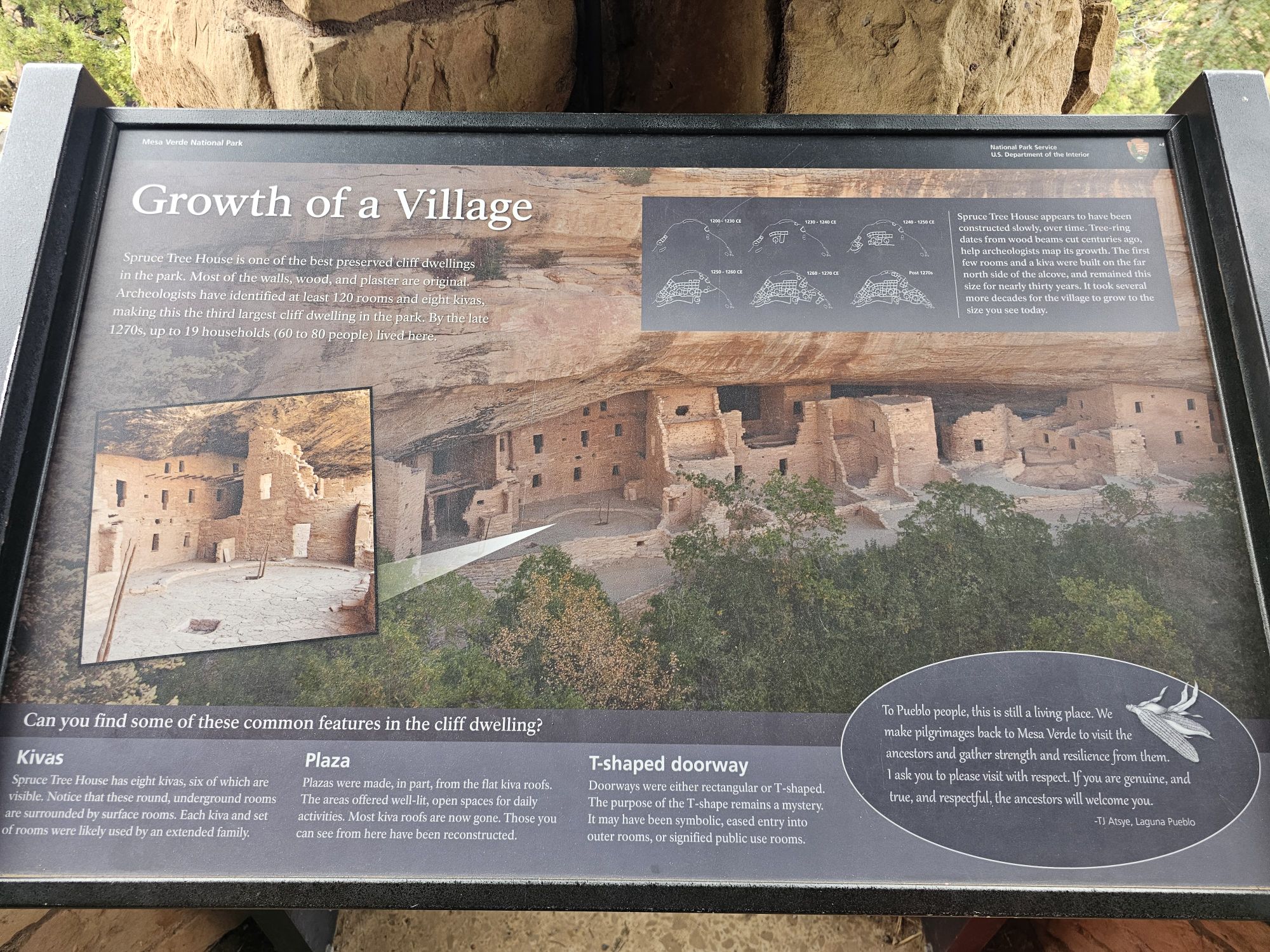
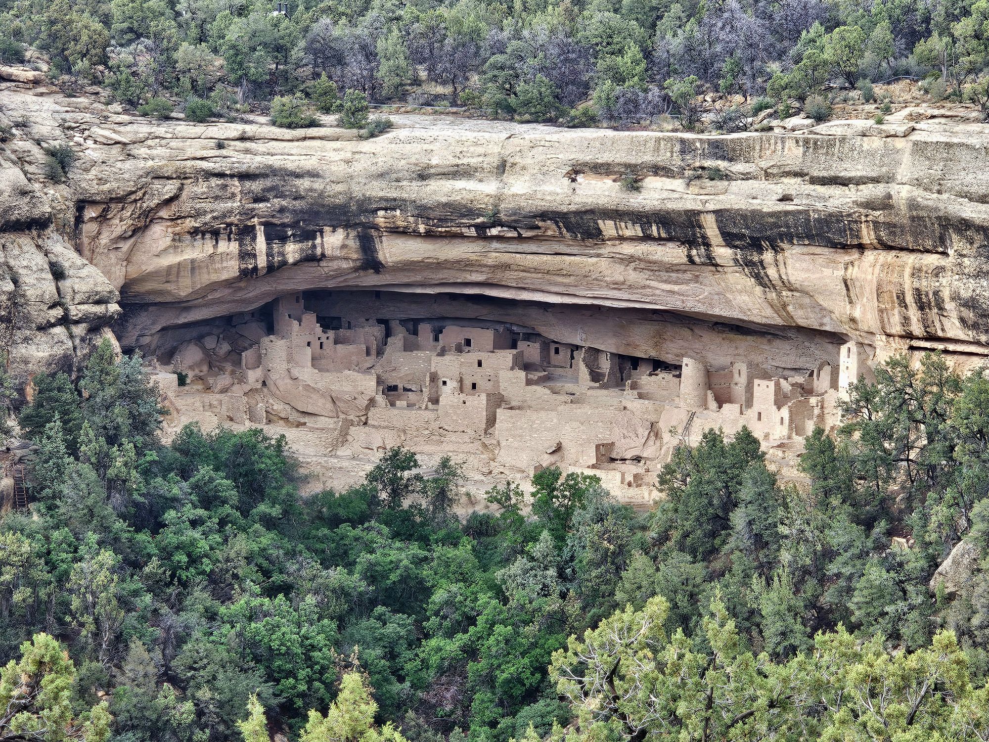
The Long House is the second largest dwelling in Mesa Verde with more than 150 rooms, a plaza, and several kivas. This was an amazing first look at what Mesa Verde is about. I had seen the pictures of course, but seeing it up close was an entirely different experience! We saw the seep spring, still running, that essentially carved the alcove protecting the dwelling. This spring was used for water for the house. These seep springs were the life blood of a cliff dwelling. The cliff dwellings are all found in an alcove and the slant of the mesas contributed to the the formation of those alcoves. The seep springs are not really springs but rather water seeping through from the mesa top until it meets rock it cannot permeate, then travels along that slant. The water works its way out of the side of the cliffs and eventually formed an alcove that the ancient Puebloans used to build these homes. The cliff dwellings in the park are all dated to almost the exact same years, roughly 1200 CE, they are also built on top of previous pit houses that date back 600 years earlier, which is very interesting! One other thing that I learned that was extremely interesting is that these cliff dwellings were not hiding. They were not for built for protection from other peoples. The peoples in the area all knew about them. Most of the peoples in the area were friendly. The dwellings were even painted in bright colors specifically so they WOULDN’T be hidden. Some of the paint can even be found to this day on some of the sites throughout the park. So there’s some history for you! Also, it was here that I learned that the NPS is no longer excavating theese sites. A member of our tour found a piece of pottery. It was black and white striped and absolutely period to the Long House. The ranger talked to us about it and then dug a bit in the ground and put it back and buried it. It was explained that they feel they have excavated enough (especially up top on the mesa top) and at this point it is better to leave all the sites and artifacts they know about buried to keep them protected for future generations. That’s a neat conservation approach that I had not considered.
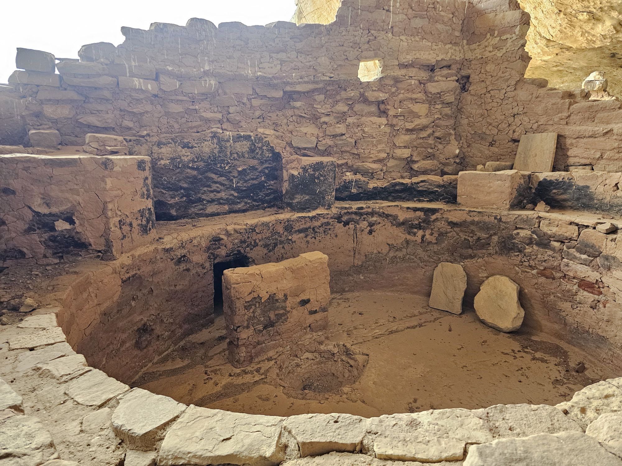
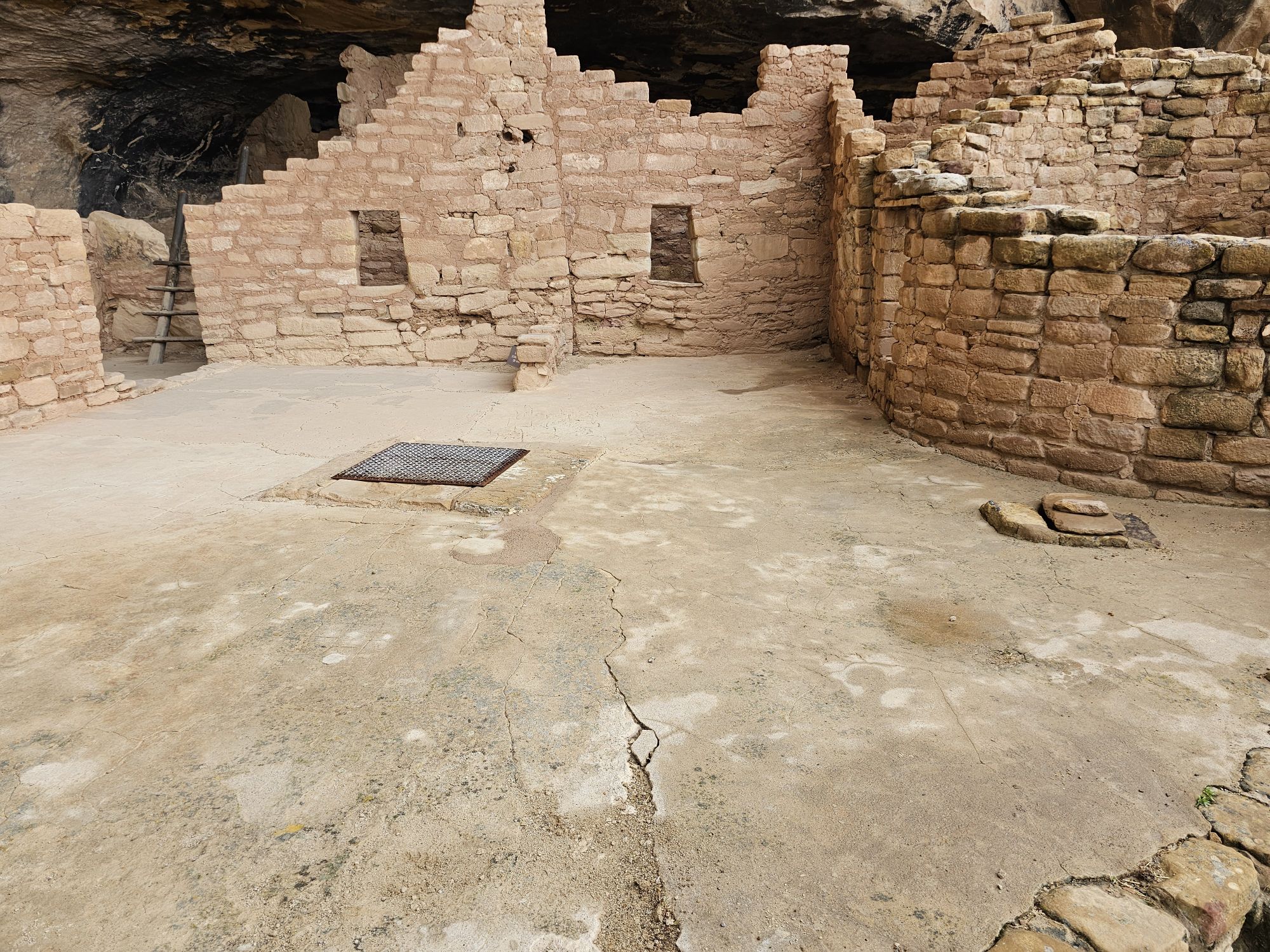
After finishing the Long House tour I had some time still before the rangers would chase people out of Wetherill Mesa. I took a self guided tour of the Step House not far away. The access to the Step House is a pretty steep walk down from the parking area. The site is interesting in that it highlights another feature of the cliff dwellings. Most/all of them started life as pit houses/dwellings/storage areas dating back 600 years BEFORE the cliff dwelling structure was built over them. In the Step House there are features of both the much older pit houses, and also the cliff dwelling architecture. This is the only cliff dwelling site in the park that you can tour without a ranger guide. There is a ranger on site to answer questions and explain what you are looking at, which was very helpful! The walk up was tough with the altitude being over 7,000 feet, so bear that in mind!
Using the ever trusty Guide Along tour, I learned more about the rather sophisticated real history, and the not made up history, of the peoples of this area. First of all, the term Anasazi is a misnomer for the people in this area, and most of the indigenous people don’t like it being used as it was. It’s a Navajo term for “ancient enemy” and that’s not what the ancestral Puebloans were. While this was being explained the guide also mentioned the words Dineh and Athabascan. Now as someone who loves Alaska, my ears perked up at those words and I had to restart that portion of the narration to make sure I was not crazy, after all I was in Southwestern Colorado, and not central Alaska! But, lo and behold, the Navajo actually go by the name Dineh and they do indeed speak a form of Athabaskan, as they originally came from that area in the far north! How cool!
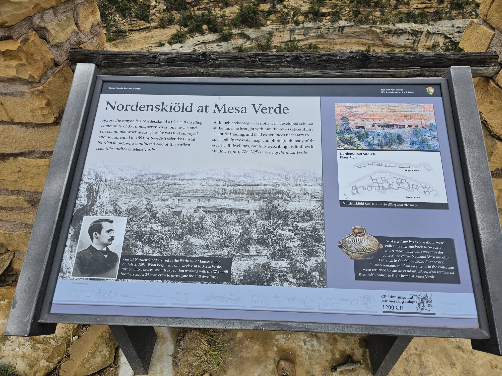
The other fascinating history I learned involves Richard Wetherill, the man who acquired the land and “re-discovered” the cliff dwellings. (The local peoples apparently were quite aware of the ruins.) Oddly enough I had seen the cemetery he is buried in, the previous day at the Chaco Culture site! I should have stopped to look around, but I didn’t! Anyway, Wetherill was wanting to farm the area. After rediscovering the cliff houses he pivoted to excavating and selling artifacts. Wetherill eventually hired a Swedish archaeologist named Gustaf Nordenskiöld to excavate the sites. Nordenskiöld taught Wetherill more proper techniques to excavate and to document all the sites and artifacts. A couple things sprouted from this. Despite his more modern archaeological approach, Nordenskiöld was sending artifacts back to Sweden, which infuriated Americans. This led to the creation of the National Antiquities Act, and the creation of Mesa Verde National Park in 1906. Additionally, Nordenskiöld taught Wetherill so well, that despite his lack of proper education, Wetherill advanced claims that were initially dismissed, but are now considered accurate! All of this may seem dry, but I found it quite fascinating!
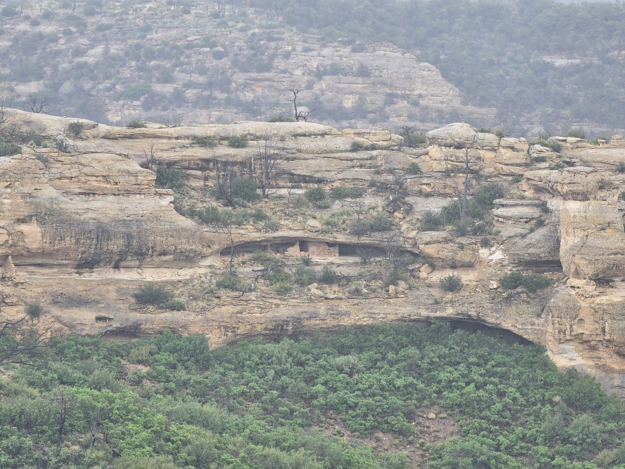
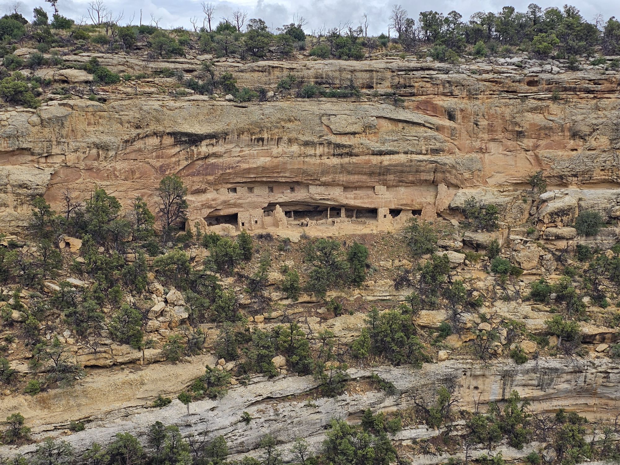
Nordenskiöld did a lot of remarkable exploring of the area. He numbered the sites, and the numbers can still be found to this day. Additionally, there are numerous trails in the park that he created. Back up on top of the mesa you can find many of these trails. I hiked Nordenskiöld Number 16, the trail to site number 16, of course. This trail is accessed off of the walking path to the Long House trail. It was super cool to get to the end of that trail and have a view of another cliff dwelling off in the distance (at this point I was unaware of how many of these there are!). But, in this case, the distant dwelling was actually RIGHT UNDER the trail I had just taken to get to the Long House tour! HOW COOL! I had just literally walked on top of one of these structures without a clue!
Upon Leaving Wetherill Mesa I headed further into the park to do some recon of the Chapin Mesa area. This is the are that most people will explore and contains the 3 other Cliff Dwelling tours, as well as the Museum. In case you are wondering, the Visitor Center is actually way back at the park entrance about 45 minutes away. You cannot miss it, but if you think there is another one deeper in the park, there is not. In any event after a decent drive, you come to a turn that takes you to the museum, park offices, and a cafe with a delicious Navajo taco on the menu! There is also a spectacular cliff dwelling, the Spruce House, to view. Like all the others a person will see, you are opposite a canyon from it, but this one is much closer and visitors used to be able to visit but conditions have led to its closure. Still, worth a peak, for sure!
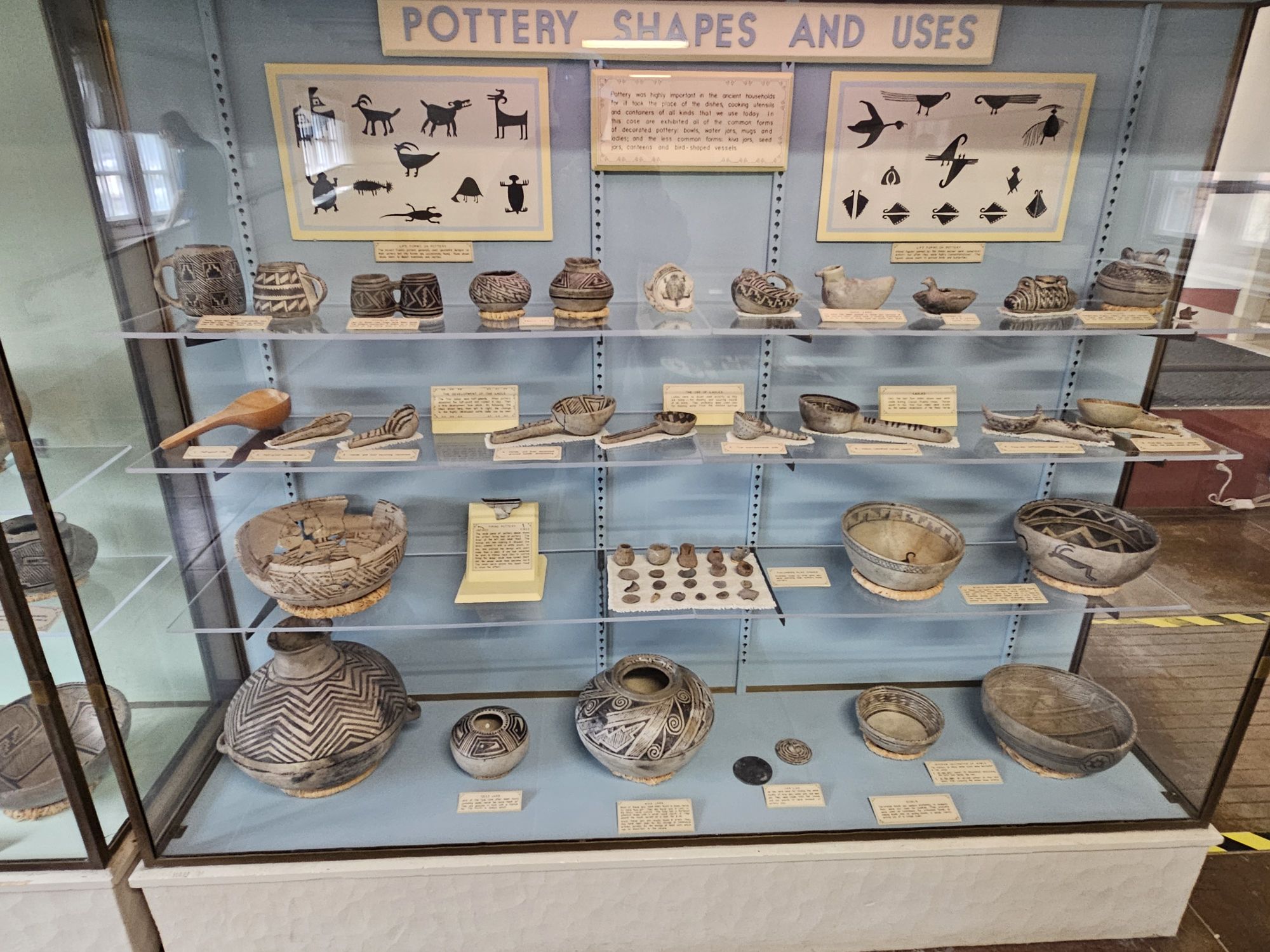
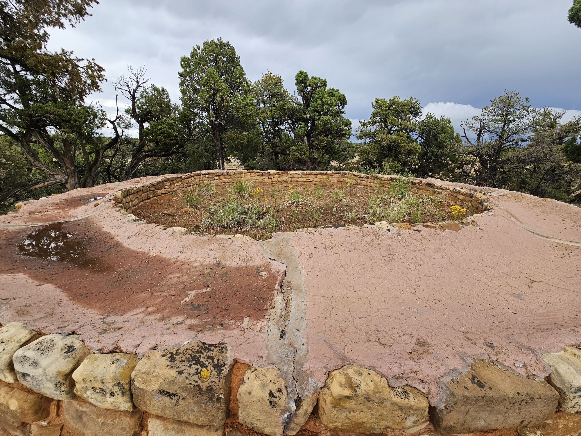
The museum is pretty great, and shows off the many artifacts, including all the pottery and highlights the importance of that black and white pottery I mentioned earlier. After checking out the museum, I headed back to explore! Once back on the road, you are soon given a fork. Going to the right leads to the Mesa Top Loop and the left leads to Cliff Palace Loop. Mesa Top Loop provides access to a number of excavated pit houses on the top of the mesa, mostly dating back to the 600-900 CE era, and to some great views of Navajo Canyon. At one overlook, though I could not find them all, the Guide Along tour mentioned that something like 30 cliff dwellings were visible! This loop also provides access to the Square Tower House. The loops are one way, so once finishing this loop, I took the Cliff Palace Loop. This loop provided many more extensive views of the numerous cliff dwellings that are visible in the park. I was pretty stunned by the shear number of these dwellings throughout the park. There are over six hundred of them! They are were all built at roughly the same time, and abandoned at the same time as well. And even more, there are at least more than FOUR THOUSAND sites on the mesa tops. The majority of these sites are NOT excavated, and will not be, to protect them.
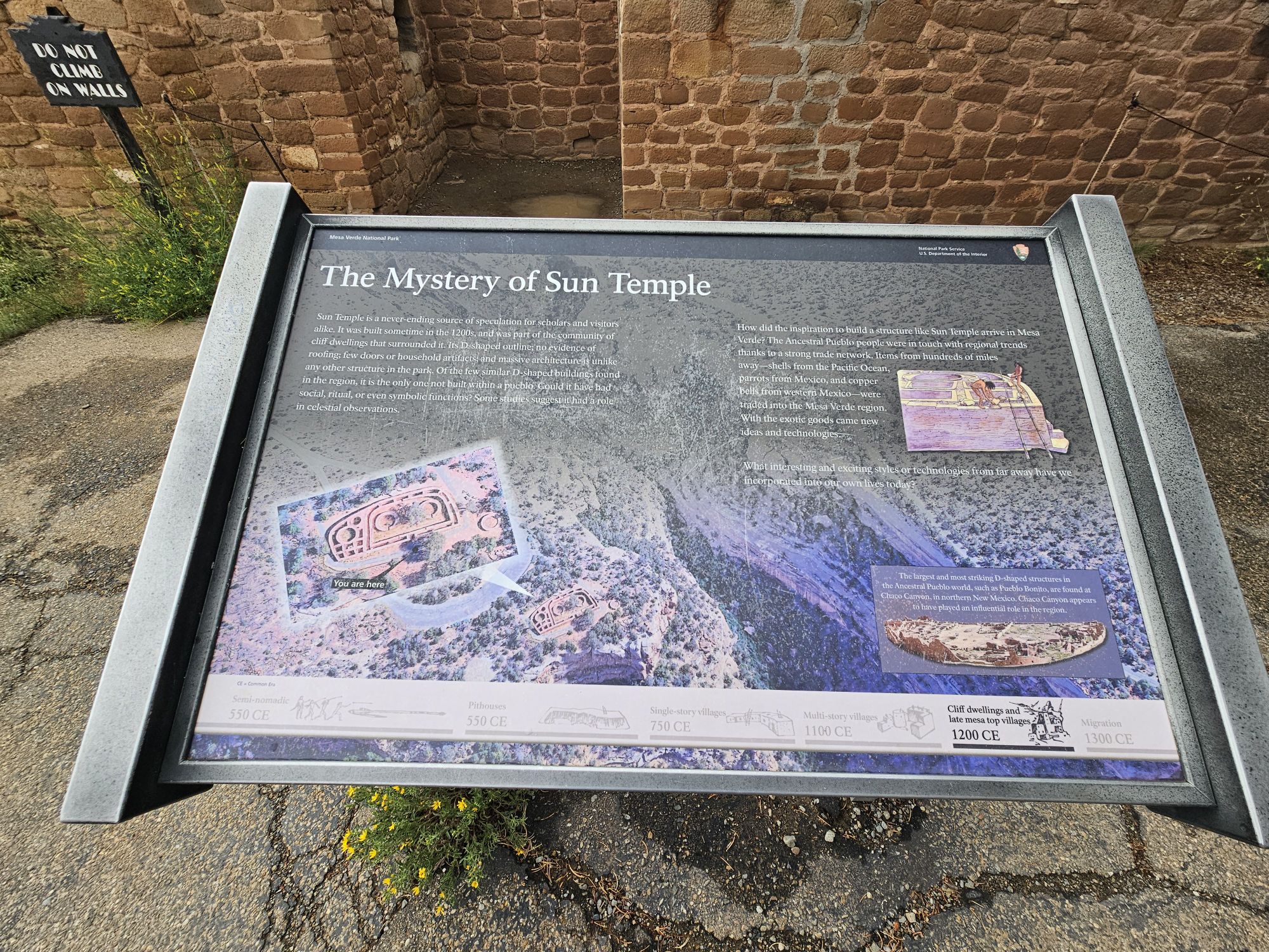
One notable mesa top site is the Sun Temple. This site is directly across the canyon from Cliff Palace, offering great views of that huge site. The Sun Temple is unique among all the sites. It is a D shaped structure which is rare enough, and it is the only one not found within a pueblo. Another notable D shaped structure in the are is Pueblo Bonito in Chaco Canyon. This one was built with no roof. Speculation is that it was an observatory. It was built the same time as the cliff dwellings, so was definitely connected to the cliff dwelling peoples.
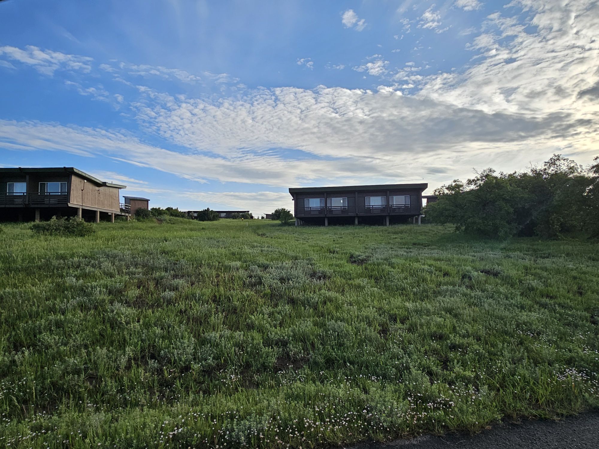
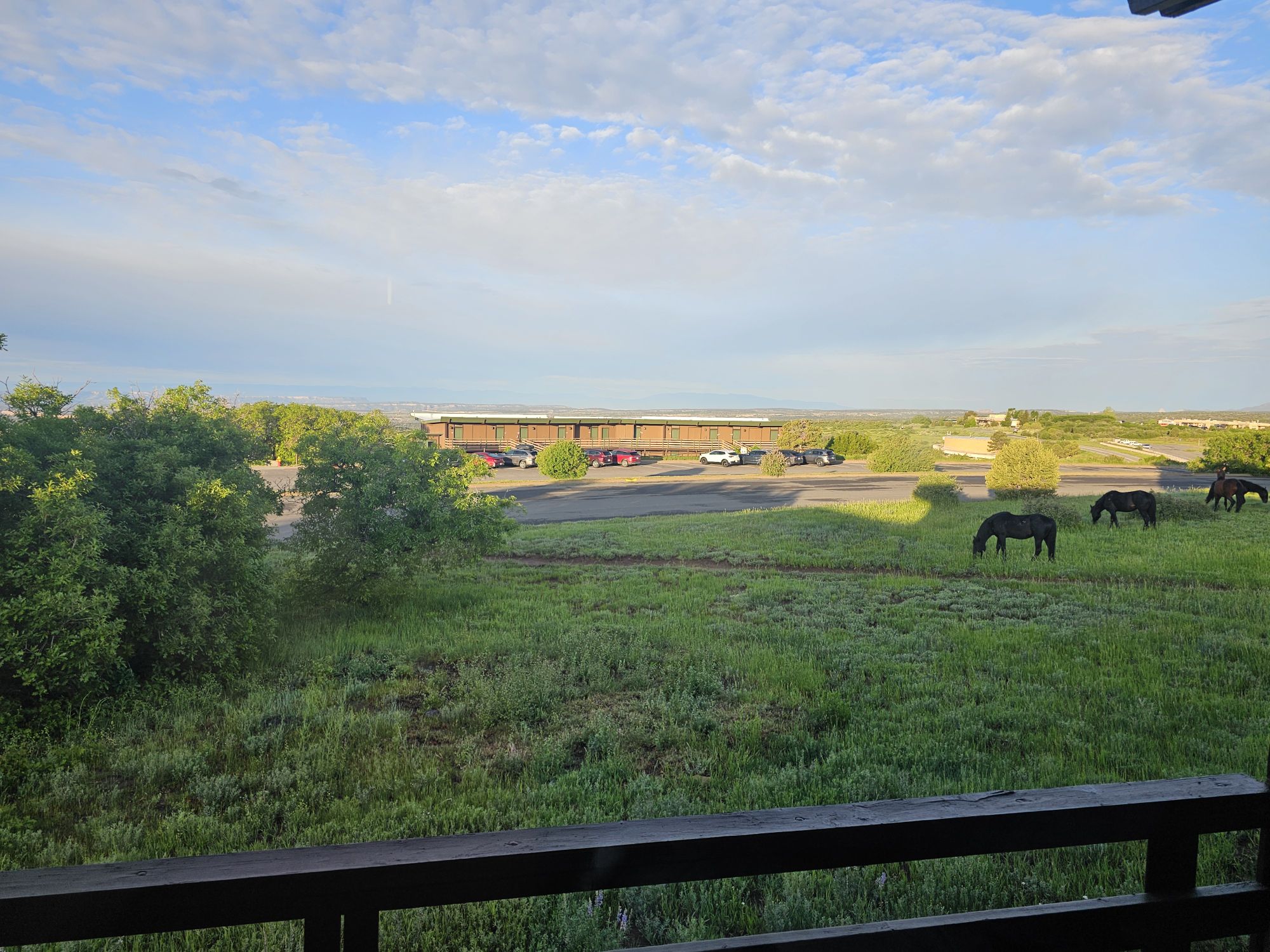
After leaving the Cliff Palace Loop I headed back to the Far View area to settled into my room for the evening. The lodge is simple but the bed was comfy and there is a restaurant, store, and bar on the property. You will find wild horses as well, though signs warn they are not friendly. Also, there is an iconic, but closed, visitor center right across the road. This one was open from 1970 to 2012. It seems the building is still in quite good shape and the park is actively pursuing a repurposing of the structure. Here’s hoping they are successful, because it looks like a neat place that offers killer views of the park! And with that, it was time to turn in the for the night.
Like is I mentioned in the opening, this is a park very large in scope and history, so I hope you at least looked at the pictures and read the captions! Stay tuned for part 2, where I share tours of the Square Tower House, Balcony House, Cliff Palace, and other mesa top sites!
