
National Park Count: 37
Pictured above is Lake Manzanita. Lassen Peak is center and the closer Chaos Crags to the left.
Hey there Adventurers! First thing, this will be a very picture heavy post. Feel free to just skim through them and read as you wish! Fresh off the trip the Sidekick and I took to California earlier in July, I decided to go back on my own and check out another chunk of the state! You may note that this was my third trip to California from Florida this year! Thank you very much Southwest Airlines! This trip included stops at Lassen Volcanic National Park, Whiskeytown National Recreation Area, Redwood National and State Parks, and Lake Tahoe. My first stop was Lassen Volcanic National Park, the location of a 10,500 foot tall volcano, Lassen Peak, and the its large eruption just a little over a 100 years ago, between 1914 and 1917, with the largest explosion in May 1915.


Reno has the closest airport that Southwest flies into and there is roughly a 2.5 hour drive out to Lassen. Redding, California is an hour away and has an airport that is served by the legacy carriers as another option. The drive from Reno to Lassen starts pretty bland for a long stretch, but once you enter Lassen National Forest, about 50 miles outside of the park’s northern entry, the drive becomes much more scenic. From this point on there is very little cell signal to be found and there are no real towns anywhere in this stretch, so be prepared. Due to the lack of nearby services and amenities I decided to camp and snagged a campsite in the park for a couple nights.
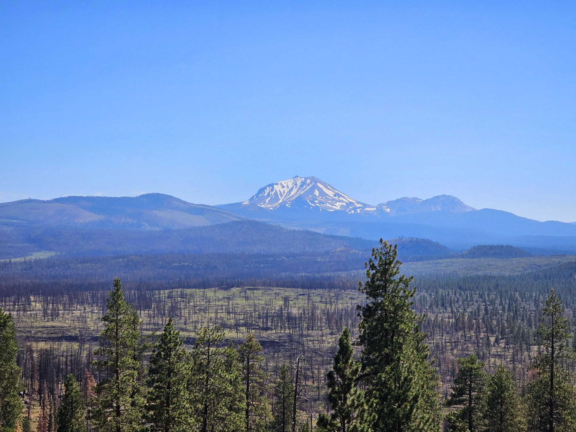
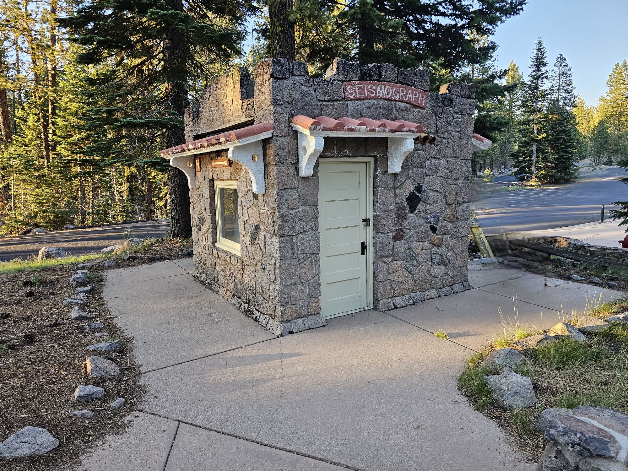
As you approach the park you can find some views of Mt. Shasta to the north, and then you can finally get some beautiful views of Lassen Peak. You also will drive through some old lava fields (there is a lava tube to visit nearby, that I will talk about later). Finally, I arrived at the campsite and got my tent up and running at the Manzanita Lake Campground. This campground is popular and you are pretty close to everyone with little privacy, but it was generally quiet and peaceful. The camp is dog friendly and has a very well stocked camp store with long hours. The store also has a landline for phone needs (most of the park, including the campground, is cell phone free), a gas pump, showers, laundry, and even a kayak rental for the lake. Nearby are several trails, none really much to write home about, other than some good views of Lassen Peak, but one could probably make a good time of it just staying in this area for a night or two!
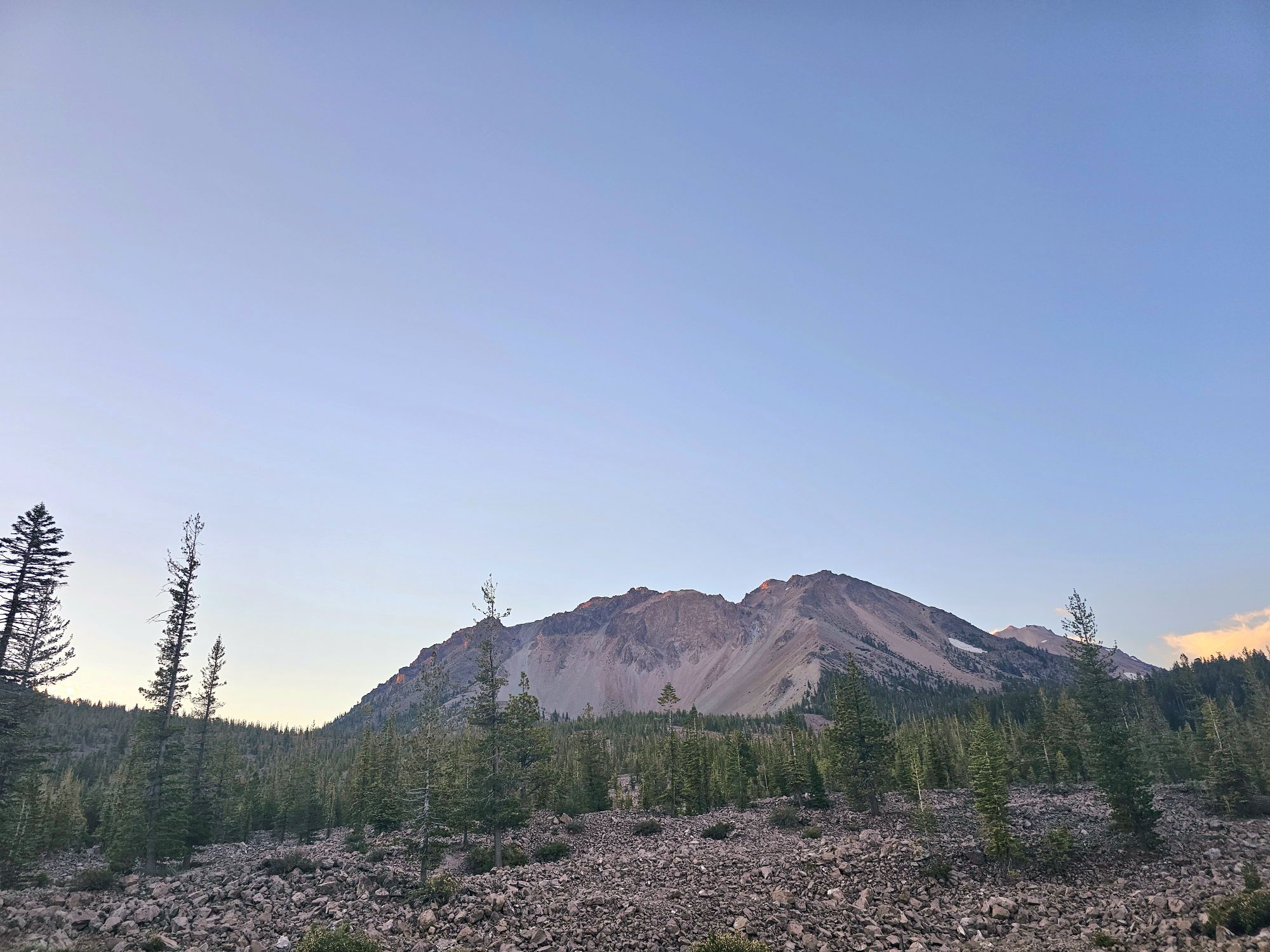
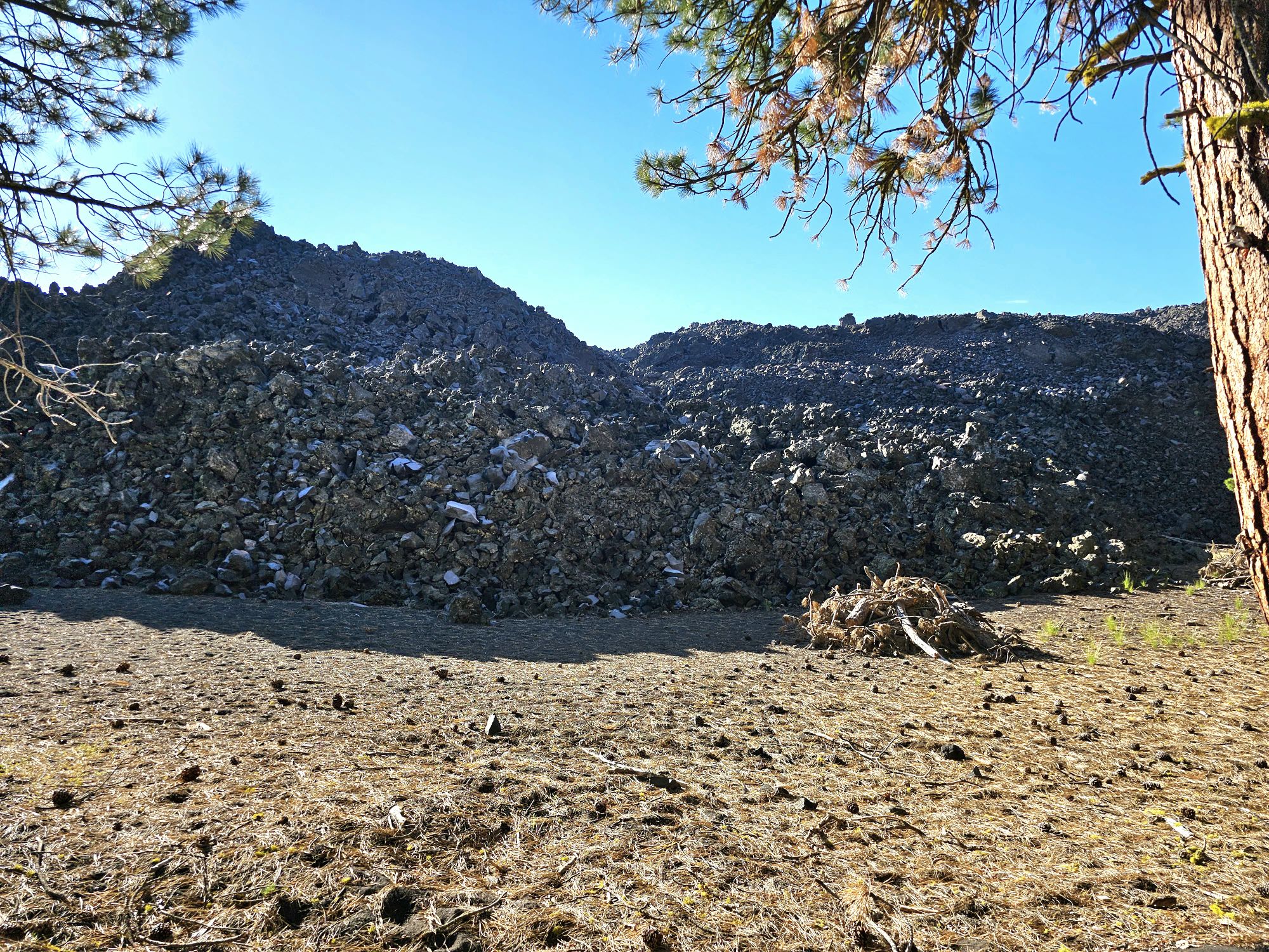
After setting up camp I went exploring this immediate area. Manzanita Lake Loop is a nice leisurely trail just shy of 2 miles with little elevation change that gives access to the lake and some great views of the mountain! After checking that out it was back to the car to do a little driving exploration! This section of the national park is quite dry with mostly pines and heavy wildfire burns. Along the road you can find large boulders that were dropped there by the most recent eruption and other evidence of past volcanic activity. This drive goes through an area called Chaos Jumbles. The cause of this chaos is easily visible here: Chaos Crags. This is a collection of dome volcanoes that are very new at only 1000 years old. About 300 or so years ago one section of the crags collapsed and the resulting landslide and avalanche flattened the forest for a couple miles and dammed the creek that formed Manzanita Lake. As an aside…if you are desperate for cellular signal, the pull out here gets you one bar, but everyone knows it apparently, so it’s a busy spot! I then ventured down the road a bit to a spot called the Devastated Area. Here, there is a half mile, paved interpretive trail with audio boxes along the way detailing the volcanic effect during the most recent eruptions. This whole area was hit with pyroclastic flows and lahars (mudslides) leaving many large boulders strewn about. This is a quick trail, but does give some good info about the eruption in this area.

The following morning was the big park day for me. I got up early and left the campground toward a remote section of the park accessible only by gravel roads to hike the park’s hidden gem, a 700 foot tall Cinder Cone and the “Fantastic Lava Beds.” My fitness level at the time of this hike was not where I needed it to be! The hike begins at a campground along Butte Lake. The shore of the lake is predominantly lined with jagged lava flows and the hike begins alongside a wall of a large lava flow. The rock is tall enough that the cinder cone is not visible for quite a while. The trail goes about a mile and 300 feet uphill before you get to the trail up to the top. I took one look at the trail most directly up the cone and was doubtful. To be fair I started it, about maybe 50 feet worth. The surface of the cone, including the trail up, is entirely lose scoria, a type of volcanic rock. Coupled with the fact that the grade of the trail here is about 40 percent, my decision was a no go! I do kinda regret that I didn’t power through it, but by opting to go the long way around the back side of the cone I was ensuring that I would still get to see the Fantastic Lava Beds and painted dunes anyway, even if I were unable to make the top via this route. I made it about 2 and a half miles and was tantalizingly close to the top, but I had already hiked through some suspects spots up the backside of this cone, and after stopping for a rest on a mercifully flat area, I made the decision that the last quarter mile up was not safe for me. It was the same as the front side, very loose scoria rock and very steep grades of about 40 percent as well. Also, I had not come across one single person the entire time since I departed the first ascending trail. My fear was hurting myself and being stuck on the back side with potentially no one to find me. It was very hot and sunny as well, and of course, no cell phone signal. The good news is that by going this back route, in addition to being able to see the beautiful painted dunes behind the cone, I was also able to get a very close up view of the remains of the vent that let out all the lava that created the huge lava field. Pretty neat to see! Had I done the first way up and not made it I may not have seen any of this. The full trail runs about 5 miles round trip and the total elevation gain is about 1050 feet. Where I stopped made my trail about 4.6 miles with 500 feet of gain. That last quarter mile was over 300 feet uphill on loose footing and I just wasn’t there. But that was ok, it was still a great experience!


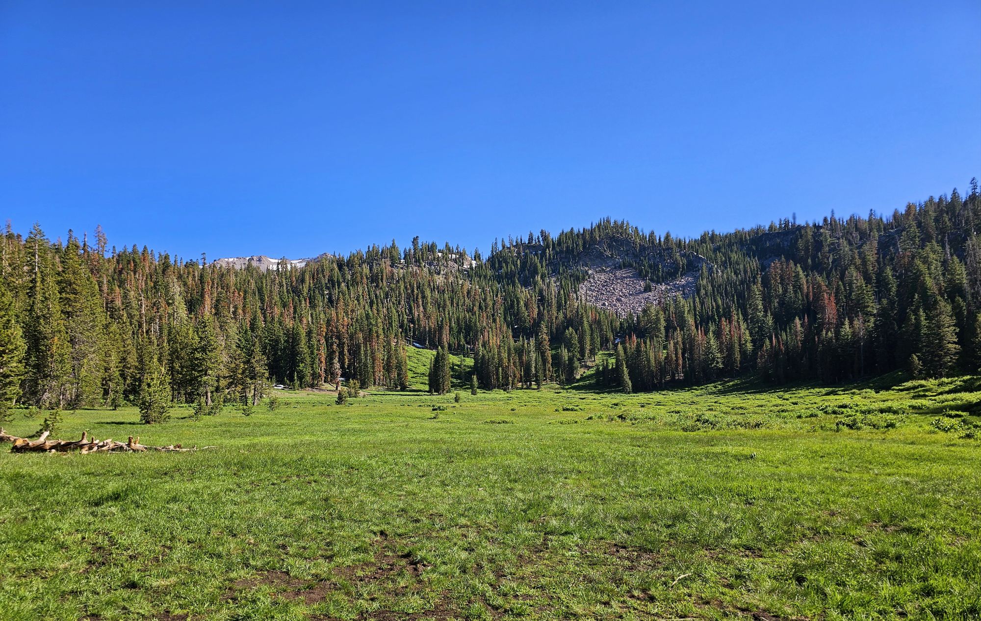
I had started the Cinder Cone pretty early, so I was back to the campground entrance of the park pretty early and began on the next part of the day. There is essentially one road through the park so my plan was to drive that road all the way to the end, stopping along the way for sights, but no hiking. One notable place to stop is Lake Helen, a beautiful crystal clear lake sitting near the top of the road, at about 8200 feet of elevation. Despite it being late July there was still a lot of snow around. Definitely a pretty spot to check out! Otherwise, I had a few hikes in mind for the way back. I did entertain the thought of hiking Lassen Peak itself, but my feet were pretty torn up from the Cinder Cone. That dust had no trouble getting into my shoes and causing a lot of problems! Anyway, I stopped at the visitor center, and south entrance sign before turning around.

The park features active geothermal features, just like you would see at Yellowstone. On the way back I stopped to check out some of those near the visitor center and then did a small hike, Ridge Lake, through some beautiful wildflowers to get a better view. This area is called Sulphur Works and is a good spot to see some boiling stuff that can kill you, up close along the road! The Ridge Lake trail is about 2 miles out and back with 1000 feet of gain, but only a short distance from the trail head gets you some good views of the this entire area.


The Bumpass Hell area looks super neat, but the trail was damaged in storms earlier in the year and was closed. This area is the largest hydrothermal feature in the park and has a lot of cool deadly things! The closed trail is about 3 miles round trip, but there was a back trail to get to the area and I thought I would give that a go. Cold Boiling Lake Trail does eventually connect to a part of the Bumpass Hell Trail that would have given a small amount of access to the Bumpass Hell area. To get to the Bumpass Hell this way requires a 5 mile round trip hike. I made about 1 mile, just past the Cold Boiling Lake. The lake does boil. And it is cold. The boiling is merely gasses escaping to the surface from below for some geological reason. I stopped to chat with a couple who comes here often and they strongly suggested that trying to make it to Bumpass was not worth the effort due to the closures and suggested another hike closer to the campground, so I turned around.

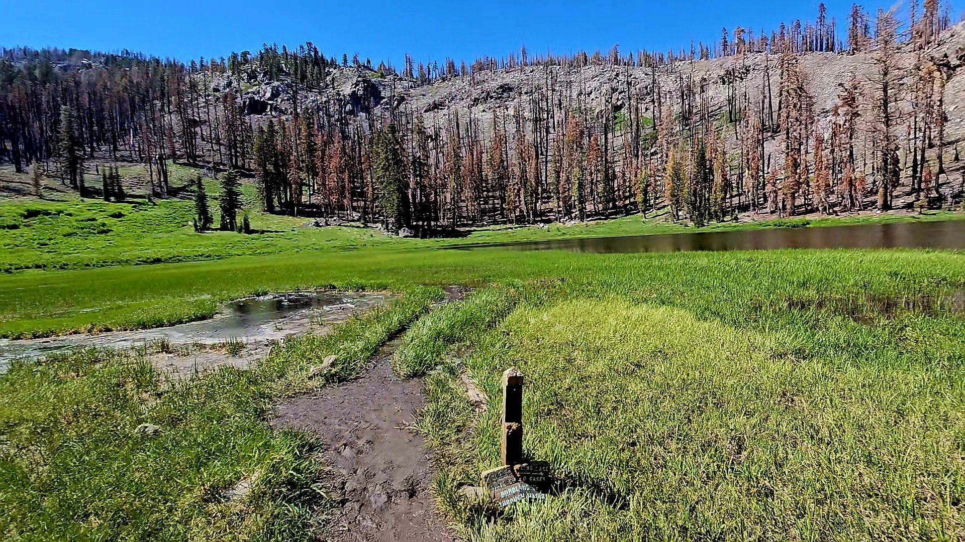
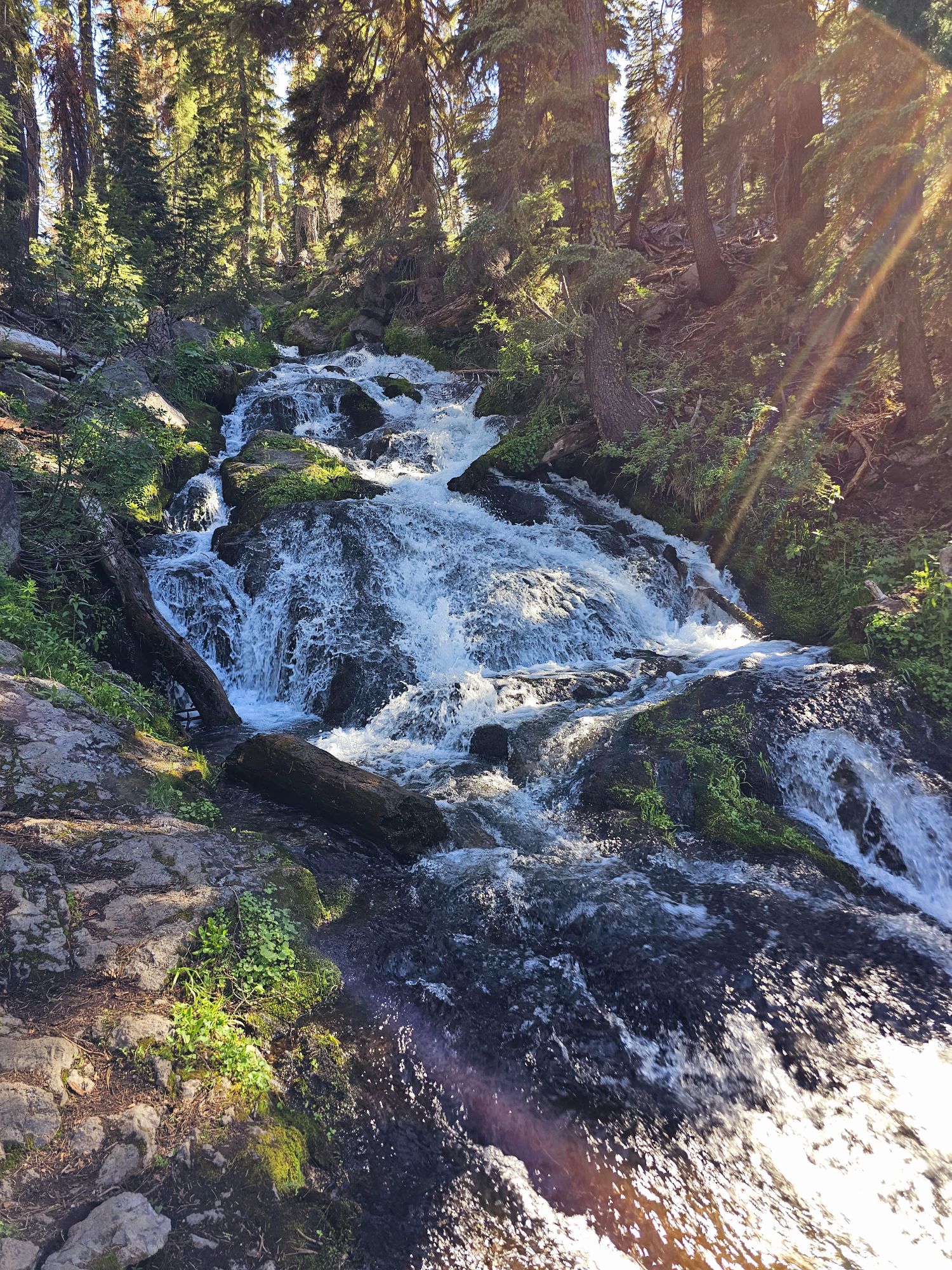
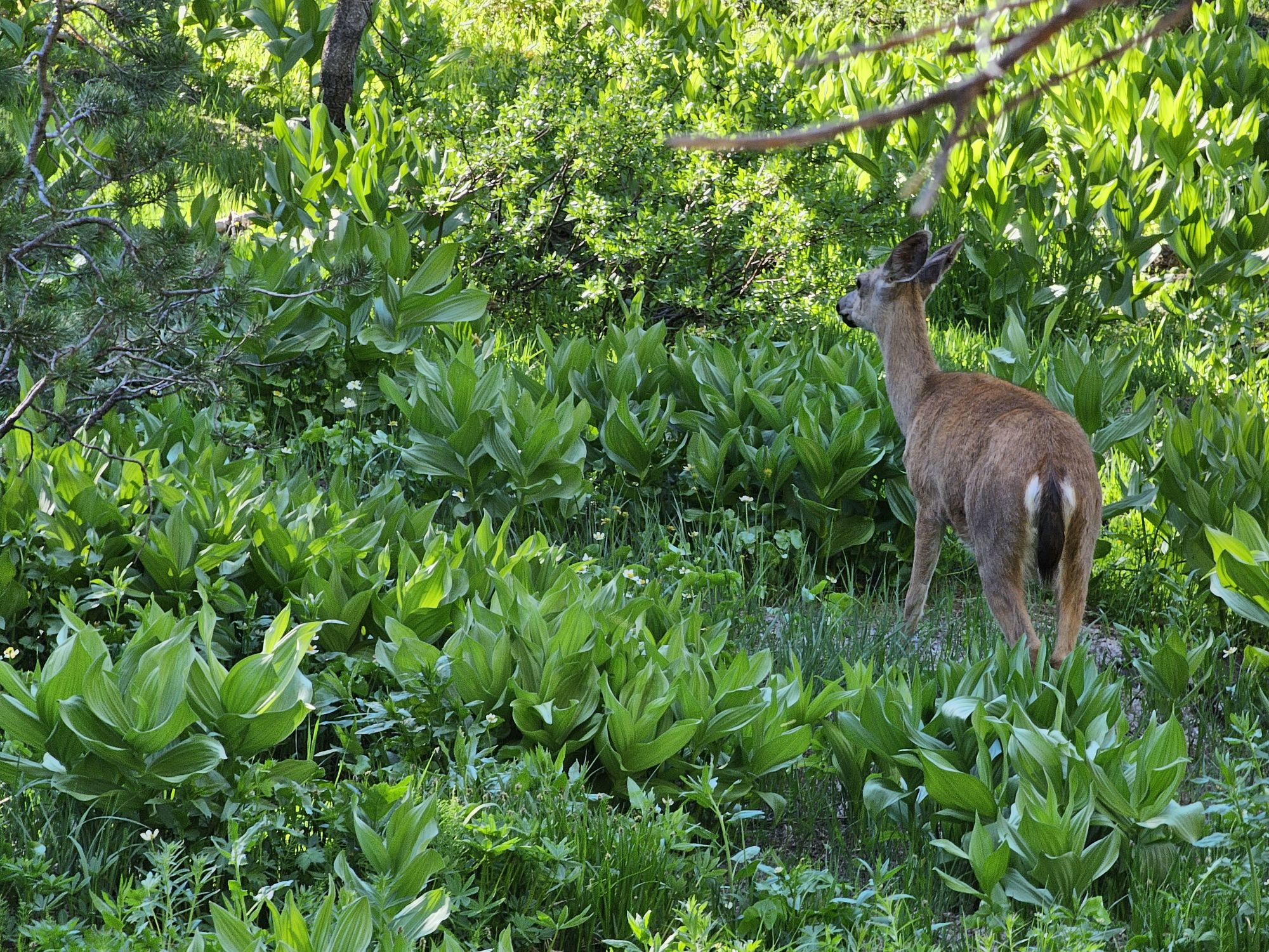
For those keeping score at home, at this point I had done about 7.5 miles of unfinished hiking this day and I was hellbent on finishing a trail, so I took that couple’s advice and found the trail they suggested: Hat Lake to Paradise Meadow. This one started near a bridge, and you can get a really nice view of Lassen Peak framed by the bridge from here (a sketchy descent down a steep hill to a stream below is required). This trail is about 3 miles round trip, with 600 feet of gain. I saw one family and that was it. The entire trail follows the stream uphill, eventually ending at a pretty meadow. There are some small waterfalls along the way and some deer were hanging very near me during parts of the hike. It was definitely a nice way to end a tiring day!

On the (long) drive from the Redwoods back to Reno, I had to pass by Lassen again, and I did contemplate coming back in and trying Lassen Peak, but time was not really on my side. Meanwhile, I discovered there is a lava tube to visit near the area where the Cinder Cone is, which was right on the way. The official name is Subway Cave. The cave itself is not very long, but this was my first ever lava tube, so of course I HAD to stop! The area is pretty popular and parking was a bit iffy. You need a flashlight as the cave is totally pristine other than concrete steps going into and out of it. There are two holes with stairs so you can make a loop trail out of the cave and the surface bits. I didn’t need to spend much time here. Even though this cave sits just outside the national park, I still consider this to be the end of Lassen Volcanic National Park experience! As a nice coda, on the way back to Reno I did stumble upon Lassen Aleworks in Susanville, about an hour away from the park. There is good food here and some good beer, including Volcanic Double IPA and Bumpass Helles.


Overall Impressions: This is a stunning national park and I think this one goes in my top parks list! I only spent a day and a half here but could have definitely spent a couple more so I can envision a return visit!
The Adventurer’s Rating: 5 Arrowheads!

We concur after our trip in 2023. A great Park to visit and you did an outstanding job of developing an itinerary.
LikeLike
Thanks! I struggled a bit planning this trip. I was feeling guilty leaving my old dog behind (she was in decent health at the time – but passed away a month later) for a second time in July. Also, initially I was going to take this trip up to crater lake. It would have been 8 days long, but I shortened it to this one which was essentially a short 6 days. Living on the opposite coast, you usually lose 3 days for travel to the other side. So, I would definitely like to come back to Lassen!
LikeLiked by 1 person
Great post. I have never heard of this park and now it’s on my list for a stop on my 2025 road trip! Thank you!
LikeLiked by 1 person
Awesome! I glad to hear! It’s definitely in my top 5 parks probably!
LikeLike