National Park Count: 39 NPS Unit 69
Hey there Adventurers! The Sidekick and I embarked on the first trip of 2024 to Joshua Tree National Park near Palm Springs, CA! The trip actually encompassed this stop, a stop at the Palm Springs Aerial Tramway, a very brief stop at the Mojave National Preserve, a visit to Death Valley National Park, and quick stops at the Hoover Dam and Lake Mead National Recreation Area and Sin City!
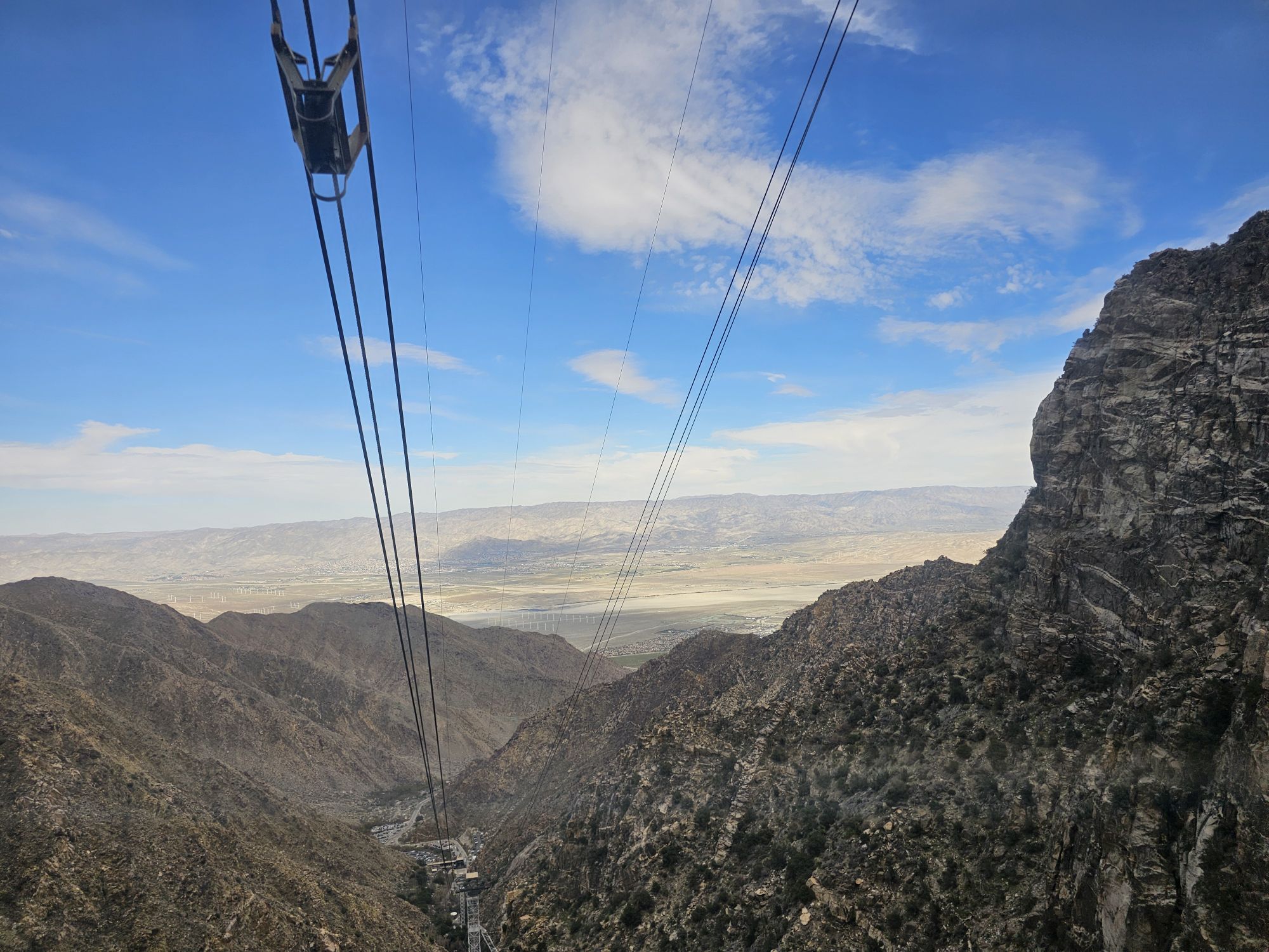
We flew into Palm Springs with Southwest Airlines. I love free flights with a companion pass in tow! Our first stop was nearby at the really neat Palm Springs Aerial Tramway, taking us up to San Jacinto Peak overlooking Palm Springs. This is a must visit if you are in the area. There is a 15 dollar parking fee, plus 30 bucks a person to go up the tram, but it is very much worth it! The tram itself is floor to ceiling glass and rotates while it ascends nearly 6000 feet up the side of San Jacinto Peak. Fun fact, Captain James T. Kirk narrates the trip! At the top you find trails accessing the 8000 plus feet elevation of San Jacinto Mountain State Park. There is a restaurant, bar, and a gift shop to take your money. There are also some awesome views up there! Note that to get up on the tram you need a ticket for an exact time and you will probably have to wait a little bit for that time. I think we had an hour plus wait. The bottom of the tram has a gift shop, a museum, and a cafe to tide you over for the wait.


The town of Joshua Tree is at the western entrance of the national park and about a 45 minute drive from Palm Springs. We checked into our AirBNB and hurried to the Visitor Center before they closed to do a little recon. The main visitor center for the park actually lies within the town and NOT within the park proper. If you are the type to head into the park before sunup and then are looking for the visitor center while inside the park, just note that it is quite a bit outside! The town of Joshua Tree does not have a ton of amenities. The closest proper store is several miles down the road in the previous town. However, the spot to hang is the Joshua Tree Saloon, a bar/restaurant with a large outdoor patio in addition to the dining/bar area. It was good one night but a miss the second…so take your chances!
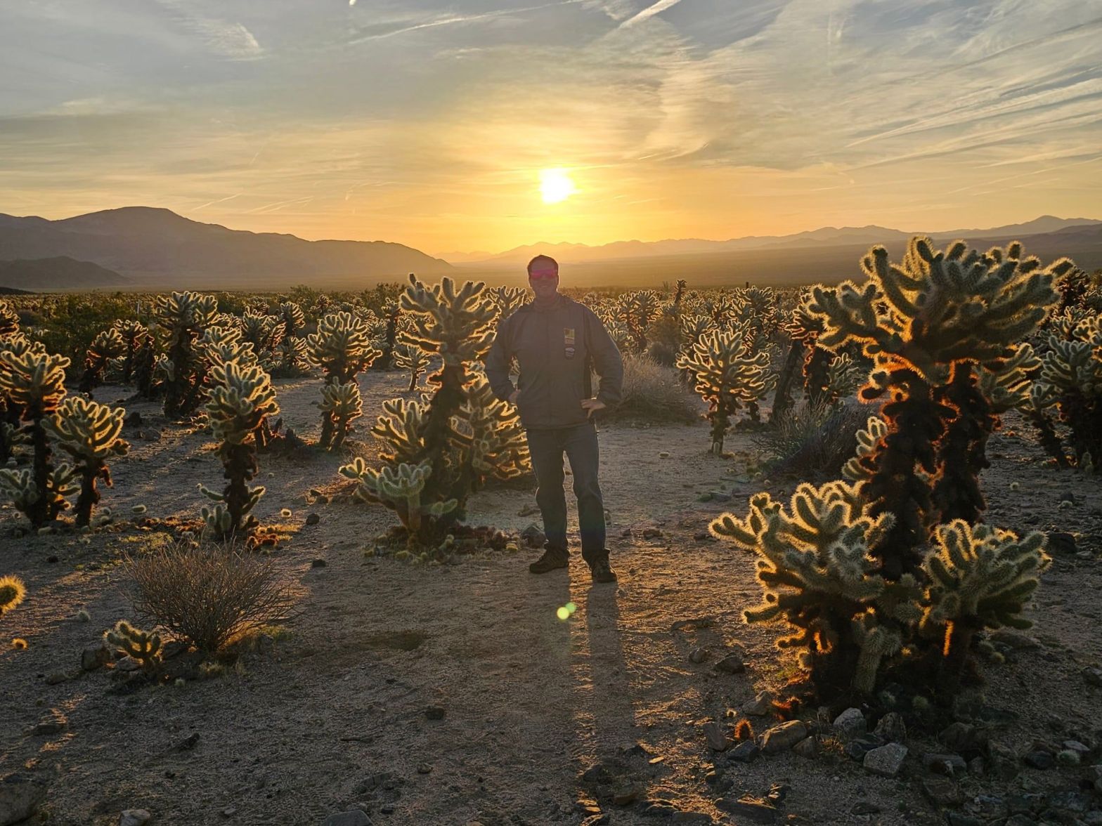
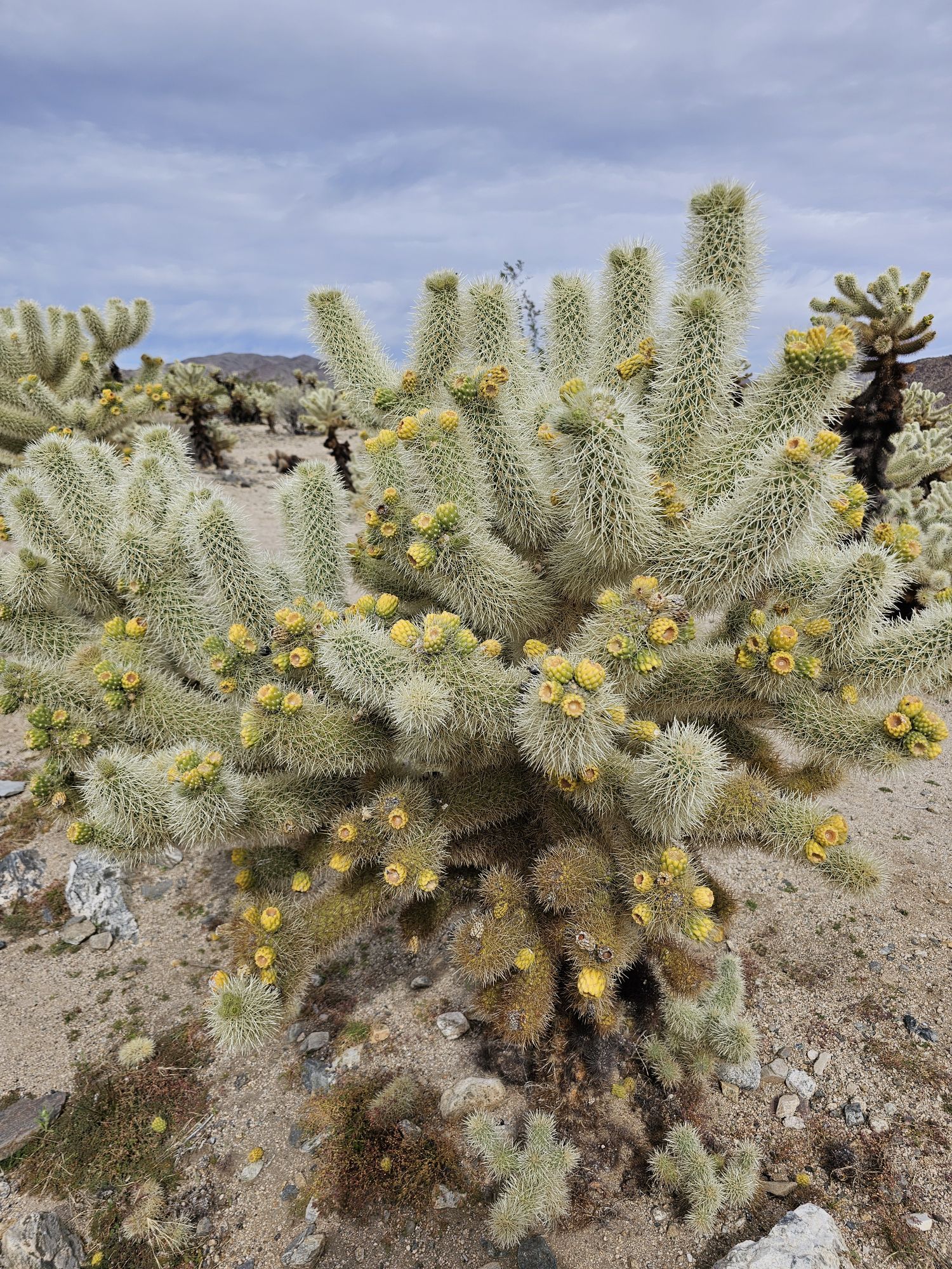
The following morning we got up very early and headed into the park. We intended to catch sunrise at the Cholla Cactus Forest, located pretty far down in the park. On the way to the cactus forest, seeing the park’s namesake Joshua Trees in the dawn light made for a pretty alien setting! If you are wondering what a Joshua Tree is…you aren’t alone. I call these “Dr. Seuss” trees because they look like they came straight from his imagination! Despite their name, these plants are not trees at all, and they aren’t a cactus either – they are actually a succulent! The name Joshua was given to these trees by Mormon settlers based on the Biblical figure Joshua. We made a stop at the interesting, and usually very busy Skull Rock (no one was there pre-sunrise) and made the Cholla Cactus Forest just in time for sunrise. I have to say this is probably the most beautiful sunrise I have ever seen! The beauty isn’t the sky here, but rather the gorgeous lighting on the cactus!


After hanging around the Cholla Cactus forest for a bit, and avoiding touching said cacti (well I did…the Sidekick seems to attract cactus spines…), we continued down to the southern entrance of the park. Here we checked out the Cottonwood Visitor Center (this one is pretty small), got the required sign picture, and then continued back into the park. This was mainly backtracking, because this is the only paved road here. But we made some stops to snap some pictures. One stop was Ocotillo Patch. Ocotillos are a very weird plant! Technically a type of succulent shrub, these guys can grow to 20 feet tall and live for decades. They are very distinct for several reasons. Their height is one reason, but they are also very green, some with pretty red flowers at the top, they are essentially a collection of thorny canes, and those canes have no limbs so the leaves grow straight from the canes. They really look quite alien…kinda how the entire park looks!

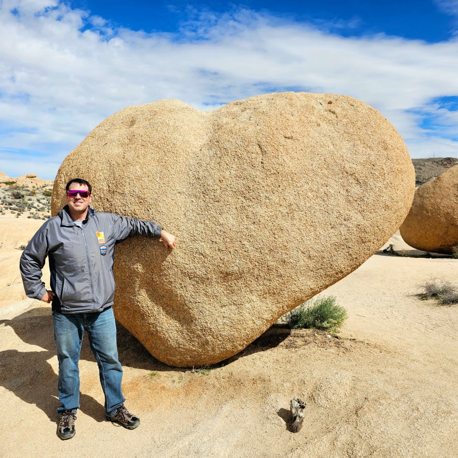
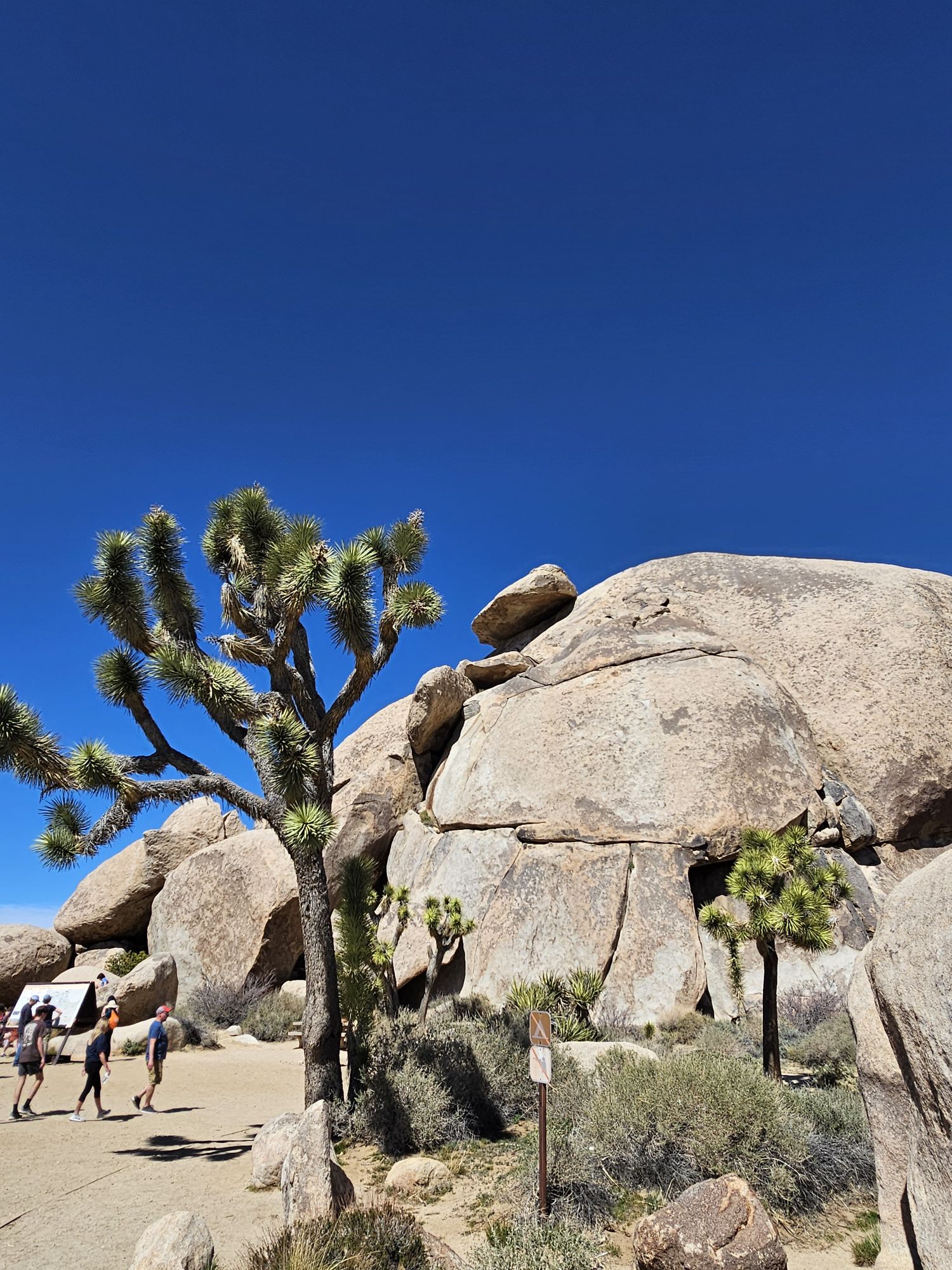
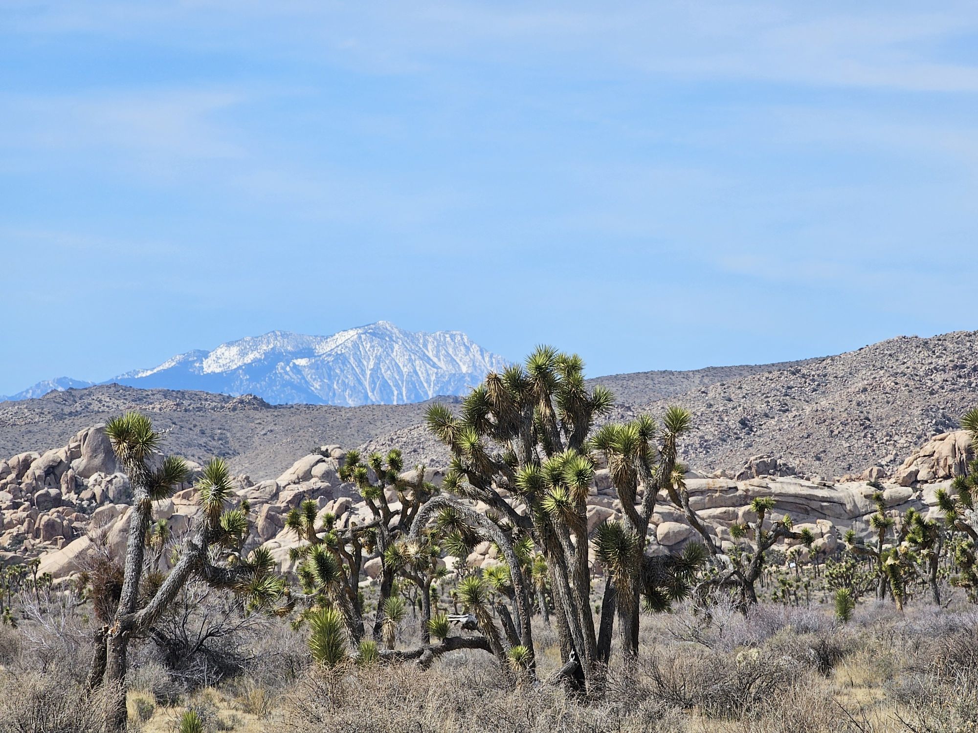
Not to harp on the need to really catch sunrise in these beautiful places, but we stopped back at the cholla forest, now well into the morning, and the stunning view at sunrise had given way to a much more muted view. Still cool, but nowhere near what we saw at ealier! We continued on to some spots we drove past at dawn and stopped for some small hikes and sightseeing. We hiked an easy 1.6 mile round trip trail to a couple rock formations in the middle of the park. These included Heart Rock, Arch Rock, and what I lovingly named Butthole Rock! We made a stop at Cap Rock to see what that was all about. And from there, we took a side road up to the highest part of the park. Keys View sits at about a mile elevation and offers a stunning view of the Coachella Valley and across to the San Jacinto Mountains! There are a couple Joshua Trees trying to exist up here, but mostly this is a good spot to just take in a view. The only problem is that air quality issues definitely affect the view.


As we exited another side of the park we went to explore a spot called the Oasis of Mara. There are a handful of oases in the park, but I understand that none of them are still on the surface, and most of them require lengthy hikes to get to. So we made the easy access Oasis of Mara our one oasis stop. This used to be the park headquarters/main visitor center and the oasis is a short walk behind the building. There isn’t much to see here, and again, the oasis has no water, but there is a spot that definitely has more access to underground water. The picture below is essentially the entire oasis now. To end the day we trekked back into the park from the western entrance and caught a beautiful sunrise.


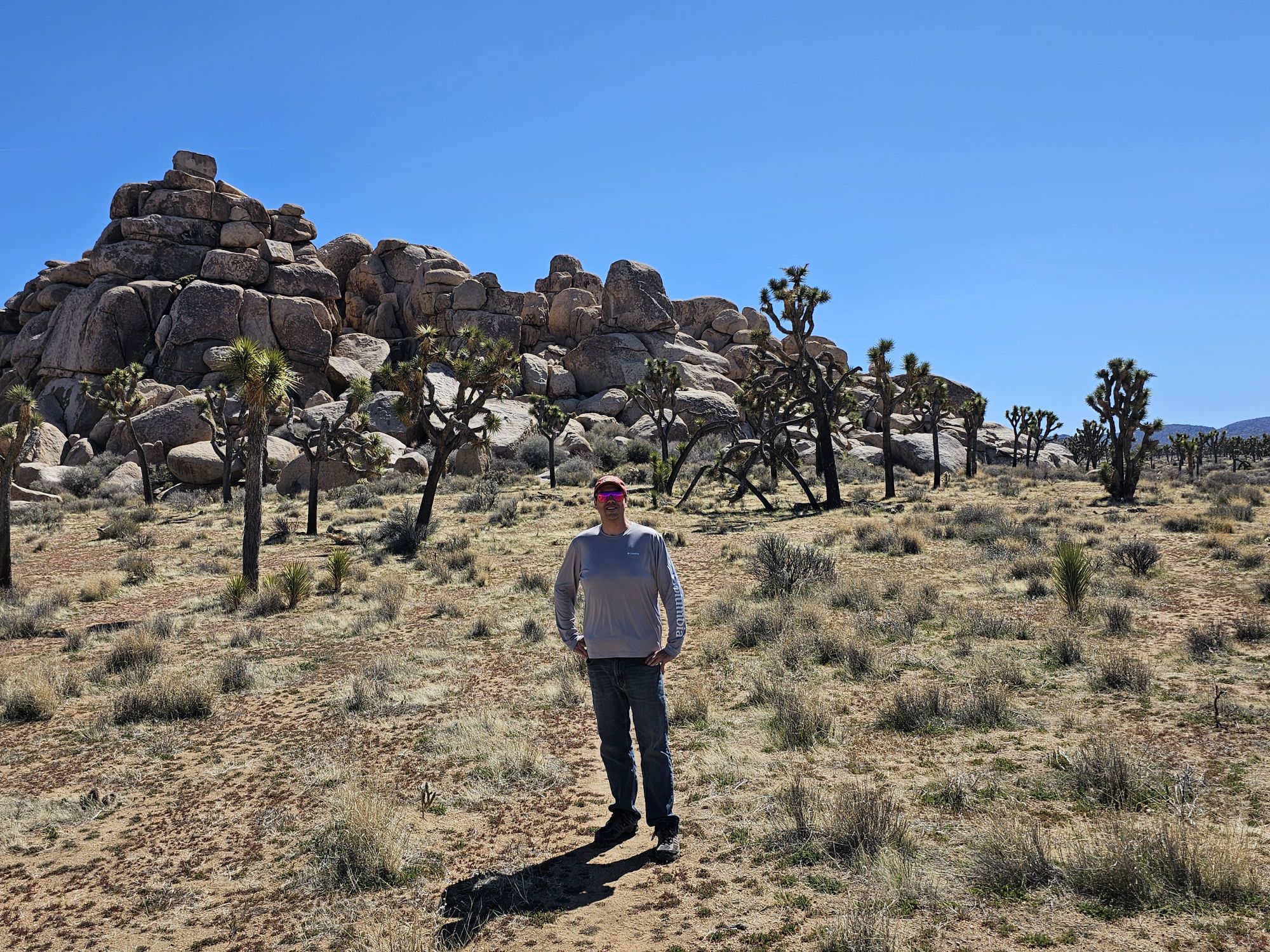
The next morning was the end of the Joshua Tree portion of this trip but there were still a couple things to do! We headed back into the park for the last time to check out two spots in the same area. There is a nice little 1 mile loop trail through Hidden Valley, and if you are a rock climber, this area is your place! This valley is named as it is because farmers (or outlaws) would hide cattle here, either from the elements or from people looking for them. The last spot we checked out was Barker Dam. This is a man made dam, first constructed 125 years ago. The Dam is found along an easy 1.3 mile loop trail. People get great rock reflection pictures in the water here, but on our visit there was no water in the reservoir. Along this trail you can also find old native petroglyphs as a reminder of the history of this land. And that concluded National Park Number 39!


Overall Impressions: Joshua Tree National Park is super cool! It really looks like another planet! It is small, which is positive in that you can see most all of the park easily and quickly, but also negative that you can …. see all of the park relatively quickly and easily! Still, it’s a super cool place and being close to a major airport makes it a must see spot!
The Adventurer’s Rating: 4.5 Arrowheads!

Well described and aptly supplemented by outstanding photos – most notably the sunrise pictures.
LikeLiked by 1 person
Thanks! It’s a really otherworldly place! That sunrise in the cactus was spectacular!
LikeLiked by 1 person