Hey there Adventurers! After departing Mesa Verde early in the morning, I was off, headed back in the direction of Albuquerque. I had 2 more full days left to this southwest adventure and I had plenty more to see! The first stop up: Aztec Ruins National Monument, about 2 hours away from Mesa Verde, back in New Mexico.
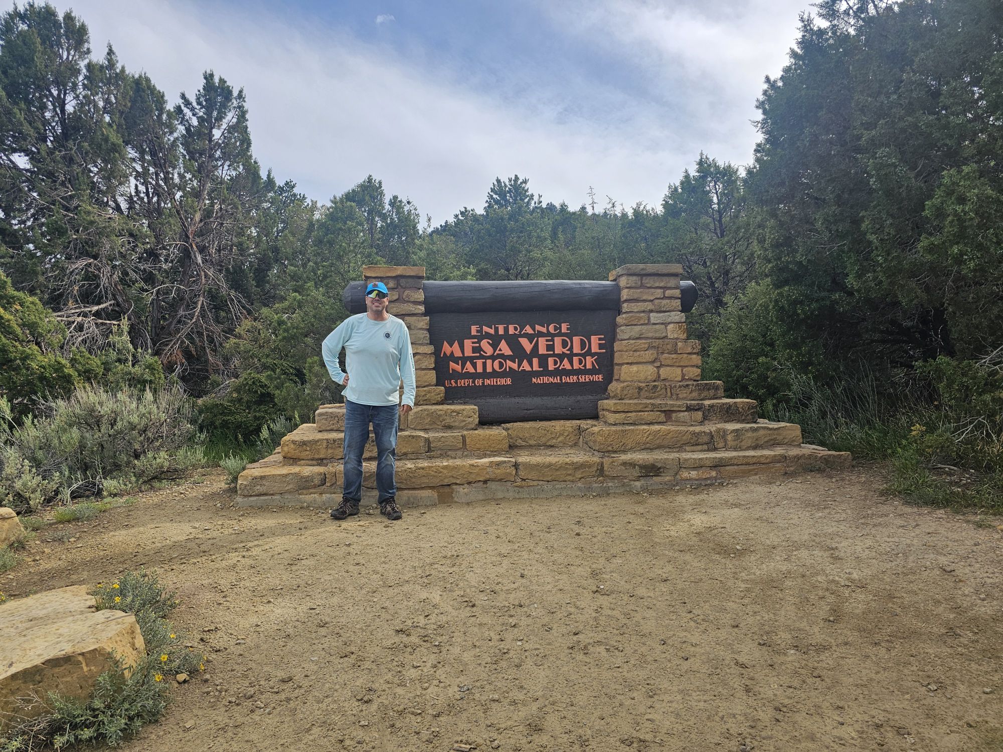
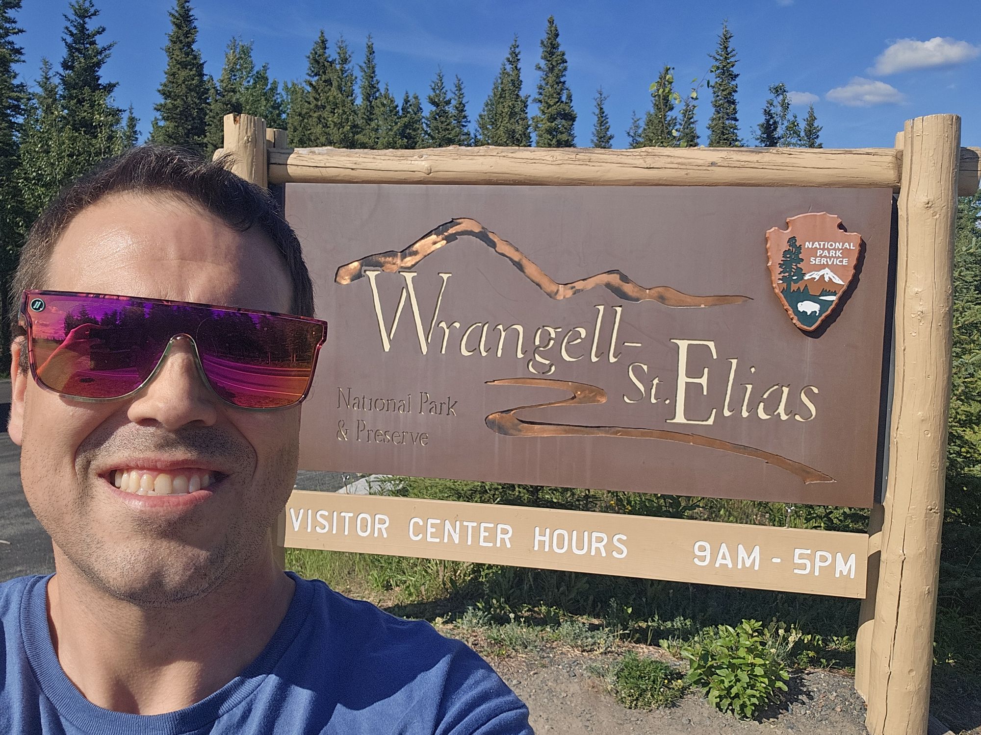
Sign Selfie!
Except I covered up the World Heritage mark.
Aztec is a part of the Chaco Culture Historical Park World Heritage Site. So cool!
A native! There were many of these little guys hanging around in the area! Taken by me.
First, one thing to get out immediately is that there is nothing “Aztec” to do with the site. In the 19th century explorers believed the Aztecs had migrated to this part of the continent and so named many sites accordingly. Though there is no Aztec history here, the site is notable for many reasons. It is considered part of the Chaco Culture World Heritage Site. It is a very sacred site to the indigenous southwest peoples. Originally, the structure included over 400 rooms and was 3 stories tall, and much of the structure still remains. And, lastly, the site is easily accessible as it sits on the Animas River near downtown Aztec, New Mexico. The town of Aztec may not be a thriving city (6,000 or so population), but it does lie on a US Highway. It should be noted that you are probably a local, or doing what I was doing, to actually be in this neck of the woods in New Mexico. There isn’t a lot going on in this area, but the history is certainly amazing!
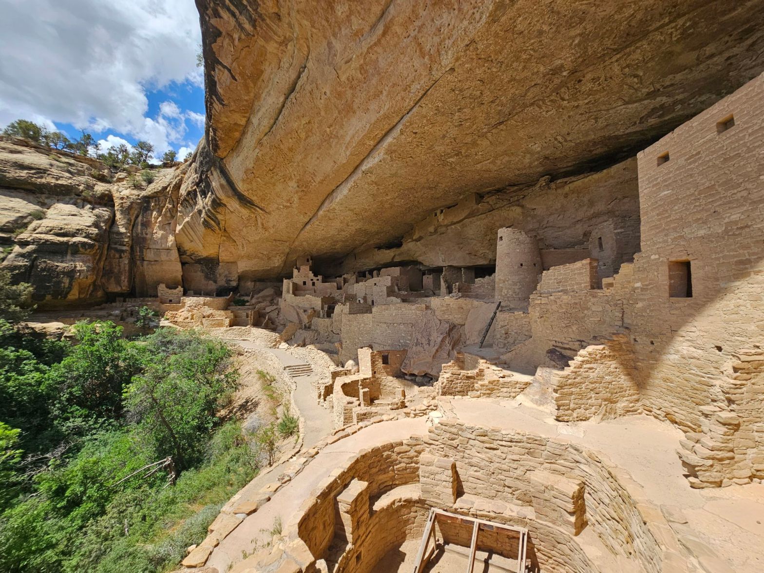
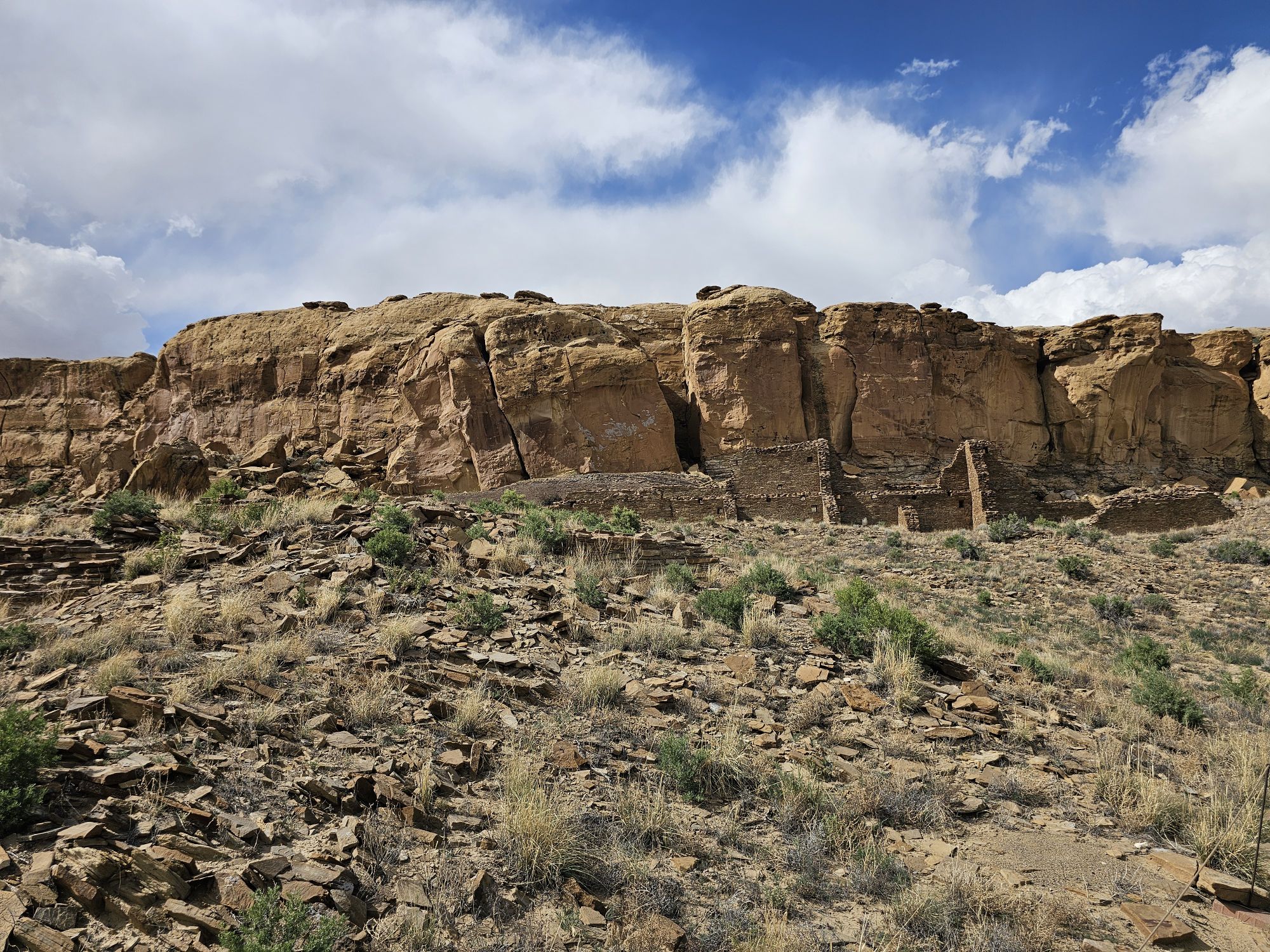
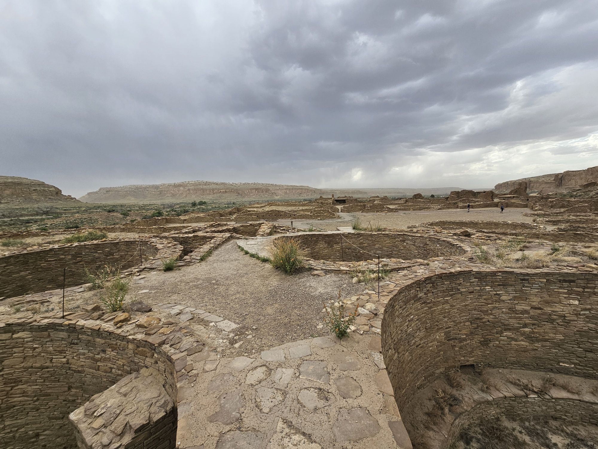
A view of the entire site. Taken by me.
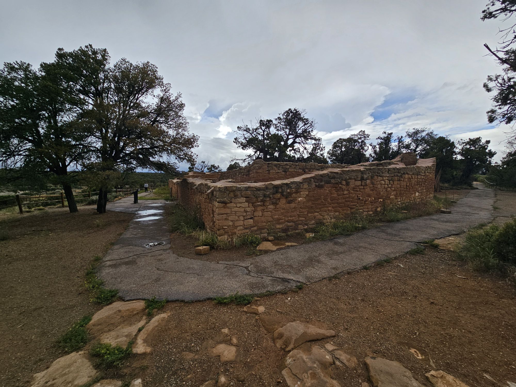
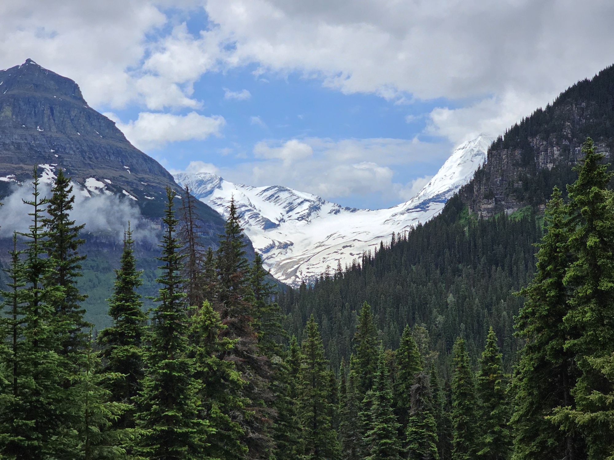
Part of the site, including the reconstructed Great Kiva, taken by me.
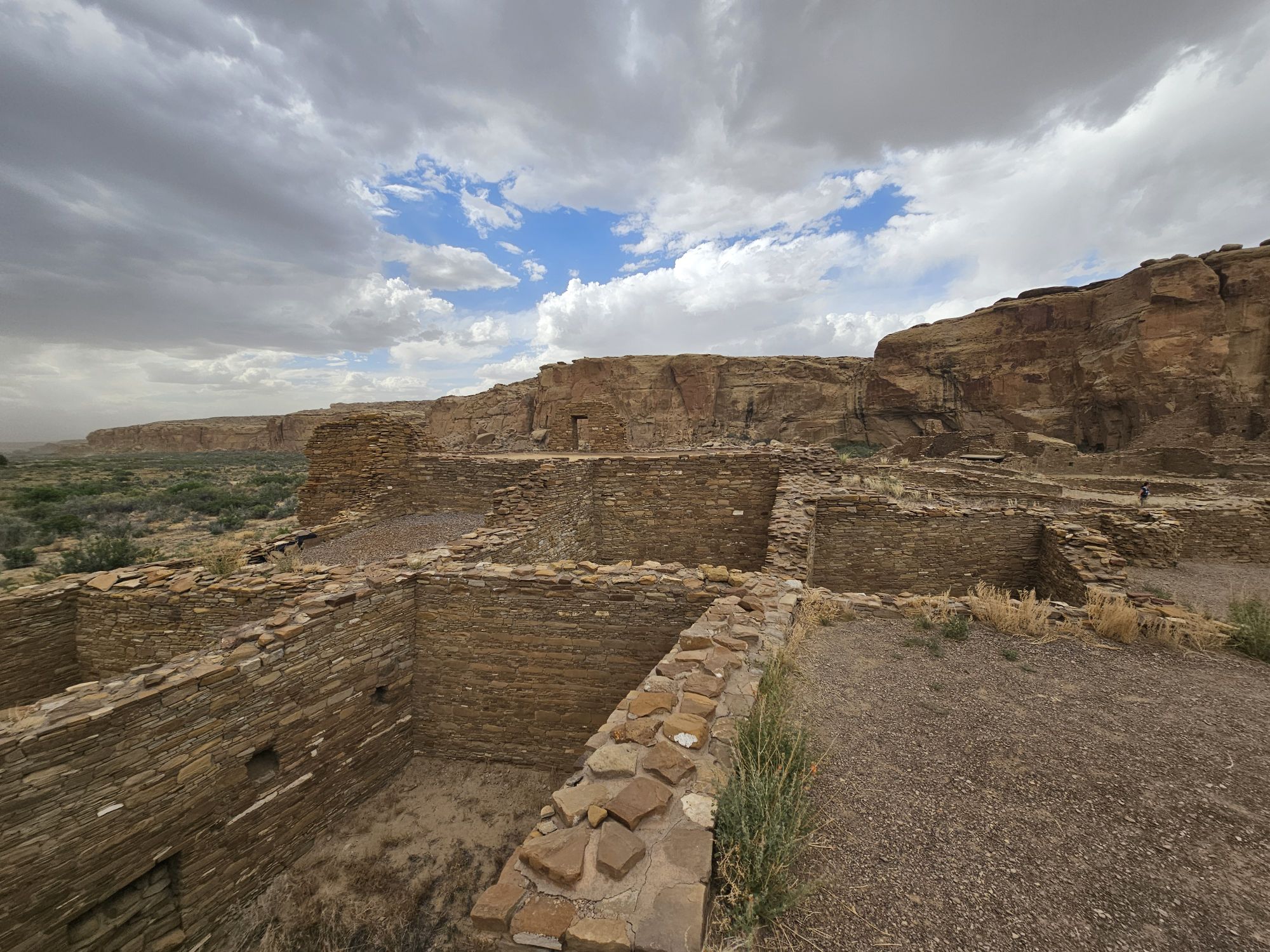
Another angle of more of the site, taken by me.
At this point, if you read my previous posts, you should know what this is. Taken by me.
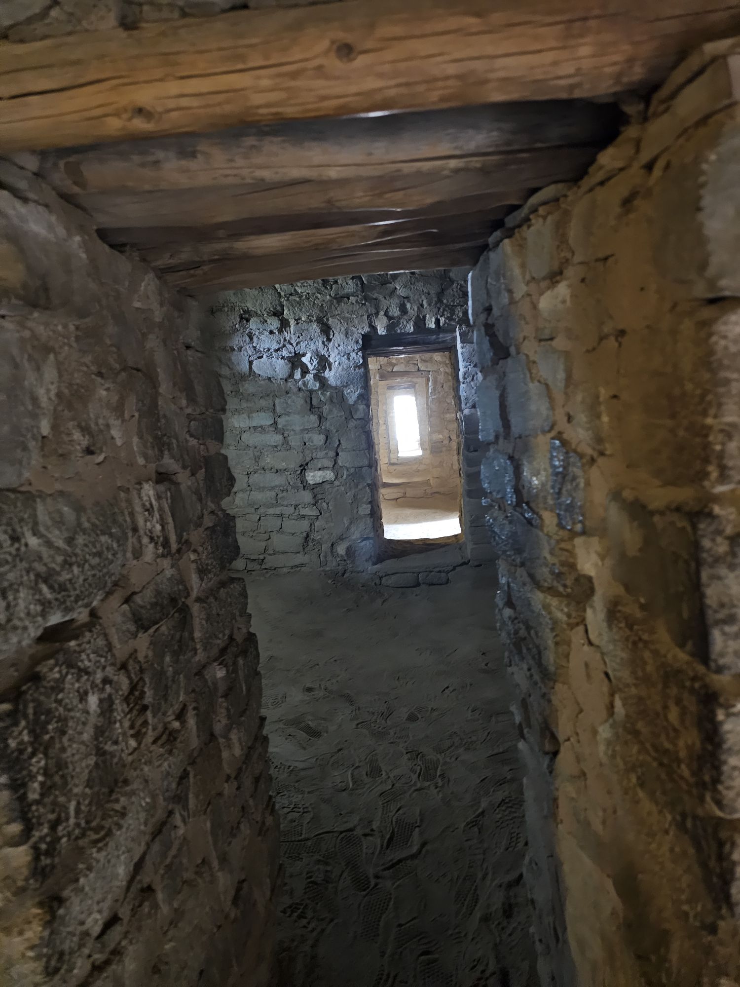
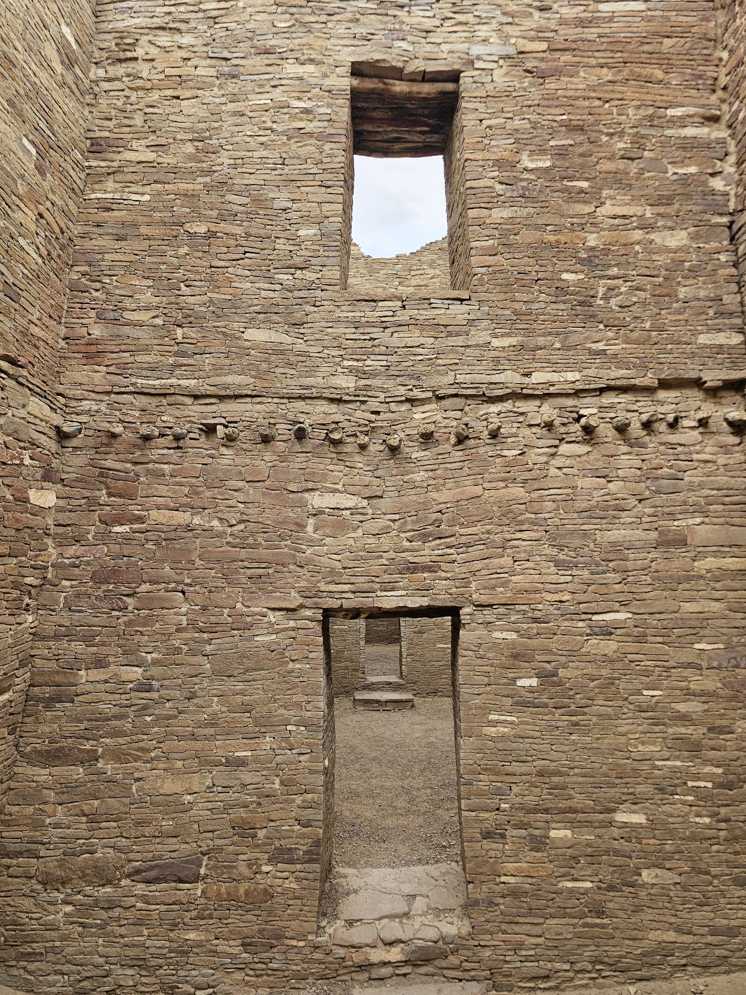
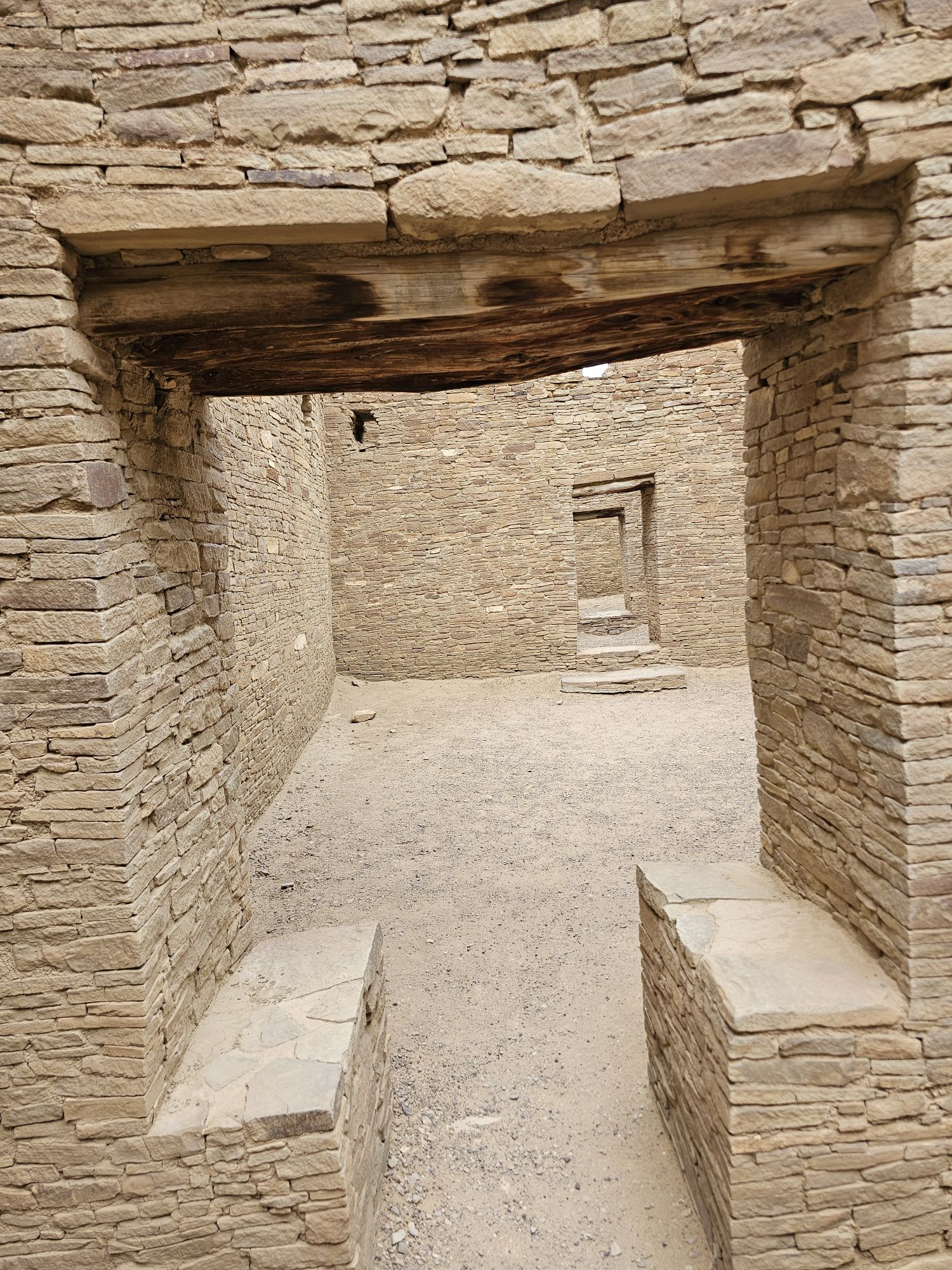
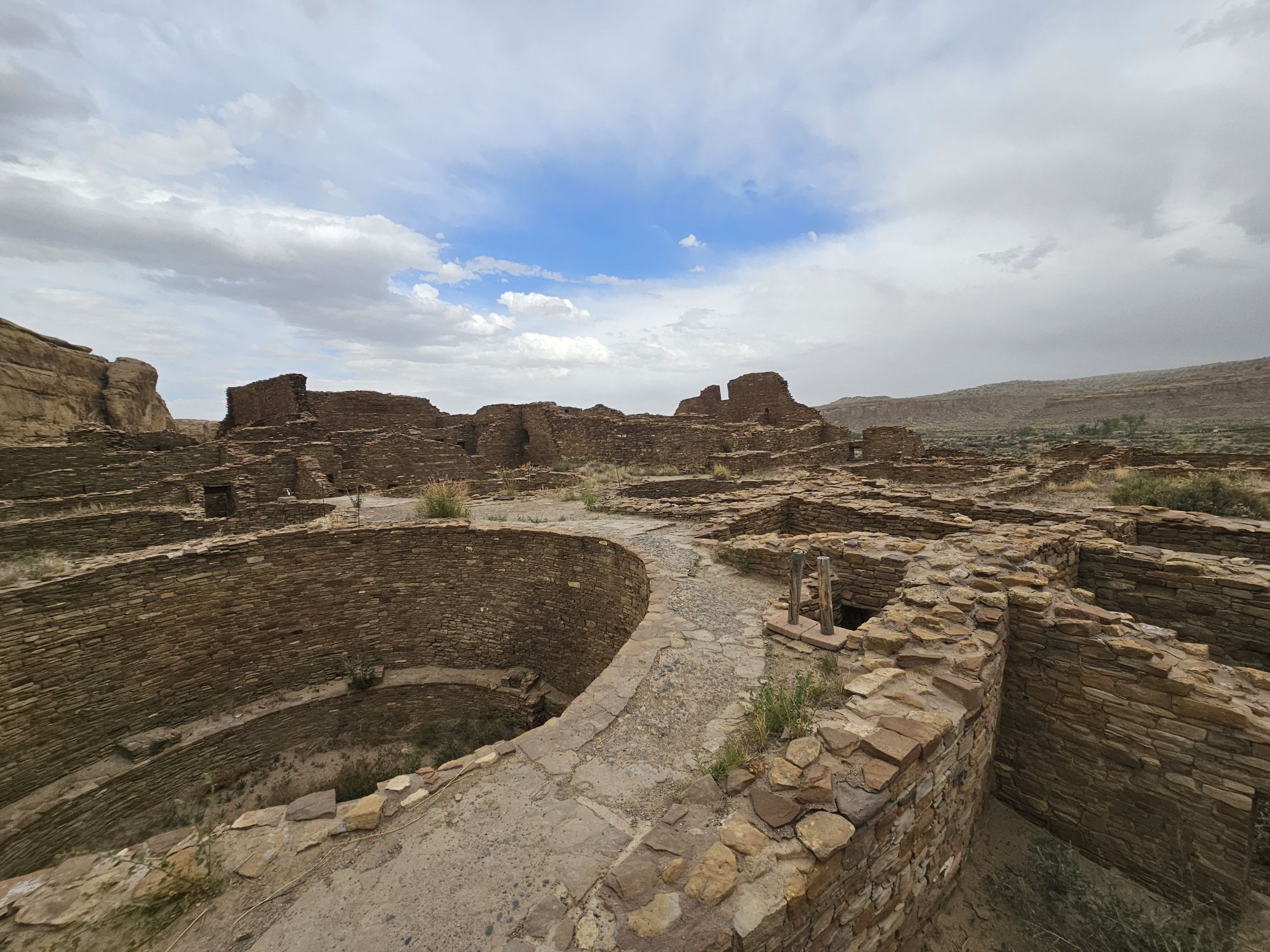
Inside the site. Taken by me.
Another are inside the site, taken by me. I continue to be surprised that visitors are allowed inside these ruins!
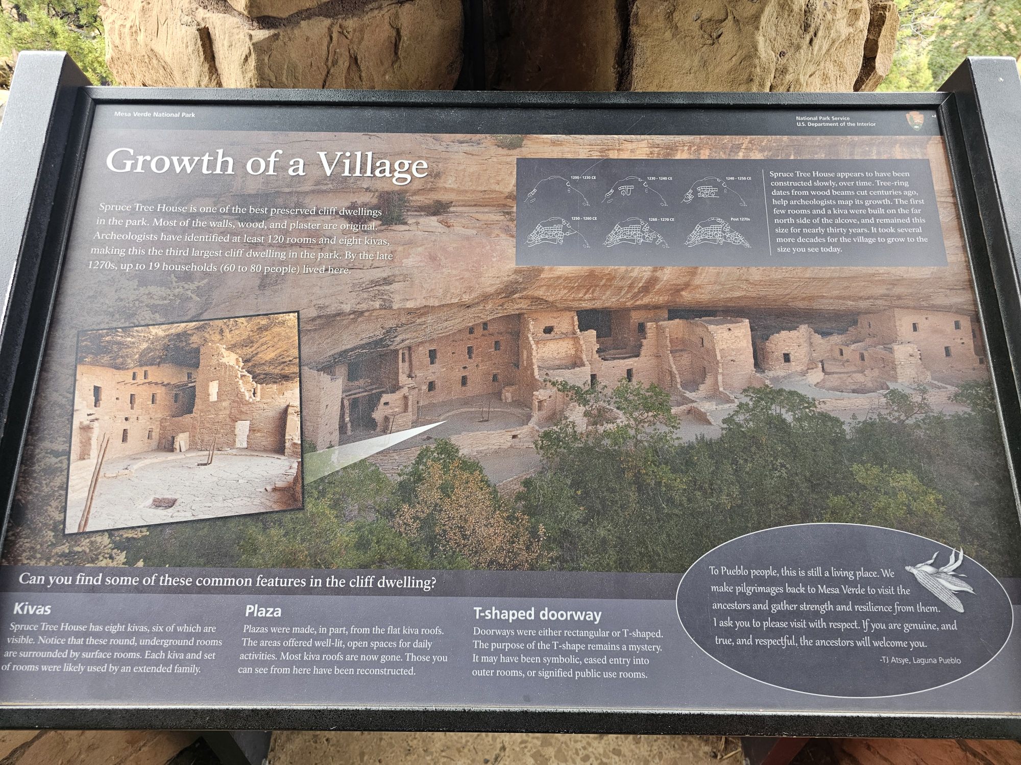
This site was built between 1000 and late the 1200s CE to support the Chacoan Culture in Chaco Canyon, only 50 miles away. However, Aztec may have become the primary center of importance as Chaco Canyon declined. The entire site itself is pretty small, not atypical for many of the “smaller” NPS units. The visitor center is standard: gift shop and interpretive museum. You will want to pick up your trail map at the visitor center and download the audio tour app to accompany you on the self guided tour of the site. You can pretty much wander through the entire site, the big rule being to stay off the walls. Most of the site is original, however there is a nicely reconstructed great kiva that allows visitors to enter and see what such a structure might have look like from the inside. This was the only reconstructed kiva I saw, and it was quite informative!
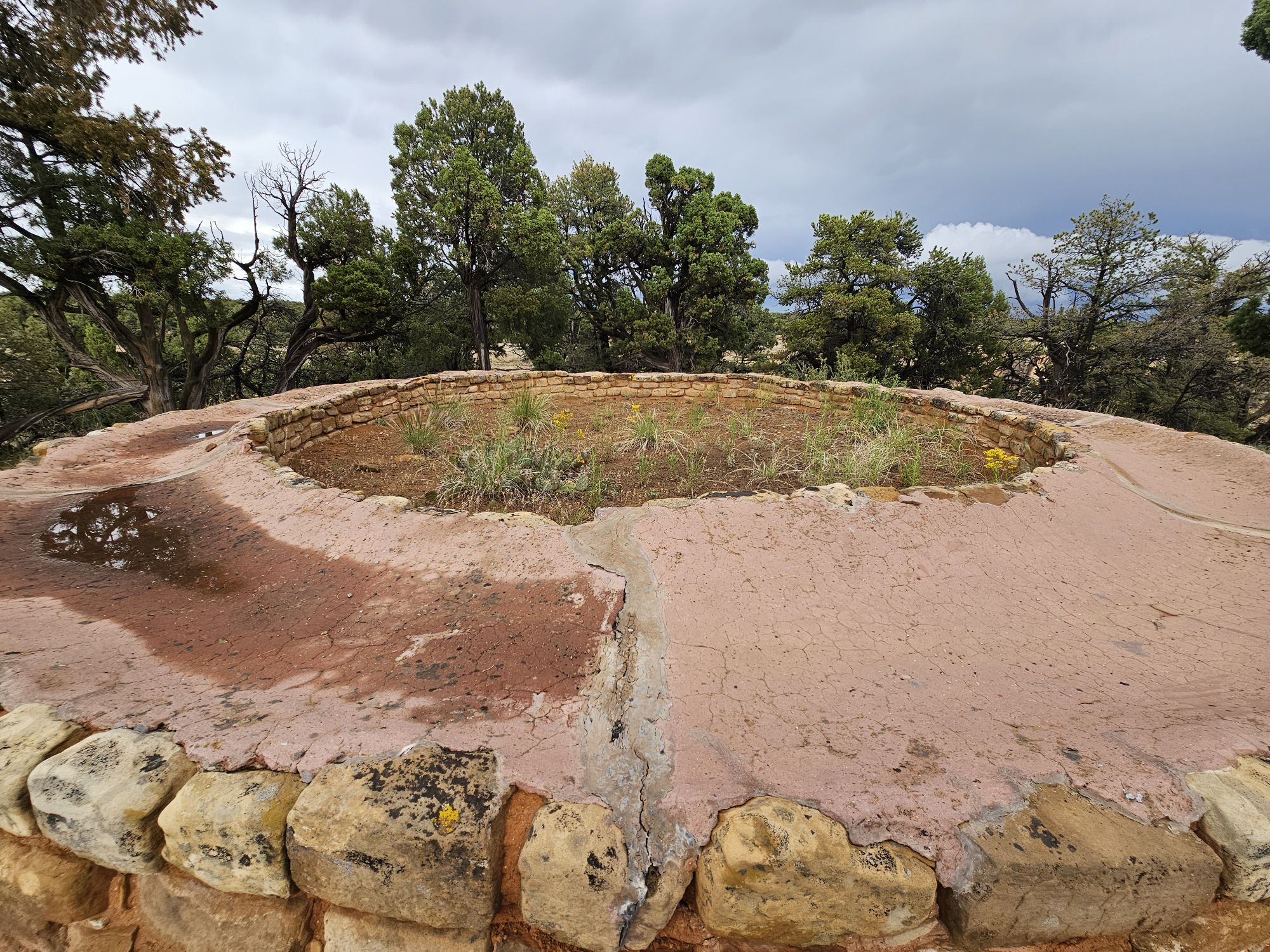
The Great Kiva from outside. This is a reconstruction. Taken by me.
A couple views in side the reconstructed Great Kiva. Taken by me. It was neat to see what they think the inside might have looked like!
Although Aztec Ruins National Monument is not nearly on par with what I had already seen on this trip, it was a worthwhile stop! You would not want to make an entire cross country trip to visit this site, but if you are visiting other sites in the area, or live near enough, you will want to spend an hour or two here learning about this site’s history!
Hey there Adventurers! Be sure to check out part 1 here!
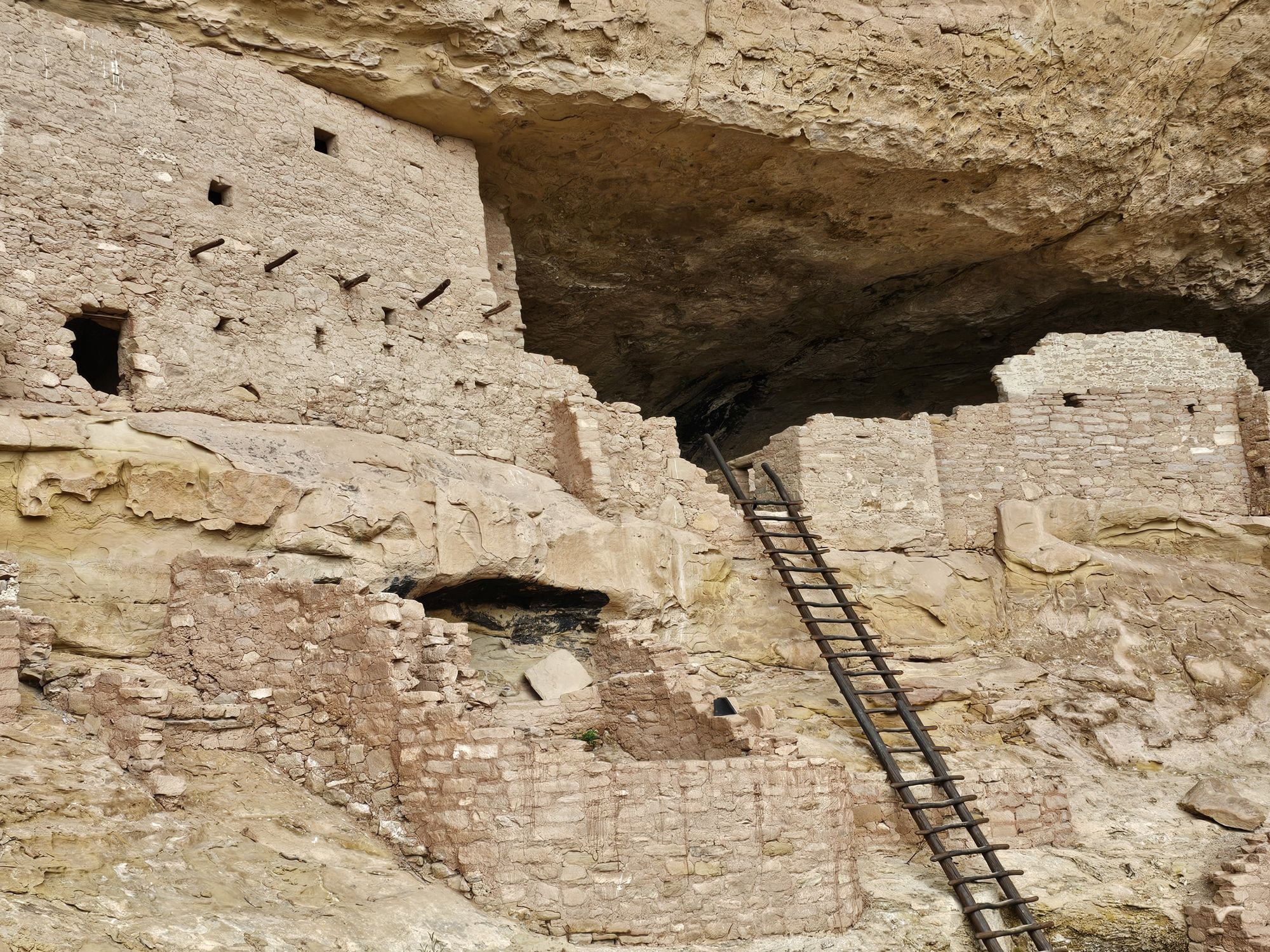
I awoke very early the next morning to be sure to get to my tour of the Square Tower House. This was the really hard one to snag. According to the Ranger, this tour is only once a day and it was small…10 people or so, and that’s all they take. It would soon become very apparent why those restrictions exist. I had stopped by the overlook the previous afternoon and was skeptical of how one got down to this dwelling and the answer to this is that it is treacherous! The tour begins with a very thorough safety talk, and a confirmation to the ranger that you are able to to undertake this tour. The ranger explained that any issues ends the tour for everyone and it is very difficult to get an incapacitated person back up to the road level. The hike begins with a ladder descent, followed by walking along the cliffs edge, with relatively new barriers to prevent falling, only to find yourself needing to descend quite a bit down further down the cliff using ladders, fashioned to replicate the ancient ones, and also the original handholds carved into the cliff. To make matters more complicated, there is an awkward transition from handholds to ladder steps, but that’s how you had to do it! The ranger explained that this was how the ancient Puebloans did it! One of the neat things our ranger guide shared was when they lead modern Puebloans down to the site and the elders do a ceremony, essentially asking the spirits for permission to enter the home. So neat!
Square Tower House from above. Taken by me.
The first descent down to Square Tower House. Taken by me.
This fence is fairly new we were told, and was only put there because people were frightened. Ha! Taken by me.
A view of the carved footholds to go between sections of the descent. We were told those are original to the time of the building of the dwellings. Taken by me.
And this is how you get from the footholds to the next ladder. Eek! Taken by me.
And at long last, at the bottom of the descent! Taken by me.
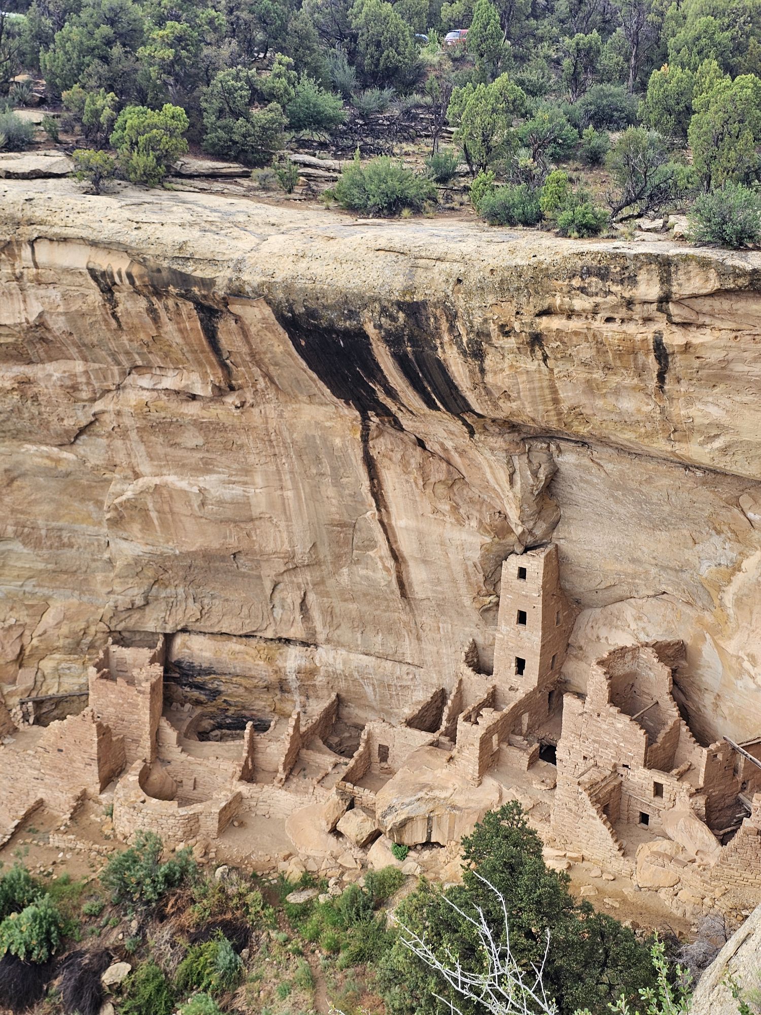
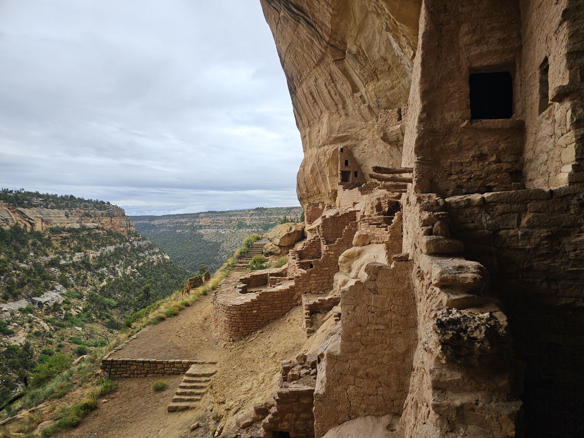
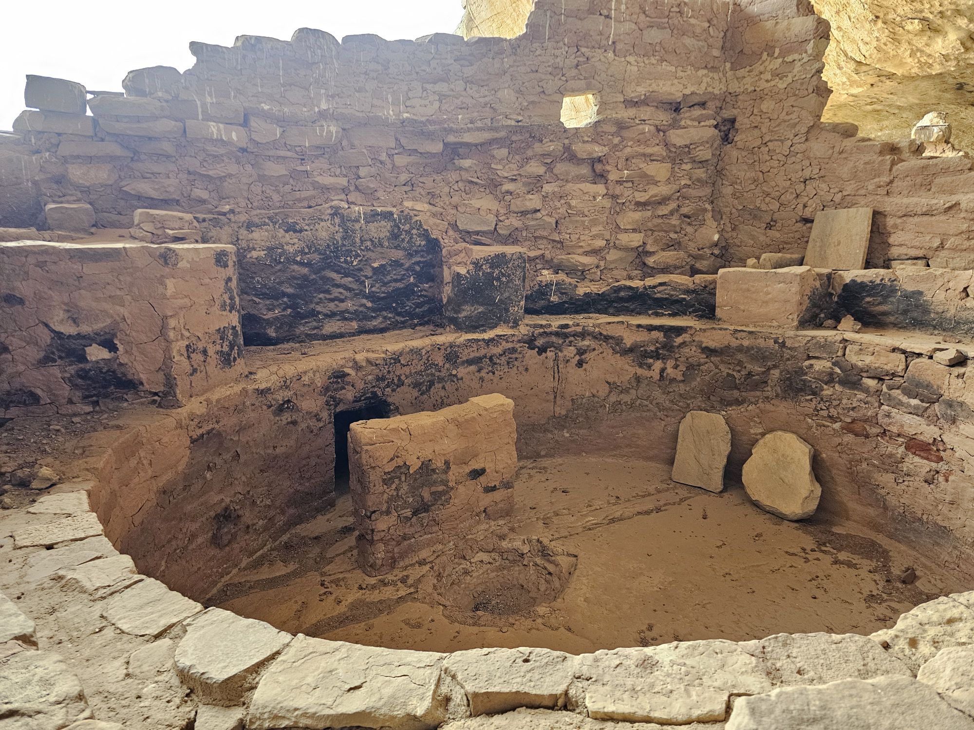
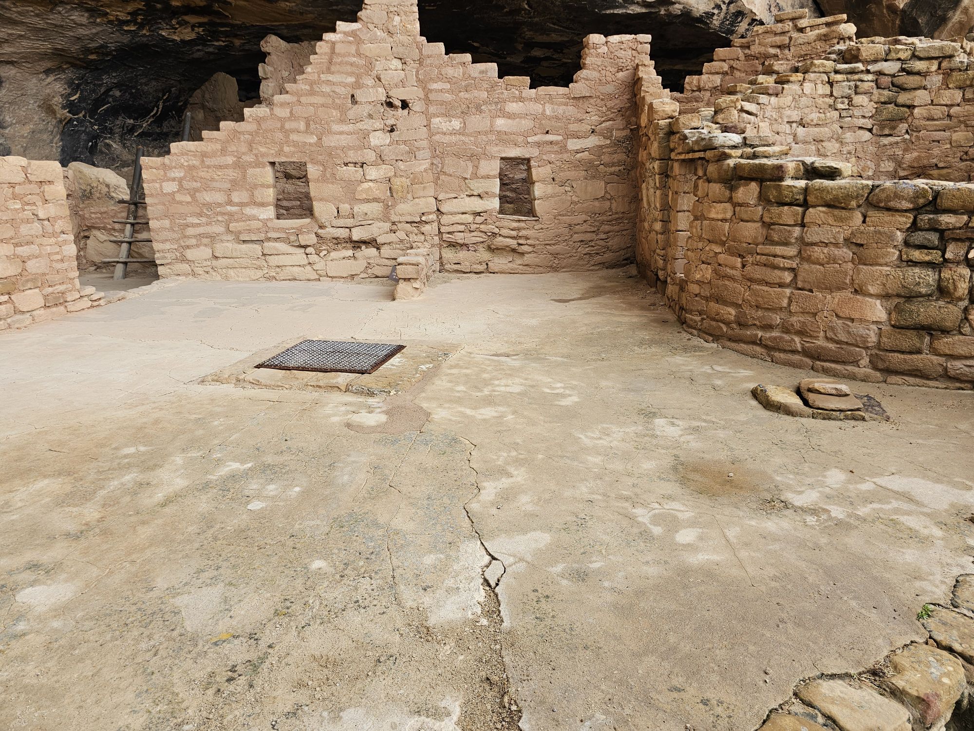
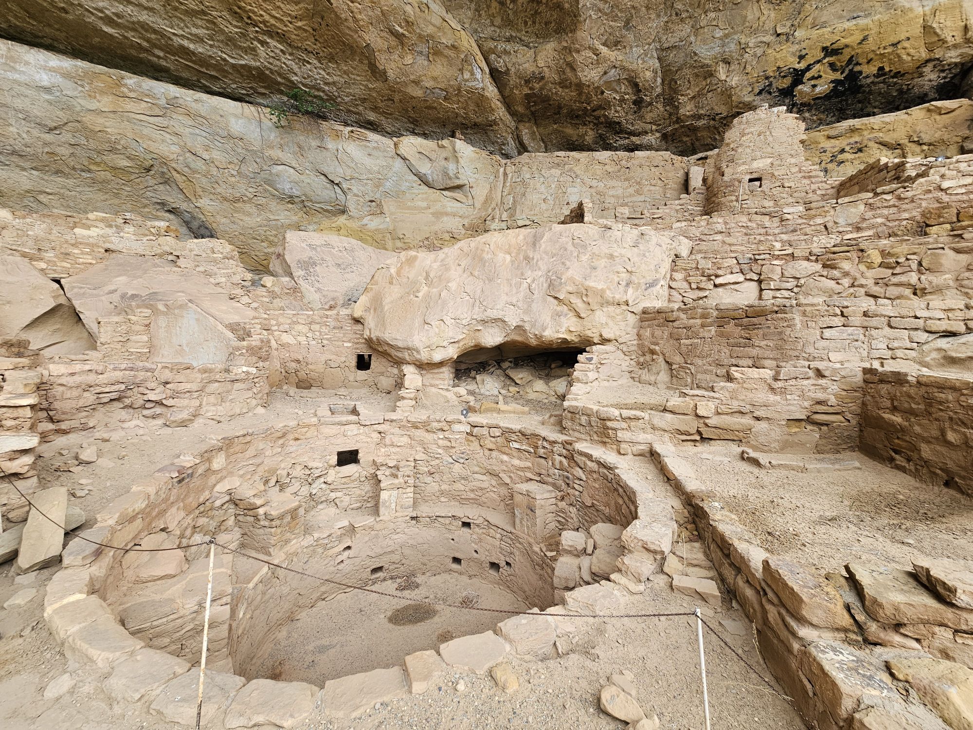
Square Tower House is smaller in terms of area that it covers, but contains the tallest structure in the park, a section that rises nearly 30 feet and 4 storeys tall! There are painted murals and petroglyphs found through out the site, and the site is 90 percent original! There is an intact original kiva roof, and we also found pottery that was then dug back into the ground. After about an hour and a half of touring the site and learning about it, we were back topside and I was off to the next adventure! Next up was the Balcony House Tour.
Square Tower House. It is important to not that while these ruins are mostly original, much of the original structure is no longer present. There would have been roofs and other ladders and ledges with ladders to allow access throughout the levels of the entire structure. Taken by me.
Some of the pottery we found on the grounds of the Square Tower House. The ranger displayed it for us, then dug some small holes and deposited the pieces back into the earth. Note the distinctive black and white patterns. Taken by me.
If I remember correctly, this is one of the only, if not ONLY remaining intact original kiva roof in the park. Taken by me.
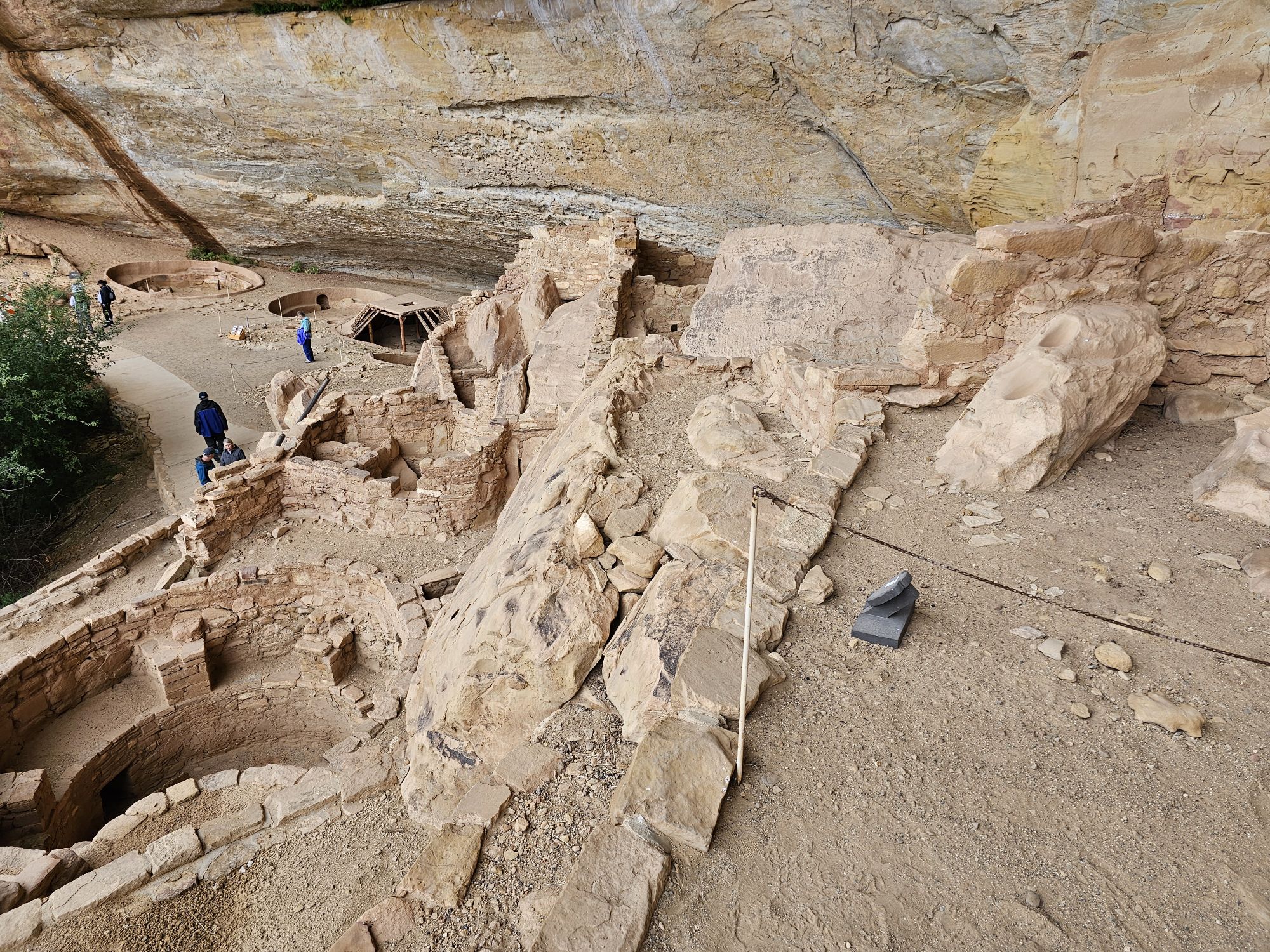
I should point of that the park and Rec.gov make it clear that its difficult to do all three of the Chapin Mesa tours in one day. I did not find that to be remotely true at all and even had time to do stops at other mesa top sites between tours. The only thing that I goofed, and I think there was a reason I had to do it, but cannot remember anymore, was the order of the tours. You would want to go from Square Tower House (which has to be the first one) to Cliff Palace, and then to Balcony house. But I arranged for Balcony House to be first, then Cliff Palace. Due to the road being a one way loop this meant I had to pass by Cliff palace to get to Balcony house, then I had to essentially do the loop again to access Cliff palace and then get out of the loop. Even with that, it was no problem getting all three of these tours in!
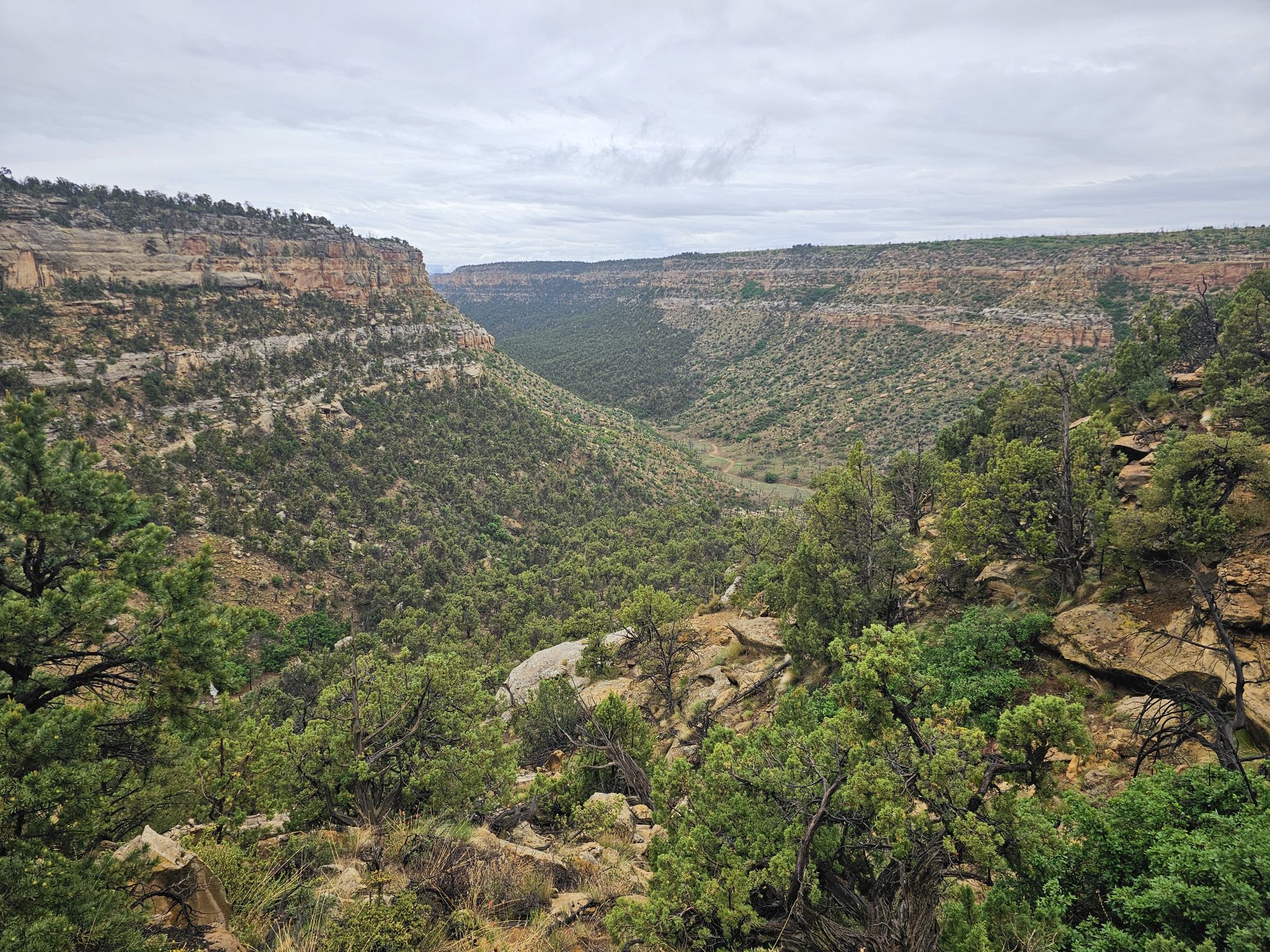
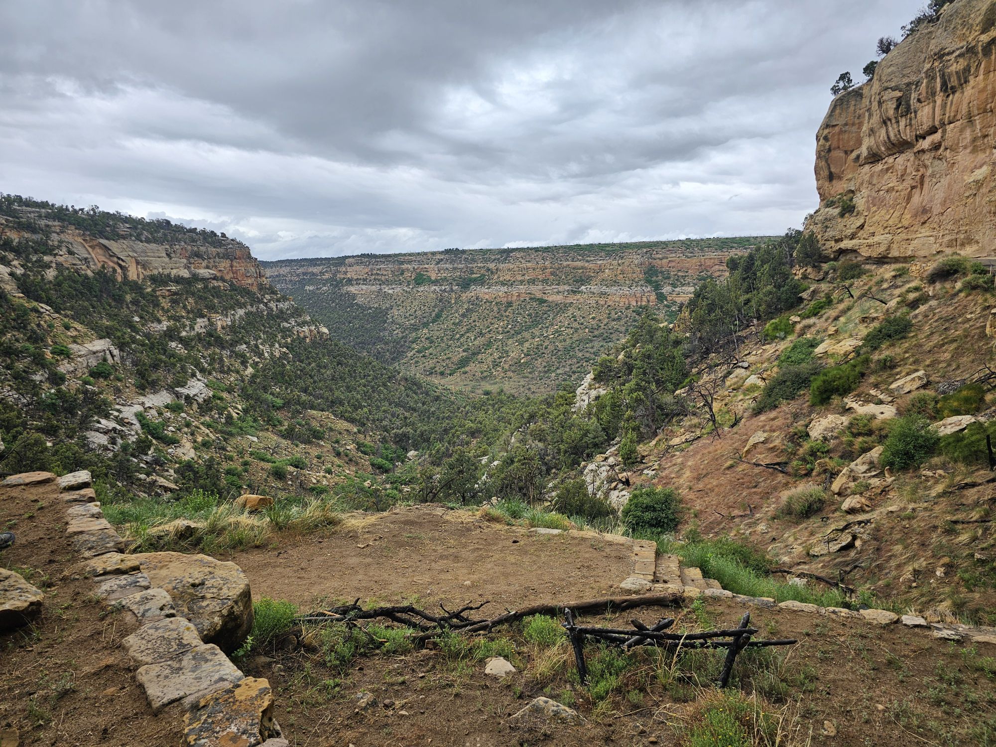
After departing Square tower house I headed down the one way Mesa Top Loop. I stopped at some pit house excavations sites along the way as well as viewpoints for other cliff dwellings. I also made a stop for some delicious Ute Indian fry bread! There is an interesting oddity along the Cliff Palace loop road. Between Cliff Palace and Balcony House the park road actually abuts Ute land and and there is a small area where native Utes have set up a fry bread stand and a couple art/trinket shops. If you are really interested, there is complicated history between the Utes and the NPS that you can research. The Utes also have many cliff dwelling ruins on their land and it possible to book tours with Ute outfitters. In any event this road is an amazing tour of the history of the land. There are numerous mesa top sites to explore and numerous cliff dwellings to view and read about along the way!
Pardon the 3 minutes or so. This was a 6 minute video I took along the Cliff Palace Loop Road. You should watch!
The info card for the Oak Tree House. See picture below.
The Oak Tree House. Taken by me from the overlook on the Cliff Palace Loop road.
This a view of the Sun Temple from an overlook opposite it on the Cliff Palace Loop road. Taken by me.
The Balcony House is notable for several things. The park service calls this tour the most adventurous one in the park. Of course, the house is totally unseen from above. There is a short hike to descend down the cliff. Then there is a pretty serious 30 plus foot ladder to get up into the structure, and then there is a pretty small tunnel to climb through. Once you have done those, then its exploration time! There are plenty of rooms and kivas to explore, watch your step (!), and other small tunnels to traverse through the dwelling. You will find spectacular views out of the dwelling. There are spots of the original paint, and more wall paintings and petrogylphs. Upon the conclusion of the the tour, getting back up requires more 20 foot ladders to access the path to the parking lot. This was a really neat experience!
After a short downhill hike you find this ladder to take you up to the Balcony House. Taken by me.
Here is the above view of that same ladder. Taken by me.
An example of how precise the ancient people’s construction was! Taken by me.
From here you can really see how protected these sites are from the elements! Taken by me.
This shows how big the kivas were in this house. Taken by me.
I took this picture to show some of the original plaster, paint, and designs on the wall here. It’s amazing how this has survived the centuries!
Here is my video of getting into The Balcony House.
And this is how you get out!
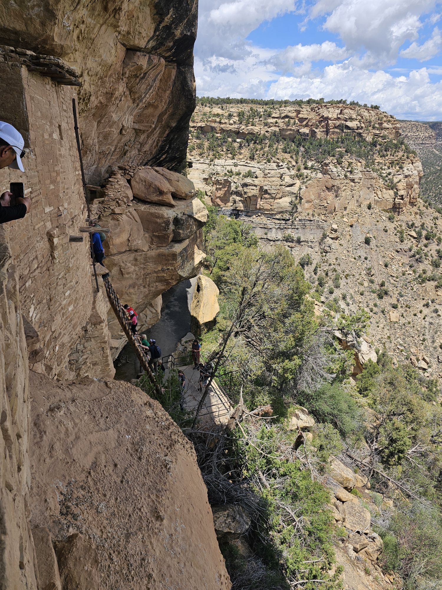
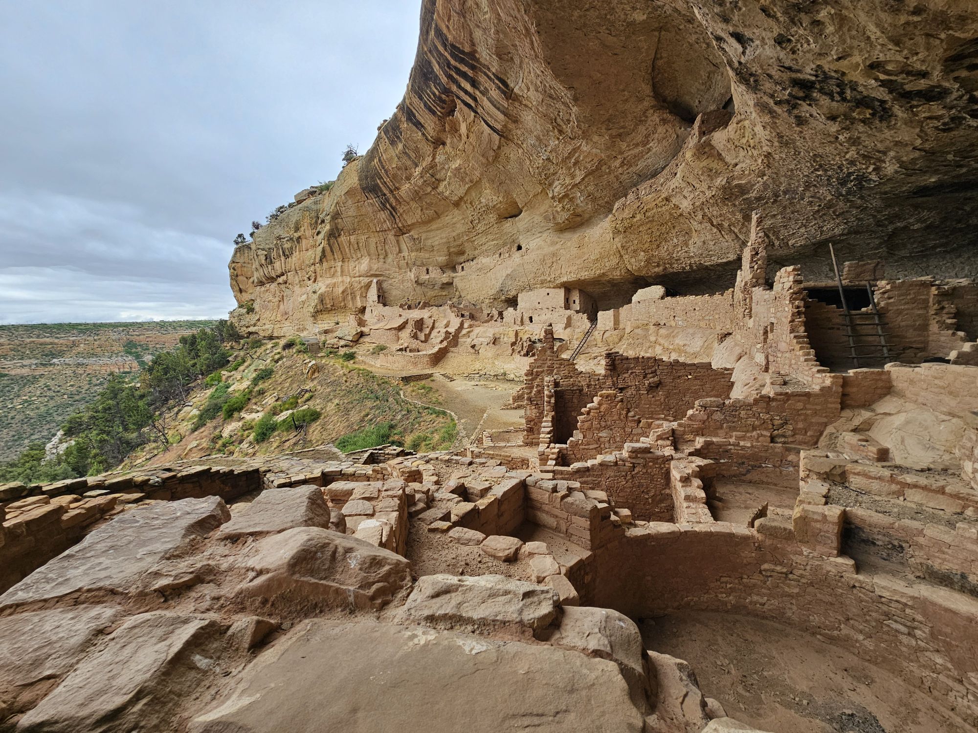
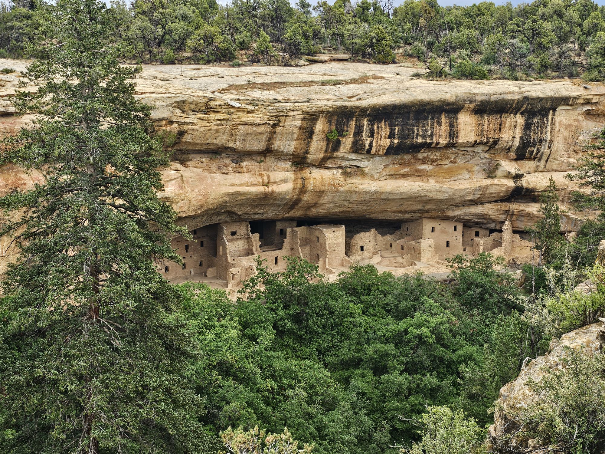
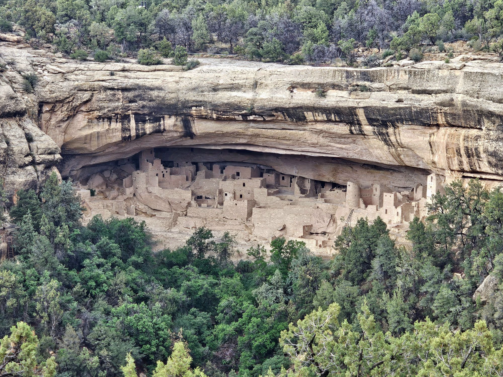
It was time now to head to Cliff Palace. This site is the largest known cliff dwelling in all of North America, containing over 150 rooms, 23 kivas, and housed approximately 100 people. Like all of the other cliff dwellings in the park, this one dates back to the 1200-1300s and was abandoned, like the rest not long afterward. Many National Parks have their “main draw” and this is it for Mesa Verde. There are many tours each day during season, and they are fairly large. Again, you have to secure a reservation ahead of time. Getting down to the dwelling is pretty pedestrian but does require some downhill hiking. Getting back out however is much more difficult and requires some ladders and hand holds to ascend up the cliffs topside.
Cliff Palace selfie!
Since the tours are timed, there is a (very) brief opportunity to snag a people free picture if you position yourself correctly! Taken by me.
View across the Cliff Palace from opposite side. Taken by me.
This was my last first hand experience with the cliff dwellings. To review, there are over 6 HUNDRED of these sites in Mesa Verde. They were all built in the 12-1300s and were abandoned for unknown reasons pretty soon after they were built. However, the cliff dwellings are only a small part of the history of the ancestral Puebloans and this land! Especially on the Chapin Mesa, you will come across MANY mesa top excavation sites. These pit houses date back much further than the cliff dwellings, many as far back as 600 CE. The interesting part about these sites is that they were often reused, some times many times over, as if the people had a recorded history of the sites. The sites were even buried between habitations. Even during the times of the cliff houses, people were still living on the mesa tops. In fact, if I recall correctly it is not even entirely known whether people actually “lived” in the cliff dwellings or not. The national park service is aware of thousands of these sites, but most of them have been left filled in and covered as that actually protects the sites. Very interesting!
Apologies for the angled picture, but this gives an example of what the mesa top homes looked like 1400 years ago!
One of the mesa top excavation sites. Most, if not all of these, are actually covered like this and protected. Taken by me.
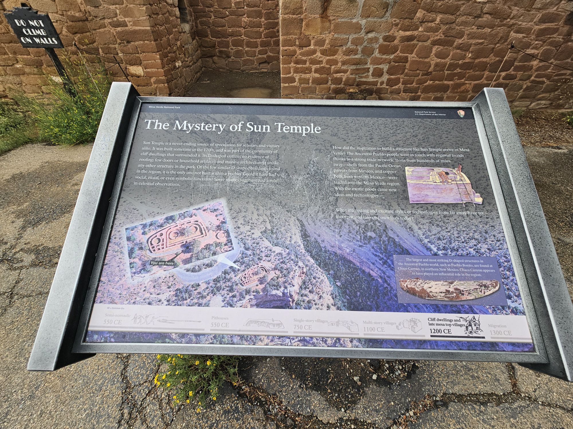
In addition to the pit houses, the unique Sun Temple sits atop the Mesa Top Loop directly across from the Cliff Palace. This site is vastly different from any other site in the park, and indeed the entire Puebloan community. It was constructed in a D shape, and perhaps never finished. It has no evidence of any roof, or habitation, is aligned with the cardinal directions, and as the name suggests, may have been an observatory or involved in tracking the seasons.
The Sun Tempe from a distance. Taken by me.
The Far View area, where the lodge is, contains some really neat ruins as well. This area was one of the most heavily populated areas in the mesa between 900 and 1300 CE. Hundreds lived here, in dozens of villages in the small area. Interestingly, people continued living here while the cliff dwellings were occupied. Of I stopped in and hiked around. The weather quickly turned poor and I got caught in a hailstorm and had to run back to my vehicle and hunker down for a bit! Once the hail subsided I finished exploring this interesting area. There are many structure ruins and even whats left of an ancient reservoir, although there seems to be some disagreement on the actual purpose of the reservoir, including if it even WAS a reservoir at all. Some research lends support that the site would not have functioned well, if at all, as a water reservoir and it might have been used for rituals.
A large ruin at the Far View site, taken by me.
This picture was taken not long after the one above and you can see how the sky changed so quickly. It began hailing soon after and I had to run for cover! Taken by me.
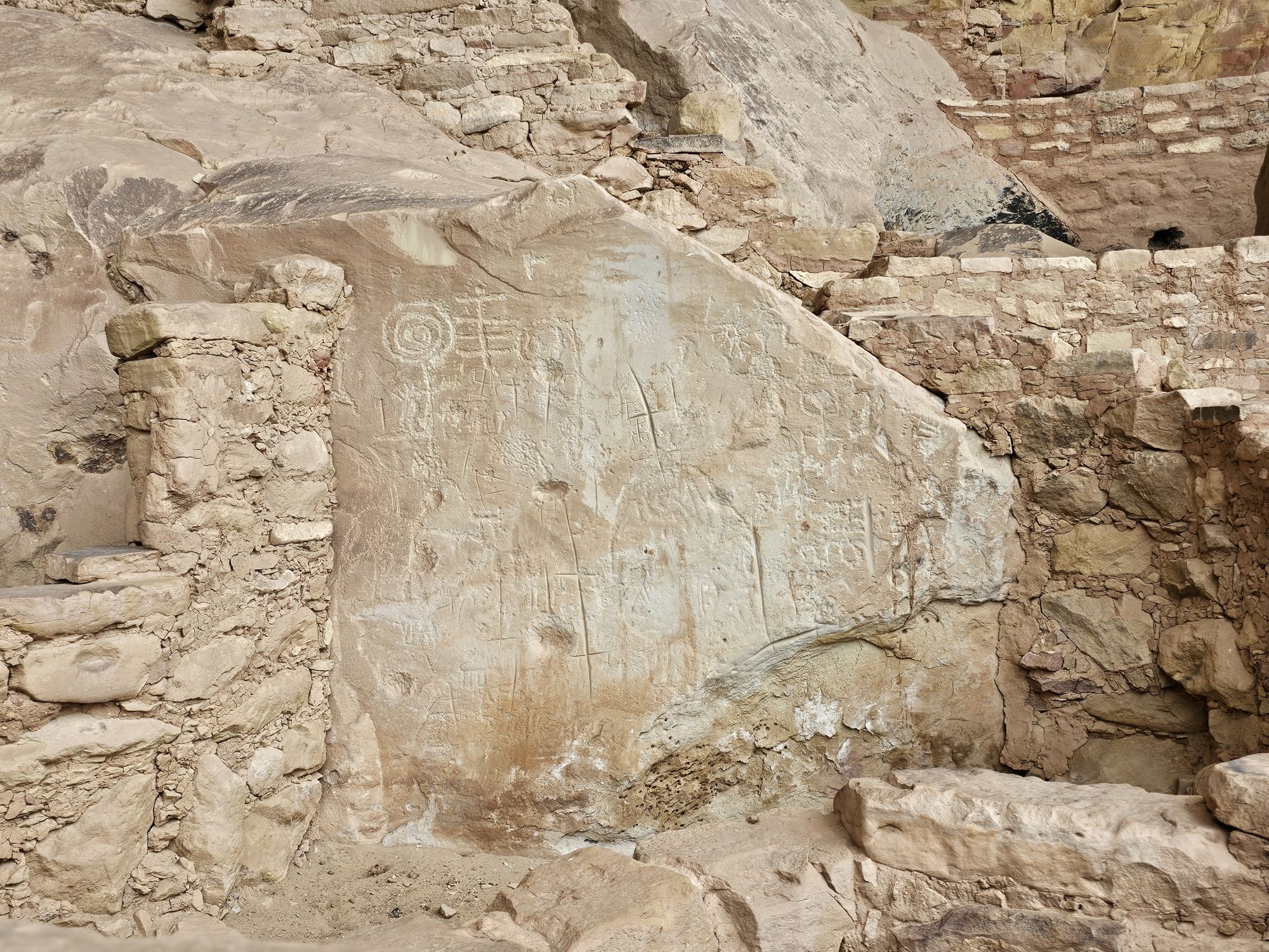
Another part of the Far View site. This carved stone was literally the only carved stone I saw in the entire park. Taken by me.
Reservoir or ritual site? You decide! Taken by me.
As you get closer to the park entrance you will find the highest point of the park, Park Point Overlook, at about 8500 feet elevation. My last afternoon I found myself up there, but the weather was a fright. The temps were upper 30s and rainy which turned into ice. There is an old fire tower up there that seemed abandoned to me, but may still be used at times. I did return the next day for better weather. Between this area and the park entrance you will find the park campground. There are many trails in this area if you are interested (I wasn’t). I stopped at the visitor center once more to get a morning view and that finished national park 43!
A view from Park Point. Taken by me. You can easily see why this was named ‘green table”!
A view to another direction from Park Point. Taken by me.
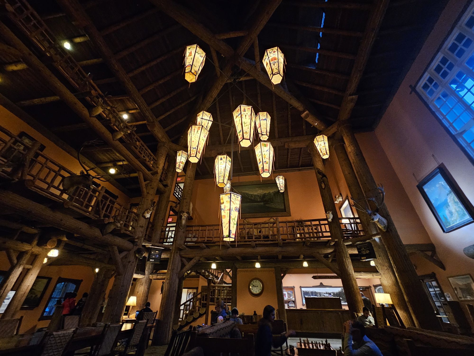
The Mesa Verde Visitor Center is a really interesting one! Taken by me.
Overall Impressions: Mesa Verde National Park is amazing, and high up on my list of favorite National Parks, maybe top 3 or 4! You should definitely go, it’s important. Do it!
National Park Number: 43/63 NPS Unit Count: 81/430 US Unesco World Heritage Sites 15/24
Hey there Adventurers! June 2025 saw me finish the Colorado national parks! If you read the previous entry, this trip involved many stops in New Mexico for #USBarkRangers purposes, but the trip focus was Mesa Verde. A quick aside, this park is more dog friendly that I thought. They are allowed on all trails in Wetherill mesa save for the trails to the two big houses and are fine at all the overlooks and paved areas in Chapin Mesa, save for ruins sites. There is no Bark Ranger here though. To my surprise I found Mesa Verde to be one of my favorite national parks! The scope of this park, even in the short 2 plus days I was there, is both intimidating and impressive. As such I have decided to make this a 2 part entry. This part is more an intro of the history of the area, and my first day experience.
Mesa Verde is not exactly remote, but it’s not easily accessible. If you are flying, the nearest airport that handles large commercial traffic is a few hours away, either Albuquerque or Montrose, CO. The park is situated in the 4 Corners region of the Southwest, in the southwest corner of Colorado. There isn’t a whole lot around the area, however, the history here is awesome. In addition to stunning views and the ancient history, Mesa Verde was the site that pretty much shaped modern archaeology in the United States, evolving from looting and profiteering, to preservation and study. There are nearly 5,000 archaeological sites in this national park, encompassing the famous cliff dwellings as well as excavated and un-excavated pit houses and ruins on the mesa tops.
Taken in a friendly photo exchange.
Created in 1906, Mesa Verde is one of the first National Parks established in the United States, number 7, and the first created to protect manmade structures. If you are totally unfamiliar with Mesa Verde, the easy description is: it’s the national park with the old adobo houses built into the cliffs. A bastardization, but that’s the gist of it. Most of the cliff dwellings are only for viewing from the opposite side of a canyon, but there are a handful that can be experienced on a ranger led tour. These have to be reserved ahead of time and they go quickly, especially one of them. It should be noted that this park is high desert (up to 8500 feet elevation) and winter lasts longer than you would expect for the southwest desert. The tours are not available until later in the spring. Luckily I had secured reservations to all four dwellings available last year (it seems that at least one of them rotates yearly).
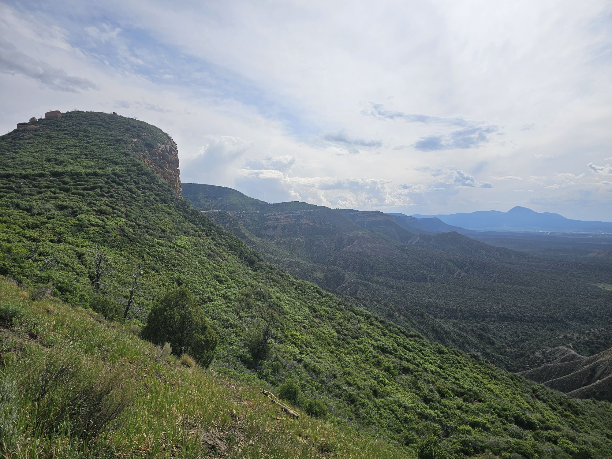
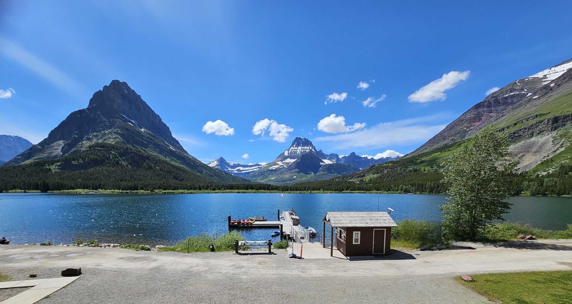
Now a little geography lesson is needed. Mesa Verde is literally the “green table.” This national park is a mesa, a large area that is flat, higher that the surrounding land, and has steep sides. They are formed by erosion, are mostly found in the SW United States, and usually have spiritual importance to the native communities. Mesa Verde is actually slanted as bit which makes it not a true mesa, but the southern slant actually led to the creation of the alcoves that house the cliff dwellings. In addition, there are many canyons here, so the park is a cumulation of many mesas (technically cuestas) between many canyons. The two main areas of the park are the Wetherill Mesa and the Chapin Mesa. The Chapin Mesa is the main area that tourists will visit. Wetherill is a lesser visited section of the park. It is only accessible seasonally, and then only certain days of the week with limited hours. Wetherill and Chapin are connected by road at an area called Far View, which is also the location of the park lodge I stayed in. Going straight takes you to Chapin Mesa, and making 90 degree right turn takes you to Wetherill Mesa.
I believe this canyon is called Rock Canyon, and Wetherill Mesa continues on the left side of the photo, with another mesa leading off on the right side. Taken by me.
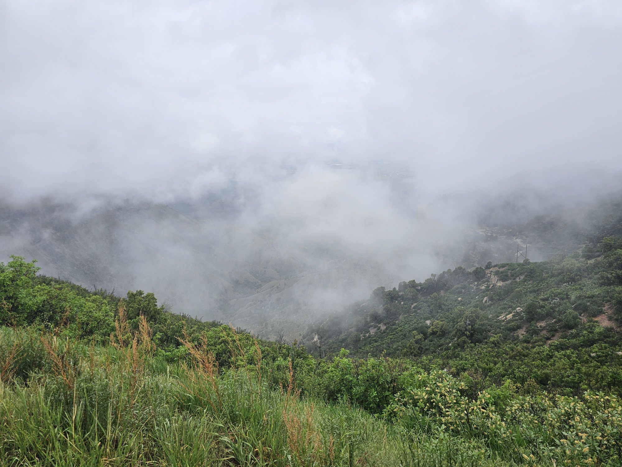
The Wetherill Mesa is considered the quieter side of Mesa Verde and for good reason. This area of the park is only open for 4 months of the year and then only 5 days a week, closed on Tuesday and Wednesdays. The area is only open from 8:30 to 4. And by 4, that means you must be out by 4. They only allow visitors in until 2 PM. The day I visited I found this side of the park to have a certain beauty that the other side did not. It was foggy, and there were beautiful white wildflowers all over the cliffs and canyons. The drive in is very scenic, but there are not many sites here. Two or the notable exceptions are the Long House and the Step House found at the end of the road. There are no services in this section of the park other than a restroom and an open air ranger station. I understand that a wildfire took the visitor center here a while back. I had tickets for the Long House tour so I followed the paved trail down to the meet up spot and joined the tour there.
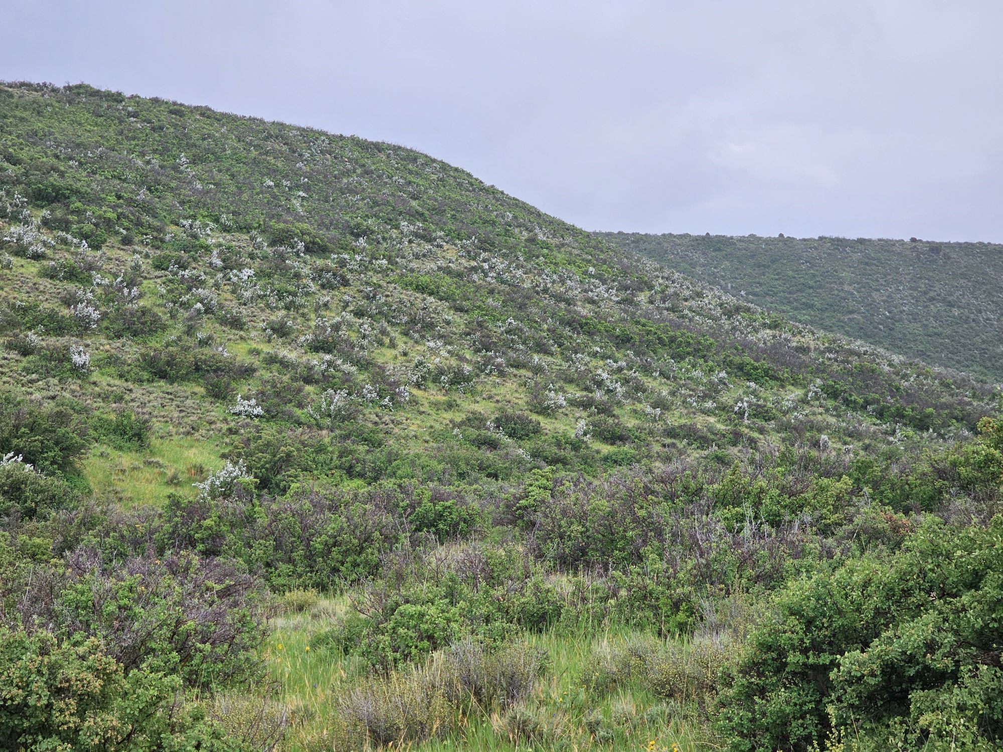
As I came down the road on Wetherill Mesa I was treated to a lot of view like this…..
…and this. These two pictures are not particularly noteworthy or interesting, other than to highlight that this section of the park is very green with beautiful wildflowers, and definitely doest not give out a desert vibe at all!
From the tour meet up area you cannot see the cliff house at all. It was cool and rainy, with temps maybe in the mid 50s. It had been raining pretty good about an hour before the tour but it started to abate at tour time. Remember the elevation here is pretty high, so even being June, the weather is a consideration! Anyway, I joined the tour and we began the descent down the cliff. From the parking lot the trail is about 2.2 miles round trip. The distance from the tour starting location to the house is only a tenth or two of a mile, but with 250 foot descent, some of which is exposed and on cliffs edge. It is not long before the Long House opens up before your eyes!
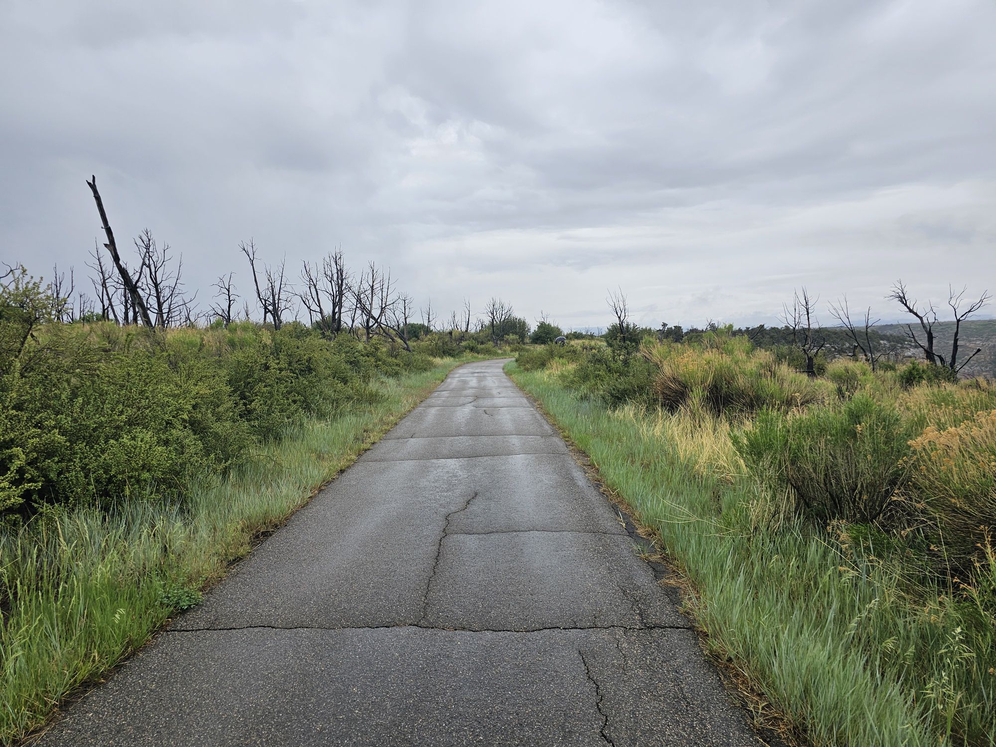
This is the path that leads to the Long House trail. Once again, notice the green. Also, there are extensive wildfire scars throughout the mesa top here. At the time I took this photo I was unaware that there is a a cliff dwelling somewhere under this area! Taken by me.
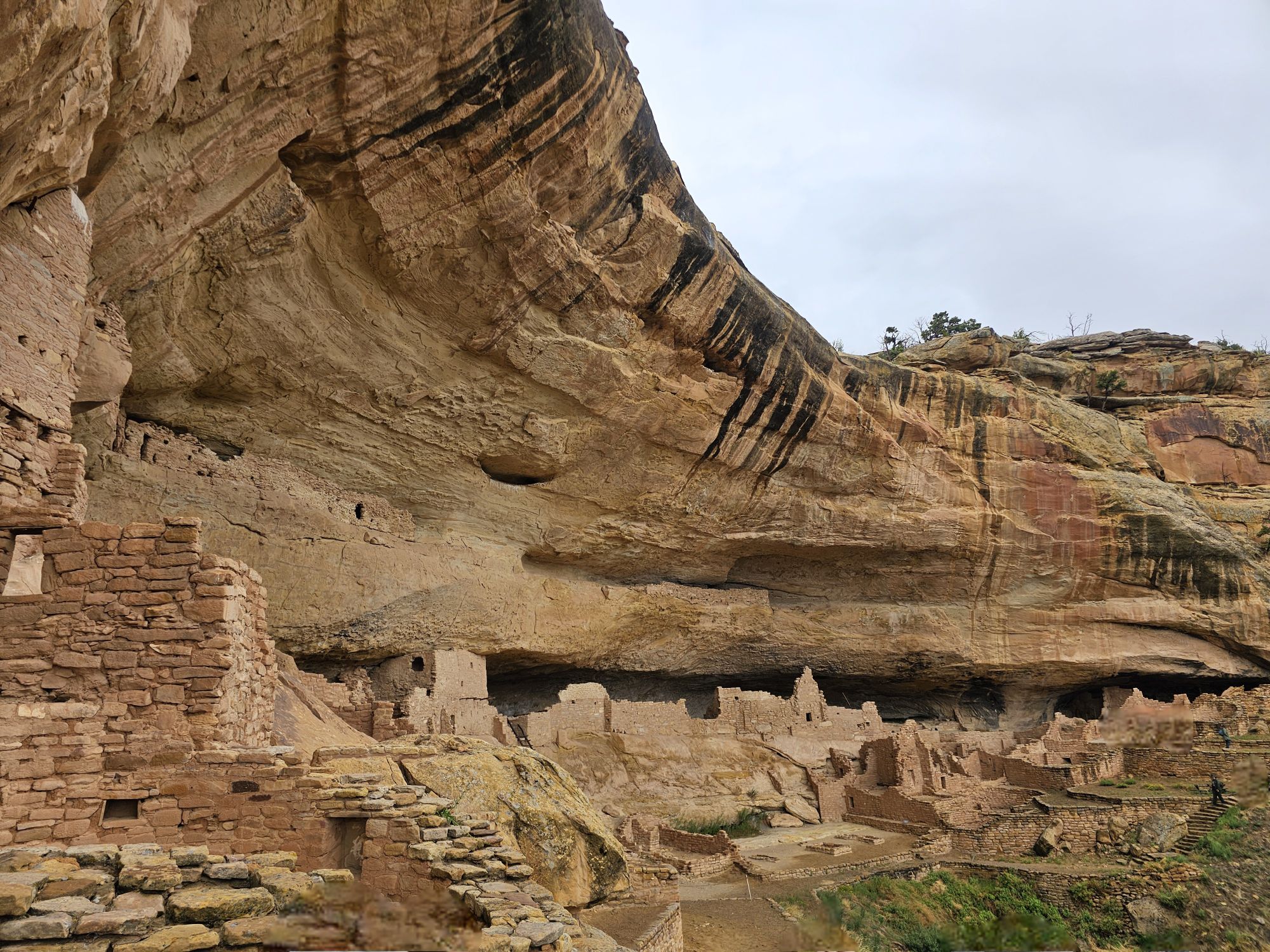
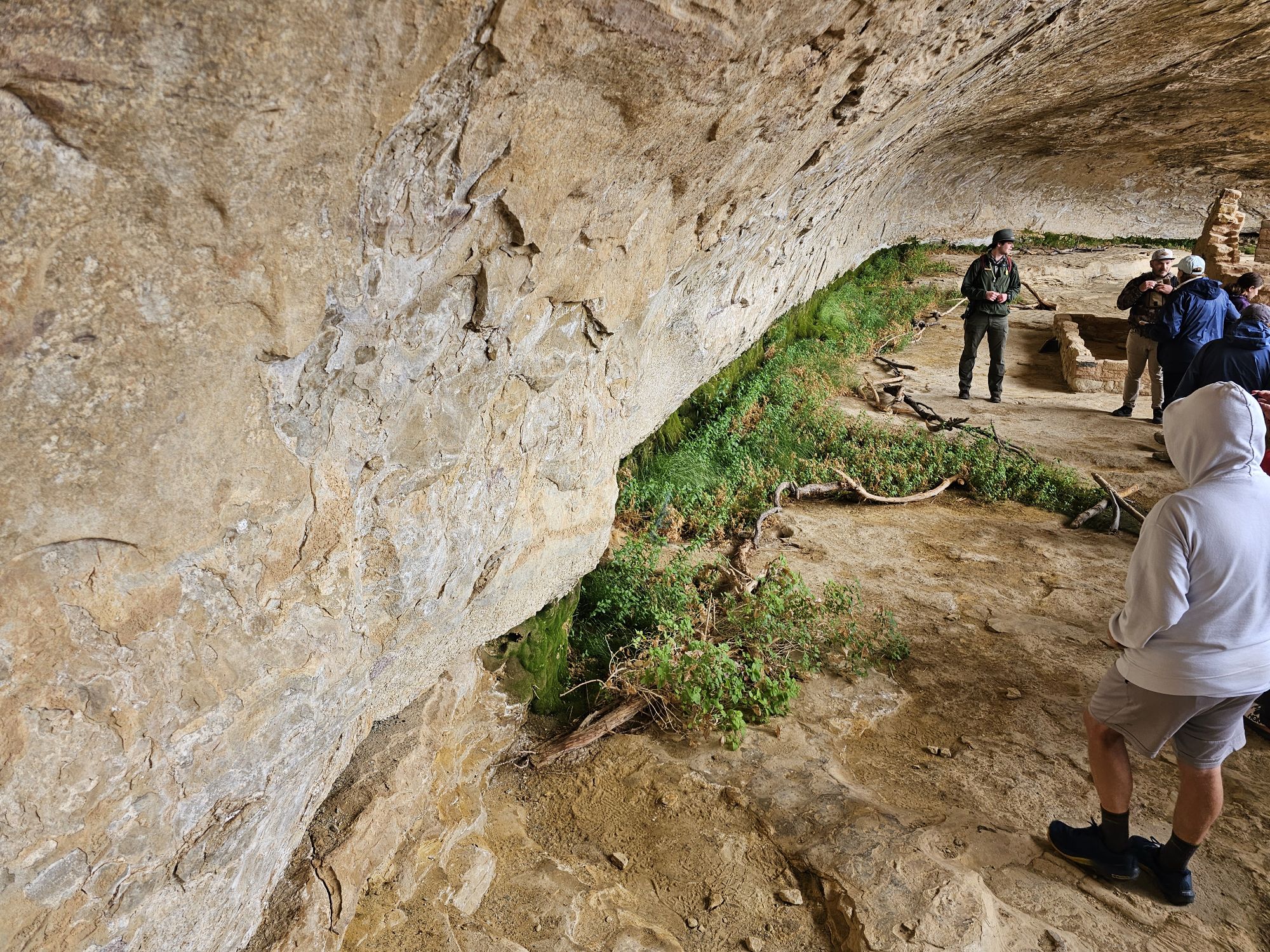
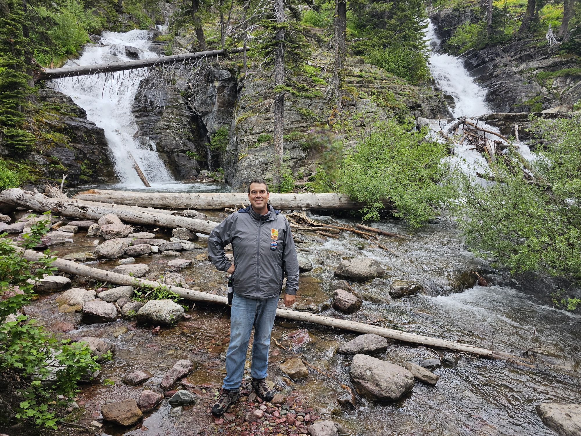
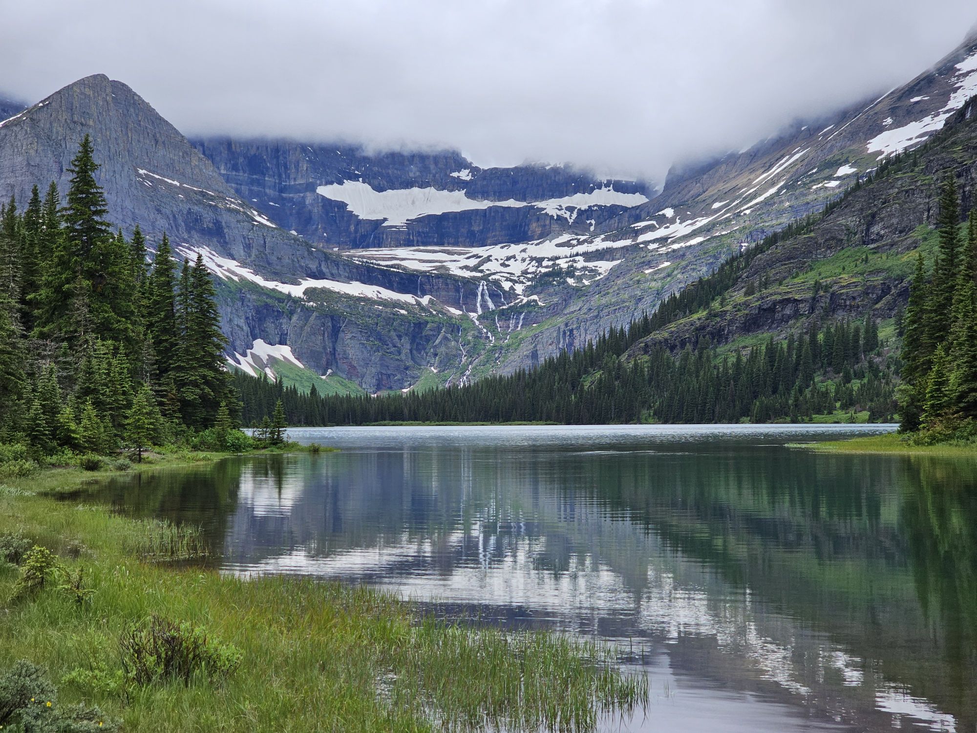
The Long House is the second largest dwelling in Mesa Verde with more than 150 rooms, a plaza, and several kivas. This was an amazing first look at what Mesa Verde is about. I had seen the pictures of course, but seeing it up close was an entirely different experience! We saw the seep spring, still running, that essentially carved the alcove protecting the dwelling. This spring was used for water for the house. These seep springs were the life blood of a cliff dwelling. The cliff dwellings are all found in an alcove and the slant of the mesas contributed to the the formation of those alcoves. The seep springs are not really springs but rather water seeping through from the mesa top until it meets rock it cannot permeate, then travels along that slant. The water works its way out of the side of the cliffs and eventually formed an alcove that the ancient Puebloans used to build these homes. The cliff dwellings in the park are all dated to almost the exact same years, roughly 1200 CE, they are also built on top of previous pit houses that date back 600 years earlier, which is very interesting! One other thing that I learned that was extremely interesting is that these cliff dwellings were not hiding. They were not for built for protection from other peoples. The peoples in the area all knew about them. Most of the peoples in the area were friendly. The dwellings were even painted in bright colors specifically so they WOULDN’T be hidden. Some of the paint can even be found to this day on some of the sites throughout the park. So there’s some history for you! Also, it was here that I learned that the NPS is no longer excavating theese sites. A member of our tour found a piece of pottery. It was black and white striped and absolutely period to the Long House. The ranger talked to us about it and then dug a bit in the ground and put it back and buried it. It was explained that they feel they have excavated enough (especially up top on the mesa top) and at this point it is better to leave all the sites and artifacts they know about buried to keep them protected for future generations. That’s a neat conservation approach that I had not considered.
The Long House. I somehow managed to sang this picture with only a couple people! Note that there is a walled off section pretty far up on the cliff face on the left side!
This is the view the people who lived here would have had everyday! Taken by me.
You need to ascend this latter to take the tour. A consideration if you have a problem with heights. Of course, if you made it here you probably already overcame any fear on the trail down! Taken by me.
Here is the reason this house exists. That plant life is thriving off of the seep spring that carved this alcove. The water still makes its way here today. Taken by me.
I think that this is when I first understood what a kiva really was. The roof, obviously is no longer here. But the rock wall in the middle is actually a deflector stone that would direct the smoke up and out. The people would have entered and exited the same way. The hole behind is the ventilation shaft that brought air in for the fire. Taken by me.
This is a kiva. The ceiling is here, and I am pretty sure this one is reconstructed. The grate is where people would enter and exit, as well as the smoke. The stones on the right are covering the ventilation shaft that brought air into the kiva. The roof was strong enough to support people using is as a plaza! Taken by me.
The angle of the Long House from the opposite side where the tour enters. Taken by me.
Just a thousand year old piece of pottery lying on the ground here! I would learn more about that black and white pottery later. Taken by me.
After finishing the Long House tour I had some time still before the rangers would chase people out of Wetherill Mesa. I took a self guided tour of the Step House not far away. The access to the Step House is a pretty steep walk down from the parking area. The site is interesting in that it highlights another feature of the cliff dwellings. Most/all of them started life as pit houses/dwellings/storage areas dating back 600 years BEFORE the cliff dwelling structure was built over them. In the Step House there are features of both the much older pit houses, and also the cliff dwelling architecture. This is the only cliff dwelling site in the park that you can tour without a ranger guide. There is a ranger on site to answer questions and explain what you are looking at, which was very helpful! The walk up was tough with the altitude being over 7,000 feet, so bear that in mind!
Ancient petroglyphs in the Step House. Taken by me.
This picture shows the “newer” section of the step house. Like the other cliff dwellings, this section’s architecture dates back to the 1200s. Taken by me. I was quite surprised by how accessible the ruins are in this park! From up here you can see the cliff dwelling structure and the old pit houses in the top left. Those date back 600 or so years BEFORE the structure I am standing on was built! Taken by me.
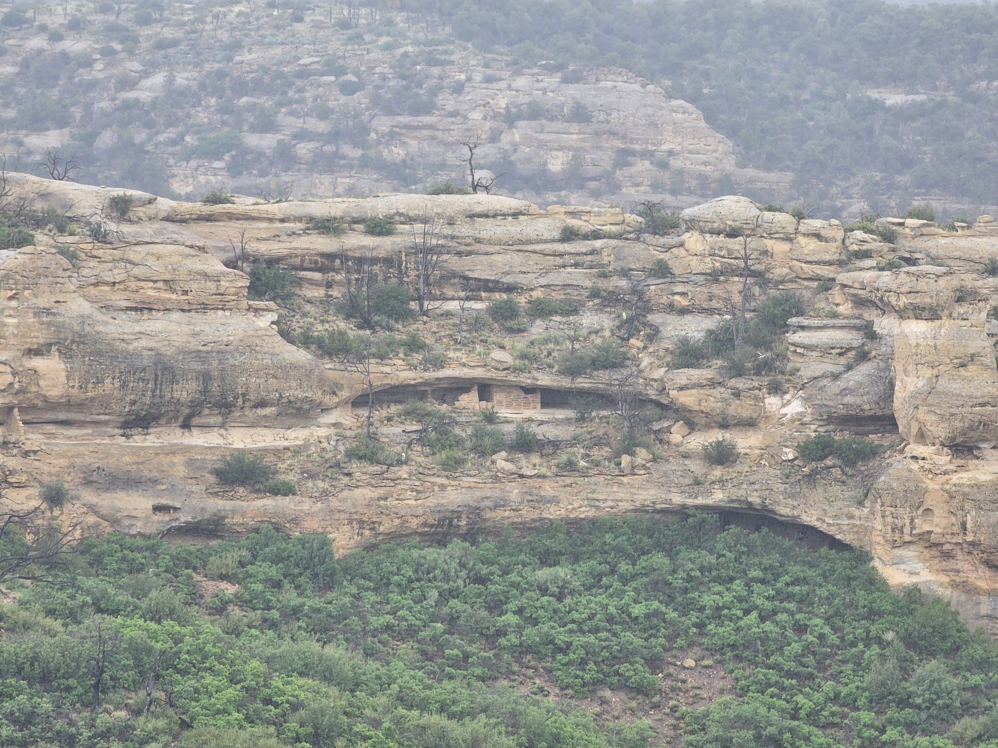
Another site, seen from the Step House trail. This one didn’t even get a sign, or a name as far as I know.
Using the ever trusty Guide Along tour, I learned more about the rather sophisticated real history, and the not made up history, of the peoples of this area. First of all, the term Anasazi is a misnomer for the people in this area, and most of the indigenous people don’t like it being used as it was. It’s a Navajo term for “ancient enemy” and that’s not what the ancestral Puebloans were. While this was being explained the guide also mentioned the words Dineh and Athabascan. Now as someone who loves Alaska, my ears perked up at those words and I had to restart that portion of the narration to make sure I was not crazy, after all I was in Southwestern Colorado, and not central Alaska! But, lo and behold, the Navajo actually go by the name Dineh and they do indeed speak a form of Athabaskan, as they originally came from that area in the far north! How cool!
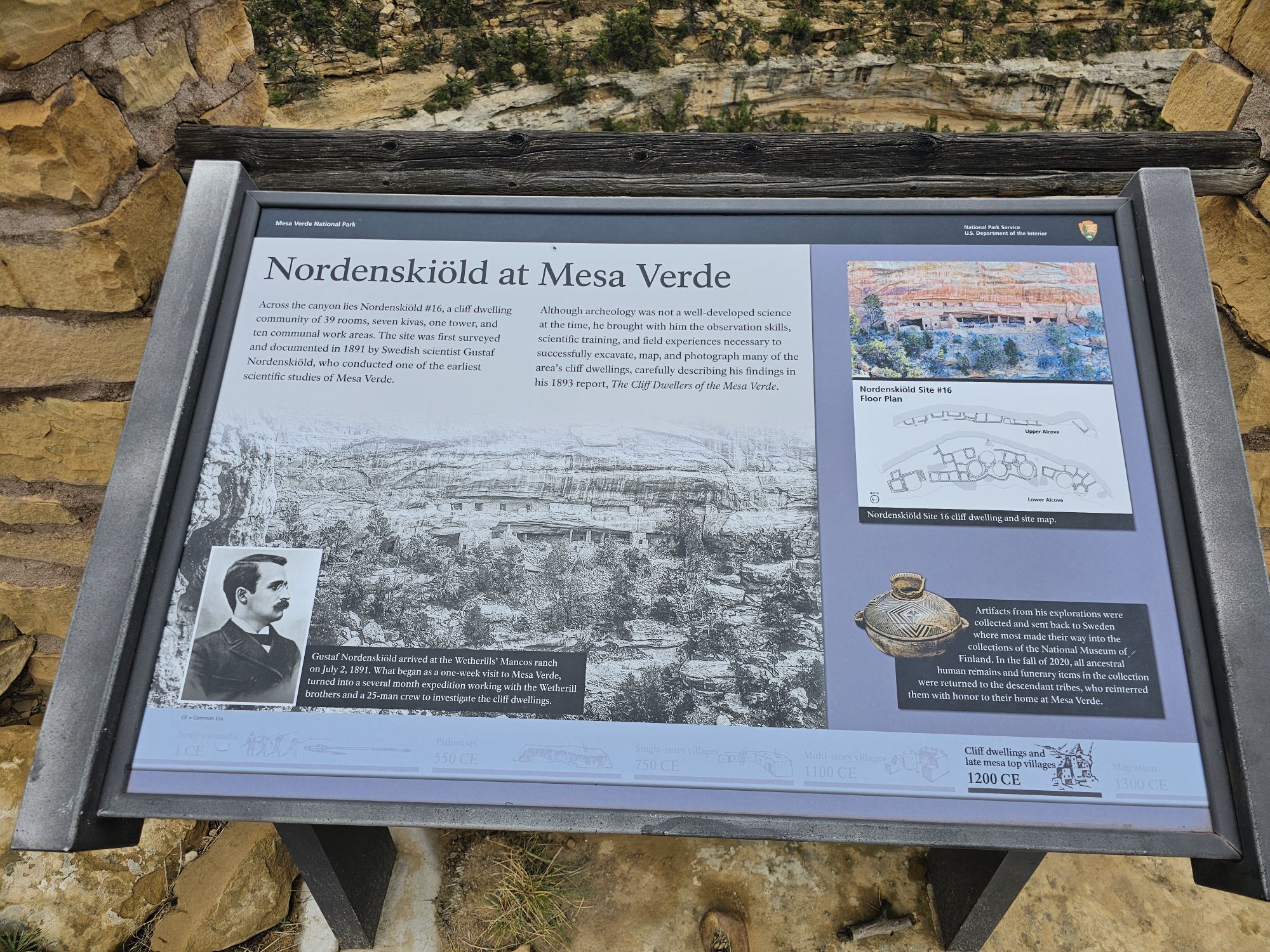
The other fascinating history I learned involves Richard Wetherill, the man who acquired the land and “re-discovered” the cliff dwellings. (The local peoples apparently were quite aware of the ruins.) Oddly enough I had seen the cemetery he is buried in, the previous day at the Chaco Culture site! I should have stopped to look around, but I didn’t! Anyway, Wetherill was wanting to farm the area. After rediscovering the cliff houses he pivoted to excavating and selling artifacts. Wetherill eventually hired a Swedish archaeologist named Gustaf Nordenskiöld to excavate the sites. Nordenskiöld taught Wetherill more proper techniques to excavate and to document all the sites and artifacts. A couple things sprouted from this. Despite his more modern archaeological approach, Nordenskiöld was sending artifacts back to Sweden, which infuriated Americans. This led to the creation of the National Antiquities Act, and the creation of Mesa Verde National Park in 1906. Additionally, Nordenskiöld taught Wetherill so well, that despite his lack of proper education, Wetherill advanced claims that were initially dismissed, but are now considered accurate! All of this may seem dry, but I found it quite fascinating!
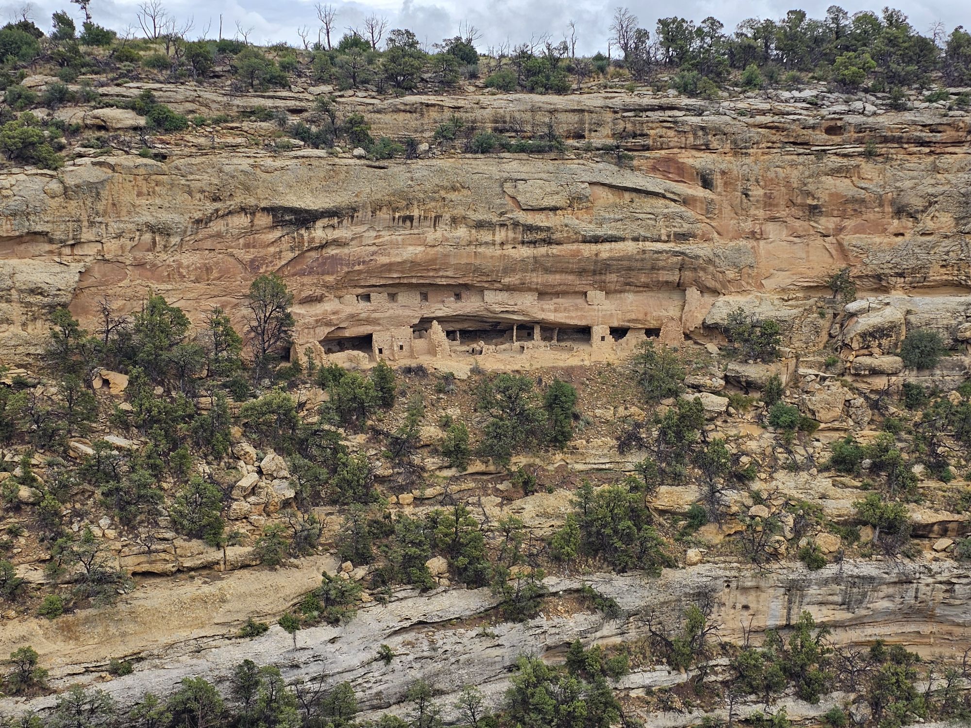
Nordenskiöld did a lot of remarkable exploring of the area. He numbered the sites, and the numbers can still be found to this day. Additionally, there are numerous trails in the park that he created. Back up on top of the mesa you can find many of these trails. I hiked Nordenskiöld Number 16, the trail to site number 16, of course. This trail is accessed off of the walking path to the Long House trail. It was super cool to get to the end of that trail and have a view of another cliff dwelling off in the distance (at this point I was unaware of how many of these there are!). But, in this case, the distant dwelling was actually RIGHT UNDER the trail I had just taken to get to the Long House tour! HOW COOL! I had just literally walked on top of one of these structures without a clue!
Infographic of Nordenskiold and site #16.
SIte #16, taken by me. The top of the cliff here is where the walking path to the Long Houses trail is located! Taken by me.
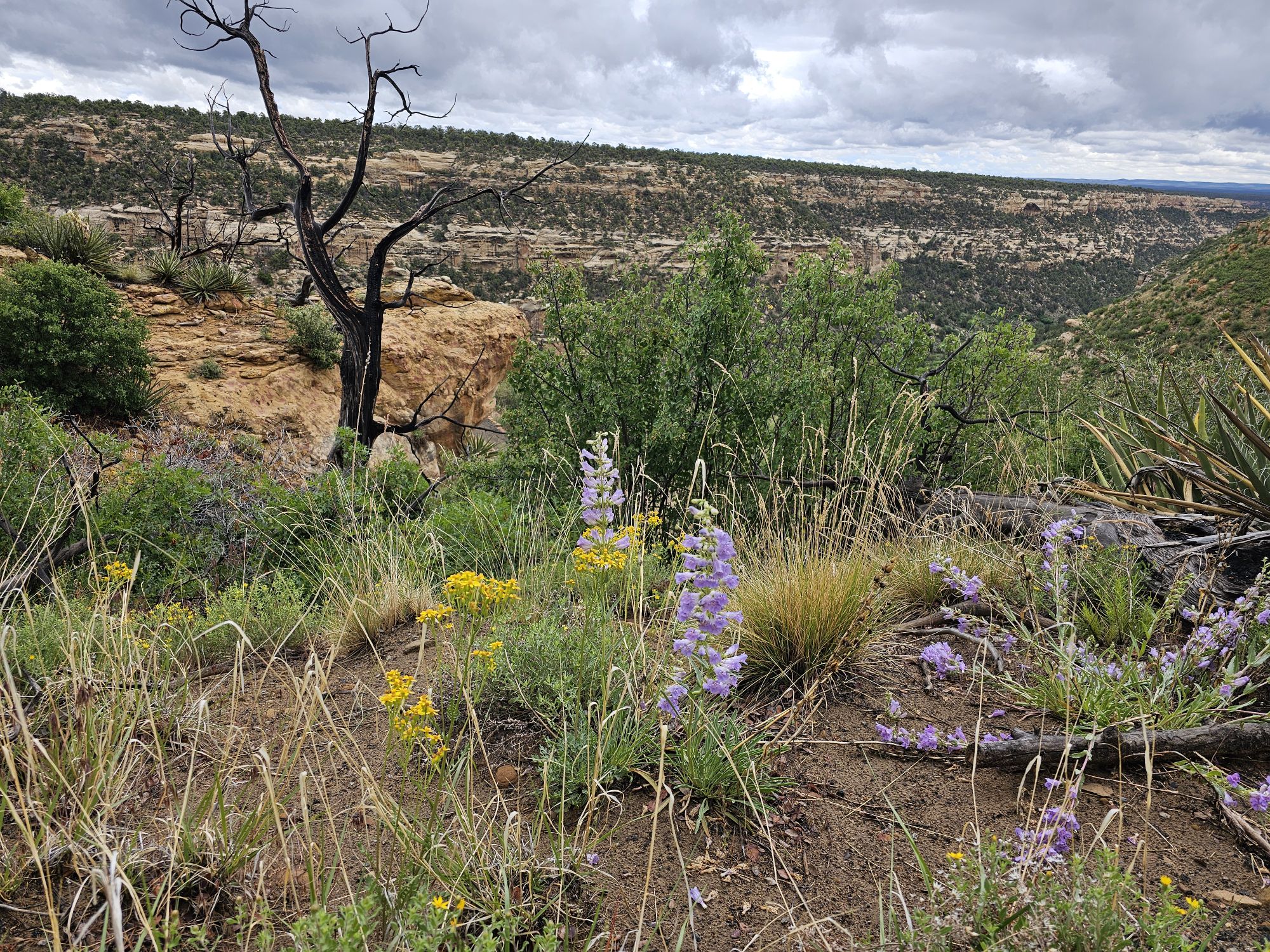
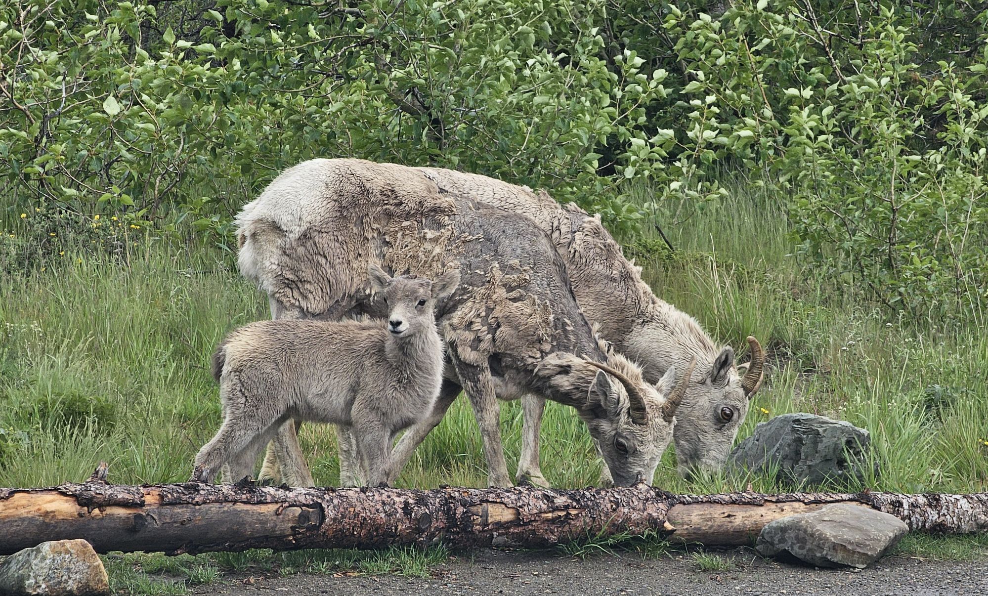
There were a lot of pretty wildflowers to be found. Taken by me, on the trail to site 16.
Upon Leaving Wetherill Mesa I headed further into the park to do some recon of the Chapin Mesa area. This is the are that most people will explore and contains the 3 other Cliff Dwelling tours, as well as the Museum. In case you are wondering, the Visitor Center is actually way back at the park entrance about 45 minutes away. You cannot miss it, but if you think there is another one deeper in the park, there is not. In any event after a decent drive, you come to a turn that takes you to the museum, park offices, and a cafe with a delicious Navajo taco on the menu! There is also a spectacular cliff dwelling, the Spruce House, to view. Like all the others a person will see, you are opposite a canyon from it, but this one is much closer and visitors used to be able to visit but conditions have led to its closure. Still, worth a peak, for sure!
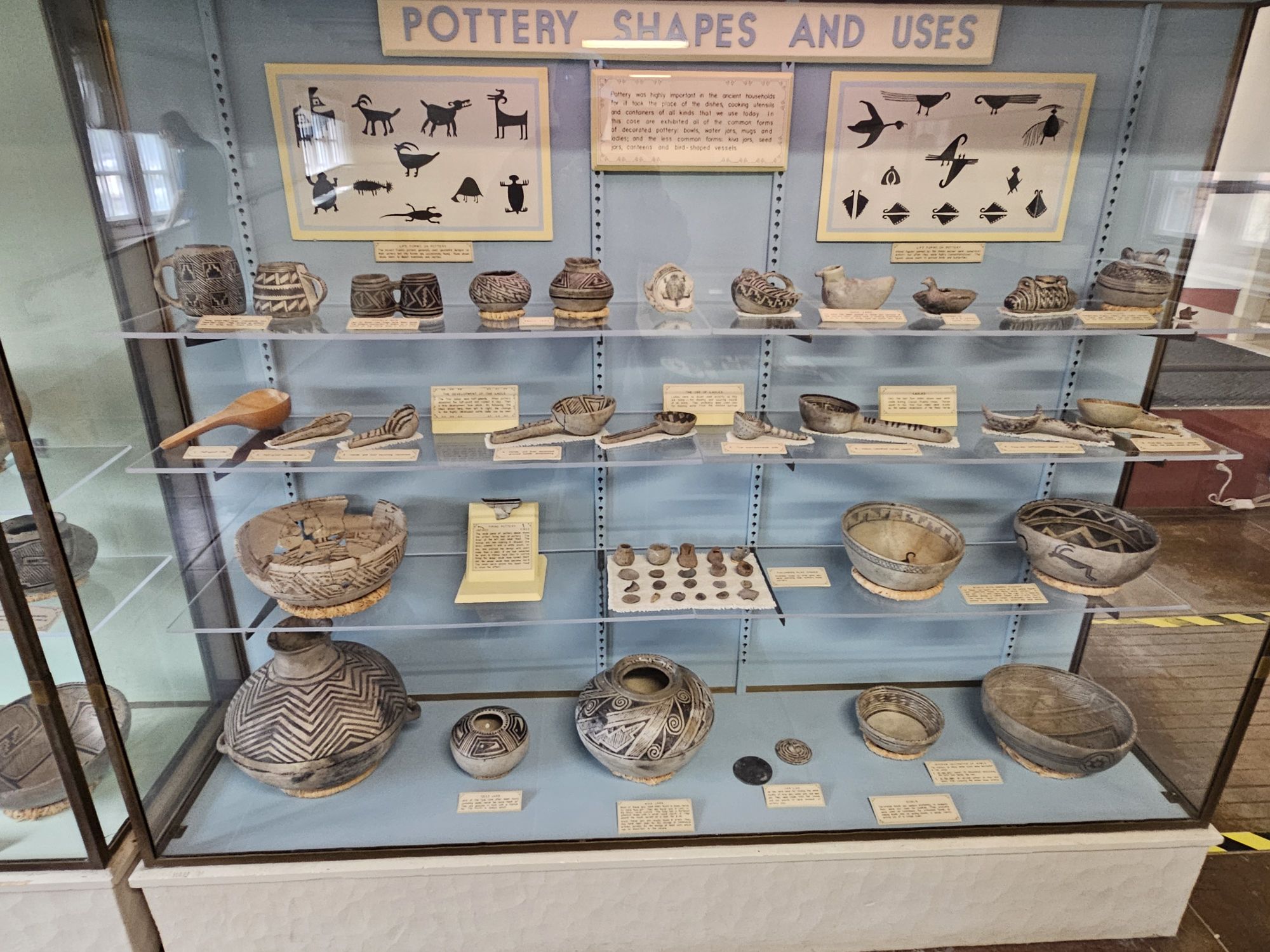
Some of the pottery in the Museum. Note the black and white coloration.
I gather the trees were the inspiration of the name of the Spruce House. Taken by me.
Worth a read. Click on picture for a clearer view.
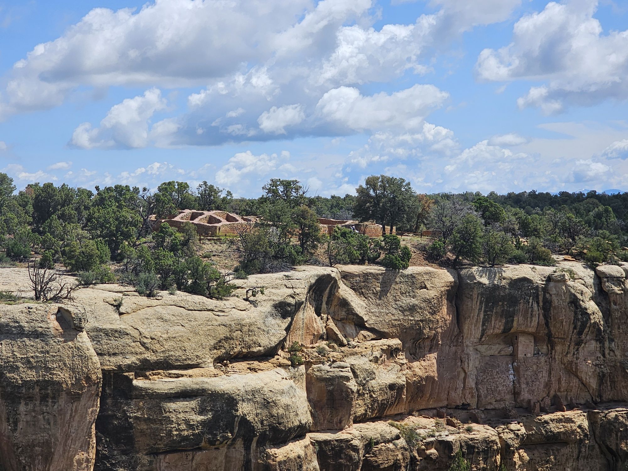
The museum is pretty great, and shows off the many artifacts, including all the pottery and highlights the importance of that black and white pottery I mentioned earlier. After checking out the museum, I headed back to explore! Once back on the road, you are soon given a fork. Going to the right leads to the Mesa Top Loop and the left leads to Cliff Palace Loop. Mesa Top Loop provides access to a number of excavated pit houses on the top of the mesa, mostly dating back to the 600-900 CE era, and to some great views of Navajo Canyon. At one overlook, though I could not find them all, the Guide Along tour mentioned that something like 30 cliff dwellings were visible! This loop also provides access to the Square Tower House. The loops are one way, so once finishing this loop, I took the Cliff Palace Loop. This loop provided many more extensive views of the numerous cliff dwellings that are visible in the park. I was pretty stunned by the shear number of these dwellings throughout the park. There are over six hundred of them! They are were all built at roughly the same time, and abandoned at the same time as well. And even more, there are at least more than FOUR THOUSAND sites on the mesa tops. The majority of these sites are NOT excavated, and will not be, to protect them.
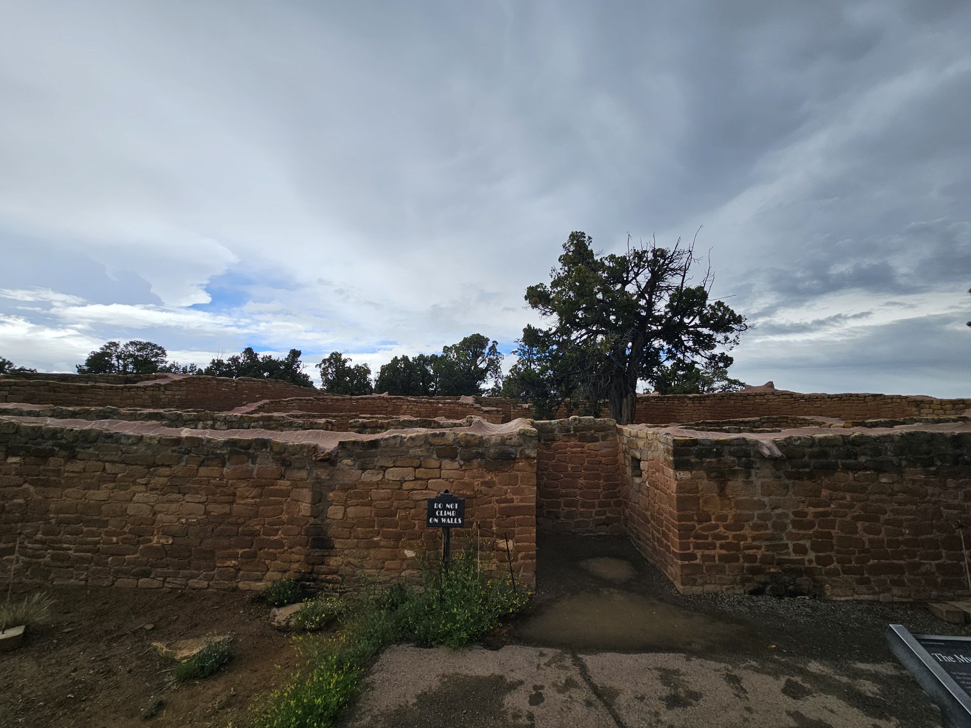
One notable mesa top site is the Sun Temple. This site is directly across the canyon from Cliff Palace, offering great views of that huge site. The Sun Temple is unique among all the sites. It is a D shaped structure which is rare enough, and it is the only one not found within a pueblo. Another notable D shaped structure in the are is Pueblo Bonito in Chaco Canyon. This one was built with no roof. Speculation is that it was an observatory. It was built the same time as the cliff dwellings, so was definitely connected to the cliff dwelling peoples.
Worth a click to read!
The exterior of the Sun Temple, taken by me.
Another part of the outer walls of the Sun Temple. Taken by me.
Another part of the Sun Temple. Taken by me.
The Sun Temple gives a pretty killer view of the Cliff Palace! Taken by me.
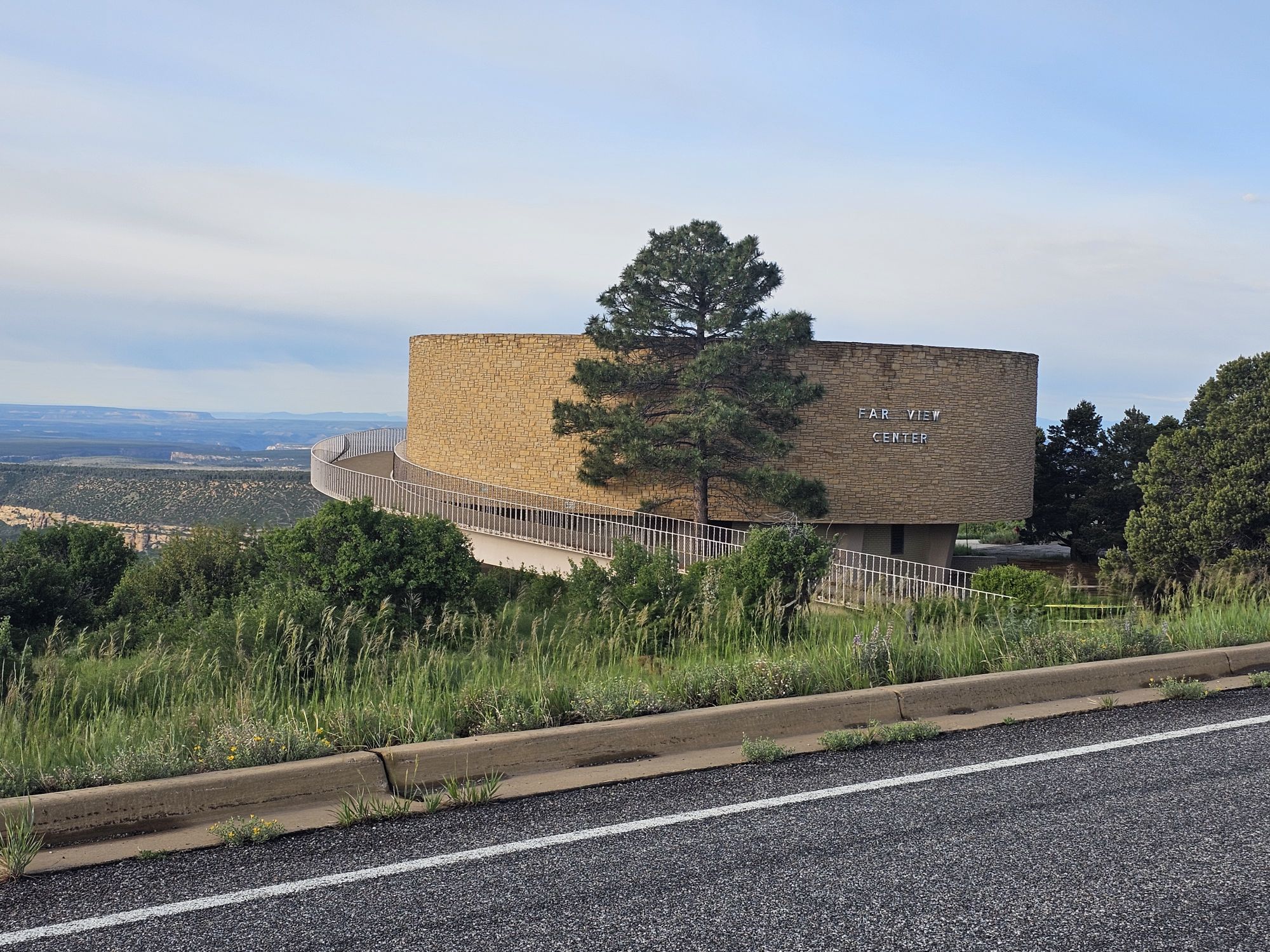
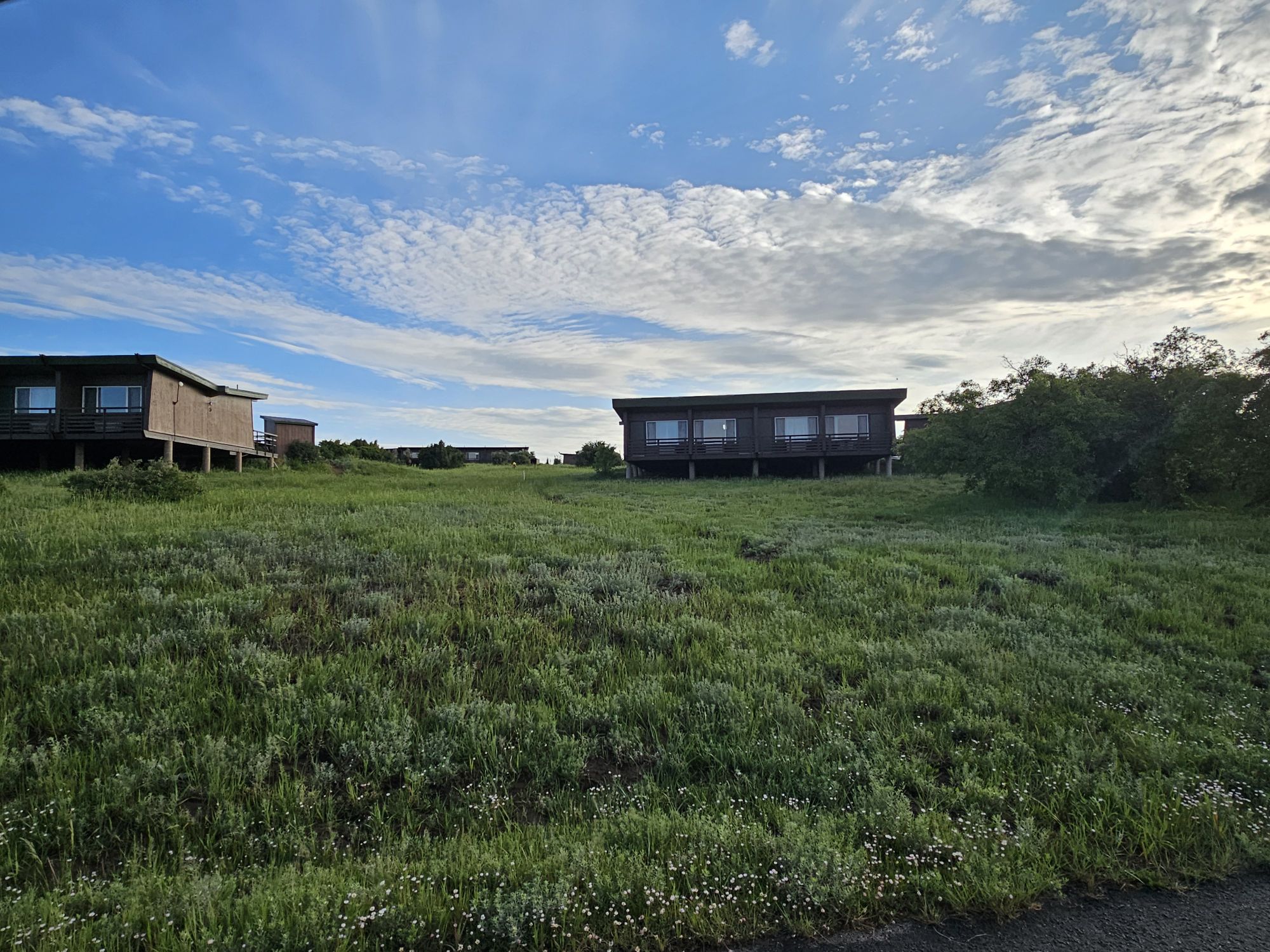
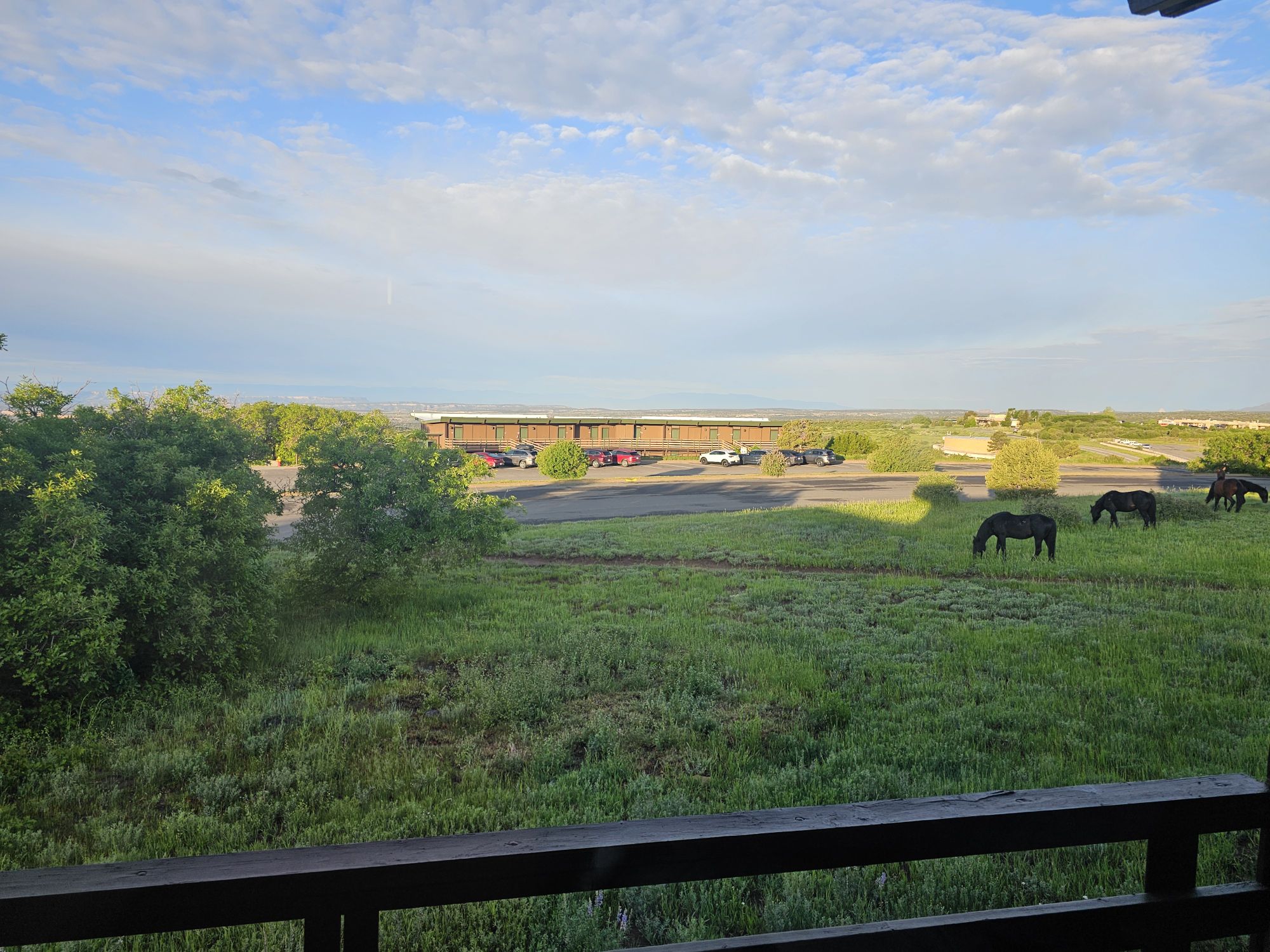
After leaving the Cliff Palace Loop I headed back to the Far View area to settled into my room for the evening. The lodge is simple but the bed was comfy and there is a restaurant, store, and bar on the property. You will find wild horses as well, though signs warn they are not friendly. Also, there is an iconic, but closed, visitor center right across the road. This one was open from 1970 to 2012. It seems the building is still in quite good shape and the park is actively pursuing a repurposing of the structure. Here’s hoping they are successful, because it looks like a neat place that offers killer views of the park! And with that, it was time to turn in the for the night.
The old visitor center. Taken by me.
The building with my room at the Far View Lodge. Taken by me.
The view from my balcony in the mornings! The horses are not friendly!
Like is I mentioned in the opening, this is a park very large in scope and history, so I hope you at least looked at the pictures and read the captions! Stay tuned for part 2, where I share tours of the Square Tower House, Balcony House, Cliff Palace, and other mesa top sites!
NPS Unit Count: 80/430 US Unesco World Heritage Site: 14/24
Hey there Adventurers! I have to say I am super excited to recount the next many posts for you all! This trip in June was to check out Mesa Verde National Park in Colorado, but there are many national park sites in New Mexico including several #USBarkRangers sites, so I planned a week loop from Albuquerque to do some cool shit! I had been to far southern New Mexico once before, but I left this trip with a new found reverence for a state I didn’t really think about too much. I feel like these sites that I visited should be visited by every single American. And, I also felt like I came back with a degree in all things native southwest!
If you choose to follow this “series,” which will encompass stops to Chaco Culture, Mesa Verde, Aztec National Monument, Pecos National Historic Site, Bandelier National Monument with a short stop at Valles Caldera National Preserve, Petroglyph National Monument, Salinas Puebo Mission National Monument, and Valle de Oro National Wildlife Refuge, you, too, are going to learn about kivas, Pueblos, the Puebloans, missions, etc! Also, since at this point we all know I can be a little long winded, other than Mesa Verde, this will probably be the longest entry of the series! (and it is mostly pictures and videos!)
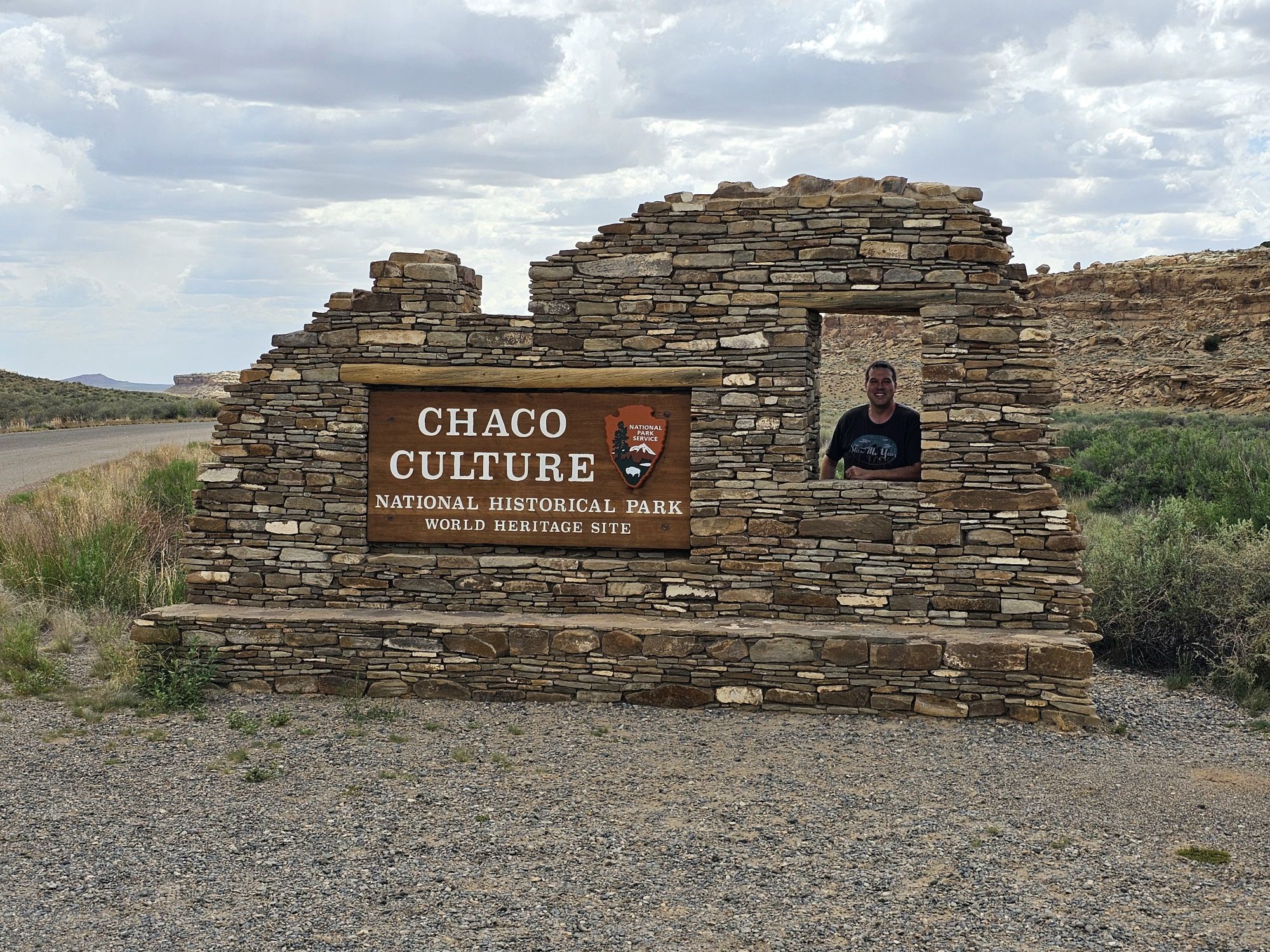
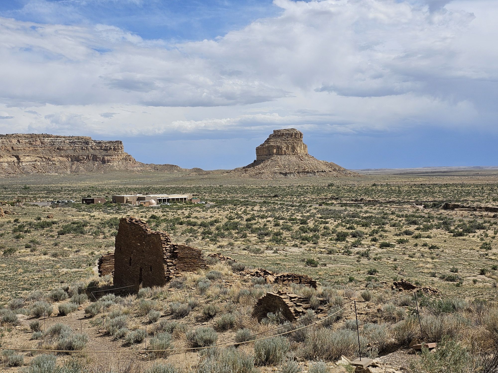
After I landed in Albuquerque I headed out toward Chaco Canyon and Chaco Culture National Historic site! I took a minor risk on this part of my trip. I had booked a hotel in Farmington, NM, which is all the way up near the NM/CO border, for the evening and Chaco is geographically in between, sort of, but not really, due to the lack of access. But, luckily flights and weather were on my side and I managed to make it to Chaco as planned! It should be noted that merely getting to Chaco is no small task. There is a very large chunk of North/Central New Mexico that is the middle of nowhere and that is where Chaco Canyon is. The GPS will lie to you. The website for the park says as much and they were not incorrect. I wrote down what the park said for directions, but even with that I still had to call en route to clarify. Cell phone signal does not exist, and the gps tries to do its damnedest to take you through small communities where the roads are actually not roads or are blocked off by Native communities. Once you do manage to make the right stop off the highway the NPS has done a good job with signage. But the road is remote bumpy, gravel and dirt, and there is a whole lot of nothing for 20 miles. But in any event I arrived at Chaco at about 3 PM local time.
Surprisingly, there was someone coming down the road behind me and we exchanged picture taking! This is probably one of my favorite signs now!
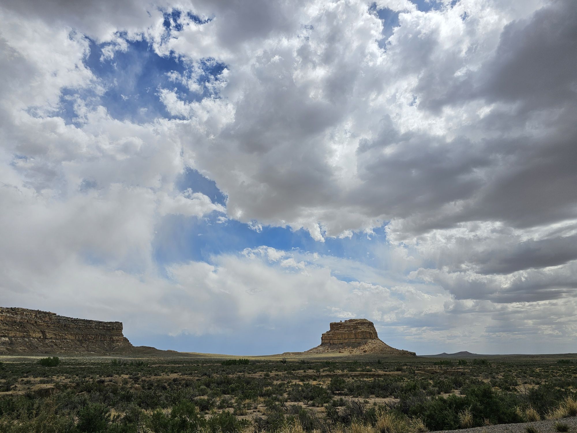
This is Fajada Butte a towering part of the landscape here, at around 450 feet tall.
Chaco Culture Historical Park is a Unesco World Heritage Site (I am starting to rack up the US ones, so I have now added a counter for that as well!) and let me tell you…this is a very important place to visit. In fact every single one of these sites I visited on this trip are super important and encompass things that are not really taught in schools, and I think every American should visit.
I would say that the first thing everyone needs to know is that the native tribal populations in North America a thousand years ago were neither primitive, nor “savage”. The ancient Puebloans maintained a network of roads, trade and culture that extended as far as Mexico and central America during the the 800 to 1200s CE. This site does have evidence of human habitation dating back nearly 10,000 years as well! Most of what is left in these sites here at Chaco is original, with little to no restoration! Many sites are now being left unearthed to protect them for future generations and hopefully better archaeology techniques. This site is in Chaco Canyon and was the major center of the Ancient Puebloans, is one of the largest native sites north of Mexico, and is one of the most important cultural sites in the United States. The Hopi and modern day Puebloans consider this site their ancestral homelands. That is all I will share, but you could probably spend years learning about this site, so go visit and get started!
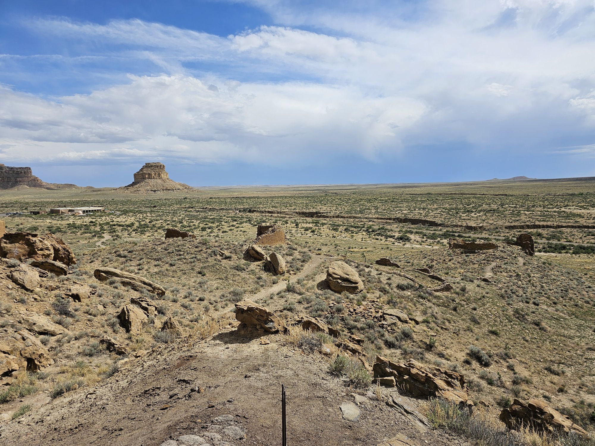
Upon entering the park area you will first pass the cool sign, then the campgrounds, then you will come to the visitor center. From the visitor center you immediately have access to hikes that go to some of the ancient ruins as well as ancient petroglyphs. Pretty cool! This area is called Una Vida and I was quite impressed with this area by itself! This is high desert, so altitude, water and exposure are the prime concerns for safety. Upon leaving the visitor center the road through the park is a several mile loop that stops at several key sites.
Fajada Butte from the Una Vida ruins. Taken by me. The visitor is visible in the middle left.
There is more to see here than is easily visible. There are at least three distinct ruins in this area of Una Vida in this picture. . Click on it to see the better view! Taken by me.
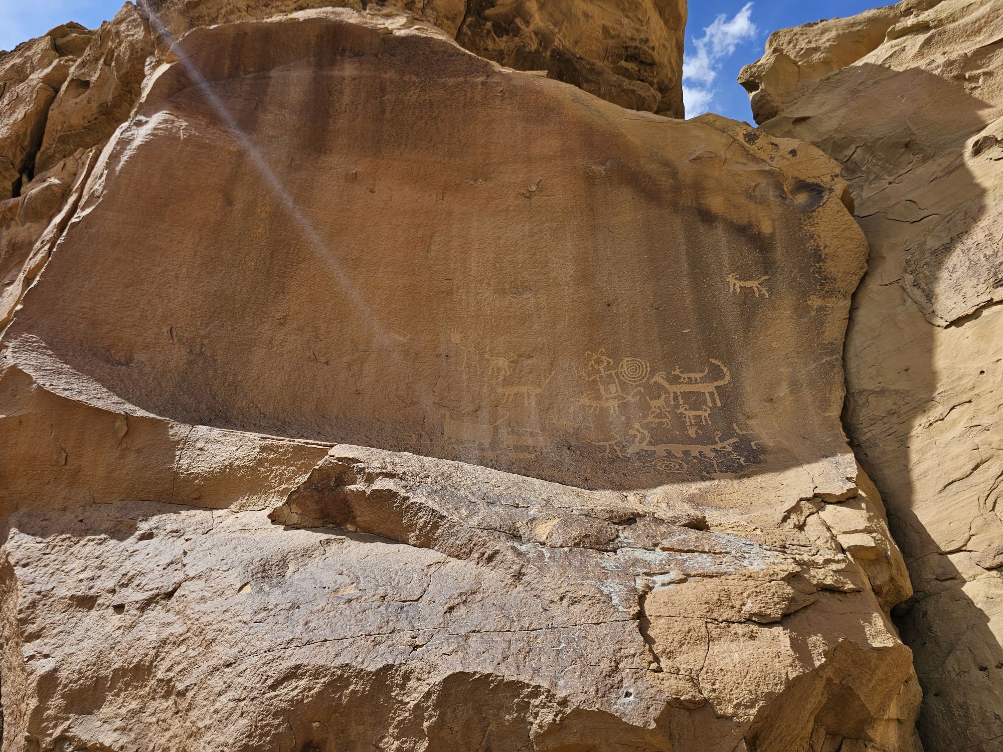
Some of the petroglyphs visible near the Visitor Center. There are many more in this area and indeed, through out the park. However, a good eye is needed for many of them.
At some point on this stop I realized that I was woefully unprepared for the educational side of things that this site was going to provide (and, indeed, ALL of the sites to come!). I had no idea what the hell a kiva was. I had a vague generalization of what pueblo meant, and I had no idea about the connection of all of these peoples throughout the now southwest US. Puebloans are basically people who use bricks with mud (no small feat considering the desert environment) to created their villages. And yes this is an obscene generalization, but that’s how I can most succinctly characterize these people. They all spoke/speak a similar type of language but it’s not exactly the same. Their descendants are still actively participating in the Pueblo culture in the Southwest. A “kiva’ is a sacred community center that is usually built into the ground, is round or square, has a roof that is able to support people actively doing people things on top. The entrance is through a ladder from a hole in the top and there is fire inside the kiva where the smoke is diverted up and out of the same hole in the ceiling by means of rocks set up to do this job. If you watch any of my videos, you can tell that I was ignorant because I reference the big round holes in the ground as pits, and I even speculate as to whether they were grain or water storage! Oops! I had no idea of any of this going out on this trip. Bad me. I got lazy, didn’t research, and didn’t know what I was getting into!
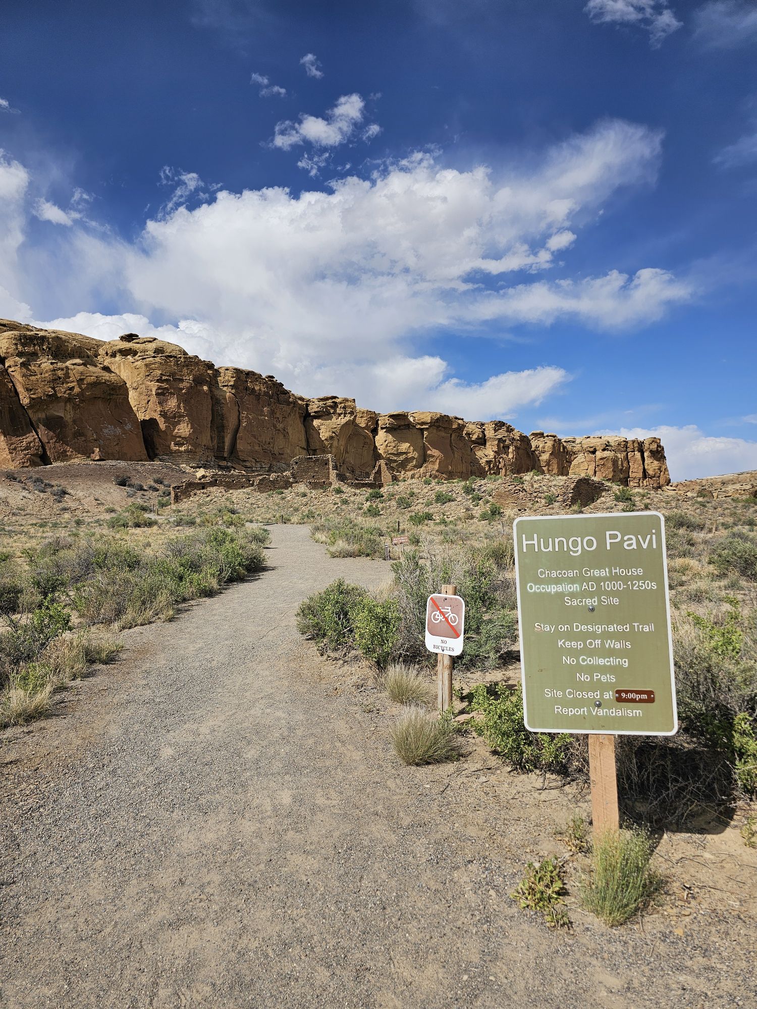
In any event, the surviving ruins here at Chaco are amazing in size and complexity. After checking out the sites near the visitor center I headed further into the park. I was amazed at the extent of the preservation of the sites and the limited work the NPS has had to do to preserve these sites. I was also surprised at how accessible the sites are. You are allowed to walk into the ruins, through the doorways, and if you aren’t watching your step you could fall into the kivas! (don’t do that!) Most of the large sites are along the north side of the loop. The first stop is called Hungo Pavi . This is an unexcavated site that contains a Great House with 150 rooms (yes 150), a great kiva and a plaza. What unexcavated means is that the ruins are still partially covered by wind blown sand and vegetation, which actually protects the site. The policy of not excavating would come up more at Mesa Verde and was surprising to my ignorant self.
The entrance to the Hungo Pavi site.
These are the first ruins of Hungo Pavi that you will see upon starting the walk to the site. Taken by me.
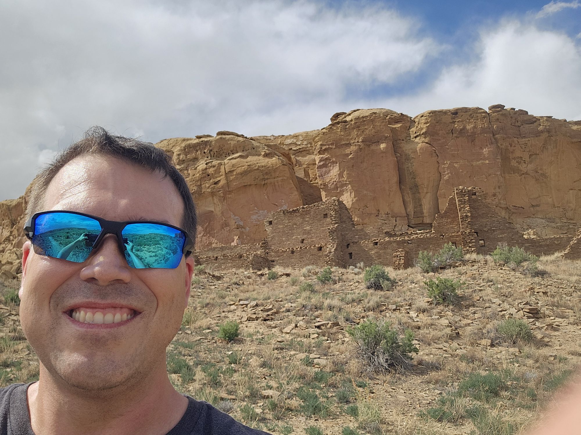
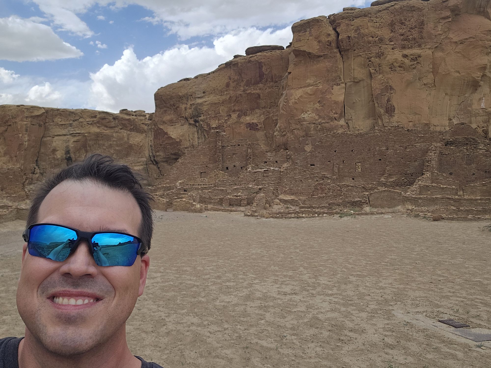
Selfie in front of that same site.
Hungo Pavi. Taken by me.
Pretty amazing craftsmanship for a thousand years old! Taken by me.
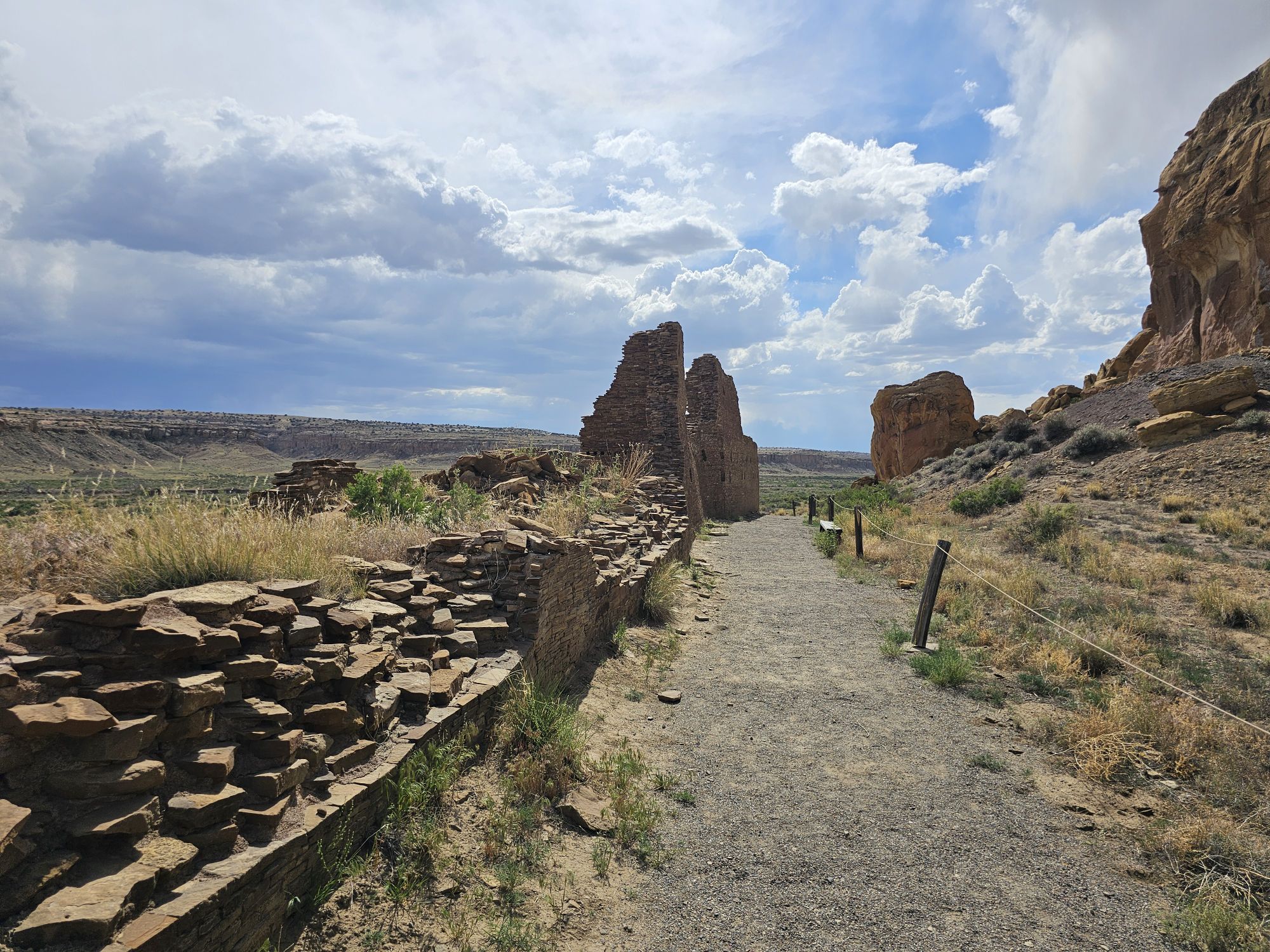
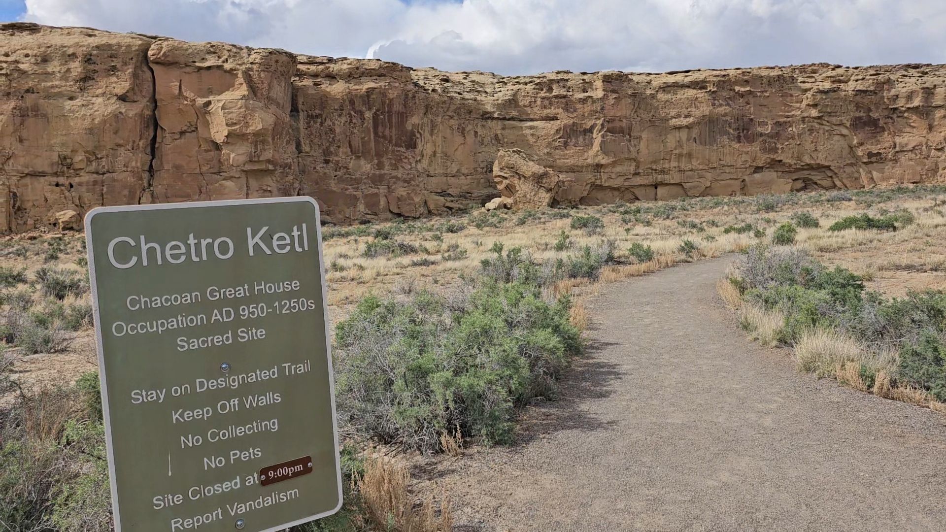
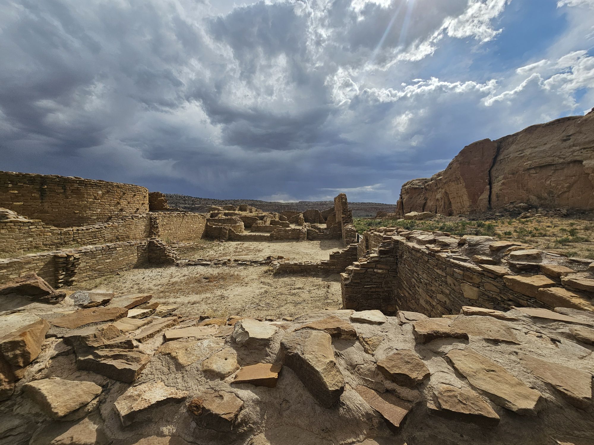
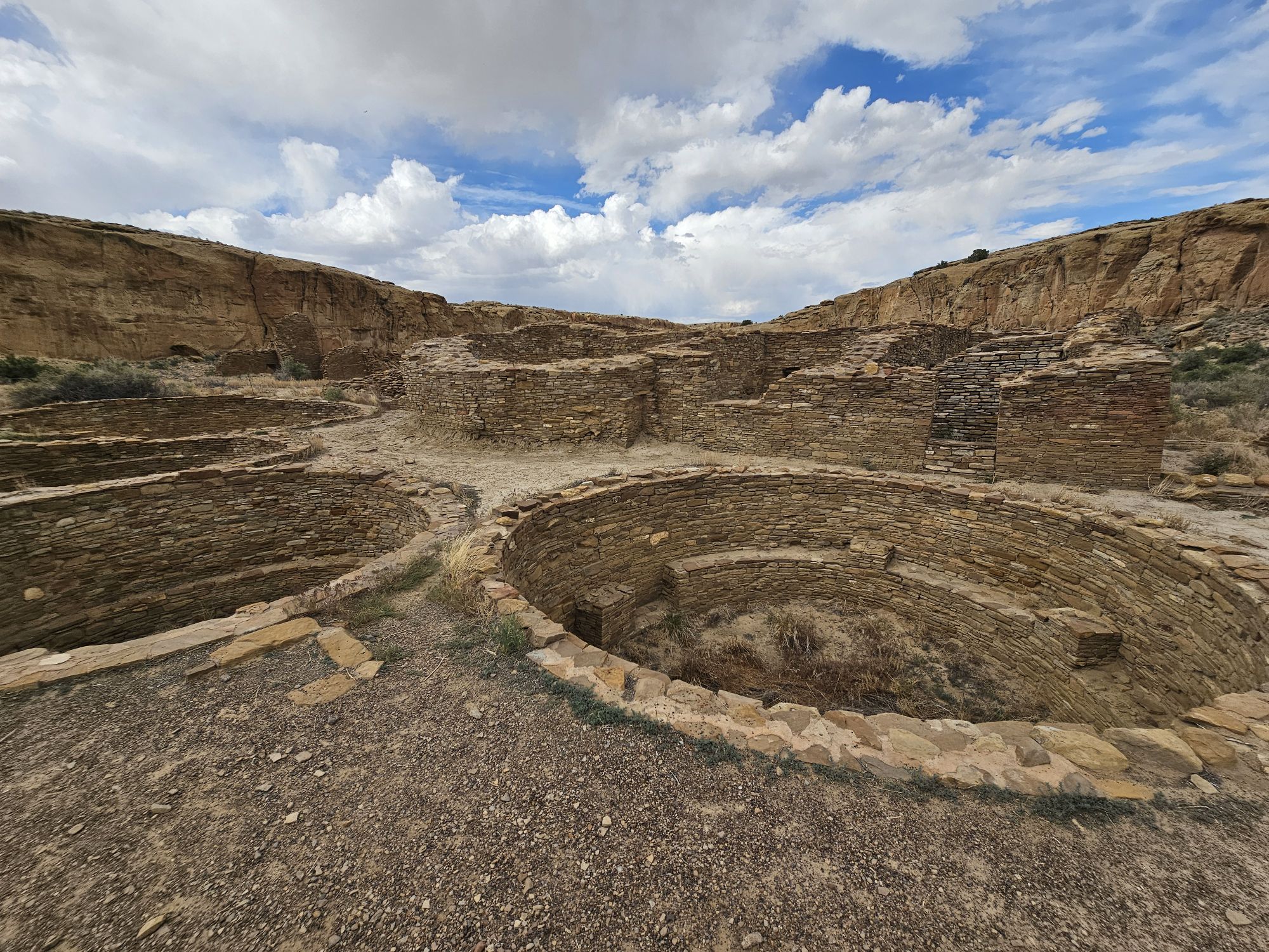
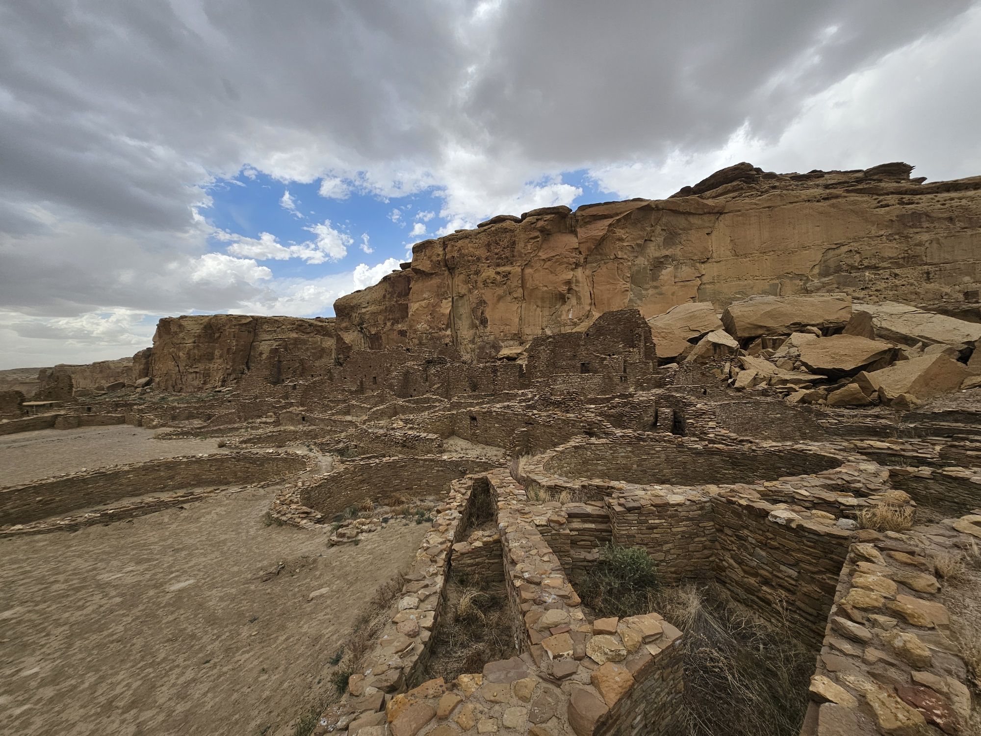
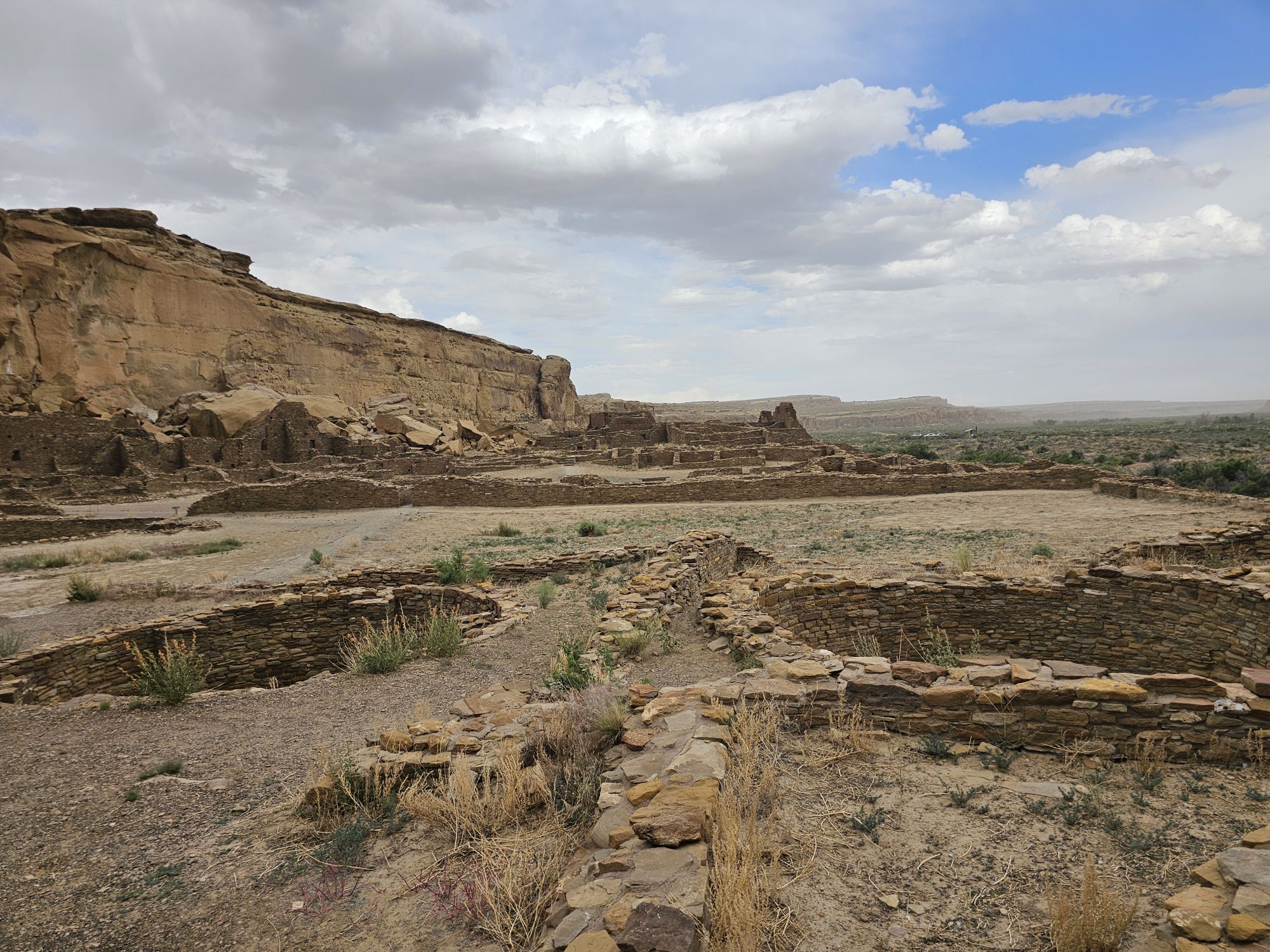
The next stop is Chetro Ketl which is the 2nd largest Great House here and included a 2nd and a 3rd storey. To get to Chetro Ketl one takes a path from the parking lot to the right, and if you go to the left you arrive at Pueblo Bonito. Chetro Ketl was a step up from Hungo Pavi and super impressive. But despite the impressiveness of Hungo Pavi and Chetro Ketl, well, Pueblo Bonito is why people come here. This pueblo is huge. It was the most important site here with 800 rooms. The site was built between 850 and 1150 CE and was the center of the Chacoan world. Cacao from 1200 miles away in Mexico has been found in jars in the site. Unforunately, the weather started to look suspect and the wind really picked up, so I decided to expedite.
Entrance to Chetro Ketl.
Some of the ruins at Chetro Ketl. Taken by me.
Video of Chetro Ketl.
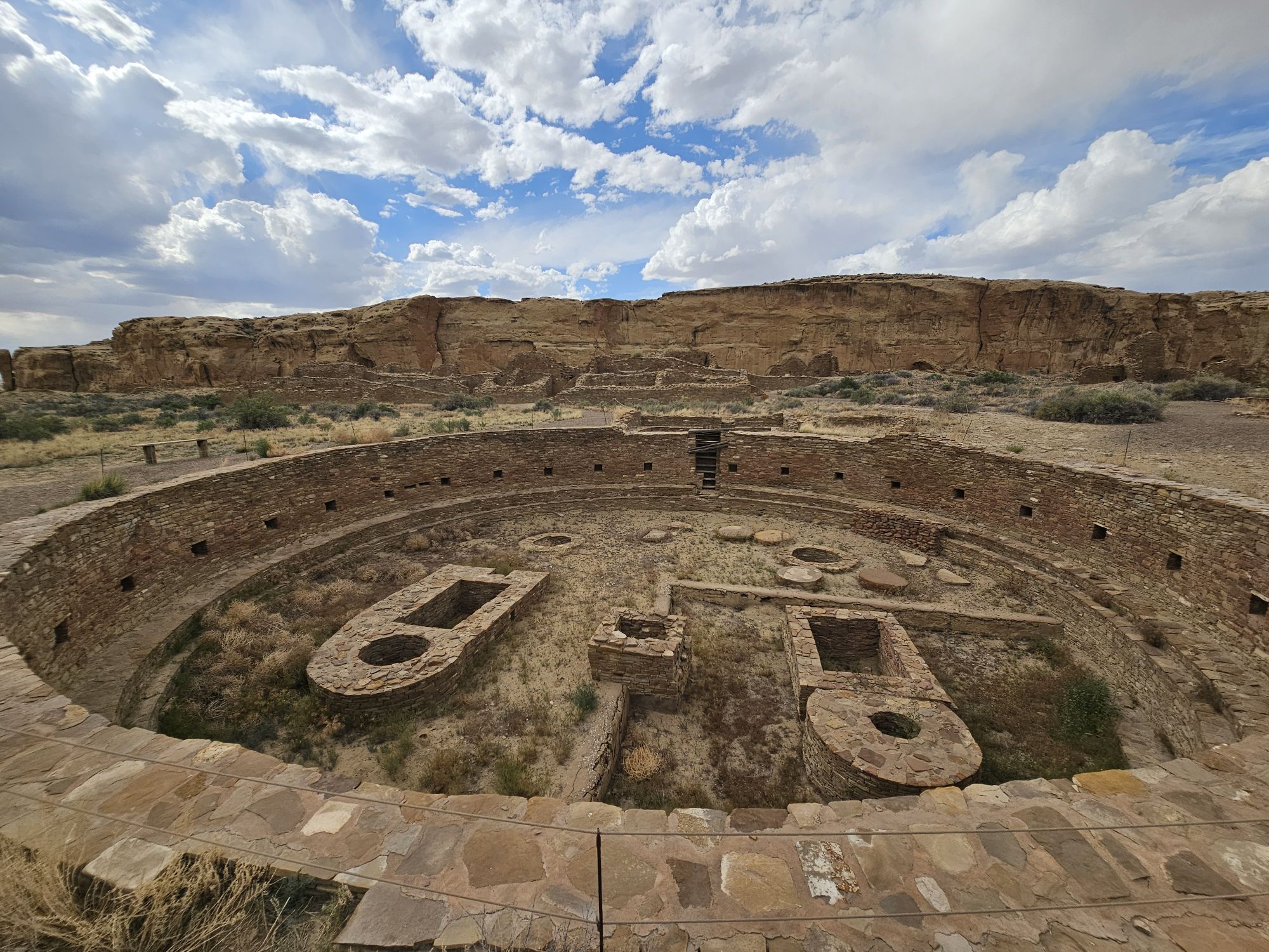
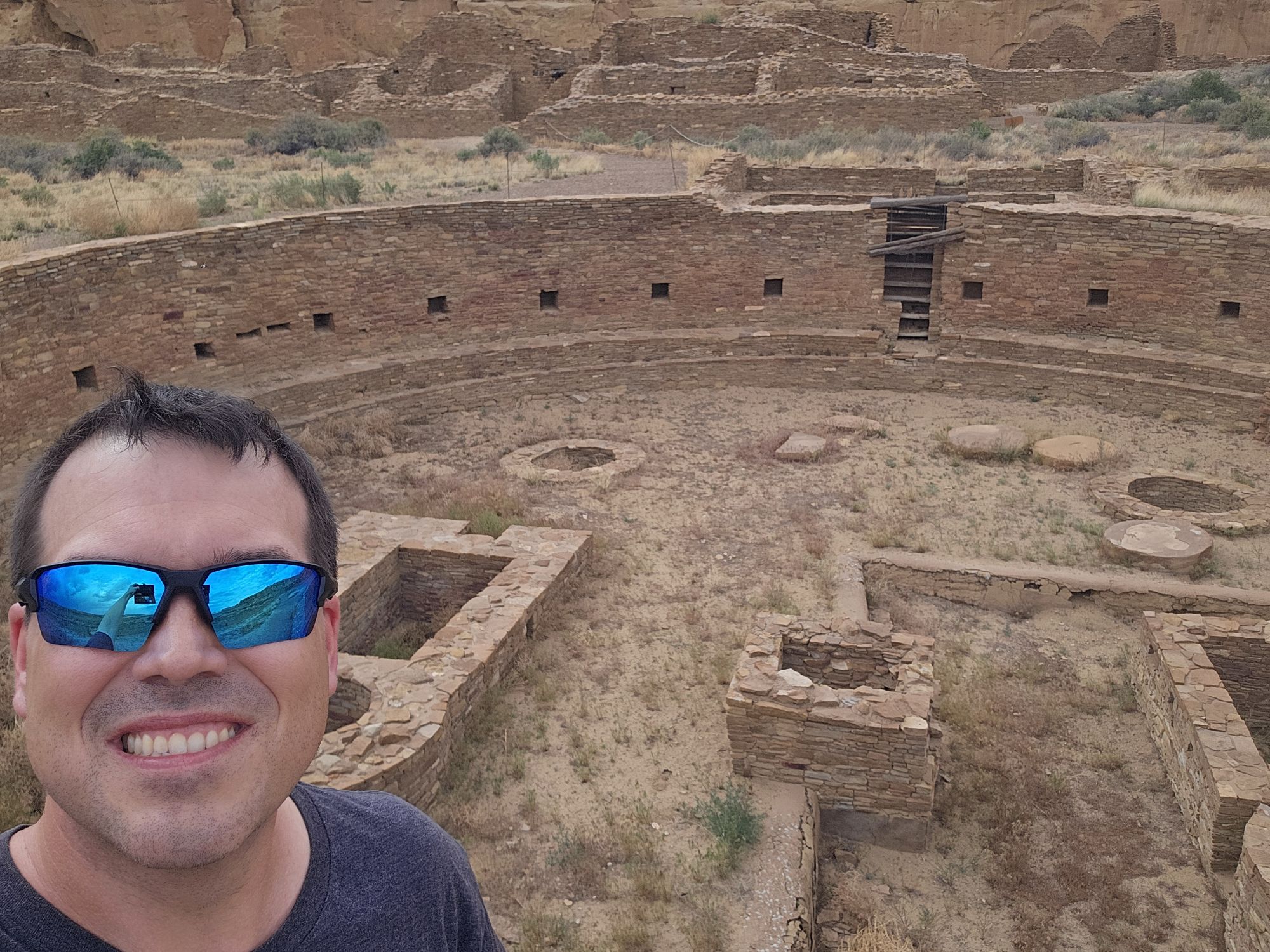
A kive in Chetro Ketl. Taken by me.
Several kivas seen here. Taken by me.
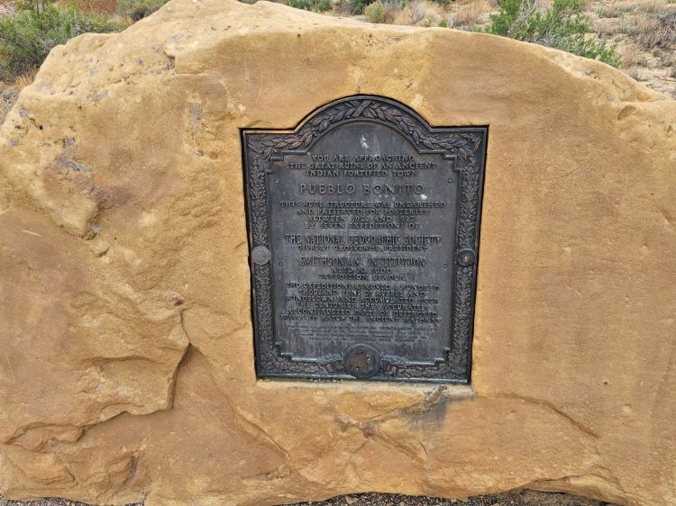
National Geographic Society plaque for Pueblo Bonito. Take by me.
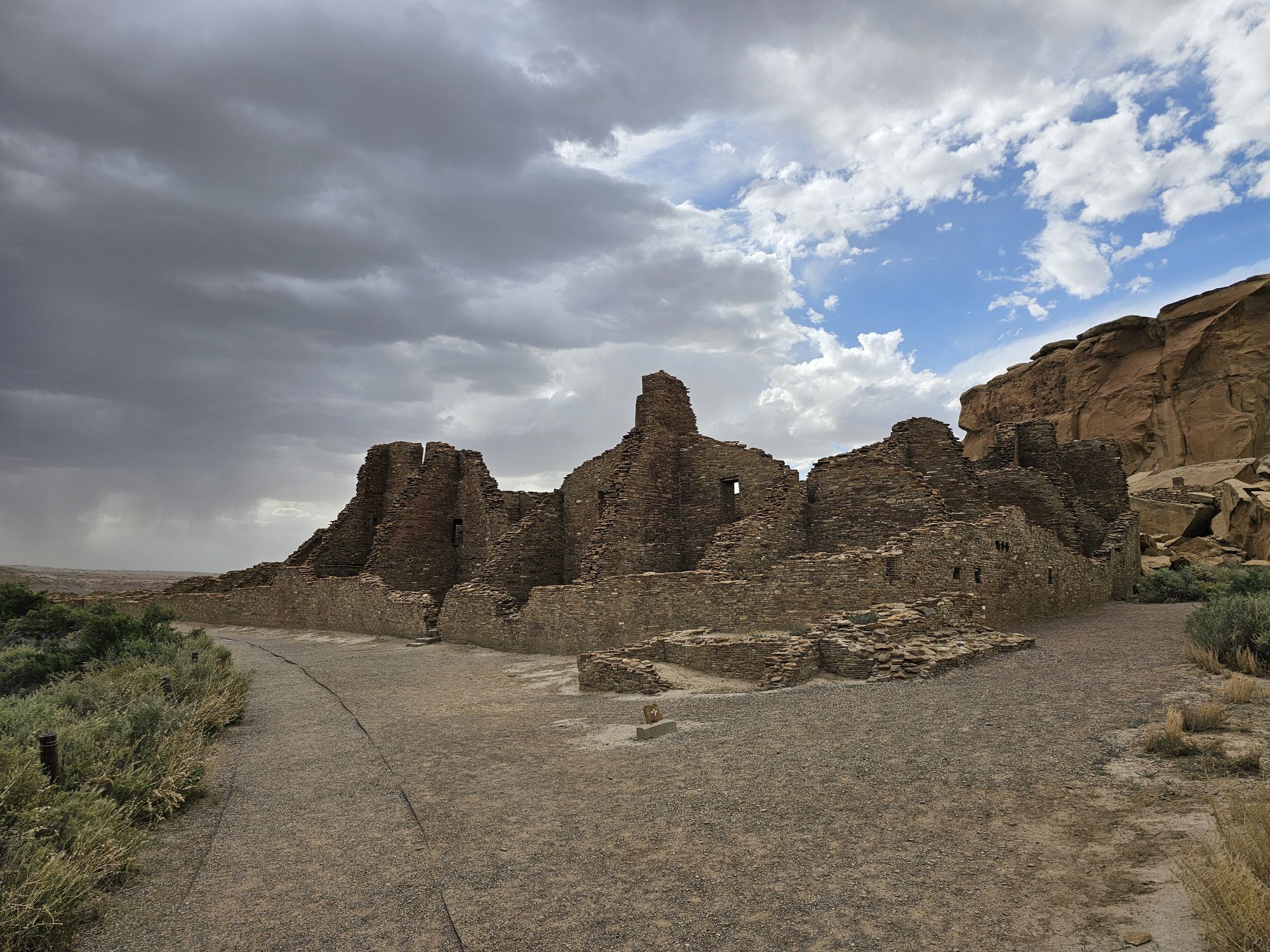
Approaching Pueblo Bonito
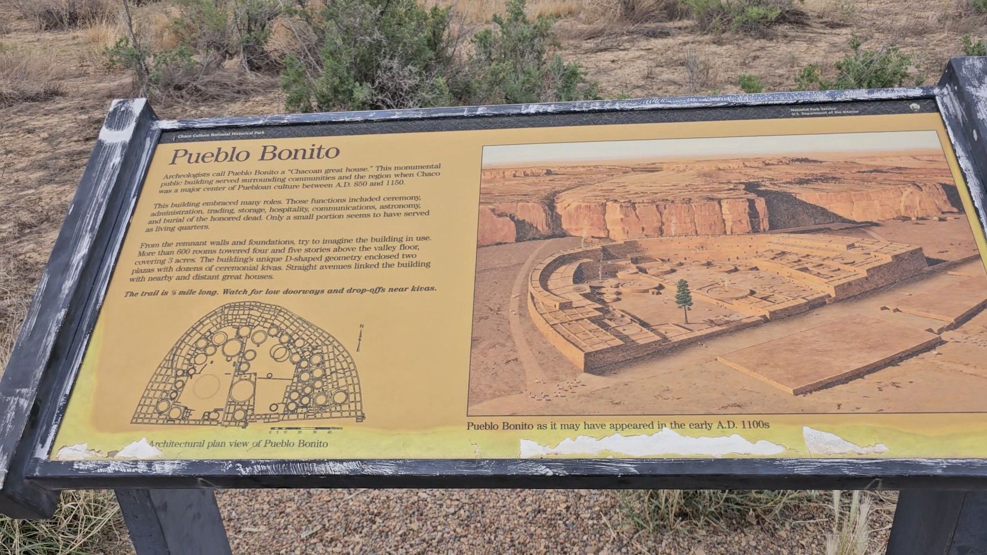
The Placard here gives you an idea of what the site would have look liked in ancient times and also what the site looks like now from above. Being at ground level really does not do any justice to this area. Taken by me.
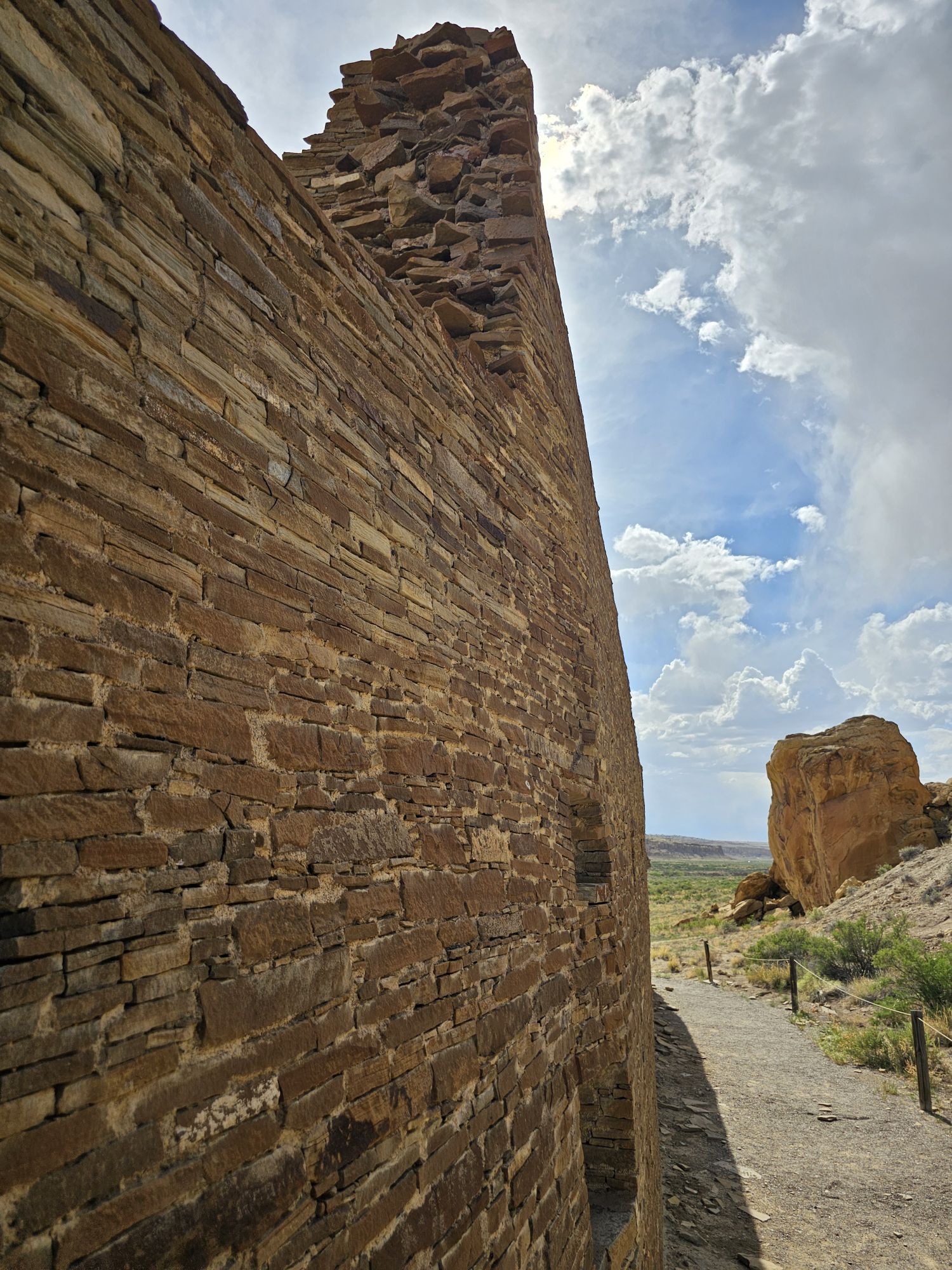
1000 years old and as far as I known, not restored in any way. Taken by me. The next several pictures are all from Pueblo Bonito.
More of Pueblo Bonito. Taken by me.
Check out this video from Pueblo Bonita!
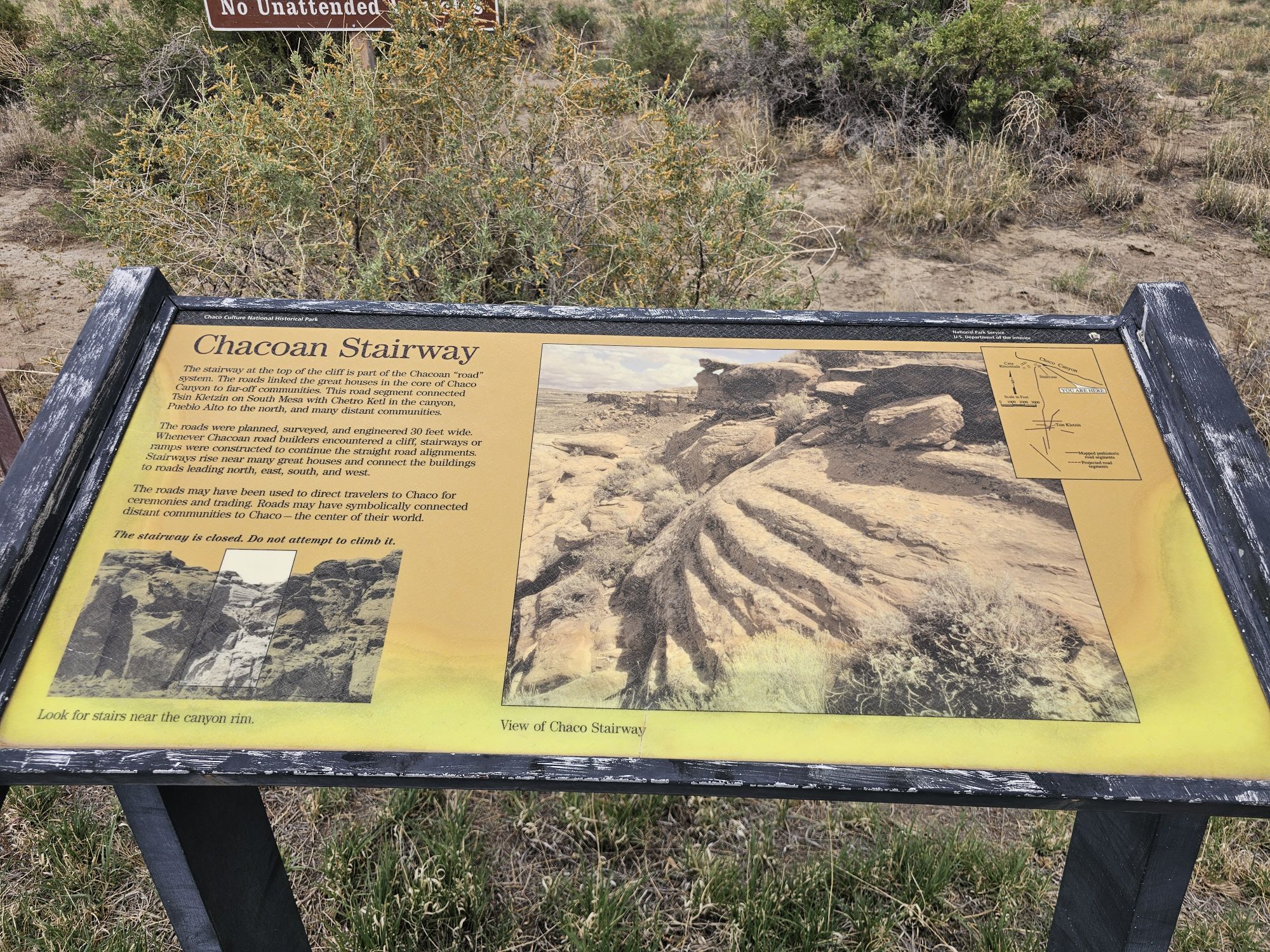
There were other things to do and see but I was concerned about the wind, which at this point was quite strong…and carrying sand, not pleasant, and the clouds coming in. I surely did not want to get caught in any kind of rain on the road getting out of here. But, the last thing I saw and will mention is the ancient Chacoan roads. This entire area was connected though a very functional and extensive road system. In Chaco Culture the roads are not easily seen other than from above, however, at many of the sites the “stairways” can be seen. Essentially these people built very straight roads and did not like curving or going around, so when it came to elevation changes they essentially built stairways down the cliffs to continue the road in a straight fashion! I stopped to check one out as the weather came in and did it in a hurry and got on my way. It was quite difficult to see, but what cool history!
This is not the only stairway in the park, but it is the one the park highlights. The stairway is right in the center of the picture. It looks like its actually paved. Any it took a minute to see it. Taken by me.
This was a very incredible place to visit if you can make it. Coming in I expected a canyon and some ruins. It was that and so much more! The history in this place is outstanding. You should definitely go, 100 percent! I only spent 2 hours here and could have easily spent an entire day, if not more. Next up will be Mesa Verde National Park!
Hey there Adventurers! We just started 2026, but I am just now catching up on my trips from 2025! First up was a spring break road trip the sidekick and I took to D.C. in March! This was a crazy trip idea to begin with. We drove. In one car – a Toyota Corolla. With two dogs. And we left Thursday morning and came back Sunday. The goal of this trip was to facilitate a #USBarkRangers meetup at the start of the Cherry Blossom Festival in D.C. As we only had two days in town it was a short trip but definitely worth sharing!
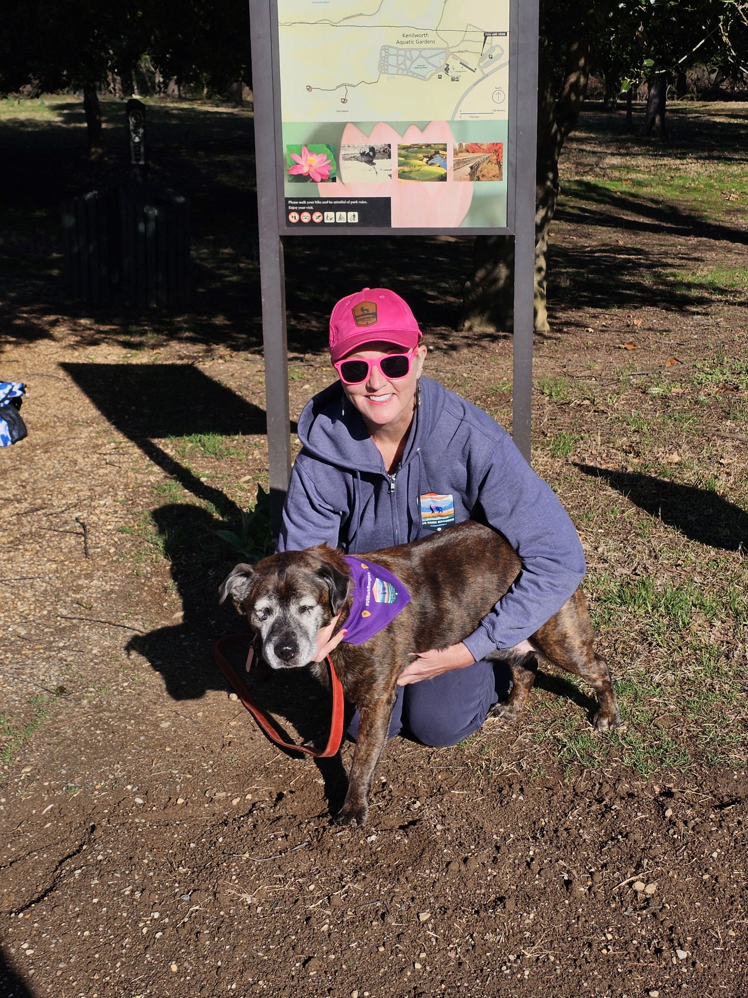
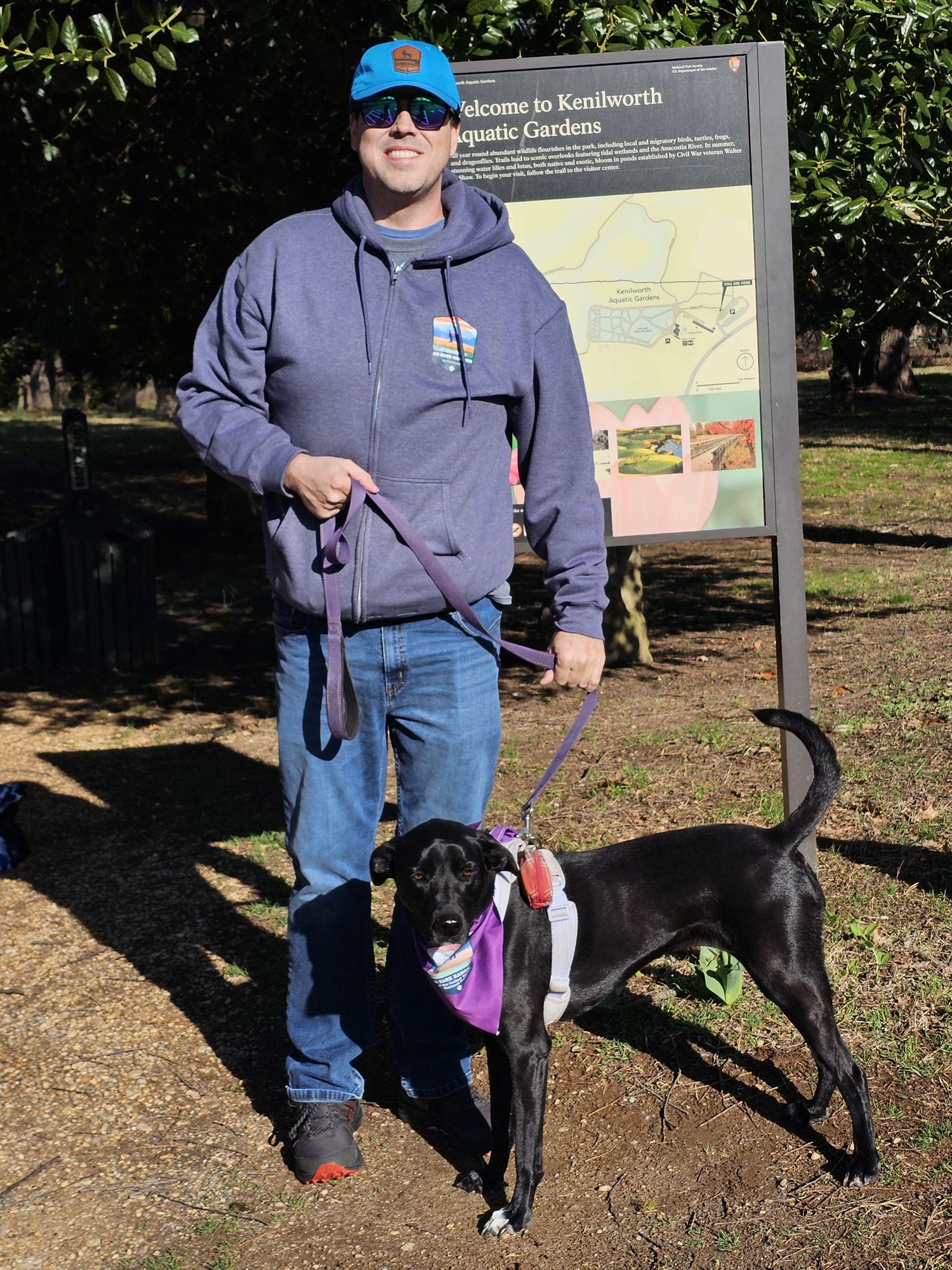
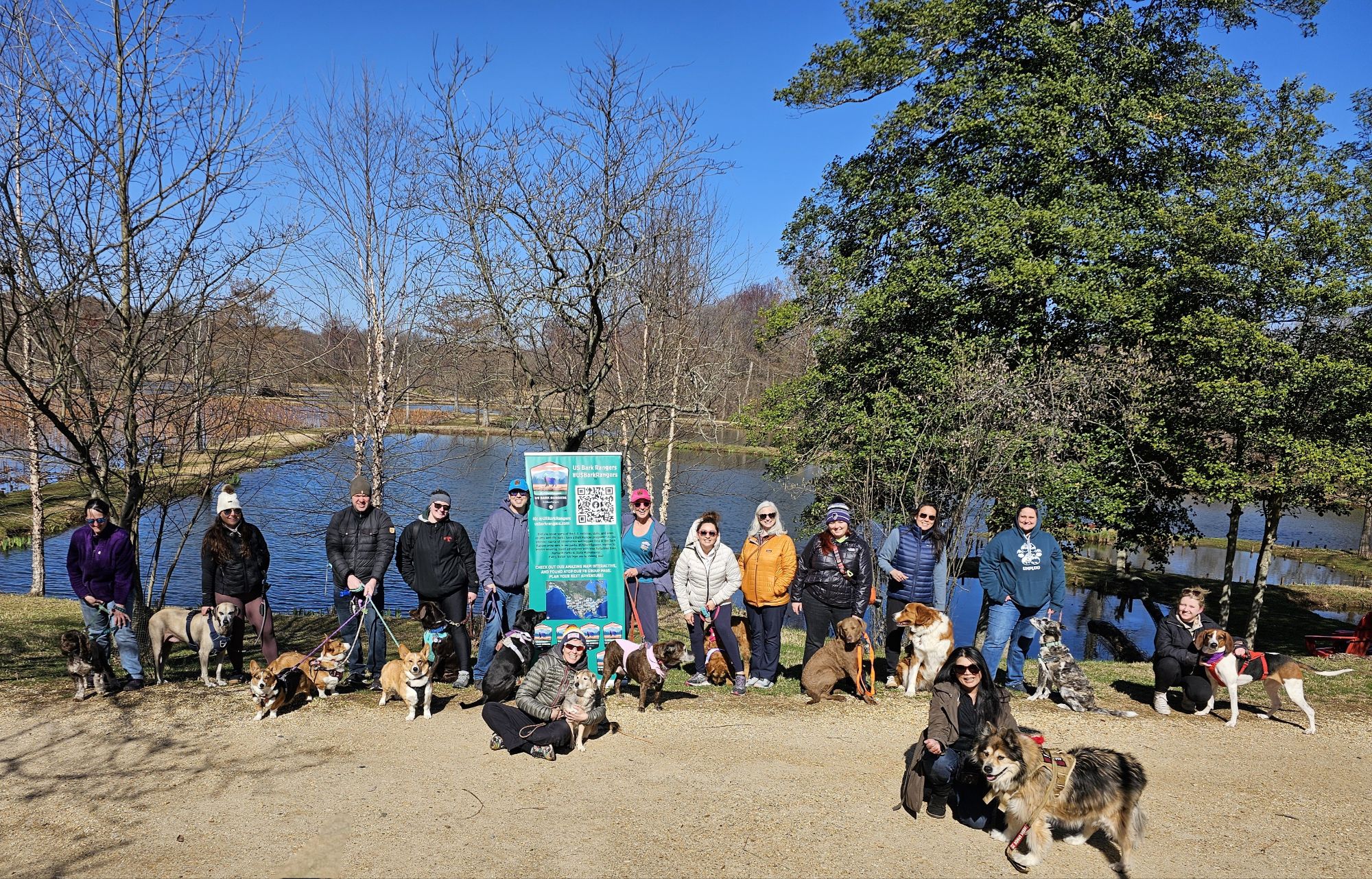
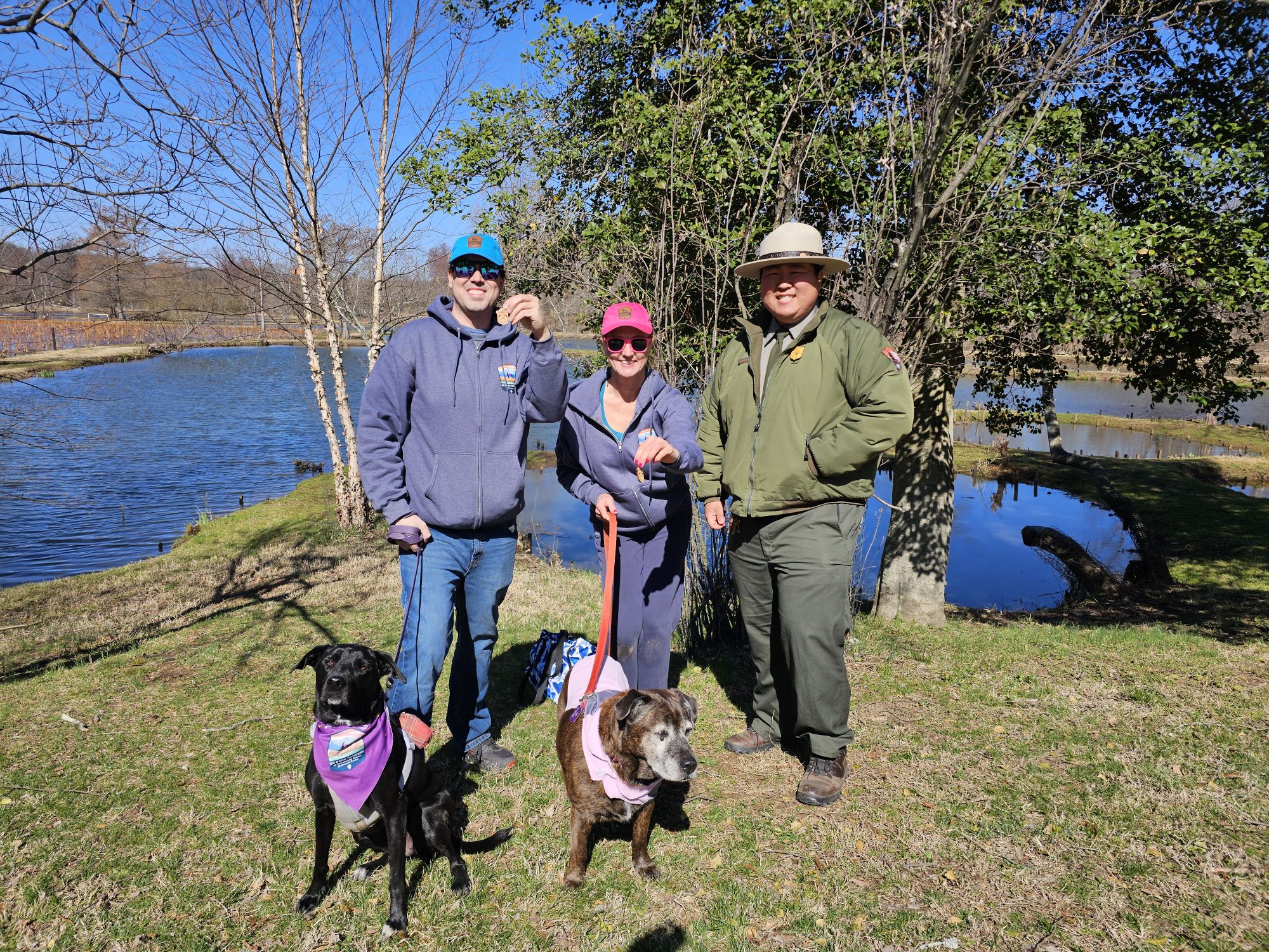
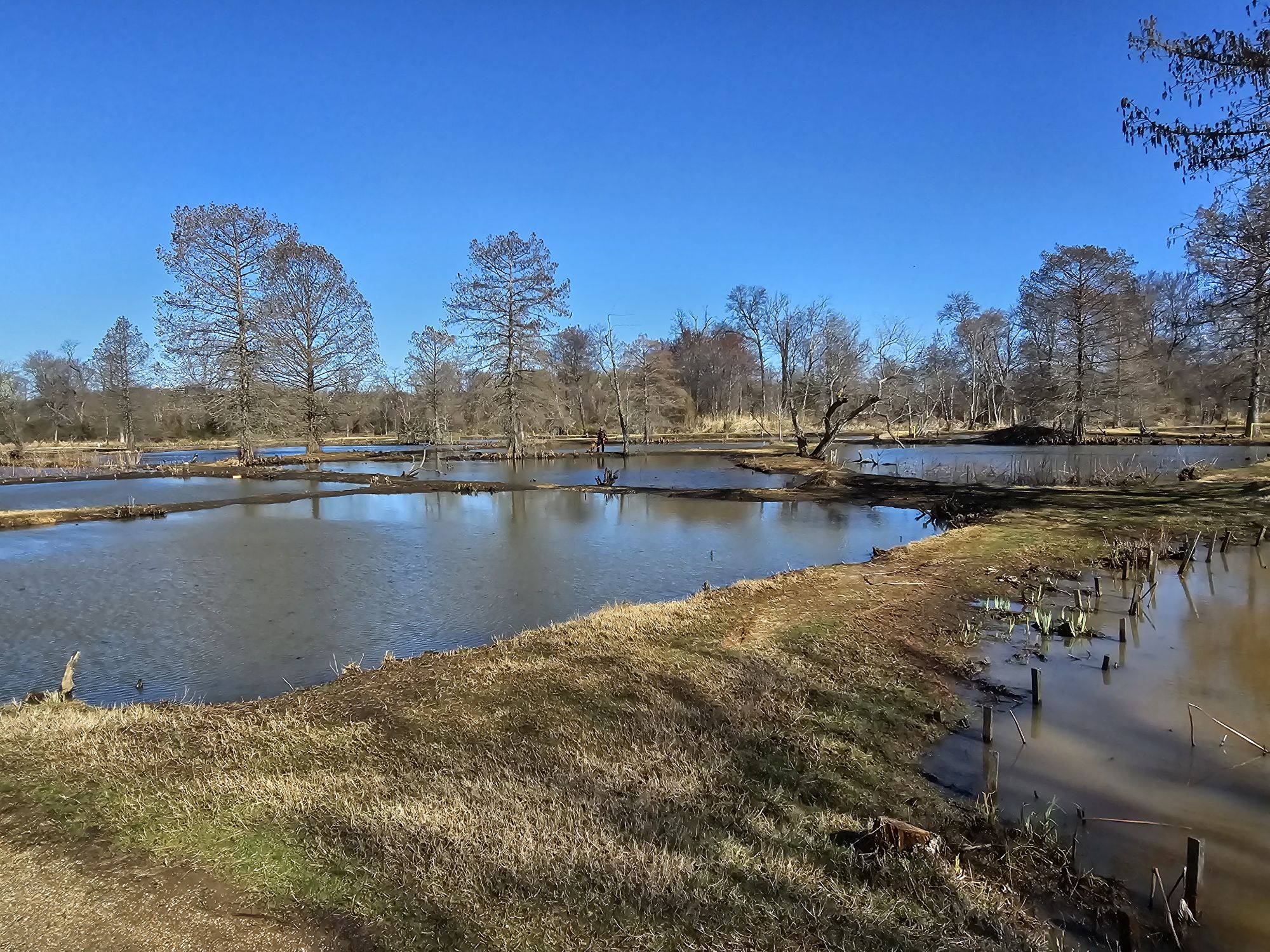
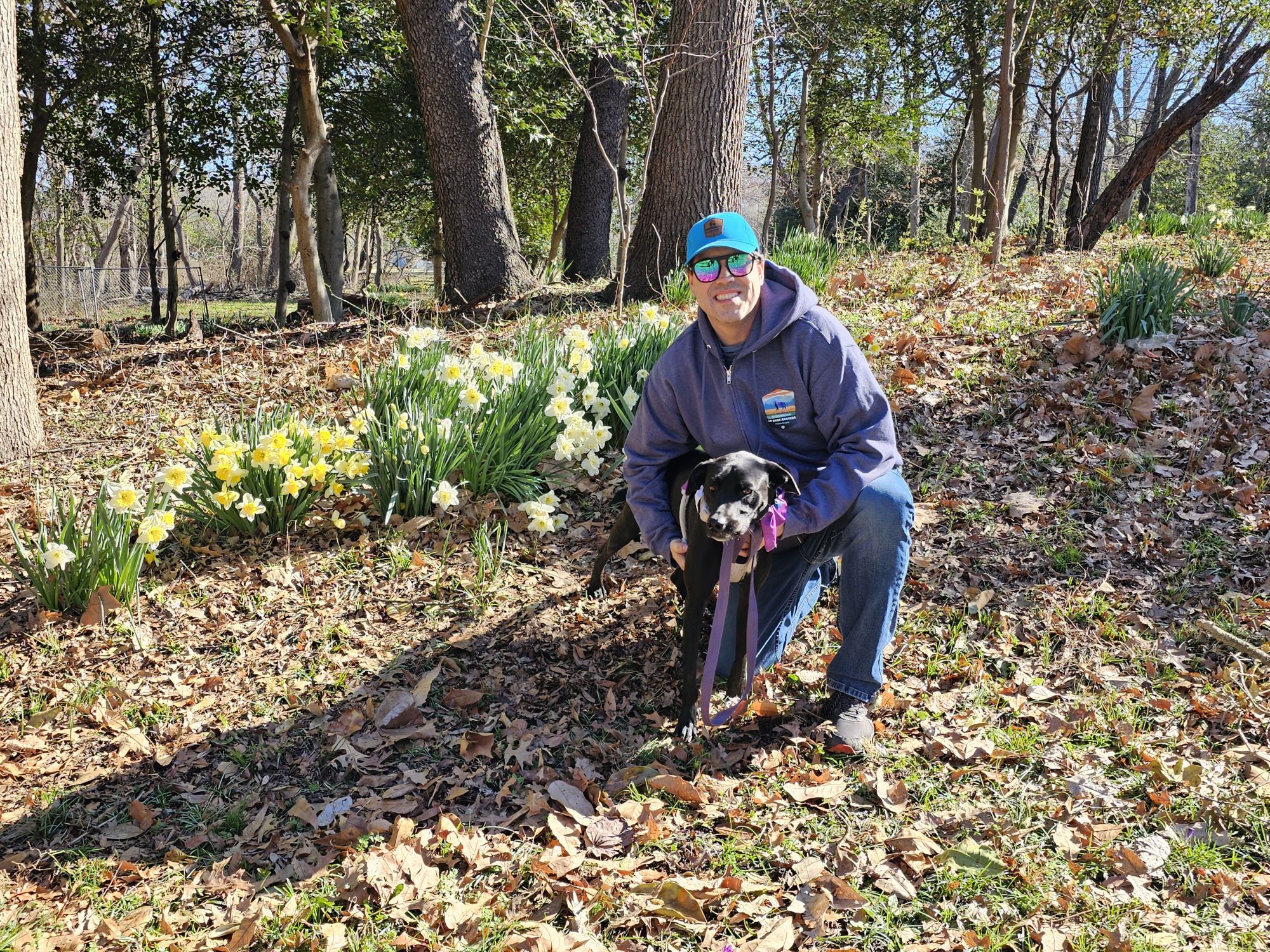
The first morning in town we met up with a group of our crew at Kenilworth Aquatic Gardens. This is an NPS unit that has a Bark Ranger program and a neat Bark Ranger tag, which is why we scheduled an event at this location. This is a really neat area to escape to in D.C.! In summer, the gardens are gorgeous, but it was still quite cool in March so the park itself was not spectacular, but the meet up event was great! We had maybe 15 members and their dogs attend and we did some pack hikes and had a large group swearing in with the Park Ranger! So cute! Later we met up with another group of a half dozen or so members of our group for pizza before calling it a night.
The sidekick and her Bark Ranger Lily!
Me and Bark Ranger Maisy.
The whole Kenilworth #USBarkRangers group! Taken by the nice park ranger!
Nicki and me with our Bark Rangers, and the Ranger who did all the cool NPS stuff for us!
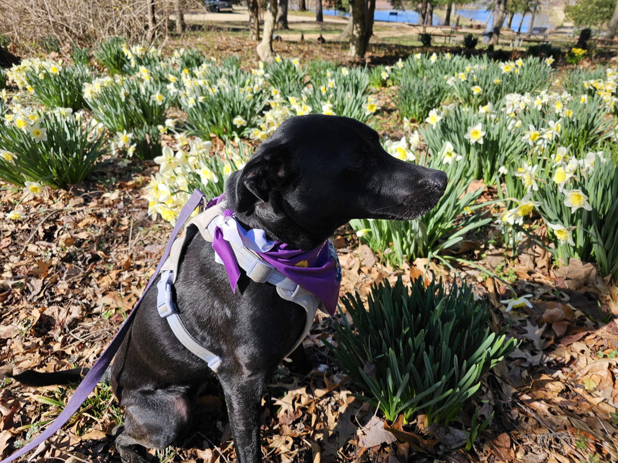
This is the gardens area. It was march and obviously the pretty flowers were not ready yet!
But some flowers were starting to come in!
The struggle getting this dog to act right for a picture is real.
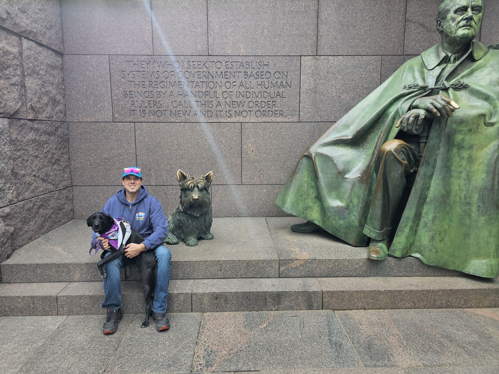
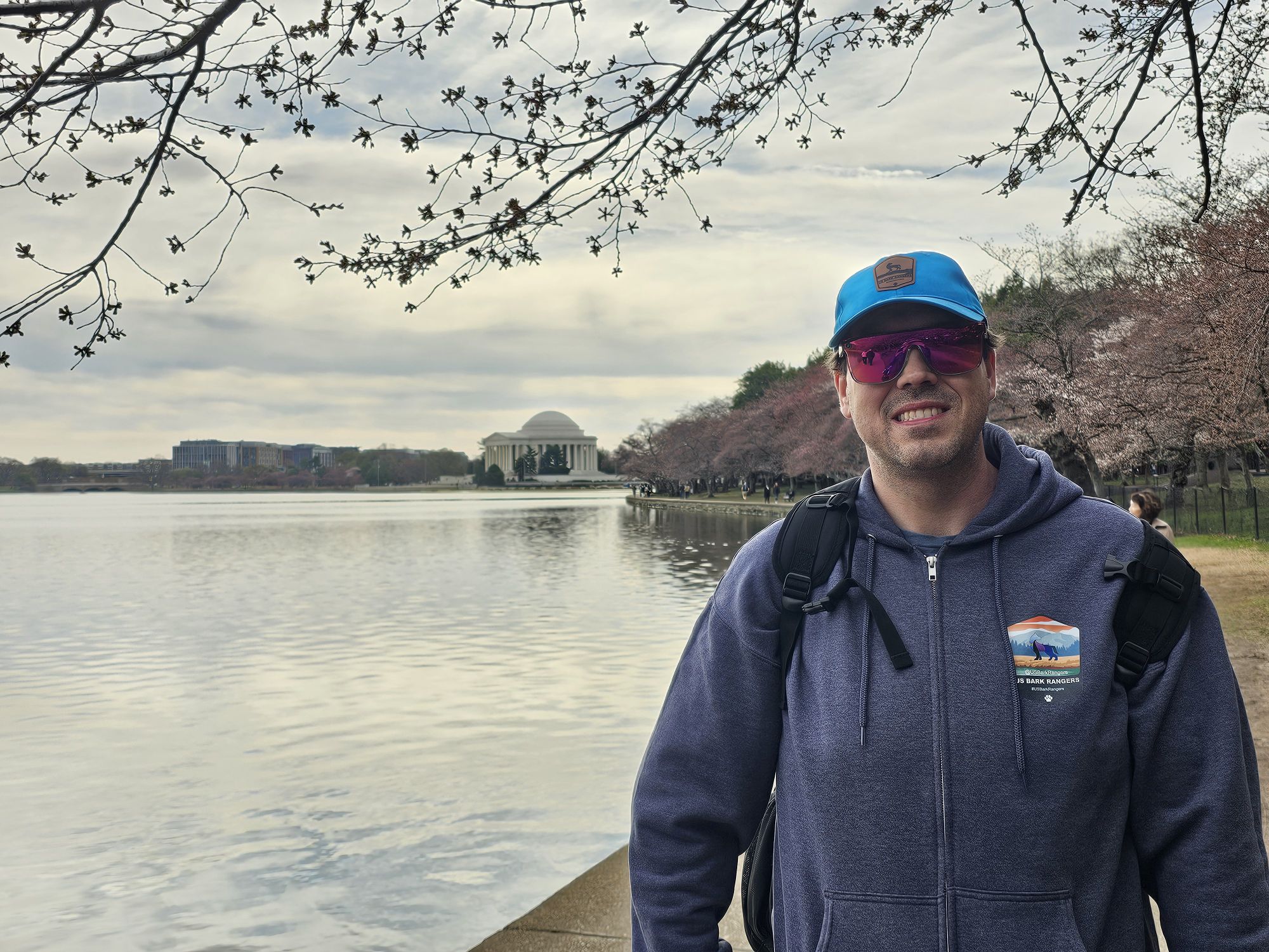
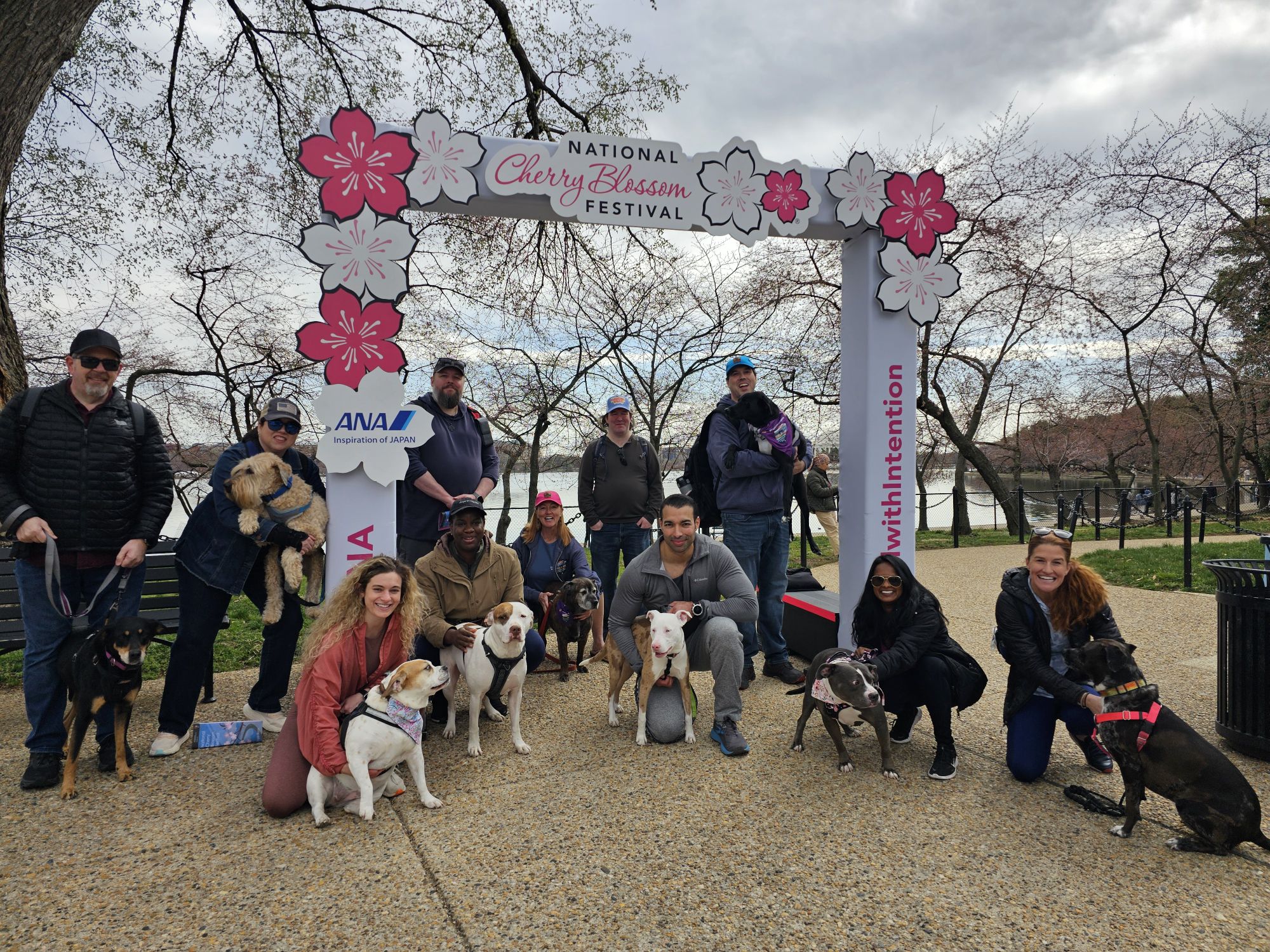
The next day we got up early and met up with another large group at the MLK, Jr. Monument in the National Mall. Nicki and I got down there early to park and went to the FDR memorial first to get in some brief sight seeing. Afterward, we met up with our crew and went to the Cherry Blossom Festival location. This event is actually put on by the National Park Service and they did a big group swearing in for us as well! Super cute! The trees were just starting to put out the blossoms, so it wasn’t great for that, but the events were great for our group!
Nicki took this picture…it’s hilarious actually…Maisy never has her ears down like this! But she was NOT having it with FDRs dog, Fala! This is the FDR monument.
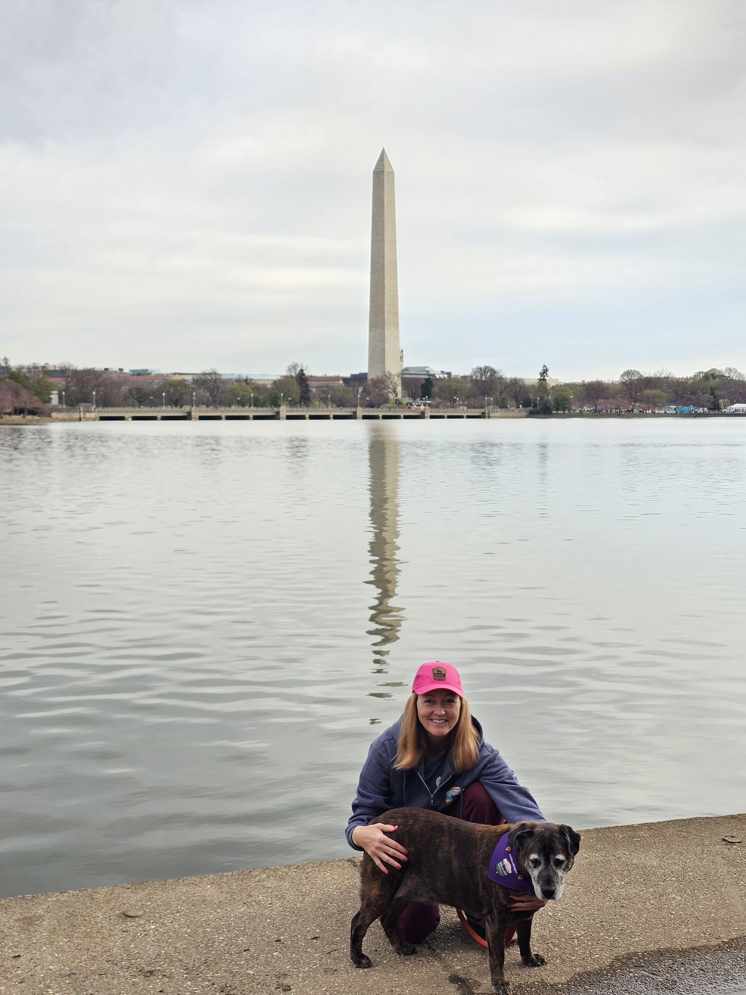
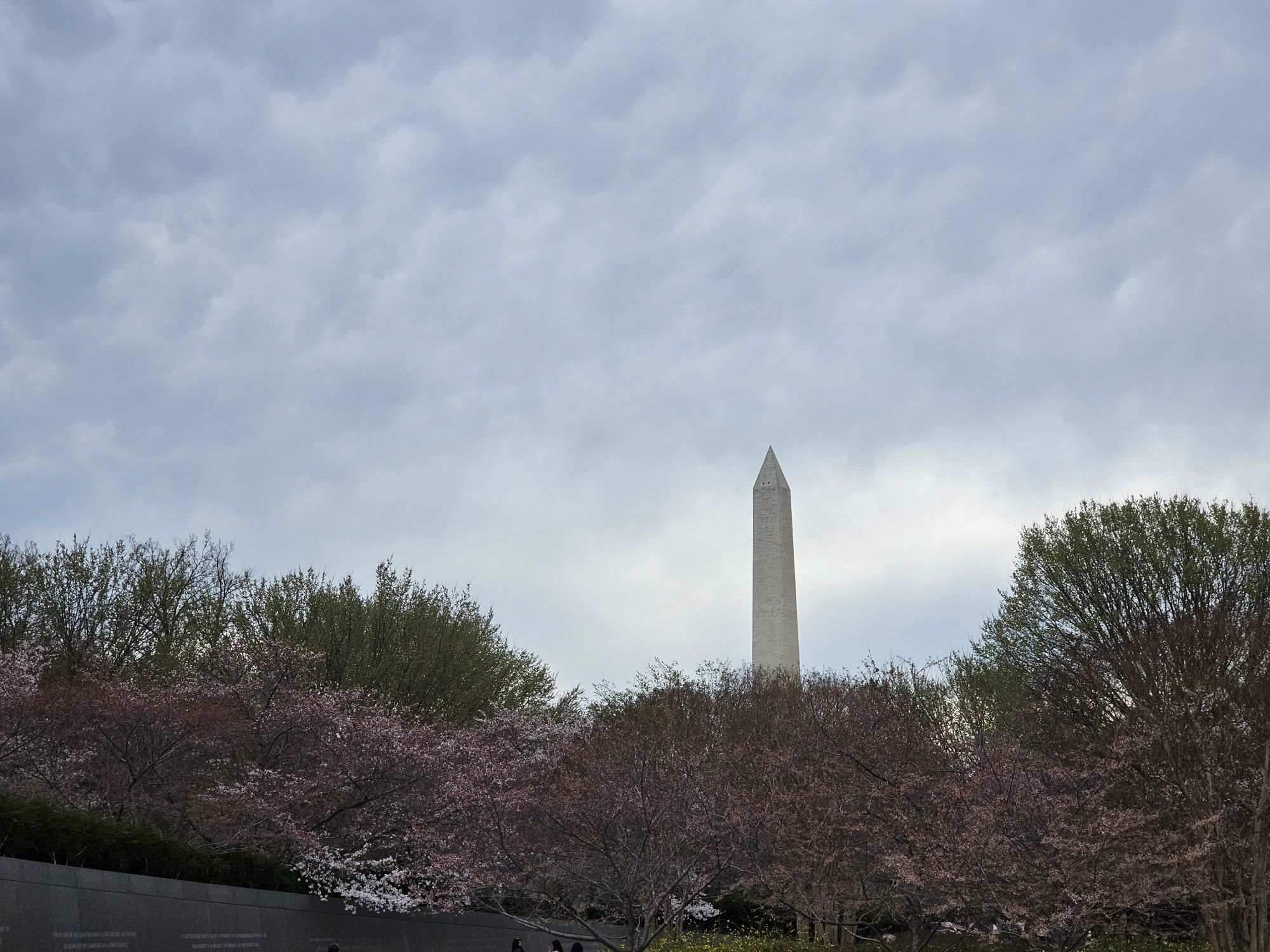
The sidekick snagged this of us in front of the Washington Monument.
And her and Lily got the same from me!
The cherry blossoms were just getting started when we were there. Jefferson monument is in the background.
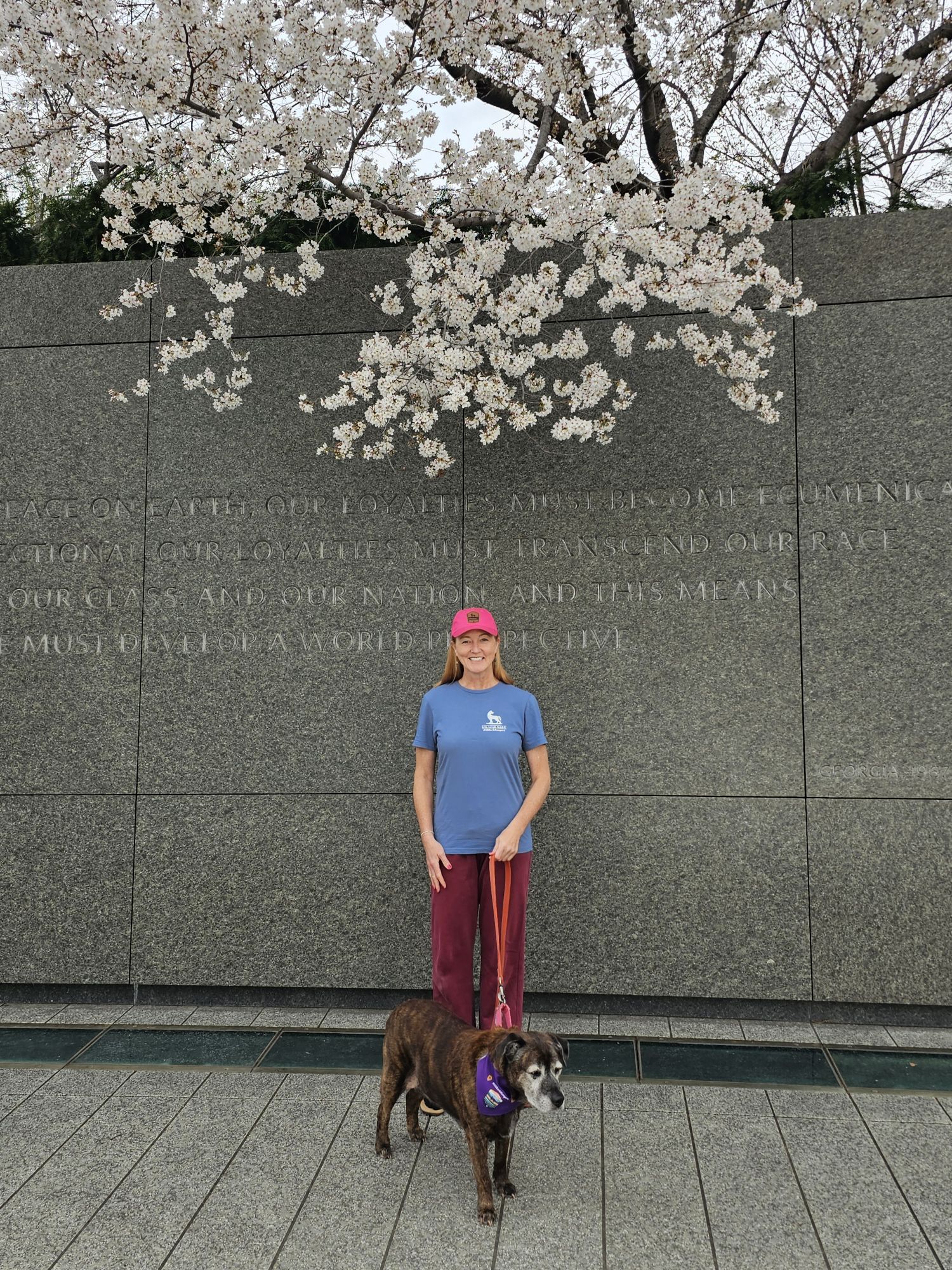
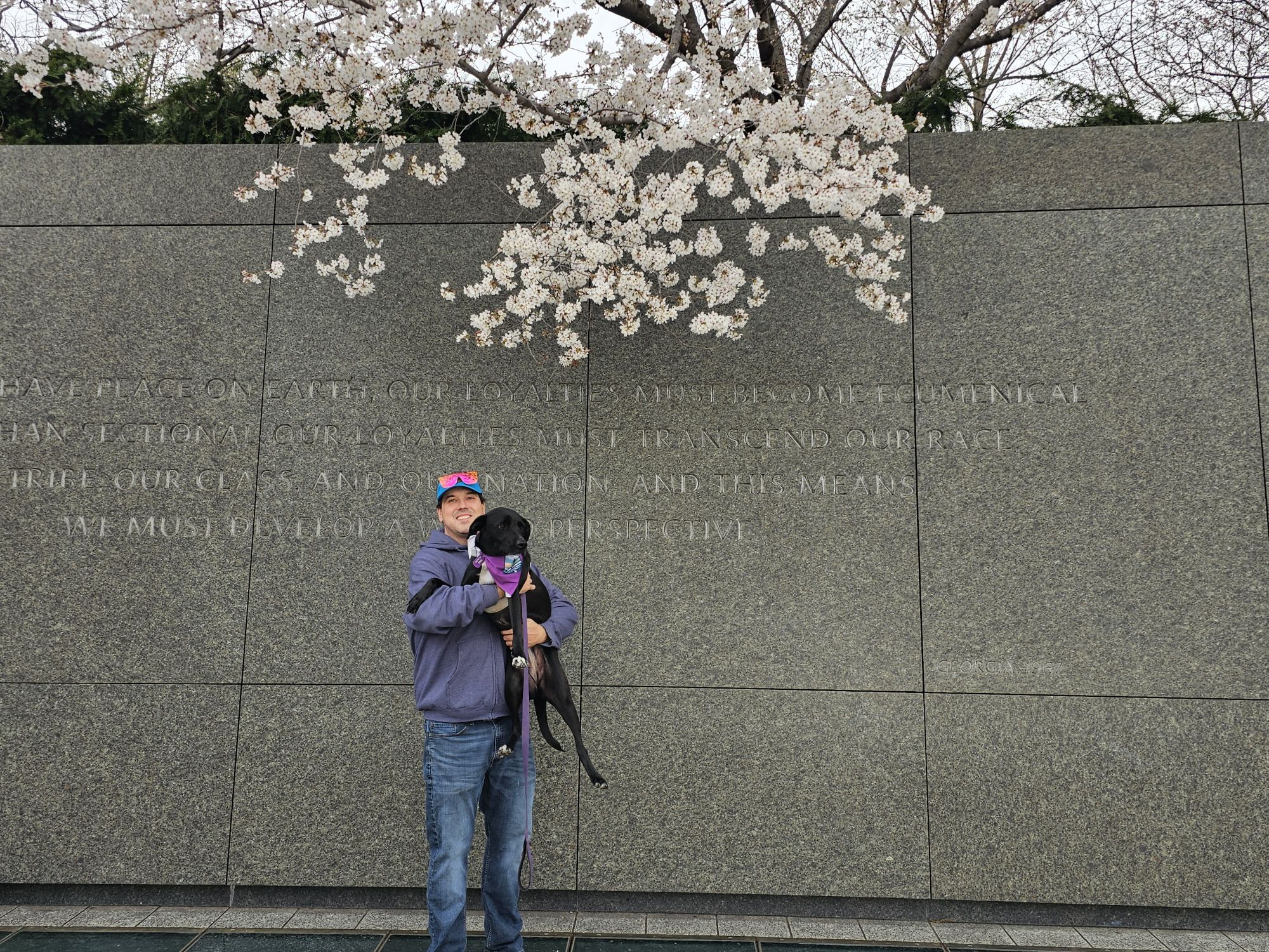
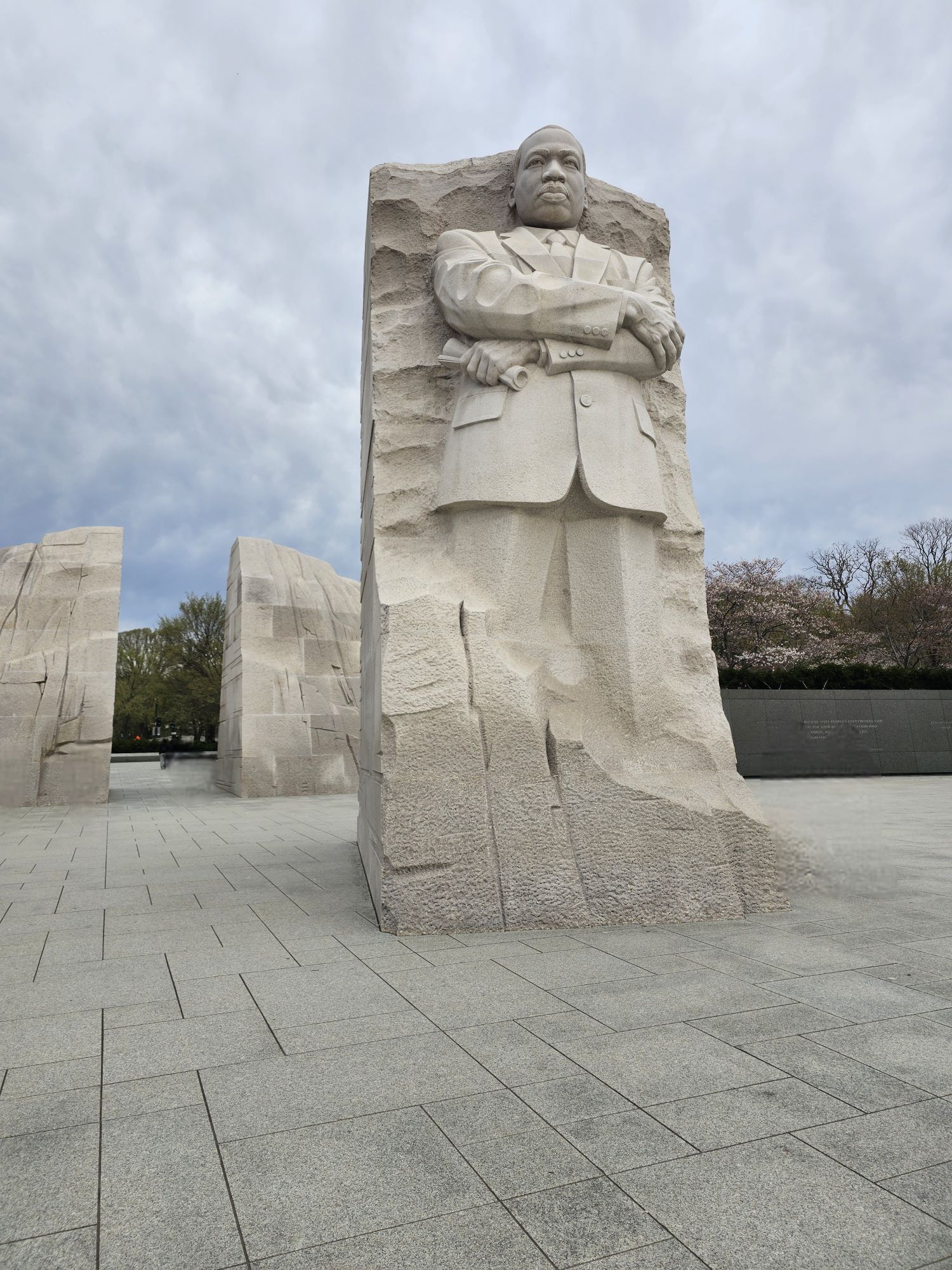
At the MLK monument.
Trying to get this Bark Ranger to pose…
MLK monument. Taken by me.
Some of these trees were trying! They are not all cherry blossoms, but some are. Taken by me.
This was part of the group that came out to get sworn in as Cherry Blossom Bark Rangers.
Check out this super cute group swearing in the Park Rangers did for our group at the Cherry Blossom Festival!
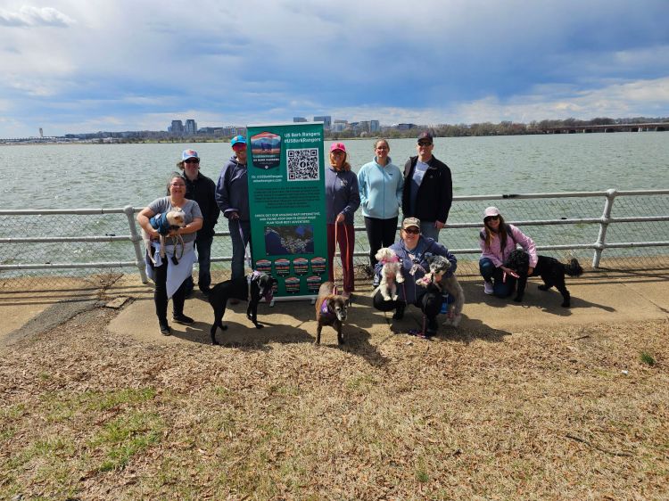
Afterward we actually met up with yet another group of people, some who were not part of either of the two previous events, down in the Potomac Park Area. We set up some chairs and socialized for a couple hours. Overall these were all super chill and fun events for our #USBarkRangers group! Because of the timing of things there was not a lot of D.C. exploring to be had…so I made a decision that I would be coming back. I didn’t really know it at the time, but I would come back just 6 months later, so stay tuned for that post!
This was the first of two official Bark Ranger Events we did in 2025 and I actually met up with another member to do Bark Ranger stuff over the summer. It was really amazing to actually get to do events with people from our amazing group! My next post is going to feature a sequence of parks in New Mexico including Colorado’s Mesa Verde, so stay tuned!
Hey there Adventurers! If you just read my Puerto Vallarta post you may have noticed I mentioned it was my last trip of 2024. That’s true, it was. However, I forgot this brief visit in Indiana earlier in November!
George Rogers Clark NHP is probably the very first NPS unit I ever visited. I grew up in Indiana only 45 minutes from this park, and everyone took a field trip there in elementary school! I already have this in my NPS unit count which is why there is no new count at the top. That being the case the last time I was here the internet did not exist, nor did cell phones, digital cameras, or any such sorcery! I found myself in Indiana in the early part of November and took a quick couple hour trip up from Evansville to Vincennes, IN.
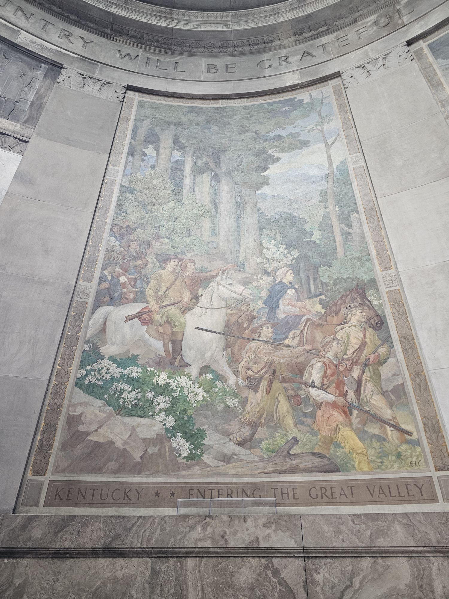
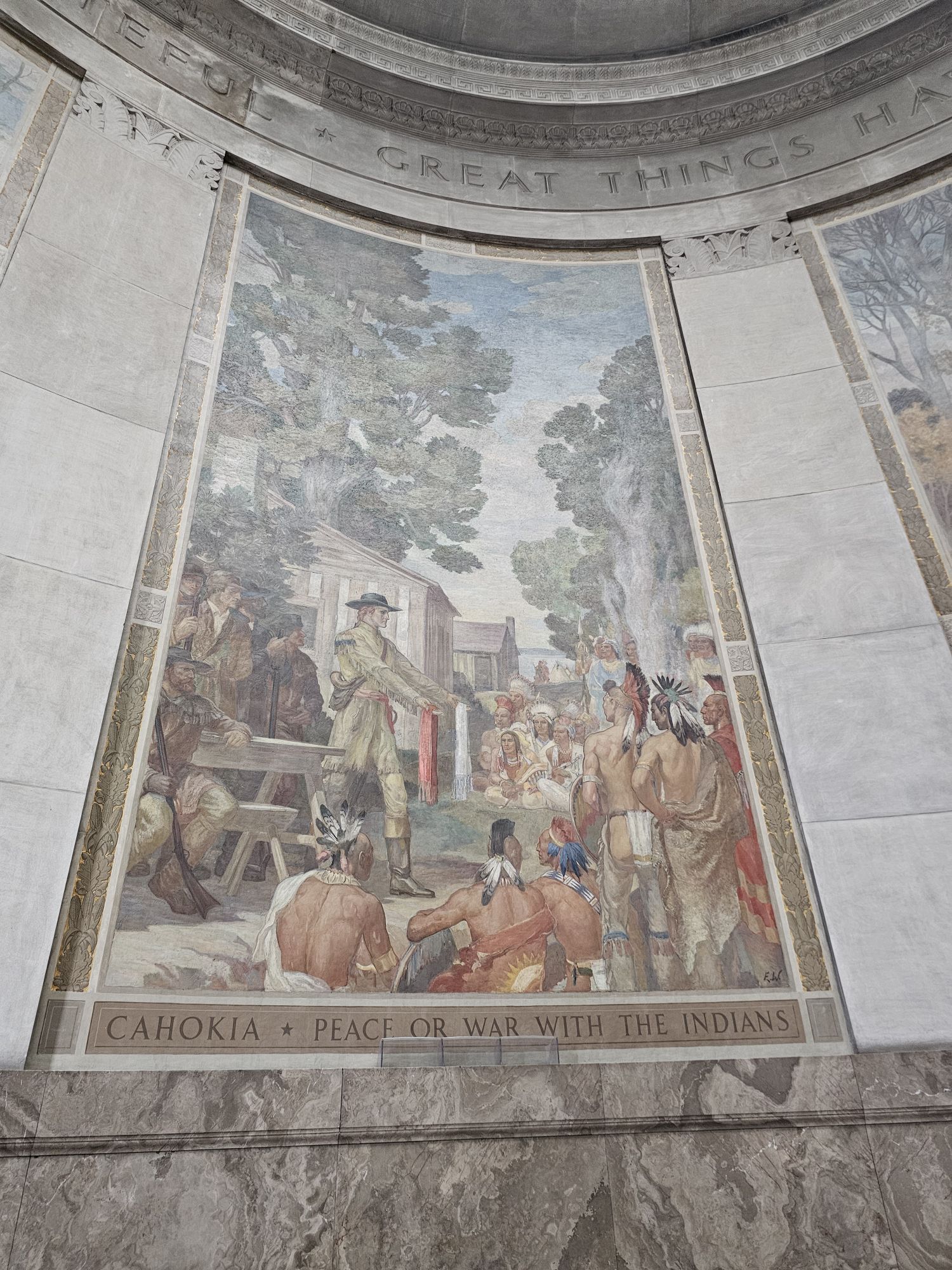
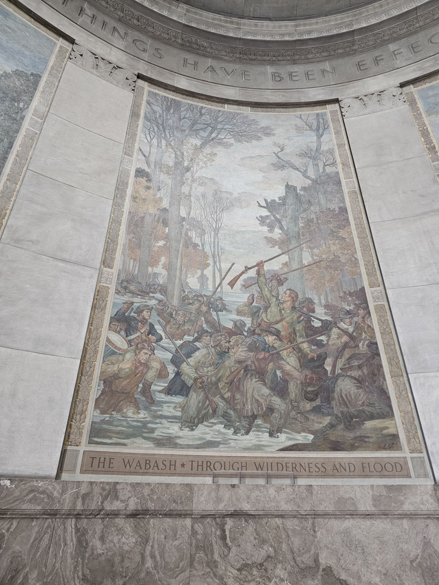
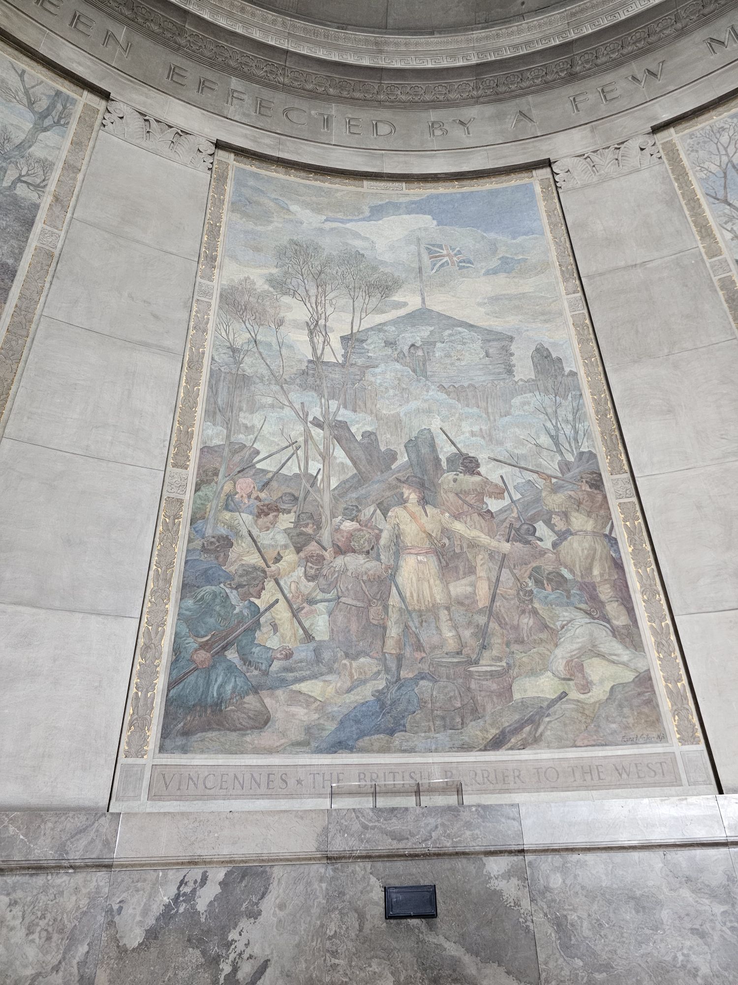
There is a lot of history here. I will give a brief account, and you can fill in the rest. This area was settled before the Revolutionary War (our native bothers and sisters, of course, where here before then). Once the war broke out G.R. Clark was in charge of the Virginia Militia in Kentucky. He was instrumental in the US forces taking Vincennes from the British during the war. This entire area was know as the Old Northwest and part of British Quebec. This weakened the British positions and they ceded all the land to the US in the Treaty of Paris. Essentially, G.R. Clark was the reason we gained the land that would lead to the modern day states of Ohio, Indiana, Illinois, Michigan, Wisconsin, and parts of Minnesota.
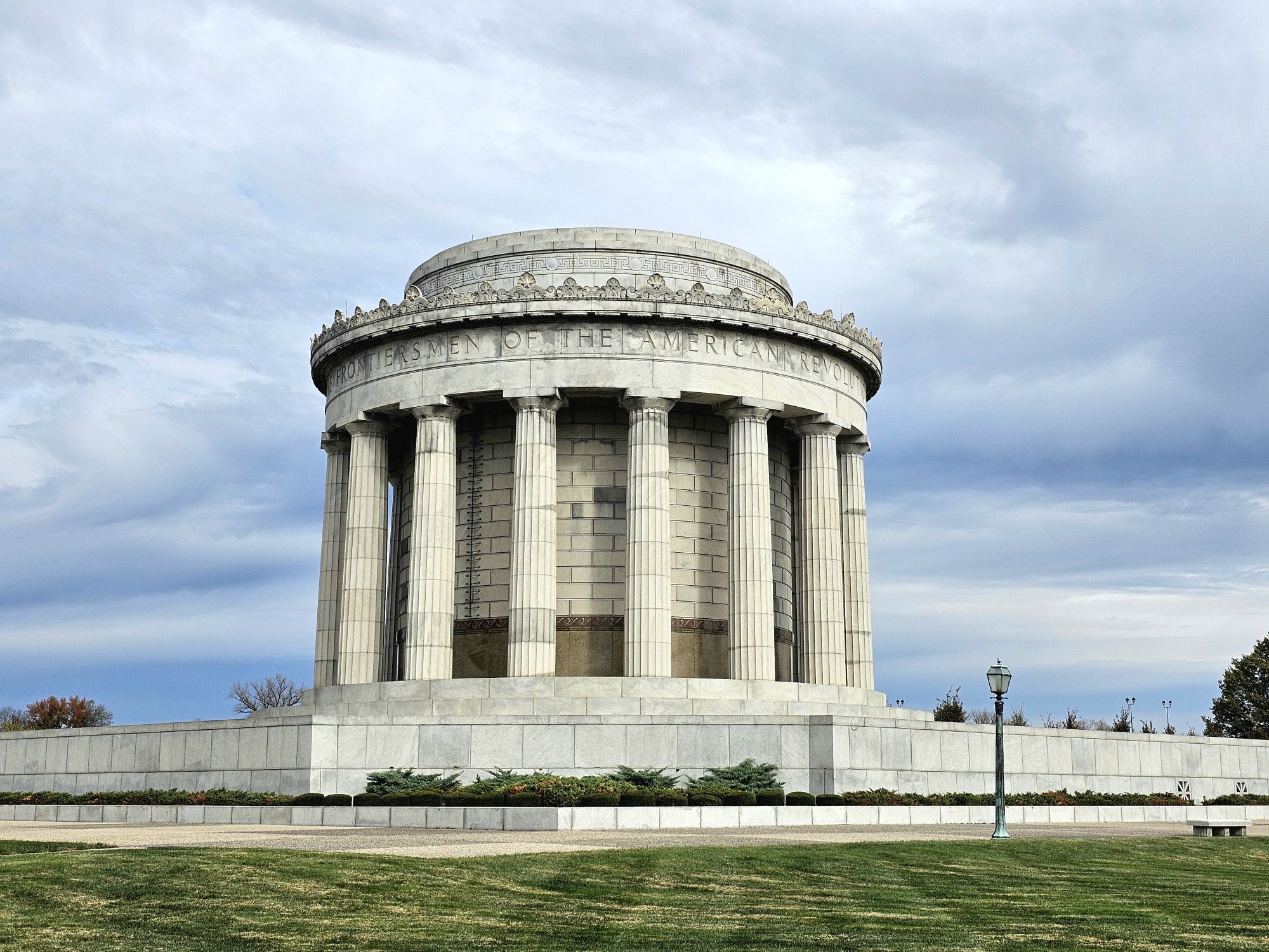
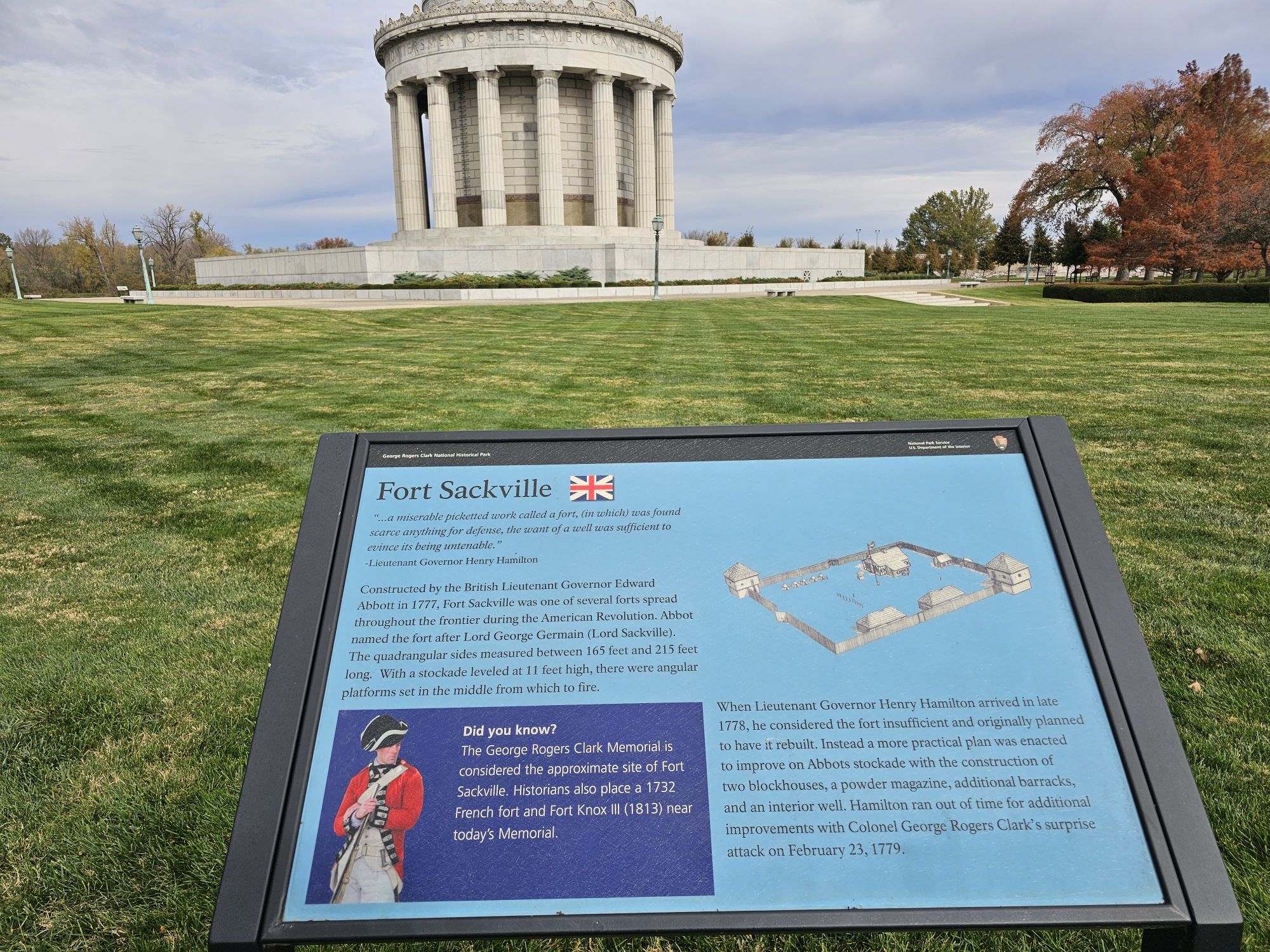
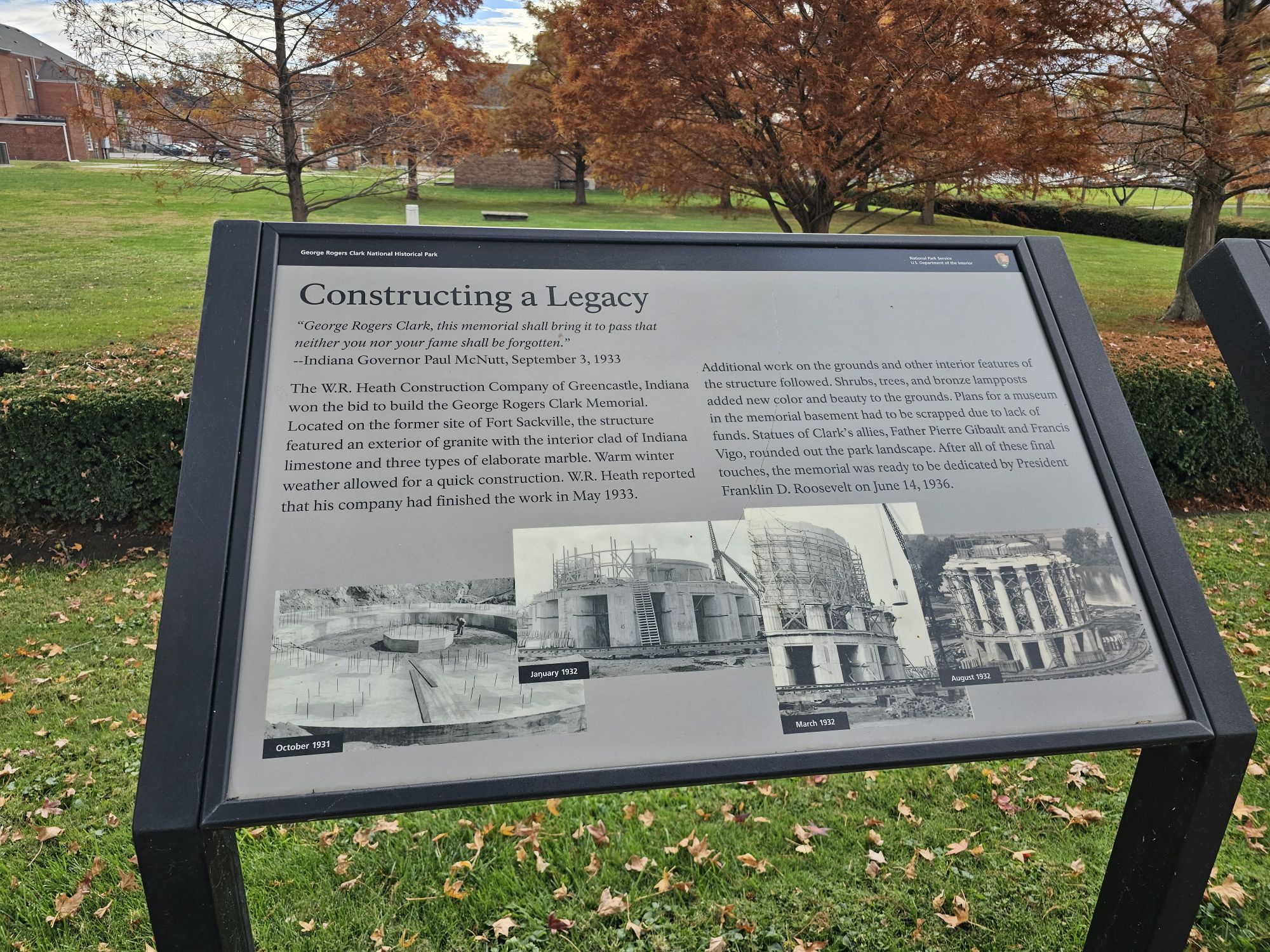
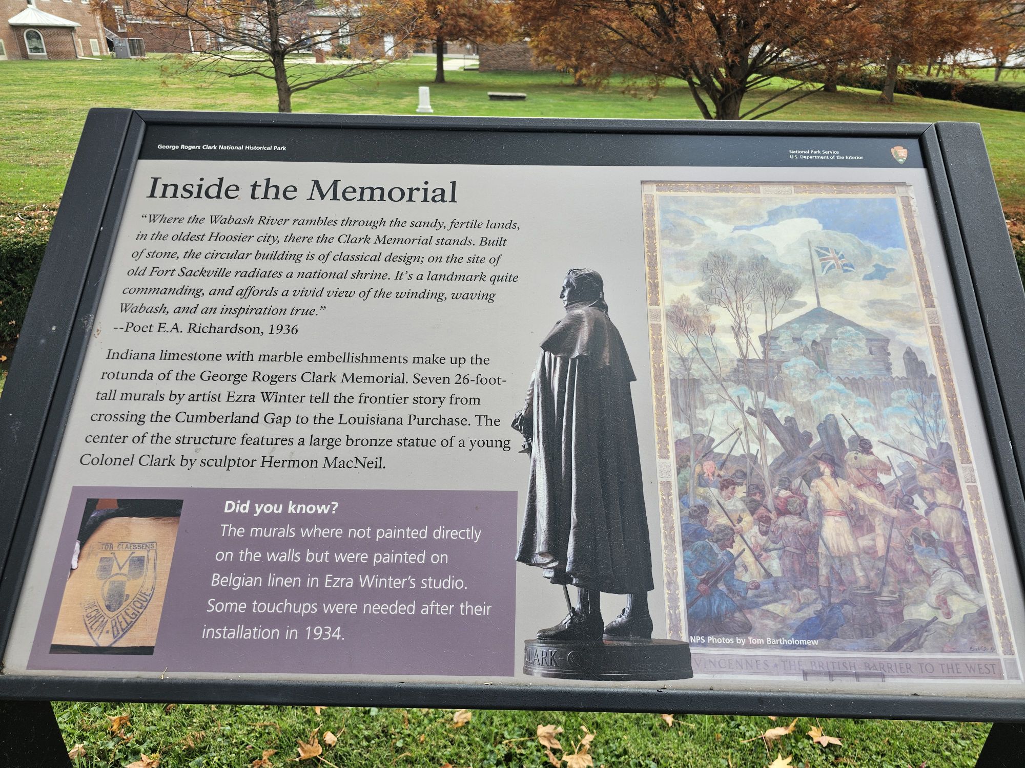
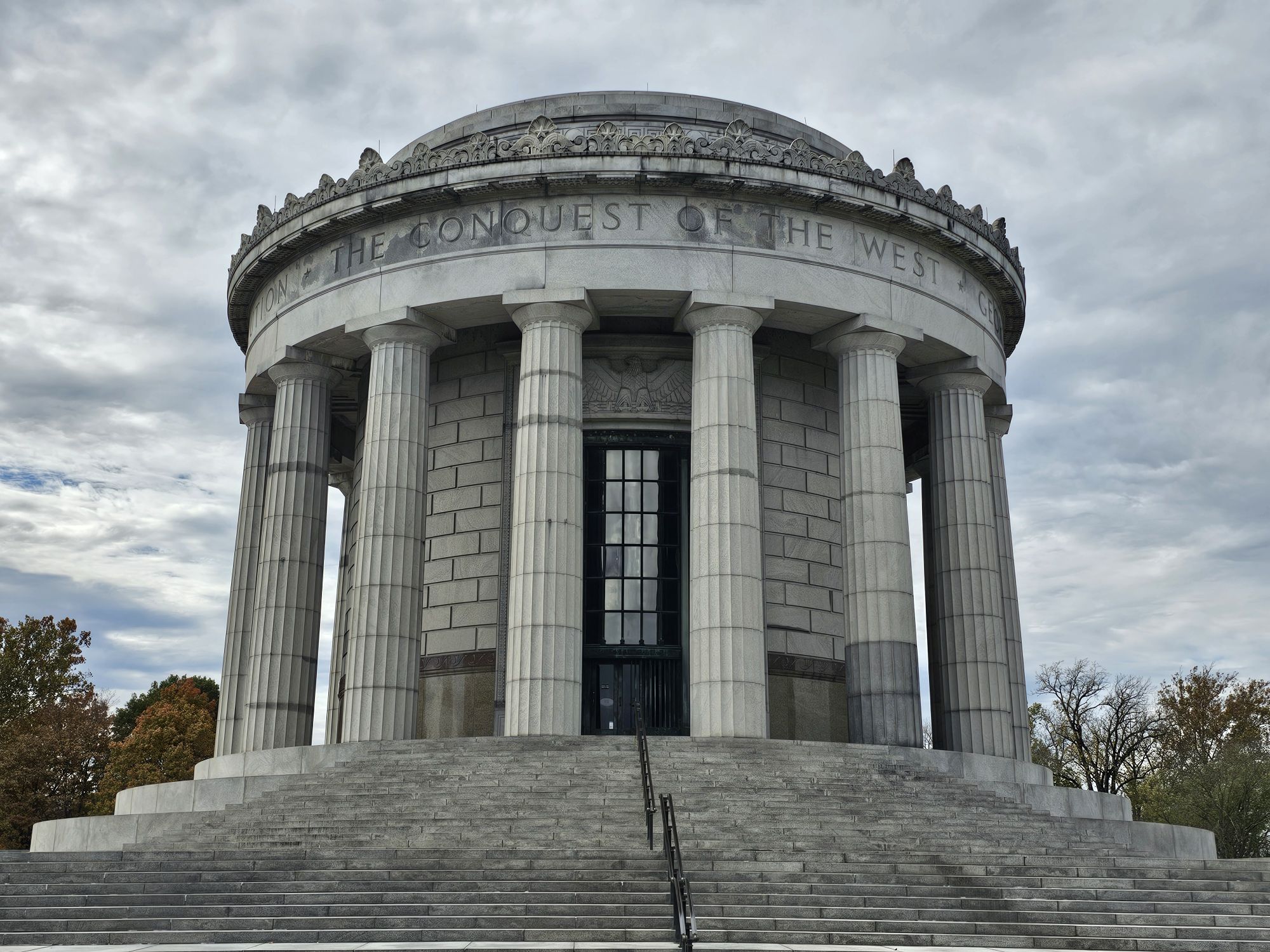
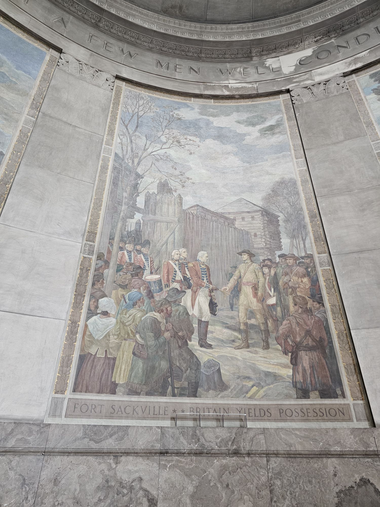
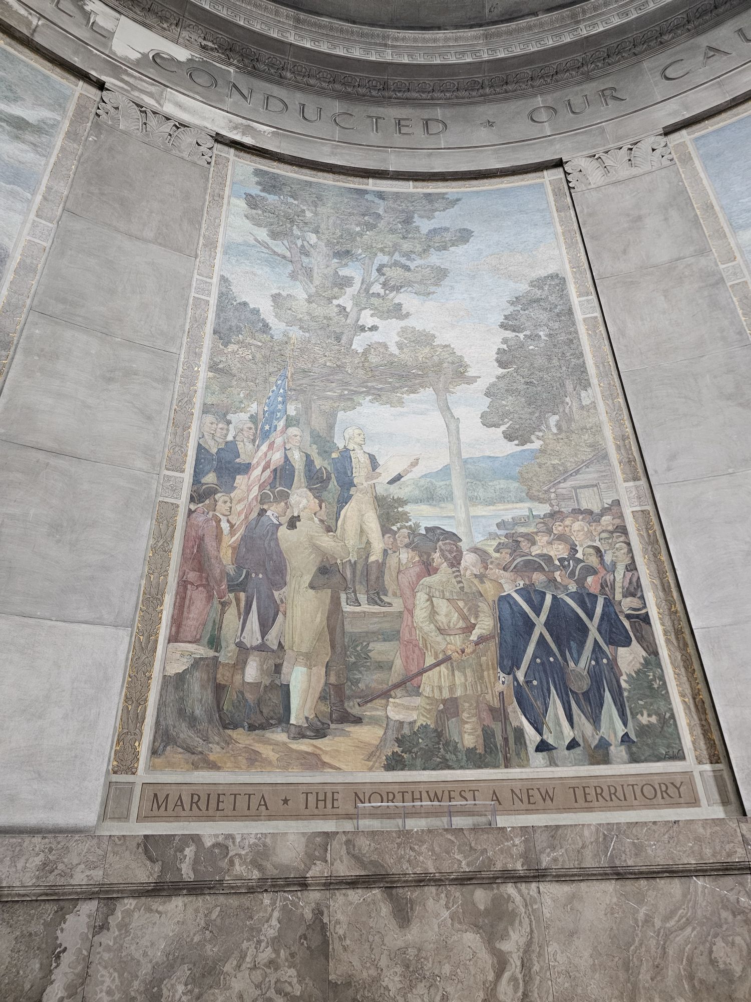
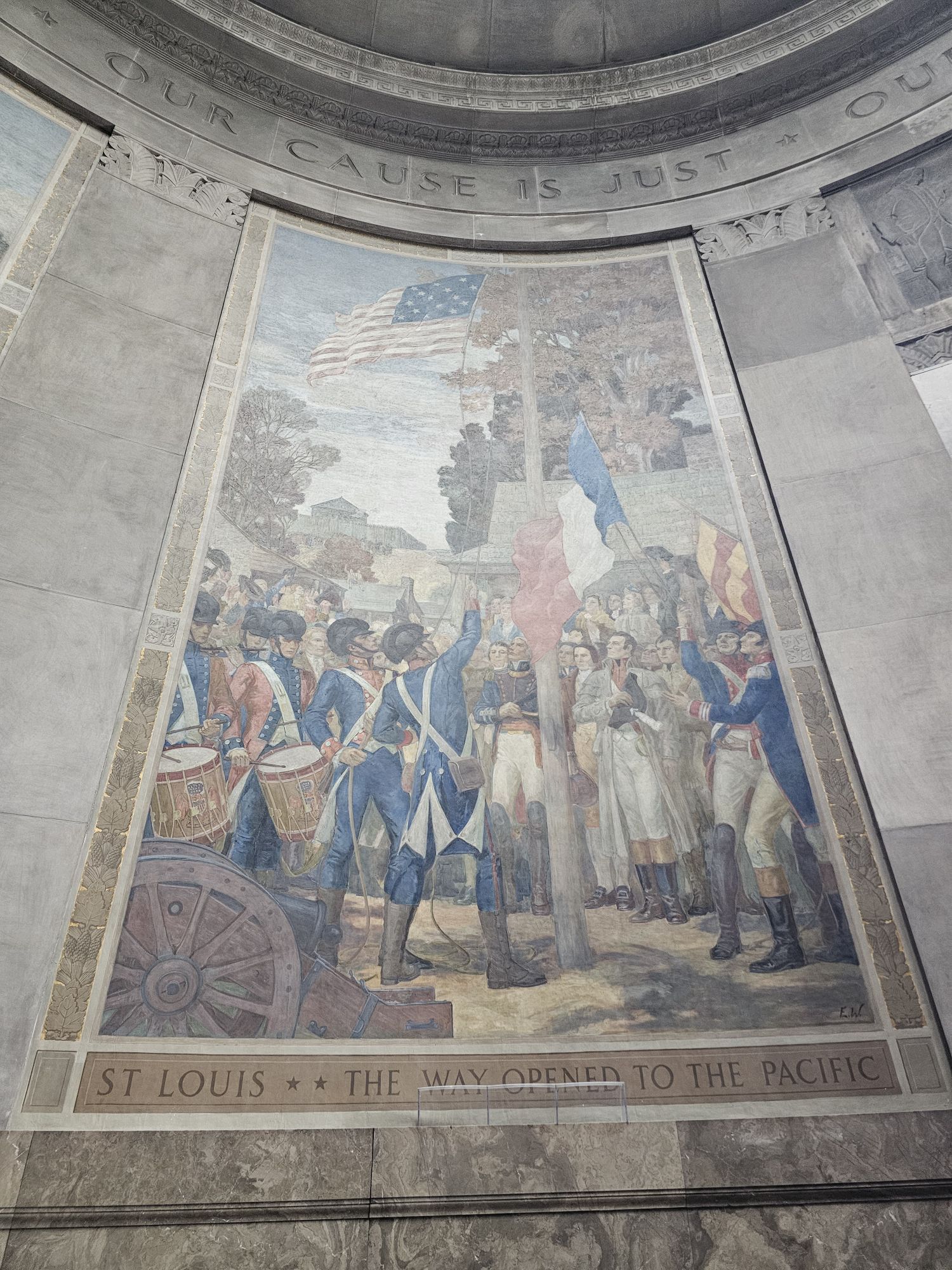
The monument here was built nearly 100 years ago and honors the man. The site of the fort is the approximate location of a fort called Sackville, but that exact location is unknown. At the end of his life he was broke and had a tarnished reputation for being a drunkard. The entire site in Vincennes is quite nice and pays homage to his history despite the rough end to his life. This is not a site you would go out of your way to visit. There is no Bark Ranger program here either, but if you DO catch yourself in southwest Indiana, this is a worthy couple hours detour for sure!
It’s really a beautiful monument. Taken by me,
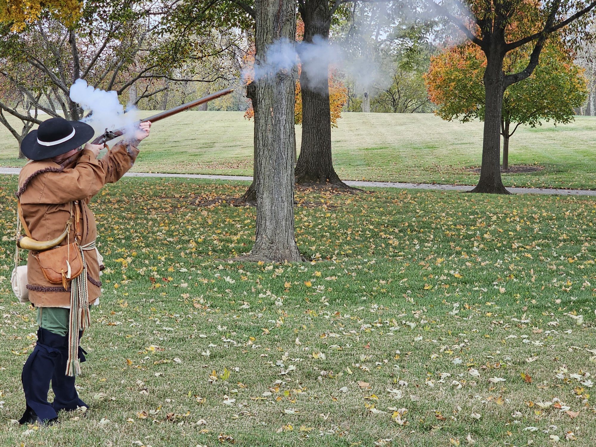
The do live interpretations here, always neat to see! Taken by me.
Another side of the monument and the way inside. There are a decent amount of steps and no way around them either. Taken by me.
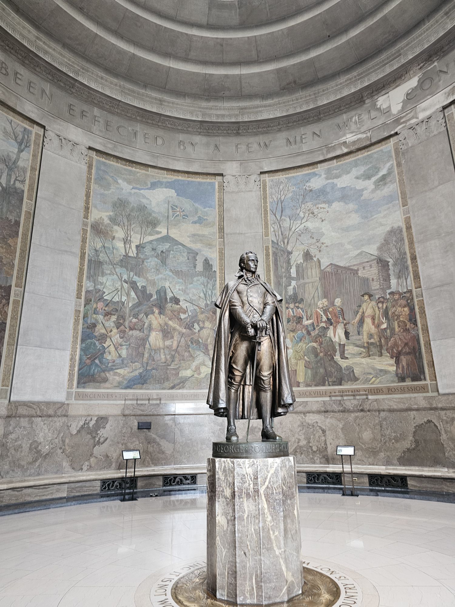
The statue of G.R. Clark inside. Taken by me,
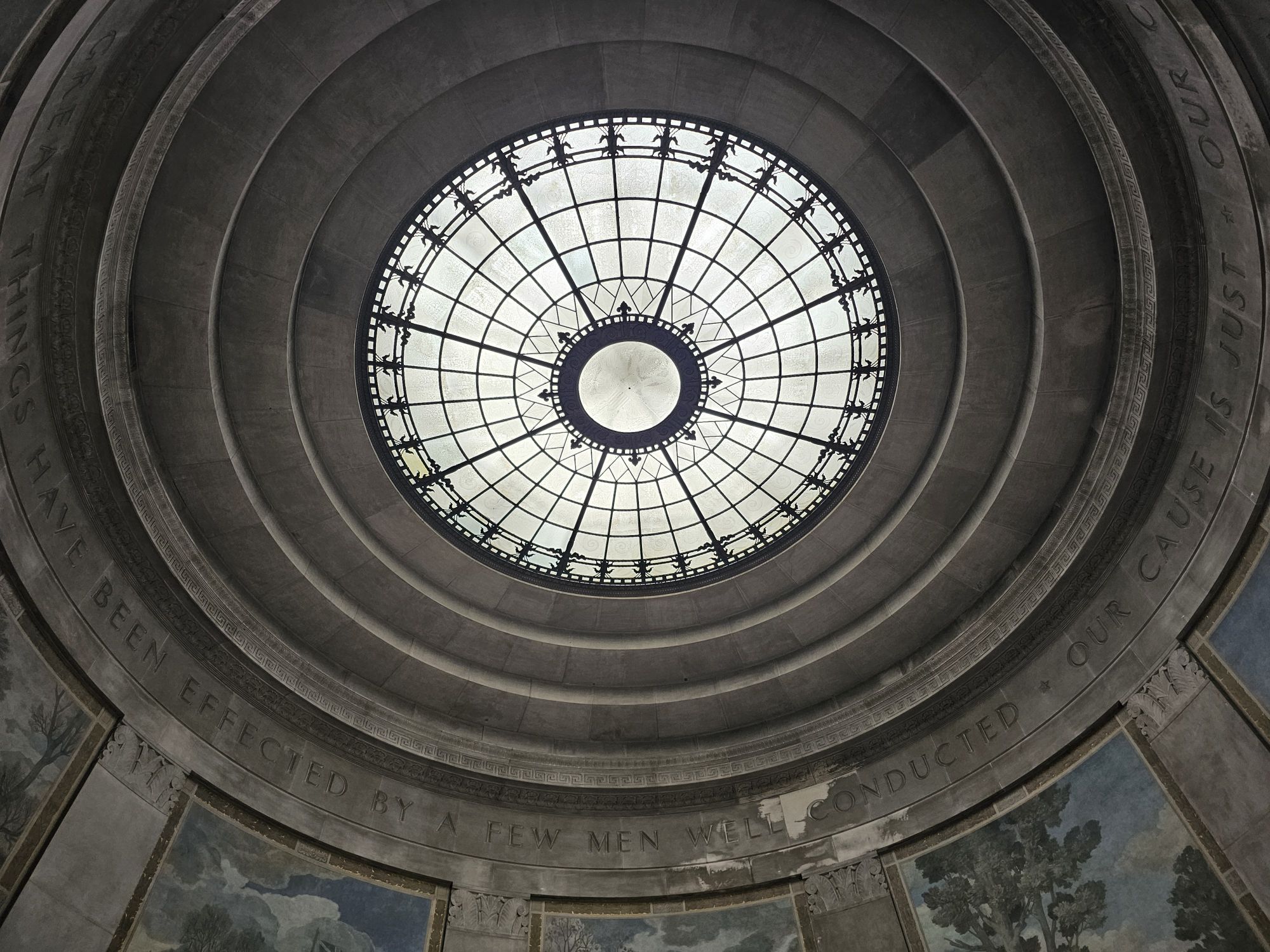
The oculus at the top of the monument. Taken by me.
There are several of these beautiful murals detailing the history of the area. All taken by me.
Hey there Adventurers! My last trip of 2024 took me to Puerto Vallarta, Mexico, for a few days around Thanksgiving. The Sidekick was doing another one of her volleyball vacation trips and I was tagging along for a a few days (I guess I was actually the sidekick?). If you managed to get through my last post, cheers! This one will be much shorter!
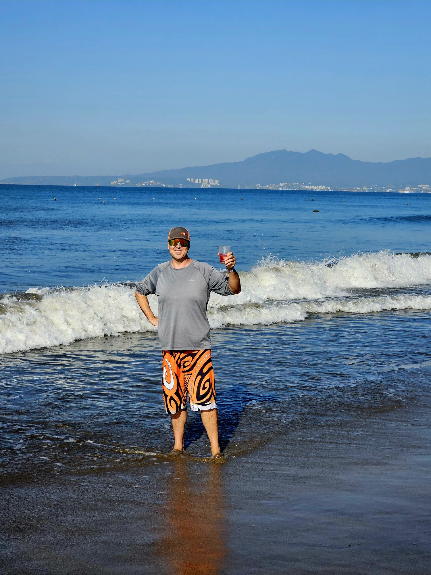
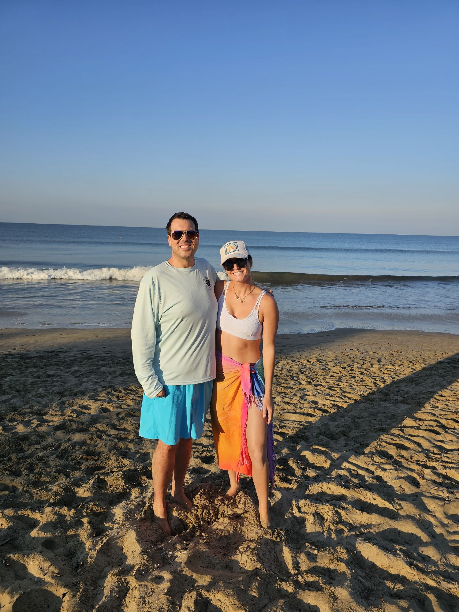
This was my second trip to Mexico and my first to P.V. We had a room at the Hard Rock, technically in Nuevo Vallarta, and it was great because it was all inclusive! It was a definitely a nice place to stay and it wasn’t terribly expensive either, considering. The company that hosts these trip is called SOB South of the Border. We got in on a Friday, and the ball stuff didn’t actually start until the next day, officially, so it was a chill day of resorting and beaching. The previous one of these trips I tagged along on was to Ixtapa/Zihuatanejo. This was much, much nicer (see: more Americanized). I ventured out into the market spaces outside of the resort, and even managed to negotiate prices on goods at the market, all in Spanish! I would not have tried that in Ixtapa. But, as in Ixtapa, there is a level of care and maintenance of their beautiful beach that we seem to lack here in the states.
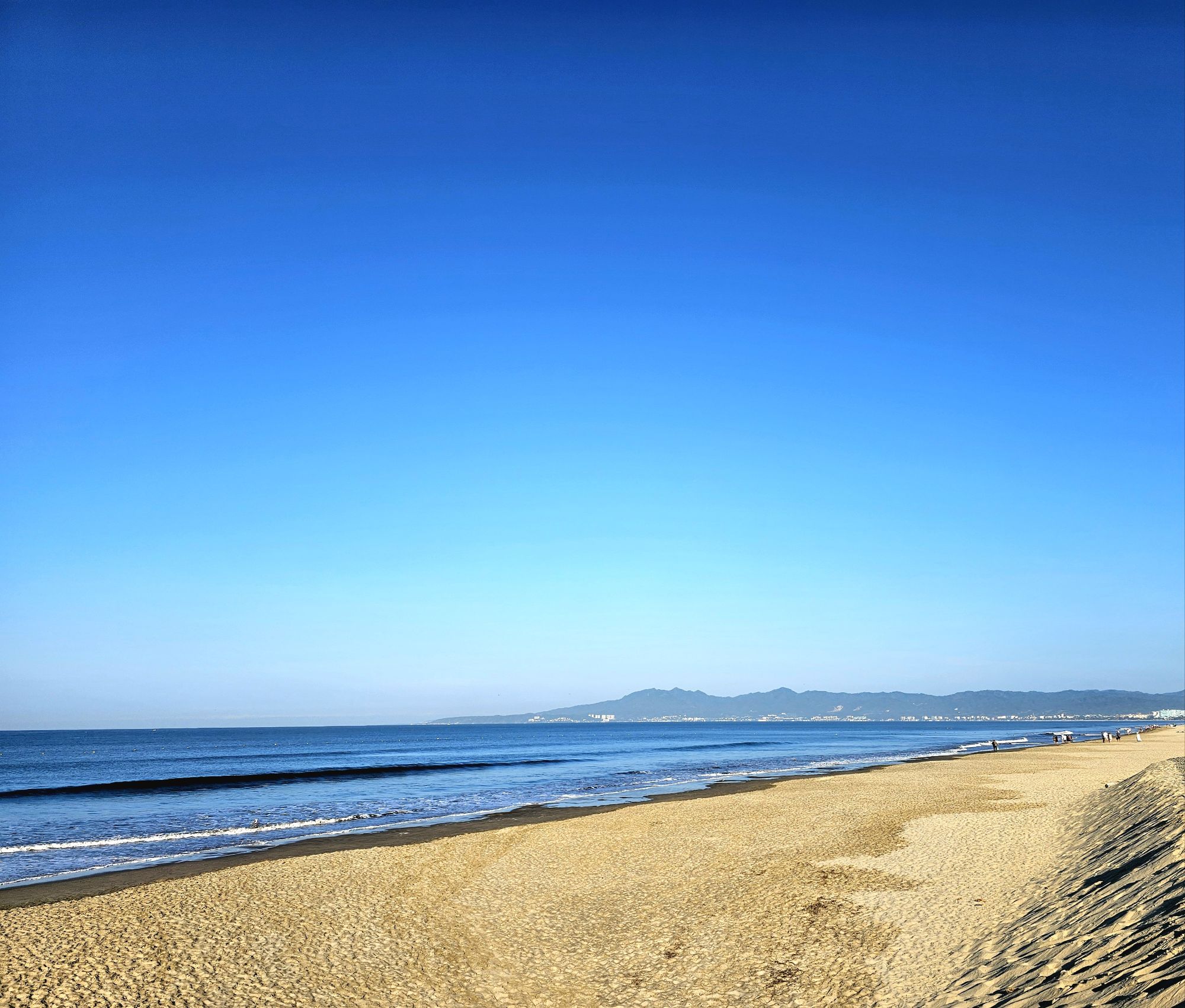
Taken be me. No trash to be found on this beach. None.
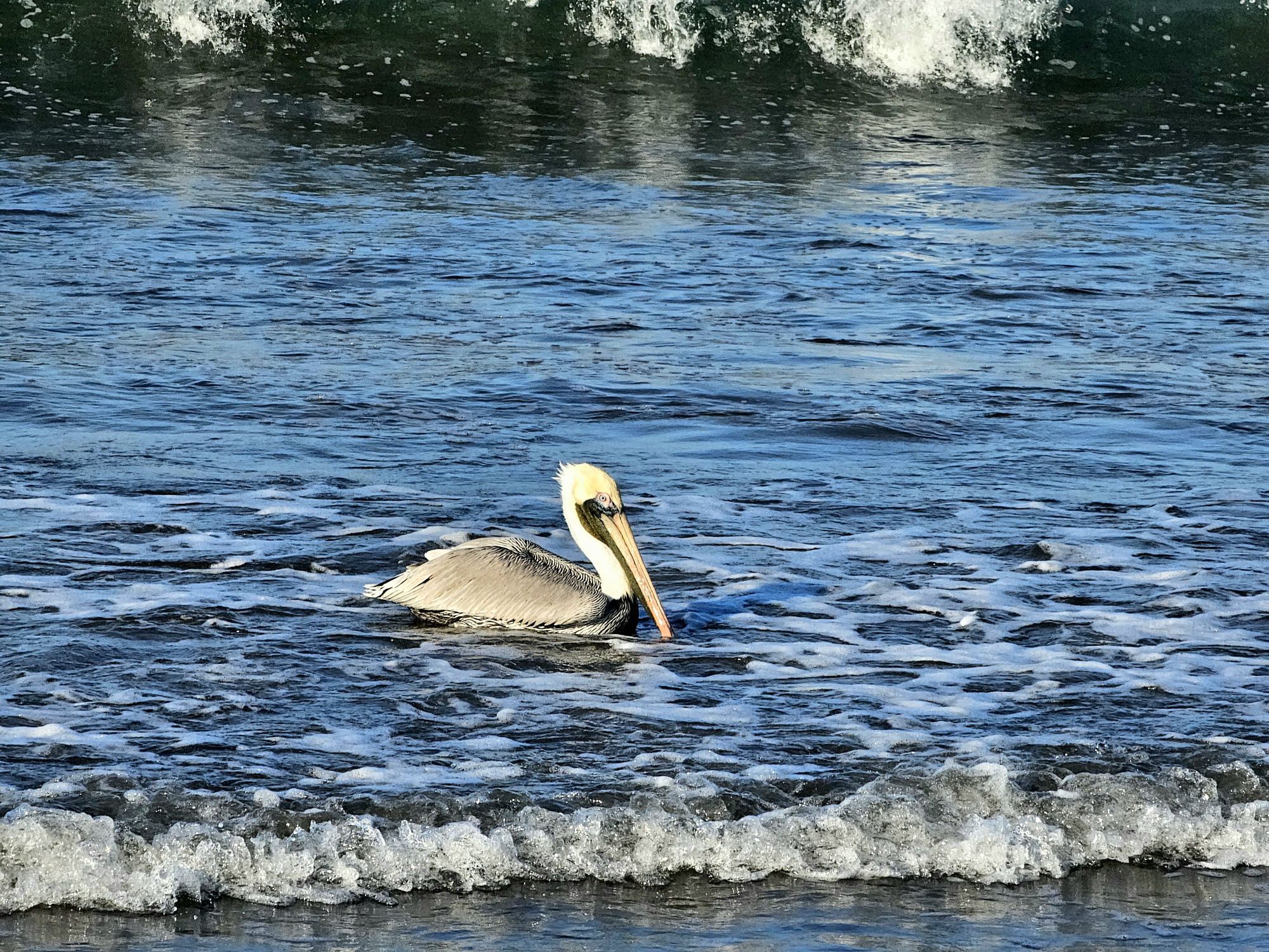
I mean….I can get these pictures every day of my life, but hey…it’s a Mexican pelican! Taken by me.
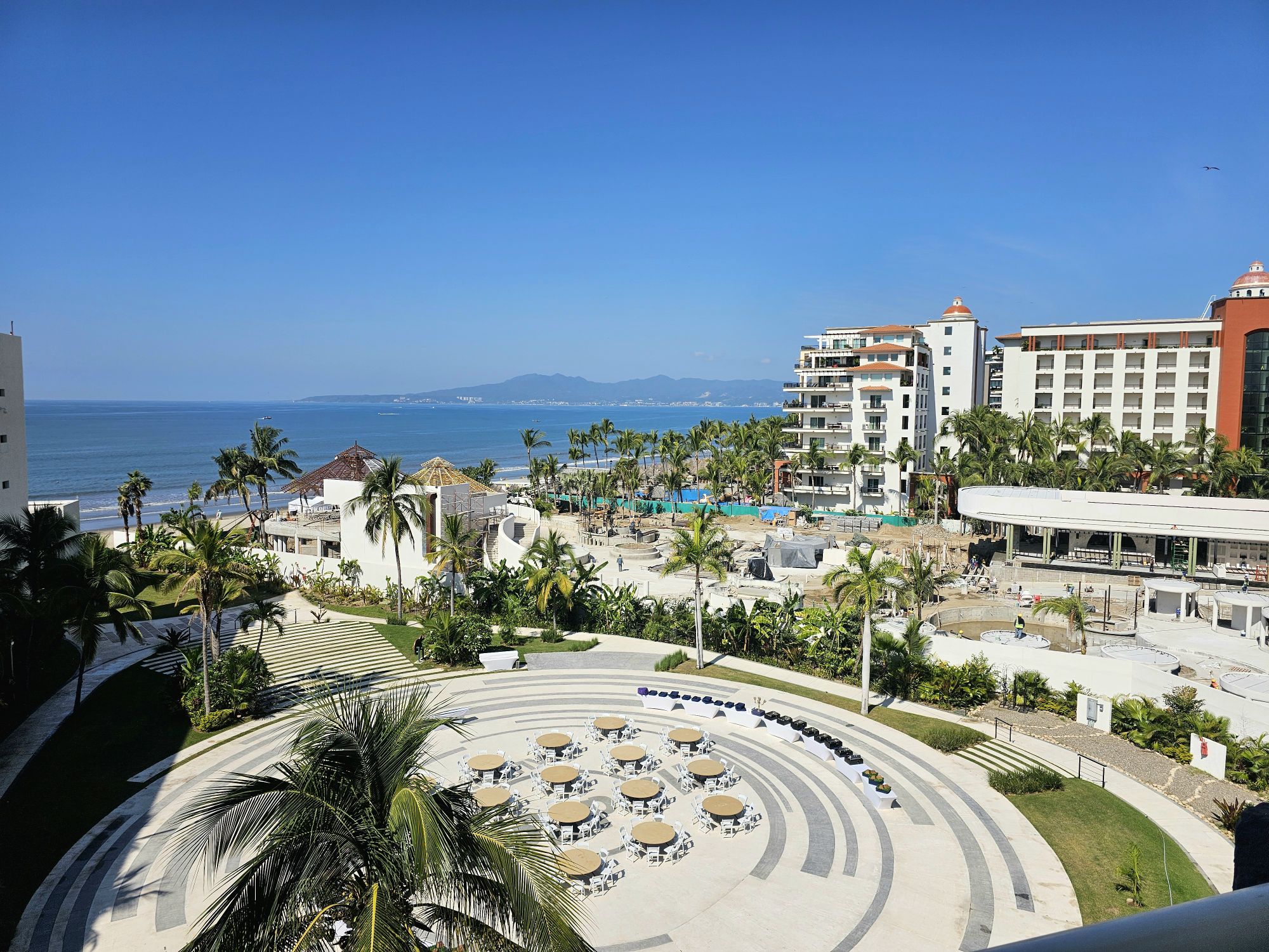
The view from out room! Not to shabby! Taken by me.
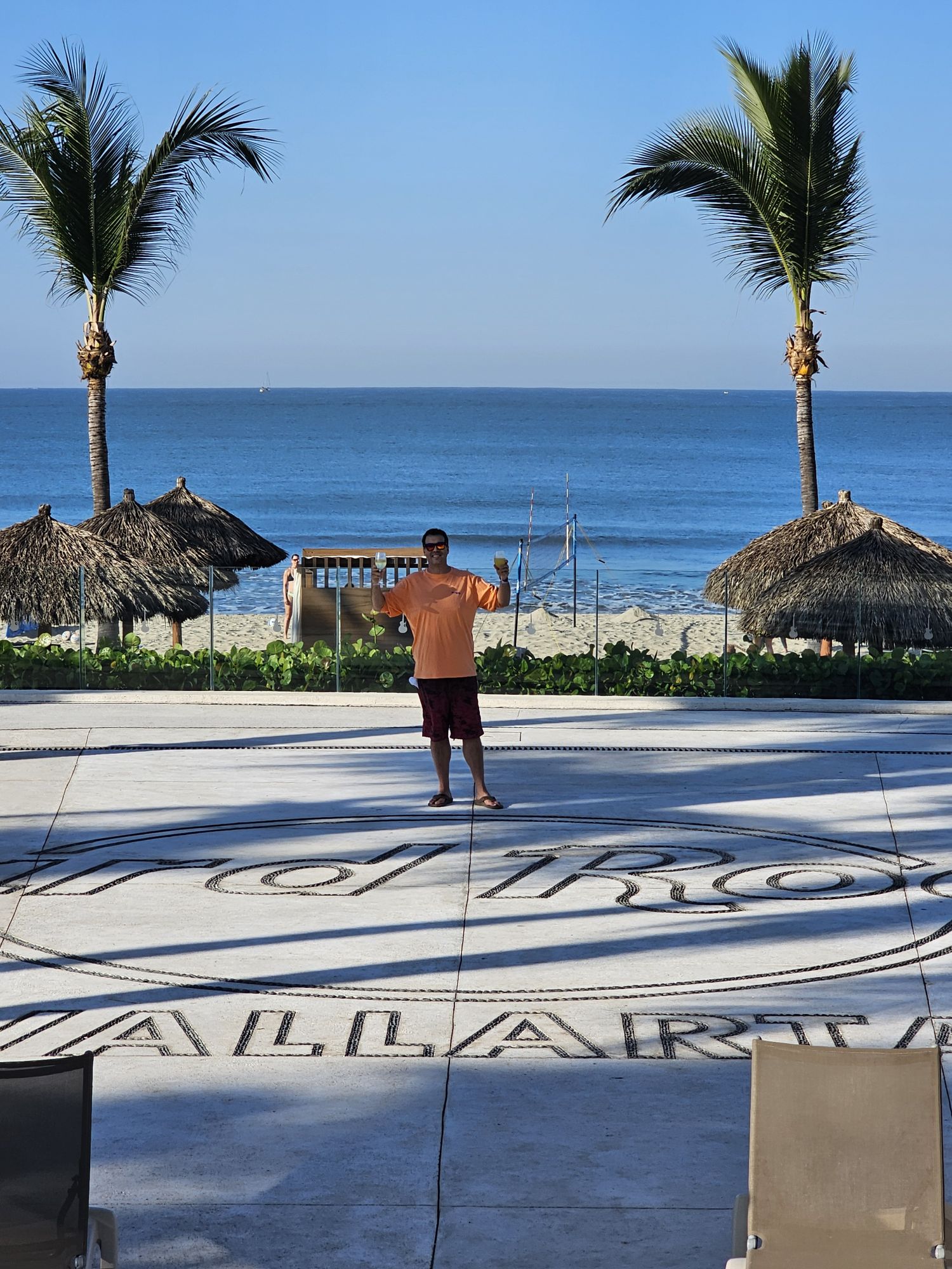
I guess I was technically the sidekick on this adventurer! But anyway, she snapped this of me on the cool concrete marker of the resort!
Taken by the sidekick.
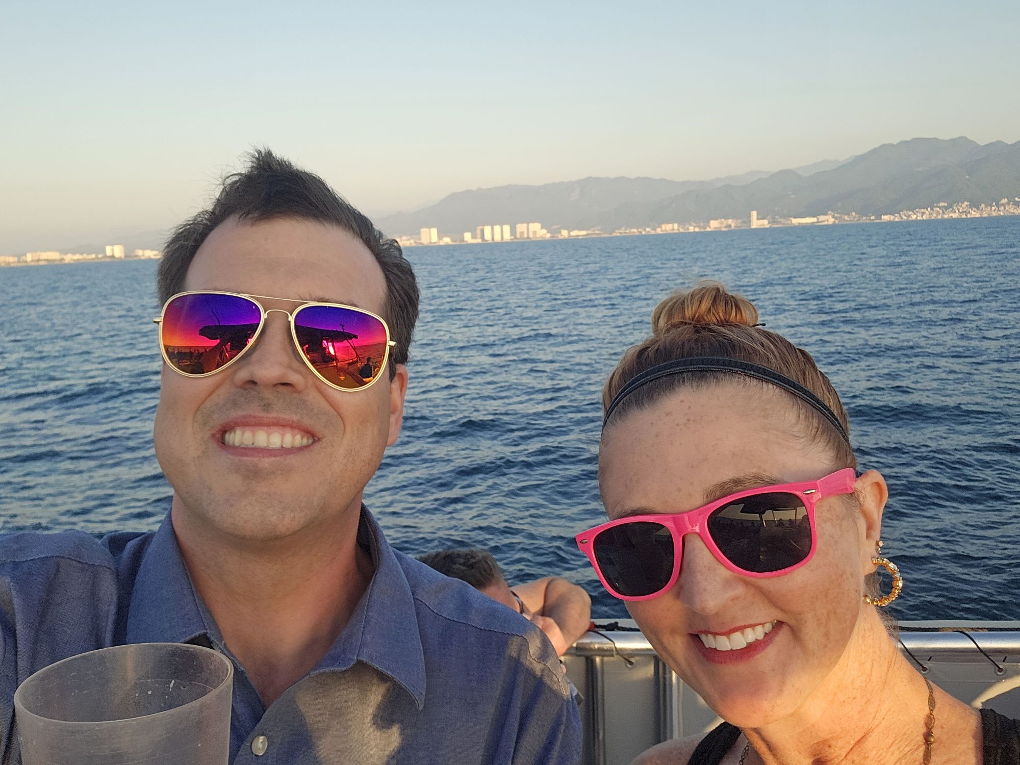
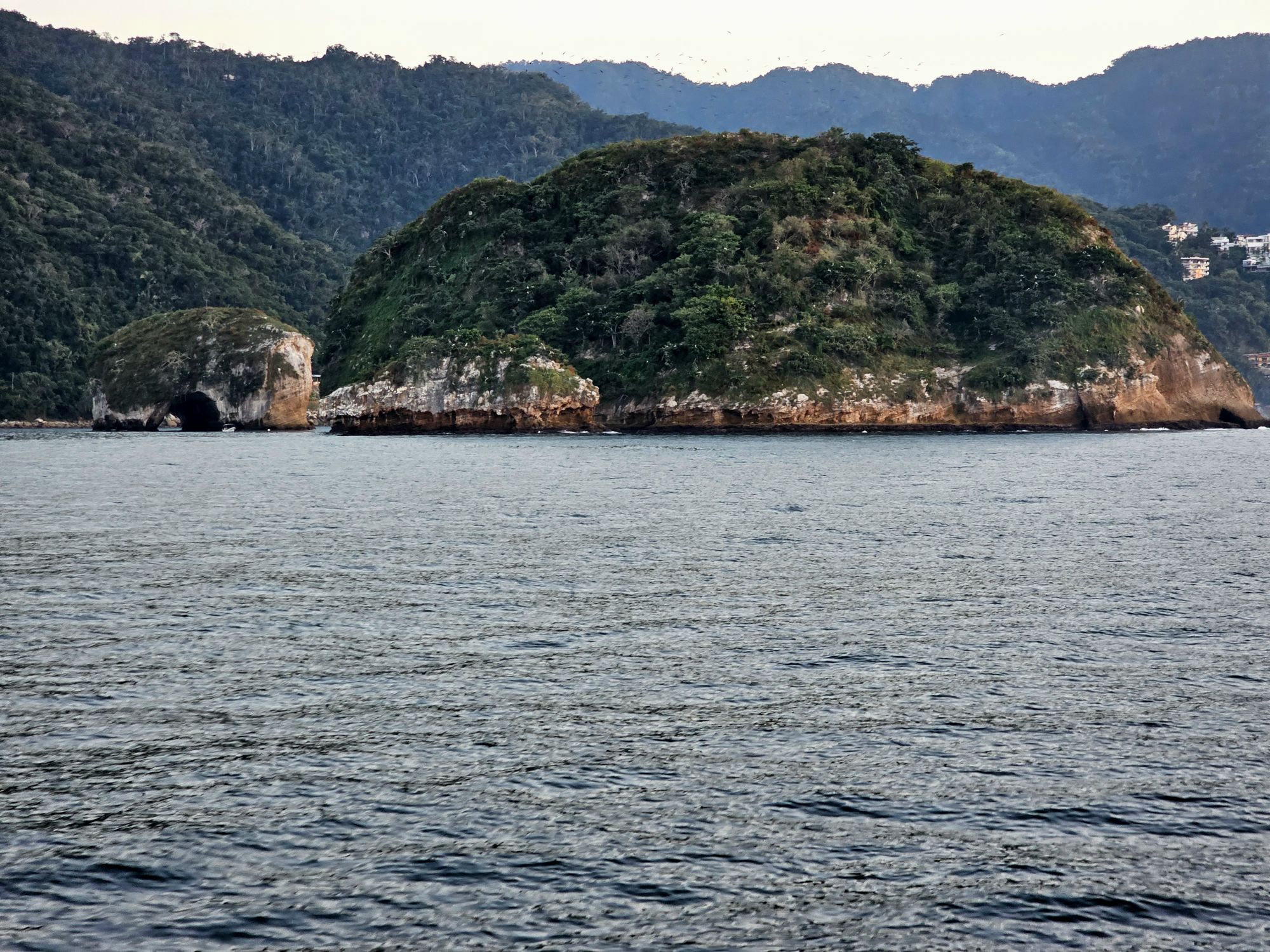
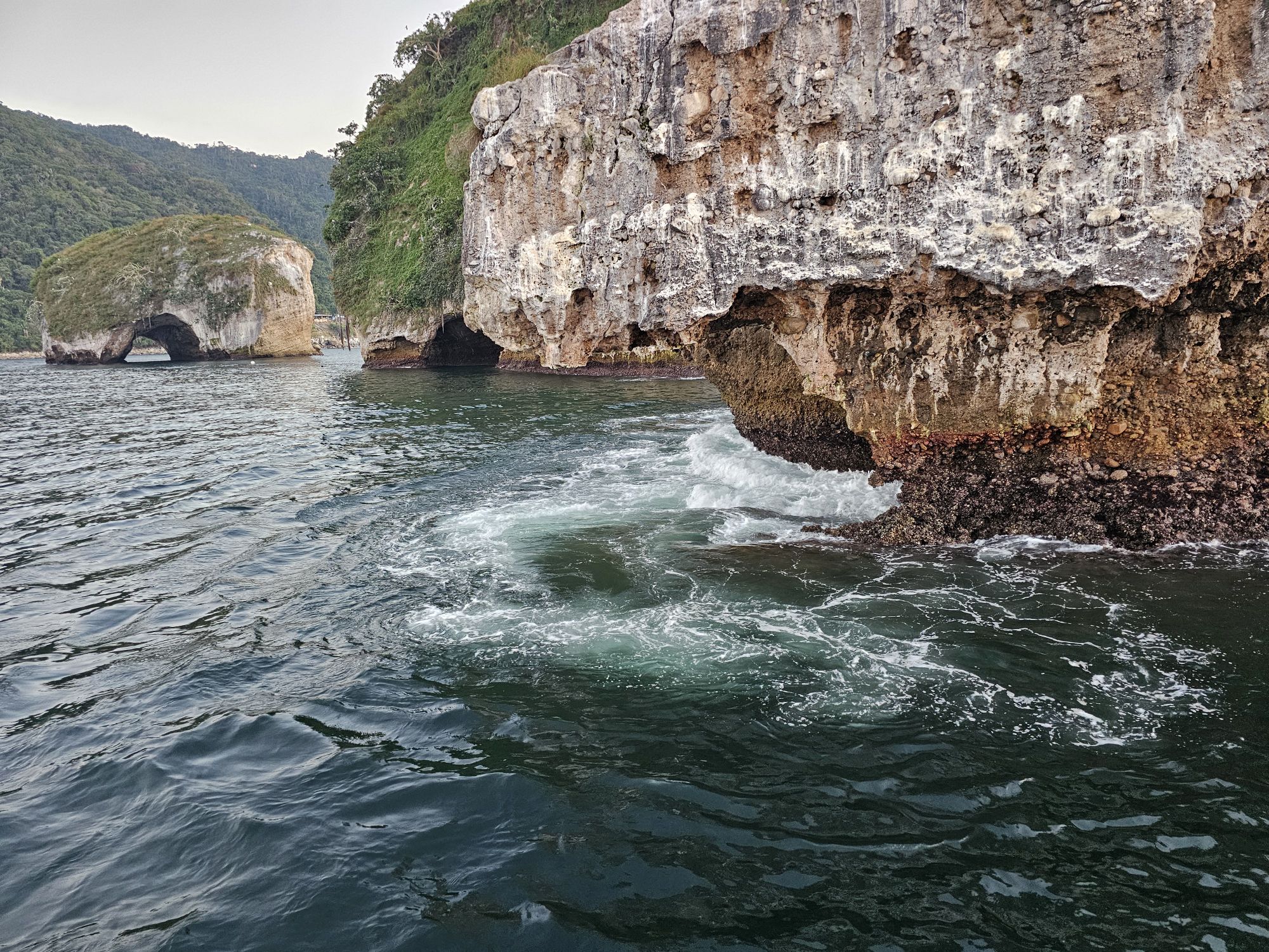
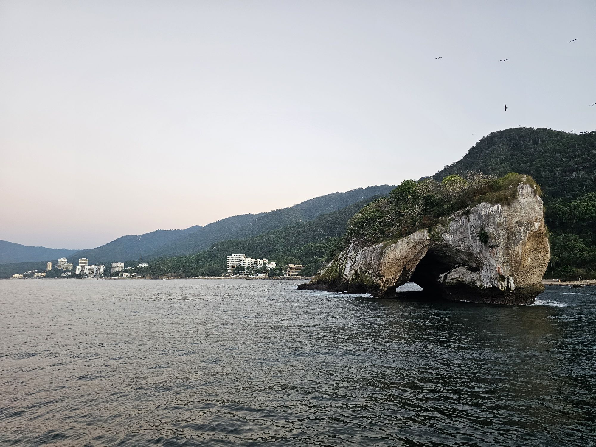
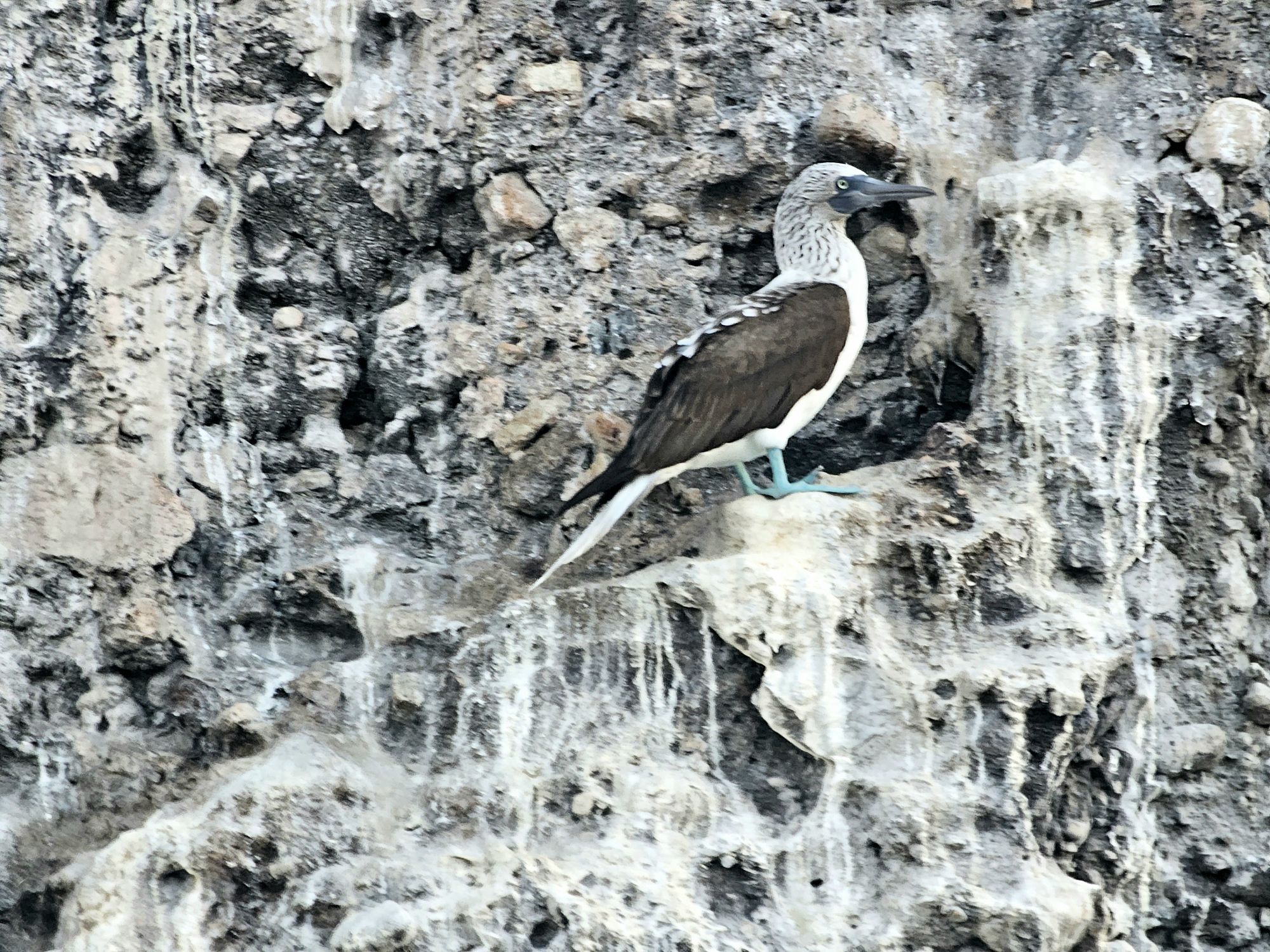
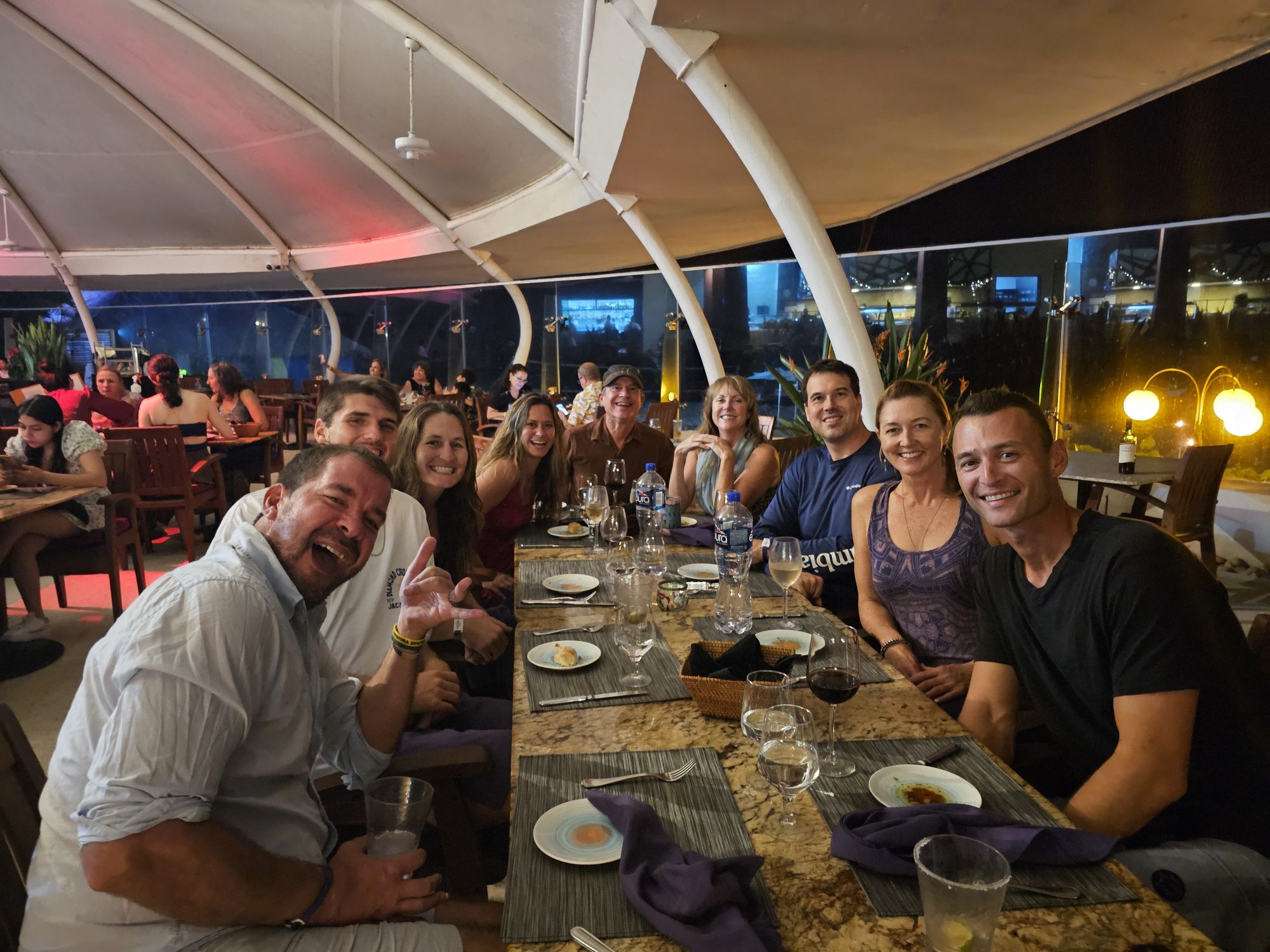
The trip was really chill and mostly hanging around the volleyball events but there were some other big highlights. Although the water was warm, it was quite rough, but I was still able to take a couple hours to go kayaking. We took a super fun afternoon/evening cruise out to my first foreign national park. That cruise was great with cool fruits, all you could drink Modelo and wine, and a return trip featuring the crew really showing out, acting like bad American rockers. It was delightful! The Parque Nacional Marino Los Orcos del Mismaloya is off the coast to the south of Puerto Vallarta. The arches in the name are the main attraction, the Mismaloya Arches. Small boats can cruise through one of the arches, but our vessel was too large, though the captain did take us in as far as possible. The big rock island is a huge bird habitat including the blue footed booby. This is one of the few places on earth you can see these birds and I did manage to snag a picture of one! It’s not great but I will include it! There was also ample opportunity to hang with professional volleyball players, including a few that I have already hung out with a few times prior to this trip, and a new Olympian. And of course, there were some volleyball shenanigans with some old friends from the previous trip!
Great Volleyball Player Savvy Simo. Nicki has known her a couple years now, and I first met her in 2022 and also again in Ixtapa. She’s a great player and a great person!
Selfie on the fun cruise out to the park.
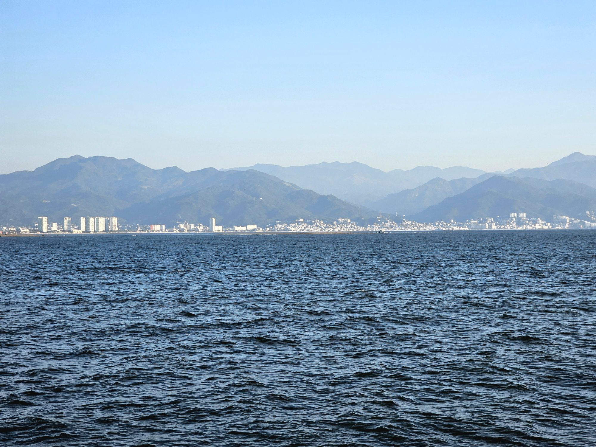
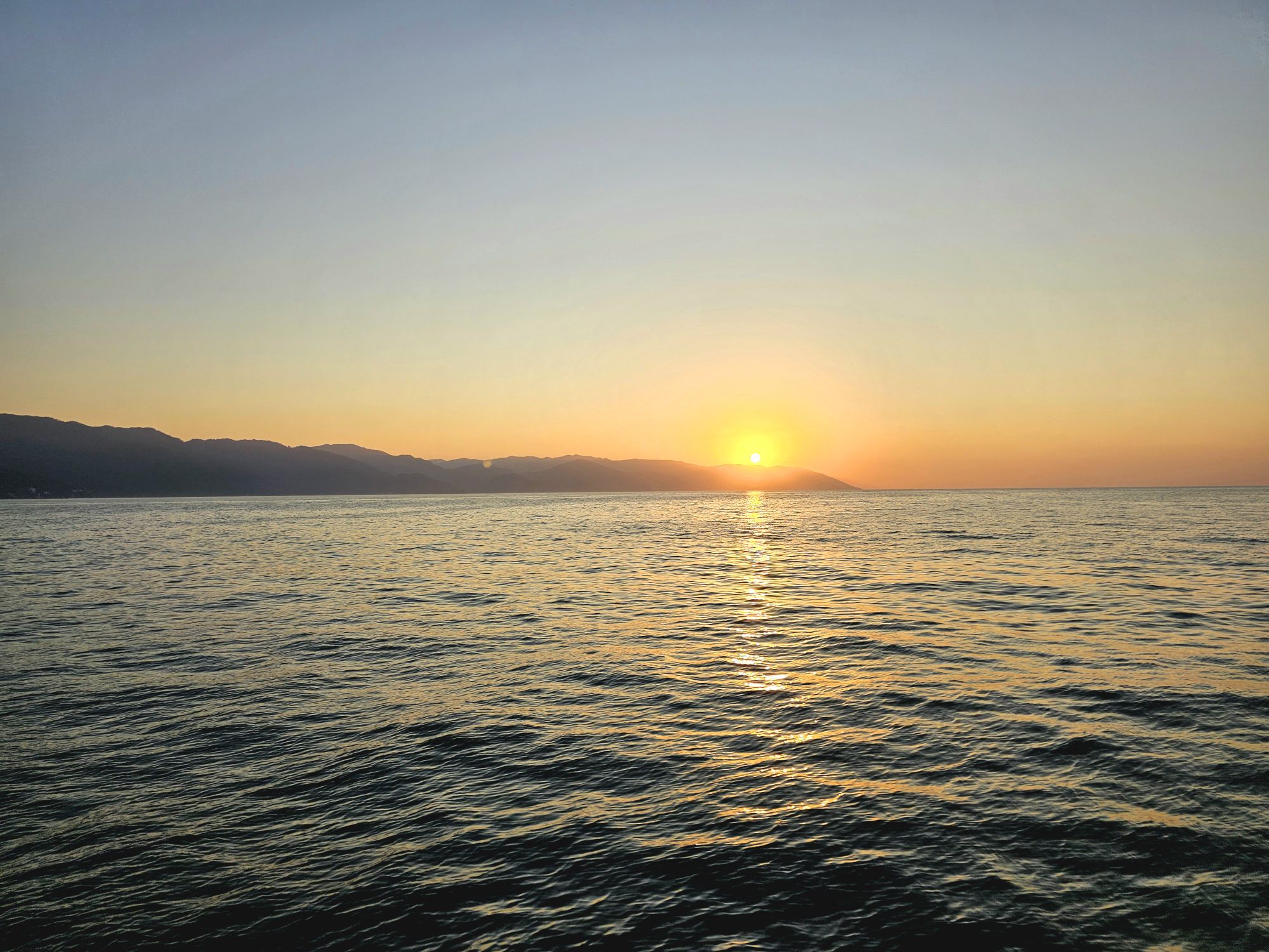
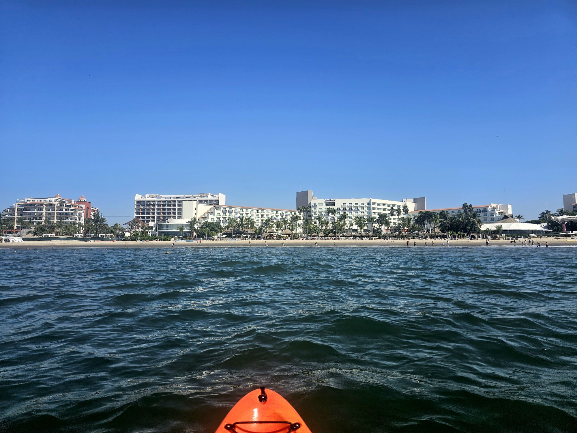
Puerto Vallarta from the Pacific! Taken by me.
Sunset from the cruise. Taken by me.
The National Park. You can see one of the arches on the left. Taken by me.
Another view of the rock formations. Taken by me.
One of the arches.
The blue footed booby! How cool! Taken by me!
Super fun crew on our trip back! Taken by me,
Boat captain took us in pretty close! Taken by me.
Some of our Vball friends! The near right side is an Olympian, on the left are two other amazing pro volleyball players I have known for a few years now! Taken by our server.
I rented a kayak for a while….pretty hard paddling with some big wind and waves, but fun! Taken by me.
So that is all I am going to write about this 4 day trip as it was obviously more of a relax, chill, and enjoy the playa more than anything else! Fun trip: Puerto Vallarta was definitely a cool place and there is a ton more fun stuff to do than I did. I would go back! That was my last trip of a fun 2024! I am really trying to make an effort to get through my 2025 trips in the next month or two. As a preview: my 2025 featured two DC trips; one trip to St. Louis; one to Chicago/Michigan and a brief return stop to the Dunes; a stop at Mesa Verde National Park, which is now maybe landing at number 2 or 3 of my favorite parks, plus many amazing sites in New Mexico; a long visit to Washington State including Olympic, North Cascades, and a very brief afternoon at Mt. Rainier; and a long trip to Australia/New Zealand! And in case you are wondering, I have spring break planned but nothing else yet. Look forward to seeing Big Bend National Park! I am also going to try (again) to summit Guadalupe Peak in Guadalupe Mountains National Park, and I am trying to to get to Chiricahua National Monument in Arizona ahead of it possible being made National Park 64 (that legislation is in the works, but who knows)!
Hey there Adventurers! 2024 was the year of some big parks which culminated with a solo visit to the largest National Park in the United States: Alaska’s remote and rugged Wrangell-St. Elias National Park. I am going to start by saying this is my new favorite park: 10 out of 10 would recommend!
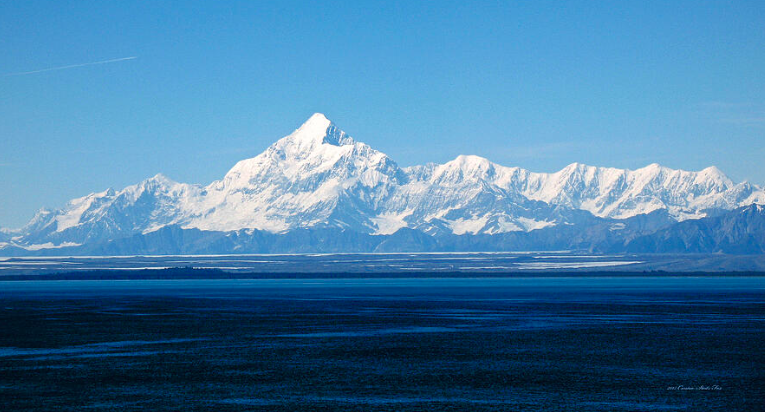
Wrangell-St. Elias is a massive, but remote park. It is named after the two respective mountain ranges that straddle the US/Canadian Border. Mt. St. Elias is the third highest mountain in North America and second in both the US and Canada, as it sits on the boundary between the two countries. Flight-seeing is the way most visitors see that mountain, but I have already done a flight-seeing tour of Denali so I chose to not do that. This national park is fully larger than the entire country of Switzerland, Yellowstone, and Yosemite National Parks COMBINED. Wrangell-St. Elias is also almost mostly unreachable and untouched. But just almost. Many people consider at stop at the visitor center in Copper Center as sufficient. Off of the extremely scenic Richardson Highway on the far eastern side of the state, with views of the landscape within the park boundaries, the visitor center in Copper Center is on the way to Valdez and where many people stake claim to a visit. Another way many people claim a visit is via cruise ship in a small area called Yakutat. This area is actually on the Alaskan panhandle and relatively close to Glacier Bay NP. However, there is a road in the interior off of the Richardson Highway for those up to the challenge!
Picture of Mt. St. Elias borrowed from connie-fox.pixels.com. From the Copper River Valley, and the McCarthy/Kennicotte area the third tallest mountain in North America is not visible.
I made the long trip from Tampa and arrived in Anchorage at an inconvenient time, but a cab got me to my nearby Airbnb. The following morning, the very, ahem, eccentric owner of A-1 Car Rental picked me up. After a stop at a garage sale (I did say he was eccentric!) we got to his … lot?…and I got a 4WD. Due to some poor reviews and his unwillingness to take any money deposits, I contacted him a few times over the months just to make sure everything was good. He always talked my ear off, but seemed a legit character. Anyway, after he ended up asking for a decent amount of money LESS than he had quoted me months ago, we still had to go to another spot to get a tire repair kit and a jack. Soooo…after all of this, my intended 9 or 10 AM start on the 6 to 7 hour drive didn’t get started until closer to noon.
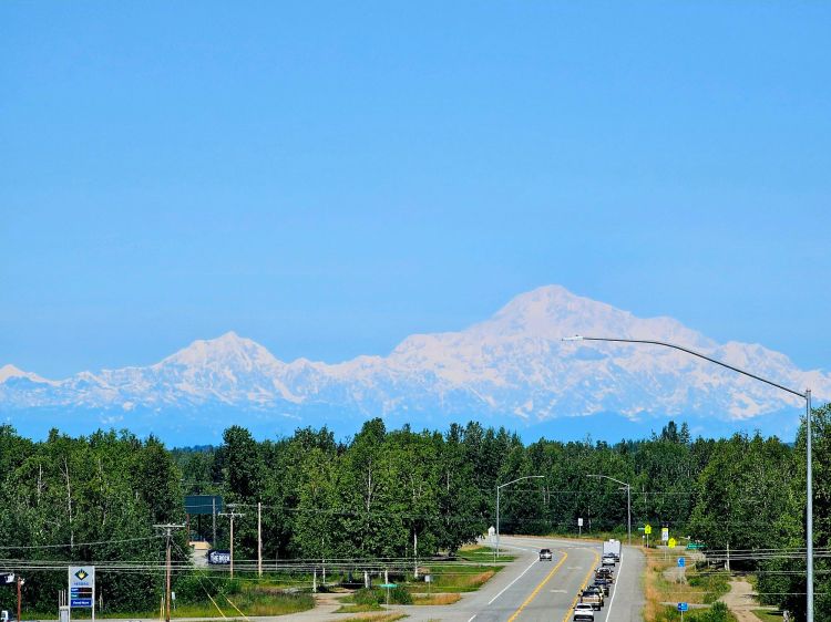
As I departed Anchorage, I noticed crystal clear skies to the north. I had my Milepost book with me and got a wild hair up my ass…so I pulled over and looked up where the first big viewpoint of Denali could be found. The great news was it really wasn’t that far, maybe an hour out of the way to Willow, 2 hours round trip. So I did it! And, I got one of those spectacular crystal clear shots of Denali that doesn’t even look as if you are seeing a mountain, more a ghost than anything! The viewpoint is still ONE HUNDRED MILES away from the mountain! Anyway, the bad news was that after trekking the 2 hours out of my way, I still had nearly 7 hours to go to McCarthy! I was driving the Glenn Highway, which has many scenic stops but those had to wait until the return trip.
Denali from Willow Alaska, 100 miles away! Taken by me.
The Glenn Highway is spectacular, boring, and then amazing, depending on the weather. I was making a beeline to McCarthy, so most of my sightseeing was on on the way back (read on) but with the clear skies, there were amazing views of the famous Mt. Drum toward the end of the highway. The picture I took is the same as the ones you have probably seen before, but it is mine so enjoy! Mt. Drum is a dormant stratovolcano within the Wrangell-St.Elias National Park boundaries and is the end, or beginning, of the Wrangell Mountains and rises a dramatic 12,000 feet in front of you. The traffic is pretty sparse so I was able to snag the iconic picture on the road!
Mt. Drum, taken by me. This is west of Glennallen, Alaska. I am glad I got this picture this day, because coming back the mountain was hidden!
After driving 180 miles to Glennallen, the last “big” stop before connecting to the Richardson Highway, and fueling up, there was STILL another 125-ish miles left to go. As you can imagine, despite these being highways, this is a remote, sparsely populated area of Alaska, with little in the way of amenities and very little cell phone service. There is a visitor center in Copper City, and this is the one you want to stop at. The visitor center in Chitina looked small and doesn’t even appear to be open. There is a visitor center in Kennecott but it is actually quite small, more of a station, and does not have a sign for the park, so do not miss the Copper Center one!
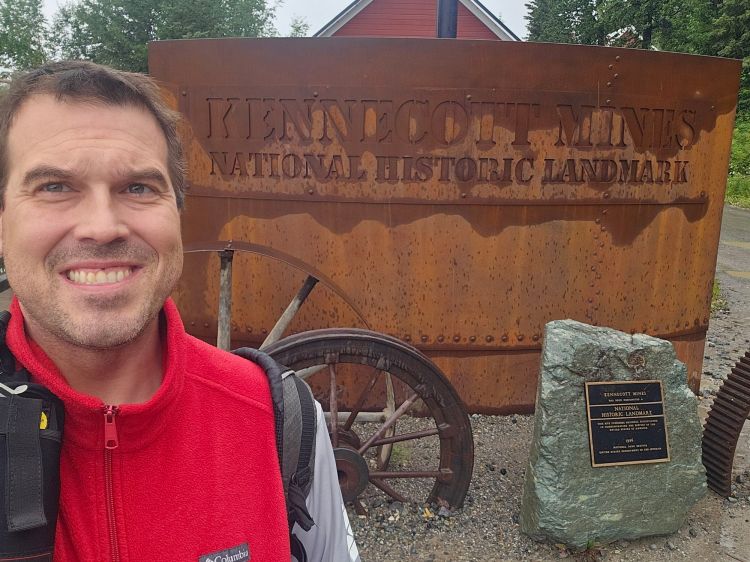
The sign appears to be made from copper, apropos for the park!
The McCarthy Road is the way to actually drive into this massive park and visit the towns of McCarthy and Kennecott. Really, this was the only part of the trip that required the early planning. The McCarthy Road used to be an old railroad track. The track was covered by dirt and rock a few decades back and became a road. One has to watch for serious potholes and remnants of not only the rail line, but also stray railroad things (like spikes for instance) that can deflate, literally, your dreams of reaching the little towns of McCarthy and Kennecott, both located inside the park, more or less. I will get back to the history of those areas later.
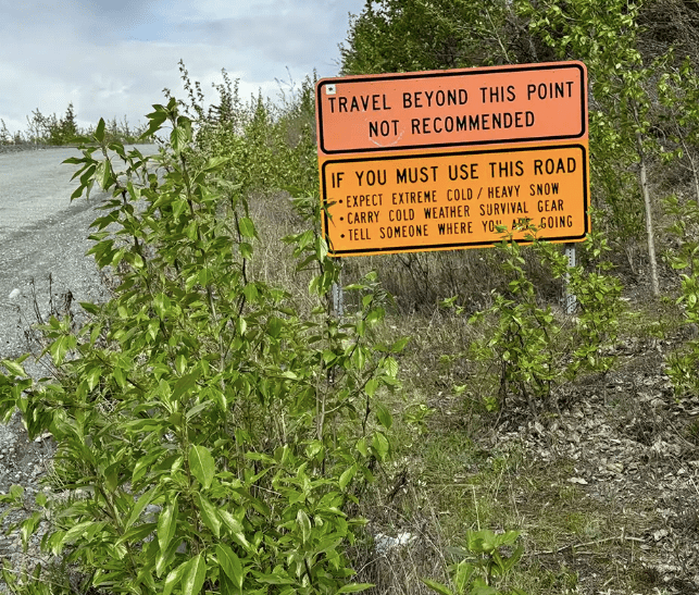
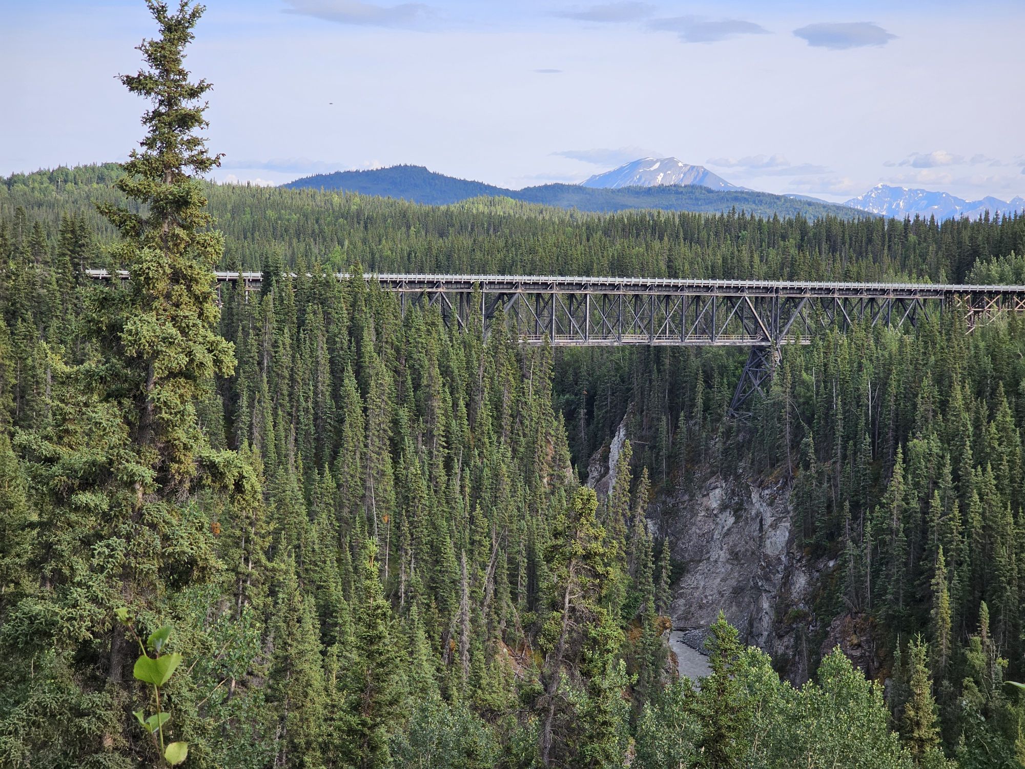
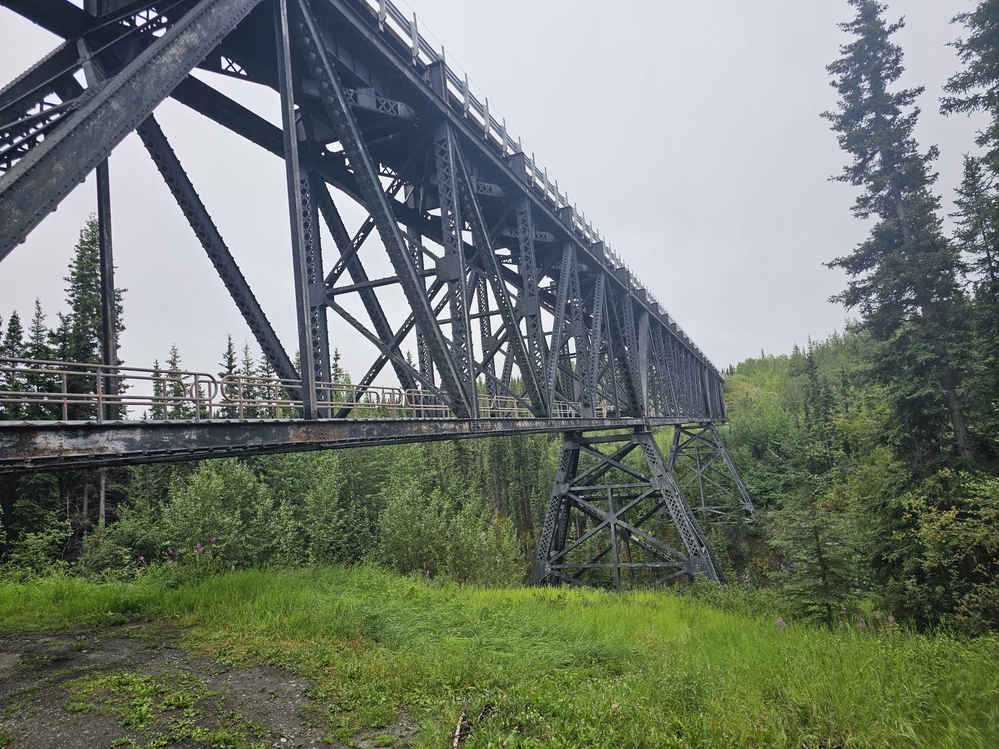
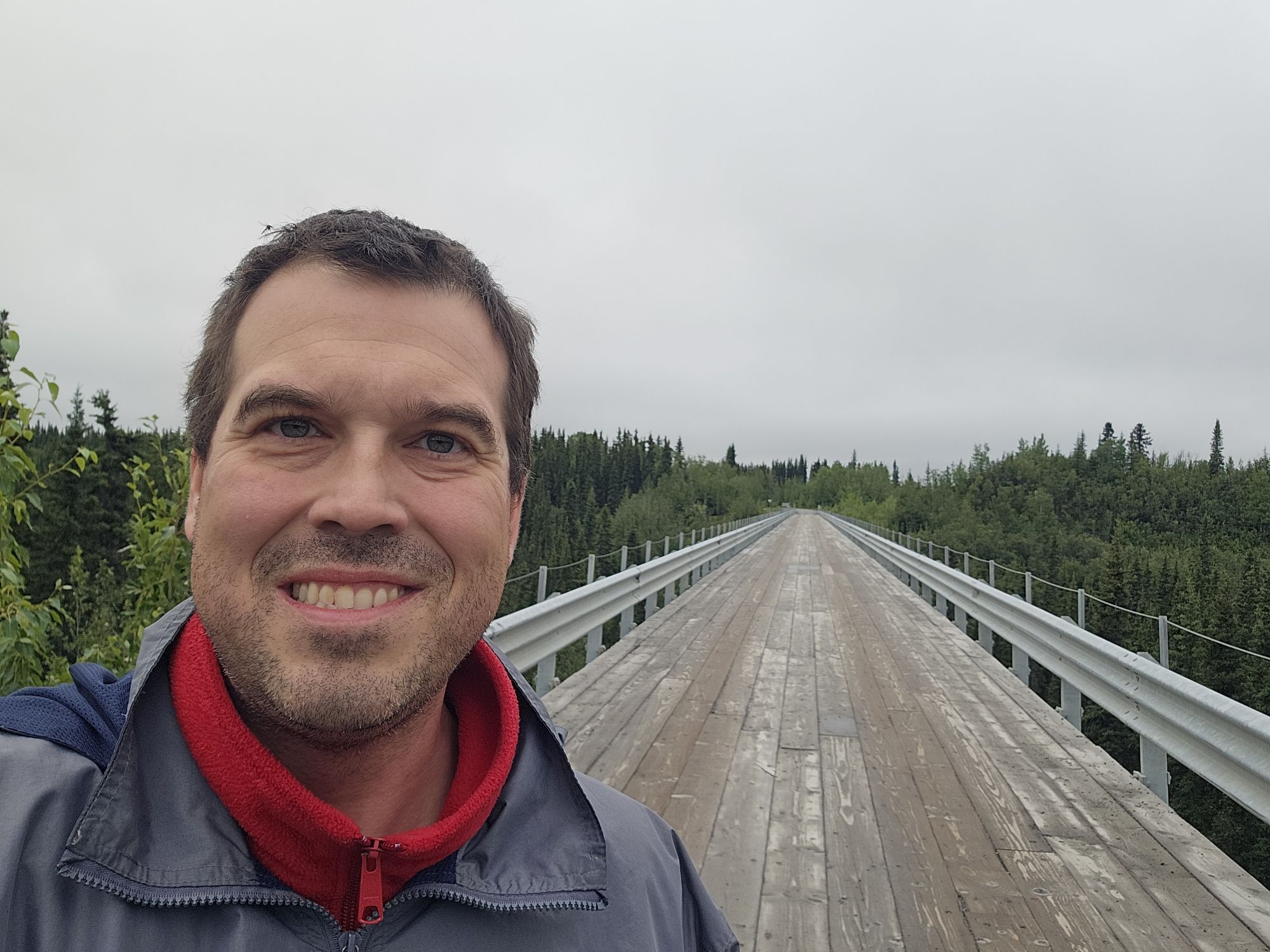
Upon reaching the McCarthy road, the pavement soon gives way to gravel/dirt and a sign warning you that going further is not a good idea. It is roughly 60 miles and 2 hours through a whole lot of nothin to reach McCarthy! This drive is not one you want a problem on. Very few cars come down the road, there is no cell signal, and there are 0 places to stop for anything. Anyway, the road was actually not that bad when I drove it, save for a couple spots. I understand from the locals that it most definitely can be bad depending on rainfall. The Kuskulana Bridge is a super cool bridge that will test your courage if you are not a heights person. The bridge is the wooden, one lane variety, and crosses the Kuskulana River, about 250 feet up. The bridge has access to the under side, although walking across seems to be blocked off. Fun fact, this bridge had zero guard rails until 1988. Imagine driving across that in the Alaskan wilderness with no guardrails!
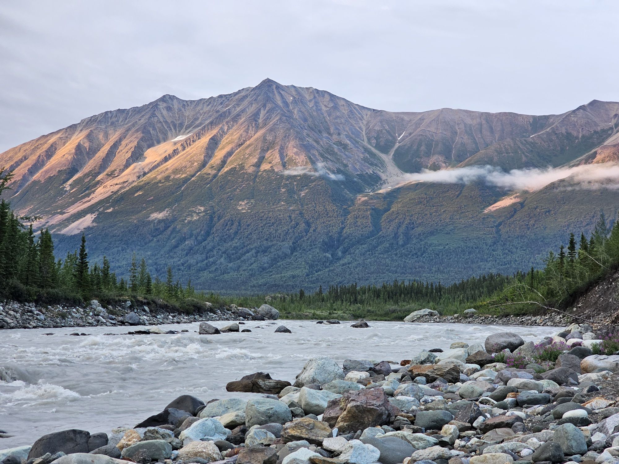
This is the view just a bit before coming to the small town of Chitina, the start of the McCarthy Road. Hiding in the clouds there is 14,000 plus footer Mt. Wrangell.
Meh.
I snagged this picture of the Kuskulana Bridge from a viewpoint a bit before the bridge.
The underside of the bridge has a walkway but it is closed off. Taken by me.
Bridge selfie! Those guardrails were not there 30 years ago!
Finally, I arrived at McCarthy, AK, population 107, as of 2020. If you are planning a trip to McCarthy it should be known that you are not allowed to drive into the town. There is a paid rocky parking lot, that you can also camp in, along the shores of the Kennicott River. Once upon a time, people had to cross the river in a bucket on a cable! Now there is a foot bridge for tourists. The locals have a separate bridge elsewhere that only they have access to, but visitors must park at the parking area at the end of the road. The town has provided wagons to help with shuttling luggage across if needed, but once across you will have a half mile or so walk mostly uphill, over rough gravel. There are privately scheduled shuttles that will pick you up for a small fee as well. Unfortunately, as I got there late, the shuttles were no longer running so I had to get all my stuff to my airbnb the old fashioned way. It was after 9 PM, but seeing how this is Alaska in the summer, even in late July there was still plenty light for me to get to my Airbnb and settled in for the next 3 nights. My place was right in McCarthy and only a few minutes walk from the main strip. By main strip, you should remember where I am…the main strip was a dirt road, and included the famous hotel in the town, Ma Johnson’s (this one is pricey and needs to be booked early!), an awesome daytime restaurant, The Potato, a late night bar/restaurant, The Golden Saloon, a general store that has wifi if you purchase something, and some excursion outfitter offices, so temper expectations. There are a few other lodging options in McCarthy as well. If you are interested, the AirBnB I booked can be found here! It is relatively affordable, the host was great, there is wifi pretty close, and it’s close to the McCarthy “strip”! Anyway, I walked to the Golden Saloon and had a bite to eat and a drink.
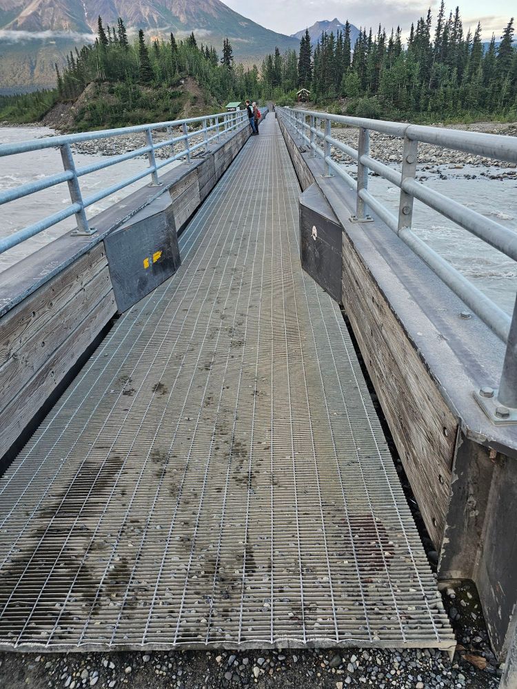
This is the footbridge to cross to access the towns.
The next morning I woke up early to another spectacular day and hopped on one of the shuttles up the road to Kennicott. Kennicott is effectively the ghost town of the old Kennecott mine, a super well known and recognizable historic landmark in the National Park. And yes, the two names are indeed spelled differently although they are interchangeable and there is a story there, but not a very interesting one (also I am not being particular about which spelling I am using throughout the post!). There are some homes up there, some outfitter offices, and there is one big lodge up there as well. Anyway, I had planned for an excursion with St. Elias Alpine Guides, one of the two big outfitters in the area. This day was a hike onto the Root Glacier, including an ice wall climb! As luck would have it, I was the only person doing this particular hike, so it was just me and the guide, which was actually really cool! From the mine, the hike to the glacier is a couple miles. It should be noted that not all that long ago one could walk straight out onto the glacier from the town itself…and that a mere 100 years ago, the glacier was so predominant that the distant mountain ranges were not visible above the glacier. Now, it is quite retreated. In any event, the 3 mile hike to the edge of the glacier involved carrying special boots and crampons to walk on the ice. After gearing up it was off to step foot onto Root Glacier! To walk on the ice required a certain gait and way to step, but it was quick to learn. The ice is not smooth. It is very rough, with a sharp consistency due the surface melting. We trekked a pretty far distance up the glacier before my guide found a suitable wall to prepare the climb. What a neat experience! I was quite nervous about the whole matter. I wasn’t even entirely convinced I was going to do it until I turned up as the only one on this tour, so of course I had to do it! The views on the glacier are pretty killer. To the north is the Stairway Icefall, a 7,000 vertical foot icefall that feeds Root Glacier. This is one of the tallest icefalls on the planet. To the northwest is Mt. Blackburn, a towering mountain 26 miles away. It is the tallest of the Wrangell’s at nearly 16,500 feet. The hike also offered plunges into super cold glacier pools. I declined, and I am pretty sure my guide was grateful for that. He did offer me the chance to rappel down into a crevasse/hole in the glacier. I told him he was nuts and he told me its “pretty safe if done correctly.” Um. No thank you. And I do not regret that decision.
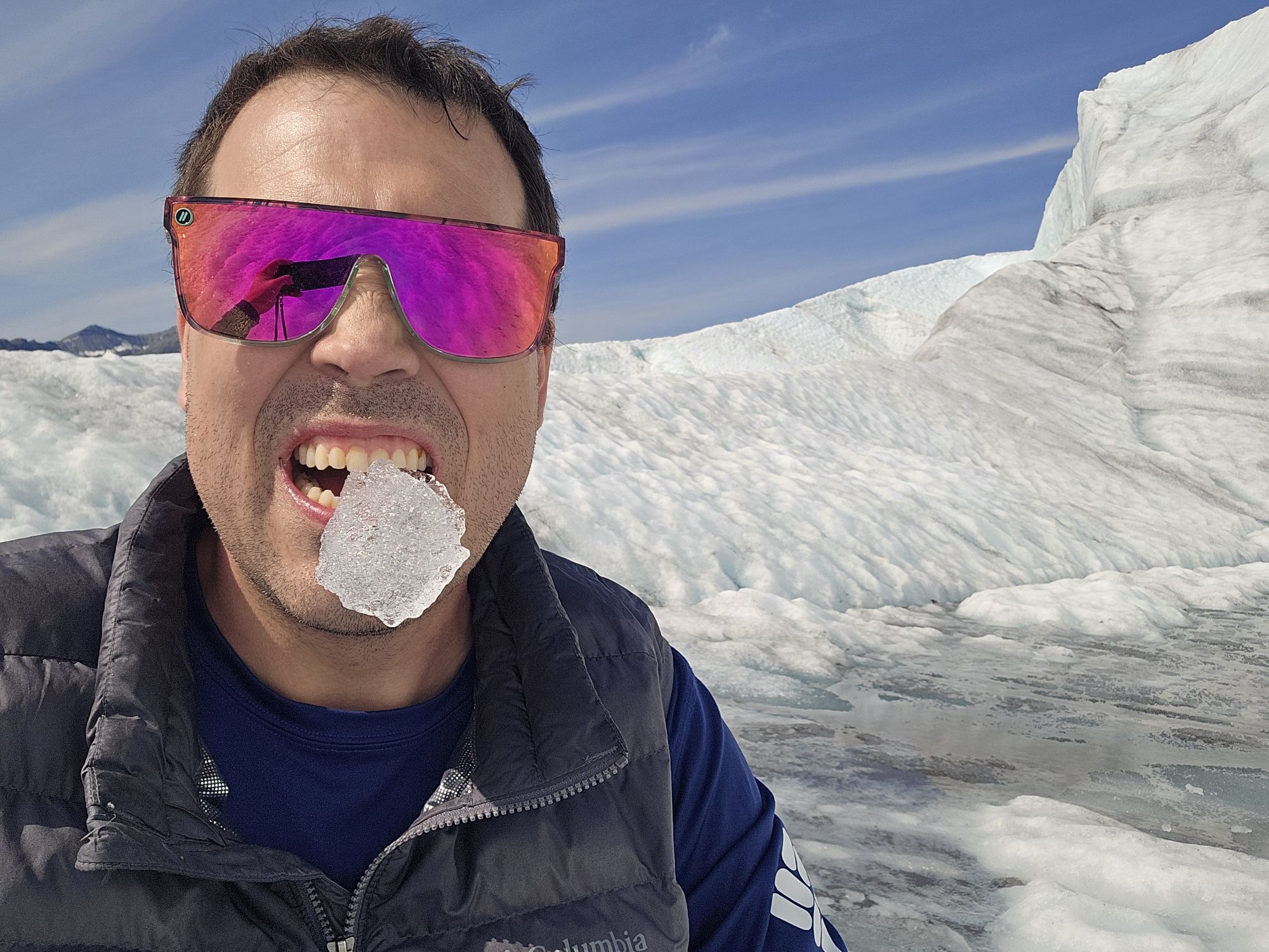
Gnawing on some Root Glacier ice.
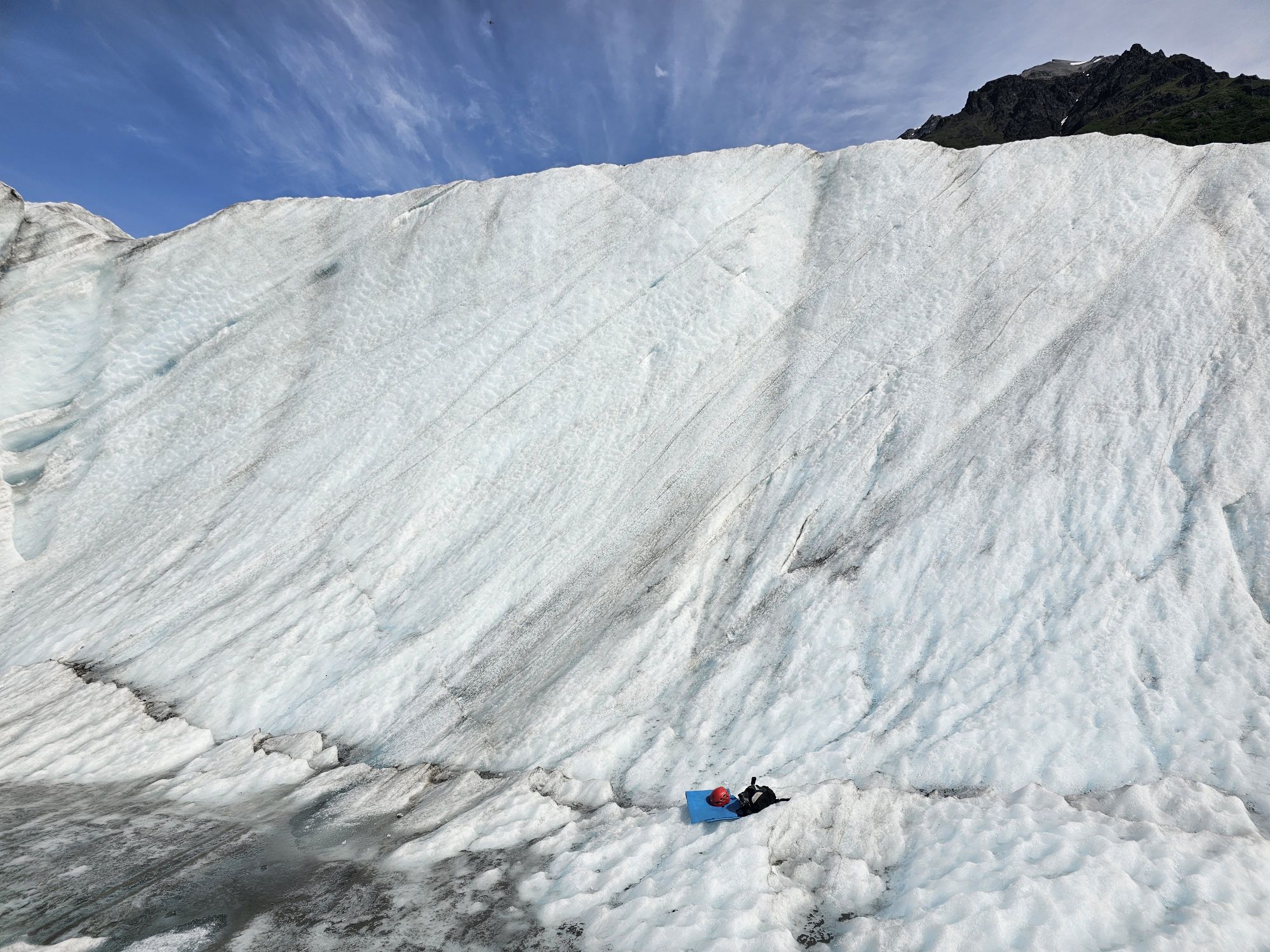
The icewall we climbed on the hike.
Ice Climb time!
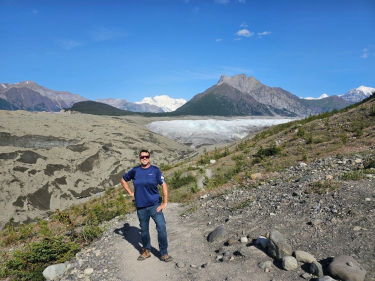
My guide took this. Mt. Blackburn is off in the distance, the snow covered peak in the center. That is 26 miles away! The root glacier is behind me. It is not just the white part, but also all the gray connecting to it. It is the bulk of the picture actually!
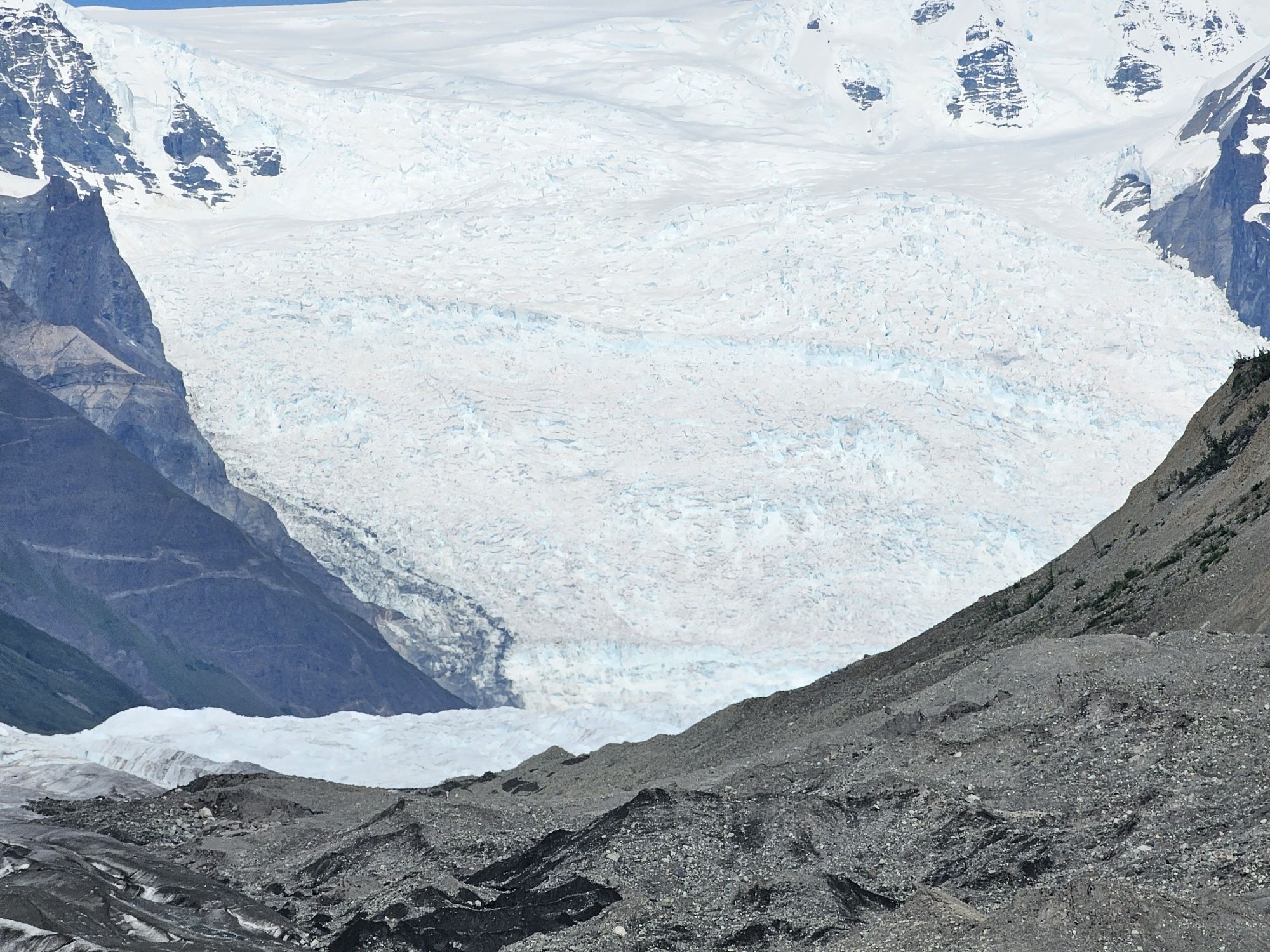
The Stairway Icefall. I had to zoom in a bit, so the picture is not great, but this is the 7,000 foot fall of ice that feeds the Root Glacier.
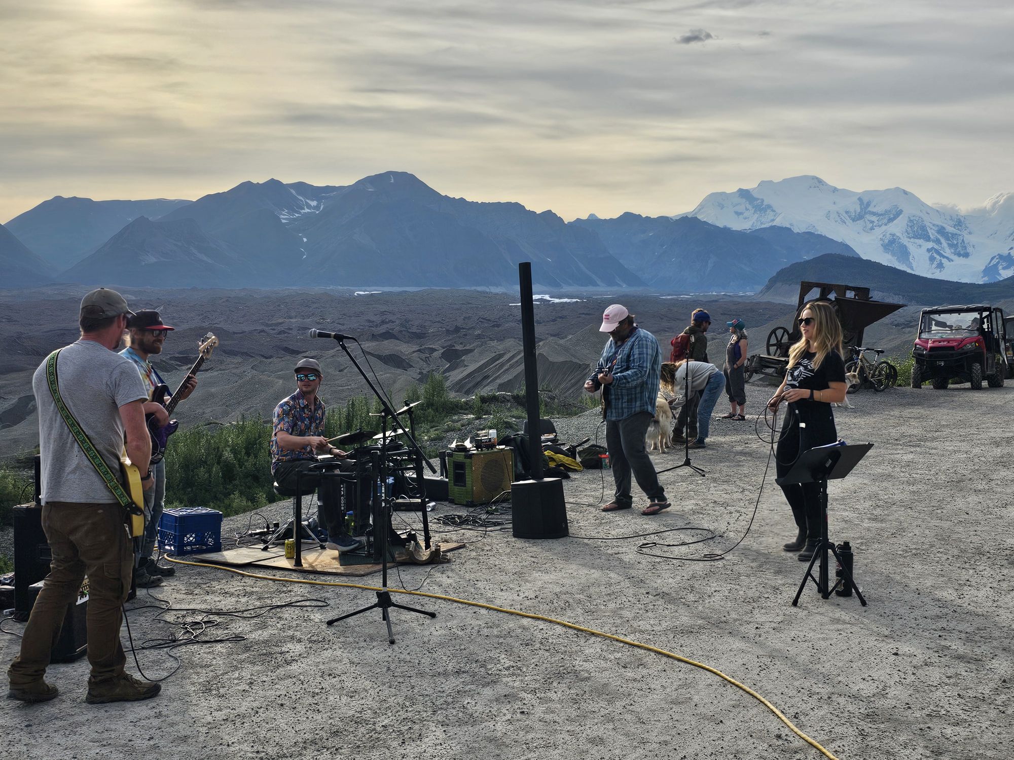
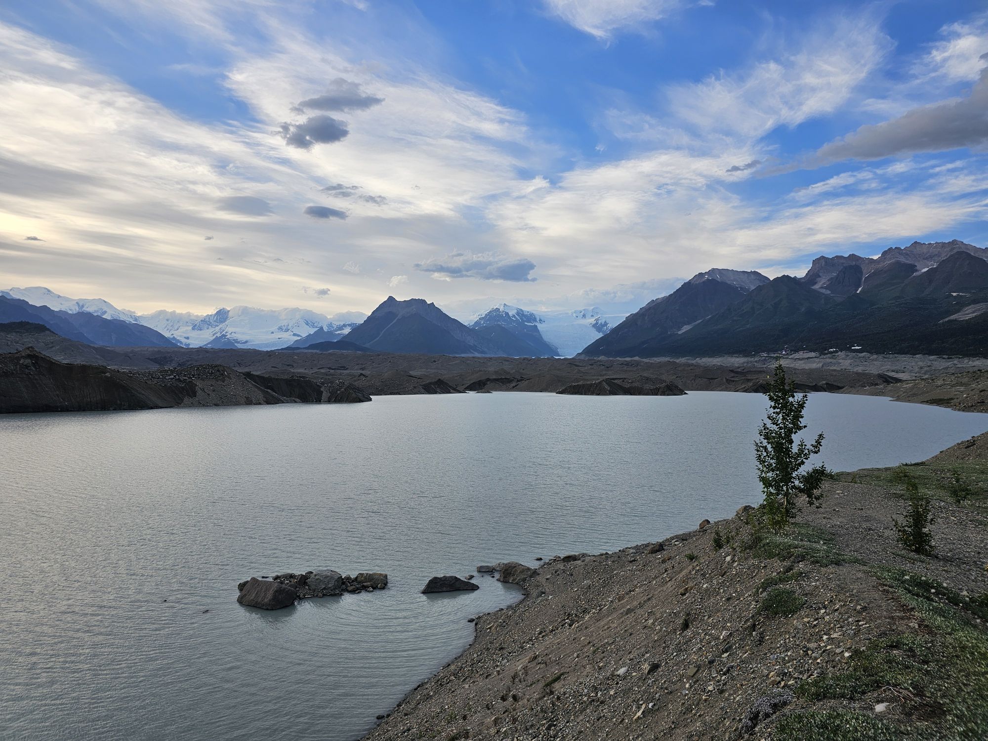
The hike took up the better part of the day but we got back to the mine around 3 PM. That was time for me to check out the NPS ranger station a bit and walk around the old mine and town. I had a mine tour scheduled for the next day so it was not a terribly thorough exploration. I took the bus back down to my Airbnb. As chance would have it, there’s a member of the #USBarkRangers group that LIVES IN KENNECOTT! She actually reached out to me a couple weeks prior to suggest meeting up and we ended up meeting that evening back up at Kennicott for some outdoor music event (?!). I was unsure if I could go because the buses only run to like 7 PM and I was thoroughly uninterested in the 5 mile walk down the mountain side but my Airbnb host was gracious enough to let me use one of her bikes, and she told me the bus would let me take the bike up, and then I could bike down, so problem solved! Anyway I met up with this lady at this open space on the edge of the cliff at this town event that was amazing and cool as hell! There was a mixture of seasonal residents, and tourists, there is a town food truck up there, and apparently they bring in bands from around the state to play during the summer! This was a random Tuesday afternoon, but was super awesome seeing this band playing in this setting! Afterward, I biked the 5 miles back down to McCarthy. En route, I found a side trail that went off through the woods and gave access to what is called the “toe” of the glacier. This is basically where the glacier is breaking up and poking out of the water. The big mounds of dirt here are not actually dirt but still parts of the ice just covered in gravel. If you look closely enough you can still see the ice and even hear the creaking of the ice! I was the only one out here, it was dusk, and this is grizzly country, so I didn’t linger but I wanted to check it out as the next morning’s excursion was a paddle in the same area.
Find me better live music venue! Taken by me.
This area is called the toe of the glacier. I am stadium on solid ground, but everything on the other side of the water is actually ice. If you look carefully Kenecott is visible on the right side at the bottom of the mountain.
I got back to my Airbnb and made dinner with what I had brought in my cooler. I later went to the bar anyway, because one cannot miss out on Alaskan beer! A couple came in at about 11 PM and provided a very useful reminder of the preparation needed for these Alaskan trips. They sat down and immediately asked if they could order food for the family. The bartender explained that the kitchen was closed, the cook was already gone, and they only had some boxes of cereal sitting around but no milk. The lady was beside herself. They had come in the same way I did, but apparently did NOT stop to get food at that Glennallen Gas Station because they though this bar’s kitchen was open later than it was. The bartender reminded her where she was and that any hours she saw on the internet are not firm. However…another Alaskan lesson….these people are friendly. The barback working offered to run to her house or wherever she was staying, and bring back mac ‘n cheese to make in the kitchen for the family. A great ending to the story, but don’t neglect to take advantage of every chance you get to stop for supplies when you visit Alaska!
The next day I woke early for my paddle…and as forecast, it was cold and raining heavily. I walked to the outfitter, still St. Alpines, and low and behold…once again I was the only person on this tour. I told my guide that she could take the morning off if she wanted….to her credit she was like, naw this is cool, it’ll be nice and easy only worrying about one person. Meanwhile…it was like 45, maybe colder, and pouring. There was a dry suit involved and I was wearing TWO supposedly water proof layers, to be sure so ok! The paddle was actually quite a good workout and interesting. The views were not great as the area was fogged in, but the eery and quiet calm of the water at the toe of the glacier was super neat. Three hours later I was chilled to the core, discovered that water proof is apparently a subjective term, and was under a blanket for the next hour with the heat cranked in the cabin as high as it could go!
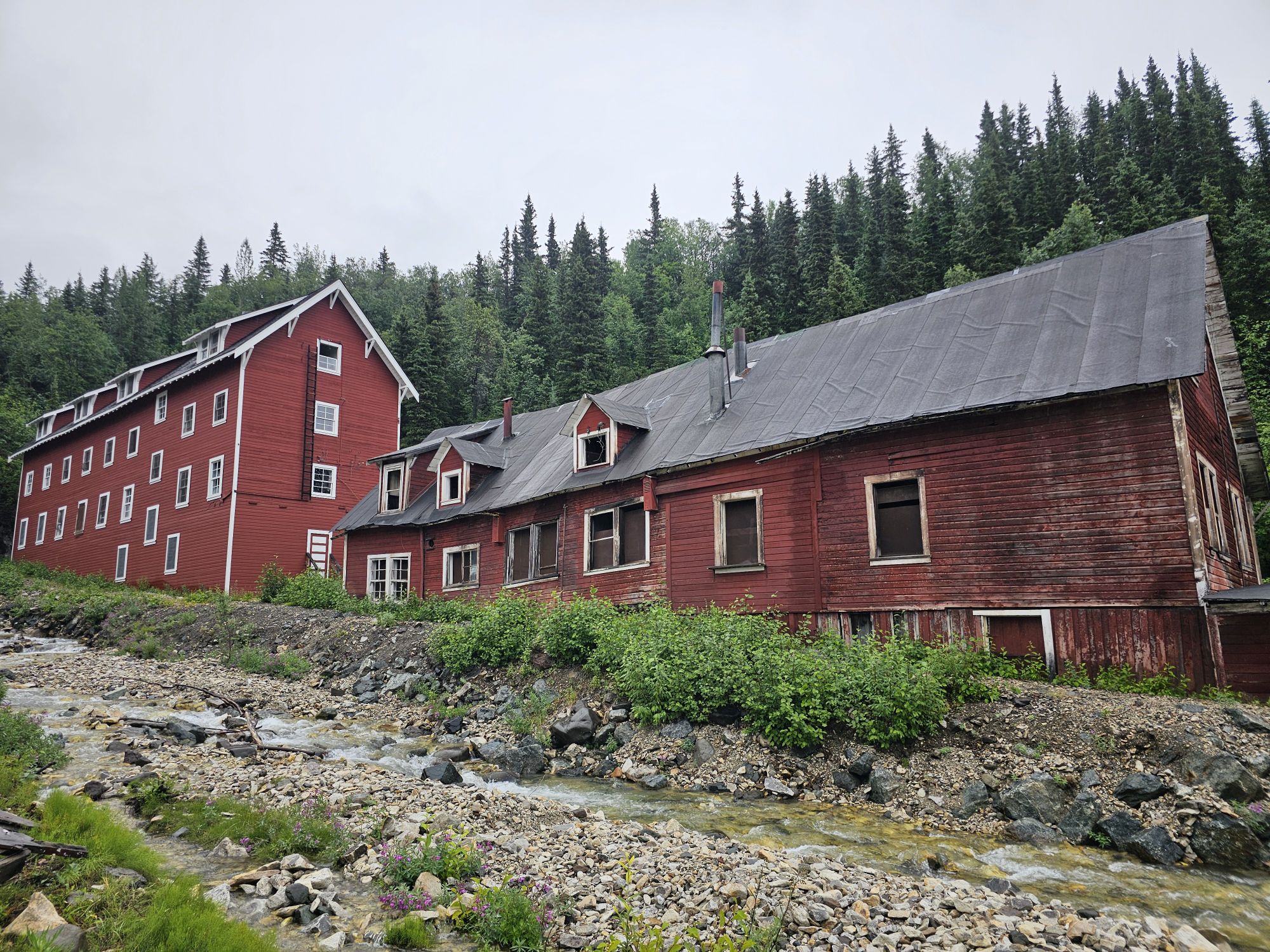
I rallied, went to lunch at the Potato, and headed back up to Kennicott for my afternoon tour of the mine mill. To tour the mine you must book with St. Alpine Guides. There is another outfitter in town, but St. Alpine is the only one with access to the mine. This time there were other people, like maybe 15, s it was a decent sized tour. Our guide was very knowledgeable about the history of this mine. I am not going to get into the ins and outs of the mine operations and how this mine was pretty revolutionary in how it worked, but I will take a minute to give the history of the area now. Roughly 130 years ago some men where doing Alaska pioneer things and came across natives talking about land where the ground was green. The men were intrigued and trekked to this area and found this green land. The green was actually copper strewn about on the surface. So, capitalism happened. A railroad was build where none had any right to be built and brought access directly up to Kennicott where this gigantic mine was constructed over the next couple decades. The mine was very lucrative as the deposits here were unusually pure. Thousands of workers set up shop here. Many were immigrants and part of the experience was going to school to learn to be American, or at least speak English. The mine town was a full functioning town but pretty much nothing fun was allowed, so that’s where McCarthy came in. The town at the rivers edge at the bottom of the mountain was were a miner could find bars, brothels, etc. Kennictott was for work, and McCarthy was for fun!
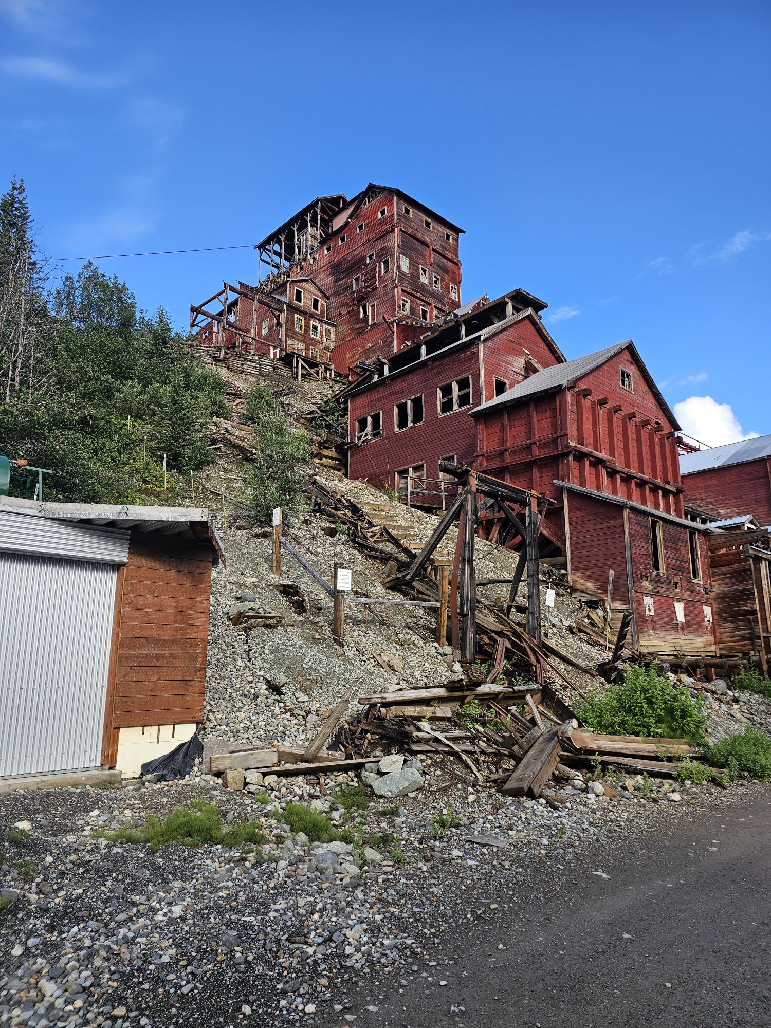
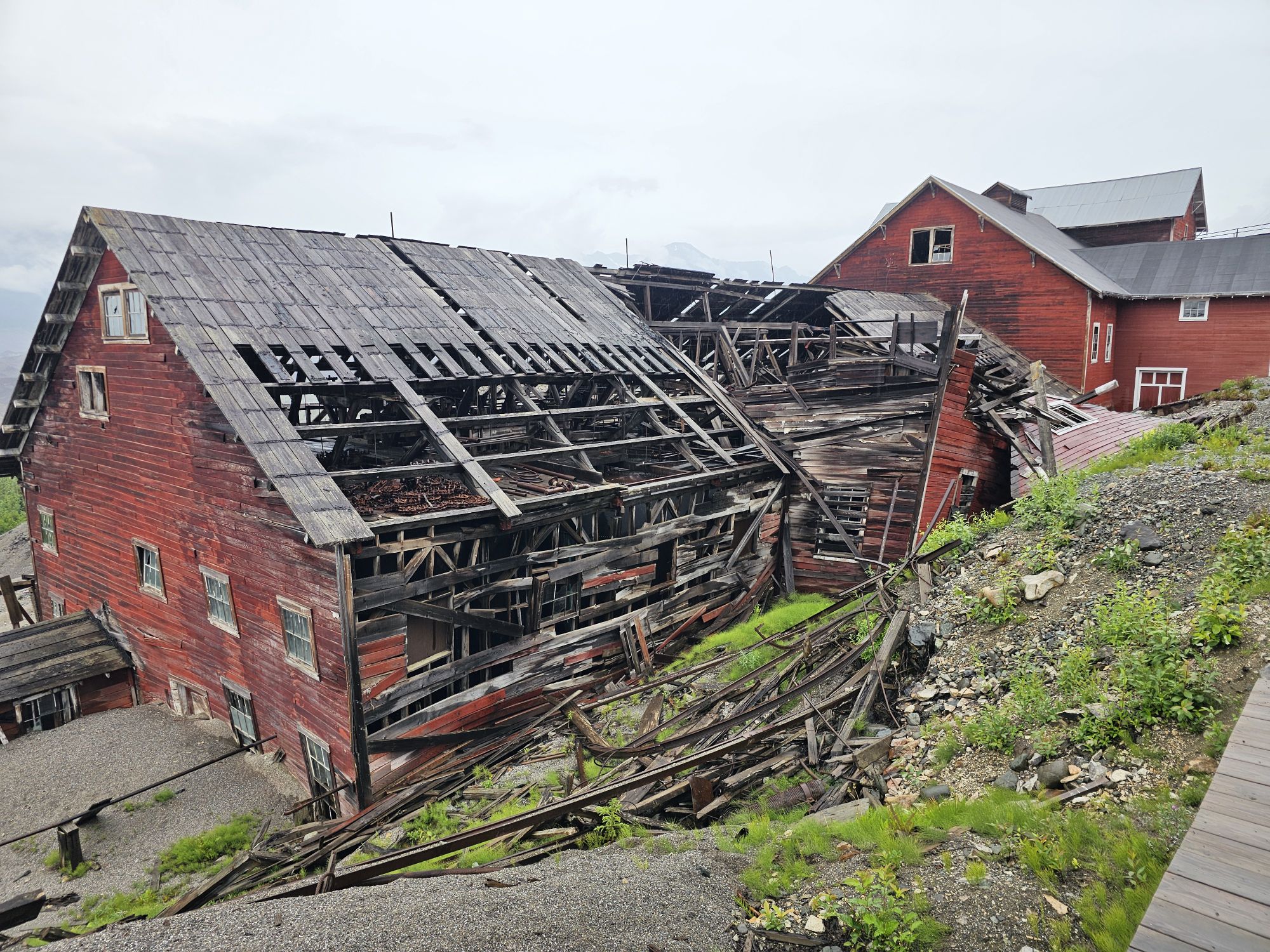
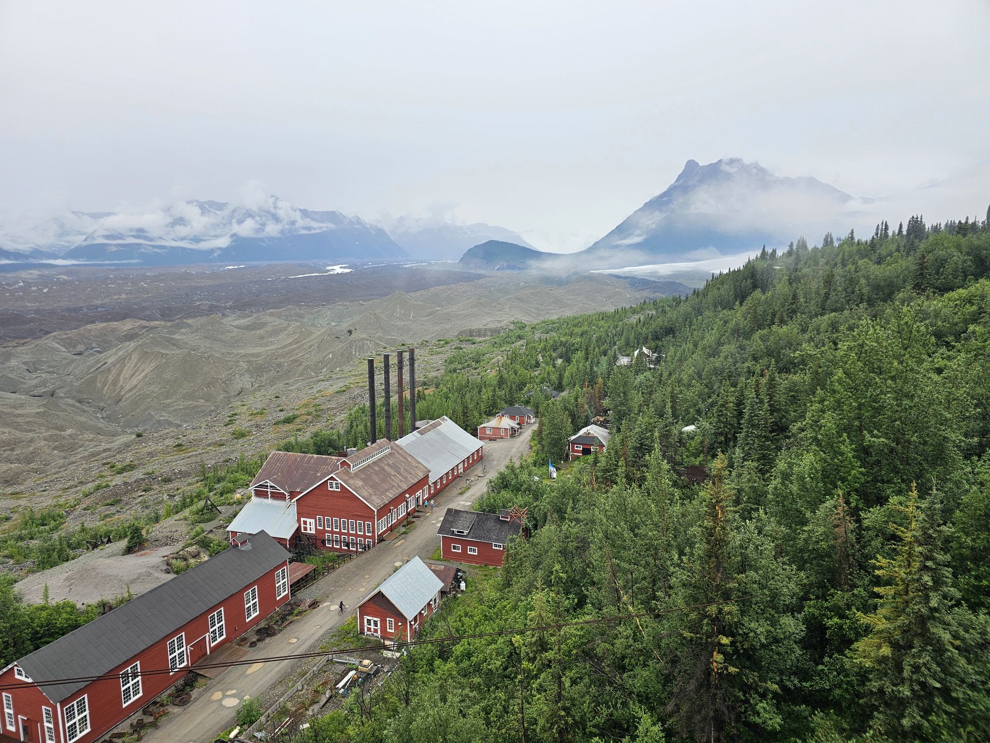
This is the famous Kennicott Mill. Taken by me.
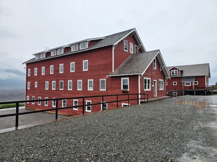
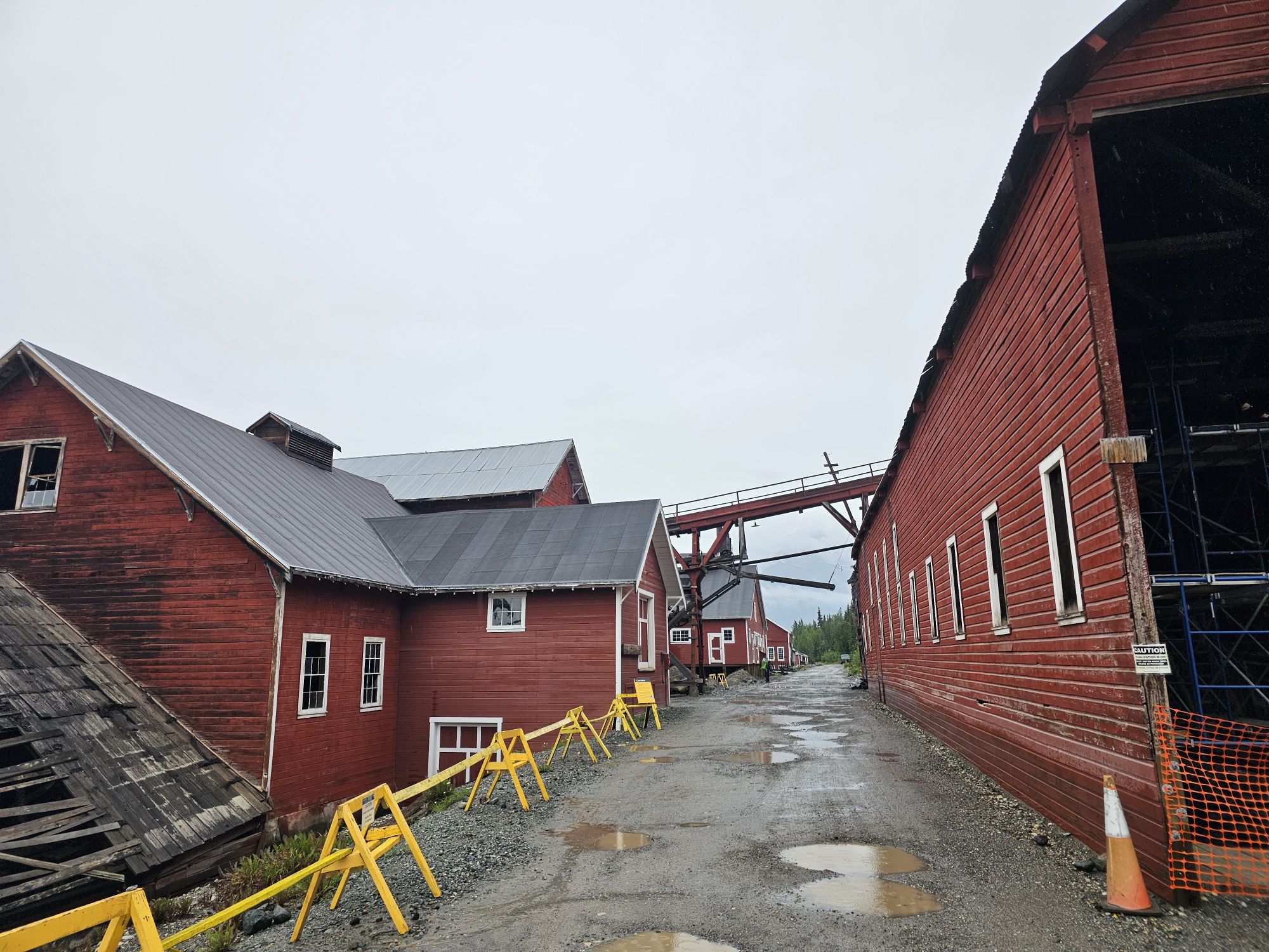
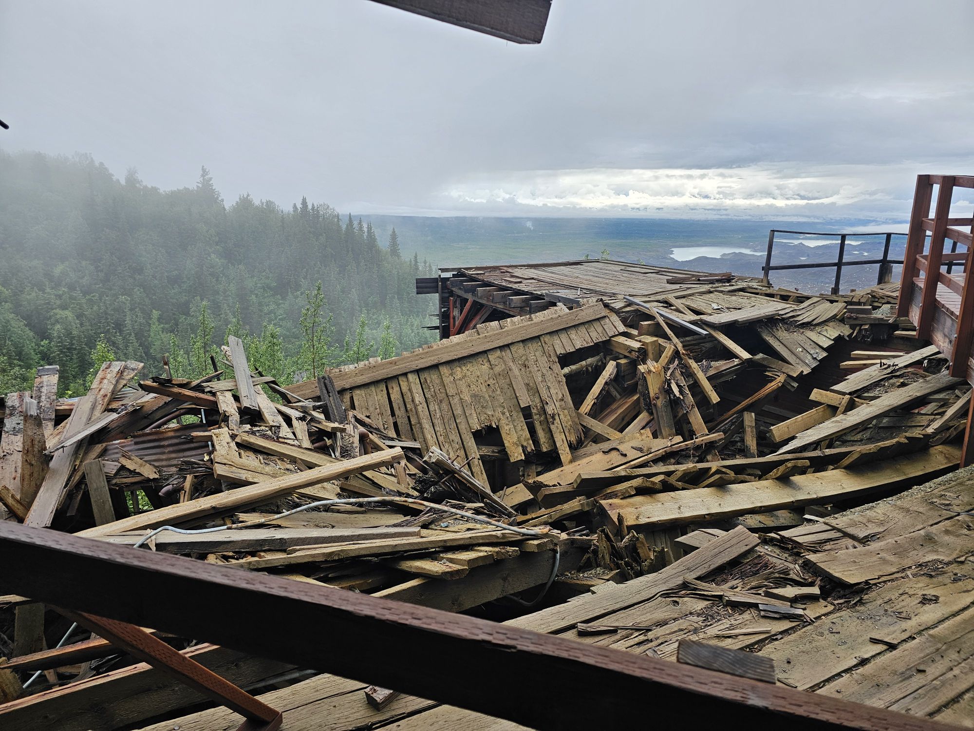
Most of the mine site is in terrible ruin and some of the buildings are collapsed. Some are still in great shape and used by the NPS as displays open to the public during operating hours. The large 14 story mill is the iconic structure of Wrangell-St. Elias National Park. It is also in quite a bit of ruin in certain places, but the NPS does allow tours conducted by St. Elias Guides. The NPS is actively working to preserve the structures so they will hopefully be around for decades to come. The mine tour begins at the road level and then goes up an uphill trail behind the mill so that the mill tour actually begins at the top of the 14 story structure and then the tour works its way down the 14 levels of the mine. Without getting too technical here, the mine is an engineering marvel, considering where it is located. The copper came in the top and basically, depending on how pure it was, worked its way down the various levels. As time went on the really pure ore disappeared and then this facility pretty much pioneered a new way to extract copper from what would have been considered waste. The mine was in operation for about 30 years and made the equivalent of nearly 2 BILLION dollars in profit in the early part of the 20th century. Around 1940 the mine was abandoned. Wrangell-St.Elias National Park was founded in 1980 and the NPS acquired Kennecott in only 1998. The mill is the only part of the mine that requires a tour. Many of the buildings are open and functioning as museum pieces, though some are still labeled as private residences. Some are standing but closed due to disrepair. There are several long hikes around to get to different mining areas further up the mountains. I did not do any of those. But there are guides that will lead you.
The video I took may contradict my typing, but I think this was the school and also a lodging building. Taken be me.
This is the road between the mil to the right, and the facility where poor quality ore was sent to be processed for profit. Taken be me.
These two buildings were bunkhouses. Both are unopen. Taken by me.
One of the ruined structures.
This is the top of the mill where the tour starts. It looks a little suspect. Taken by me.
View to the north from the top of the mill. Taken by me.
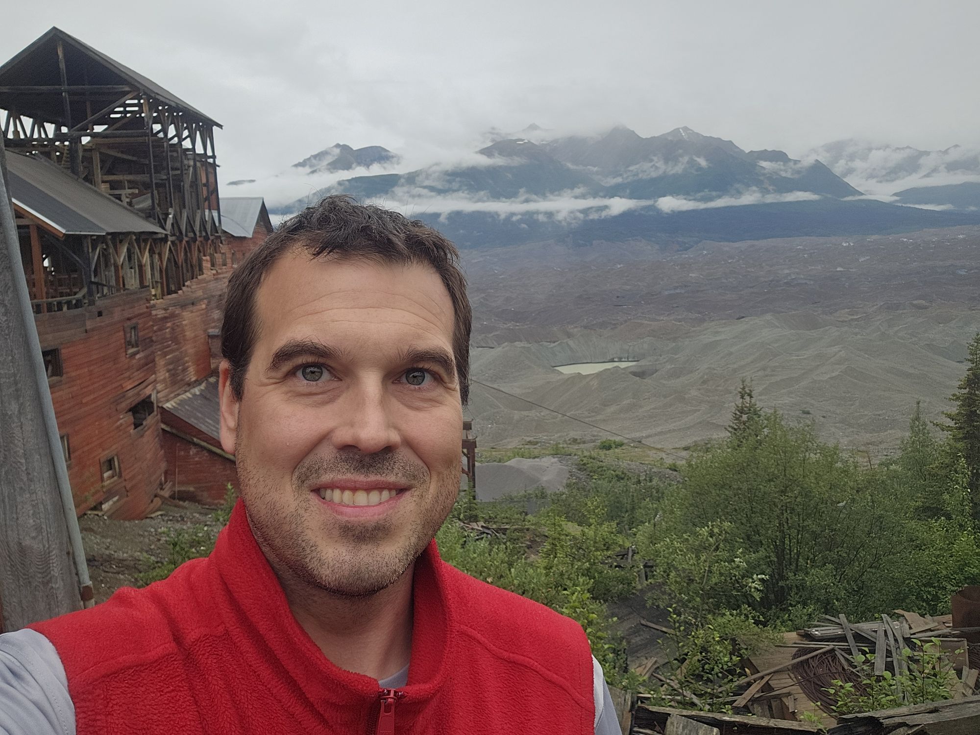
Selfie at the top of the mill.
Walking tour of Kennicott, narrated by me. It’s 15 minutes long, and may not be entirely accurate, but if you are bored give it a go!
After the tour I explored the entire area not part of the tour, and then I had to rush to make the last van as I had not brought my bike along. And let me tell you…I was in the front, wedged between seats in a thoroughly bad way. There was not going to be another shuttle…so it was that or walking! The driver said that the driver of the the other van that was supposed to be operating decided to stop working for the day sometime earlier! So, if you go, understand the shuttles are super helpful and convenient…but it’s Alaska! That evening I grabbed my borrowed bike and went around the town, back across the footbridge, back to the toe area, just to kinda get the last visuals in. The weather had vastly improved in the afternoon so it was a beautiful early evening!
View of the Kennicott River from under the footbridge. Taken by me
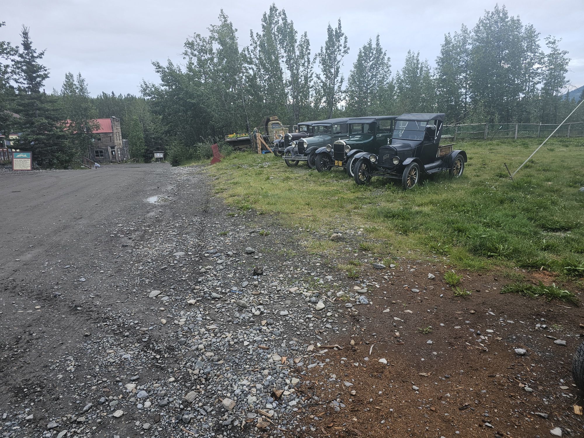
Weird collection of old cars just sitting on the main strip in McCarthy. Taken by me.
The next morning I got up early and packed out my stuff and hit the road. I feel like this drive back to the Anchorage area took nearly 12 hours…because it did. Remember, on the way out, because I stopped to see Denali, I did not have time to stop and really view anything, so coming back to Anchorage I did stop often. The big thing to see along this high way is the Matususka Glacier. This is a huge draw for tourists as its only 2 hours or so from Anchorage. Again, the glacier, which is visible for miles and miles of this drive, has retreated so much that is used to be easy to drive up to and walk on, but now requires a lot more effort and a required ($$) guide. I drove down the road to the entrance area, but there isn’t much to see, so skip unless you are hiking the glacier. Pro tip…there is an elementary school off of the highway that actually has killer views of the glacier.
Finally, I arrived back to Anchorage, and it was only 6ish so I drove down to Girdwood, to make a repeat visit to Girdwood Brewing. I love their beer and I needed a new glass! A couple hours later I sat down to dinner at 49th State Brewing back in Anchorage and called it a night.
The following day was my last day of this trip but it was a full day. I did not have any real firm plans for this day so I ended up checking out Eagle Lake Discovery Center, Lake Eklutna, and Thunderbird Falls. All of these were in the same area about an hour north of Anchorage. They were nice for what I was looking for, but nothing too special. When I got back into Anchorage I called the A1 dude to return the vehicle. He asked what I was doing the rest of the day, I told him I was planning on some Moose’s Tooth Pizza. Being the every interested party as he was, he strongly suggested I go to the sister restaurant, Bear Tooth Grill instead. He then offered to drive me AND pick me up if I would just give him a slice or two! Anyway, I got back to the Airbnb (I had rented for the night even thought I would be leaving at midnight). I decided I was not quite done yet, so I called a cab and went to Matanuska Brewing for my last Alaskan beer (sadly it seems that at least the Anchorage location I visited has closed). And with that, it was a trip!
Overall Impressions: This is about as great of a National Park trip as you can take. I am writing this entry more than a year later and I have really enjoyed reliving this trip. This park is my favorite now, and I would love to go back!
Hey there Adventurers! I know I have said this before, but I am really trying to get caught up on my trips! Summer of ’24 included two amazing trips to see two parks, both of which have claimed the title of Crown of the Continent. We will start with Glacier National Park, National Park 41 for me!
To begin with, one should know that this park is widely considered to be the best park in the NPS system and the visit here generally happens in a small window in the later summer. A trip to Glacier National Park cannot be discussed without first discussing the ordeal that is planning, scheduling, and paying for a visit to this pinnacle park! The Sidekick was in tow once again. Southwest flies to the northeast, southeast, northwest, and almost every thing in between, but there is a sizable void in the north central part of the country. One could fly into Bozeman but there is a lengthy drive up to Glacier. So, we actually ponied up and *gasp* purchased tickets on other airlines to fly directly to Kalispell, MT. That was the easy part. The tough part was lodging. Camping was out of the question. She needs a proper bed for back issues, weather is suspect as hell that time of year, and I am not tenting out in grizzly country anyway! So the options are the in-park lodging, which isn’t cheap and is not easily available, or you lodge outside the park, which is also expensive, and requires lengthy drives in and out each day. We settled on in-park lodging, which was a hassle! I started booking the three main lodges in June of 2023. For the next roughly 6 months I kept canceling and rebooking, looking at the schedules nearly every day to achieve the goal of 5 consecutive nights in the park between the three main sections of Glacier National Park: Lake McDonald Lodge, Many Glacier Lodge, and Rising Sun Motor Inn. By around January or February, I FINALLY got our 5 nights! Those were 2 nights in the Rising Sun on the East side of the park, 1 night at Many Glacier, and then 2 nights at Lake McDonald. Stay tuned for a very big problem at Lake McDonald Lodge!
For the route we took on this trip we came in from Kalispell from the west to West Glacier, then followed the southern route around to Two Medicine, up to St. Mary, up to Many Glacier, and back down to St Mary, past Logan Pass to Lake McDonald, the large lake between Logan Pass and Apgar, and then back out through West Glacier.
Ok, so its June and GO TIME! Our very first night in the area was in Kalispell. Upon landing we grabbed the car, got supplies, checked into the hotel and took the nearly 45 minute drive up to the visitor center in West Glacier just to get a lay of the land up there. We would not be back until the end of the trip and just wanted to make sure we actually got a chance to get to that visitor center during operating hours.
The sign in West Glacier, taken by the sidekick.
The next day we got up early and headed toward the east side of the park. We did not take the famous Going to the Sun Road for this segment. Rather, we took the highway that goes around the south of the park. I had read it was a neat drive, and we were going to an area of the park called Two Medicine in the southeast quadrant. The most sensible route was the one we took. Of course, being late June in summertime Montana, we ran into temperatures in the 30s and ice/sleet on the way! But once we got to Two Medicine the weather was a bit better. We took in the stunning views and then had a boat ride across Two Medicine Lake. This ride is a short cut to Twin Falls. After departing the historic boat it is about a mile or so hike to the falls. I have to say this area of the park was stunning, and I think more so than the rest of the park, maybe an unpopular opinion! When we got back to boat dock we ran into a cute goat family, the first wildlife of the trip! We also talked to a ranger in the small station here who had a legit Bark Ranger with him! After spending some money in the gift shop, we were off to our lodging at the Rising Sun Motor Inn in the St. Mary area inside the park’s East Entrance.
The Sidekick snapped this on the shore of Two Medicine Lake.
On the boat ride in front of Sinopah Mountain..
Quick video on the boat ride across Two Medicine, with the Sidekick acting foolish.
The appropriately named Two Falls. Taken by the Sidekick
This goat family was hanging out by Two Medicine Lake. Taken by me.
I want to spend a quick moment to point out that this side of the park is adjacent to the Blackfeet reservation. They are very much active in the administration of this part of the park and the names here are still their names. For instance, Two Medicine is a Blackfeet name, as is Sinopah Mountain in the same area. Blackfeet flags are present in this part of the park, and the visitor center actively makes reference to the Blackfeet tribe.
Display inside the Visitor Center on the east side of the park, near the Blackfeet reservation. This was not in the other visitor centers. Taken by me
Closer view of the previous picture.
The three flags of the park. The Canadian flag is displayed because Glacier is a combined park with Waterton National Park right next door, across the border. The park unigrid designates the park as Waterton-Glacier International Peace Park.
After checking out the visitor center here, we headed into the park to our lodge at Rising Sun. The lodges in the Rising Sun Motor Inn are very spartan, as expected. There is no cell signal, also expected. If you are driving a large vehicle, parking at your individual room might be tricky but there is parking at the restaurant and store and you can also find some sweet spots in that building to get wifi and/or cellular signal. (If you want more reliable cell signal, there was a good spot in St. Mary Village but you had to walk around a bit to find it!) What wasn’t really expected was how cold it was! Over night I about froze! Our lodge was a one bed, and I had brought along an air mattress, so part of that was being in the nook between the bed and wall with the heater on the other side of the room which did not allow heat to get to me, but the room was quite drafty, as well. It was late June, and I have been to Alaska earlier and later than this and not been that cold overnight!
The St. Mary Lake area is quite splendid! If you are on the east side of the park you aren’t going to miss it. There are plenty of great viewpoints of the lake and then as you go further up some amazing views of the mountains and the valley. There are waterfalls everywhere and even a viewpoint of a glacier along the road. Fun fact, there is a tiny island in the lake called Goose Island, which was the location used in the opening scene of the original TheShining movie!
A shot I took of St. Mary Lake looking west. The boat is one of the four boats operating across the lakes in Glacier.
I really like this shot I took of the east side of St. Mary Lake.
The iconic Goose Island, taken by me.
Even though we were to traverse the Going to the Sun Road to Lake McDonald a couple days later, we got up the next morning and went ahead and drove up to Logan Pass anyway. Despite being late June, there were still many feet of snow at the pass and the spectacular Highline Trail was snowed in and closed. The pass sits at around 6600 feet elevation and is on the continental divide. The parking here is notoriously limited, and the visitor center and parking lot were jammed, despite the trail closures, so be sure to arrive early! The road only opened a few days prior to our visit, and it seems everyone was rearing to drive through even if they couldn’t hike. Despite missing the hikes here, the drive and the views are spectacular! We had lunch on a roadside pullout with maybe the best scenery one can find!
Jackson Glacier is visible in this picture, one of the few remaining glaciers visible from the road. Taken by me.
There are many waterfalls in the huge valley along Going to the Sun Road on the east side of Logan Pass. Taken my me.
The snowpack still at the pass. It was June 29! Taken by me.
Another parkgoer was nice enough to snap this picture of me and the Sidekick at the Logan Pass sign.
Clement’s Mountain towers over the Logan Pass Visitor Center. Taken by me.
Coming back to Rising Sun we hiked to the awesome St. Mary Falls, ran into a bear and her baby, and found a really amazing and super easily accessible spot that gives killer views at sunrise. This is the Sun Point Nature Trail area. We stopped here this afternoon and then came back for that sunrise view the following morning! The Guide Along app was once again an MVP on this trip, but even it didn’t offer this site as a stop. Don’t miss this spot! Literally, the best views of St. Mary Lake are found here!
The Sidekick took this of me in front of St. Mary’s Falls
Adorable baby! Taken by me.
And a good shot I took of mama. Apparently, they were often in the Rising Sun area.
We did not utilize a tour on one of these, but these are iconic and old tour busses which still operate in Glacier! Taken by the sidekick.
Our next day was the trip up to Many Glacier. After catching sunrise at the Sun Point Nature trail, we headed that way. We had some mail to drop off and found a small post office in Babb, MT, but we were early and drove up to the border to wait for the post office open. After an awkward but brief drive onto Canadian soil with a Canadian border agent escort to fill in the time, we found ourselves at the Many Glacier Lodge. We immediately ran into goats and amazing views. Somehow, despite paying a reasonable price, we had a room with a balcony, lake side, on the second floor, pretty much the best room you could get! As we were only here that afternoon, this part of the trip was short but no less great! That afternoon we hiked around the lake a bit and ended up at Fishercap Lake to go looking for moose. Apparently moose frequent this lake and we found one! We were hiking and came across her (assuming a her, no rack in June) in the woods and followed her out to the lake and watched her swimming across. So cool! (also, a friendly reminder to stay back a good bit as moose are not to be trifled with!)
Sunrise at the Sun Point Nature trail. I did edit out an annoying shadow, but other than that, what a gorgeous spot! Taken by the Sidekick.
The same spot as above.
The Sidekick snapped this one of me in front of a Blackfeet Nation Art installation just south of the border outside of Babb, Mt. The Two flags on the right are the Montana and Blackfeet flags.
Many Glacier lodge, taken by me….was hoping to find a better vantage point.
In front of Swiftcurrent Lake, the lake the Lodge sits on.
This was the view from our room balcony in the lodge! This was actually only an hour or so later than the picture above, so weather can change in a hurry! Taken by me
Came across this one hiking around Fishercap lake. Taken by me.
Followed her into the lake. Pretty cool! Taken by me.
The next morning we had to ad lib. You can hike from the lodge to the Grinnell Glacier or take a boat as a shortcut. Well, getting those tickets was tough. I managed to get one persons worth of tickets, but we could not get the second set. You can standby, but there were a ton of people trying to do that. From the lodge, one boat crosses Swiftcurrent lake. From there you hike a bit to Lake Josephine and catch another boat. Then that boat takes you to a much shorter section of the Grinnell Glacier hike across Lake Josephine. However, as we only had one persons worth of tickets, we were told that we could hike all the way out and then both of us could one way back on the boats. So we hiked from the lodge all the way to the back end of Lake Josephine on the Grinnell Glacier Trail! It was about 3 miles or so. It was awesome. We ran into people coming the other way who were warning of a grizzly on the trail, so we decided to only go to the boat dock and come back. The remaining part of the Grinnell Trail was still snowed in anyway, and while on the boat coming back we could see bears very near that section of the trail, eek!
Cool photo op along the trail, taken by me.
The Sidekick got this one of me at the same spot as above.
We departed Many Glacier early in the afternoon and made our way to the Lake McDonald lodge on the west side of the park. To make this trip we drove the much lauded Going to the Sun Road. We had suspect weather along the drive, but this is definitely a great drive, and well worth all the accolades! The only gripe was the weather had a lot of the drive fogged in, but when there were clear sections, it was spectacular. There were many view points along the way, and we stopped at a noteworthy spot called Red Rock Point, which gave awesome access to the raging creek running through, a cool spot to not miss!
A photo op near the famous “Weeping Wall” on the GTTSR. Taken by the Sidekick.
There are a crazy number of waterfalls in Glacier National Park! Taken by me.
Lunch along the Going to the Sun Road. This spot was east of Logan Pass Visitor Center.
The Sidekick snapped this of me in front of the creek at Red Rock Point. The spot is right along the GTTSR just north of Lake McDonald.
So, this is an unaltered picture. Those rocks are famously photographed and almost always over saturated…but yeah that can look pretty spectacular, especially with that gorgeous water! Taken by me in that Red Rock Point area.
We got to the lodge and had some problems. Not to get into things too much, we were in one of the buildings on the property, not the main building, but our room door would not open. A lodge employee was only able to get in by breaking through the window and even after that, was unable to fix the door. Additionally, another party was there and thought they had the entire building to themselves, and they were not particularly friendly about it. After a couple hours of waiting around (which we had intended to be spent exploring) we were told we would be moved into another building and given this huge area, essentially the entire second floor to ourselves, but we could only be there one of the two nights and then the lodge was to move our luggage to another room inside the lodge proper for the second night. It was a little more of a fiasco than what I wrote, but that is how it was resolved. It is probably an issue that rarely happens, but I feel like it should be known.
Inside Lake McDonald Lodge. Taken by me.
Lake McDonald. This trip gave so many reflection photo opportunities! Taken by me.
The Lake McDonald Lodge boat dock. Taken by me.
Despite losing the time that evening, we were still planning on hiking the Avalanche Lake Trail the following morning. This is a great trail, in fact the number one rated trail in the park, with an amazing payoff after 3 miles, making it a 6 mile roundtrip. There is also a nice walk of a mile or so at the start, the Trail of Cedars. Both make it a 7 mile trip. The Avalanche Lake Trail follows a really cool and scenic creek. Be mindful, as there were selfie induced fatalities on that creek around the time we were there. Avalanche Lake is spectacular. We didn’t have sun, but even so, it was still beautiful! Afterward we worked our way back to the lodge, hit some cool side spots on the way back, and did an evening hike along Lake McDonald before settling in to prepare for the trip home the following day.
The Sidekick snapped this one of me alongside the Avalanche Creek. That water is really moving!
In front of Avalanche Lake, taken by fellow hiker.
Taken by the Sidekick.
We got a little better sky and light before we left. Taken by me. I think its an awesome shot of a beautiful spot!
Overall Impressions: This is a huge park with a ton to see and do. There was an entire gravel access part of the park that we were not able to visit due to weather and time (even in a 5 day visit!) and then a visit to the adjacent Canadian Waterton Park would push the trip to probably at least 10 days to do everything. Despite our trip being the end of June and top of July, weather and snow is still a consideration you must account for. And yet, even so, there are plenty of humans around to remind you how popular the park is. Overall Glacier is a gorgeous park and absolutely one of the great parks in our country. Must see and experience and I would absolutely go back.
Hey there Adventurers! May of 2024 saw the Sidekick and I take a Memorial Day weekend trip to Tennessee to check out the Smokys and some other awesome spots in Tennessee! Included in this trip were stops at a mountain top amusement park, a couple state parks, another NPS site in addition to a return visit to the Smokys, and an intense white water rafting trip!
Once again taking advantage of Southwest Airlines, we took a free flight from Florida to Nashville. The drive from Nashville to the Knoxville area is not bad, and there are several nice Tennessee state parks close to the interstate. Our parks’ goals were to explore places that had Bark Ranger programs, or at least had Bark Ranger items for sale, to check the info on the handy dandy map we provide over at #USBarkRangers! We stopped first at Cummins Falls, in Cookeville, just a bit off of I-40. The park highlights a nice waterfall and a gorge. Unfortunately, due to recent heavy rains we were unable to go down to the gorge, so the visit was short. But we did buy Cummins Falls Bark Ranger tags for our Bark Rangers!
Cummins Falls.
Closer view of the falls. Taken by me.
As we neared Knoxville, we took a detour to check out Obed Wild and Scenic River, one of the NPS units in Tennessee, and one that offers a Bark Ranger program! The visitor center can be found in Wartburg, TN, though the NPS land is lengthy along the river, of course. The visitor center is dog friendly, as well! This site offers a free tag, a certificate, and swearing in of your Bark Ranger! Big South Fork, another nearby NPS site, is under the same administration and offers similar dog friendly amenities, but we were unable to make the trip to that site.
The Obed River near the NPS visitor center. Taken by me.
We managed to get into our AirBnb in Maryville early enough to still make it to the nearby section of Great Smoky Mountains National Park, specifically the Cades Cove area. This marks my second trip to this park. My first trip was part of a roadtrip with another friend, and we were only in the Smokys for one mostly rainy day. Our early evening visit into Cades Cove was great! The history of the people living here in the Cades Cove area and the NPS is quite interesting. In a nutshell, there was a community here that was slowly but surely absorbed by the NPS through lengthy agreements with the people living there, and when the last resident left, in only 1999, the area all became part of the National Park. We stopped at some of the old structures there including the church. We made our way around the loop road and saw many bears, making this a very worthwhile evening excursion into the park!
Cades Cove Primitive Baptist Church. The church was organized in 1827. Taken by me.
Inside the church.
Taken by the Sidekick.
A black bear cub. It’s mom and siblings were near as well. Taken by me.
Another Cades Cove native. Taken by me.
Black bear cubs in the trees in Cades Cove!
The next day we got up early and headed for the obligatory sign picture. We entered the park through Townsend and drove up to Clingman’s Dome. (After this trip Clingman’s Dome was renamed for the old Cherokee name for the mountain: Kuwohi). As in my previous visit the dome was pretty fogged in, though some glimmers of distance could be seen in some directions. We stopped at the Sugarlands Visitor Center close to Gatlinburg, and ended up having a conversation with the ranger in charge of the Bark Ranger program there! It was a great 30 minute or so talk! It is important to note that Bark Ranger programs in the parks are an entirely voluntary outreach by the park. Some parks place more emphasis on this program than others and some parks are naturally less dog friendly than others. Great Smoky Mountain National Park falls into the latter category (bears). They do have a cool tag you can buy and a great certificate that the rangers will fill out. They will even do a swearing in, IF THEY HAVE TIME. This is the busiest National Park in the country and if the visitor center is slow, they will do the swearing in. However, it is rarely slow, so temper expectations! As far as dog friendly areas, there are two trails, one by each of the visitor centers, that are dog friendly. Other than that your pups are best off (and required) in the car or only outside on the pavement portion of overlooks!
This view was found in one direction from Clingman’s Dome. Taken by me.
But, this was most of the view from the top of the mountain. Taken by me.
However, just down a bit, near where you turn to go up the dome, you can find this view while the top is fogged in!
The visit to the Smokys was only a part of this trip, not the focus, so that was about the extent of the Smokys part, but there was plenty more fun to be had! The next day saw an early breakfast at Sunliner Diner, a cool diner in Pigeon Forge, with convertibles you can eat inside of, before heading to the great tourist trap known as Gatlinburg, TN. But, in this case, the visit was well worth the money! We checked out a park called Anakeesta. After taking a tram up the mountain, you can access this amusement park. You will find some killer views of the surrounding mountains, plus some beautiful themed landscaping, restaurants, live music, and of course, some mountain roller coasters! After finishing up here we took a roundabout way back to our Airbnb, which took us past Dig’n Zone, a construction theme park in Sevierville. I am not going to say much about it except that the tickets were way too expensive. But we stopped in the parking to see what was going on. The Sidekick narrated a video I took, so we’ll let that do the ‘splainin!
Wait staff was kind enough to get this pic of the me and the Sidekick in one of the cars in the Sunliner Diner.
Posing in front of the tram to get up and down Anakeesta.
This is the observation tower at Anakeesta. Taken by me.
The Sidekick took this one of me on the observation tower.
This is a video that Anakeesta makes of your ride down the HellBender Coaster! Pretty cool! They use their own sound track however.
The Sidekick gives a great narration at Dig’N Zone.
The next morning was an hour or so drive down nearly to Chattanooga to grab a rafting trip on the Ocoee River. The sidekick and I have both been entertained for years by watching videos of a hillbilly river guide named Fast Fred (be sure click the link to get a sense of the man). He operates on that stretch of river and we managed to get him as our guide! The Ocoee is a dam release river and was also the site of the 1996 Olympics white water course! This stretch of river goes up to class IV, which are pretty significant rapids, both in danger and intensity. As expected, this trip was full of both! At one point the Sidekick got sucked out into a recirculation, but she was quickly rescued by another raft. She was, and continues to be, pretty upset by the whole ordeal, and cannot be blamed. Fast Fred made a mistake and told us to lean one way, and it was the wrong way. He acknowledged his mistake at the end of the day, but that just highlights that it is a dangerous activity and even the best and most safe guides can make mistakes! As for me, I can say that the beginning of this run had me skittish, then I was super stoked after going through the hard parts. Then seeing the Sidekick go for a swim was rattling.
This is a 360 degree video, the fun stuff starts about 1.30 in. This is the stretch of the river that was used for the ’96 Olympics.
This is the section where the Sidekick went for a swim. It wasn’t long but this stuff is definitely extreme!
Being silly at the Ocoee Adventure Center.
Posing with Fast Fred.
Later that evening we ventured out an explored some of the Foothills Parkway which is a part of the Smoky Mountains National Park. If you are a driving enthusiast, you might know this road as an extension of the famous Tail of the Dragon drive. It had been an exhausting day and also the weather was suspect, so we did not venture too far down this road, but I did want to mention it since there is a sign there and I had actually not even heard of it until this trip!
The Sidekick took this.
This area on along the Foothills Parkway really emphasizes why these mountains are called the Smoky Mountains. Taken by me.
Our last day in Tennessee was the drive back to Nashville, but there were still some stops to be had! We made stops at Cumberland Mountains State Park and Burgess Falls State Park. Both of these are close to each other and pretty close to I-40. Other than a lake and a neat damn, Cumberland Mountains State Park was mainly a nice picnic and walk through the woods type of park. Burgess Falls was more of the hiking to a cool waterfall payoff park. After this trip, I can say I am impressed by the Tennessee State Parks. The ones we visited were very clean, well maintained, the staff were very friendly staff, and of course, beautiful scenery.
I took this picture of this neat bridge you have to drive over in Cumberland Mountain State Park.
Burgess Falls, taken by me.
Overall Impressions: As my first real exploration of the Tennessee nature scene, I am a fan! It’s a pretty state with lots of fun things to do! Once again, be prepared for weather to play a role. The TN state parks are a real nice supplement to a trip through the state for sure.