*I broke this one out of an early post. At the time it made sense to have this bundled with the Macy’s/NYC Trip, but I really think with how different they are, and especially with my National Parks goal that this one should be separate. As such, the national park counter is behind the previous entries!*
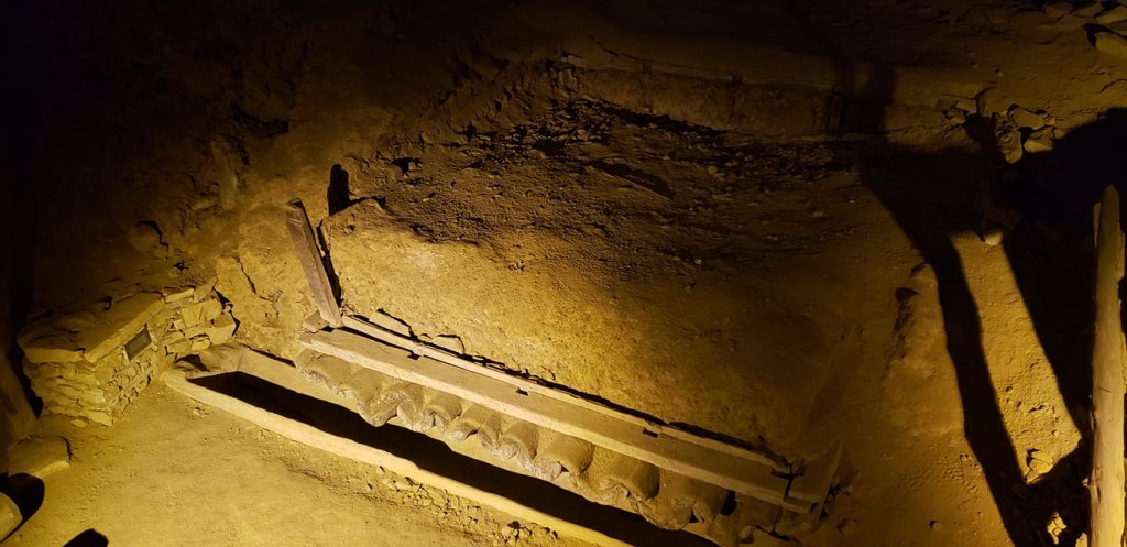
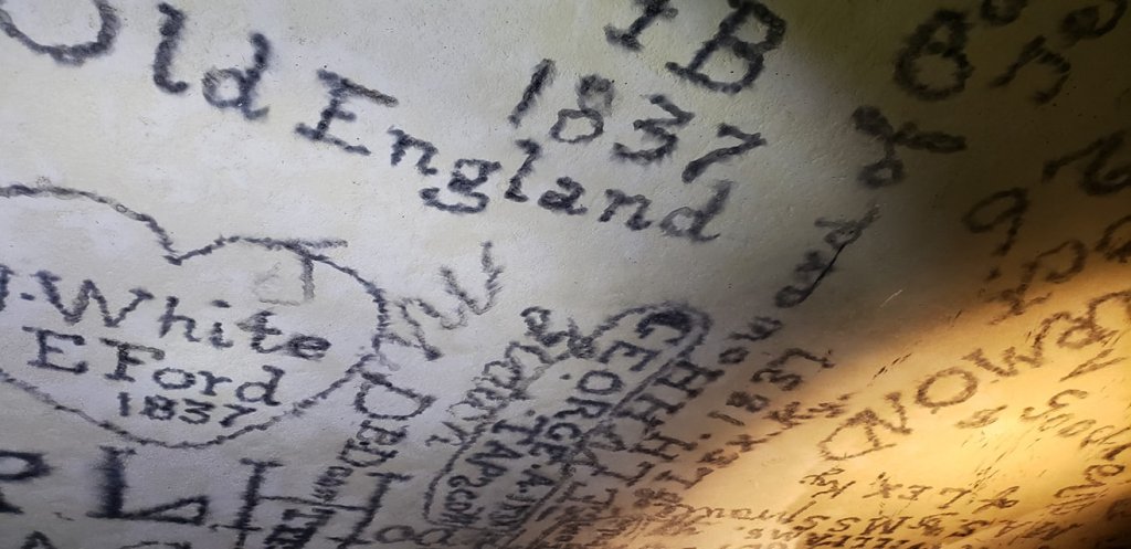
This is going to be a really short entry as it was just a short morning/afternoon trip while visiting the mom. So, immediately after the Macy’s event, I was off to Indiana for a family wedding. That’s not what I am writing about! Instead, I took my mother to visit Mammoth Cave National Park a few days later! In the middle of Kentucky, and really not too close to anything noteworthy, but also not out in the middle of the sticks lies the largest known cave system in the world! It is usually pretty busy, but we went on a Monday and I guess there is a pretty big lull in attendance between Thanksgiving and Christmas, so it was very short on people. One thing though: you absolutely MUST reserve any cave tours in advance, no matter how few people are there. The daily tours stop being offered at like 12 or 1 PM, so don’t mess that one up! So this part of Kentucky is actually quite pretty, it’s not mountainous really, just rolling hills and a lot of farmland. You would definitely not know there would be something as awesome as Mammoth Cave lurking beneath the soil! It is a very, very large cave. There are something like 400 miles of cave, and counting, as they keep discovering more! There is a pretty neat history too, going back to the early 1800s. It used to be privately owned and they sold tickets to go in. As this was before electricity the visitors went in with torches and large candles. And they thought it was appropriate to graffiti up the place! The graffiti is mostly names and dates, but apparently the park service has actually logged who all of these people were and you can find that info somewhere. That was it for this National Park!
The Entrance to the Depths, taken by the Adventurer.One of the early big rooms, taken by the Adventurer. There are many leftover human things from operations going on in the cave back in the 17 and 1800s. Taken by the Adventurer.Formations in the cave, taken by the Adventurer.Lots of historical graffiti exists on the ceiling of the cave. Taken by the Adventurer.
Overall impressions: Pros: It’s a large cave. It’s spooky. It’s so different. Cool spot. There actually are other things to do than just the cave. Cons: Despite being a big draw there is no go way of getting here and you would likely not find reason to happen upon it. The next closest national park is probably 5 or 6 hours away. The closest large towns are Lexington and Louisville, KY, not exactly huge tourist draws.
The Adventurer Final Word: 3.5 Stars! If you are into seeing all the weird super unique places, this is for you. If one cave is like the rest and you have been to one before, probably not!
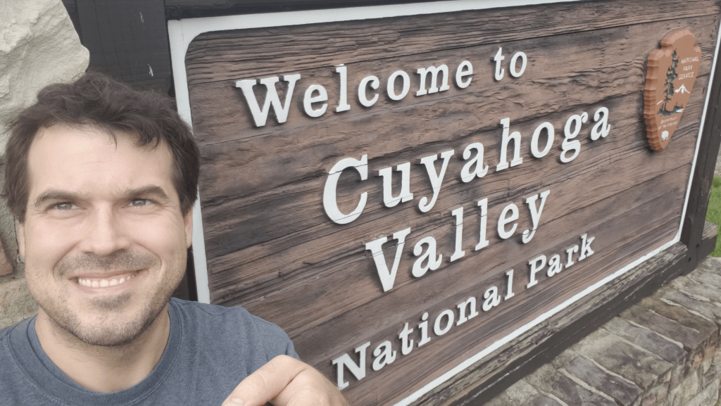
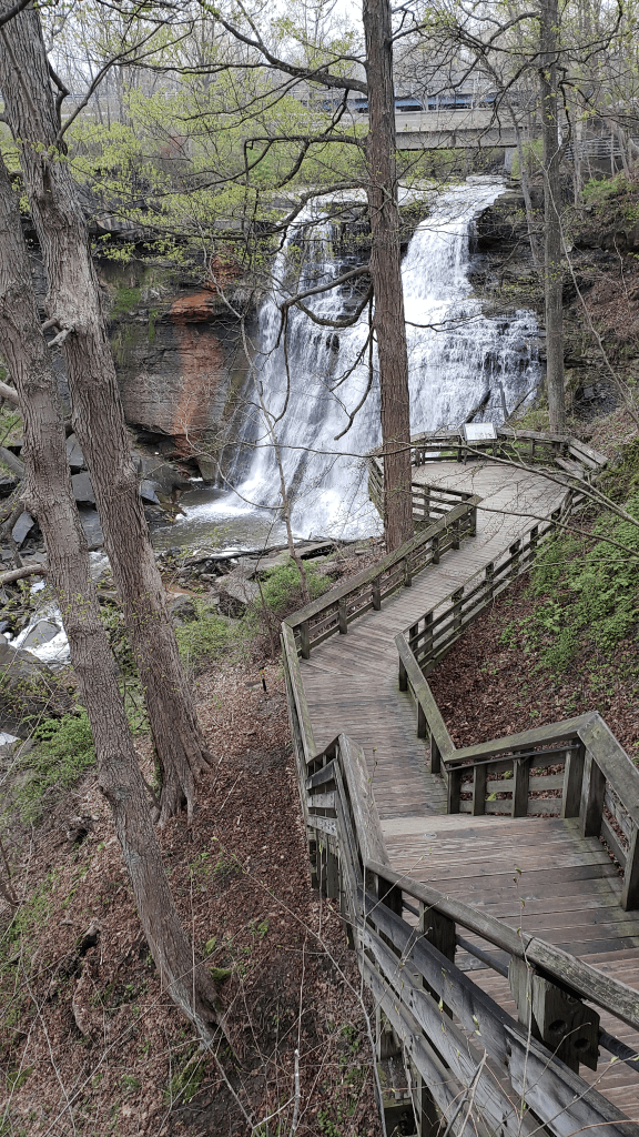
Hello Adventurers! Situated in a decidedly not “national parky” spot edging Akron and just 20 minutes or so south of Cleveland is a nice little piece of nature called Cuyahoga Valley National Park. This is a park that has an unusual history! This whole area is settled and dotted with small towns, homes, and farms along the Cuyahoga River and an old canal called the Ohio and Erie Canal. The history of the Cuyahoga in the modern times is one of pollution. The river famously CAUGHT FIRE many times due to the extreme level of pollution flowing through it. Fun fact, only in the last couple years has the fish in the river been deemed safe to eat! The last time it caught fire was in 1969 and that spurred into action the creation of the EPA. Saddled with this, residents in what is now the area encompassed by the national park started a movement to protect the area from development. One resident, John Seiberling, was elected to congress and eventually was able to get legislation passed to designate the area as a National Recreation Area into the National Parks system. Seiberling is also instrumental in effectively doubling the size of the national parks system.
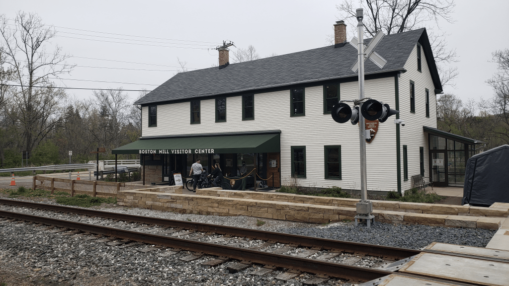
The Boston Mills Visitor CenterSelfie time!
My trip was of the wam bam variety. I flew into Cleveland on Saturday morning, picked up the rental car, and made line straight for the park about 25 minutes away! My first stop was the visitor center to get my National Park Passport Stamp. I then discovered I left my passport at home! D’oh! But I got the stamps anyway and have just stuck them on! Anyway after that brief visit I was HANGRY. Encompassed with in the park boundaries is a town called Peninsula…there is not to my knowledge any such geological feature there to warrant that name..but whatever, I found restaurant in the town called The Winking Lizard. I love that name! They had some solid beer and a crazy long list of available brews! The burger I got was solid as well. The outdoor balcony allows for watching the tourist train as it makes its way along the river. I did not take the train, but if that’s your thing, they do have a train ride through the park!
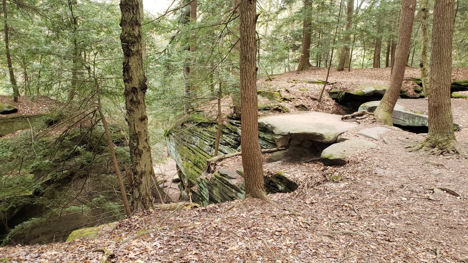
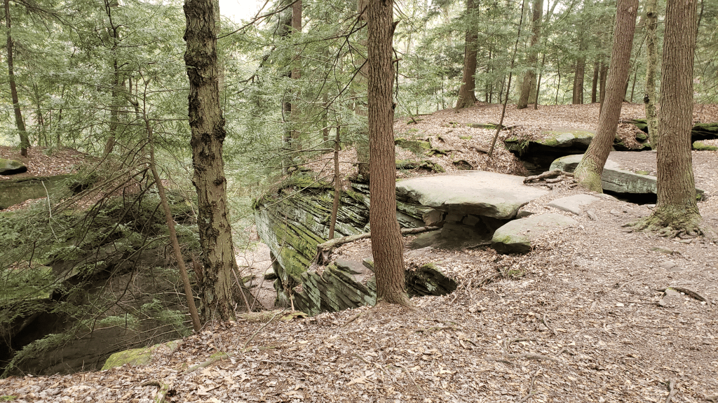
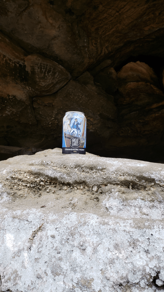
Anyway, I didn’t come here to sit and watch a train, so I got on my way and did my first hike! The trail is called the Ledges. The trail itself is super well marked, about 2.5 miles and is fairly easy going, but you will need non slip shoes for sure! Again, it is a loop, but the convenient part is the loop encompassess the parking area so there are plenty of side trails to take you back to the car if needed. As the name indicates there are many ledges! Most of the good stuff is right at the beginning of the hike as well, or can be right at the end, however you want to do it! There is a cave and all kind of little nooks and crannies you or a little one can get into! I found a good little spot to stop for a tasty local brew from the Great Lakes Brewery, a delicious IPA called Commodore Perry! The back end of the trail allowed for some very small wildflowers and a pretty decent overlook over the valley!
Some of the Ledges, taken by the Adventurer
Commodore Perry from Great Lakes Brewing, taken by the Adventurer!
After finding my lodging for the weekend I found myself in a cute little town along the river called Cuyahoga Falls. I did a small amount of hiking along the “falls” which is actually just the spillway of the damn on the river here. This was a part of the Metro Parks system in the area which is a nice nature escape for the locals. This park system seems to be quite large in the area and the national park itself is pretty intertwined with this park system as well. I made a brief stop at two of the local breweries along the river here. The first is a Brewery/Pizza Joint called HiHo Brewing Co. Their stout is VERY good. A short while later I found myself at Missing Mountain Brewing Co. for a tasty flight and a bit of grub. My server here explained to me that the owners love Ohio and that it’s only missing mountains. Ok, good to know!
If you are in Cuyahoga Falls and want some good beer and pizza, this is your go to! Taken by the AdventurerIf you are looking for a more intimate spot, Missing Mountain has a decent ,menu of food and brews, plus a nice sit down area right on the river! Taken by the Adventurer
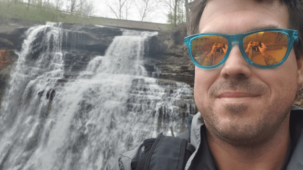
The following day was my main day exploring the park! It was quite chilly when I got up, but no bother, I got myself up to the first trail a little after sunrise. First up was the Brandywine Gorge Trail. I was mainly interested in this one for the large waterfall it is named after! The trail itself is 1.5 miles or so loop and the waterfall can be found right at the start of the trail actually which is convenient! If you want to get down to the lower part of it though, the only way is via stairs off the boardwalk. If you don’t like stairs or cannot do them, there boardwalk in this area does provide an overlook from higher up! Of interest is that there used to be a bonafide town that was centered around the falls as a power source. The town has since be lost to history, other than the ruins of an old factory and one old house that is still around. The rest of the trail goes through the woods and has a couple steepish spots, but nothing major. This trail also links up to another trail that can add many miles if you choose, but I did not, as I already had my eyes on the next trail.
Selfie in front of Brandywine Falls!
A view of Brandywine Falls and the boardwalk/stairs down to the lower viewing area. Taken by the Adventurer.
The Blue Hen Falls Trail was my next trail. It’s a 3 mile plus out and back starting at the Boston Mills Visitor Center. There is a pretty steep ascent right off the bat, and then not too far in there is very steep set of stairs (87 I think…I did count -I generally hate stairs!) followed by another good ascent back up. As I mentioned earlier, this is not a park out in the middle of nowhere, and in fact the interstate is close enough to hear which is a drawback for sure, and the trail eventually parallels a road that you do need to cross. When you do you are close to the falls, but there is another pretty steep descent coming and the bottom of that area is where you can find this pretty small, but pretty, waterfall. The good Commodore and I sat down for a minute and then it was back to the car. This trail took me just a little more than an hour.
Blue Hen Falls. I feel the payoff was a little less than stellar for the hike, but here it is! Taken by the Adventurer.
At this point it was nearly 10:30 and my stomach was reminding me that lunch time was near, so I started making tracks in that direction. But first I stopped by another visitor center on my way out…it was closed for the season, despite what the parks website said…ah well. One thing to note here though, is that there is quite a lengthy parth all the way through this park that runs along side the river/canal. This is what they call a tow path, and is where the mules or horses pulled the barges through the canal locks. It is a pretty busy trail with joggers and bikers. The trail itself it very flat, and quite wide, so good for those activities! According to the internet it is 80 plus miles long, if you are into that kind of thing! I drove down the road a bit and actually did a portion of this tow path near Beaver Marsh. The marsh itself is the former site of a junkyard! And, as the name implies, beavers actually flooded the whole area by damming the canal here! Little buggers! I did not see any beavers sadly.
I then proceeded to make a trip into downtown Akron to get a bite to eat and a brew from Akronym Brewing. I got in just a smidge after 11, it was pretty empty so I sat inside for a very tasty and most certainly unhealthy brunch bagel sandwich! It hit the spot and it was back into the park! The entrance/exit of the park I used here was only 10 minutes or so from downtown Akron, so super accessible to the local residents!
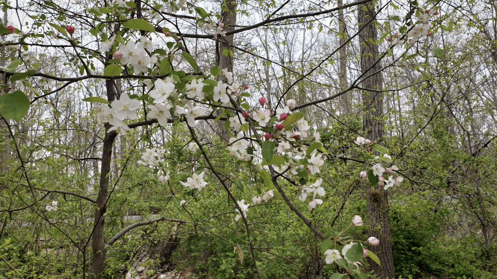
The last hike I did in the park was The Furnace Run, a moderate 2 mile loop. The parking area for this one was extremely packed and I had to park off road. There is a very close by covered bridge and it is a big draw. The hike can either end or start at the bridge. I started it there and headed on my way. The start of this trail as I did it, had a pretty serious incline right away as well before leveling off. The reason I chose this trail was for the chance to see some color and there were more wildflowers and blooming trees along this trail than I came across on the others! The trail itself is easy to follow, but there are a few side trail options and connections to other trails that are not quite so well marked and it could be easy to get onto one of them without intending to do so.
Some wildflowers on the Furnace Run trail…And some more….And some pretty flowering tree. All taken by the Adventurer!
Overall impressions: Pros: Super accessible to the locals and anybody visiting Cleveland. This one has stuff that is very family friendly: easy biking, a train, some neat history, very doable trails for most anyone short of people with health problems. It’s a great park to go in, do some hiking, come out, get lunch and a beer, and come right back in without any hassle Cons: I feel like the wildflower scene, which I was very interested in seeing, was a little underwhelming, whether I was not at the optimum time or just had unrealistic expectations, I do not know. There is really no “awe” factor in this park. You will never be away from road noise.
The Adventurer Final Word: 3.5 stars. I actually really enjoyed this trip, but it was dirt cheap for me and as checkoff visit, it was great. I really cannot ever see any reason to come back here again, and I don’t really know that this is a spot that would ever be considered the “main” draw to most people to come do. But if you are in Cleveland, yes, stop by!
Trip number two of the 2021 year occurred in March. My Sidekick and I hopped on yet another Southwest flight out west! Our target this time: Arizona. Specifically we were planning on checking out Sedona for an afternoon en route to Holbrook, AZ which is the closest town to Petrified Forest National Park. From there we would head all the way down to Tucson and check out Saguaro and Mt. Lemmon.
After landing in Phoenix we picked up the rental and were very fortunate enough to have been upgraded into a 4 WD. Before heading toward Sedona, we were hungry and found a place called: Cold Beers and Cheeseburgers. It is not divey as the name would indicate! They had a nice dog friendly outdoor area, with heaters, and I think both of us had really good food, and they Alaskan Brewery beer on tap which made me quite happy:)
As we approached Sedona it started snowing. Now, I concede that there are spots of elevation in Arizona where weather may be sketchy even in mid March, but I was not expecting road closures winter weather in Central Arizona for spring break. Oops! We pulled into Sedona, which I might add does actually look very pretty in the snow. We stopped by to take a picture of that Chapel of the Holy Cross that is there. We then found a covered outdoor balcony for a beverage at the Vault Uptown, an upscale looking place with a pretty awesome view of Snoopy Rock, which was shortly renamed by us to Sadie Rock :). The snow started to clear a bit to give some really pretty views of the red rocks covered in the white snow. Unfortunately, when we left, the route I planned to take from Sedona to Flagstaff was closed. Then the other route, the interstate, was ALSO closed. The Best Western in Sedona was apparently on its game with this and offered a room, all at the sympathetic rate of nearly $500 for the night! So, I pulled out the ole Google maps and found a sketchy local roads route from Sedona to Holbrook. The drive was high elevation at times, looked like pretty much BFE and the roads were snow covered. EEK! While we should have pulled into our Days Inn Holbrook at around 8 PM, we actually got in closer to 11. I would say to plan your March Arizona adventures carefully around potential bad weather and road closures!
Chapel of the Holy Cross in the snow, Sedona, AZ, taken by the Adventurer.“Sadie Rock” aka Snoopy Rock on the right. Seen from The Vault Uptown balcony. Taken by the Adventurer.
The next day we got up and headed for the store for snacks, then to the park which was about 20 minutes away. Holbrook is the closest town, so if you are overnighting it, this is the place. The Days Inn we stayed at was terrible, but the La Quinta in town looked brand new and fancy. The rest of Holbrook is a blighted, run down wreck of a town. Most of these parks towns are really soaking up that National Park exposure with merchandise and businesses…not so much here. No gift shops, no Petrified Brewing, No Petrified Cafe. Nothing like that at all. There is a heavy native population here and is very alarming to see first hand how dilapidated their living conditions are!
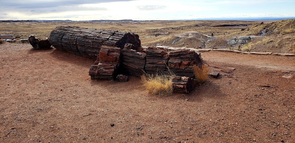
Anyway, now for the park! So we came in from the south entrance and made our way north to the Painted Desert entrance. The park road is not a loop so you will start at one end and leave the other. Coming in from the south was 0 traffic and 0 cars coming in. Granted this was a Sunday and the weather was SUPER windy, overcast, and not warm at all. In fact, the weather was pretty miserable! At least it wasn’t raining or snowing! After a brief stop in the visitor center (the apology letter on display from a child returning a stolen piece of petrified wood is great!) we did the mile or so loop through the petrified logs behind the visitor center called the Giant Logs Trail. Afterward, we did some short hikes, including the Agate House Trail, which was the longest we did, probably 2 miles out and back to a reconstruction of an old native house made of the petrified logs. A note about this one, is that it is right at the end of the visitor center parking lot and we missed it driving by and had to double back later on! Heads up! The other hikes we did were also short and really…once you’ve seen some petrified logs, I think you have kinda seen them all!? I will say the landscape, while particularly pretty, sure seemed unique and very alien to me. One spot that might have been a good pretty hike was the Blue Mesa Trail, but even that one is very short coming in at like a mile. The drive up to where that trailhead was was the only spot of elevation during the drive, not much, but it did afford some get views over the landscape. We did not do the hike. The weather was just too meh.
A petrified log, obviously, near the visitor center, taken by the Adventurer.They totally knew what they were doing when they stuck this one in from of the visitor center. Possibly my favorite thing in this park. Taken by the Adventurer.The Agate House in Petrified Forest, NP. Taken by the Sidekick.
Before heading to the Painted Desert portion of the park we did stop and pull off and I went to an area of native ruins and some old petroglyphs marking the stones. That was pretty neat to see for sure. I cannot recall ever actually seeing any type of petroglyphs in person! It was a short drive to the Painted Desert. That part of the park is definitely something pretty to see. The colors are beautiful! And then it was back to Holbrook.
One section of petroglyphs in the Petrified Forest. Taken by the Adventurer.The Painted Desert with a little snow splash for extra color, taken by the Adventurer.
It was a quiet evening as there is NOTHING to do in that town. I thought Front Royal in Virginia was a little lackluster; this one is downright depressing! We did find some good juevos rancheros at a drive through at the Camaleon (that spelling is correct) Cafe. It looked like a native run place and it was good! And for an evening dinner, we were looking for outdoor options, which seemed nonexistent, but Nicki got a feeling and we stopped at this sad looking Italian place called Mesa Italiana Restaurant. Despite being in a small shopping looking building, they did have a hidden back balcony. The food was ho hum at best but we had a great native server who was doubling as the bartender and working her butt off it seemed, and she was very friendly and attentive, so I feel a shout out is necessary.
The next morning we started the trek to Tucson. We did the tourist thing, stopping at the big meteor crater off of the interstate. FYI, its 20 bucks to get in, and it’s cool and all, and probably worth the stop, but if you thought you could hike around the whole thing you are wrong. You only get a few spaced out platforms along the visitor center perched on the edge.
Nicki in the crater, taken by the Adventurer.
After a brief stop in Flagstaff (which looks like a potentially really cool town by the way) we were off on the long trip south to Tucson. We were staying in a hotel in North Tucson, an area called Marana. This spot was chosen for a couple reasons, one being that it is closer to Phoenix and two, that it is pretty close to the west side of Saguaro National Park.
Ah, sunny, hot Arizona in March! Taken by Nicki, this was a scenic pulloff on I-17 South outside of Flagstaff.
There are two sides of the park: the west side, which is supposedly less visited, called the Tucson Mountain District and the east side called the Rincon Mountain District. Tucson sits between both sections. Upon getting to our hotel and dropping out stuff off we headed for the west side. The cactus are pretty stunning and amazing! It literally is like a cactus forest. I had never seen such a thing in my life and it was VERY cool. Also, the area is actually quite mountainy, so this cactus forest is on the flat stretches all the way up to the tops of these large hills and small mountains in this area. Very neat! After a stop at the visitor center, we did the initial little visitor center hike. Nicki posed with a cactus and promptly got stuck for her efforts! We did a dirt road loop, The Bahada Loop Drive, through the cactus which included a 1 mile out and back trail called the Valley View Overlook. Despite being a short trail, it has a beautiful view at the end overlooking a valley full of more cactus that you have ever seen in your life!
Attacked by the cactus on the right in 3…2…1… Taken by the Adventurer.
View from the Valley Overlook. These cactus are not small plants! Taken by Nicki.
That evening we found a brewery called the Catalina Brewing Company and sat down for a couple beers and wines for the two of us. Cool spot with an outdoor area close to our hotel. The beer is good and I had a flight and then picked the best of the bunch. This place has a lot of inside game machines and what not, so it is probably a super chill spot after covid is gone!
The next day we planned to drive to the top of Mt. Lemmon, the large 9000 footer overlooking Tucson and then go into the eastern part of Saguaro. Bad weather in general that morning, and especially on the mountain, dictated going into the park first and then assessing the Mt. Lemmon situation later! We got into the park fairly early on that Tuesday. And heads up, whether covid or not, I don’t know, but the visitor center there is NOT OPEN on Tuesday or Wednesdays. Lame and random! Anyway, this part of the park is much larger and much more visited. It also seems to have much more hiking, more mountainous terrain to look at and maybe some more colorful flora. The road is a loop, about 8 or 9 miles long and does do a pretty good job of showcasing the park. I might add, that the park on this side is actually significantly larger than what the road shows you. We did the drive first, in the snow, in the desert of Southern Arizona, amongst thousands and thousands of cactus. I do not know if that’s all that common an occurrence or not, but I certainly was not expecting it. We stopped to do a short 1.5 mile hike, a loop that was part of what is called the Mica View Loop. It was nice easy flat walking. I will say, there are many many trails in this part of the park and they are all short little pieces that all kind of interconnect and this particular spot the trails are really not a whole lot wider or more trail looking that the normal paths through the wilderness, so it’s easy to lose track of exactly where you are, even if looking at a map, so heads up!
Saguaro, east side, in the snow. GoPro footage.
A little hiking snippet, courtesy of the ole GoPro.
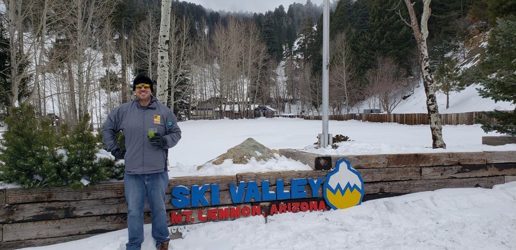
Eventually the weather turned sunny and pleasant so we did the road again, found a little rock scrambling photo spot, ate our packed in lunch and headed toward Mt. Lemmon. It was quite the drive up there, but not my first mountain drive! Mt. Lemmon came highly recommended. It does seem like the summit would be really cool! There are restaurants, trails, skiing opportunities, etc. Unfortunately, we came on a Tuesday and almost every single thing is closed on Tuesday. And due to recent snowfall, no trails were accessible. The little general store in the town up there was open, but very limited in what they offer. Unfortunately the trip up was more a go up, look around, throw snowballs at each other, and come back down situation. However, it was interesting being in the sun and desert with 70 degree-ish temps at one hour, then being sub 30 in blowing snow the next, only to be back to the desert life the following hour.
The Adventurer on Mt. Lemmo, taken by Nicki.
Fun on the mountain! NSFW language in this one haha!
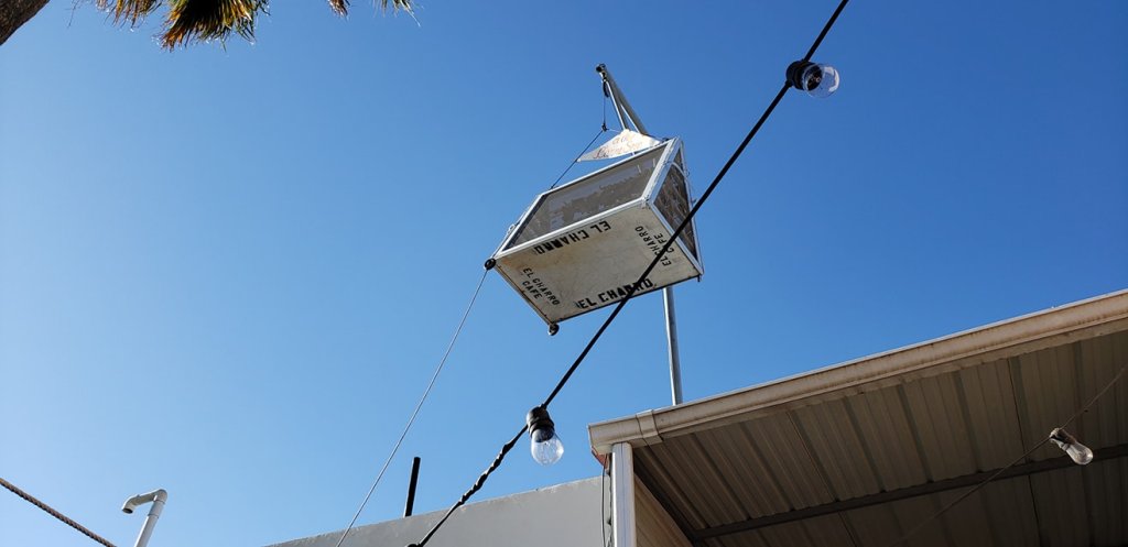
Our last evening of the trip found us at an early dinner at this super famous Mexican place downtown called El Charro. It is known for this meat called carne seca which is a beef that is left out in the sun hanging above the restaurant. I had some of that and it certainly was tasty! The restaurant came highly recommended and it was delish! Afterword we also found a rooftop bar overlooking the The University of Arizona called the Moonstone. It has some nice views of the city, the school, and Mt. Lemmon. I was hoping for a sunset view, but the outdoor deck was facing east, not west…so you get what you get! The next day was back to the FL and another trip in the books, and 2 more national parks off the list!
View of my dinner at El Charro, the supposed oldest family run Mexican joint in the country, take by the Adventurer from the dinner table 🙂View from the Moonstone, a rooftop bar at the top of a hotel in the University of Arizona area, taken by the adventurer.
Overall impressions: Pros: Awesome scenery. Saguaro is super cool and unique. Some good stops throughout the trip. Cons: The weather was not great, so a march plan to Arizona needs to take that into account. Mt. Lemmon is not a stop other than on weekend. I did not have super high expectations for Petrified Forest, and yes it is a unique special place but there is not much to do, and the town offers very little to do as well.
The Adventurer Final Word: Two ratings on this trip! 2.5 Stars For Petrified and environs. 5 Stars for Saguaro. Saguaro is a potential return visit, Petrified not so much!
2021 LETS GO! I am going to start this blog off with something surely controversial to National Parks people. Zion is gorgeous, a wonder, and a must see. It is also underwhelming to its reputation and to put on top of a national parks list is silly to me. As of the writing of this post I have been to 18 of the 63 current national parks. And granted, Denali, Rocky Mountain, Grand Canyon are among those 18 I am not sure I would even have Zion it in my top 5 right now!
I took this trip with my Sidekick. It was a short weekend trip with a non stop to Vegas (shit hole) and then zipping it out to Hurricane, Utah (pronounced hurra-kin) for the evening. It was too late to go into the park at this point so we found about the only good outdoor option for food and that was at River Rock Roasting Company a short drive away in La Verkin. We would end up visiting this place twice! They have great pizzas, good beer, and unbeknownst to us at first (it was dark) great views, being kind of perched on top of a cliff looking over a river in a small gorge. The first morning was an early rise. Zion is very, very packed and at times they only allow visitors to travel the park in shuttle buses. This particular time of the year was not one of those times, but as is the case with almost every national park, parking is at a premium and very limited. Early starts to a visit is a must!
Zion in its morning glory! Taken by the Adventurer.
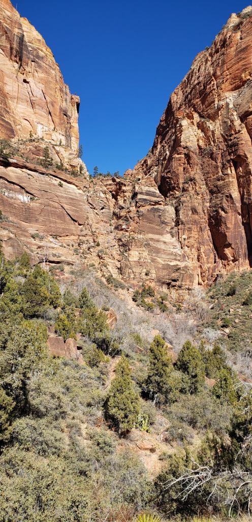
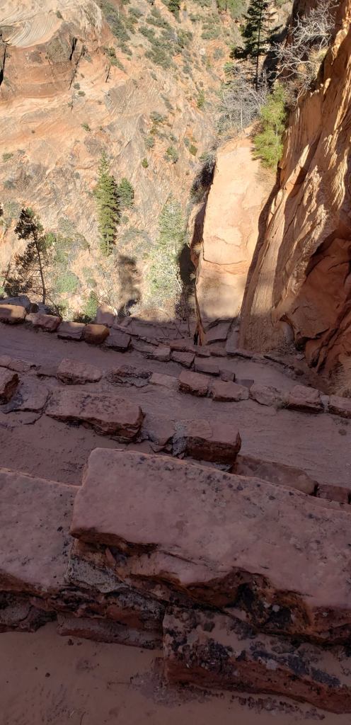
We got in pretty early and drove straight for Angels Landing. The parking lot was already pretty packed at 7 AM but we got a spot and started the hike. I had a basic sense of this hike from following others’ posts and doing my own research, but I was a bit surprised. It’s 4.4 miles out and back with 1600 feet of elevation gain. It does follow another trail called the West Rim. I did not expect the hike to start with a pretty steep series of switchbacks. That just gets up to the canyon which eventually leads to Walter’s Wiggles, a set of 20 some really tight switchbacks which leads up to the start of the final ascent up the landing. Good to know fact, there is a composting bathroom up there, very important since there are no private spots to be found on this trail and there are many people. No trail pissing here! Anyway, the SIdekick took about one step of the next part of the hike. I think when she grabbed the chain she called it a hike! I decided I was going to go for it. Spoiler alert: I only made if about a third of the way maybe? I was very unnerved, not by the heights or even the chains, I was unnerved by the sheer number of people coming and going as it was a one way trail and someone would have to let go of the chain. It was happening way too much for my liking, so I found a shady spot to sit and take in some views and worked my way back.
Believe it or not, there is a trail up along that cliff…
And this is what that part of the above pictured trail looks like from above…
Walters Wiggles, which consists of 20 some odd switchbacks, and they are not even all visible here, such the steepness of this section…
And after all that, here is the rest of the hike. I did go maybe to about where those trees on the very right edge are….
But this situation right here, especially when people started coming back down, was a no go! All these pictures taken by the Adventurer!
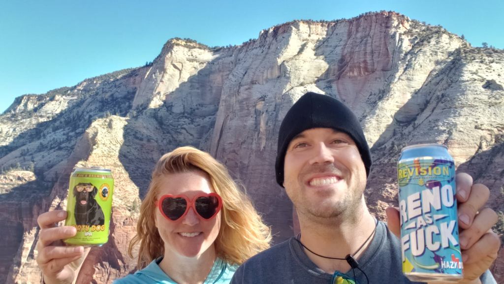
My Sidekick saddled up near a ranger who was monitoring condors and we got to watch some live condor action! SUPER cool. Unexpected treats like this are always great in the parks. The ranger was pretty disdainful of hiking the landing and told us a better place to go along the trail we got off of to go to the landing. So we took his advice and followed around that trail a bit, this was actually the West Rim Trail that I mentioned in the previously. We found a great open and sandy area to sit down and have a beer and lunch 1 or breakfast 2, however you look at it!
Beer thirty on the trail! These were beers we picked up in Nevada because we were unsure of the beer availability and quality in wonderful old Utah!
My tap out remarks.
Close encounter with a condor! Taken by the Adventurer.
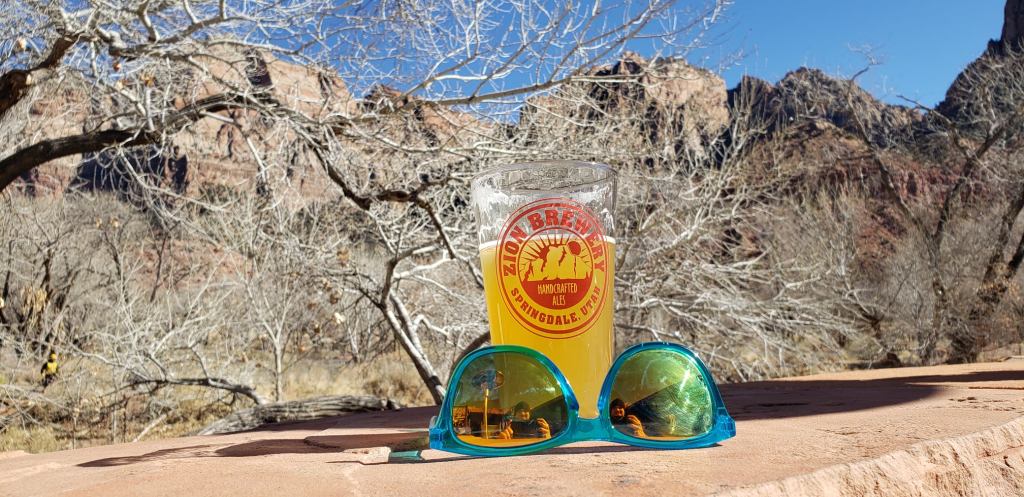
After coming down from the hike and some more minor exploring of the park road we stopped at the Zion Brewing Company for some snacks and beer! The place is literally maybe 100 feet from the entrance to the park, so definitely the closest spot to grab grub and a brew! Being February, it was still chilly but they were kind enough to accommodate with heaters outside. At some point during this day we also stopped a nice little spot with good food and outdoor seating called Me Me’s Cafe.
A tasty IPA from Zion Brewery with a pair of my trusty Blenders shades! And maybe one of these days I will learn how to take pic like this without my mug showing in the reflections!
The next day was the Narrows! We weren’t even entirely sure about doing it until the evening before when it was time to rent the gear, due to cooooold mornings. The following morning we got into the park early and it was pretty cold…like sub 30, so we decided to risk an annoying parking situation and just drive the other part of the road to the east and through this old tunnel. Right on the other side of that tunnel we found a new impromptu hiking opportunity: The Canyon Overlook Trail, a short 1 mile out and back with about 300 feet of elevation change. Not hard, but a very satisfying hike!
Silly posing on the Canyon Overlook Trail, taken by the Sidekick.
This was an area called the Temple of …something or another …on the Canyon Overlook Trail, taken by Sidekick.
Then it was time to tackle the Narrows! If you are unfamiliar with this hike it is a hike that is almost exclusively in the water as you hike up the Virgin River that runs through the park. The temp had reached somewhere in the 40s or maybe even lower 50s, so it seemed like a good time! We actually happened to LUCK into a parking spot at the trailhead (remember all the times I mention this National Park parking situation? This is actually probably one of the bigger parking lots I have seen and it had maybe 50 spots. And roadside parkers were walking a long way to get there. Anyway, we suited up in our sexy suits and off we went. This hike is not that fun. Like Angel’s Landing it is probably known everywhere as this amazing must do! However, the rocks are VERY slippery and the risk of slipping into a bad spot seems very high. You must use something more sturdy than regular ole hiking poles for this one. The gear we rented included those with the suits and shoes so we were properly geared up! This hike can be forever long or just a little as you deem worthwhile. We did probably 3 or 4 hours of it, so make sure to bring food and drink and a back that is ok in the water!
Having a little fun in the Narrows.Still from GoPro of our Narrows Hike.
After we finished this it was time to depart Zion. We did stop again in the town of Springhaven, which is the entrance town. It seemed like a cool park town, but most of it was closed for the season. Except that we found that one of the recommended restaurants literally reopened THAT DAY. Zion Pizza and Noodle was a bit of a wait, but they legit had spaced tables out really well, including on the outdoor balcony where we requested seats. We caught the sunrise and then hightailed it back to the hotel.
The next morning we had to be back at the airport for our flight out from Vegas, but not too far out of the way was The Valley of Fire State Park in Nevada, near the Lake Mead Recreation Area. We took a side jaunt there and what a beautiful treat! My cover photo of The Parks Adventurer site is a stellar picture the Sidekick took of me at sunrise in that park! We sat in that same spot, had some homemade Bloody Marys, and watched the sun come up! Now this is a gorgeous place and sunrise was spectacular! And there was no one here. And it was a Sunday morning. A great treasure.
Sliver moon over the Valley of Fire pre-sunrise. Taken by the Adventurer.It’s really pretty how the sun comes up across these pink and white rocks. Taken by the Adventurer.Great scenery this road traverses. From GoPro footage.
Driving through the Valley of FIre. GoPro footage.
Overall impressions: Pros: Good hiking and stellar views in both spots. Valley of Fire is super empty of people. Cons: Too many people in too small of a park at Zion. And to be honest, it wasn’t that crowded but it was a weekday and a weekend day of the same weekend as the big game. And it was still a pain to find parking, even with coming into the park super early. Valley of Fire presented me with 0 cons.
The Adventurer Final Word: 4.5 Stars! Zion is great, and absolutely worth your while, but the size and difficulty of doing anything because of parking and people is a definite drawback. If you are in Vegas and want a quick escape to someplace pretty and devoid of people, Valley of Fire might be your spot!
My girl dog Bella did so well on the road trip to Columbus and Providence Canyon, GA that I decided to take her on a much longer trip just a week later! I was going to drive to see my mother for Thanksgiving with Bella. We took a roundabout trip through AL, MS and into a national park in Arkansas called Hot Springs National Park. The drive was long enough that an overnight stop in Birmingham was in order before continuing on. And, in case anyone did not know, La Quinta Inns, while not the epitome of luxury, are pretty solid and are dog friendly, with a small fee depending on the location (this one and the one I used the next night were both free).
The drive the next morning to Hot Springs, AR was another 6 and half hours. I did break up that drive a little in Tupelo, MS where I just literally stumbled across a National Park Service Arrowhead sign for the Natchez Trace Trail, Mississippi. Bella and I did maybe a mile worth of hiking up and down the trail here but honestly, it wasn’t anything too interesting so we were soon on our way to Hot Springs National Park!
Bella and I were only here for about a 24 hour period, and that did feel like enough, though I could see how people might take longer for a visit. It was a very interesting, if short, visit. First of all, this is an old park. It is almost 100 years old. Secondly, whatever your idea of a National Park is, go ahead and throw it out for this one. I have seen people poo-paahing this one and I get it but this one is weird! Basically the park is in the town and any outdoor nature stuff revolves around that, but I daresay there are very few places in America that have 140 degree water just bubbling up out of the ground. The geology AND the history in this area are basically what made the government designate this as a National Park back in the day. This place is located in the Ouachita Mountains in Central Arkansas and was a very spiritual place to the natives living in that area. The hot water was very popular later on with the tourist industry, specifically, early spring training baseball and mobsters. Thats led to development into casinos and hotels. At that point the area was already notched as a National Park. The hot water that bubbles up out of the ground is not volcanic like you would find in Yellowstone or similar places, but it is something to do with how fast rainwater that goes into the ground comes back up from the depths. Because of this, this hot water is not mineral water. It is safe to drink, and it tastes and looks just like normal old water!
144 degree water. The locals come here and to another spot to fill up for free! Taken by the AdventurerThe hot water coming up straight out of the ground! How cool! Had I not already known this was not volcanic I might have been concerned! The path there is the Grand Promenade mentioned in the blog. Taken by the Adventurer.The one big hot water viewing spot. Honestly I expected more of these holes but the water has been heavily diverted through piping to the bathhouses. Good spot to toss a penny in! Taken by the Adventurer.
So anyway, we arrived and the rain had just stopped but it was cool and overcast, but it was passable. I really did not know what to expect. The park is really kinda 3 different spots. Spot one is on the road, the touristy district with the early 1900 bath houses, resorts, and hotels. This is at the base of spot 2 which is Hot Springs Mountain. Behind the bathhouses and sorta connecting one big hotel to another at each end of the bath house row is what is called the Grand Promenade. This in itself is a walkway that passes by some of the hot water fountains and can also lead to other trails going up the mountain. To drive up to the summit of the mountain you derive past all the bath houses to find the mountain road entrance. At this point if you do not go that way, but continue on you actually leave the park proper and enter into a more residential area of the town that is actually entirely enclosed by the park. And then it is through this area that you can access spot number 3, as I call it, the West Mountain. Honestly, this part is the most “parky” of the who park and does feature some nice hiking trails, including some decently lengthy ones. The trails on Hot Springs Mountain connecting to the bath houses are very popular but also short and easy and cross the road several times and you would never forget you were in a town.
I took this on the Mountain Tower Deck. On the left, the large building is an old hotel. On the right, right of center, is another historic hotel. In between is the Bathhouse Row and those two hotels mark the ends of the park right here. The far right and the very far left top are actually not in the park. However, the center mountain is West Mountain and if you follow that range up and to the right, and then continue it around in 360 degrees you come back to where I am here and that.s the whole park, with the non park “hole” in the middle.
Bella and I did the “drive and pull off at lookouts” thing for a bit while the weather was settling down. We stopped on Hot Springs mountain and did a little “get out the energy” hiking up the mountain (maybe an hour). We made our way to the West Mountain and did a little hiking along Sunset Trail, which is a very long trail that pretty much encapsulates the entire park. The weather was starting to cooperate so we explored the bath house area a bit. I did not really know what to expect, but the two bathhouses that are still operational, limited due to covid restrictions, are not free, and in fact are quite expensive, and have weird hours anyway. I was hoping to experience it, but it was not meant to be!
Taken from one of the pull offs. There were still a little bit of fall color to be found, but I would bet two weeks earlier looked stunning!
After a brief check in and unload at the hotel outside of town, we came back to get dinner. The Pizza Joint I checked out was called Grateful Head Pizza Oven and Beer Garden. DELICIOUS pizza. Great place with outdoor seating….it was very chilly but the dog was perfectly happy with it, but I had my pizza and a beer or two and was on my way. The next stop was a brewery! There is an actual brewery IN the national park, called Superior Bathhouse Brewery and it is set in one of the old bathhouses and uses the Hot Springs water for brewing purposes! How cool! According to them they are the only brewery allowed to operate within national park boundaries. Pretty cool! I did not have a beverage there as there was no outdoor seating, unfortunately, but I got a growler to go, which was actually DIRT cheap…it was a glass 32 ouncer and I think with the full fill it was 15 bucks. I came back the next day and got the full one, also glass, and with the fill was only 20 bucks I think! Crazy cheap, really! The beer was very good but definitely different! The one I got in the evening was the Beez Kneez, a Honey Basil Kolsch and that was my evening hotel beverage!
Water from Hot Springs National Park on the left. And, a large and small version of the glass growlers the Superior Bathhouse Brewery Sells.
The next morning, before rolling out, Bella and I went up the Hot Springs Mountain to hike Goat Rock Trail. This trail was 2.5 miles out and back and passed a very easy to miss “Goat Rock.” This is a nice trail with about 400 feet of elevation change. After finishing that we took the elevator up to the top of the mountain tower viewing platform at the top of the mountain. Before calling it a trip I stopped at the brewery right at opening to pick up the big growler and also at the visitor center to buy a jug to fill with Hot Springs water!
This is goat rock. I was following the trail using this as my marker. I managed to go further than I needed to because …other than this being a rock, it’s not very goatlike. After I got back to the road I asked someone who kinda chuckled and said go back and look for the only rock outcropping on the trail, which is what this is.
Overall impressions: Pros: There are a variety of things to do depending on your tastes. Want a day of outside light hiking but want to stop and sit down for lunch? Check. Dip in the hot water in the baths? Check. Want to camp check. Though small, the nature is pretty and I bet is awesome at peak foliage. Also, this entire area of the country is pretty devoid of an easy to access national park, so this is good for them. The Hot Springs thing is definitely very neat. Everything seemed very dog friendly. Cons: This is not the national park for outdoor adventures. There is some hiking, but it is mainly limited to easy and simple trails. The park itself is very small and quite frankly, it is not on anyone’s travel list unless you are like me and trying to hit all the parks. The chances of you strolling through this one by accident is small and I do not think this is too much of a destination for anyone but those living within a few hours probably.
The Adventurer Final Word: 3 Stars! Cool little place that is worth a visit, but probably not going to far out of your way for! I will say it is a great place to take your dog!
I have not talked much about my pup..but here is a picture of my old girl Bella:
Bella Brown and daddy out for a day at the Dog Bar in St. Pete
She is an awesome dog, but she is up there in years. In that picture she is about 9 or 10 and she is now between 11 and 13. You wouldn’t really know it as she hasn’t really slowed up at all! Anyway, since all this outdoor travel excitement began, I have not really been able to take her many places for travel because of her sister. Sadie was the most sweet, but mischievous hell raising beagle you would have ever known! I loved her to death and she just passed in September of 2020 at nearly 15 years old. Unfortunately, there was almost no time in her life when she would not cause chaos, and when that started to… lessen? she developed an incontinence problem, so she never got to travel much. She did make a road trip to Indiana once when she was a puppy, and when on some short ones in Florida. And she go to go lots of places around town, just not much in the big overnighter type trips.
Sadie Lou. There are at least 12 years between these pictures…we got old together!
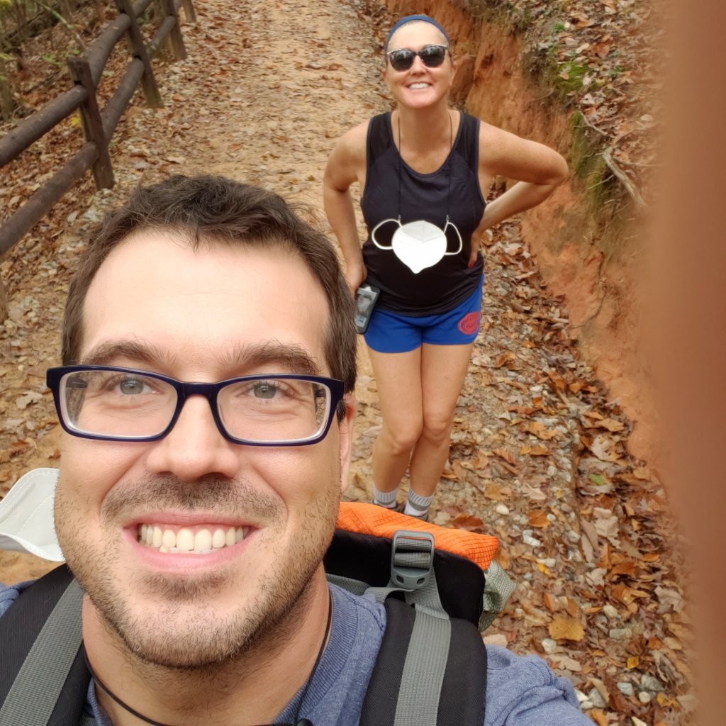
Anyway, Sadie Lou passed away and I vowed that Bella was going to get to go on some trips. My friend Nicki, the Sidekick, and I were looking at possibilities in Georgia. Clayton is always a strong favorite of mine, but it’s a ten hour drive and Bella has never done more than an hour in a car, so it was good that we decided on a place in western Georgia called Providence Canyon. Nicki has an older crippled dog herself (Charlie), and a new rescue (Tiger Lily) who is quite the handful like my old girl Sadie, and she was wanting to do this trip with all the pups. Providence Canyon is this rather interesting man-made feature a little south of Columbus, GA and about 6 hours or so away from home. A fun addition to this story was that a hurricane was approaching. Nicki and her dogs left earlier in the day. I had to finish up at work and left a little later and had to drive through a few nasty moments but soon enough made it through the bands of Eta and the crazy beast in the back seat and got up to Columbus.
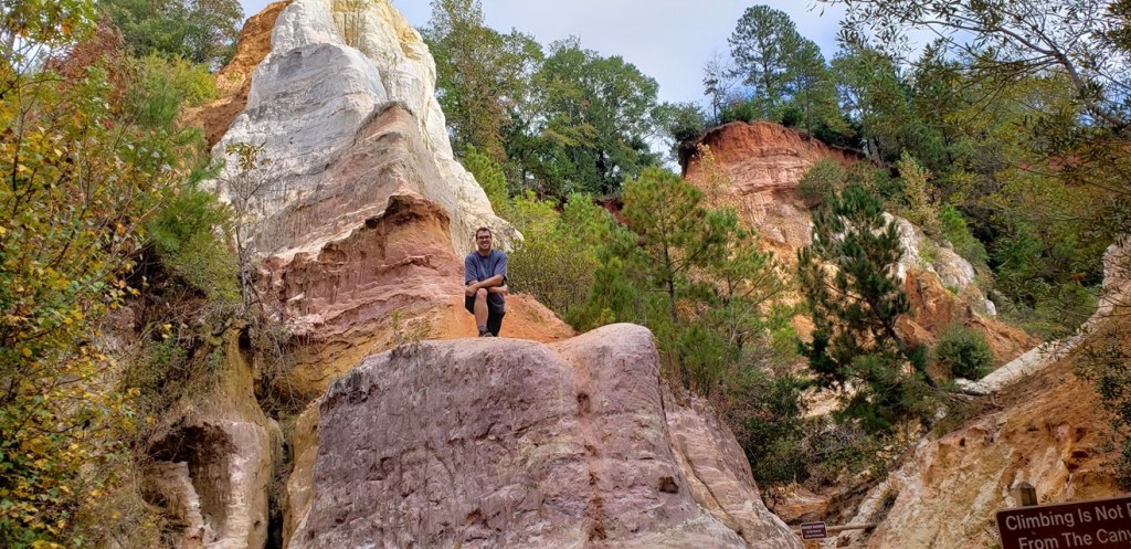
Our AirBnb was on the Chattahoochee which runs through town so we got some easy city river walks in at times. We went down to the canyon a couple times: once with all three dogs to do some easy hiking around the Perimeter Loop and then again with Nicki’s new dog Tiger Lily and Bella to hike down inside the canyon on the Inner Loop. As I mentioned earlier, this is actually a man made canyon. I do not know all the particulars, but back in the 1800s, poor farming techniques created some bad erosion in the fields the farmers were working, and due to the soil in the area those cracks and fissures open up more and more and more and you have what it is now.
Charlie, left, Bella, middle, Tiger Lily, right. The Sidekick took this photo of all of us on the walk overlooking the Chattahoochee near our Airbnb in Columbus.
The hike is pretty easy, even for the dogs. The descent is a little steep and then, if you do the loop all the way around, the slope back up is more gradual. The colors of the earth here are very pretty…and we were catching the tail end of the foliage season in the area. Despite being out in the middle of nowhere it did get busy a bit!
Providence Canyon from the rim. Super neat and random place in the middle of nowhere Georgia! Photo by the Adventurer.Cheesin on the way down!Posin. Taken by Nicki.
The Sidekick and her new rescue posin. Taken by the Adventurer.
Providence canyon is a super neat and random, unexpected treat on the GA/AL border. It is definitely a cool place to stop by and do some leisurely hiking. If you are into boating there is another state park just a few miles down the road called Florence Marina which is also on the Chattahoochee River. There is not a whole lot in the way of services around here, though. Columbus is about 45 minutes or so away, and that’s about it. There is a little town nearby called Omaha, which does have a large open air brewery, the Omaha Brewing Company, and it is definitely close enough to bring lunch and get a beer, but you’ll need to pack lunch for this trip. I also want to point out one other spot we checked out in Columbus: a brew pub called Chattabrewchee Southern Brewhouse. The beer was pretty decent, it had a nice outdoor space, and their logo is an opossum. There is a magnet on my car of their logo now!
Chattabrewchee in Columbus, GA.
Overall impressions: Pros: Beautiful state park. Nice weekend getaway. Good spot to take dogs or young ones. Cons: Not too much nearby, and Columbus is ok, but not what I would call a touristy draw. They do have some whitewater rafting through the city, and that might be something that would also draw me back, but that’s about it.
The Adventurer Final Word: 4 Stars! Perfect for an extended weekend hiking or get away from the city type of trip.
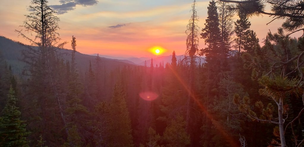
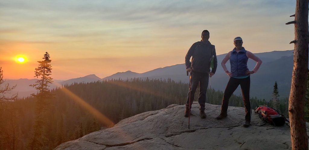
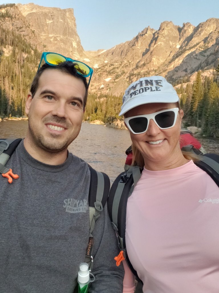
Shenandoah National Park was actually a spot I was actively thinking about going to in March of 2020. I never quite got to the booking stage because our friend covid was starting to make a muck of things just before and I was holding off. It also sounded like March was hit or miss on weather in that area. After getting back from Colorado my Sidekick and I were looking for new spots. Again, it had to be non stop flight and easy access to a cool outdoor spot. Slim pickings at that time, but we found it with a flight to Baltimore, and a quick hour, hour and a half trip to an area close to the Virgina/West Virginia border called Shenandoah National Park. This was over Labor day, so we made it an extended weekend. Shenandoah is a huge draw during the fall foliage season but it wasn’t possible to get there at that point.
We got in rather late and had hotel reservations at…wait for it…Super 8, in Front Royal, VA. So long story short, the park is beautiful and great, but that town at the entrance is pretty much garbage! There actually were not a whole of hotel options to be had and Super 8 it was! But at least the hotel was very close to the park entrance.
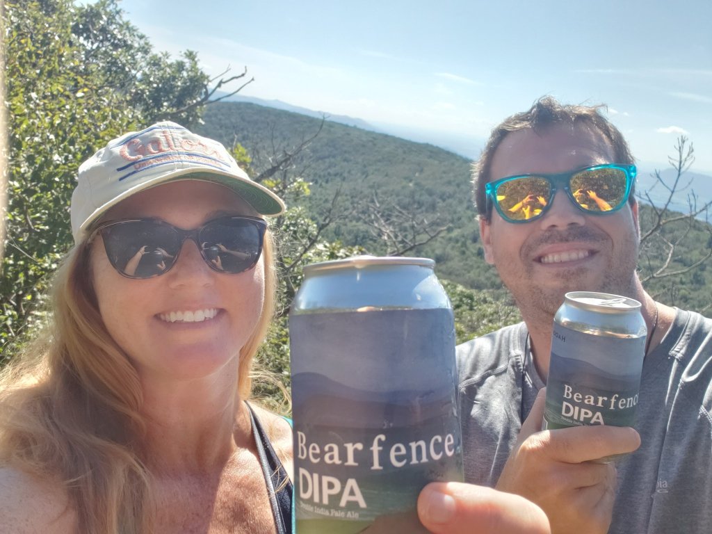
So this is an interesting park with a complicated history that I am not going to get into, but feel free to check it out here. The park is very thin, and very long. Basically it is situated around the main drive through the park called Skyline Drive and it is slightly longer than 100 miles long. We actually came into the park early the next morning and did our recon thing, scoping out things. We found a store inside the park selling some locally brewed beer, specifically for the park and found a little baby introductory hike, that was actually a part of the Appalachian Trail called Bearfence Mountain Trail, and we conveniently had the namesake beer! This trail is actually fairly simple, a mile with 250 feet elevation gain, despite alltrails saying it’s moderate…but it was quiet and had a good spot at the top to sit, soak in the views and have a Bearfence IPA!
View of the Shenandoah Valley. Taken by the Adventurer.Bearfence IPA at the top of the Bearfence Mountain Trial! Summit at 3500 feet
Our second hike was an early morning one called the Whiteoak Canyon Trail. We went to a waterfall called the Lower White Oak Falls. The trail went on for a while and I think we actually went a bit further than that. According to alltrails, it’s about 3 miles out and back to the lower falls, if that is indeed where we stopped and turned back, with about 400 feet of elevation gain. The spot we accessed this trail from was actually not off of the main drag through the park. Instead, we drove through an area parallel to the park. The town? if you want to call it that, that was close to the area is called Etlan. The hike was nice and easy, but could be pretty lengthy and it was actually pretty crowded, especially considering it was off the beaten path and there was still a small ranger station there for payments. No free access to this park! After this trail we stumbled upon really calm and chill winery in that Etlan town called DuCard Vineyards. Really pretty spot in the Virginia Mountains and good wine! There is no cell phone service out here either!
The Adventurer in front of lower (I think) White Oak Falls, taken by the Sidekick.Looking for a good stop after the White Oak Canyon Trail? Right here is your spot! DuCard Winery. Food truck and all! Even out in the sticks!
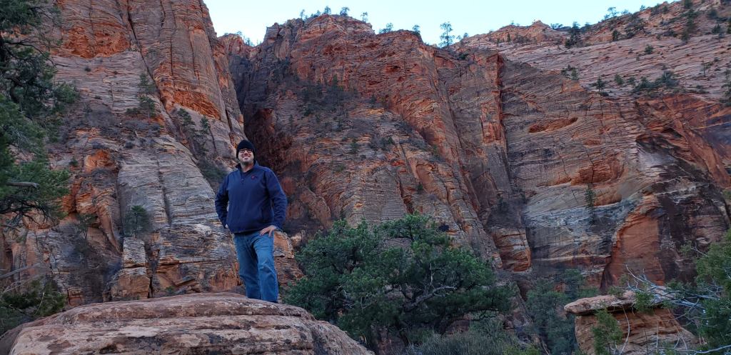
After catching a beautiful morning sunrise in the park a couple other trails we did from the more usual way to access the park were the Mary’s Rock Trail and the Upper Hawksbill Trail. Another general National Park hiking reminder: parking lots are usually tiny and fill up fast, so always keep that in mind, ESPECIALLY in busy parks like this one. Mary’s Rock is a 3.5 mile out and back summit trail with 1200 feet of elevation gain and a good rocky top with killer views! This trail is also a part of the AT. Hawksbill is the tallest mountain in the park at a little over 4000 feet and there are several trails to access the summit. The one we chose was called the Upper Hawksbill Trail. It is the fastest trail to the top at only about a mile each way and 400 feet of gain. Alltrails says this one is moderate and has a “gradual” slope. There is nothing “gradual” about that trail. In fact, it may very well be one of the steeper trails I have done. No, it’s not long, no it’s not exposed, and it is very wide, but it’s a calf work out on the way up and don’t slip and bust your ass on the way down! There is a nice observation deck at the top that looks over the park and the Shenandoah Valley to the west. Heads up! There does appear to be a false observation point. When the trail finally flattens there is a structure of some time and then an open expanse to view the surrounding area. Past the structure, though, the trail does actually continue a bit to get to the proper observation area.
Sunrise in the park, taken by the Sidekick.
On top of Mary’s Rock (which is actually a mountain elevation 3500). Picture by the Sidekick.
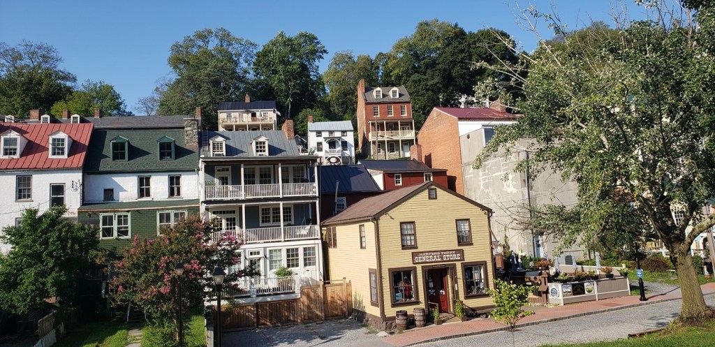
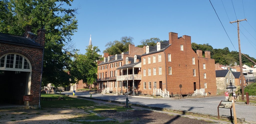
The out of the park life was a little disappointing. This town was really dirty and blighted looking. Finding good outdoor places to eat or hang was not too easy. There was a brewery in town and it was surprising that the little Italian joint we found sold none of their beer. We stopped at the Front Royal Brewing Company once. The first impressions were not great. It was a chore to get a table and the staff seemed inattentive and overwhelmed. Eventually we got seated and the food and drink were pretty solid. I would hope that post pandemic the place is more pleasant, but it’s about the nicest place we found. After a few days, it was time to start making our way back to Baltimore. We took a route back that went past some dinosaurs and through Harpers Ferry, WV. This is an old historic town on a river. The whole area is a national historic landmark. The Appalachian Trail passes through here. We came on a day when a lot of shops and restaurants were closed up but we did find one place open to microwave some food that serves hikers on the AT, called The Towns Inn. The lady running the place is a former teacher and now tends the house for the hiking crowd.
DIno fight in Virginia. Harper’s Ferry. Taken by the Adventurer.Another section of Harpers Ferry. Taken by the Adventurer.
We stayed just long enough to soak up some views over the river and traintracks once Almost Heaven Pub and Grill opened and then it was time to come back to the FL!
Overall impressions: Pros: Beautiful National Park. Great hiking. It was not terribly overcrowded. Harpers Ferry looks like a cool little quiet weekend spot. Cons: Front Royal, VA sucks. We were in Harpers Ferry on a not weekend day.
The Adventurer Final Word: 4 Stars! A definite nice place to go out of your way for but there are parts of the overall experience that could have been better!
Well now, we had a travel hiatus didn’t we! So my Sidekick’s Southwest companion pass was only good for 2019. I managed to snag the normal one from them early in 2020 just in time for the old pandemic. Great timing! So anyway, my Sidekick and I decided that the best course of action was to enjoy the outdoors and decided to go for it a couple times in 2020.
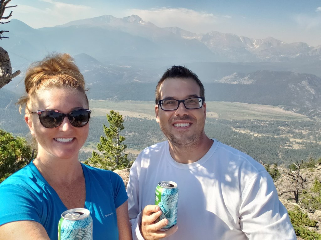
Due to the pandemic a lot of non-stop Southwest destinations dried up. We were looking for non-stop only flights that led to cool outdoor options. So, naturally, Colorado fit the bill, even if it was the third time in as many years that I have visited the state! We decided to get into Denver and head on up to Estes Park and Rocky Mountain National Park and stay a few days up there!
We stayed at a fairly no frills hotel near the lake, but it was reasonably priced compared to everything else around there. Highlights of the trip included a visit to the top of Trail Ridge Road, summiting Deer Mountain in Rocky Mountain Park, doing a cool hike to Dream, Nymph, and Emerald Lakes, seeing some elk and checking out the Stanley Hotel.
As I mentioned in my first Colorado post, Estes Park is a really pretty spot at decent high elevation surrounded by 10k plus peaks and, of course, is at the entrance on the east side of Rocky Mountain National Park.
This is Rainbow Curve, along Trail RIdge Road. Killer viewing spot! Taken by the Adventurer.My second time standing with this sign! Taken by the Sidekick.
So my Sidekick and I have done a lot of traveling together now and we have our way of doing things which is basically getting into the place we are staying to check over things and then go out and do some recon. This one was a little tricky. Due to covid restrictions, RMNP was/is doing a timed entry and requires tickets for specific time frames. Luckily we were able to get in when we were supposed to and took the drive up to the Alpine Visitor center at the top of Trail Ridge Road. I would say that among the national parks I have been to so far, this road is probably tops in terms of grand scenic views, and I think it would be very difficult to top for sure. It is also a high elevation road up to 12000 feet!
I went ahead and reserved tickets for entry each of the days we were there but honestly, the thing about some of these parks that are very popular and crowded, and especially if one is hiking in these high altitude locales, you have to start early. The main reasons are logistics and atmospheric. These are national parks, not malls. There are very small parking lots, no parking garages, and when they are full, that’s it. Also, it seems that many do not know the actual hours of the parks. Very few of them actually ever lock the gates. Many of them have posted hours for paid entry (I have an annual pass) and visitor center and restroom access, but, generally speaking, you can come in and leave whenever you want. With RMNP doing that. it meant getting around the ticketing system and ensuring a parking spot for our hikes. The other reason is that weather in the mountains gets suspect after midday and if you happen to be in an exposed spot and are the highest thing above the ground, that means lightning is not your friend. Plus you get down from a hike and still have a lot of the day left! We did a couple nice big morning hikes on this trip. The first one was the Emerald Lake Trail, accessed on the Bear Lake side of the park. Again, even though this parking lot is decent sized, we were there before sun up and it was already filling up! The hike was about 3.5 miles out and back, with 700 feet of elevation gain. We had our packs and second breakfast and a couple beers for the end of the hike. And, we got to catch a killer sunrise!
Sunrise over Rocky Mountain National Park. Photo by the AdventurerMountain People. Photo taken by a nice passerby.The middle lake of the three, Dream Lake. One of us was using a selfie stick on the phone.End of the hike, this is the Emerald Lake, elevation about 10,100 feet.
After this hike we checked out the Estes Park Brewery for a brew and a sandwich. We later checked out the historic Stanley Hotel. This hotel served as the exterior for the hotel in the movie The Shining. It is an operating hotel and has a restaurant and bar that we actually visited the next day for some really good food and cocktails!
The historic Stanley Hotel. Well, part of it. Oops.Some of the many elk seen on the trip. This one was in a group laying down outside the pool of our hotel.
So the next day was supposed to be some hike that I had my eyes on, but neither of us were really in an 8 mile hiking position so we pulled an audible. We spied a mountain hike at a mountain called Deer mountain with a trailhead just off of the road and decided on that one. Again, we got up early to hit the very small parking area for this one. Deer Mountain Trail, is rated hard at 6 miles and 1400 feet of elevation gain up to the summit at 10000 feet, and features killer views! And, also some very hungry chipmunks! We stopped along the way for 2nd breakfast and then at the top had either 3rd breakfast or 1st lunch and the chipmunks were literally climbing on us! Gorgeous hike, though.
The Sidekick and I having a local beer on top of Deer Mountain! Killer view! Another view from the top of Deer Mountain. Pic by the Adventurer!Desperate Chipmunks: Deer Mountain Edition. 🙂
Fun outdoor trip and the perfect recharge from a weird year.
Overall impressions: Pros: Beautiful National Park. Great hiking. It was not terribly overcrowded, with the timed entry ticketing Cons: None. This is a must visit, period.
So this was the last 2019 trip! You might be wondering how on earth a teacher affords all this! Well, almost all of these flights were free with my Sidekicks companion pass on Southwest and she had accumulated enough points from that perk (a credit card offer) to basically make almost all the flights expenses during this year for damn near nothing! Hotels/Airbnbs and rental cars were a different story, but we managed to do most of all of that on the cheap, especially splitting between 2 people.
I usually go to Indiana for Christmas, but I had been there just 3 weeks prior so we found one last flight to the Caymans that fit the free flight bill! So other than a brief visit to Niagara falls 15 years ago and a day in the Bahamas from a cruise, this is the first time I have been out of the US!
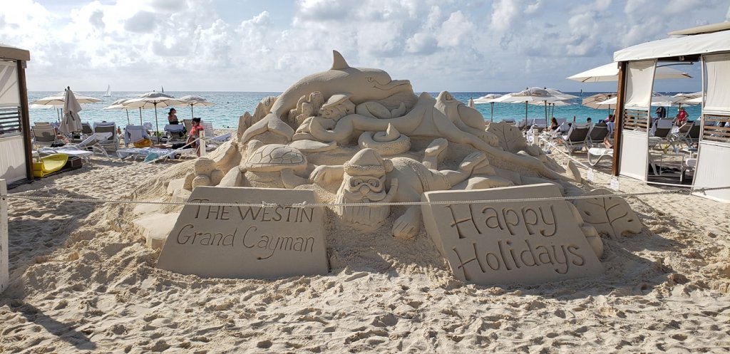
Merry Christmas from the Caymans!They take Christmas pretty serious on the island!
So, there is a conversion rate problem here and things are kind of expensive. That being said, we found a hotel, Sunshine Suites Resort, right across the street from the beach hotels that was decent and about the cheapest we could find. The good news is it was a sister hotel to the resort across the street so we were allowed to use that hotels amenities. That was a great perk! Other than lounging on the gorgeous beach the entire time we did do a couple other things! We got on boat and went to a place called Stingray City. It was not without some trevails. The boat broke down a bit and it was a little weird…but we got to Stingray City and it was pretty cool! My friend was a chicken and wouldn’t get off of the boat! Afterward the boat took us to a snorkeling spot to do that for a bit. Later on in the trip we took another boat up to the northern part of the island and did a nighttime kayak trip through waters that had a bioluminescent plankton (the videos and pictures did not come out well).
I made NO adjustments to this selfie. Look at that water!
Close encounter with a stingray! Footage on my gopro from a random stranger.
Snorkeling in the Caymans! Gorgeous! Using my GoPro Hero Session 5. It’s a pain in the neck camera, but it does a great job when it works!
It was a short trip but was a lot of fun and was a new out of the US experience for me!
Overall impressions: Pros: Gorgeous water. Super friendly people. Neat things to do. It is pretty close to home! Cons: Exchange rate stinks. And I think we were the poorest tourists there. You will spend money quickly here.
The Adventurer Final Word: 4 stars! Really awesome place but be prepared to open your wallet, which cost a star for me!
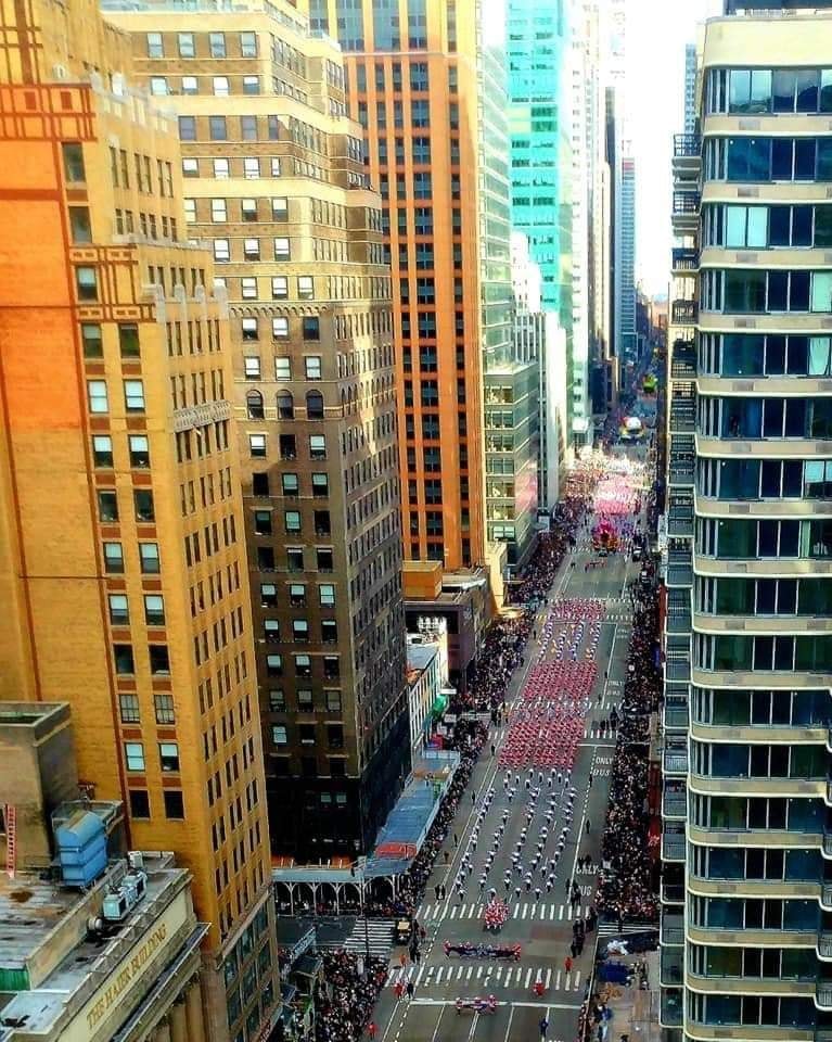
Whoo! Lots of fun stuff in 2019! So, I am a pro musician and trumpet player down in Florida. In my area there is an adult marching band. It is mainly much older people than me and just more amatuer level than anything. It is also about 500 strong and they travel the world. I did not know playing in the Macy’s Thanksgiving Day Parade was on my bucket list, but here we are! I went with the Sidekick, as she used to live in NYC and was itching to get back to visit.
So the Macy’s thing was a good year and a half in the making. The buddy who I met up in Colorado the first trip and also who had the birthday that brought me down to South Florida this same year was also in the marching band. We were two of the “horses” so to speak in the trumpet section and planned on doing the Macy’s thing. So, we did. It’s NYC. It’s late November. It was about as warm and windy as you might expect! A couple notes about the Macy’s situation: 1) The Choreography of both the performance and the logistics has to be spot on perfect to be put on the TV telecast. 2) The practice for the parade and those logistics happens at like 1 or 2 AM and then from there its to breakfast and then lining up by 8. Not a short day at all! The Sidekick and I did a little New York stuff when we got into the city. The entire band was in a hotel just behind Times Square, so a super convenient location for sure. We did the performance, it went off pretty well! The Sidekick and I did some exploring of the city that night and the following day.
Me on TV!Evening Rehearsal. Not the 1 Am one…Behind the scenes!
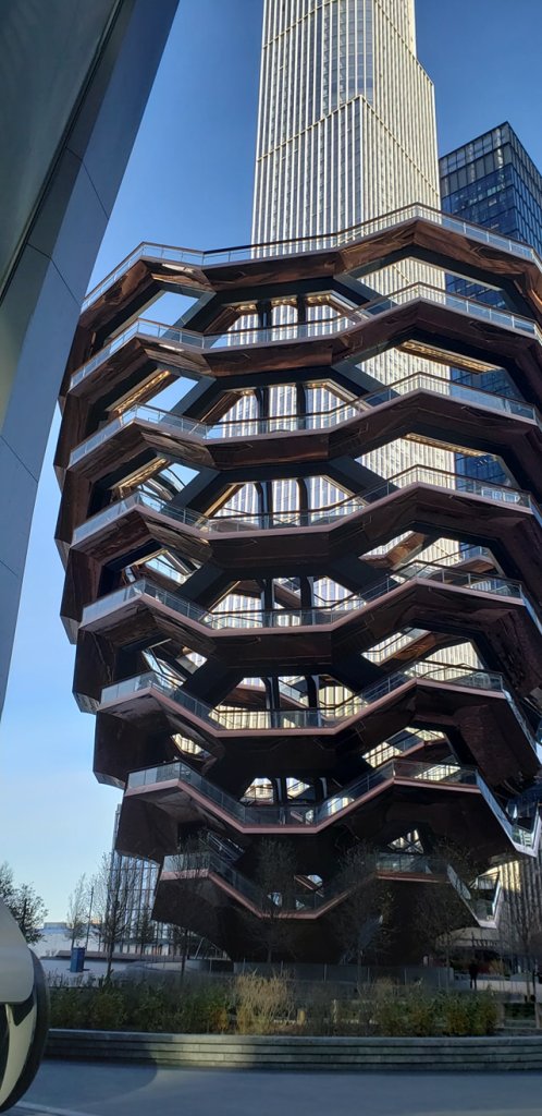
Climbable thing in the city.
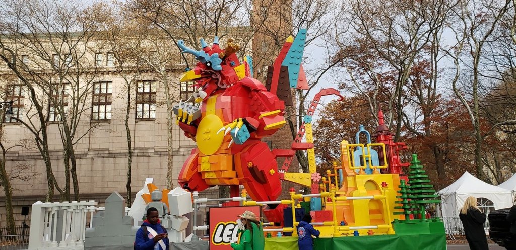
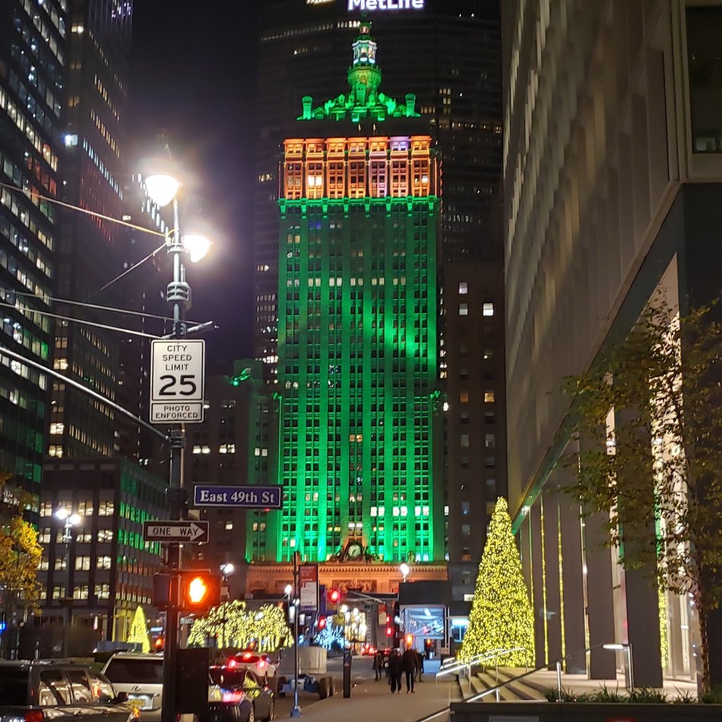
Pretty Holiday Scene in the City.
Early Sat we got up and ubered our way to Laguardia. The sidekick was back to Florida and I was off to Indiana, first.
Overall impressions: Pros: A neat once in a lifetime experience! NYC is a lot of fun and plenty of stuff to do. Cons: Cold and windy in the winter. Probably too busy for my liking. The band has done 2 Macy’s parades in only 11 years. If it comes up again, I have little desire to do this again.
The Adventurer Final Word: 5 Stars! Just because so few get a chance to do the Macy’s Parade. NYC is cool too, but probably wouldn’t be a 5 star without the Macy’s Experience.