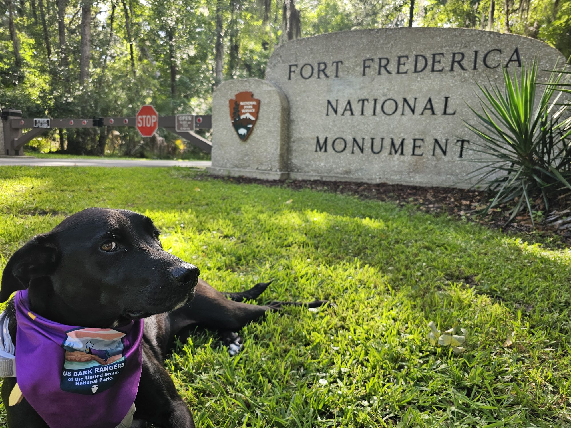
Hey there Adventurers! The next stop on Bark Ranger Maisy’s grand summer tour took us to Fort Frederica National Monument, halfway between Jacksonville and Savannah, near the Georgia coast. The site includes the ruins of the fort and the town that supported the fort.
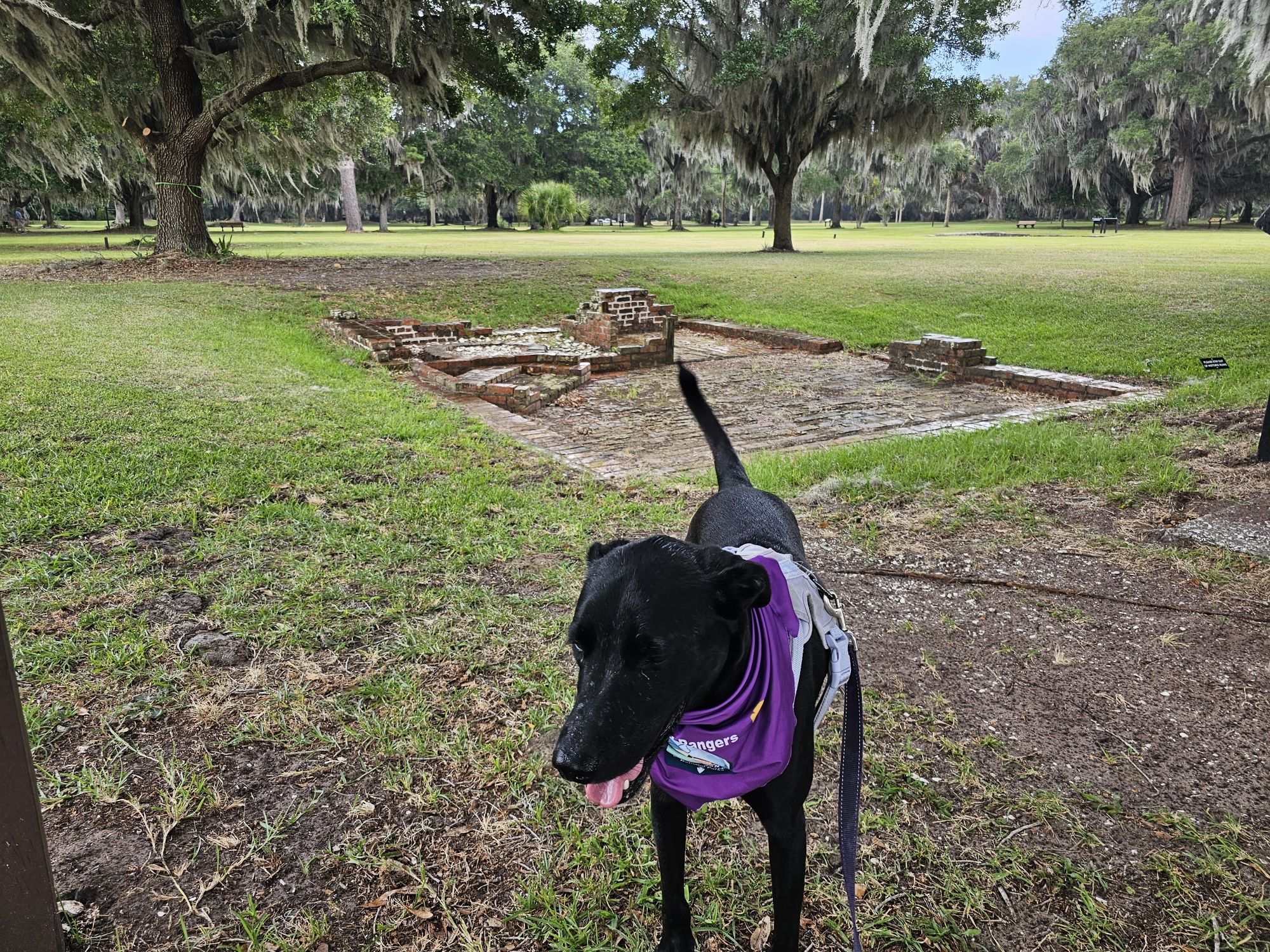
This British fort was constructed in the first half of the 1700s to protect the colony of Georgia from the Spanish. In 1742 the Spanish did try to invade and were repelled by the British forces. Soon after, the British removed the troops and the town fell into hardship. A fire damaged the town in the 1750s, and by the early 1760s it was entirely abandoned. Now, all that remains are the earthworks of the wall that surrounded the town, a small sectioned of the fort ruins, a bit of the old barracks, and some of the town buildings’ foundations.
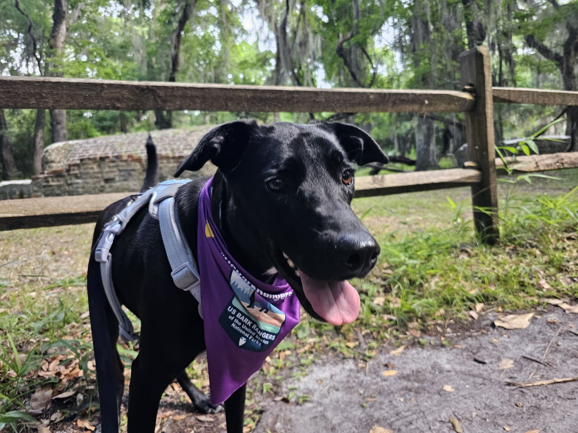
It took a lot of attempts just to even get this annoyed side eye picture!
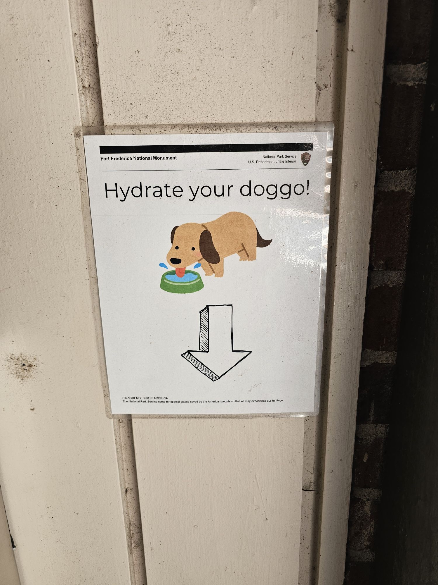
This site is very dog friendly! It is very hot in the summer so we appreciated the dog water station!
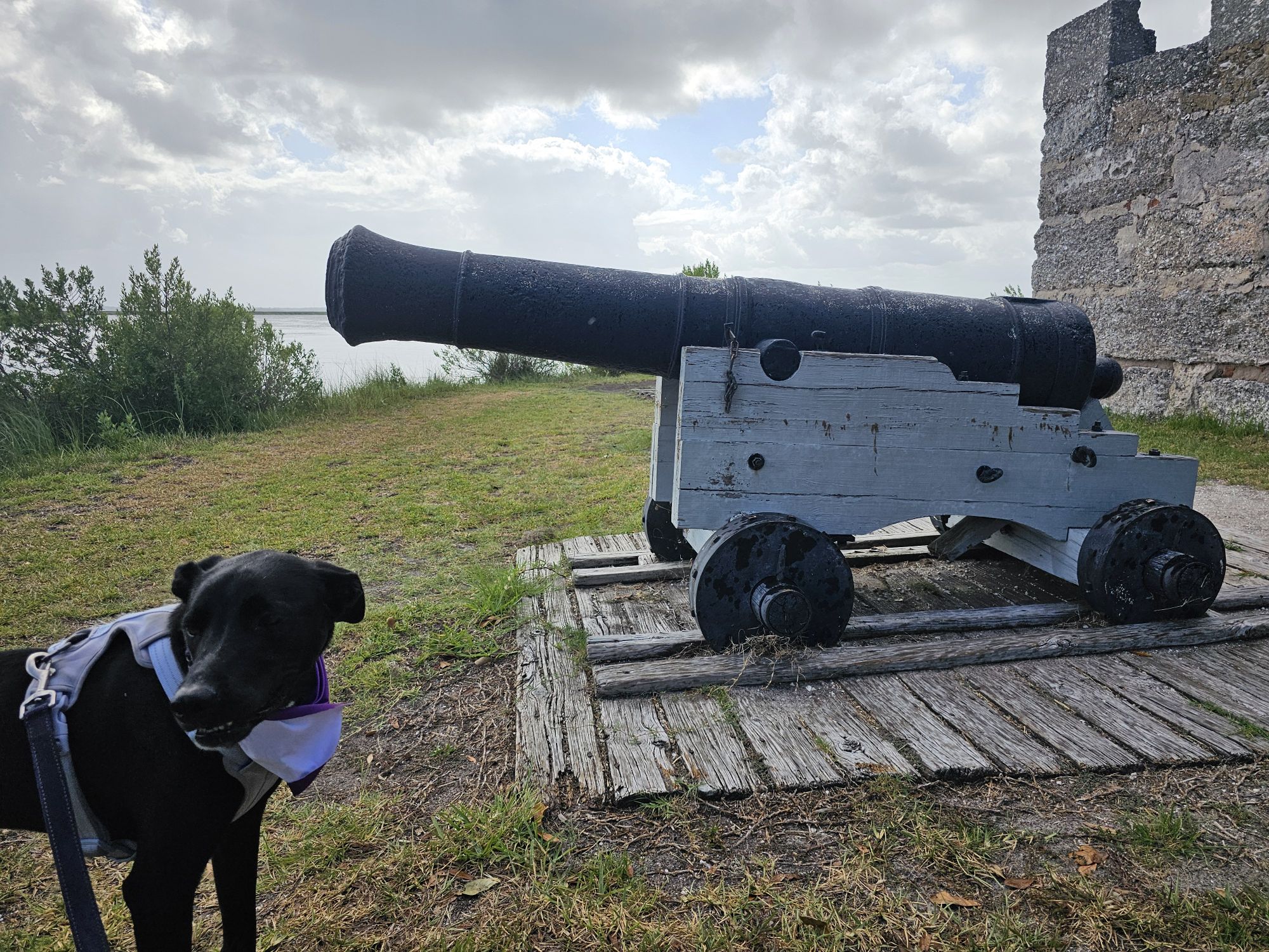
Maisy posing in front of the British Flag. The background structure is the King’s Magazine, and the only remaining structure from the fort.
This site is on our map for Bark Ranger locations, but there is no actual Bark Ranger Program here anymore. Once upon a time they did have an actual program, but now all that is available is purchasing a site specific metal Bark Ranger tag. That being the case, the entire site is dog friendly except for the visitor center/gift shop and is a nice stop to take your Bark Ranger! Maisy enjoyed her time here a lot! She also was very interested in the deer that wandered through the site, so be on the look out for that! The R in B.A.R.K. stands for “Respect the wildlife”, so be sure to mind that! I will also add that the park closes at 5 PM but they have a gate that opens when you leave after hours.
Maisy posing in front of some of the ruins in the town area.
Maisy wonders what these redcoats were all about!
The Bark Ranger investigates the info cards of the town!
All that remains of any of the town buildings are the foundations, if even that.
This is the King’s Magazine, the only remaining part of the fort.
Maisy says she’s tired of posing in front of forts and canons!
The dad gets a picture too! This is all that remains of the barracks.
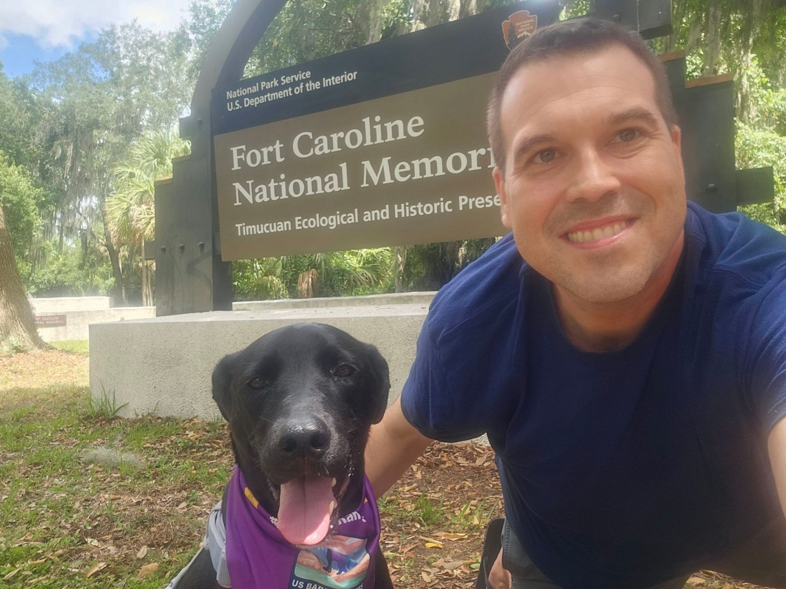
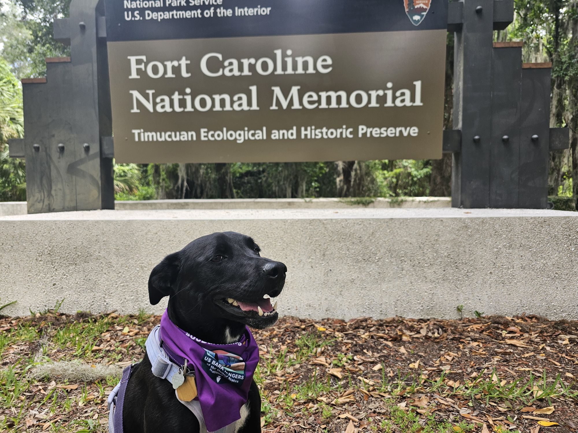
Well, that title is quite the mouthful! Fort Caroline National Memorial is a part of Timucuan Ecological and Historical Preserve, but they are regarded somewhat separately at the same time. This spot was the next stop of Bark Ranger Maisy’s big summer tour!
This visit to Timucuan National Ecological and Historical Preserve included stops to Fort Caroline, the Ribault Monument, and the Kingsley Plantation. As of the writing of this entry in September, there is currently no Bark Ranger program here, though there was just a year ago in the Spring of 2023.
As became a feature of this trip, it took a great many attempts to get a decent Bark Ranger and sign picture!
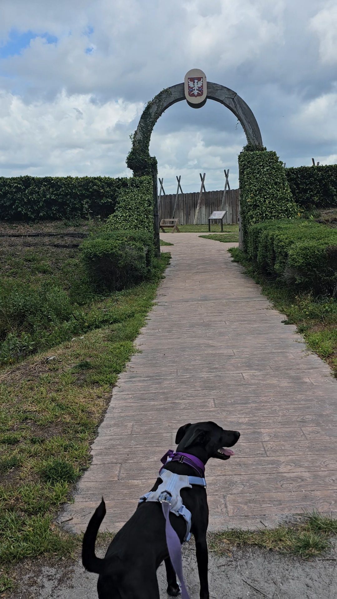
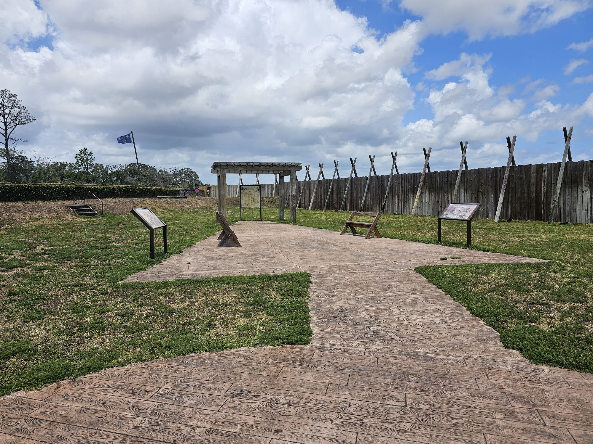
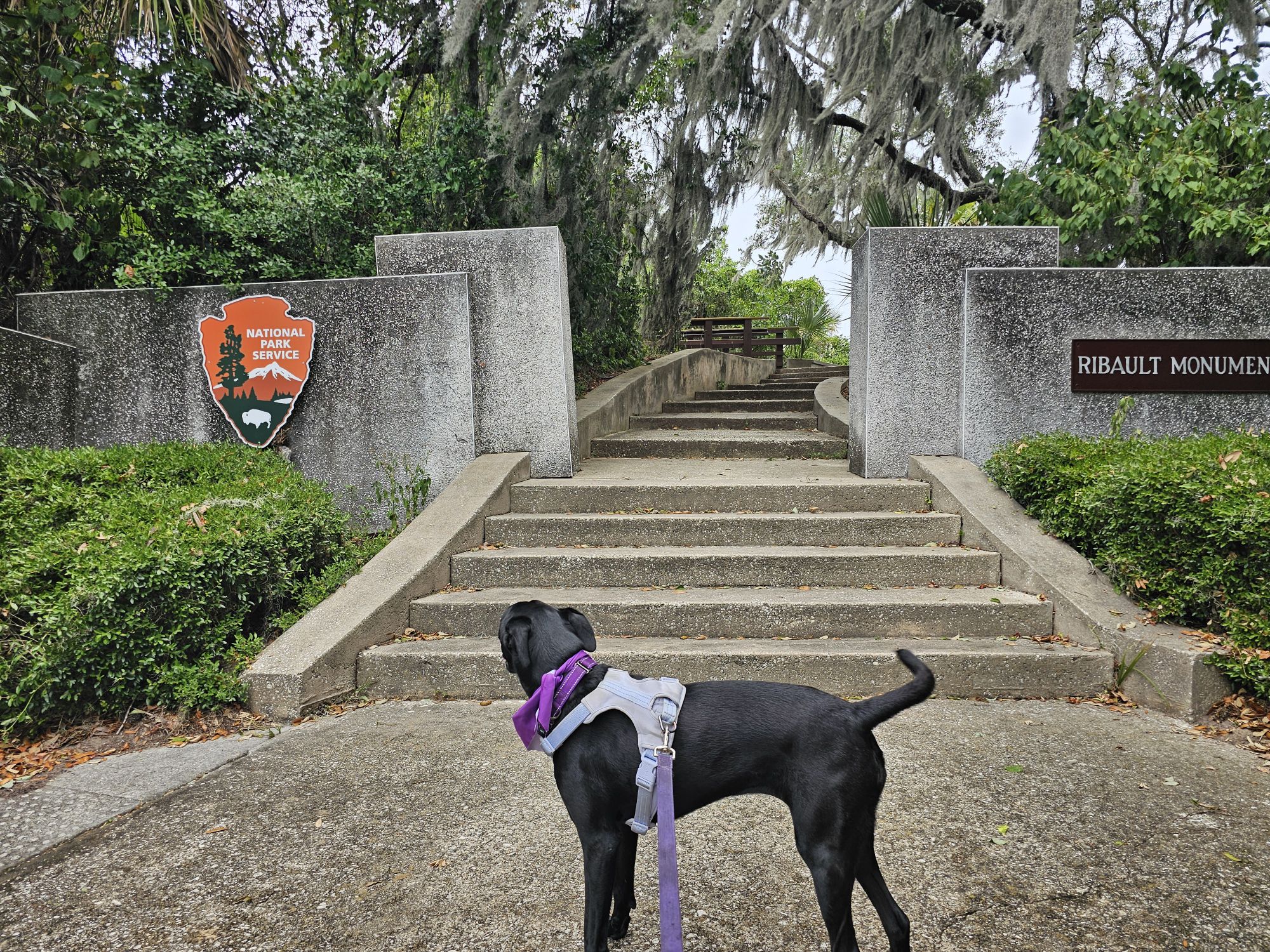
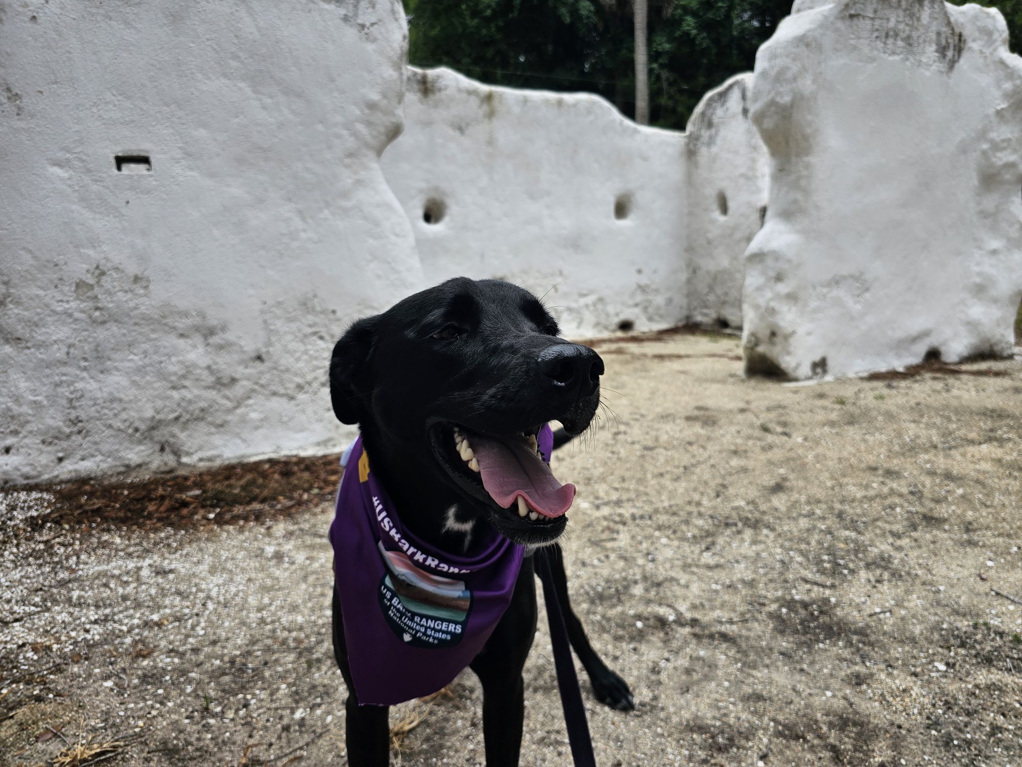
Our first stop was to Fort Caroline. The Ranger I spoke with here seemed very excited about our group. He asked for video of my OG Ranger Bella’s swearing-in in 2023, took pictures of Maisy in her bandana, and took pictures of my USBarkRangers T-shirt! He is hopeful they can restart the program soon. Fort Caroline is essentially where the French tried to establish their presence in Florida after Spain had already done so. The local Timucua peoples, where the name of the site comes from, numbered nearly 200,000 at the time. A few hundred years later they were essentially extinct. The fort is on the southern shores of the St. John’s River between Jacksonville and the Atlantic coast. This entire area is dog friendly, other than inside the visitor center! We walked the nice 1.5 mile loop around the area which includes the fort. It’s pretty level, save for a couple slopes and big steps. Dogs are allowed in side the fort. There is another trail across the street to the Spanish Pond which is also dog friendly and about 2.5 miles long. It was pouring, so we opted to skip. We also visited the nearby Ribault Monument nearby and then took the long side trip to the Kingsley Plantation.
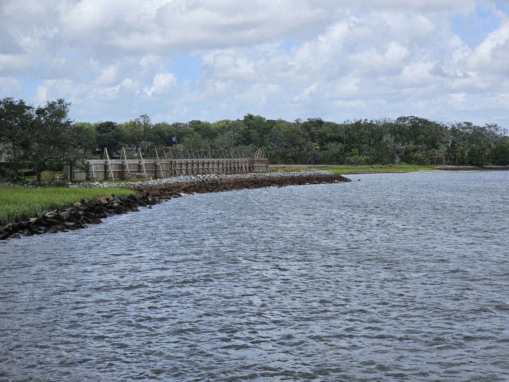
This is the outer wall of the fort. Taken by me.
The entrance to the fort proper.
Bark Ranger Maisy investigating an info sign about the people who were involved with the fort.
The view inside of the fort. Taken by me.
Bark Ranger Maisy checking out the canon aim!
The stairs up to the monument.
This is the monument. It is a replica of a marker put here to commemorate France taking Florida in 1562. Taken by me.
North of the St. Johns River is where you find more of the Timucuan preserve area and the Kingsley Plantation. Even though I said it’s a long trip from Ft. Caroline, it should be noted that near Ft. Caroline there is a small car ferry which leaves every 30 minutes to take you much closer to the plantation site. However, I drove the long way to avoid waiting a potentially longer wait for the ferry. The plantation is pretty remote but offers a complicated history, steeped in slavery. The site is dog friendly, save for inside the structures. Be sure to check it out if you are in this neck of the woods! You do have to go out of your way to get to both Ft. Caroline and the plantation, but the fort is far more easily accessible. If you have your pup, it is well worth the side trip to do some Bark Rangering!
Ruins along the road up to the plantation. Tabby is a type of concrete made using oyster shells that was used by Spanish settlers in Florida. Taken by me.
Maisy checking out the plantation grounds.
Maisy investigating the ruins of the sites slave quarters.
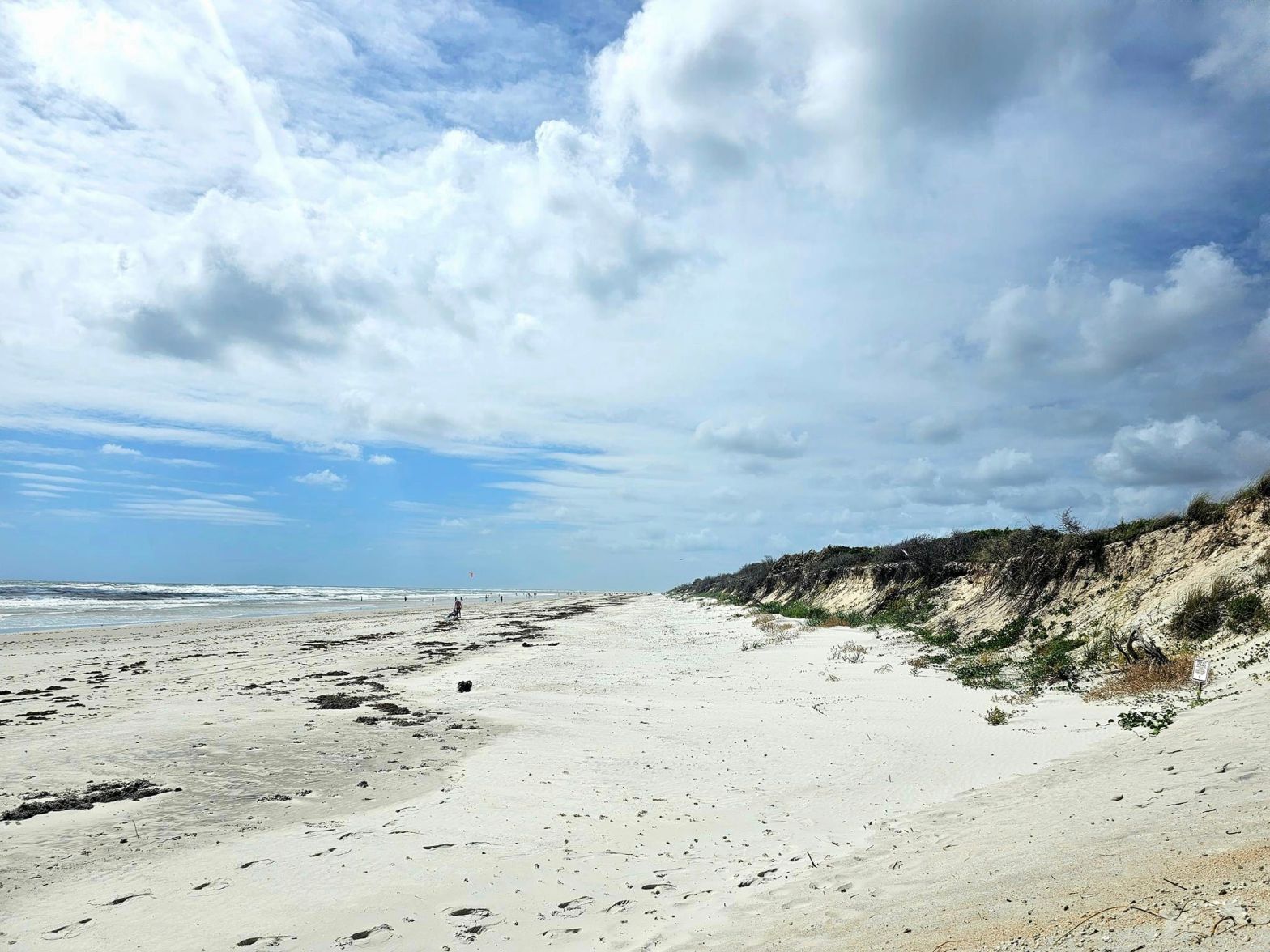
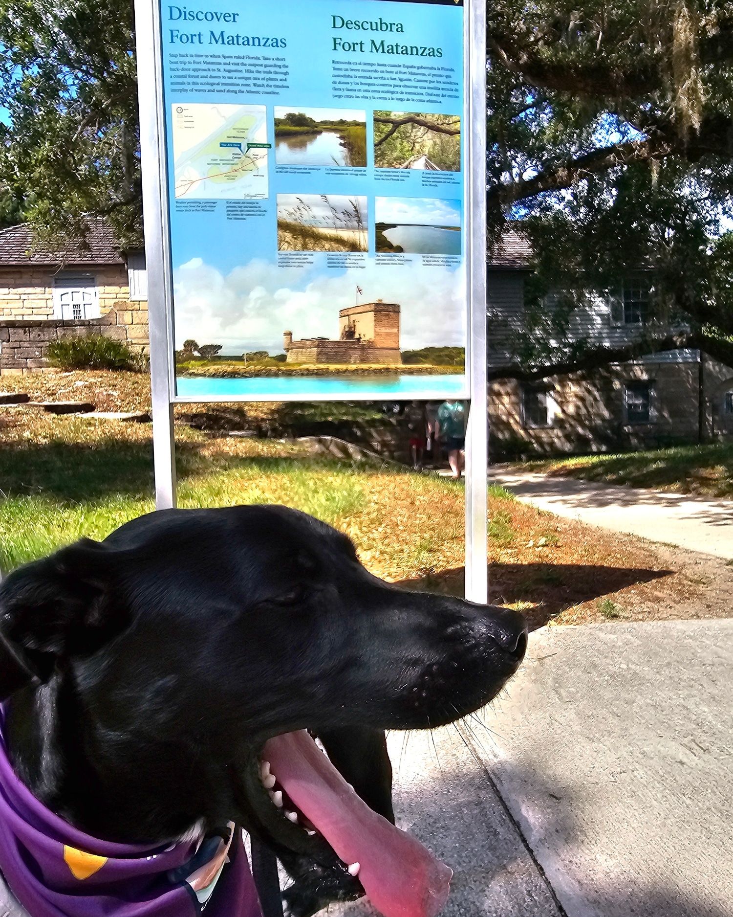
Hey there Adventurers! Stop number 2 on #USBarkRangers Maisy’s grand tour of the southeast was Ft. Matanzas National Monument in St. Augustine, FL! I forgot to take a picture of the sign, so the cover photo is just the Ft. Matanzas beach….oops!
Click on the image to go directly to the interactive map on #USBarkRangers facebook group!
Some of the entries in this tour will be shorter than others, and this will be one of the shorter ones. If traveling with your pup, this is not going to be a long stop. If you look at the park website it indicates there is a Bark Ranger Program there, however there is not, and this location is not on our map, accordingly. That park website page was last updated over 4 years ago! The out of date info found on NPS websites is one of the reasons why the Sidekick and I created the Bark Ranger group!
Fort Matanzas proper, is accessed only by ferry, and neither the ferry, nor the fort are dog friendly. This fort is old but not as old as others around. Originally a Spanish fort, this one was built in the mid 1700s to protect a backdoor into St. Augustine that would get around the much older, but larger Castillo de San Marcos, the fort that everyone associates with St. Augustine. Fort Matanzas was only engaged in one altercation, and it wasn’t too many years later that it fell into British control, then back to Spain, before the US gained control about 80 years after it was built. By that point the fort has fallen to ruin so the US never really utilized it. The part of the park that is accessible by pups includes the visitor center grounds and a beach across the main road. There are a couple really short trails nearby that dogs can use, on leash of course! I did speak very briefly to the ranger in the small visitor center/ticket facility. It was crowded so I only chatted briefly. He mentioned the park used to have the program years back but has no real plans to bring it back.
Bark Ranger Maisy looking over taking pictures!
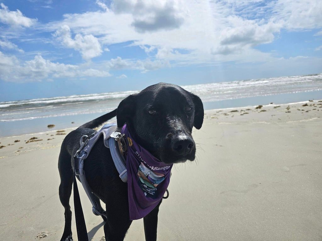
The short trail near the visitor center that is dog friendly is only about 3 tenths of a mile long, and is mostly boardwalk. It does not really lead to anything, more of just a small stretch break. Across the road from the entrance is the access to the Ft. Matanzas Beach. This is a dog friendly, on leash beach that’s actually on park land! Be sure to watch out for stranded or dead jellyfish on the beach! The highlight of this park for Maisy and I was the beach. This NPS unit would be best combined with a day trip to Castillo de San Marcos National Monument, also in St. Augustine, and/or Canaveral National Seashore a little ways down the road.
Looking picture grump on the beach!
She is a water dog through and through though, and loved it!
Next up: Timicuan Ecological and Historical Preserve.
Hey there fellow Adventurers! If you have a dog, enjoy the national parks, and want to make great memories with your Bark Ranger(s), please join our now 35,000 member community! I am proud to share that #USBarkRangers is now an affiliate with both AllTrails and GuideAlong (formerly the Gypsy Guide)!! If you click on those links, AllTrails will give you a free trial, and GuideAlong will discount 15 percent off any tour, INCLUDING those on sale, and their bundled packages as well! Check out the shot below of our interactive map! We are now actively compiling US Fish and Wildlife, Bureau of Land Management, Forestry Service, AND state and local/county/city park systems that offer Bark Ranger programs into our map! Clicking on the sites brings up the info we have that is as most up to date as we can find! Additionally USBarkRangers is active on IG @USBarkRangers and Maisy has an IG also @BarkRangerMaisy!
A screenshot of the interactive map on the #USBarkRangers Facebook page. Black borders are NPS sites, blue is everything else. There are over 200 of them now!
In an effort to actually, you know…upload posts or something, for a weird change of pace, I am going to do a time jump. I am actively working on Death Valley, and still have Tennessee/Great Smoky Mountains, both of which happened before this roadtrip, and then Glacier, and Wrangell St. Elias National Parks afterwards. In the meantime my new Bark Ranger baby Miss Maisy Daisy got to explore many national park sites in the southeast, including many that have Bark Ranger programs or Bark Ranger badges! All of them had some pretty dog friendly rules, of course, so we had a blast! This will be a lengthy series of posts, and thankfully they are already mostly done, so expect to see a good amount of posts coming soon! I will keep my NPS unit count correct, as best I can!
Not cooperating….
Still not cooperating….a common theme!
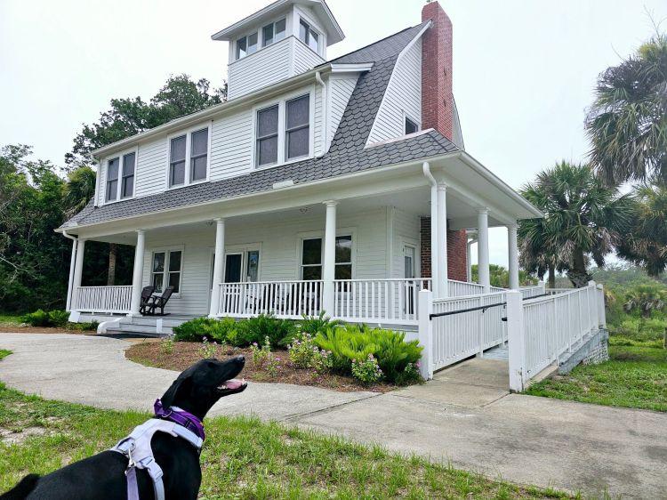
Our first stop took us to a very windy and rainy Canaveral National Seashore in Florida. This site does NOT have anything Bark Ranger, but is very dog friendly! I found no rangers, so I spoke to the lady running the small bookstore and left some of our cards. The short and easy rule here is that dogs are not allowed on the Atlantic side of the road but they are allowed on the other side of the road along the lagoon. The biggest site to see on the lagoon side is the Eldora Village State House. The house dates back more than 100 years when there used to be a village there. This is possibly a museum to visit, but it was not open when I was there, and it was not clear about hours or anything like that.
Maisy checking out the Eldora Statehouse.
Actually cooperating on the porch of the Eldora House!
The website says dogs are not allowed on “beaches or boardwalks” in one paragraph, but then says in another paragraph where they are allowed – which says the lagoon side and specifies locations. There is a boardwalk on the lagoon side, specifically at one of the listed locations. There were no signs indicating pet allowance either way at that location, so it’s unclear to me what the rule is there.
This is a pristine and undeveloped seashore, but honestly….this is the least attractive coast of Florida. Still, a nice untouched area of Florida worth checking out! Maisy was fine in my air conditioned car for the less than 5 minutes it took me to go out here and snap a few pics!
Maisy checking out the area! This is the boardwalk on the lagoon side. This area was specifically mentioned as dog friendly. But it’s a boardwalk…I apologize if I broke rules, but it isn’t very clear.
This is Mosquito Lagoon.
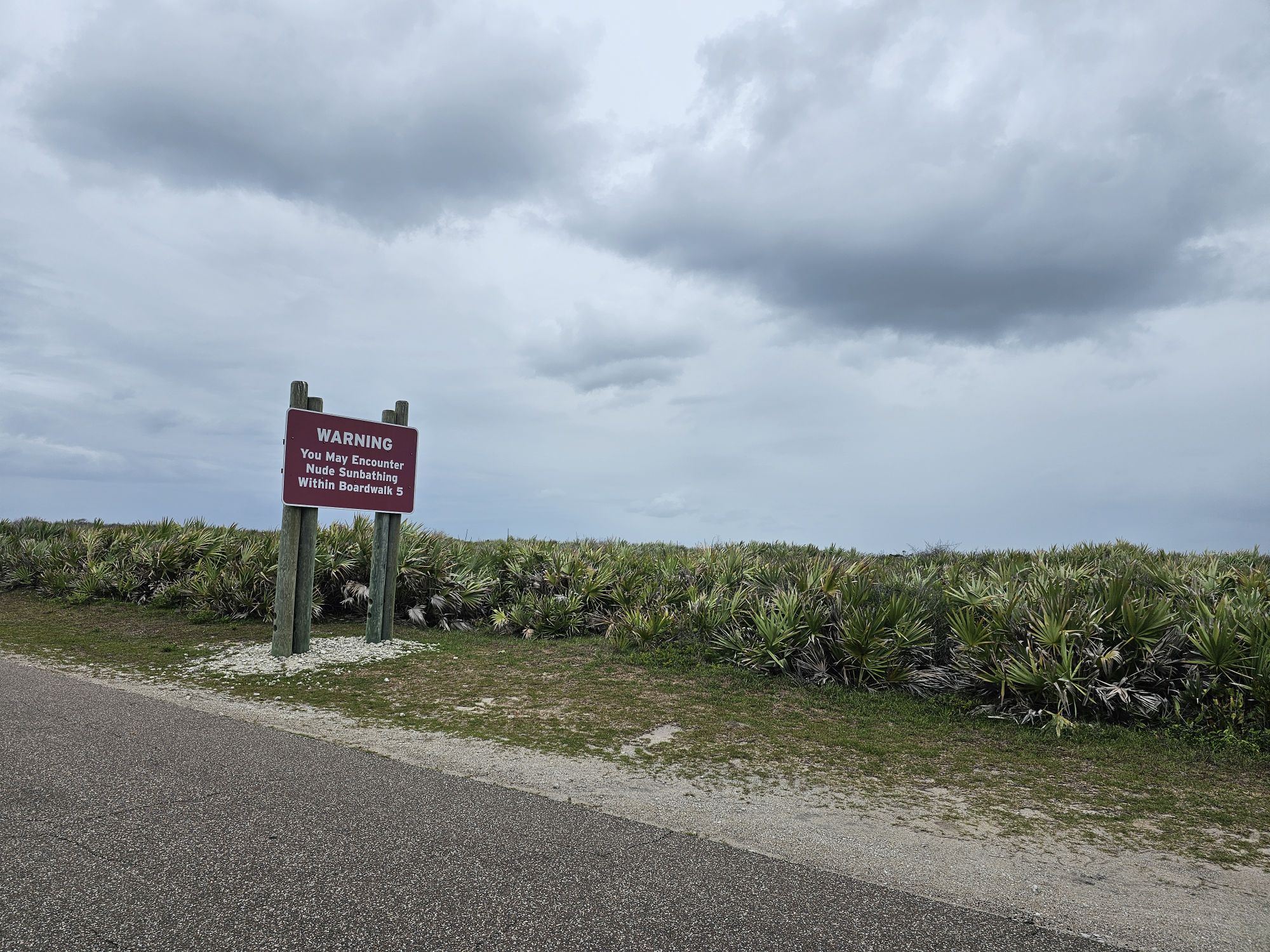
There a a few other things to point out for Canaveral National Seashore. When driving, watch out for gopher tortoises! We saw a few hanging around the side of the road. The beaches look pristine, but bear in mind that this is the Atlantic side, which is absolutely the least scenic of the 3 Florida beach environments. There is a marked nude area in this unit as well! Canaveral looks easy to get to on the map, and is, but it actually takes a decent amount of time to get to off of the highway. Lastly, there is another section of the Seashore that is accessed nowhere near this area. Where I went is the “main” section, with the visitor center accessed through New Smyrna Beach. However, if you go through Titusville and NASA land you can access an area called Playalinda. We did not go to this area, and there are a fair amount of launches now, so be sure to check that its accessible!
Watch out for these guys! This was pretty close to the road and in the middle of the day!
I bet there aren’t too many of these signs in the NPS system….
Thanks for reading, next up will be nearby Ft. Matanzas!
Hey there Adventurers! The Sidekick and I embarked on the first trip of 2024 to Joshua Tree National Park near Palm Springs, CA! The trip actually encompassed this stop, a stop at the Palm Springs Aerial Tramway, a very brief stop at the Mojave National Preserve, a visit to Death Valley National Park, and quick stops at the Hoover Dam and Lake Mead National Recreation Area and Sin City!
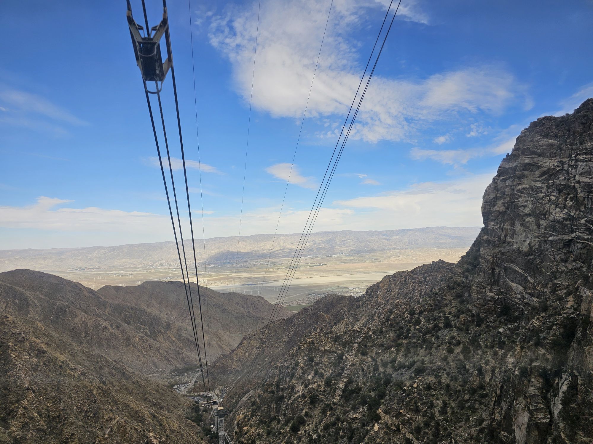
We flew into Palm Springs with Southwest Airlines. I love free flights with a companion pass in tow! Our first stop was nearby at the really neat Palm Springs Aerial Tramway, taking us up to San Jacinto Peak overlooking Palm Springs. This is a must visit if you are in the area. There is a 15 dollar parking fee, plus 30 bucks a person to go up the tram, but it is very much worth it! The tram itself is floor to ceiling glass and rotates while it ascends nearly 6000 feet up the side of San Jacinto Peak. Fun fact, Captain James T. Kirk narrates the trip! At the top you find trails accessing the 8000 plus feet elevation of San Jacinto Mountain State Park. There is a restaurant, bar, and a gift shop to take your money. There are also some awesome views up there! Note that to get up on the tram you need a ticket for an exact time and you will probably have to wait a little bit for that time. I think we had an hour plus wait. The bottom of the tram has a gift shop, a museum, and a cafe to tide you over for the wait.
View from the tram looking back down the mountain. Taken by me.
The Sidekick and I at the Mount San Jacinto State Park sign.
The start of one of the trails at the top of the tram. Taken by the Sidekick.
View from the top, over Palm Springs. Taken by me.
The town of Joshua Tree is at the western entrance of the national park and about a 45 minute drive from Palm Springs. We checked into our AirBNB and hurried to the Visitor Center before they closed to do a little recon. The main visitor center for the park actually lies within the town and NOT within the park proper. If you are the type to head into the park before sunup and then are looking for the visitor center while inside the park, just note that it is quite a bit outside! The town of Joshua Tree does not have a ton of amenities. The closest proper store is several miles down the road in the previous town. However, the spot to hang is the Joshua Tree Saloon, a bar/restaurant with a large outdoor patio in addition to the dining/bar area. It was good one night but a miss the second…so take your chances!
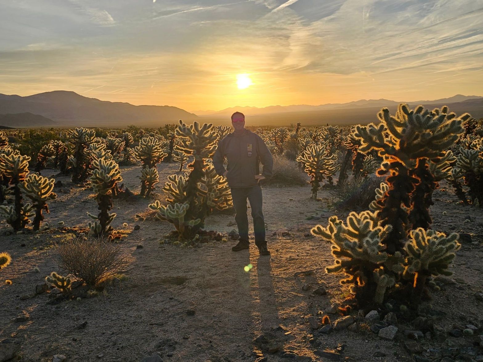
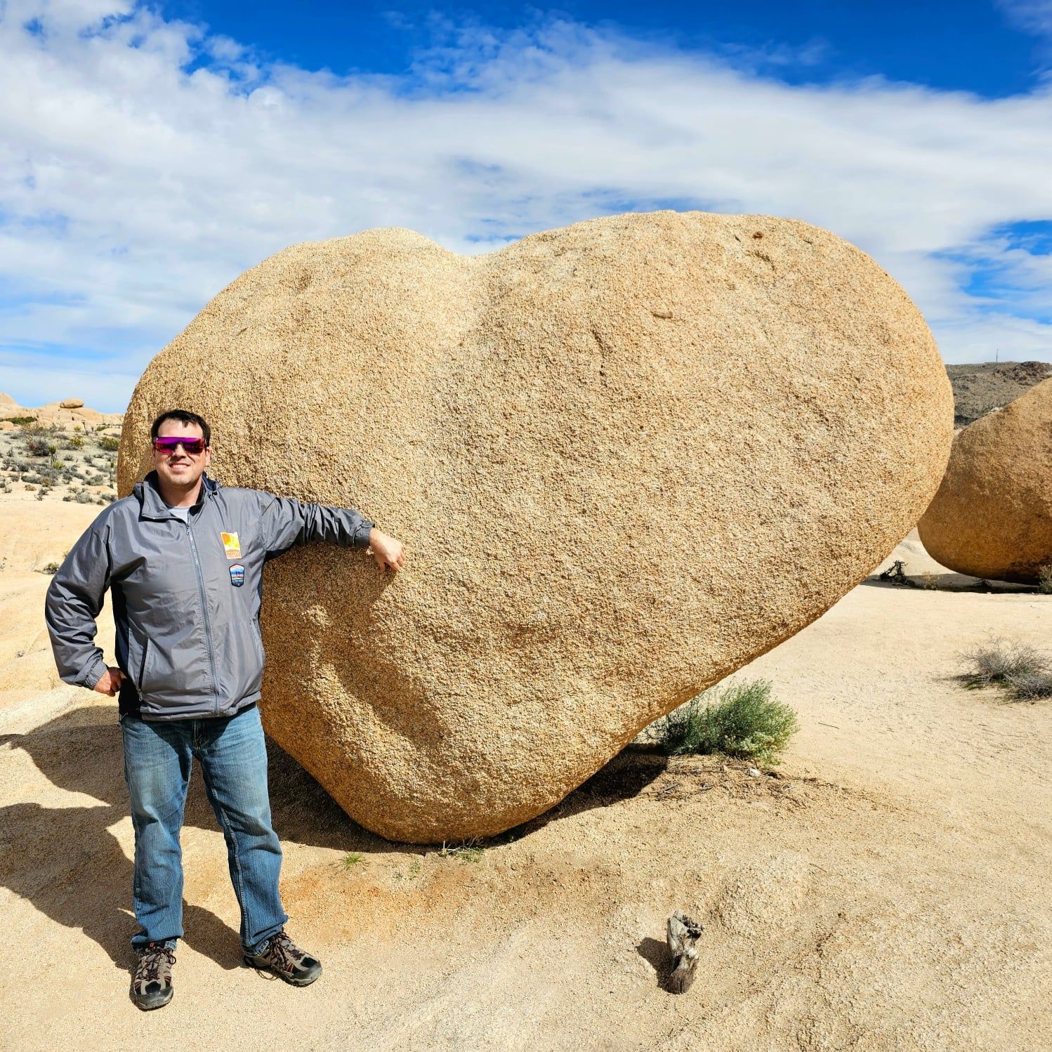
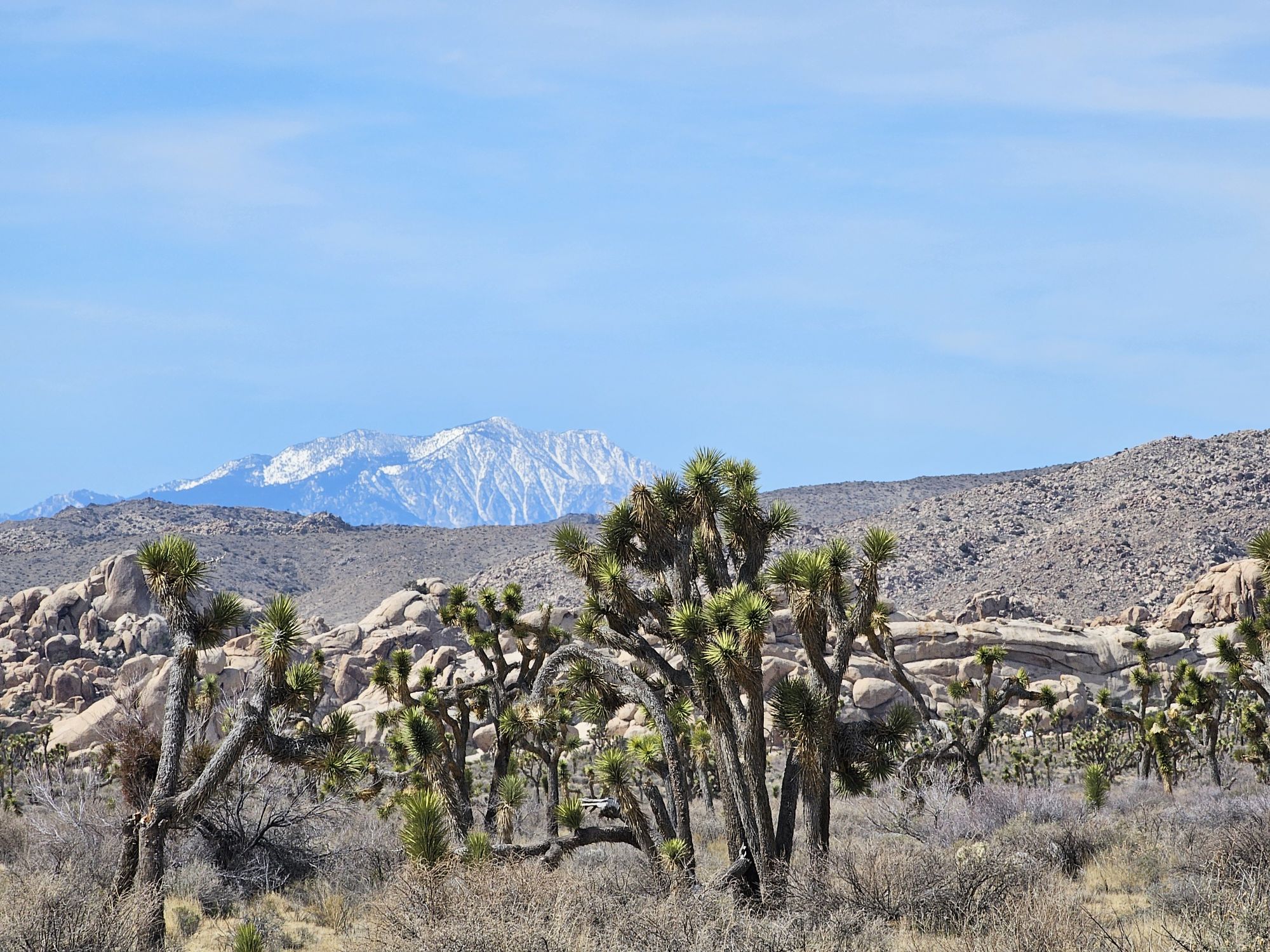
The following morning we got up very early and headed into the park. We intended to catch sunrise at the Cholla Cactus Forest, located pretty far down in the park. On the way to the cactus forest, seeing the park’s namesake Joshua Trees in the dawn light made for a pretty alien setting! If you are wondering what a Joshua Tree is…you aren’t alone. I call these “Dr. Seuss” trees because they look like they came straight from his imagination! Despite their name, these plants are not trees at all, and they aren’t a cactus either – they are actually a succulent! The name Joshua was given to these trees by Mormon settlers based on the Biblical figure Joshua. We made a stop at the interesting, and usually very busy Skull Rock (no one was there pre-sunrise) and made the Cholla Cactus Forest just in time for sunrise. I have to say this is probably the most beautiful sunrise I have ever seen! The beauty isn’t the sky here, but rather the gorgeous lighting on the cactus!
This glow is legit and seems to only occur at this angle of the sun! Gorgeous! Taken by the Sidekick.
Joshua Trees in the dawn. Taken by me.
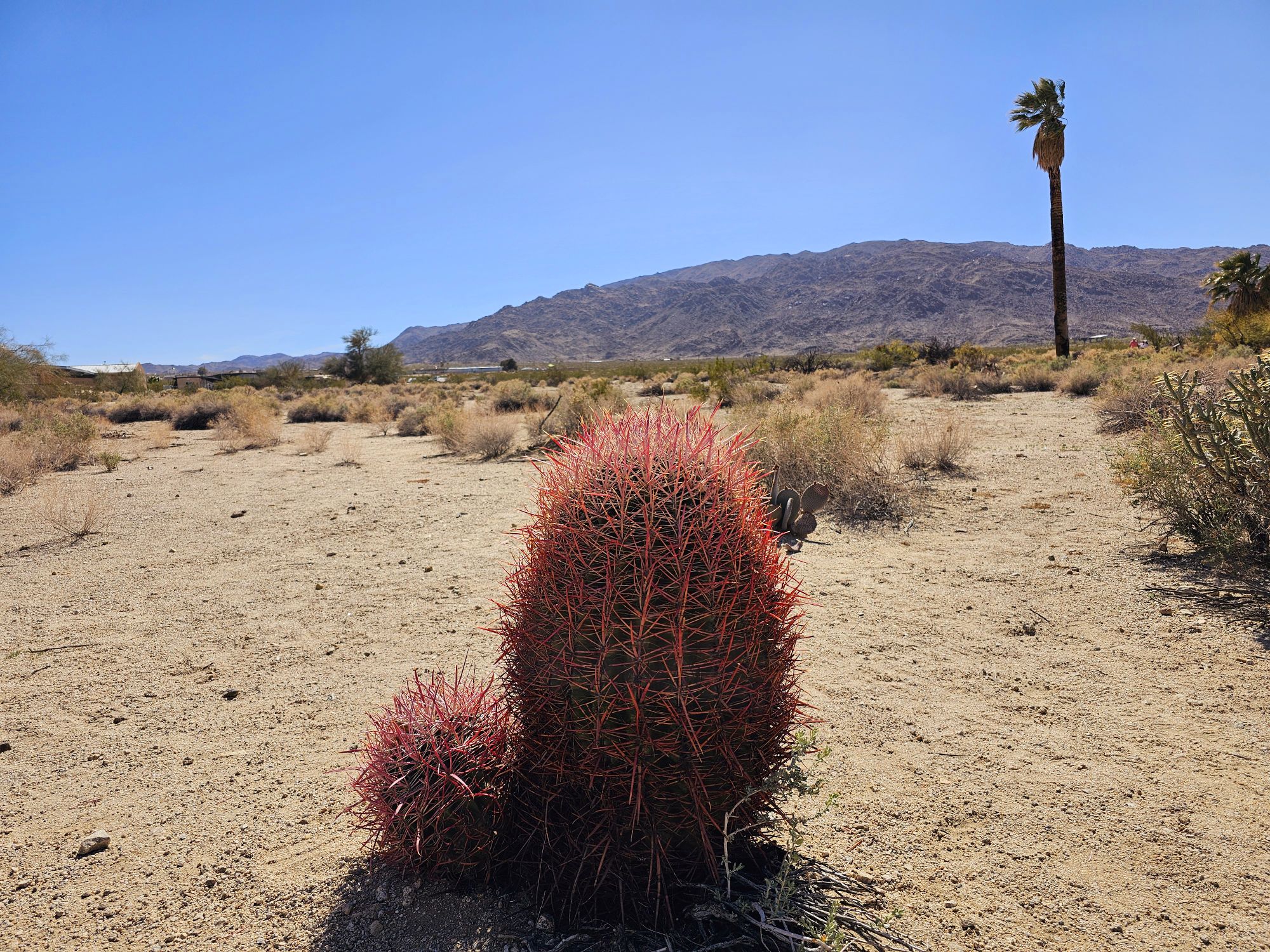
After hanging around the Cholla Cactus forest for a bit, and avoiding touching said cacti (well I did…the Sidekick seems to attract cactus spines…), we continued down to the southern entrance of the park. Here we checked out the Cottonwood Visitor Center (this one is pretty small), got the required sign picture, and then continued back into the park. This was mainly backtracking, because this is the only paved road here. But we made some stops to snap some pictures. One stop was Ocotillo Patch. Ocotillos are a very weird plant! Technically a type of succulent shrub, these guys can grow to 20 feet tall and live for decades. They are very distinct for several reasons. Their height is one reason, but they are also very green, some with pretty red flowers at the top, they are essentially a collection of thorny canes, and those canes have no limbs so the leaves grow straight from the canes. They really look quite alien…kinda how the entire park looks!
An ocotillo. Taken by the Sidekick.
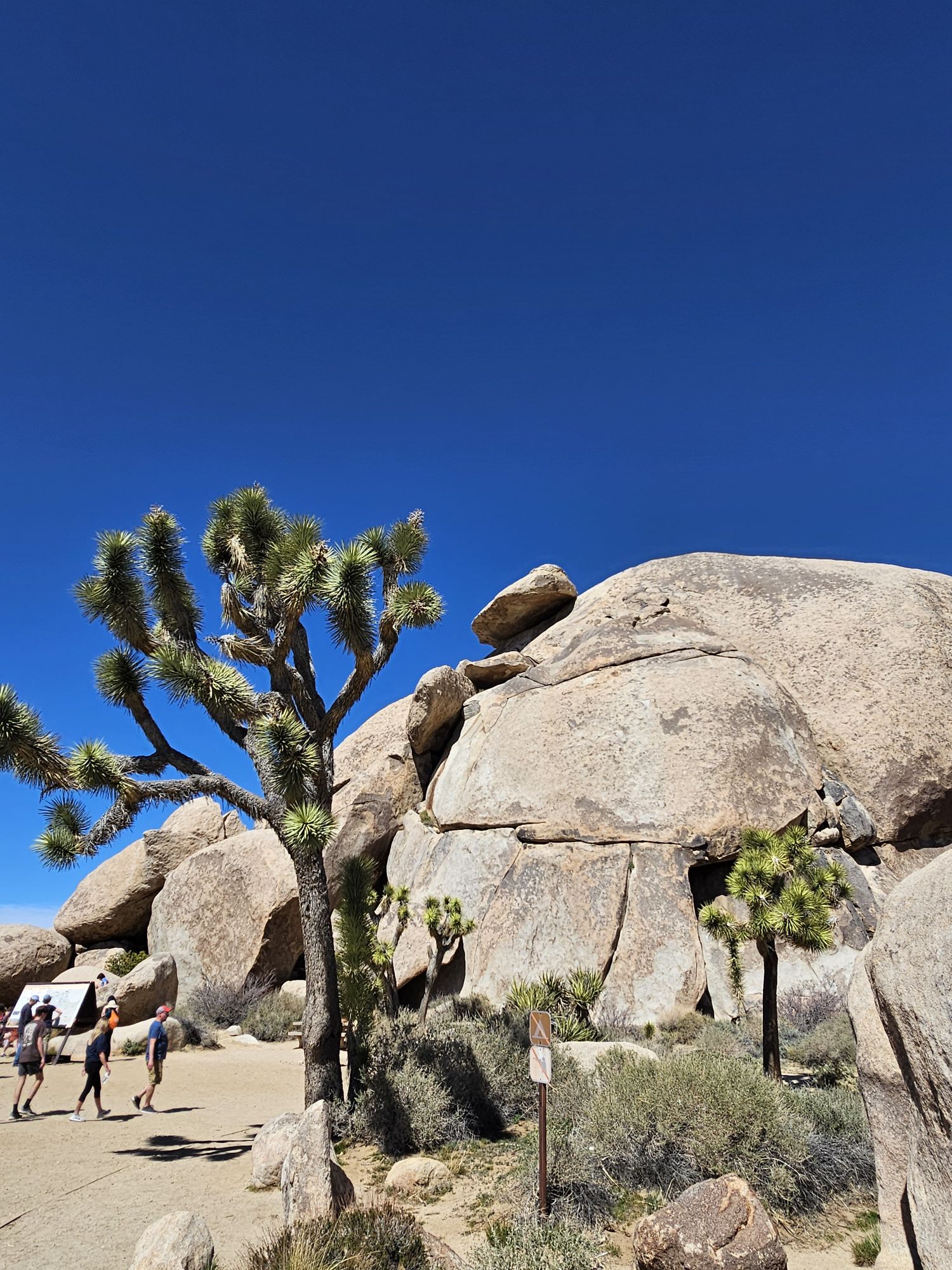
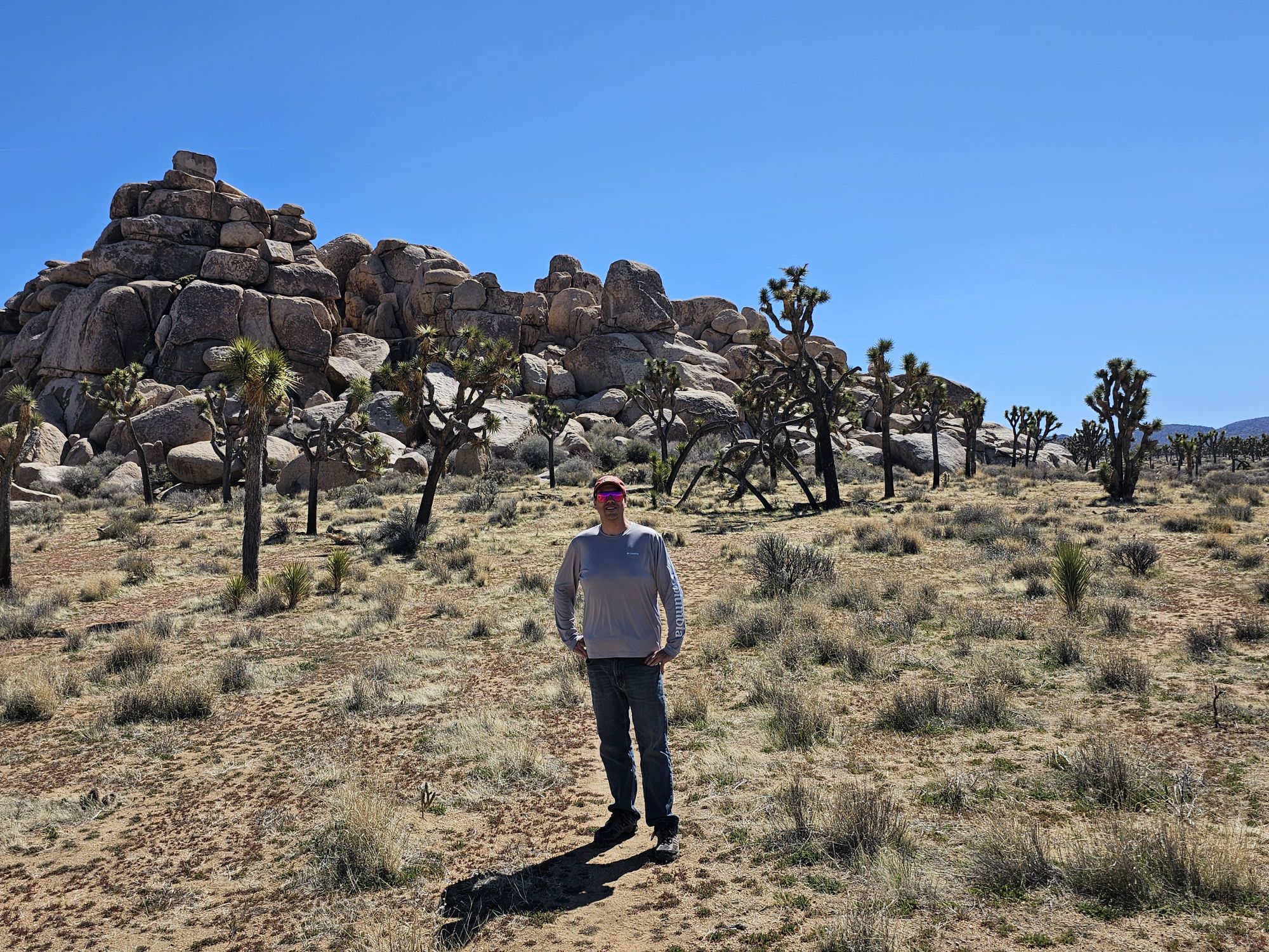
Not to harp on the need to really catch sunrise in these beautiful places, but we stopped back at the cholla forest, now well into the morning, and the stunning view at sunrise had given way to a much more muted view. Still cool, but nowhere near what we saw at ealier! We continued on to some spots we drove past at dawn and stopped for some small hikes and sightseeing. We hiked an easy 1.6 mile round trip trail to a couple rock formations in the middle of the park. These included Heart Rock, Arch Rock, and what I lovingly named Butthole Rock! We made a stop at Cap Rock to see what that was all about. And from there, we took a side road up to the highest part of the park. Keys View sits at about a mile elevation and offers a stunning view of the Coachella Valley and across to the San Jacinto Mountains! There are a couple Joshua Trees trying to exist up here, but mostly this is a good spot to just take in a view. The only problem is that air quality issues definitely affect the view.
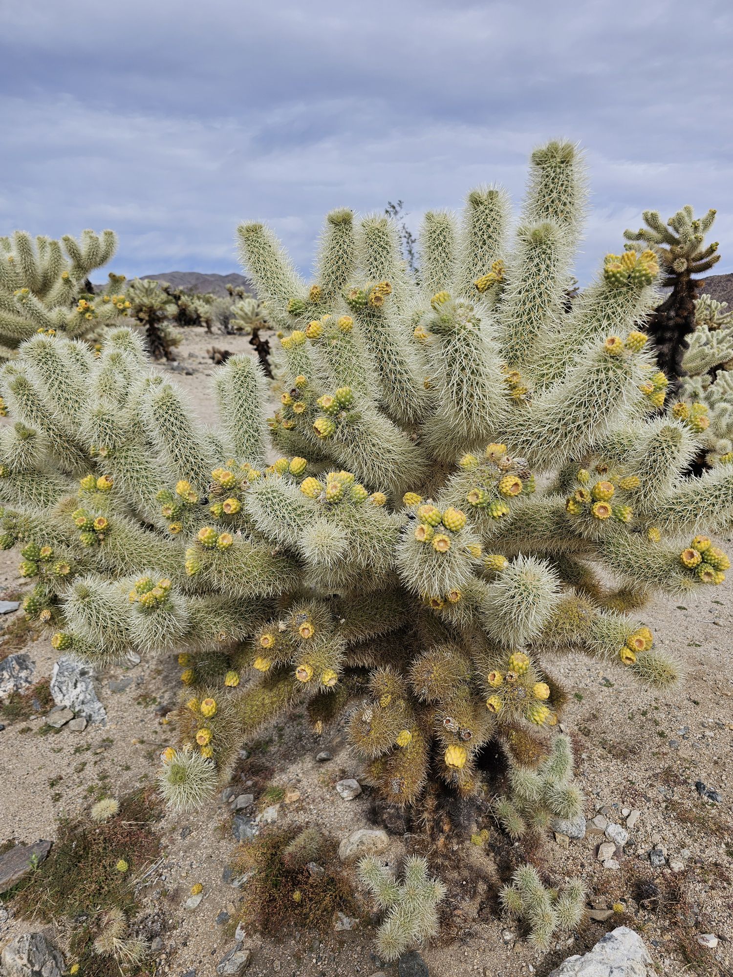
Close up of a cholla cactus with those pretty yellow tips. Taken by me.
Heart Rock. Taken by the Sidekick.
What I lovingly call Butthole Rock ;). Taken by the Sidekick.
Arch rock. Taken by the Sidekick.
Arch rock without any people. Taken by me.
Now don’t be awestruck here, but that rock hanging at the top is why this is called Cap Rock. Taken by me.
Taken in front of some Joshua Trees in the Cap Rock area. Taken by the sidekick.
Smog filled view of the Coachella Valley from atop Keys View. Taken by the Sidekick.
As we exited another side of the park we went to explore a spot called the Oasis of Mara. There are a handful of oases in the park, but I understand that none of them are still on the surface, and most of them require lengthy hikes to get to. So we made the easy access Oasis of Mara our one oasis stop. This used to be the park headquarters/main visitor center and the oasis is a short walk behind the building. There isn’t much to see here, and again, the oasis has no water, but there is a spot that definitely has more access to underground water. The picture below is essentially the entire oasis now. To end the day we trekked back into the park from the western entrance and caught a beautiful sunrise.
Not too much to see here. This is about the entirety of the oasis, and there is no water above ground anymore. The rest of the area is desert. Taken by me.
This is the area around the Oasis of Mara. Desert with some pretty cactus hanging around. Taken by me.
Sunset over Joshua Tree National Park. Taken by me.
The next morning was the end of the Joshua Tree portion of this trip but there were still a couple things to do! We headed back into the park for the last time to check out two spots in the same area. There is a nice little 1 mile loop trail through Hidden Valley, and if you are a rock climber, this area is your place! This valley is named as it is because farmers (or outlaws) would hide cattle here, either from the elements or from people looking for them. The last spot we checked out was Barker Dam. This is a man made dam, first constructed 125 years ago. The Dam is found along an easy 1.3 mile loop trail. People get great rock reflection pictures in the water here, but on our visit there was no water in the reservoir. Along this trail you can also find old native petroglyphs as a reminder of the history of this land. And that concluded National Park Number 39!
Never seen this before. They painted this in the parking lot in a couple spots in this park. This is the entrance to the Hidden Valley area. Taken by me.
This is inside the Hidden Valley. What is not seen is the rocks basically encircle the entire area offering good protection for cattle and rangers…and cattle thieves. Taken by me.
Barker Dam. Water would be held back on the other side. Taken by me.
The petroglyphs found along the Barker Dam trail. Taken by me.
View of maybe San Jacinto Mountain from the Barker Dam area. Taken by me.
Overall Impressions: Joshua Tree National Park is super cool! It really looks like another planet! It is small, which is positive in that you can see most all of the park easily and quickly, but also negative that you can …. see all of the park relatively quickly and easily! Still, it’s a super cool place and being close to a major airport makes it a must see spot!
Hey there adventurers! I haven’t made a post in a hot minute, but they are coming! In the meantime please check out another #USBarkRanger update! IG, website, new items, and some affiliate info can be found below!
In my last post, the Bark Ranger facebook group the sidekick and I started had about 7000 members. That was in February. In just ten weeks, we are now nearly to 18 THOUSAND!!!!! We have an amazing community of members sharing their pictures, promoting the BARK Principles, and providing on the ground information so we can keep our amazing interactive map as up-to-date as can be! Please check it out! If you join, be sure to answer the questions for membership! We now have an amazing 9 member mod team looking over everything to make our group scammer and spammer free! And, there is more exciting news as well:
We are now on Instagram @usbarkrangers. We follow back and share content!!
Check out usbarkrangers.com ! This is an early stage website put together rather haphazardly by yours truly! Here you will find a link to our most important info that tends to get pushed down on the facebook group!
We have a few new items for sale in our ebay store! We have a new Live. Laugh. B.A.R.K. sticker that I can also make into a magnet! We have a new emergency sticker with our logo to put on your doors and windows! I can make that one into a magnet also which is perfect for RV doors! And through JUNE 2 we have a beautiful T-shirt for sale! This is a time limited store, and my apologies for not having this available sooner!
And, lastly, we have a couple exciting affiliate opportunities! Check out Rex Specs to find some awesomely amazing dog goggles, leashes, collars, and much more! Through June 15 Rex Specs has partnered with us to offer a 15 percent discount on your purchase using code BARK15. And EVEN BETTER: There is currently a sale of up to 40 percent off selected items, and that 15 percent stacks! Amazing! Be sure to check it out!
Check out these cool #USBarkRangers rocking out their hot USBarkRanger gear with their Rex Specs googles!
We love to hike, of course, and many of our members do as well, accompanied with their Bark Rangers! We use AllTrails and think you should, too! In addition to all the other awesome features that AllTrails offers you can easily find out if a trail is dog friendly or not just by scrolling along the filter buttons at the top! Or checking on the trail page itself! The best part about AllTrails is that it is FREE. Simply click that link and download the app and/or create your free account! You can also so a one week preview of the paid version of AllTrails Plus. That’s what I have been using for years and it is vital! But the free one is great too! Just be sure to create a free account to keep track of your hikes, pictures, etc!
See the “Dogs on leash tab.” It’s there by default. This is the desktop view.
And this is the mobile app view where you can see the dog friendly tab at the top for easy trail searching!
We would love to see you all on our group and sharing the best pictures of your #USBarkRangers doing their best Bark Ranger things!!
Hey there Adventurers! I just want to share an important update for the US Bark Rangers of the US National Parks! The Sidekick and I have been interviewed on two podcasts recently featuring the group! I wanted to share this one done by Brad of Changing Roads!
If you would like to learn about Brad and Rangers story click here! (Apple podcast) Ranger is a medical service dog assisting Brad and the story of them completing all 63 parks is very interesting!
Hey there Adventurers! As we draw near to the end of the first month of 2024 (already!) it is time for a belated 2023 review!
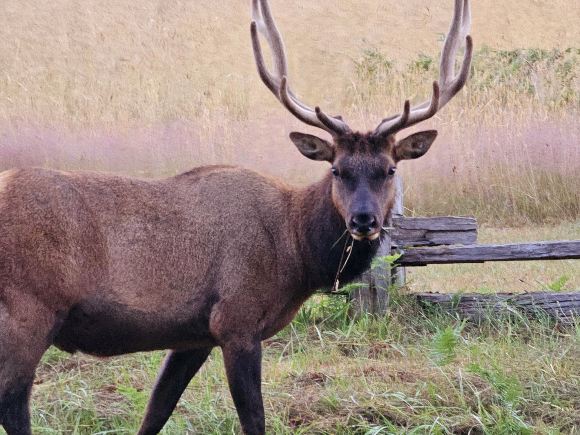
Last year was another jam packed year with several really cool trips! The year started off with my first ever trip to Mexico, tagging along with the Sidekick. Then there was a short solo weekend trip to Pinnacles National Park in CA. Spring Break saw the Sidekick and I checking out The US Virgin Islands National Park in St. John. In the summer, the Sidekick and I visited Juneau, AK and nearby Glacier Bay National Park, Sequoia and Kings Canyon National Parks in California, and I took a solo trip to Northern California to check out Lassen Volcanic and Redwood National Parks. The final trip of the year was to Texas to see the annular eclipse. Here are some of my favorite pictures of each trip!
Ixtapa, Mexico: South of the Border Volleyball Vacations
Cool rocks off shore in Ixtapa
The beach strip in Ixtapa.
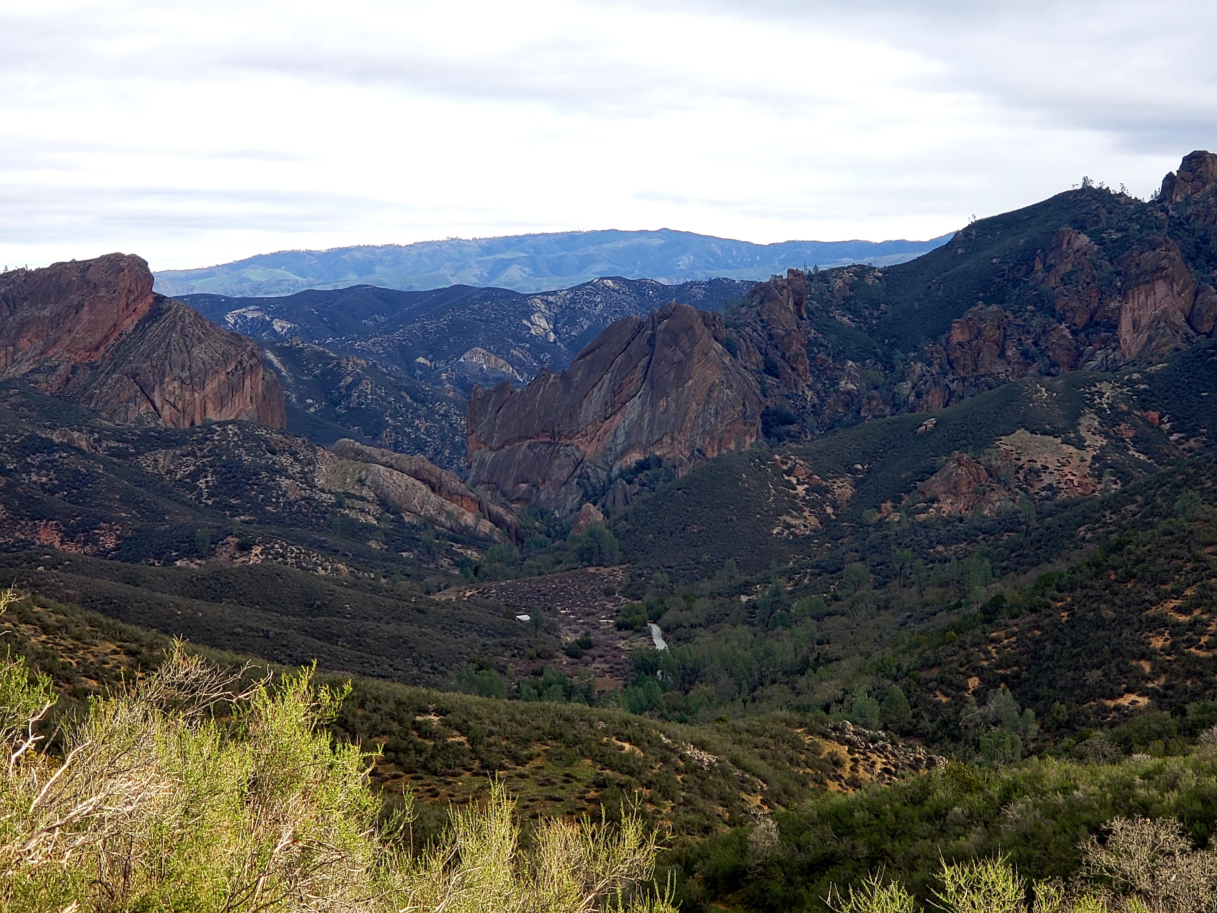
Pinnacles National Park, CA
Bear Gulch Reservoir.
This is a cool view of several fault lines running through Pinnacles. The San Andreas is up at the top. I only know this because of the sign here! Otherwise, I can’t tell a fault from a cliff here!
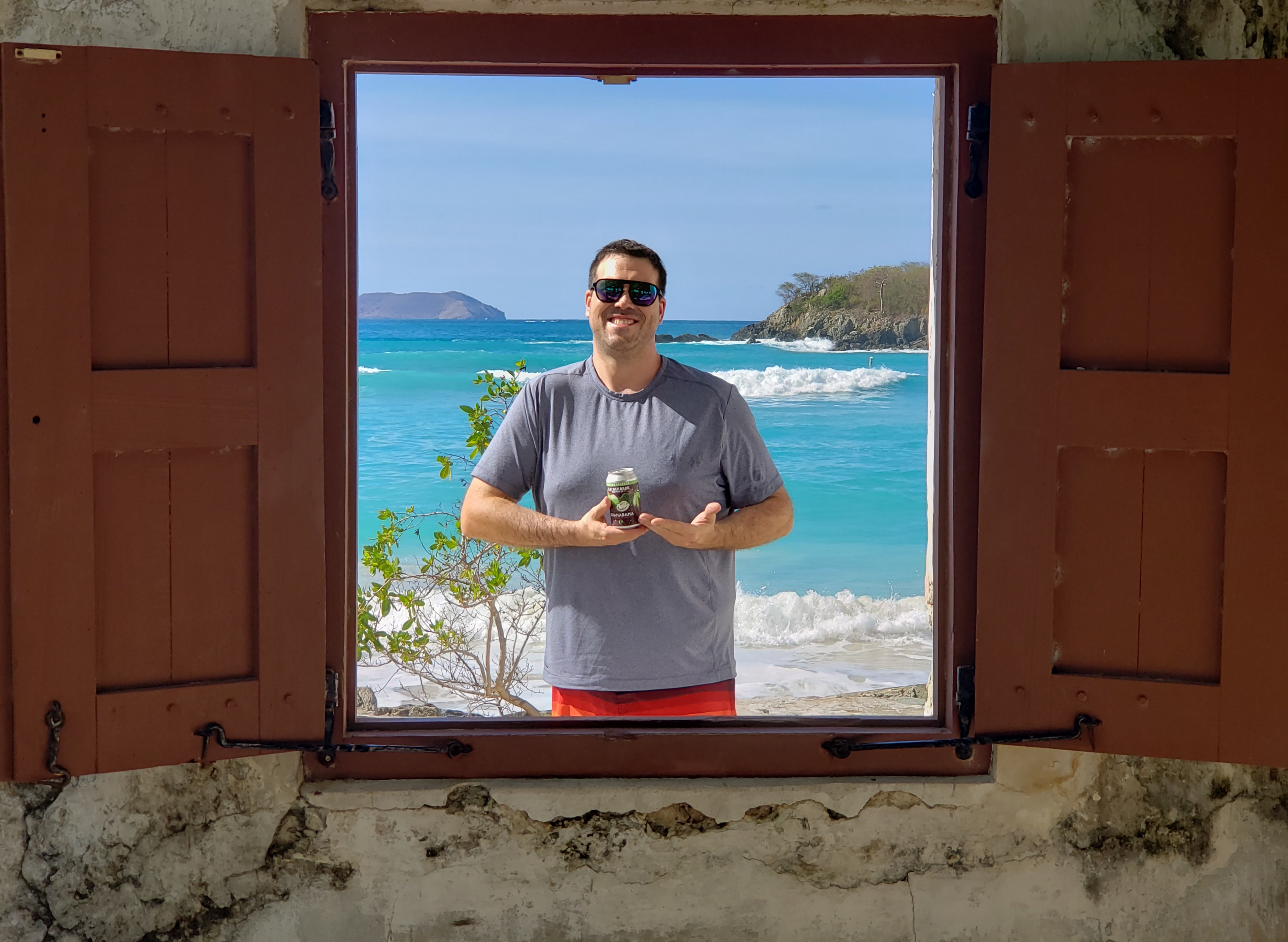
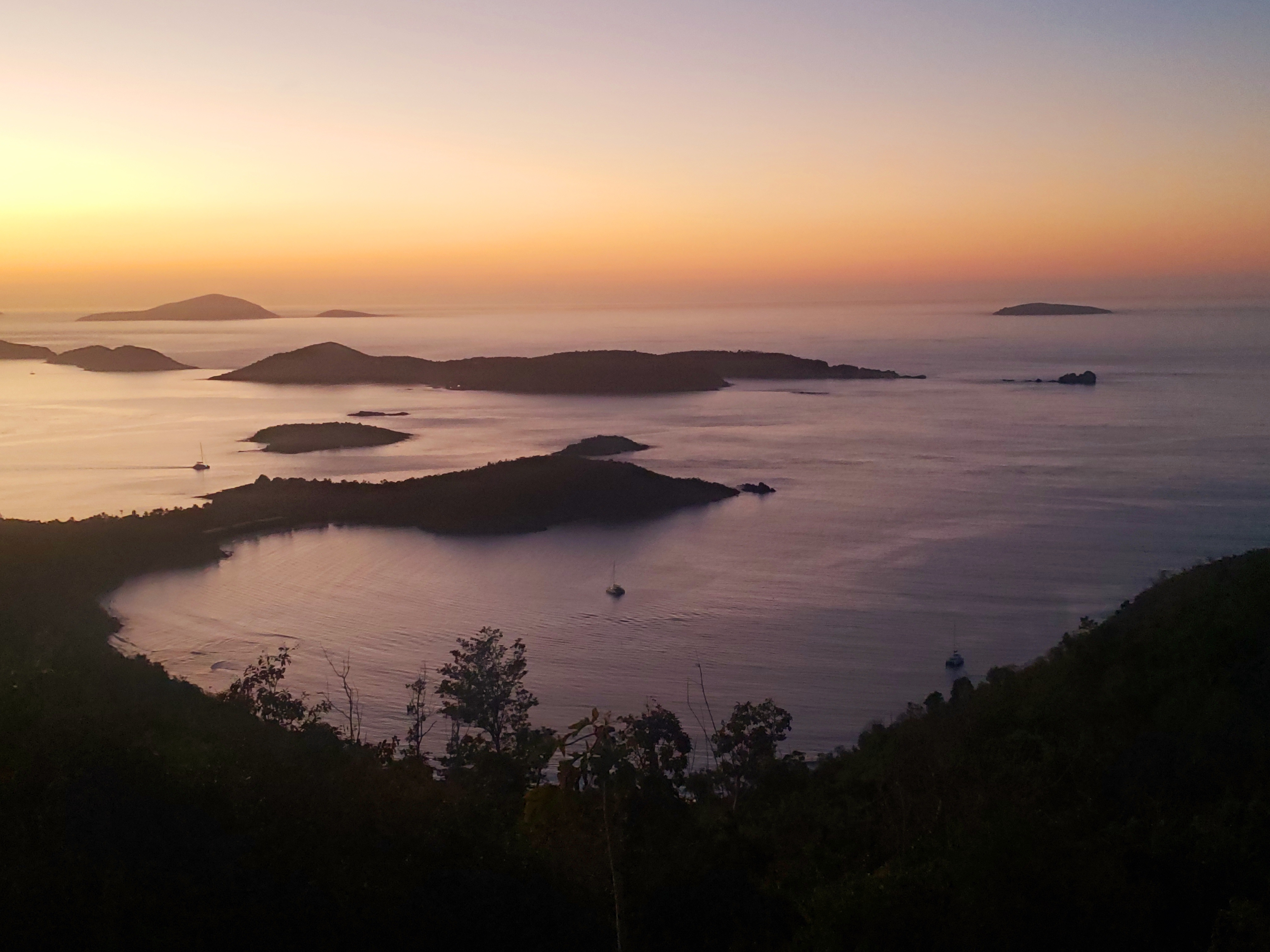
Puerto Rico, St. Thomas, St. John, and Virgin Islands National Park
Cool photo spot in Cinnamon Bay.
View over Hawksnest Bay.
Mary Creek.
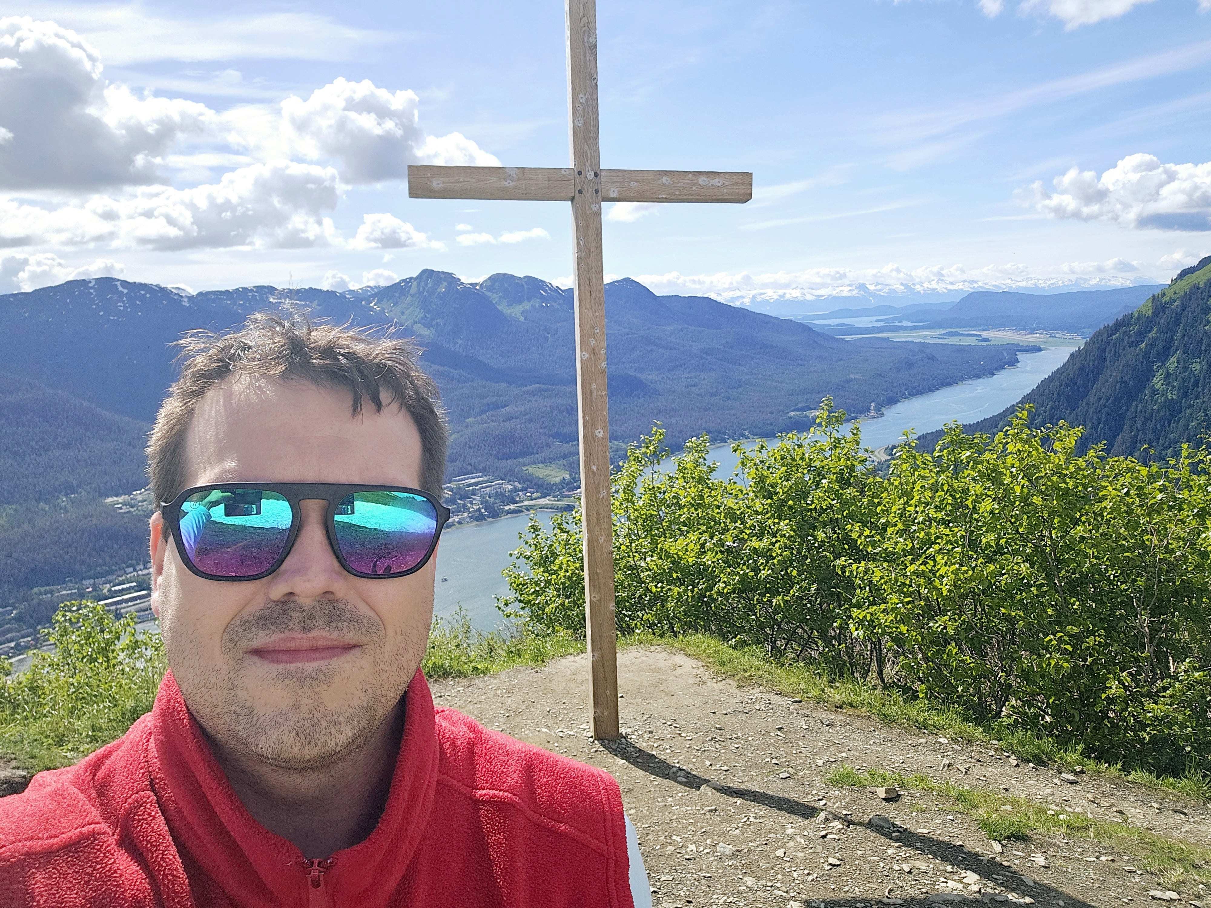
Juneau and Glacier Bay National Park, AK
Nolans Cross, on the Mt. Roberts trail, overlooking Juneau and Douglas.
Downtown Juneau, seen from Douglas.
Mt. Fairweather, 7th tallest mountain in the US at 15,325 feet. This is a mountain that is hard to see, but what a beautiful, clear day! This is from the Gustavus area of the national park.
Sequoia and Kings Canyon National Park, and Hermosa Beach, CA
General Grant in Kings Canyon.
Cool photo op inside a felled sequoia in Kings Canyon.
Drive through tree in Sequoia.
Manhattan Beach, with volleyball courts as far as the eye can see!
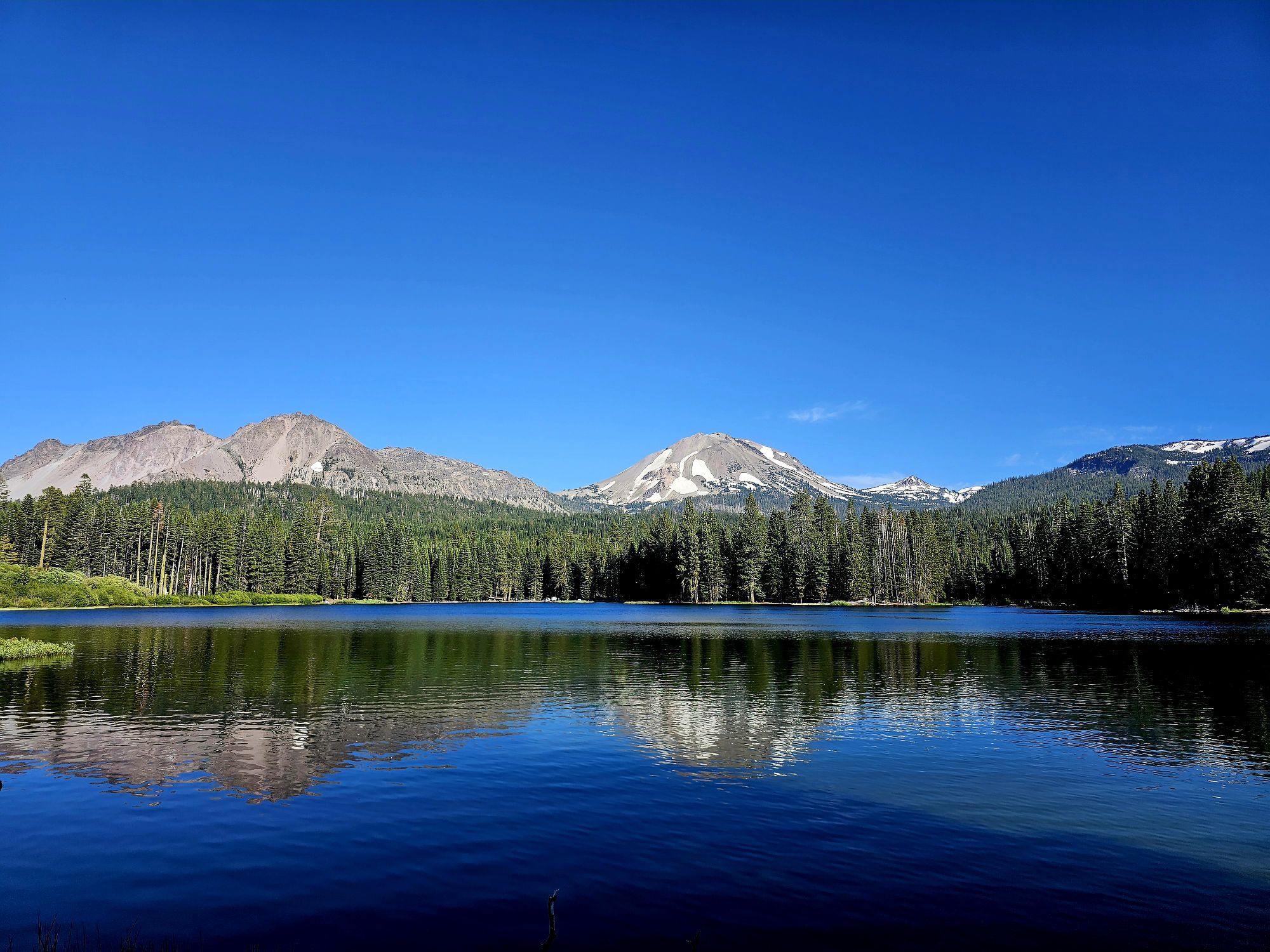
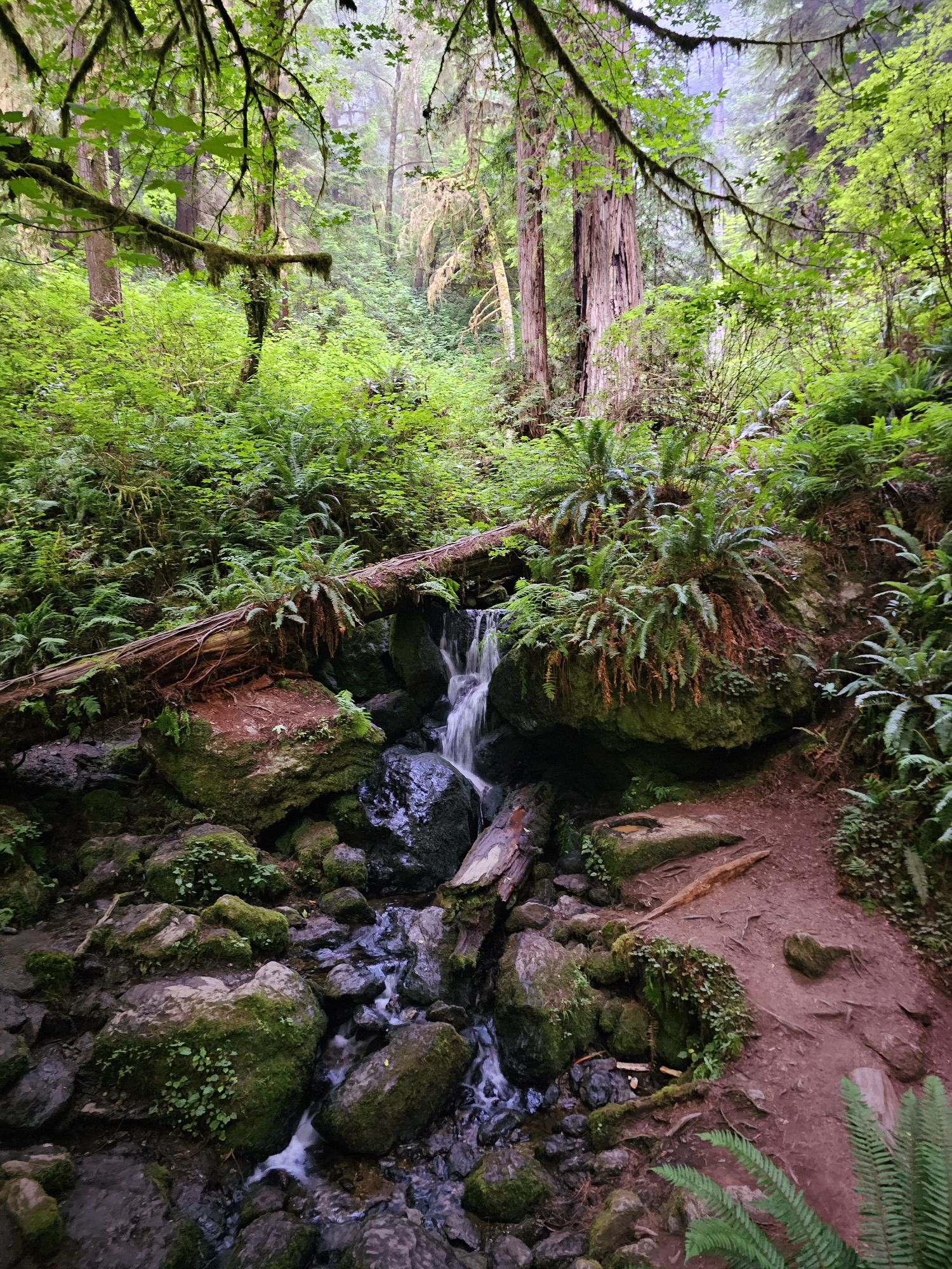
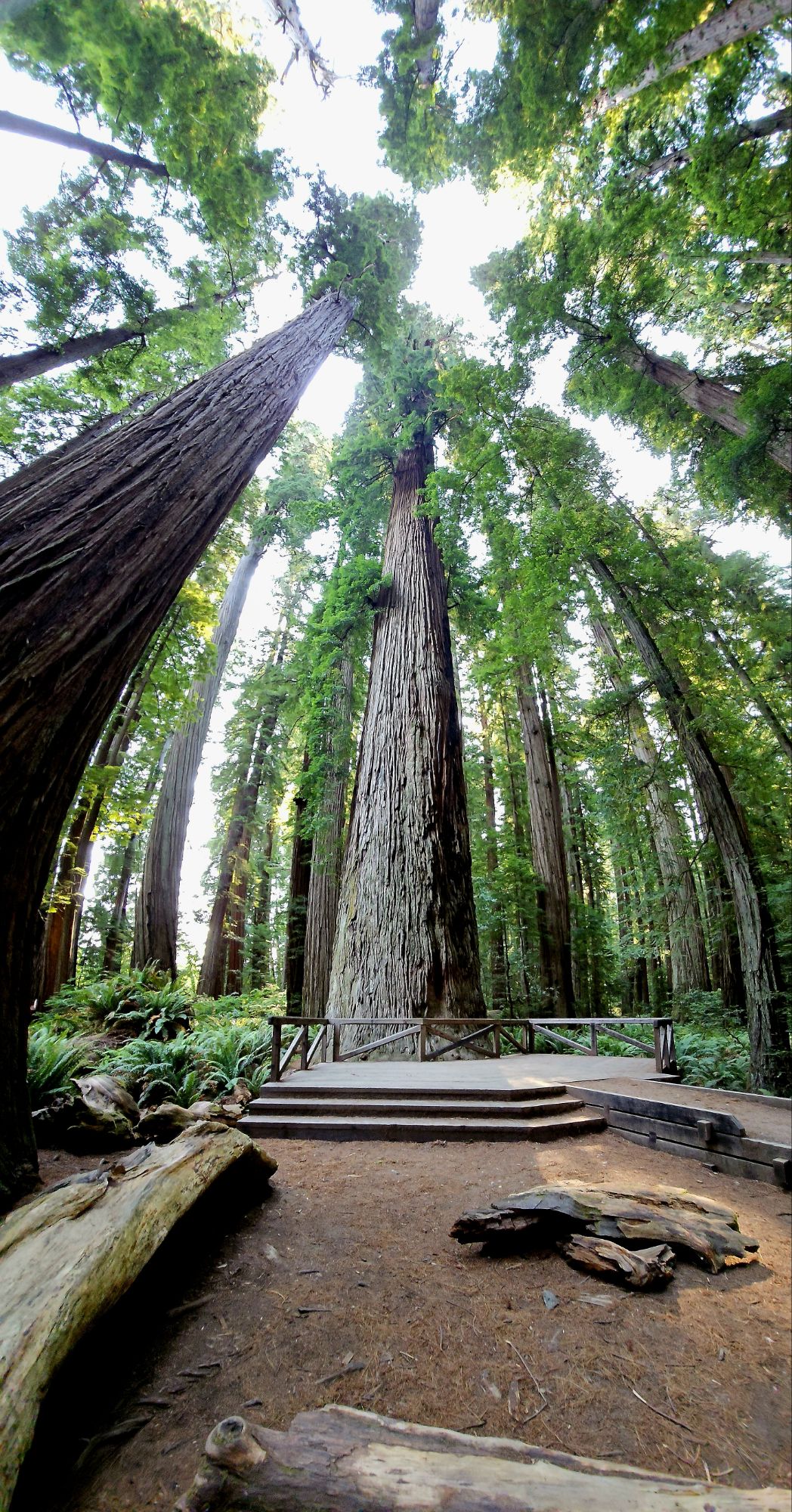
Lassen Volcanic and Redwood National Parks, CA
Lake Helen in Lassen.
Cinder Cone in Lassen.
Lassen Peak.
Whiskeytown Lake.
Trillium Falls in Redwood National Park.
In Redwood National Park
Klamath Beach.
A tall redwood in Jedediah Smith State Park.
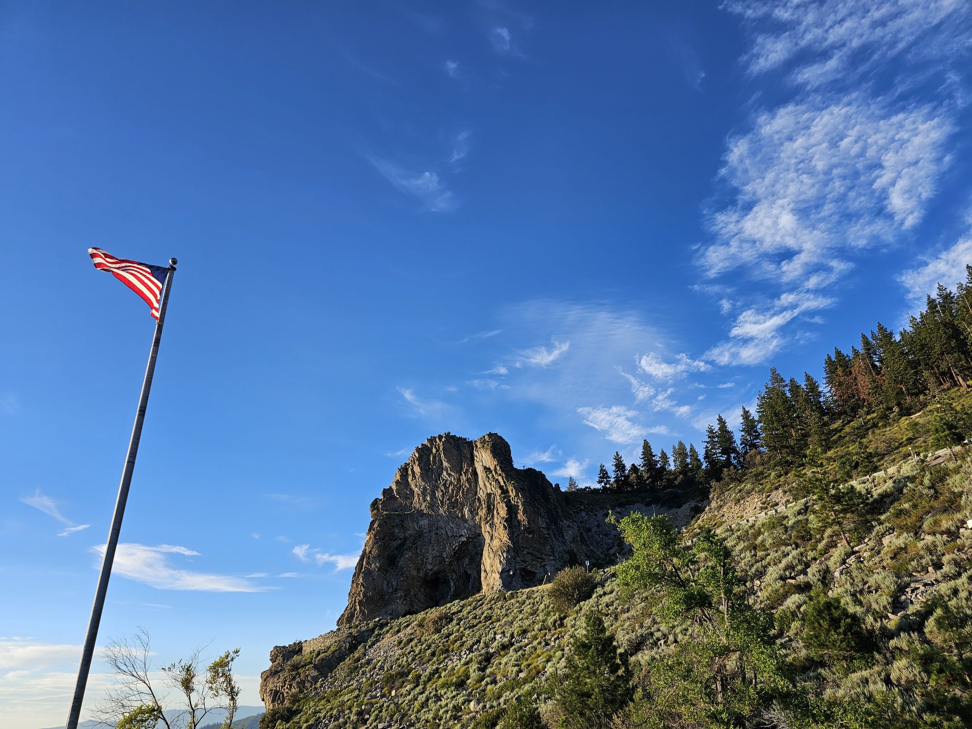
Cave Rock, Lake Tahoe
Sunset over Lake Tahoe.
Texas Annular Eclipse
Good vibes and great travels to 2024! Thanks for taking a look and following!
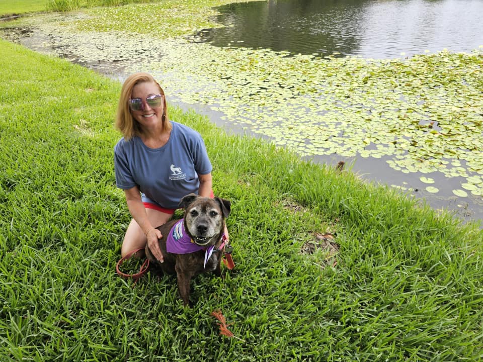
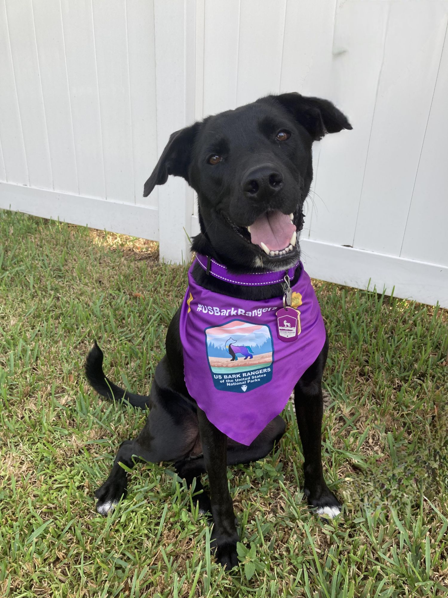
Hey Adventurers, the previous post was in honor of my much missed Bark Ranger Bella. Now, I am very excited to introduce Bark Ranger Miss Maisy Daisy, aka Wiggle Butt, and Wiggle Worm.
Bella passed in August. I wasn’t entirely sure I was ready to rescue so soon, but the house was empty and quiet. In mid-October I waited in a room at Pet Pal Animal Shelter in St. Petersburg, FL. Maisy was named Katie and when she was brought in, it was pretty clear the dog was coming home with me! She had been at that shelter for 7 months after being returned from her first adoption. I cannot fathom why she was returned but I am glad I got the chance to save her! She actually just turned 2, a few days before my birthday!
We are now 3 months together and she is the sweetest space invader! I renamed her Maisy right away. I like southern names for dogs for some reason: Sadie Lou, Bella Brown, and Miss Maisy Daisy! She made herself right at home immediately, and honestly, I feel like she must have known she was home because she didn’t seem to go through any of the stages of adoption. Maisy has big shoes to fill, but she’s her own dog, she’s awesome, and we are going to have great adventures together!
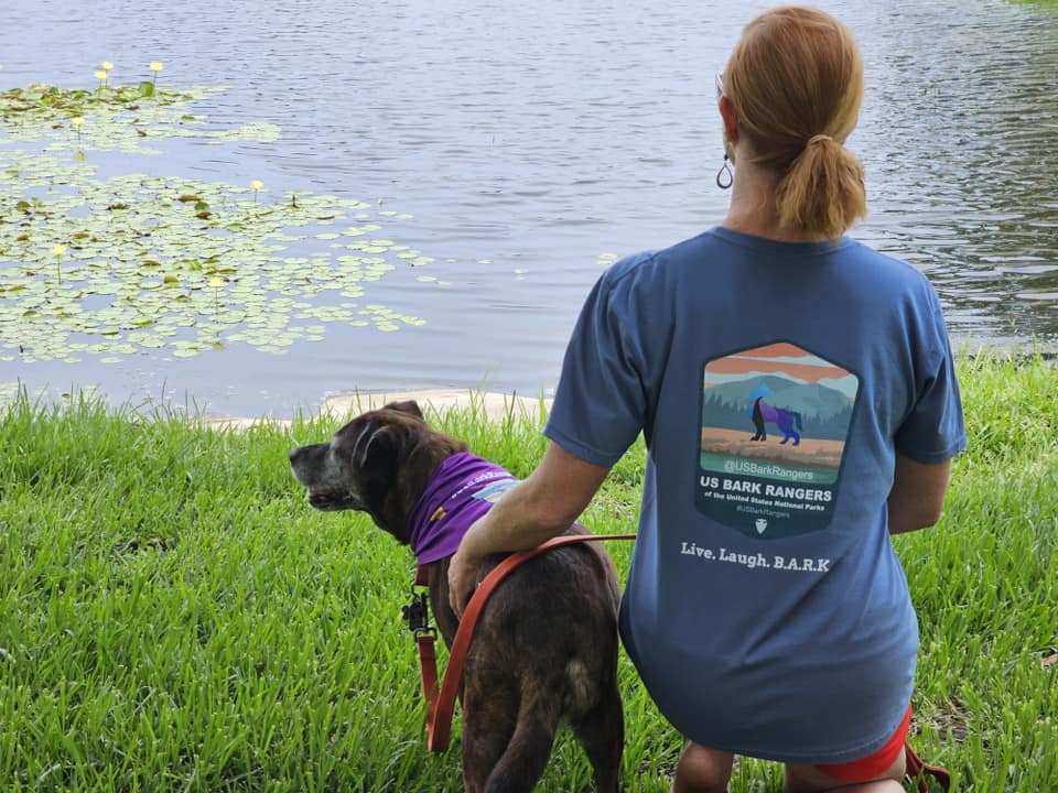
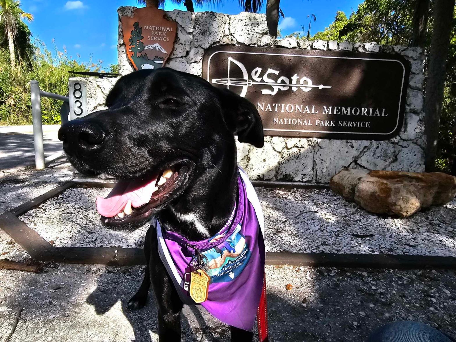
We have only had one opportunity for Bark Ranger stuff so far, so that is what I will be sharing! A couple weeks ago, Miss Maisy cut her nails in the Bark Ranger Program at De Soto National Memorial. This is the closest unit of the NPS to me, and only about 45 minutes away. This was my 3rd visit here, and somewhere in the page I already talk about the place, so I am mostly just going to post some pics of Bark Ranger Maisy! But in a nutshell this memorial marks the spot that Spanish Conquistador Hernando de Soto made landfall in the Tampa Bay Area in 1539 before pillaging his way through Florida and the Southeast. It’s a nice little park for sure and a good spot for Miss Maisy’s first adventure!
I am excited to share more Bark Ranger Adventurers with her to everyone!
Hey there Adventurers, this is going to be a personal post, which I haven’t done, but I wanted to share and move on. Part of why I was so far behind on posting this fall was because my old girl Bark Ranger Bella started having walking issues back in August, which is also right when I get back into a work routine. The last couple weeks of August we started cold laser therapy sessions on her back and hips. The therapy sessions were pricey, about 200 bucks a session for 8 sessions, done every other day. I have to say, she definitely improved, so it was money well spent, and I would recommend it. Other than that, she was generally a very healthy dog, right up until she wasn’t. She had finished her last session of laser therapy on Saturday morning, and Sunday evening she was gone, probably from a stroke. Because she had been a healthy girl, it was unexpected. I rescued her in April of 2011 when she was an adult dog, between 1 and 3 at the time. By the time August 2023 rolled around she was between 13.5 and 15.5, but that’s not really any comfort.
Bella was a special dog. She was incredibly loyal and never far away. The first day I brought her home she was a couch and bed dog. I didn’t particularly want a dog in the bed, but shut doors triggered my rotten beagle Sadie. (Sadie passed away in 2020 and was a a super sweet and beautiful beagle…but naughty was her middle name!) Bella would get into my bed if the bedroom door was open, and Sadie would roo, whine, and scratch at the door if it were closed. Mind you Sadie would then proceed to sleep on the couch in the living room…So there we were. Bella was the kind of dog you could take anywhere. She had a great temperament, and for the most part she could even be an off leash dog. She didn’t get into things, she loved car rides and barked her head off out the window! She loved her treats and would not hesitate to tell me when she wanted one. I loved playing hide and seek with her. She might not have been the brightest but whenever she finally found me, she was excited but also gave me the business for hiding from her! She was not an overly affectionate dog, but I could not leave a room or leave her sight without her following closely behind. She is very missed and will always be loved. I am honored to have been her dad. And that’s enough sad stuff.
Bella’s lasting legacy will be the Bark Ranger group that the Sidekick and I started. As of this post, the group is now over five thousand members and growing fast! It was summer 2021, Bella and I were roadtripping, and I was looking for national park spots to add to my passport book. I noticed a cool looking spot called Little River Canyon National Preserve in the northeastern nook of Alabama. This was not altogether far off my path, so I made a plan for a stop there. Looking through the park’s website, I noticed in the pet section a blurb about this Bark Ranger thing! I had never heard of this and though it was a definite must do! In addition, another nearby National Monument, Russell Cave, also had a Bark Ranger program, so she got to double up! You can check out my entry on this trip here.
I wish I had more time to do Bark Ranger activities with Bella but these programs did not even start until 2016. Judging by the growth and responses of new members to our group, many are unaware of this pawesome activity! Hopefully our group will help lead to more awesome memories made with dog parents and their Bark Rangers, exploring the country’s national park sites! Bella’s only big National Park, was Hot Springs, which we did get to hike together. In addition, we made a trip down to Big Cypress National Preserve, near the Everglades, a long road trip up north which included several NPS unit stops in Tennessee and Georgia, and her last trip was a short one to Ft. Caroline, in the Jacksonville area, which unfortunately was when the very first sign of a back problem crept up. While I could never pay tribute enough to my Bella, I do want to post some of her best Bark Ranger pictures.
This was the very first Bark Ranger tag that she earned, at Little River Canyon National Preserve in Alabama.
This one is in Macon, GA.
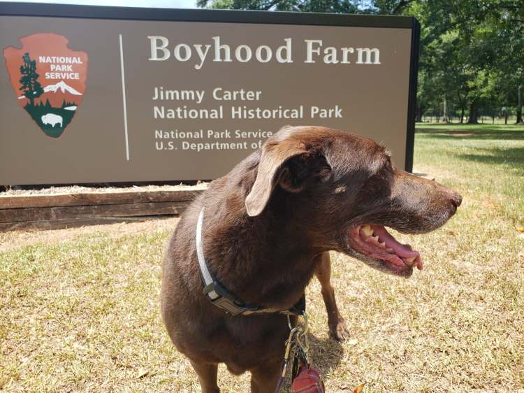
One part of the Jimmy Carter National Historical Site, Plains, GA.
Also in Jimmy Carter National Historical SIte.
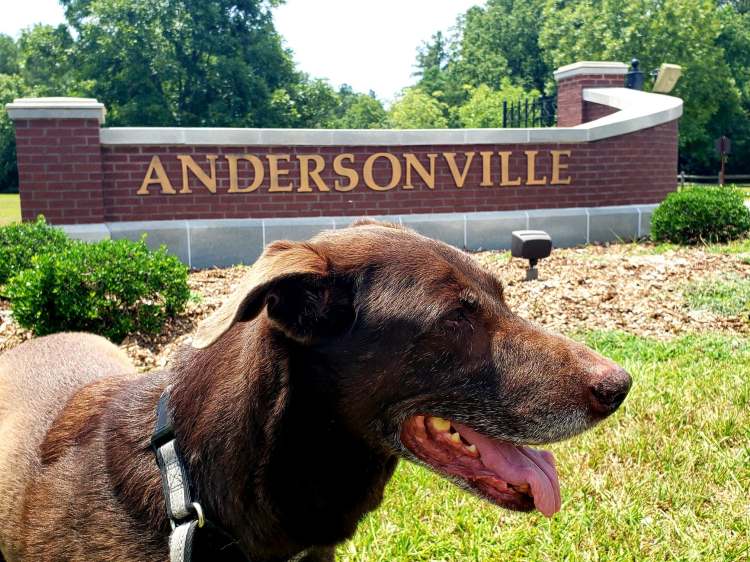
Andersonville National Historic Site, GA.
This is Cloudland Canyon, a Georgia State Park near Chattanooga, TN.
Also in Cloudland Canyon.
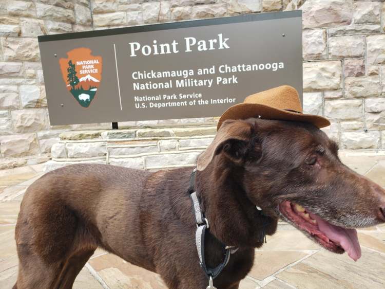
Not the best picture, but this is Point Park at the top of Lookout Mountain in Chattanooga, TN.
This is also in Point Park.
This is in Stones River National Battlefield, Murfreesboro, TN.
Also in Stones River.
In Cedar Key, Florida. Not a Bark Ranger trip, but i like it!
This was the only picture that we got together in with a sign. We actually were going to Big Cypress National Preserve but stumbled upon this little nook of the Everglades nearby. This area is on the southwest side of Florida.
On a trail in Hot Springs National Park, Arkansas.