Hey there Adventurers! I wrapped up my 2023 travels a little on the early side. The last trip of the year was to check out the total annular eclipse that crossed the United States on Saturday, October 14. The Sidekick and I made a long weekend of the event in central Texas!
The eclipse started in the US in Oregon and exited in southern Texas. The eclipse actually crossed several national parks, but those were all out west, and earlier in the day. Texas was not really on my list of places I had a desire to visit, but for this eclipse, Texas was ideal: close nonstop flight and a midday event. A note, first, about this eclipse. An annular eclipse is one where the moon is closer to the earth, meaning the sun is not completely covered. These eclipses are called “ring of fire” eclipses due to this fact: the moon is smaller than the disk of the sun, leaving a fiery edge around the entire moon. This type of eclipse happens more often than a total eclipse, though they are still a rare occurrence to witness on any given spot on the Earth. These eclipses also do not cause the darkness that is experienced with a total eclipse and you absolutely must use glasses and filters for your cameras throughout the entirety of the eclipse. I was able to see the great total eclipse in 2017, so I have now experienced both! I thought I had made a post about that one, but apparently I did not. I might do one eventually if I can dig up anything to post with!
The path of the eclipse.
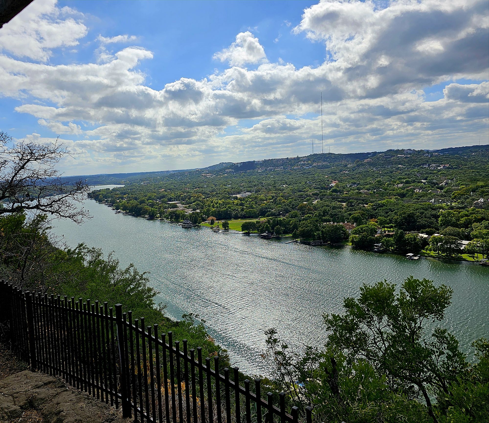
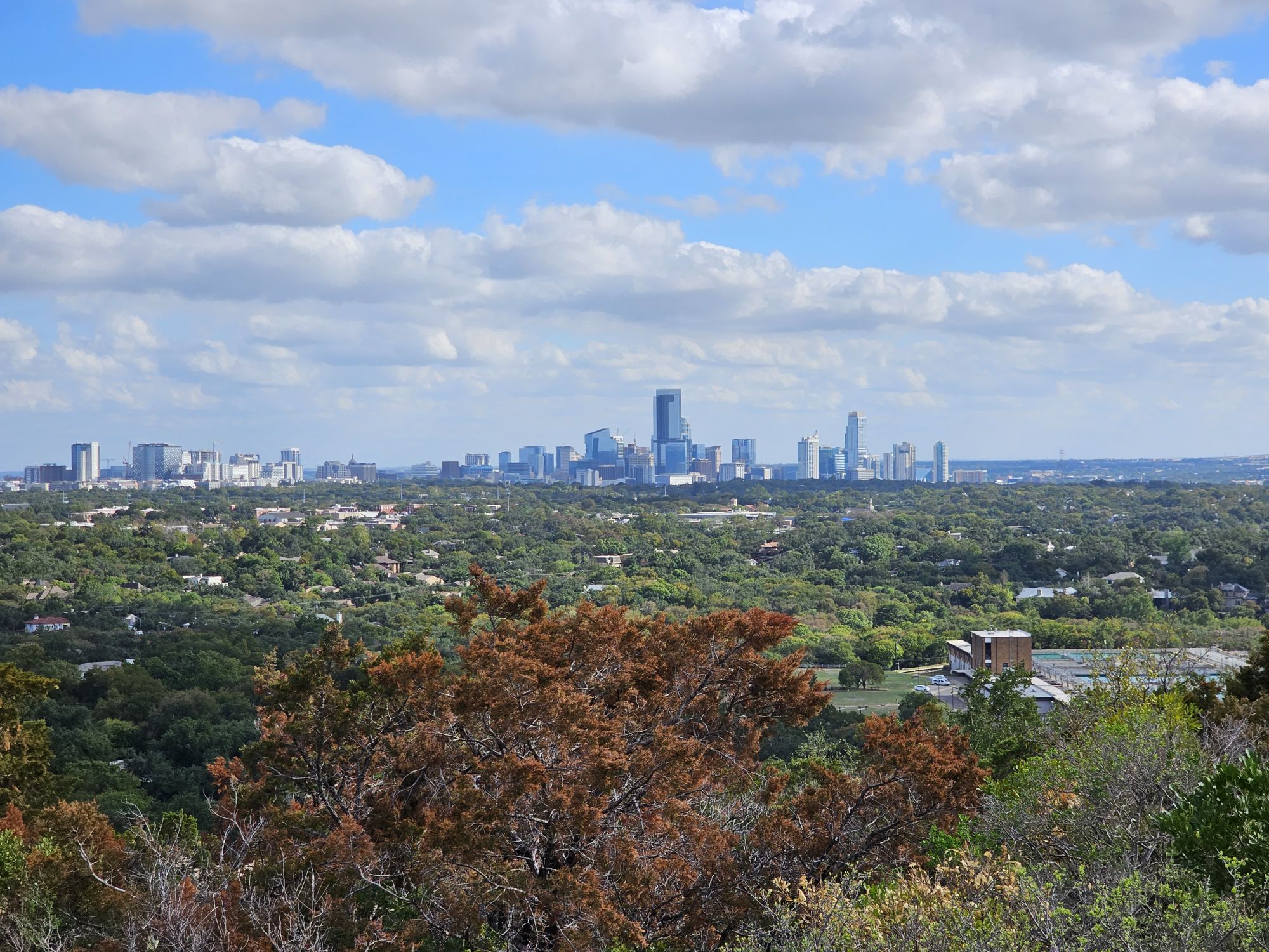
We flew into Austin and hung out there for the day and night. We got in pretty early so we started out by a visiting scenic overlook on the outside of town called Mt. Bonnell. This is the highest spot in the city and overlooks the Colorado River about 700 feet below. The other direction gives nice views of downtown Austin. Austin is a really fun town, but it’s very loud. Our hotel was in the heart of downtown and the music was going full blast into the wee hours of the night. The upside is there is great jazz to be found! The Elephant Room is a great underground club with some awesome live jazz and should be checked out! Austin also has a famous downtown bridge known as the Bat Bridge. Technically, it’s Congress Ave Bridge, but Bat Bridge will do. During part of the year the bats will all come out from under the bridge around sunrise and put on a shown for the humans. October is part of their bridge season, but, unfortunately they no showed for us :/.
View overlooking the Colorado River from Mt. Bonnell.
And, this is the view the other direction toward downtown Austin. Austin is much larger than I expected.
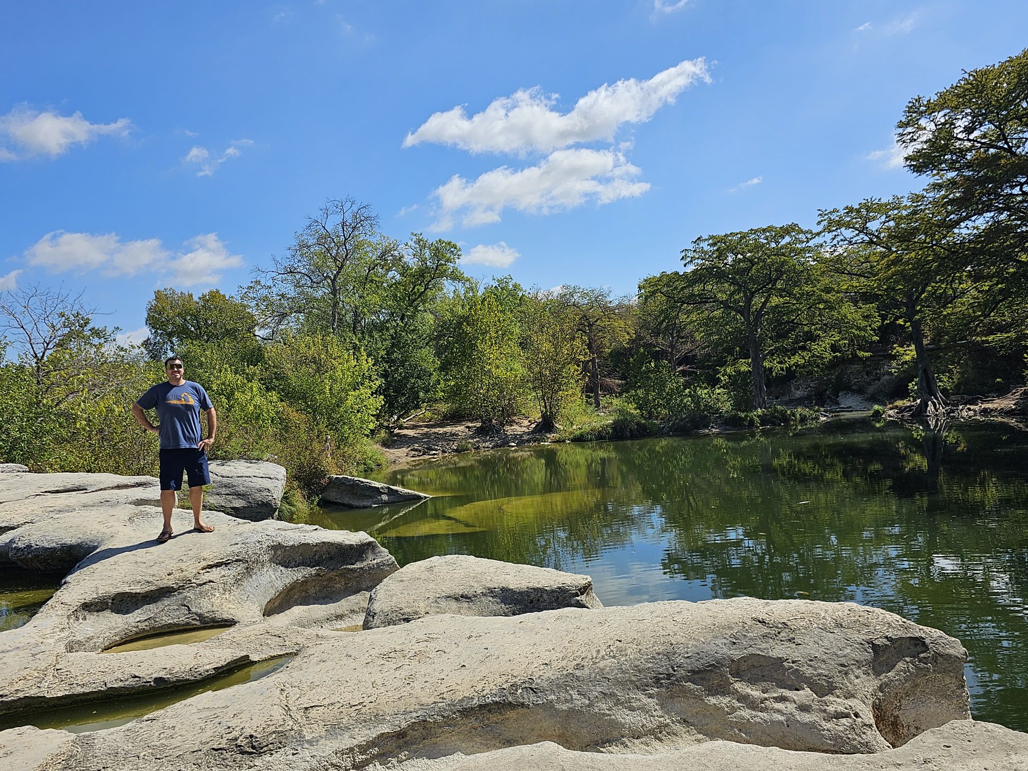
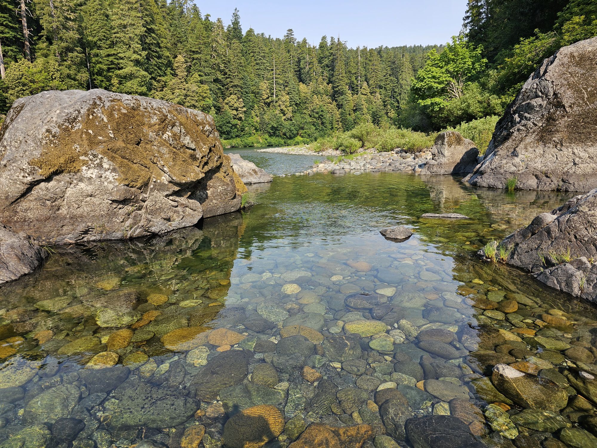
Austin was not in the path of totality, but San Antonio was, so the next morning we packed up and headed south. En route, we stopped by a Texas State Park called McKinney Falls State Park. We were just looking to see the dog/Bark Ranger situation at the Texas parks. This area is within Austin so it’s a nice, easily accessible spot for the city dwellers. There are supposedly some waterfalls here, but Texas had a very dry 2023, so there was very little water, and no falls to be found. After looking around a bit we continued on our way.
This place is probably a ton more scenic and interesting if there were more water. Where I am standing is where there is supposed to be a waterfall, but obviously the place is so dry that the water off to your left, my right, is not sufficient to make it over the ledge into that lake.
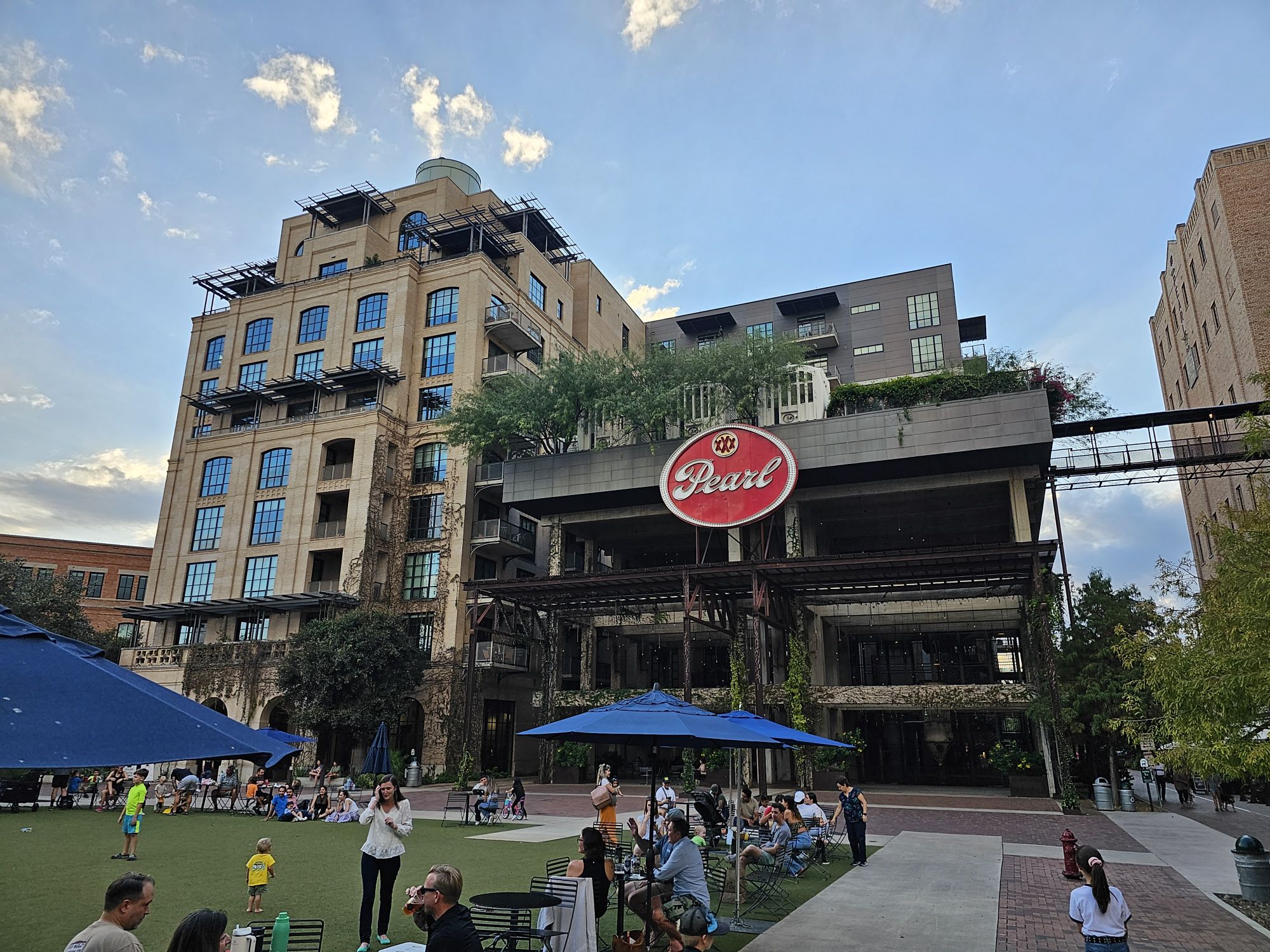
San Antonio is home to the San Antonio Missions National Historical Park. This NPS unit is a trail of old Spanish missions starting from outside downtown and ending at the famous Alamo in the heart of downtown San Antonio. San Antonio is also home to the Pearl Brewery. This is where we chose to watch the eclipse. The Brewery is defunct, but the entire complex has been repurposed into restaurants, a hotel, and a market space. The whole idea is very nicely done and a pretty big hotspot! More importantly, it has a large open courtyard with unimpeded views of the midday sky.
This is the Pearl Brewery.
We managed to set up a spot at the brwery a couple hours prior to the big event. At times the clouds threatened, but it ended up being a perfect spot and we got a perfect view of the eclipse! I had my phone with a solar filter and a tripod to take some shots. There is another big total eclipse in April, 2024, that will also be passing right through here! We are planning on coming back to Texas (kinda in the same area as well!) and this presented a good opportunity to practice with this set up. Anyway, the eclipse began around 10:30 or so and totality was just shy of noon. We viewed the great celestial show and then when it was over we packed up and headed to the missions.
I took all my eclipse photos with my Samsung Galaxy S23 Ultra on its fancy moon zoom, with a solar filter, and a stable tripod. I used the pen to actually snap the pictures. This was the beginning and you can see the clouds.
About half way to totality here.
Almost there….
And, totality!
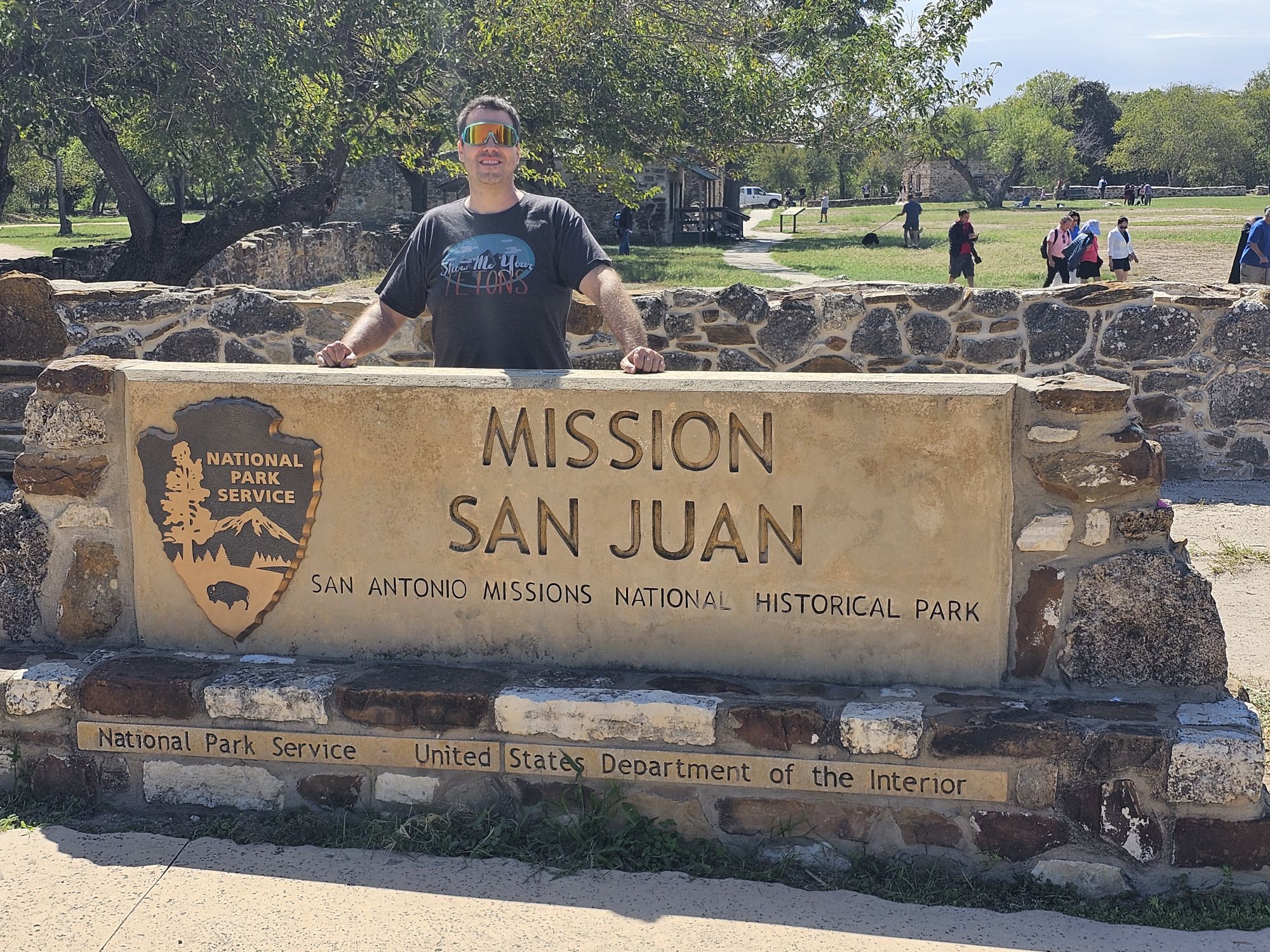
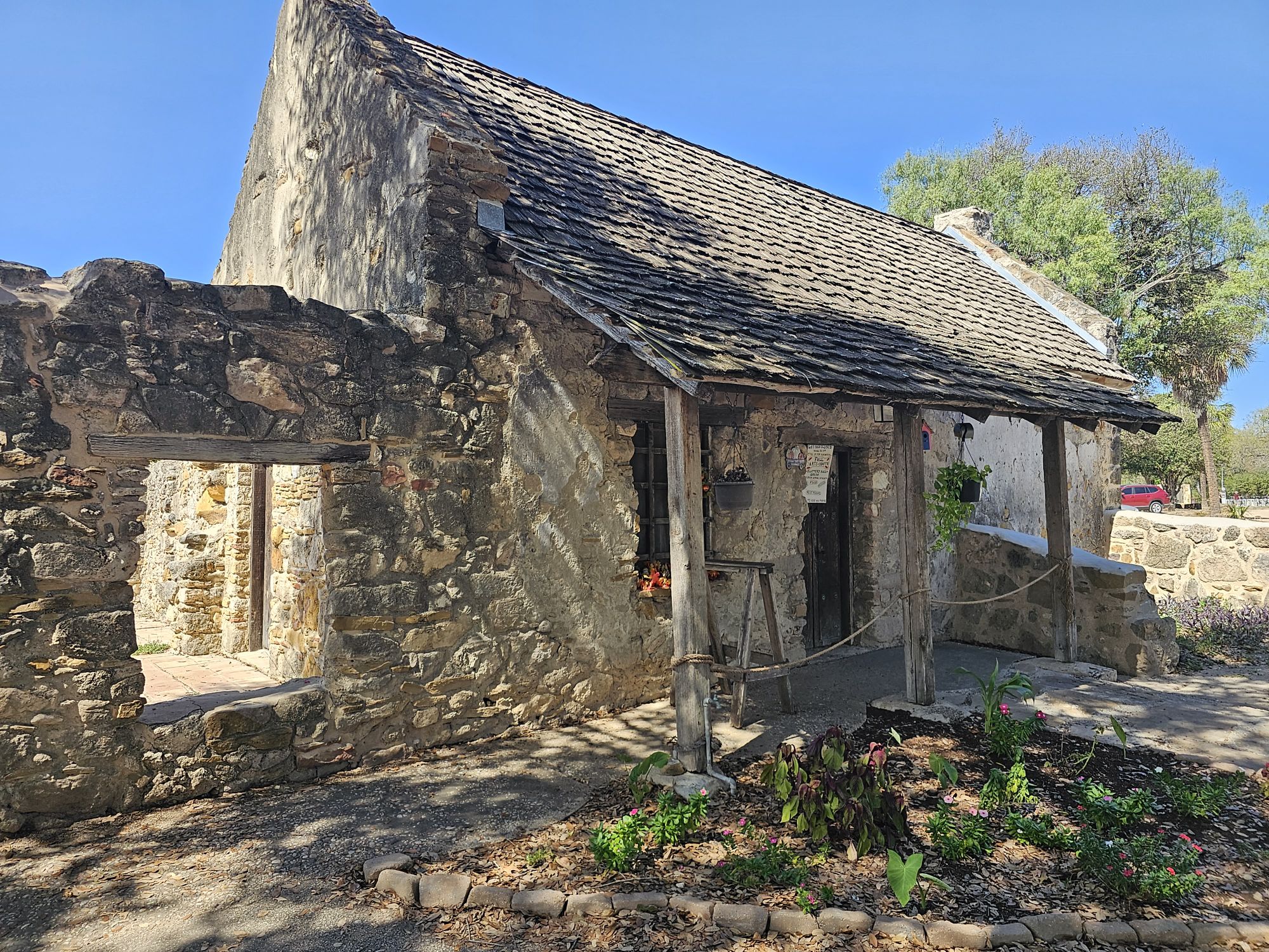
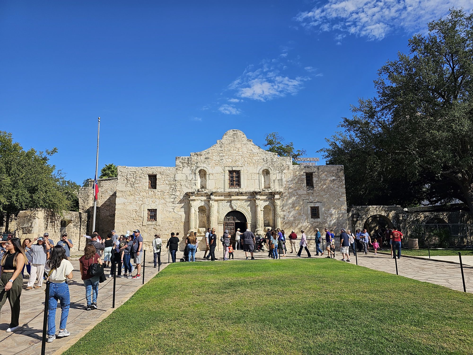
The visit to the missions was more of a short, just-stop-and-take-a-look-around visit. This site has a Bark Ranger program, so we wanted to stop by and talk Bark Ranger to the rangers and try to get some tags to take home. We started at Mission San Juan, the southern part of the unit. This area is a collection of smaller structures, in addition to the church, which is also on the small side. This is where we accomplished our Bark Ranger business. Next we headed up the road to where the visitor center is located, at Mission San Jose. This is a much larger church. We didn’t stay here very long as we had an hour and half or so drive to our overnight location and we still wanted to check out the Alamo. The Alamo was surprising to me. It is quite small and it is right smack dab in the middle of downtown. Also, unless I am mistaken, the site, while a component of the Spanish Missions, is not a part of the national park service. There is a ticket situation we didn’t want to fuss with and the area was super crowded so we headed on our way.
Required sign picture, taken by the SIdekick.
Mission San Juan.
The inside of Mission San Juan.
One of the other intact structures in the San Juan area.
I forgot to stand next to this one!
The Alamo.
Our evening stay was in a small town called Wimberley. This town is somewhat out in the middle of nowhere about halfway between San Antonio and Austin. I only mention it because it is really quite a neat little place. Despite its small size and relative remoteness, it is surprisingly artsy with some really good restaurant and shopping options. There are also a lot of fun outdoor activities in the area. We were not here long enough for those experiences, but the places we had thought about checking out were mostly water features that the locals told us were not worth the effort due to the extremely dry conditions. They included Blue Hole Regional Park, Jacobs Well, and Cypress Falls. Maybe worth a visit if conditions are better! The following morning we got up and stopped at a really nice winery/brewery, Wimberley Valley Winery This is a great spot! In addition to wine, they also operate Lone Man Mountain Brewing Company. If you need some grub, they have a food truck that had some tasty pizza. And on top of all that they have donkeys and ponies you can feed! With our flight later that afternoon, this trip was a wrap with a successful eclipse viewing and a nice, surprising taste of a new area of the country here in the Austin/San Antonio corridor. Keeping fingers crossed for April, we will be traveling to Austin again to check out the total eclipse in Waco from the Waco Mammoth National Monument!
So, this trip ended the 2023 travel year. Upcoming, I have a couple Bark Ranger related posts and my 2023 round up. The 2024 travel year is looking exceptionally busy! The Sidekick and I have trips planned to Joshua Trip and Death Valley in March, the aforementioned total eclipse trip in April, a wedding to attend that will couple with a visit to Great Smoky Mountains National Park in May, Glacier National Park in June/July, and I am embarking on a solo trip to to Wrangell-St. Elias National Park in Alaska in July, so stay tuned!
National Park Count: 38 I bet you expected a super tall tree picture above here!
Hey there Adventurers! After I left Lassen Volcanic National Park, I made a beeline for the Northern California coast to visit the Redwood National and State Parks! This was part of my second July California trip which also saw stops at Lassen Volcanic National Park, as well as Whiskeytown National Recreation Area and Lake Tahoe.
July was not only the month of California, but also the month of VERY LARGE trees! This trip was my first time visiting Northern California and that area is definitely an experience for a midwesterner transplanted to Florida! Leaving the Redding, CA area there are only 2 options to reach the Giant Redwoods. The route due west out of town, the one I took, leads through a canyon following the Trinity River and then an offshoot following a creek that eventually found me driving through a wildfire (wtf), before reaching the coast. This route starts at a higher elevation and temperature before getting to sea level and the very cool southern end of the redwood coast. If you were looking to reach the northern part of the park you would have to depart Redding due north, drive pretty far up into Oregon and then drop south down to the redwoods. The Oregon route is a about an hour longer and probably is a better route if you want to make stops. The western route I took is remote with limited options for stops and services, and there is very little cell signal. Three hours later I reached the coast at Arcata, CA. Just a wee south of there is Eureka, CA which is the home of Lost Coast Brewery. Their beers actually make it to Florida, so I made the diversion there for some brews and a delicious cup of chowder. The weather on the coast here is drastically different than where I was a few hours earlier, so a warm cup of chowder was perfect in the now foggy, 60 degree weather! Lost Coast is a pretty solid brewery! The chowder was great and so was the beer. In Florida, we mainly get their Tangerine Ale. That one is ok, but the other beers at their home site were much better!
The Redwood National and State Parks has an interesting history. You might notice from the name that it is a mix of different parks. There is a complicated history in this area. When gold miners descended on California they also found the giant redwood trees. The trees each produced a tremendous amount of wood and the wood itself is very durable and easy to work with. As you might imagine, the humans around that time over-logged and conservation groups eventually got the state to set aside groves of Redwoods for protection in the 1910s. These parks are the ones named as State Parks in the area. As logging technology improved, the rate of logging only increased, to the point that only 10 percent of the forest remained by the 1960s, when the U.S. government started to get interested and created Redwood National Park in 1968. The government did not acquire all of the land containing the trees at this point and the creation of the park was met with some concerns from locals since logging was their livelihood. However, other public pressure eventually led to the government buying up a large portion of the remaining land from logging companies. Today only FIVE PERCENT of the original forest remains and most of that land is protected now. Five. Percent. All that being said, the remaining 5 percent of the forest is spectacular!
Biggest park entrance sign I have seen!
I had arranged to camp in someone’s open garage in a town called Klamath for the next two evenings. The drive from Arcata to Klamath is actually the Pacific Coast Highway (as an interesting aside I was on this same highway in SoCal just a few weeks prior!) and runs along the coast for a while before turning in through the entrance of the park. There are some views of the Pacific and some large lagoons along this stretch. Right around here is the obligatory sign picture op! After getting my sign picture I entered the park and was greeted by some wildlife in a couple herds of elk! Continuing down the road you find a fork and I was prepared, but you need to be aware that the right side of the fork goes to the same place, but misses the redwoods entirely. The left side is where you want to go. This is the Newton B. Drury scenic parkway. This is an awesome drive though this part of the redwood forest and gives access to many trails. (I actually drove this road 4 times during my brief visit!) I stopped at the visitor center, (discovered that I actually missed the *first* visitor center near the sign), and then was off on my adventure!
Little fella could have found a better spot I think!
Cool animal entrance to the park!
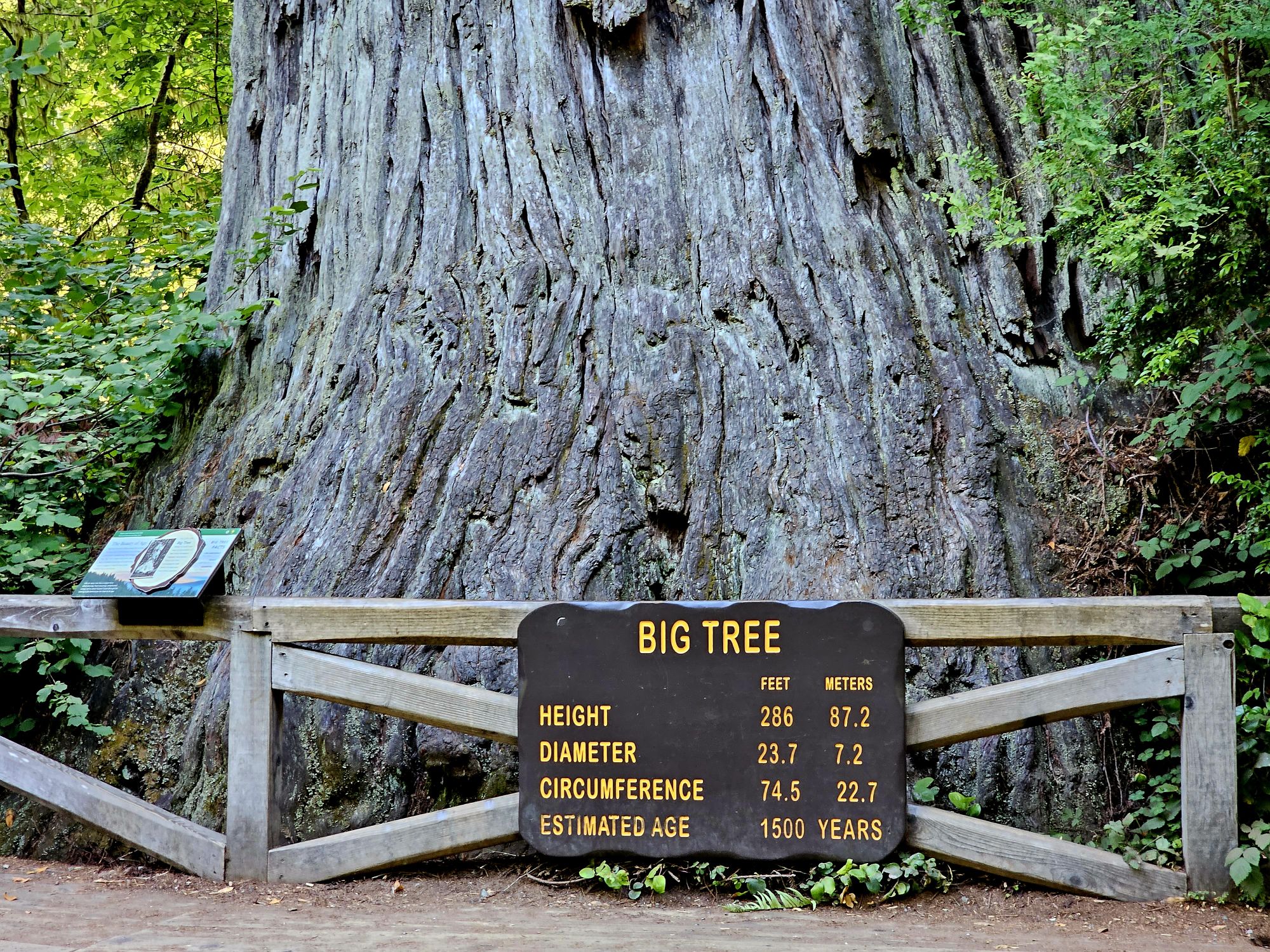
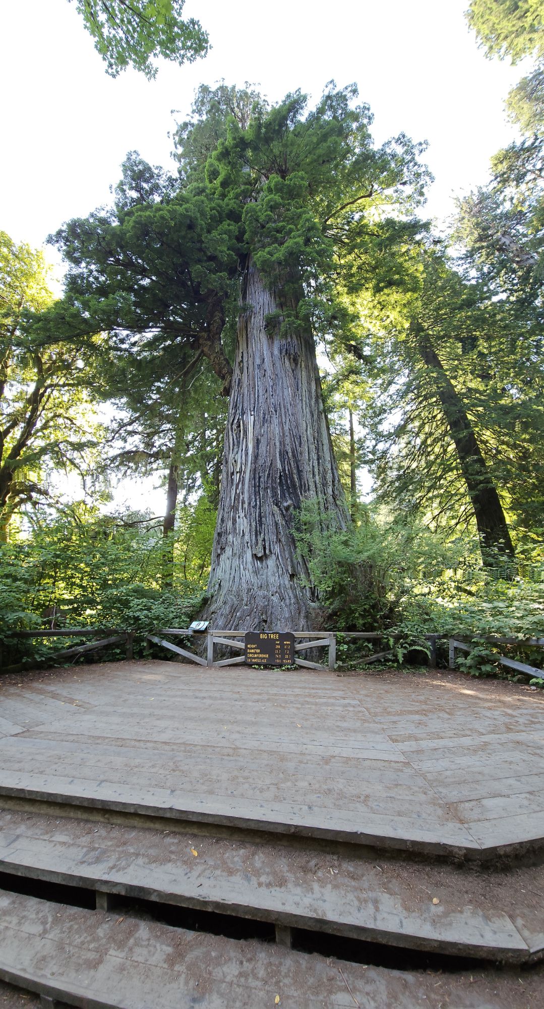
I first stopped at a spot called Big Tree, a very apt name! The tree is accessed by a very short trail that is very accessible and close to a parking lot with a restroom, and the first place you get to see the redwoods up close. If you want to extend the trial, you can. Most of the trails throughout the section of the park off of this road connect. Now a brief comparison and contrast to sequoias. First of all the two trees are very closely related. Sequoias are larger by volume. Redwoods are taller and more slender. Oddly enough redwood bark is more brown colored while sequoia bark is more red colored. Go figure. Sequoias grow more spread out and at high elevation, while redwoods are clustered in a continuous belt of nearly 450 miles long but only 15 miles wide, along the Pacific coast. Both trees have exceptionally small cones, like hilariously small for their size, but the redwood is tiny, about a third the size of a sequoia cone. Redwood trees have the ability to basically create clones of themselves from roots, cut stumps, and even from branches up high. Big Tree actually has one such close growing downward from way up high. I spoke to a park ranger in the area for a while about the trees and the differences between the two. This ranger also threw a bit of shade at Sequoia National Park, which was amusing. I mentioned casually about how they find the tallest trees like Hyperion (this is the tallest known tree in the world at nearly 400 feet but its location in Redwood National park is guarded to protect it). This particular ranger was a bit coy but also mentioned that they do not name trees like “other parks” do because they are trees and don’t need names! Anyway, Big Tree (Which is a name, I might add!) is 286 feet tall, 24 feet around as an average, 74.5 feet around at the base, and is 1500 years old! The other thing I noticed about the redwood area is that these trees are everywhere! In sequoia they were spaced out and only in certain areas, but here the redwoods are everywhere!
Big Tree trunk.
Further back perspective to see the growth hanging down from the left is actually a clone of sorts of the tree.
I’ll let the NPS drop some facts on you.
I left the Big Tree area, and at this point it was actually getting later into the afternoon, so I started in the the direction I needed to go. I found a short trail called Ah Pah. This is a short out and back, only about a half mile. There isn’t much parking and, really, it’s not much of a trail, but I met a ranger on the trail, the only person I saw, and he and I chatted a bit about some other trails to check out. Always talk to the rangers – his suggestions helped me plan the next day!
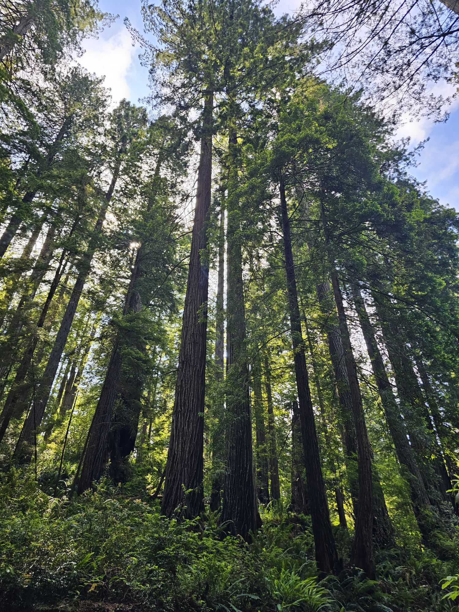
Some of the trees on the Ah Pah trail. Obviously they are towering, but the fact that there are so many of them so close to each other is noteworthy compared to Sequoia.
After returning to the vehicle I decided it was time to go check in at my garage “bnb” in Klamath, just a ways up the road. Leaving the park road you rejoin the Pacific Coast Highway and Klamath is just a short way north. It is a pretty small town, but essentially the only one, along the highway through the park. The park is long and thin running along this highway. That being said, the entire northwest nook of California here is essentially one large swath of protected park land. In the midst of the natural scenery are a only a handful or roadside structures, other than the small town of Klamath. Located along the banks of the river with the same name, the town is quite small and is a part of the Yurok Reservation. There really is not much here, and again cell service is very spotty. However, the Klamath area is about 45 minutes to each end of the park, so it was the place I picked to spen d my nights! After setting up my tent in the garage I went out exploring. Klamath is basically on the border of the park and right across the river is access to a cool spot to check out: Klamath Beach. There are a lot of cool things to check out here! The scenery here is great. This beach is located where the Klamath River meets the Pacific. Within the beach is a Yurok Ceremonial Grounds with some old structures remaining. If you continue up the road you find a nice overlook of the ocean. The road here turns one way coming out to this spot so I turned around to find the route to get back to that spot from the one way road. The road travels through the forest for a bit before reaching the bluffs high above the Pacific shore. I found myself at the High Bluff Overlook, a really scenic spot with a restroom and picnic area. There is also a short and easy trail leading down to a clear spot directly over the ocean. It is very windy here, so hold on to your hats! From this spot I saw whales out in the ocean! Super neat! I have to be honest, seeing whales in Redwood National Park was not something I realized was a possibility! I hung out here watching the whales and taking in the views for a bit before heading back. I finished my evening with a stop at the local Klamath bar, where I had a nice talk with the Yurok bartender about her people. Neat!
Klamath Beach.
Some of the Yurok structures on Klamath Beach.
Another Yurok structure on the beach. Kinda looked like an amphitheatre with a big hole in the middle.
Beautiful wild flowers overlooking the Pacific near (above) Klamath Beach.
View of the coast from the High Bluff Overlook.
The next morning I arose very early and headed north through the dense fog toward Crescent City. This is more of a proper town and just outside the northern border of the park. There is a lighthouse to visit here but I think the hours did not align with my timeframe and the fog meant there would be no view anyway, so I stopped to take a peek and then proceeded on my way. My objective was to check out Jedediah Smith Redwood State Park, a section of the park highly recommended to me by the park ranger from the day before. After stopping by the visitor center for a stamp and to talk Bark Ranger (the park does have a Bark Ranger program!), I went into the forest. This section of the redwood forest is situated along the Smith River. Many of the roads in this area are gravel, and one of the more popular ones is Howland Hill Road. Off of this road are some highlights of the park that I visited: Stout Grove and the Grove of Titans.
Lighthouse in Crescent City. Not exactly the lighthouse look I am familiar with in Florida.
Stout Grove is rumored to be the site of filming the speeder chase scene in Star Wars: The Return of the Jedi. Cool story, but sadly, probably not correct (a park ranger told me that the place filming took place on a private logging company’s land and that forest has since been logged, ugh). Anyway, this grove differs from the groves I had seen the previous day. This section of the forest was much more open and cleared out. The trail is easy and mostly flat. There is access to the Smith River and there is even a crossing over the river that leads to the campground on the other side. This is a really pretty and serene spot!
Stouts Grove. There was no sign here, but the big brain thought is the podium makes that tree the tallest in the grove!
Smith River.
The next stop was down the gravel road to the trail leading to the Grove of Titans. This area was known to the local indigenous people, but then “lost,” only to be rediscovered by researchers around the turn of 21st century. Soon thereafter visitors did a lot of damage to the forest trying to find the grove for themselves. It was only in 2022 that the trail I took was completed. This trail has a lot of up and downs and I did see some people struggling with it. Although the trail is basically at sea level and the overall elevation change is not much, it does go up and down, and up and down alot. Eventually you find the short route off of this trail to the actual Grove of Titans. The trail is mostly a boardwalk to protect the forest and to be honest…the area is very small. However, the trees here are ginormous. But the trees are not individual, they are huge because several huge trees have basically grown together at the base. Hence, Grove of Titans. The trail to the Titans is a little short of 2 miles out and back. Instead of driving from Stouts Grove to The Grove of Titans one can hike a trail that connects. If you are able to camp at the Jedediah Campground you can access all of these trails right from there.
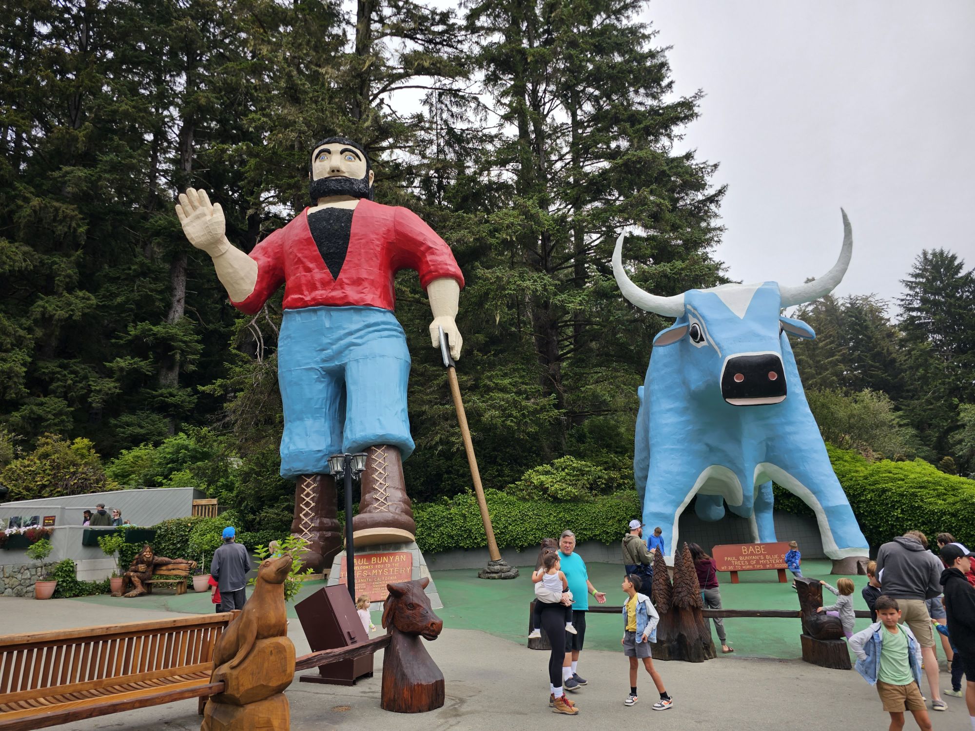
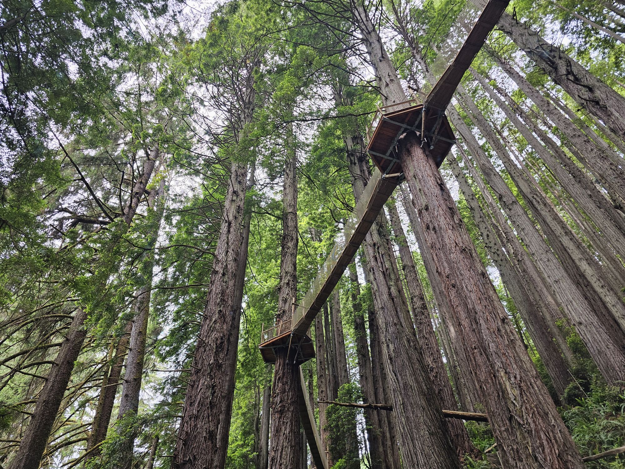
After departing Jedediah Smith, I noticed it was still pretty early, so I had many things left to do! To start, right near my BNB garage, I noticed there was a tourist trap looking place called Trees of Mystery. It was 25 bucks, and soooo worth it. Yes, it is more the same of large trees and what not, but this place has some good things going for it! In addition to a seeming reverence for these trees, they also have a legit canopy walk between the trees probably 50-75 feet off the ground. Pretty terrifying but a super awesome experience! There is also a tram up to the top of the area here, probably a couple hundred feet up, not really a mountain, but seemed more than a hill. Anyway, at the top there are supposedly awesome views of the ocean, but fog was a problem again!
Statues at the Entrance area of Trees of Mystery.
Part of the Canopy Trail at Trees of Mystery.
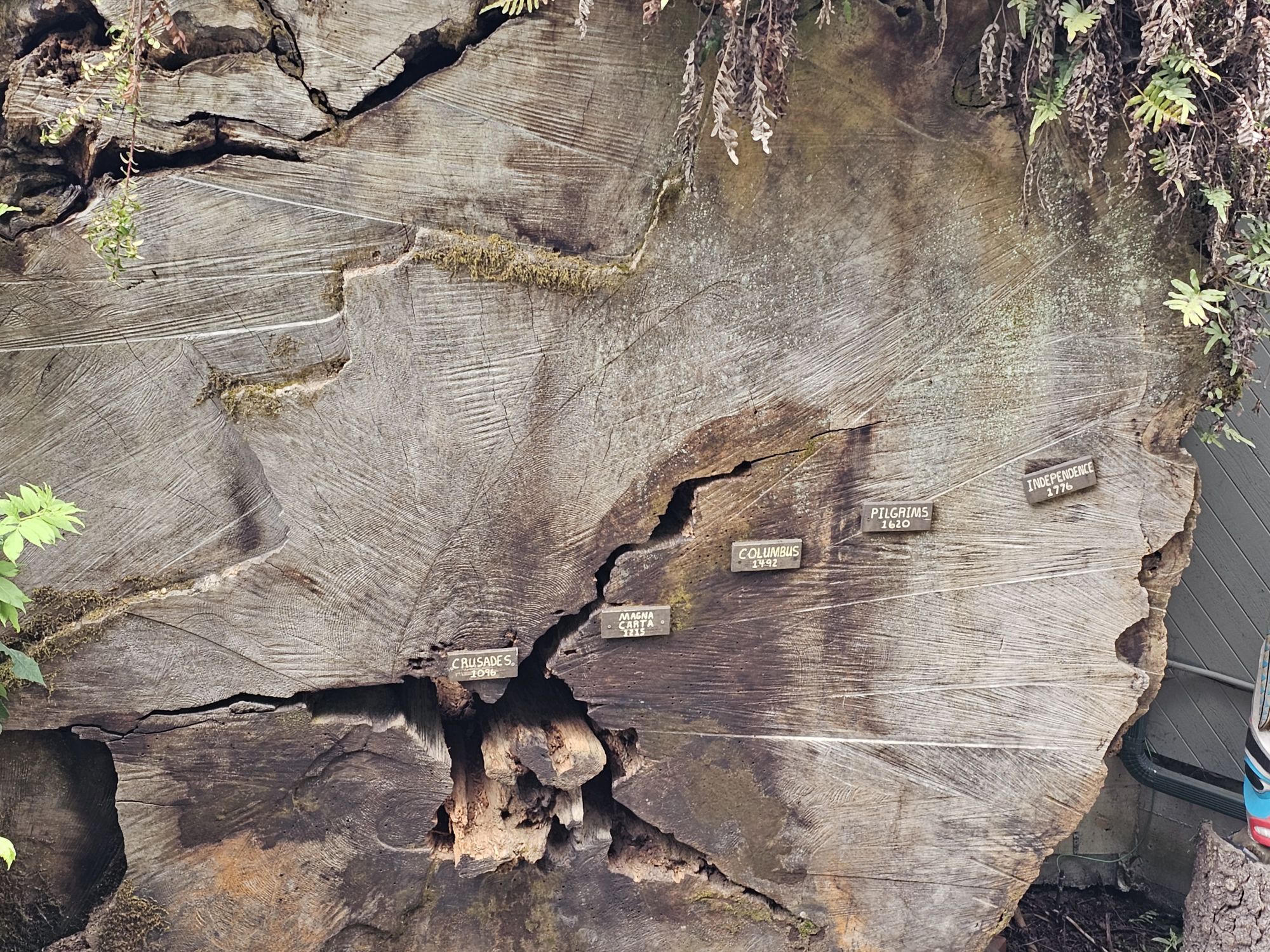
Trees of Mystery has this displayed to show some historical events in the rings of the tree.
Next I headed all the way down to the south end of the park. After stopping by that first visitor center I missed the previous day I took a drive up Bald Hills road, an active logging road. The first stop on this road is the Lady Bird Johnson Grove. The one time first lady had a big interest in protecting the environment and her husband dedicated this grove to her when he was President. The grove here is actually quite a bit higher in elevation and is not the optimal environment for the redwoods. They are smaller and share space with a lot of different trees and shrubs. Continuing on a way up the road was my turn around spot, though one can certainly go on, where the road turns to gravel as you come up to an new section of the park, one of higher elevation, a lot more heat, and a very prairie-esque look. How bizarre! I had already run unexpectedly into cool beaches and whales, and now here we have section with a distinctly plains feel. Very surprising! Anyway, where I turned around was the trailhead for the historical Lyons Ranch which was in operation from the mid 1800s to mid 1900s. The trail is 4 miles round trip so I decided to not pursue the ranch.
Another section of Redwood. This is the plainish type area accessible from Bald Hills Road. Not far past here is the Lyons Ranch.
Upon returning to Klamath I discovered another really cool tourist spot, the Tour Through Tree! So, this makes two trees that I drove through this summer! This one cost me 5 bucks, but was worth it! This tree is alive and still standing, and the hole to drive through, was very tight. I had a medium size car and I had to put the mirrors in to make it! So of course I did it a couple times and had a blast doing it (video to come later!). Afterward I did one last trail, one that started at the Trees of Mystery place and went down to the shore of a secluded hidden beach. The trail starts basically on the side of the highway and is easy to miss. It also goes through some very thick vegetation and at times seemed a little suspect. I came across no one on the trail and the beach was pretty empty, just me and two others. It was definitely a beautiful spot, but it was foggy again, so I took in the grey and overcast beauty, rather than a sunny one.
Tour Through Tree in Klamath.
From the Hidden Beach.
The Hidden Beach.
The following morning was my departure from Redwood, but I had one more stop. At this point I should point out that there is one very huge draw in the park. I am slightly embarrassed to say that I was not aware of it ahead of time. The spot in question is called Fern Canyon. It is very popular and in fact so popular that one is not even allowed to drive to it without an online reservation. Of course, I did not have one. I hoped that getting up very early I would be able to get down to that spot and do a really quick in and out (the canyon itself is not very long) before the rangers showed up. I got about half way down the narrow, gravel road, which took me nearly 30 minutes and then I knew there was a creek crossing coming up. Being that I was in a rental car, and the time required to finish the drive and then drive back was longer than I was comfortable with, I decided to turn around. I had a back up though! The road to Fern Canyon provides access to a trail to Trillium Falls. The trail was fairly easy and took about 45 minutes. The waterfall in question…well, lets just say it is very pretty, but is actually pretty underwhelming from a size perspective. In fact, I almost thought this was not it and I needed to go further, but no, that was it. Pretty to be sure! But not jaw dropping. And with that, this National Park was done!
Trillium Falls. At the time I was unimpressed, but I really like this picture!
Overall Impressions: This is a beautiful park with a surprising variety of things to see! I think the fact that I had already been to Sequoia only a few weeks before diminished by admiration for the park, at the time. As I recounted the trip in this entry I think my opinion has improved! The only knock I can give to the park is access is not the easiest (not the park’s fault by any means) and there do not seem to be many activities to do other than driving and hikes. And, you can only be impressed by big trees so much!
NPS Unit Count: 66 Pictured above is Whiskeytown Lake, Whiskeytown National Recreation Area.
Hey there Adventurers! As part of my July trip to northern California national parks, I also made a couple smaller visits, one to Whiskeytown National Recreation Area (an NPS unit) and also to Lake Tahoe’s Nevada side. The caveat being these were super short visits (hours each), here are my brief thoughts on these two lakes!
Selfie time! This is not the “official” sign, but it’s much more interesting than the boring, generic one the NPS has used here. The water curtain to help out the fish is in the water back there.
Whiskeytown NRA is located just to the west of Redding, CA and directly on the path from Lassen Volcanic National Park to the southern end of the Redwood National and State Parks. Once upon a time Whiskeytown was a gold mining town. How did it get that name? Well, there are two theories! One is that a miner was hauling supplies to his mine and dumped a barrel of whiskey into the creek, thereby leading to the name of Whiskey Creek and Whiskeytown. The other thought is merely that the miners drank a lot at the end of the day! Anway, in the early 1960s, a dam was constructed on a creek here and the valley where the town sat was flooded. This was part of a large project to move water to other parts of California. The government bought up most people’s land and structures, and what structures were not purchased were moved down the road or up above the water line. President Kennedy dedicated the dam as his last official stop in California in 1963. I have read that it was unusual, but that he may have made the trip simply because of the name! Who knows, but it seems reasonable! From an ecological point of the view, the engineers created a special “curtain” of sorts to preserve the cooler water needed for Chinook Salmon eggs to survive. The salmon used the old creek to spawn and when it was dammed that led to the water in the lake being to warm for them, so this curtain forces incoming water to the lake bottom rather than mixing, thereby preserving the Chinook’s spawning ability! Pretty cool!
Plaque commemorating JFK’s dedication of the site. Taken by me.
I only explored a bit of this area but what I saw looked great. The lake is beautiful and can be used for boating, swimming, fishing, etc. There are trails and a nice waterfall to find. Some of the remaining buildings are available to see but most of them seem to be for NPS housing, maintenance, or administrative uses now . I found out later that there is a unique cemetery that people like to visit (weird). It was moved from its original site as well. And, the best part? There is a Bark Ranger program here as well! The entire area is dog friendly and I saw humans and dogs alike swimming in the water (it looked cold!). I would say the best use of this area for tourist is doing what I did – if traveling between Lassen and Redwood and looking for maybe a relax chill day in Redding, this would be a great place to relax and enjoy for a day. Indeed, my initial plan for this trip included an overnight in Redding for this very reason, but for timing reasons I just drove straight through with this brief stop to .
A manzanita shrub on the shore of the lake. Taken by me.
Just gonna leave this right here. Click on it to read the nitty gritty. TLDR, like all Glory Holes, stay away! Taken by me.
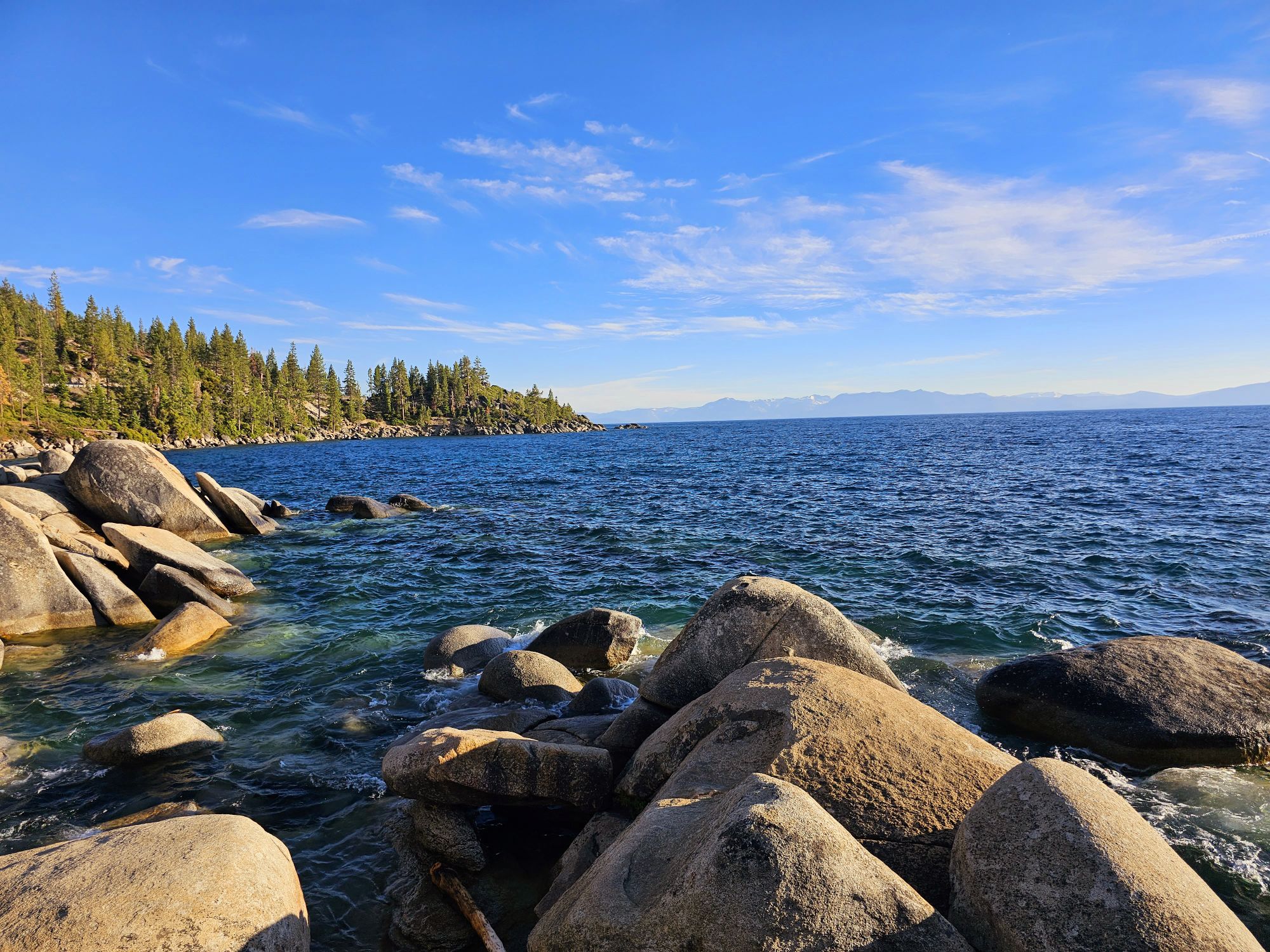
At the conclusion of my Northern California trip I decided to make my way south from Reno to check out Lake Tahoe. If you are not familiar with the lake, it is the largest alpine lake in North America and the 2nd deepest lake in the US. It is exceptionally blue due in part to algae in the lake. Despite that, the lake is exceptionally pure, almost as pure as commercially distilled water. It is also very clear, but not as clear as it used to be, which has led to intense conservation efforts. The lake never freezes, and rarely warms above 70 degrees. It was nearly 110,000 degrees in Reno the afternoon before I flew out and a escape to the lake seemed like a great idea! Now, all that education I dropped on you a few sentences ago I did not know prior to my visit. I was very surprised that the lake sits at a high altitude, about 6200 feet. Even more fun was the road I took reached the summit of Mt. Rose at nearly 9000 feet. It was a cool drive for sure. And that was about the last cool thing for quite a while….
Lake Tahoe from a bit up the road from Incline Village. This was the first spot I found to take a picture of the lake.
I entered the lake area at a town called Incline Village and talk about a mess. This area is super crowded. Even trying to get a view of the lake from here is a daunting task. There is very little public parking to be found and it took nearly 45 minutes to find a spot. I sat down at a restaurant on the main strip here that had an outdoor second floor and got two tacos, chips and salsa, and a beer….that was a 40 dollar bill after tip. And the only view was of the street and the rental homes on the lake shore blocking all view of the lake. I found some spots that led down to the lake but they were inaccessible for belonging to resorts. To be fair, this was a scorching hot Sunday afternoon, so being busy was to be expected. That being the case, I never imagined such a huge lake would be so hard to even see!
I got in the car and headed south along the east side of the lake and did manage to finally get some views but parking was a persistent issue. For instance I found a spot that features an overlook, a restroom and trail access down to the rocks of the lake shore but parking is restricted to 20 minutes! At least it was free…and I finally got an obstructed lake view at water level, however briefly! I will add that if you are biking it appears the experience is much different. There is a bike trail that runs parallel to the road here that probably makes the whole experience a lot more convenient. My drive continued past a popular beach called Sand Harbor Beach. I would have stopped…but parking was full … and was like 20 bucks even if it wasn’t full! This spot did seem to be that point where people decide not to go any further though so from here on the drive was much less crowded and thankfully finally gave some good views of the lake without worrying about traffic! In hindsight, I would have came straight down here to begin with and skipped the Incline Village altogether, but honestly, I was not planning on going even this far down the lake. But, here we were, so I kept going and continued a bit . I continued down a ways still to a spot called Cave Rock. The road steers considerably away from the lake here, but eventually finds the shore again before arriving at Cave Rock. This is actually a tunnel for the road but mercifully I found a mostly empty parking lot. It was advertised as a pretty high cost to park as well, but the lady working the both let me in for 2 bucks since it was nearing the end of the day. This was definitely a nice spot to catch a bit of the late day sun. As I headed out I very nearly timed it perfectly to get sunset from the spot I took my first picture of the lake, but I missed it by a just minutes!
I took this from a spot accessed from the generous 20 minute parking spot. At least it got me down to the lake itself!
This is Cave Rock .It was pretty empty late in the day. Taken by me.
Sunset over the lake. I missed it by only a few minutes! I took this at the same spot I took the first picture from. There were many people in this spot for good reason!
I think Whiskeytown has some great fun opportunities, but I do not foresee myself getting back out there again. I definitely think I enjoyed the low key and less populated nature of Whiskeytown versus Tahoe. However, I think Tahoe would be a place I would be interested in returning to. In my thoughts of Lassen Volcanic National Park I concluded that a return visit might be in store. If I do so, via Reno, I may very well try to spend some more time at Tahoe now that I know some better areas to visit and what to avoid!
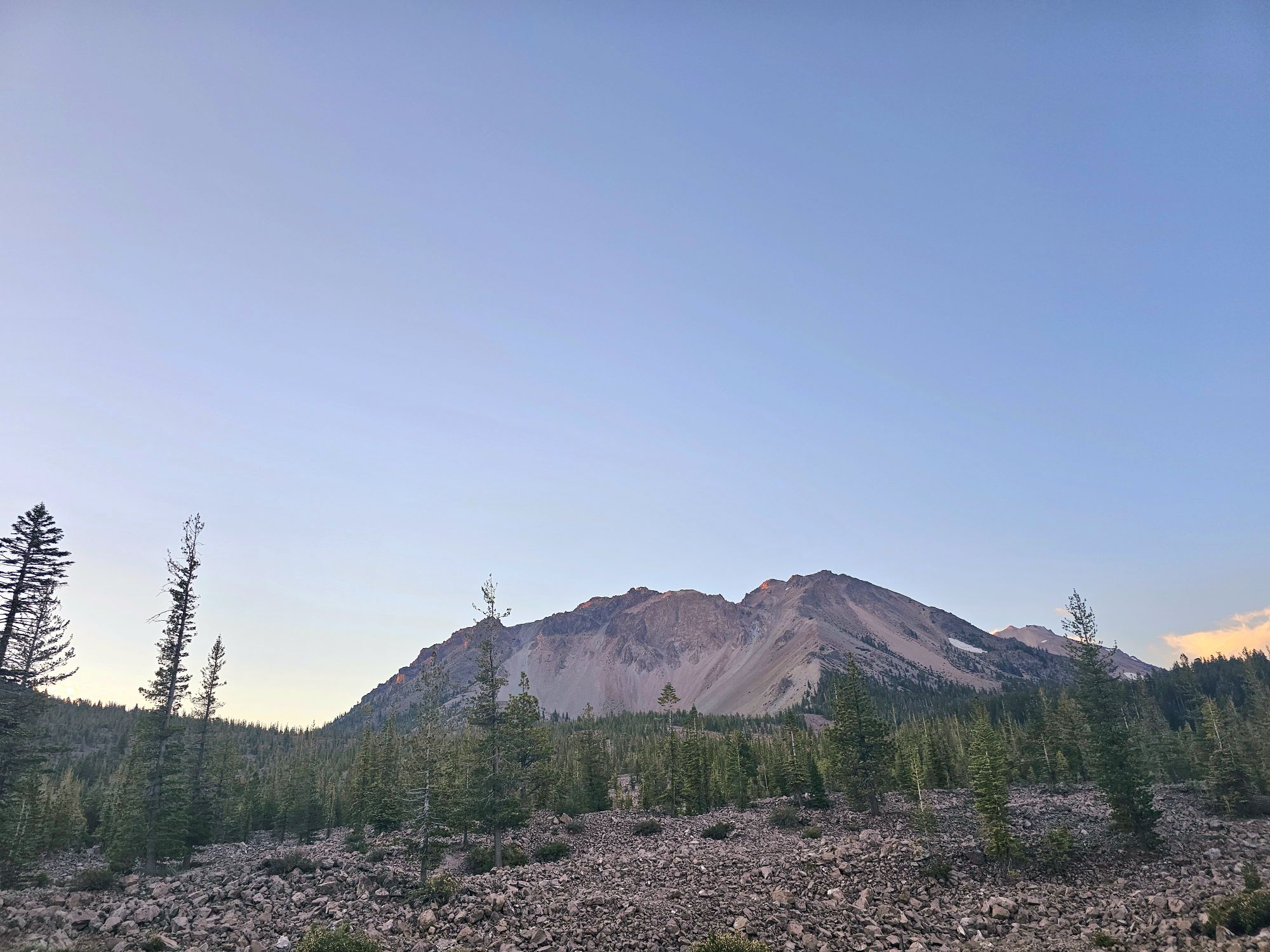
National Park Count: 37 Pictured above is Lake Manzanita. Lassen Peak is center and the closer Chaos Crags to the left.
Hey there Adventurers! First thing, this will be a very picture heavy post. Feel free to just skim through them and read as you wish! Fresh off the trip the Sidekick and I took to California earlier in July, I decided to go back on my own and check out another chunk of the state! You may note that this was my third trip to California from Florida this year! Thank you very much Southwest Airlines! This trip included stops at Lassen Volcanic National Park, Whiskeytown National Recreation Area, Redwood National and State Parks, and Lake Tahoe. My first stop was Lassen Volcanic National Park, the location of a 10,500 foot tall volcano, Lassen Peak, and the its large eruption just a little over a 100 years ago, between 1914 and 1917, with the largest explosion in May 1915.
Surprisingly, there is video footage of one of the eruption events from a hundred years ago!
This is the sign found at the southern end of the park. Taken by a passerby.
The north entrance sign at the entrance near Manzanita Lake.
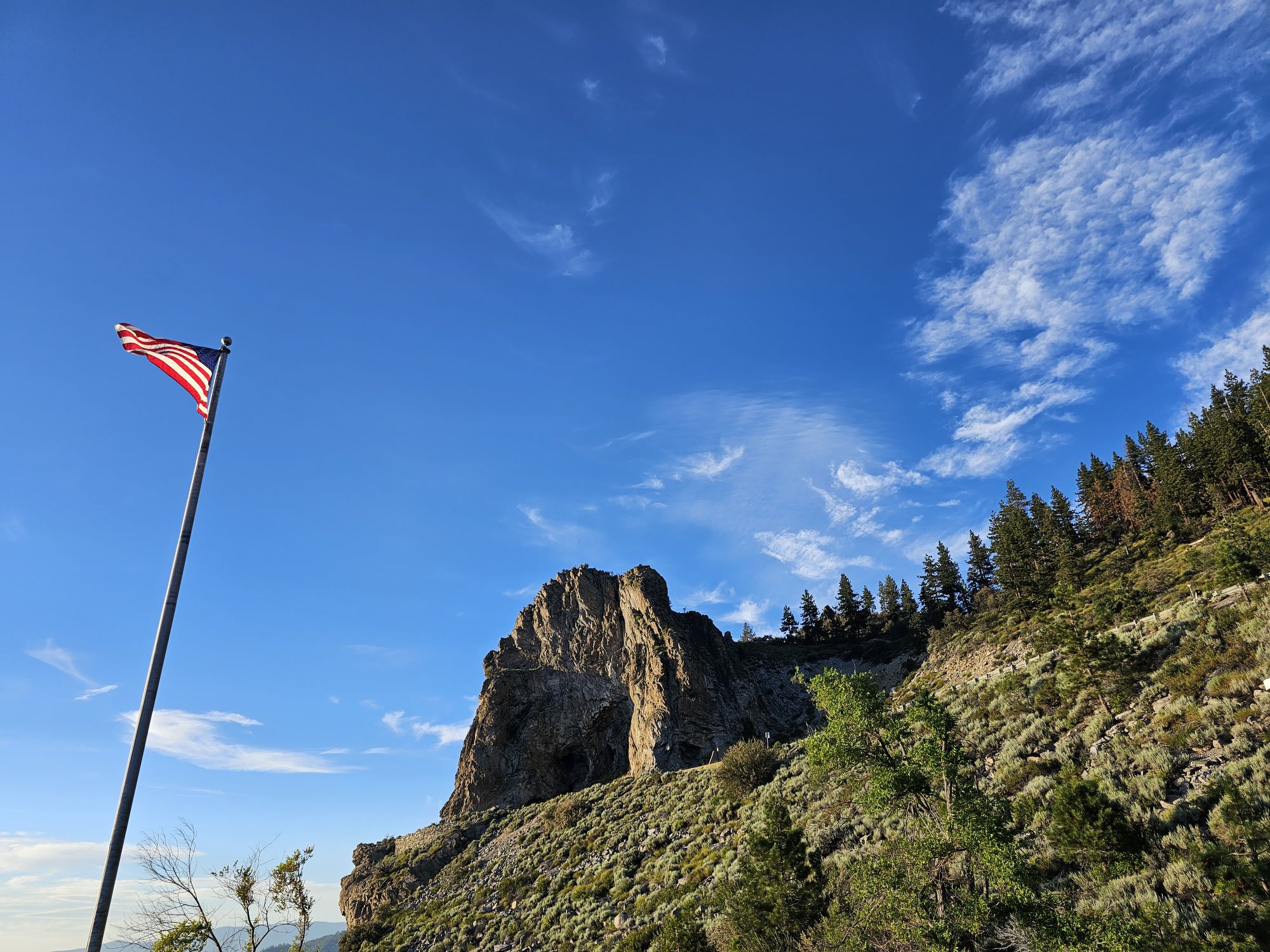
Reno has the closest airport that Southwest flies into and there is roughly a 2.5 hour drive out to Lassen. Redding, California is an hour away and has an airport that is served by the legacy carriers as another option. The drive from Reno to Lassen starts pretty bland for a long stretch, but once you enter Lassen National Forest, about 50 miles outside of the park’s northern entry, the drive becomes much more scenic. From this point on there is very little cell signal to be found and there are no real towns anywhere in this stretch, so be prepared. Due to the lack of nearby services and amenities I decided to camp and snagged a campsite in the park for a couple nights.
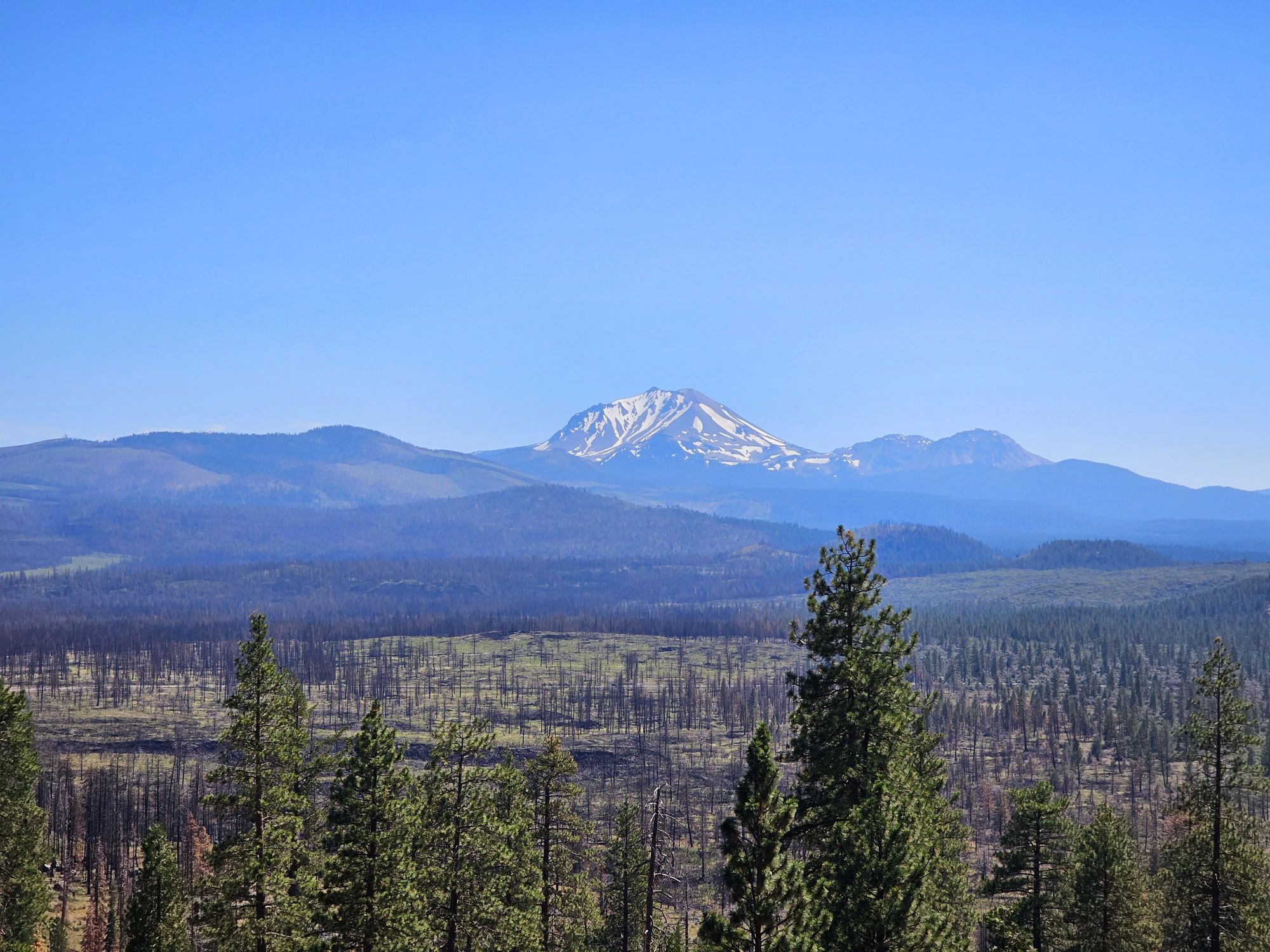
As you approach the park you can find some views of Mt. Shasta to the north, and then you can finally get some beautiful views of Lassen Peak. You also will drive through some old lava fields (there is a lava tube to visit nearby, that I will talk about later). Finally, I arrived at the campsite and got my tent up and running at the Manzanita Lake Campground. This campground is popular and you are pretty close to everyone with little privacy, but it was generally quiet and peaceful. The camp is dog friendly and has a very well stocked camp store with long hours. The store also has a landline for phone needs (most of the park, including the campground, is cell phone free), a gas pump, showers, laundry, and even a kayak rental for the lake. Nearby are several trails, none really much to write home about, other than some good views of Lassen Peak, but one could probably make a good time of it just staying in this area for a night or two!
I took this from Hat Creek Rim Scenic Viewpoint. Among the burned trees you can see remnants of ancient lava flows. This is also very near the Subway Cave lava tube.
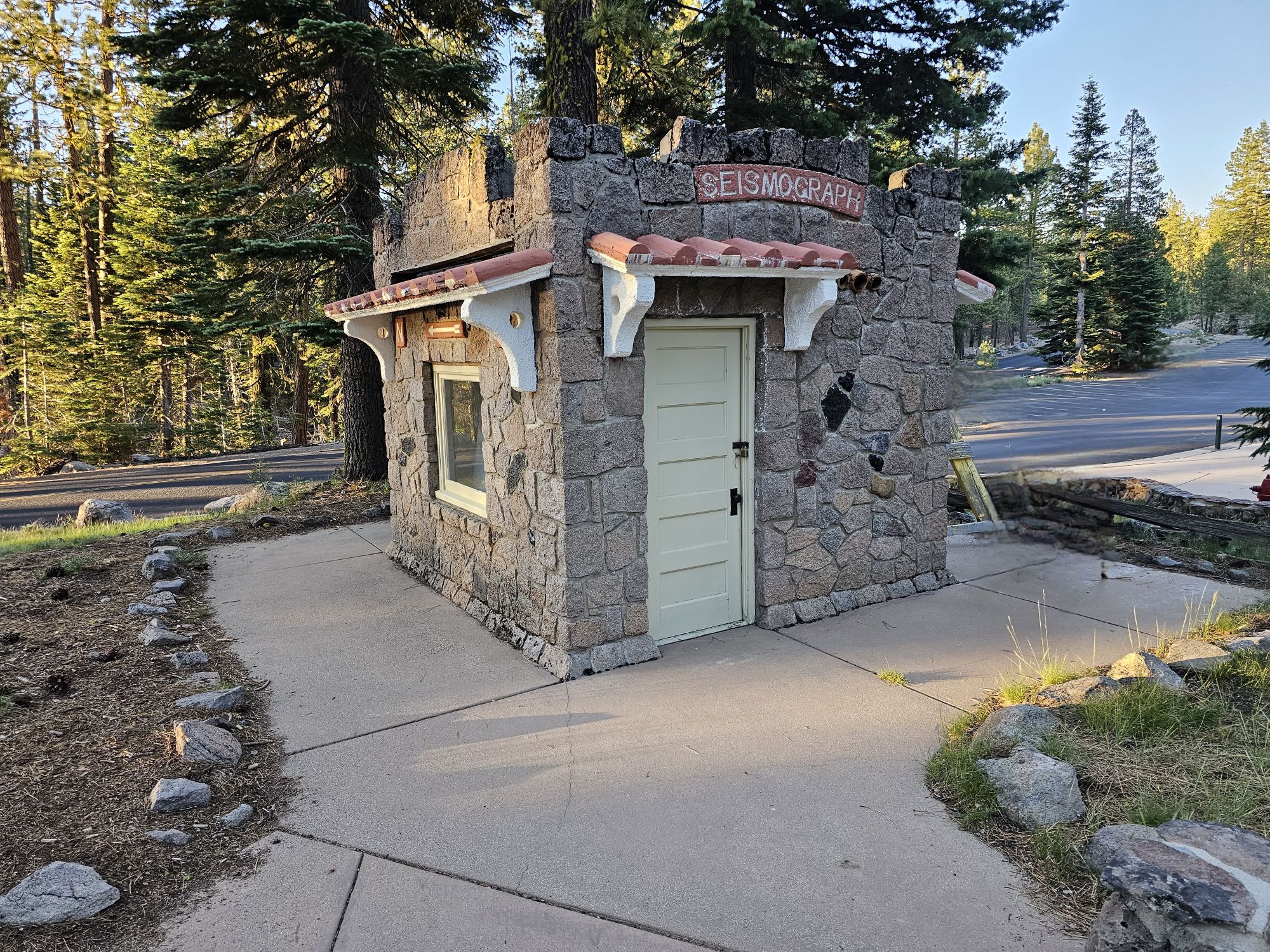
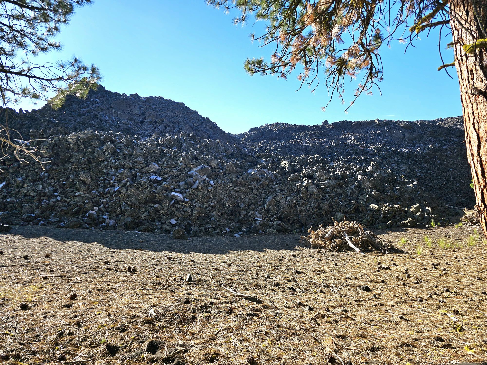
After setting up camp I went exploring this immediate area. Manzanita Lake Loop is a nice leisurely trail just shy of 2 miles with little elevation change that gives access to the lake and some great views of the mountain! After checking that out it was back to the car to do a little driving exploration! This section of the national park is quite dry with mostly pines and heavy wildfire burns. Along the road you can find large boulders that were dropped there by the most recent eruption and other evidence of past volcanic activity. This drive goes through an area called Chaos Jumbles. The cause of this chaos is easily visible here: Chaos Crags. This is a collection of dome volcanoes that are very new at only 1000 years old. About 300 or so years ago one section of the crags collapsed and the resulting landslide and avalanche flattened the forest for a couple miles and dammed the creek that formed Manzanita Lake. As an aside…if you are desperate for cellular signal, the pull out here gets you one bar, but everyone knows it apparently, so it’s a busy spot! I then ventured down the road a bit to a spot called the Devastated Area. Here, there is a half mile, paved interpretive trail with audio boxes along the way detailing the volcanic effect during the most recent eruptions. This whole area was hit with pyroclastic flows and lahars (mudslides) leaving many large boulders strewn about. This is a quick trail, but does give some good info about the eruption in this area.
The old seismograph that measured the area. It is part of a museum behind me that was not open. Taken by me.
This is a view of Chaos Crags from near the campground. Taken by me.
Here is what a small section of the Chaos Jumbles looks like. Taken by me.
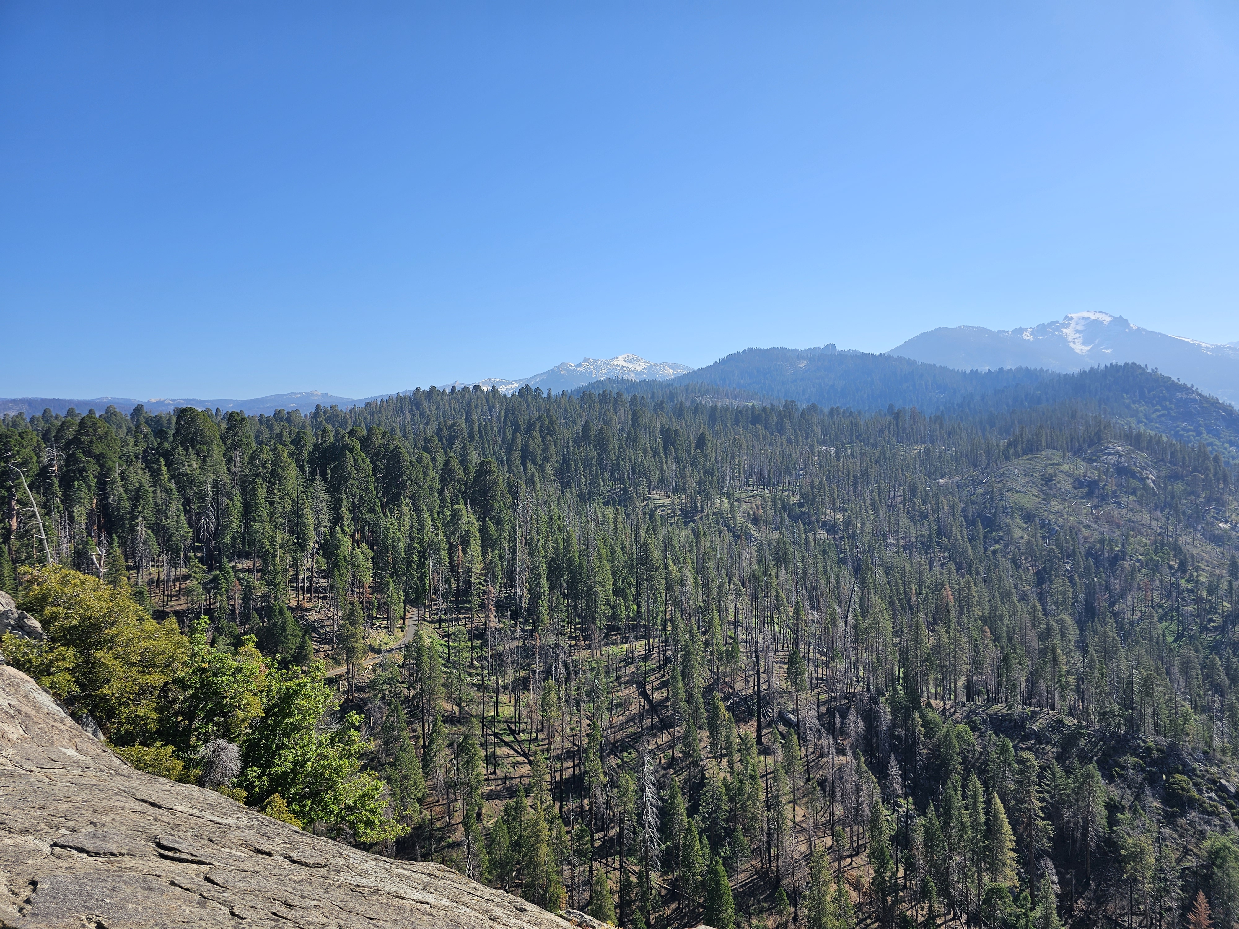
The following morning was the big park day for me. I got up early and left the campground toward a remote section of the park accessible only by gravel roads to hike the park’s hidden gem, a 700 foot tall Cinder Cone and the “Fantastic Lava Beds.” My fitness level at the time of this hike was not where I needed it to be! The hike begins at a campground along Butte Lake. The shore of the lake is predominantly lined with jagged lava flows and the hike begins alongside a wall of a large lava flow. The rock is tall enough that the cinder cone is not visible for quite a while. The trail goes about a mile and 300 feet uphill before you get to the trail up to the top. I took one look at the trail most directly up the cone and was doubtful. To be fair I started it, about maybe 50 feet worth. The surface of the cone, including the trail up, is entirely lose scoria, a type of volcanic rock. Coupled with the fact that the grade of the trail here is about 40 percent, my decision was a no go! I do kinda regret that I didn’t power through it, but by opting to go the long way around the back side of the cone I was ensuring that I would still get to see the Fantastic Lava Beds and painted dunes anyway, even if I were unable to make the top via this route. I made it about 2 and a half miles and was tantalizingly close to the top, but I had already hiked through some suspects spots up the backside of this cone, and after stopping for a rest on a mercifully flat area, I made the decision that the last quarter mile up was not safe for me. It was the same as the front side, very loose scoria rock and very steep grades of about 40 percent as well. Also, I had not come across one single person the entire time since I departed the first ascending trail. My fear was hurting myself and being stuck on the back side with potentially no one to find me. It was very hot and sunny as well, and of course, no cell phone signal. The good news is that by going this back route, in addition to being able to see the beautiful painted dunes behind the cone, I was also able to get a very close up view of the remains of the vent that let out all the lava that created the huge lava field. Pretty neat to see! Had I done the first way up and not made it I may not have seen any of this. The full trail runs about 5 miles round trip and the total elevation gain is about 1050 feet. Where I stopped made my trail about 4.6 miles with 500 feet of gain. That last quarter mile was over 300 feet uphill on loose footing and I just wasn’t there. But that was ok, it was still a great experience!
Butte Lake. The opposite shore is an old lava flow dating back a few hundred years. Taken by me.
Just showing the lava flow that forms a wall the Cinder Cone trail parallels for a while. Taken by me.
I found a nice older hiker to snap this one of me in front of the Cinder Cone.
A much needed beer break! Belching Beaver Brewery, from Southern Cal.
Lassen and the Painted Dunes seen from the back side of the Cinder Cone. Taken by me.
This appears to be the point of origin of the Fantastic Lava Flows. The vent is the area in the bottom left quadrant. Taken by me.
I had started the Cinder Cone pretty early, so I was back to the campground entrance of the park pretty early and began on the next part of the day. There is essentially one road through the park so my plan was to drive that road all the way to the end, stopping along the way for sights, but no hiking. One notable place to stop is Lake Helen, a beautiful crystal clear lake sitting near the top of the road, at about 8200 feet of elevation. Despite it being late July there was still a lot of snow around. Definitely a pretty spot to check out! Otherwise, I had a few hikes in mind for the way back. I did entertain the thought of hiking Lassen Peak itself, but my feet were pretty torn up from the Cinder Cone. That dust had no trouble getting into my shoes and causing a lot of problems! Anyway, I stopped at the visitor center, and south entrance sign before turning around.
Lake Helen. Taken by me. The mountain is Mt. Helen. Lassen Peak is actually out of frame here but is off to the left.
The park features active geothermal features, just like you would see at Yellowstone. On the way back I stopped to check out some of those near the visitor center and then did a small hike, Ridge Lake, through some beautiful wildflowers to get a better view. This area is called Sulphur Works and is a good spot to see some boiling stuff that can kill you, up close along the road! The Ridge Lake trail is about 2 miles out and back with 1000 feet of gain, but only a short distance from the trail head gets you some good views of the this entire area.
A boiling mud pot in the Sulphur Works area. Thankfully pictures don’t produce smells! Taken by me.
A vent with smoke in the Sulphur Works area. Taken by me.
Beautiful part of the Ridge Lake Trail. Taken by me.
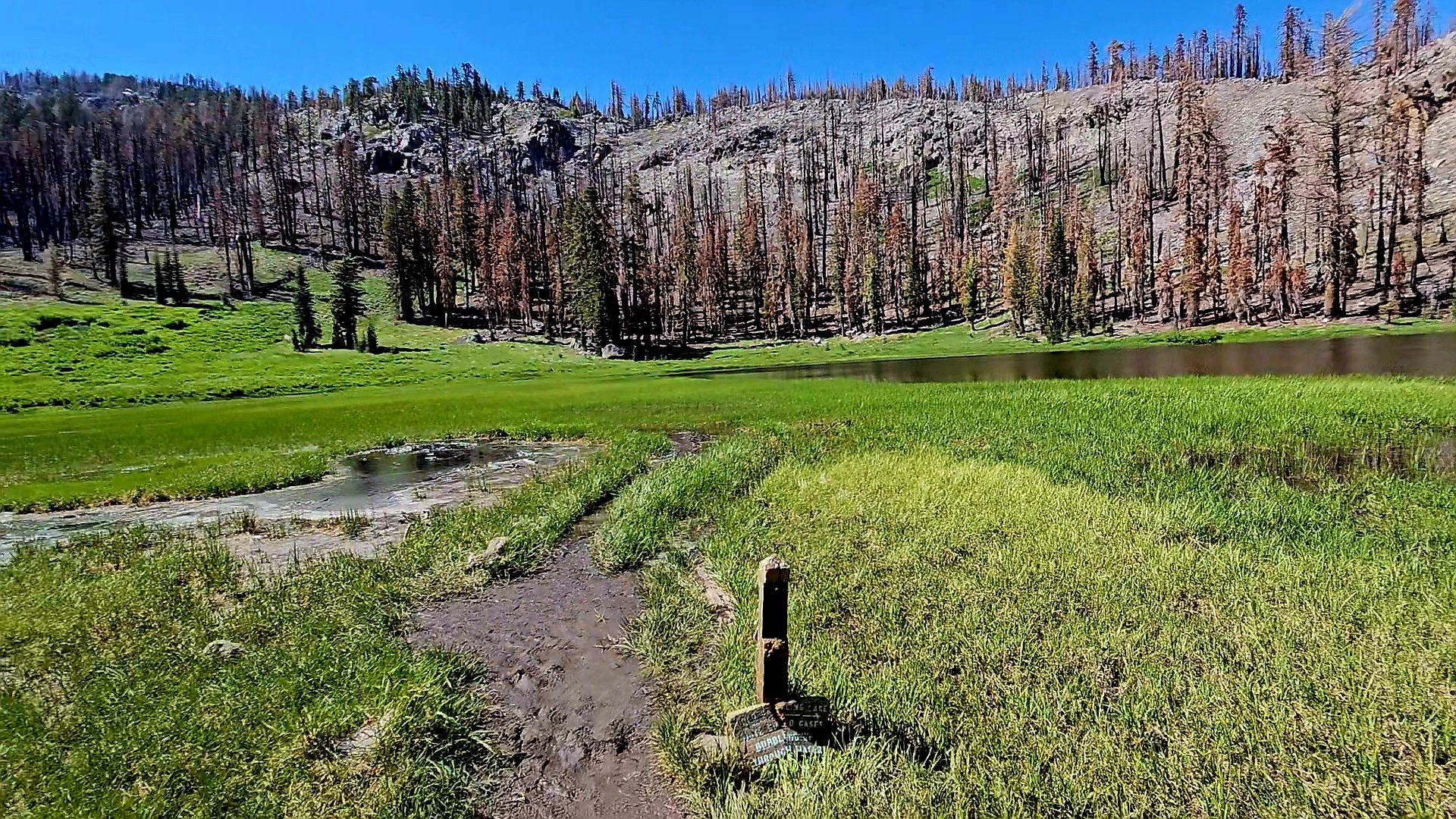
The Bumpass Hell area looks super neat, but the trail was damaged in storms earlier in the year and was closed. This area is the largest hydrothermal feature in the park and has a lot of cool deadly things! The closed trail is about 3 miles round trip, but there was a back trail to get to the area and I thought I would give that a go. Cold Boiling Lake Trail does eventually connect to a part of the Bumpass Hell Trail that would have given a small amount of access to the Bumpass Hell area. To get to the Bumpass Hell this way requires a 5 mile round trip hike. I made about 1 mile, just past the Cold Boiling Lake. The lake does boil. And it is cold. The boiling is merely gasses escaping to the surface from below for some geological reason. I stopped to chat with a couple who comes here often and they strongly suggested that trying to make it to Bumpass was not worth the effort due to the closures and suggested another hike closer to the campground, so I turned around.
Recent wildfires have really done a number on this part of the park. This is the trail to the Cold Boiling Lake. Taken be me.
Cold Boiling Lake. The “boiling” part is the small area center left. The ridge in the background would have need to be hiked over to make it to Bumpass Hell from here. Taken by me.
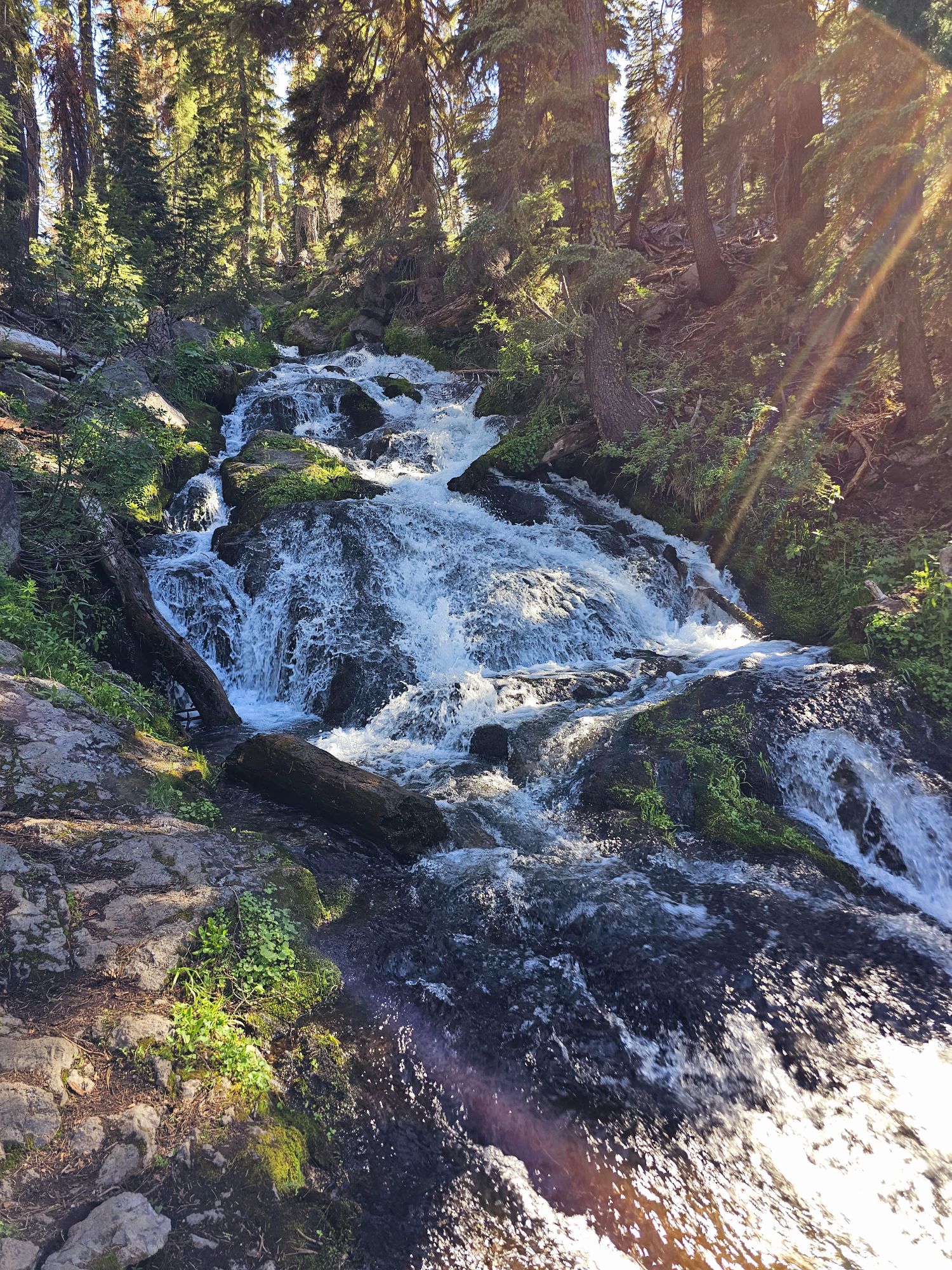
For those keeping score at home, at this point I had done about 7.5 miles of unfinished hiking this day and I was hellbent on finishing a trail, so I took that couple’s advice and found the trail they suggested: Hat Lake to Paradise Meadow. This one started near a bridge, and you can get a really nice view of Lassen Peak framed by the bridge from here (a sketchy descent down a steep hill to a stream below is required). This trail is about 3 miles round trip, with 600 feet of gain. I saw one family and that was it. The entire trail follows the stream uphill, eventually ending at a pretty meadow. There are some small waterfalls along the way and some deer were hanging very near me during parts of the hike. It was definitely a nice way to end a tiring day!
I really like this picture I took. The lighting isn’t the best and there was probably a better angle but it was sketchy getting down to here as it was!
Waterfall along the hike to Paradise Meadow. Taken by me.
A friend I met on the trail. Taken by me.
Paradise Meadow. A nice payoff in solitude at the end of the mile and a half hike. Taken by me.
On the (long) drive from the Redwoods back to Reno, I had to pass by Lassen again, and I did contemplate coming back in and trying Lassen Peak, but time was not really on my side. Meanwhile, I discovered there is a lava tube to visit near the area where the Cinder Cone is, which was right on the way. The official name is Subway Cave. The cave itself is not very long, but this was my first ever lava tube, so of course I HAD to stop! The area is pretty popular and parking was a bit iffy. You need a flashlight as the cave is totally pristine other than concrete steps going into and out of it. There are two holes with stairs so you can make a loop trail out of the cave and the surface bits. I didn’t need to spend much time here. Even though this cave sits just outside the national park, I still consider this to be the end of Lassen Volcanic National Park experience! As a nice coda, on the way back to Reno I did stumble upon Lassen Aleworks in Susanville, about an hour away from the park. There is good food here and some good beer, including Volcanic Double IPA and Bumpass Helles.
One of the entrances to the Subway Cave lava tube. Taken by me.
Looking into the darkness of the lava tube. Taken by me.
Stop at this place!
Overall Impressions: This is a stunning national park and I think this one goes in my top parks list! I only spent a day and a half here but could have definitely spent a couple more so I can envision a return visit!
National Park Count: 35,36 (General Sherman pictured above)
Hey there Adventurers! Hot on the heels of the Juneau trip, the Sidekick and I embarked on another adventure – this time to California with that fancy Southwest companion pass and free flights! This was a two event trip: a couple national parks before catching an AVP Volleyball Tournament in Hermosa Beach, outside L.A. This will be the national park component and before I begin, an important lingo clarification, the two parks, while “separate,” are actually connected and administered as one park which is referred to as Seki (but still counts as two parks!)
First, I have to say that we were EXCEEDINGLY blessed with circumstances. Earlier this year California experienced some really bad weather which wreaked havoc on Central California. In the Seki area, the roads in the parks were greatly damaged, and the parks were mainly closed up to July 1st. We had booked our lodgings in such a way that the road through Sequoia being closed would have posed a huge problem. But, around the beginning of June, the park anticipated a July 1st opening and thank GOODNESS that is what happened as we got there on July 4th! It wasn’t all perfect news, though, as the road through Kings Canyon only went so far and then is closed the rest of the way, at least for the rest of 2023. Additionally, some sections of Sequoia, including some caves are also closed for the year. A bummer there, to be sure, but it ended up ok!
Cool display in the Fresno airport! Taken by me!
We flew in Fresno (cool little airport), grabbed the rental car and headed for Kings Canyon! I was not familiar with this area at all and was quite surprised at the large elevation change. Fresno sits at about 300 feet. The entrance to Kings Canyon is only about 50 miles away and sits around 5 to 6,000 feet of elevation, so it was a fun drive! We booked our first night just outside the park at a place called Gena’s Sierra Inn. The price is good per night and it’s close to the park. Lodging is not readily available in the area, and I guess you get what you pay for at 120 a night. I am going to give a rare negative review here, which I really do not like to do. The room was very small. We knew that going in. The bed situation was a bed on the ground with a lofted bed perpendicular above. The being said the lofted bed was very, VERY rickety and the decision to share the ground bed was made. Also, the room was literally not large enough to accommodate our luggage without putting them up on that lofted bed anyway. That was not a huge deal. What was – the AC had to be plugged in when we arrived and then after going out to explore a bit and grabbing dinner at the lodge restaurant, we came back to a hot room with the power out! Did I mention it was like 100 degrees outside? It was just our room – the ac tripped the breaker for the room. Anyway, the owner literally took us into the deep dark recesses of the motel and showed us which breakers to reset if it happened again over night….so that might be a consideration at Gena’s! There was also some incident in the restaurant. We were enjoying our food and the restaurant apparently decided to close randomly while we were there and wouldn’t let others in. Then about 2 hours laters, they apparently reopened randomly? Pretty bizarre. I guess pack some food in case the restaurant part of the location is not open if you stay there!
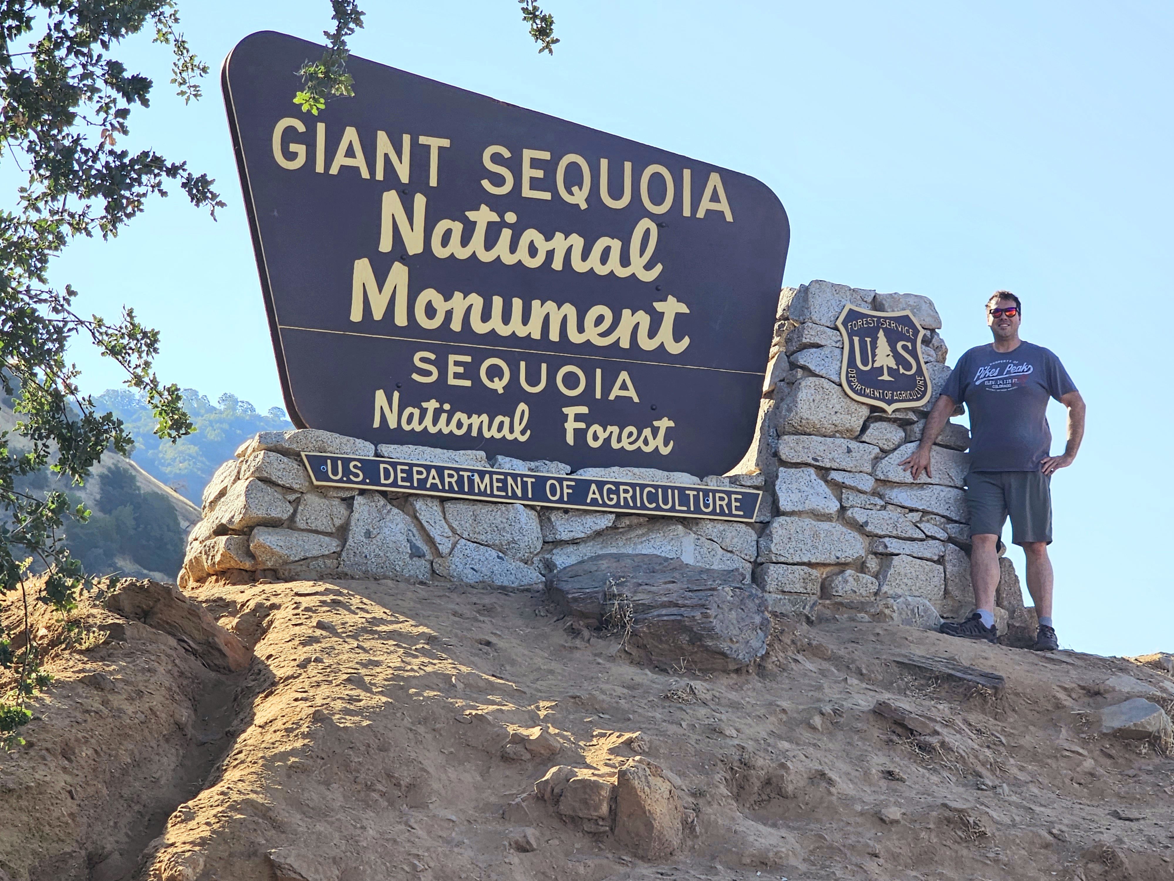
Our first evening was basically right at the entrance to Giant Sequoia National Monument, part of the Nation Forest Service.
This is the north sign and you can see the wildfire effects. Taken by the Sidekick
The southern sign. Taken by the Sidekick.
This was the only Kings Canyon sign found. I have seen a better one online, but I think it was somewhere past the road closure. If not, then somehow we missed it!
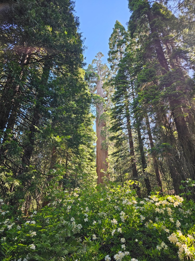
Thankfully, the night at Gena’s passed relatively event free once the room cooled off. The next morning was up and at ’em, heading into Kings Canyon. Seki sits firmly inside Sequoia National Forest, so Kings Canyon has its share of sequoias as well! In fact, one of the big attractions in the park, at least the part that is open right now, is the General Grant tree. It’s really hard to describe how huge these trees are. Pictures cannot do justice to the size of the giant sequoia; and the other trees in the forest are quite large as well. The sequoias are also very old! The lifespan of a sequoia can be 3 millenia! Sequoias are not the tallest trees, nor are they the widest, and they are also not the oldest either. That being said they are the most massive tree, and potentially, most massive living organism, on the planet, by volume. To add the trees feel weird. They are kinda spongey, I guess would be the best word to describe it. These trees coexist with wildfires and the nature of their bark does a great job of protecting them. That being said, there have been a lot of intense wildfires in just the last decade which have taken their tolld on the trees. Anyway, the stats on General Grant are impressive! It is about 1600 years old, 107 feet in circumference at the base (!!) and 267 feet tall! At a volume of 46,600 cubic feet it is the second largest tree in the world and is about 1500 years old! The top of the tree is apparently no longer growing, but it still adds about an entire tree’s worth of wood every year. In addition, General Grant is also referred to as the Nation’s Christmas Tree.
Just a handful of ginormous trees.
I like this picture I got of General Grant! You can see the dead top.
General Grant, taken by me.
After checking out General Grant and its grove of massive trees, we proceeded further into the park. There is a neat felled sequoia that is hollowed out, giving some fun photo opportunities. At some point around the early 1900s a group of people actually made a home of sorts inside this large tree trunk. It is worth noting that the next section of the park we explored leads to the section of the park that is closed for the year and also goes through a part of the park that was hit really hard by all the recent wildfires. The landscape at the start of the drive is very scarred from those fires before moving back into a more green area. Despite the road being closed further down, we decided to press on and I am glad we did! You might have noticed this park is called King’s Canyon. You might also notice I have not used that word since the top. Well, there is a large canyon here and this is the part of the park where it can be seen! The main road is actually what you want to use to access the canyon floor, but unfortunately, it’s closed! BUMMER. However, right where the road is closed there is an exit to a side road that goes to Hume Lake. We had some snacks and beverages at the lake and just took in the scenery for a bit. The great thing about Hume Lake Road is that it affords some great views of the canyon itself from up high, so it was a worthwhile trip coming this way despite the main road being closed.
Fun photo inside a felled sequoia! Taken by the Sidekick.
I like this picture of some tall trees I snagged through a hole from inside the felled sequoia trunk.
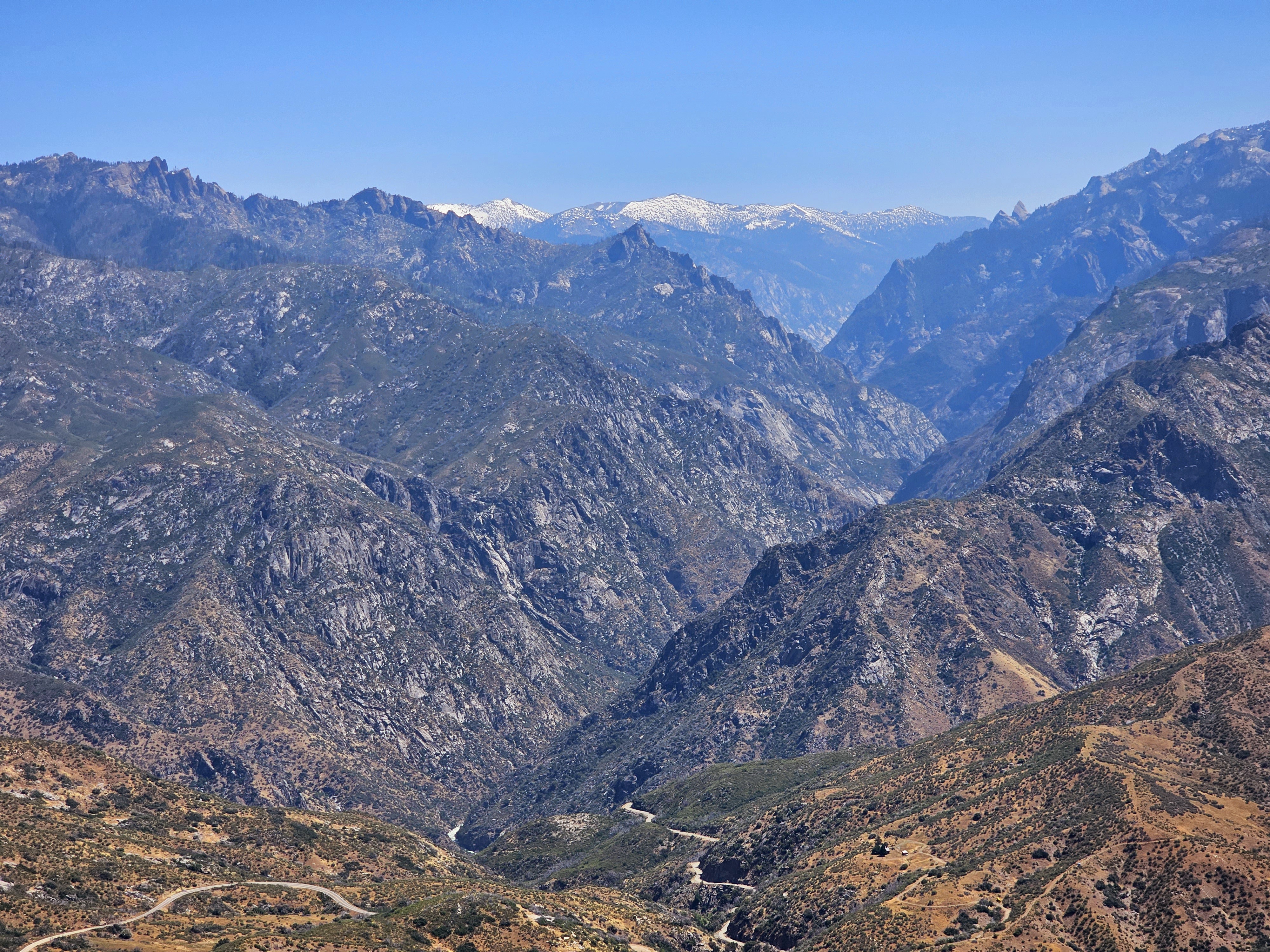
This is Kings Canyon. Unfortunately, the road you see that goes down to the bottom is closed for 2023 :(. Taken by me.
Hume Lake in Kings Canyon. Take by me.
After exploring that area of Kings Canyon we drove the recently re-opened General’s Highway down through Sequoia National Park. Our hotel for the next 2 nights was in Three Rivers, located at the entrance in the south end of Sequoia. Had that road not opened in time for our trip it would have been a loooong detour from Kings Canyon to Three Rivers. Thankfully, luck was on our side with the road and we managed to snag some good recon while taking in the scenic drive and large trees south through the park. These two nights we stayed at the MUCH better Gateway Lodge and Restaurant. The hotel was great! The restaurant was about as good as one can get out in the middle of nowhere, but had a nice bar staff and a killer location on the banks of the Kaweah River, which was raging through at this time.
Restaurant view of the Kaweah River from the Gateway Lodge, with the required California beverage! Taken by me.
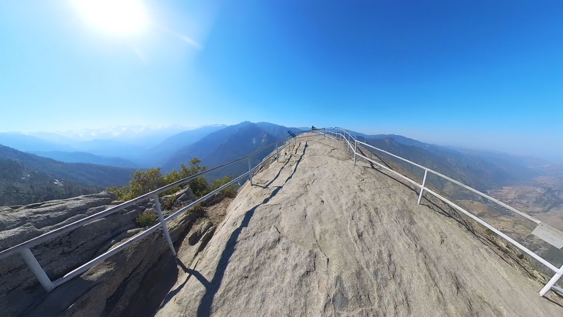
The next day we started out our morning exploring Moro Rock, one of the big draws in Seki. This is a huge rock formation that sits at a pretty high spot in the park. There is a small parking lot right at the start of the climb but you better get there early for a spot! The climb up is about 350 steps with about a 275 feet gain and the top of the rock sits at about 6725′ elevation. This is well above the surrounding landscape, giving beautiful views of the nearby sequoia groves, the valleys below, and the Great Western Divide. This is a pretty cool spot to take in some great views and some fresh air!
Along the route to Moro Rock. Taken by the Sidekick.
Well, this was the best I got apparently. That’s moro rock from down below!
Part of the trek has rails, parts to not. Don’t tip over! Taken by me.
I dubbed this Eagle Rock, along the trek up to the top of Moro Rock. The national park service missed out! Taken by me.
This is the top of the rock. It can get pretty jammed up here, early is best! Taken by me.
One view from the top of Moro Rock. Giant Forest is off to the left side. Taken by me.
This is the opposite view to the one directly above. Very different look! Taken by me.
And this is the view of the Giants Forest from the top of Moro Rock. The pines here are also huge, but they are dwarfed by the sequoias, which you can make out by the more rounder top, as opposed to a sharper point. Taken by me.
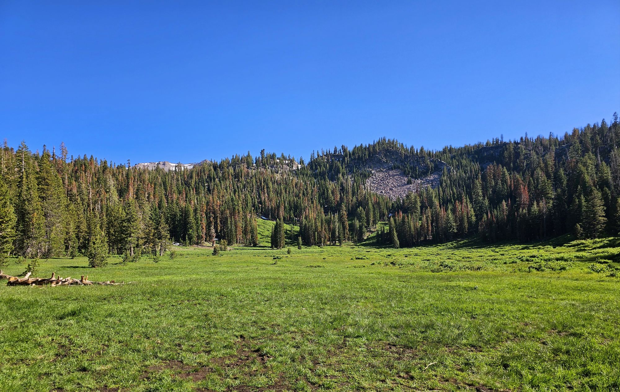
Next up it was back to some trees and some hiking! In the same area where Moro Rock is you can find a fallen sequoia that you can drive through! Much to the chagrin of the Sidekick, I insisted on doing it several times! Hey, it’s not every day you get to drive through a tree! Anyway, in this same nook was also a nice pleasant hike through the woods in Crescent Meadow. This was a nice spot to get in some wildflower views, and there was also a deer friend we met, and there was a bear (that we luckily did not meet, nor did the deer, I think). In general, this is a nice low intensity walk and pretty accessible.
The Sidekick took this picture to give some sense of scale to these huge trees!
Fun pic a random park goer took of us driving through the tree!
View of the meadow. Really pretty area and a nice leisurely stroll. Taken by me.
Pretty flower carpet outside the meadow. Taken by me.
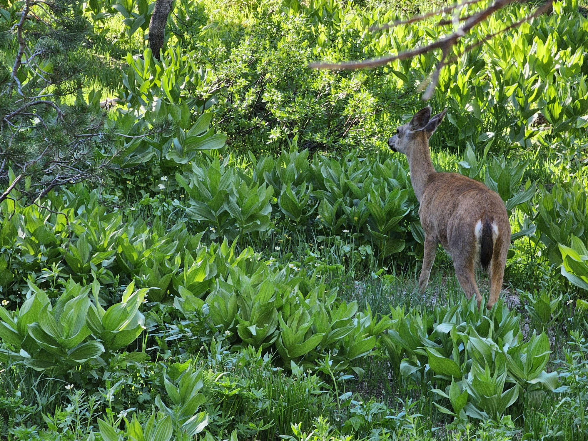
Oh deer! This fella was walking along with us for a while! Taken by me.
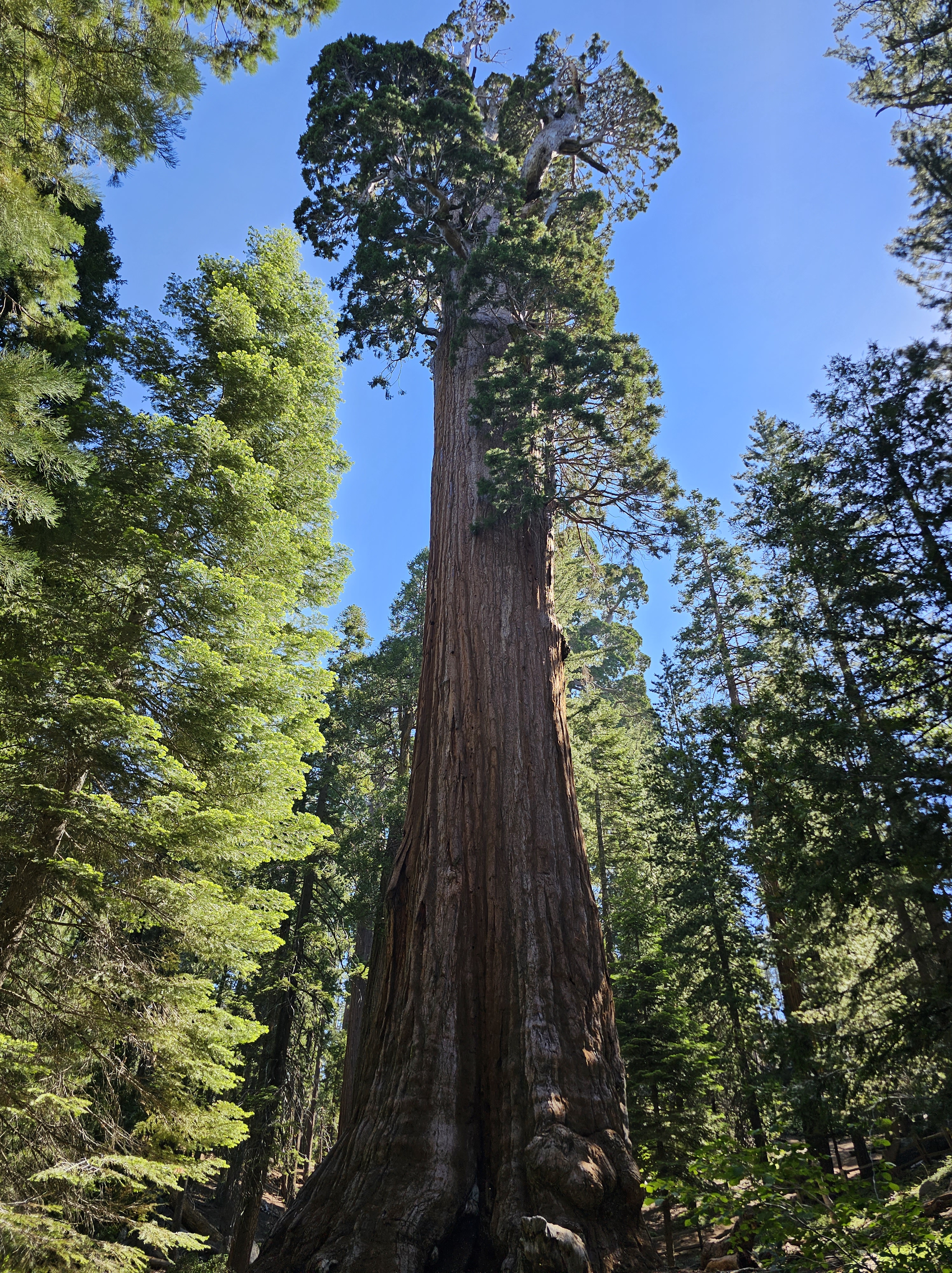
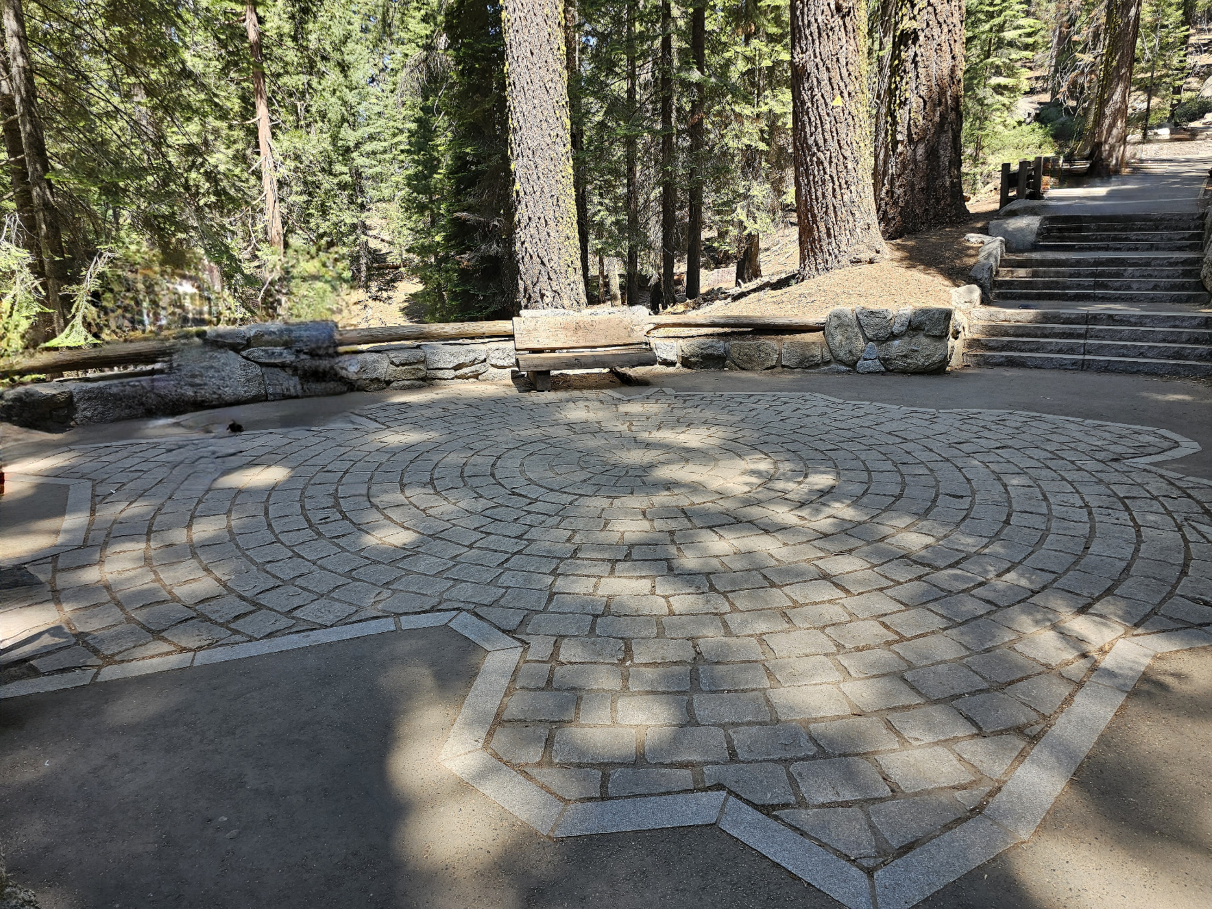
Next up was a visit to the king of the trees: General Sherman. This is the largest known living thing on the planet! To be fair the tree is slightly smaller around the base, but is slightly taller that General Grant, but the tree is thicker throughout making it about 12 percent bigger, by volume – 52,500 cubic feet, than General Grant. General Sherman stands just shy of 275 feet tall, 103 feet in circumference at the base, and adds the equivalent wood of a 60 foot tree every year! The tree is around 2500 years old and is located in the Giant Forest, a large section of the forest filled with these behemoths. The area requires a shuttle to reach, unless you are handicapped and can utilize a small parking area, and most of the area is paved. A peaceful stroll on Big Trees Trail nearby concluded our adventure to Seki and that’s two more national parks!
The footprint of General Sherman up the trail a bit from the tree itself. Taken by me.
Taken by the Sidekick.
General Sherman.
Overall Impressions: Despite many parts of Seki being inaccessible in 2023, and some intense wildfire scars, I was quite impressed! Seeing these massive and beautiful trees in person is a real delight and is probably one of the more interesting things I have seen! I think I would come back for a second visit, if just to see more of Kings Canyon and to (hopefully) see a more recovered forest.
Hey there adventurers! The Sidekick and I ended up in Juneau in June this year! Most people cruise to Juneau and can only stay 8 hours or so, but we flew and stayed a week to see the whole area and to optimize the chance for good weather. This trip also included a day trip to Glacier Bay National Park. Feel free to visit that entry and check it out! *It took way to long to get this one out, I already had this done but apparently hitting save did not actually save because I had left the window open too long before hitting save, and lost it all. Ugh. Also, some life situations hit….several more trip logs should be coming in short order!*
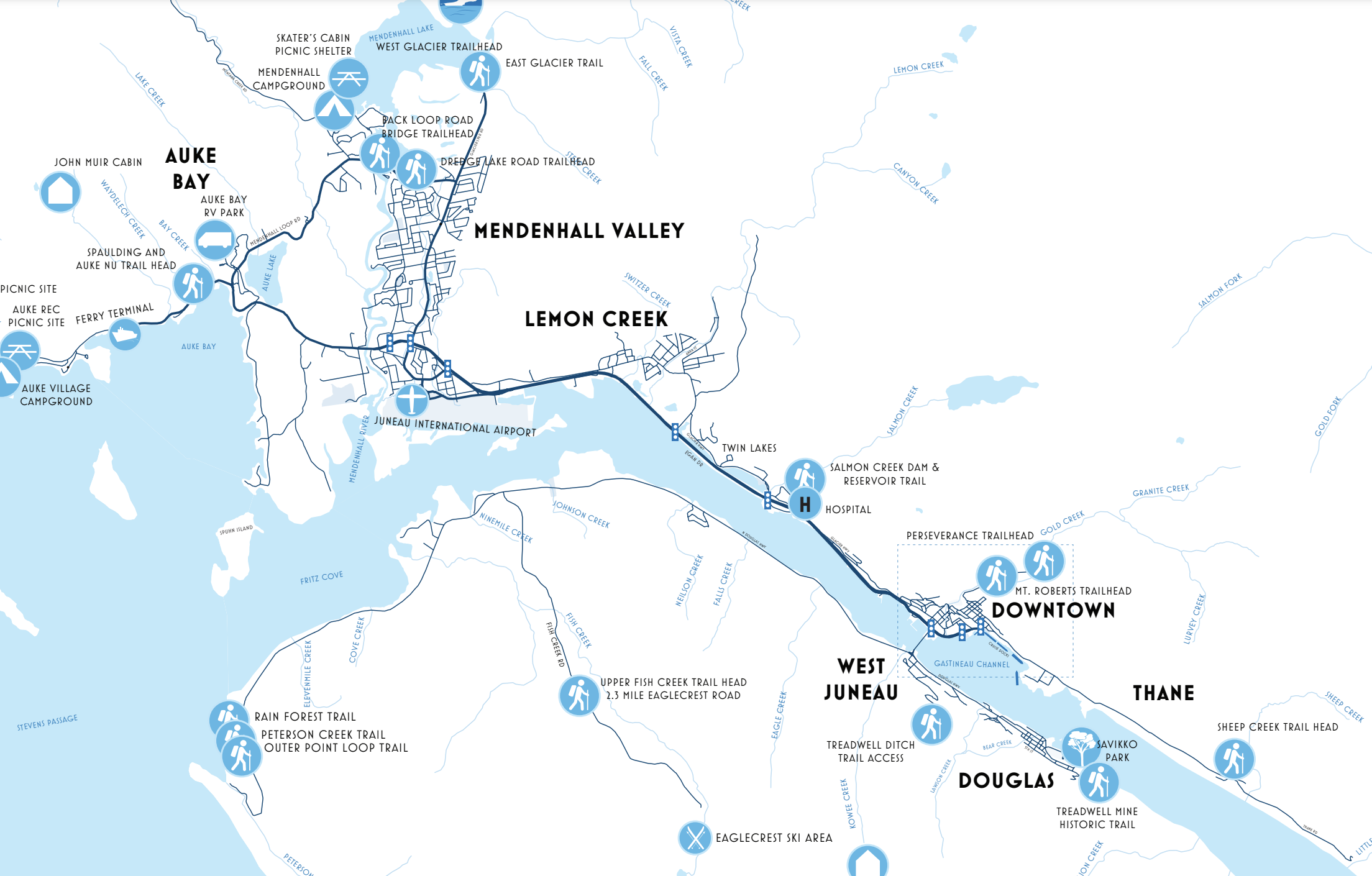
Before I get into the entry, I will give a quick geography lesson of the area! Southeast Alaska, which is predominantly mountainous rainforest, is cut off from the rest of Alaska, and mostly even from neighboring Canada. Many people visit Juneau as one stop on a cruise that visits several towns in what is called the Inner Passage. Despite being Alaska’s capital city, it is only accessible by plane or one of those cruise ships. Juneau sits to the east of a channel of water called the Gastineau Channel. Downtown is the touristy area where the cruise ships dock. The main road travels north a few miles to the “midtown” area, then continues further north through the Mendenhall Valley, where the airport and University of Alaska Southeast is located, as well as the namesake Mendenhall Glacier. The road continues north quite a ways into the sparse surroundings before ending. The road also continues south of downtown for a little bit as well. From downtown there is a bridge across the channel to Douglas Island. Douglas Island is a mountain that is mostly just the road from the smaller town of Douglas that wraps about halfway around the northern part of the island passing homes along the road and a ski resort at the top. If you care to travel elsewhere you need boat or plane access!
This is a good map from the city of Juneau showing the areas I mentioned. You can see the extent of the Douglas Island road and the southern end of the road through Juneau, but the northern terminus of that road is still aways off the map.
View of Juneau from Douglas, looking across the Gastineau Channel. Cruise ships, mountains, and a plane coming into land on the water!
We landed on Wednesday, as scheduled and were off on the adventure! We settled into our AirBnb, a really nifty cabin on Douglas Island, right across the Gastineau Channel from downtown Juneau. The area and cabin were perfect for the peaceful setting, but the spot was only a few minutes from downtown Juneau and also from Douglas, the little town at the south end of the Douglas road. There aren’t many things to do on the island other than the ski resort. There is a Sandy Beach (that’s its name!) and a few restaurants and shops in Douglas. Other than that, it’s mostly residential with some hiking opportunities, but made for a convenient base camp for the first half of the trip. Heading into Juneau, we made a stop at the Red Dog Saloon in downtown. This is a very kitschy place that seems to be a “must do” for tourists in downtown. I am glad we did it, although the place was a little too touristy for me, but they did offer a proper duck fart (it’s a shot)! Next up we meandered a bit and took in the sites of downtown. Juneau is the 2nd largest “city” in the state, and also the capitol, but it’s still quite small with a population of 32,000. The scenery is great, so simply walking around was cool! After dinner we checked out the Alaskan Hotel and Bar, an old school hotel and saloon style bar, with a stage and karaoke that night. After some fun there it was time to catch some shut eye. Mind you …June in Alaska: even though pretty far south, still, June in Alaska (bring eye masks!)
I took this shot of Douglas Island and town from a trail above Juneau.
Be sure to click this to get a better resolution to read the sign!
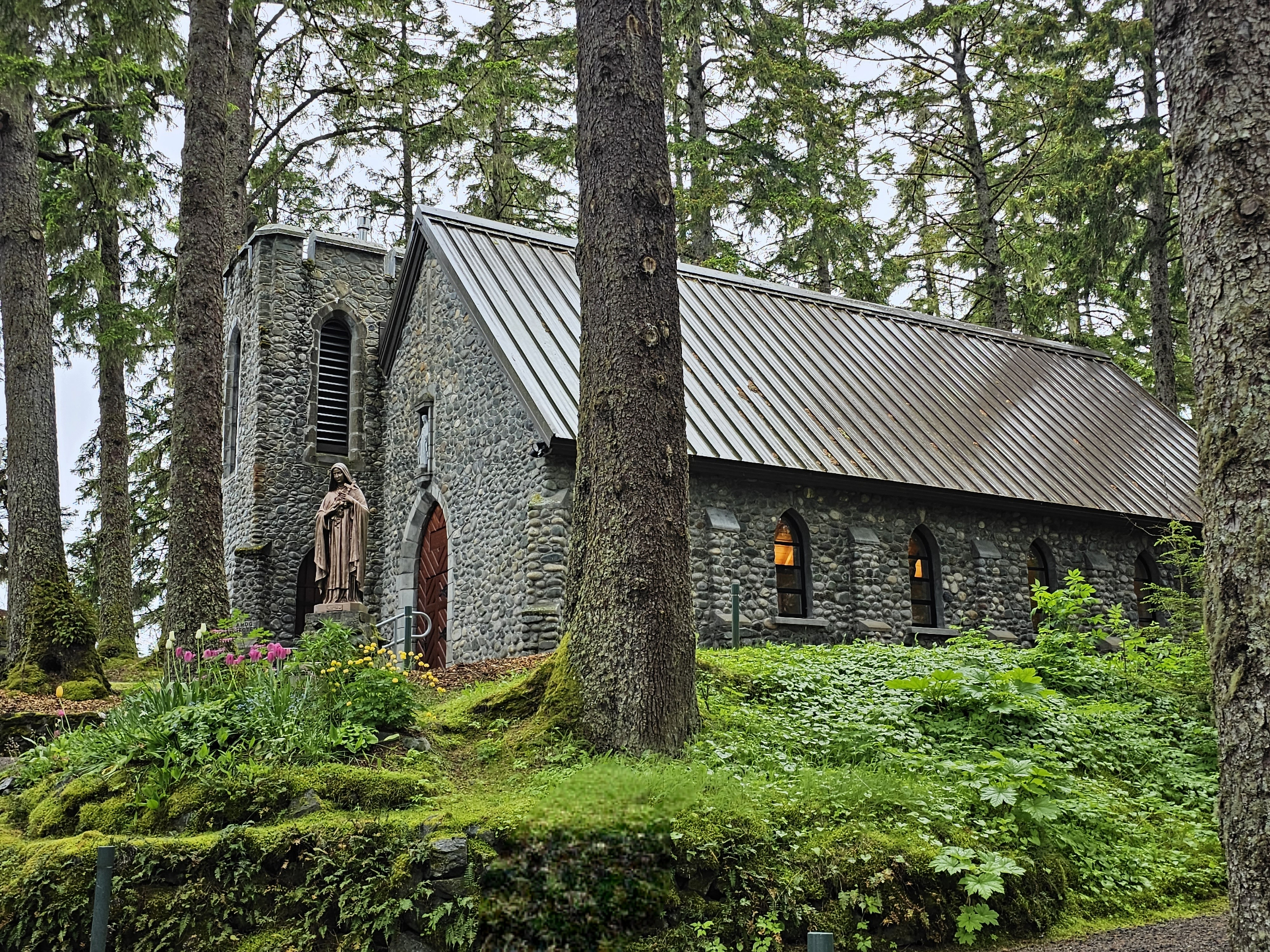
Thursday saw us begin the day by visiting the Sandy Beach in Douglas. Here we walked on an actual …well…Sandy Beach! There was some kind of structure sitting up high out of the water (it was low tide) and a bald eagle was chilling on top with the mountain serving the perfect backdrop. It was a great peaceful spot to take in the surrounding scenery. From there we headed into Juneau and did some more exploring! Juneau has a cruise ship port so we checked that out: pretty much what you would expect with shops and restaurants for the cruise passengers. We stopped at a couple breweries: Alaskan Brewing Company and Forbidden Peak Brewery. FYI, there are weird alcohol laws in Alaska. A brewery can only serve what they make, and only like 32 ounces to anyone in any one day, yet you can go to the bar down the road and drink as much as you want. They also have to close at 8, and there is some weird rule against games and music in a brewery as well. Really bizarre! Alaskan Brewing Company is located in an industrial type spot in the midtown area, although they do have a tap room near the cruise terminal. They had the better beer, and you can actually find their beer in a lot of the lower 48. Forbidden Peak is in the Mendenhall Valley, and has a nice covered outdoor area with fires, overlooking Auke Bay, so the scenery was much better. We departed from there and drove the road north about 15 miles to a quaint church called The Shrine to St. Therese. It’s a particularly well known photogenic spot, but at this point it was raining and starting to get cold so the visit was brief and we headed back to downtown. A very enjoyable place to hang down by the cruise ships is a place called the Hangar. The bar here overlooks the marina and you have a huge cruise ship staring down at you, but the sea planes depart from right below the Hangar…hence the name! The Hangar had some pretty banging fried mushroom “fries” with sweet chili sauce…I highly recommend! We did some additional recon for activities later in the trip and stopped for dinner at a delicious Indian place called Spice, and by “nightfall” we found ourselves at another old school saloon type tavern called The Crystal Saloon. There is also a stage there and it was open mic night, so good entertainment was had!
Thought this was a perfect first morning view! I took this from the Sandy Beach.
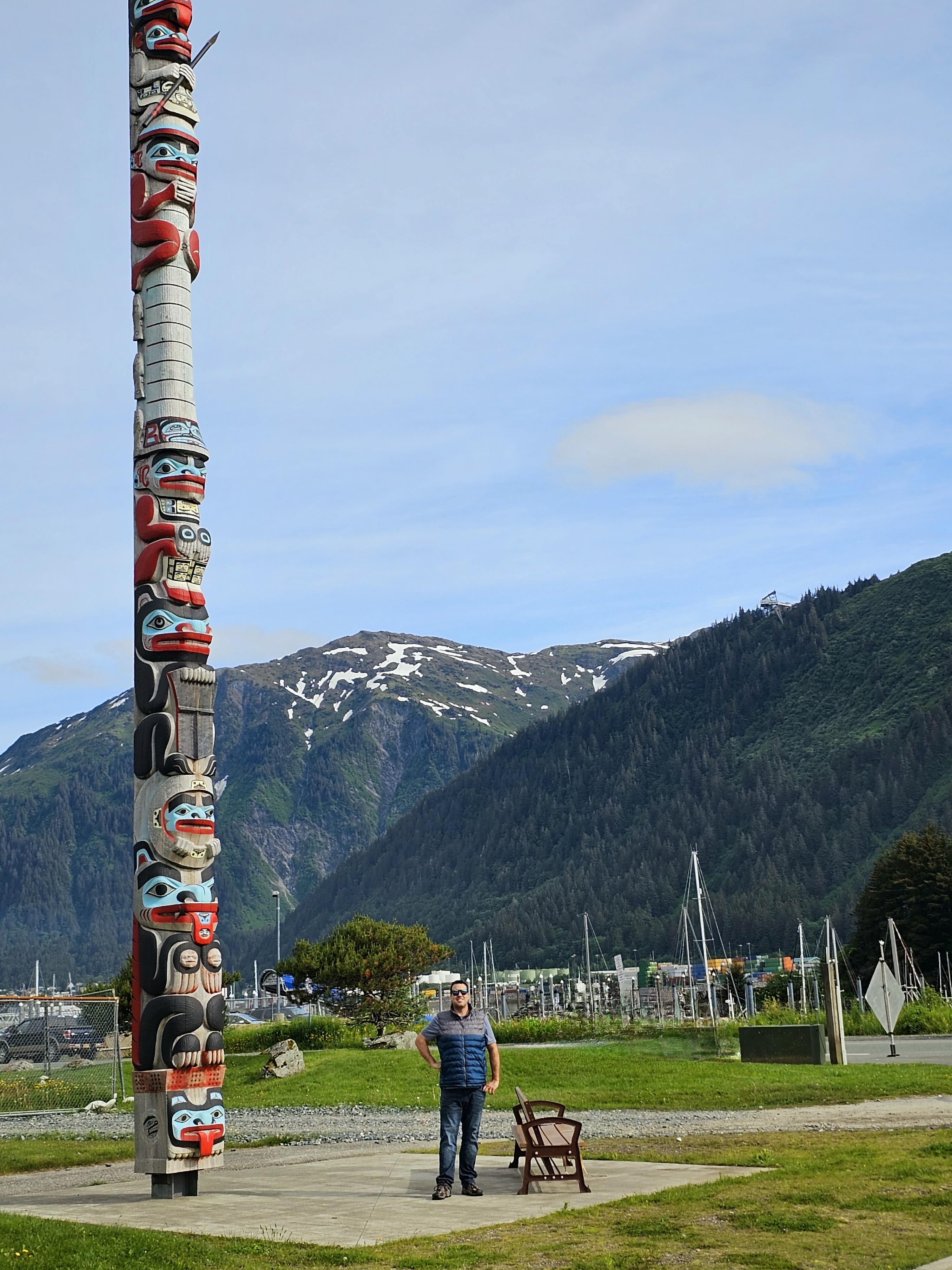
Pretty stinkin tall totem pole! This is also in the Sandy Beach area.
A surprisingly large amount of friends and family members thought this was a real whale when posted to social media! We found a nice passerby to snap this picture and unknowingly got the perfect angle to make this sculpture inside a pond look like we were right in front of the channel with a breaching whale!
The Shrine to St. Therese, taken by me, before the rain started coming down.
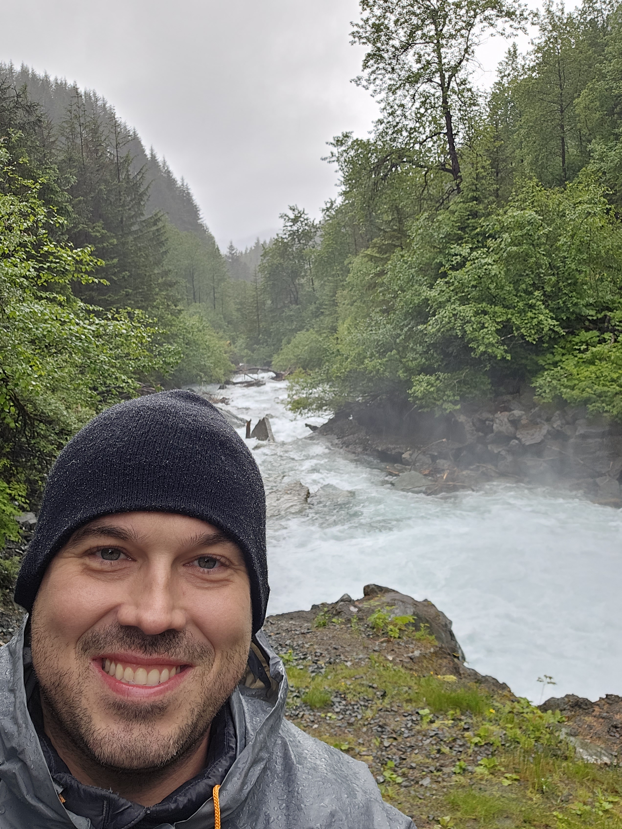
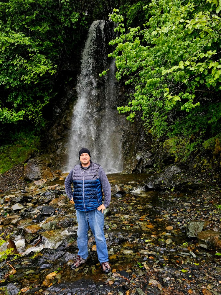
While Thursday was a litle suspect, weather-wise, Friday was a good old fashioned southeast Alaska day: heavy rain and 50 degrees. This was also the day that I had initially intended to check out Glacier Bay National Park. Thankfully during the layover on the way up, I was able to get everything rebooked for a Sunday visit! So, instead we did rainy day things! After a nice breakfast at The Rookery Cafe, not too early, we headed to another brewery nearby in downtown called Devil’s Club Brewing Company. They have some damn fine beers as well, check it out for sure! As you can imagine, with all the mountains around there are many trails to explore. Even with the rain, we did a simple, not terribly long, yet pretty hike called the Gold Creek Flume Trail. This trail is accessed pretty much from the downtown area and follows an old creek that I bet used to be a gold panning creek (big brain!?). The trail itself looks to have been an old transport rail and is generally flat and very easy. After the hike and a revisit to the Hangar, we drove back to Douglas Island and drove the road north a bit. We explored a bit of the ski resort area, closed for the season, of course, and found a cool waterfall near the end of the road!
Water rushing down Gold Greek. The trail runs parallel, but crosses the creek at the end before continuing on to Mt. Roberts.
Waterfall found near the end of the Douglas Island Road. Taken by the Sidekick.
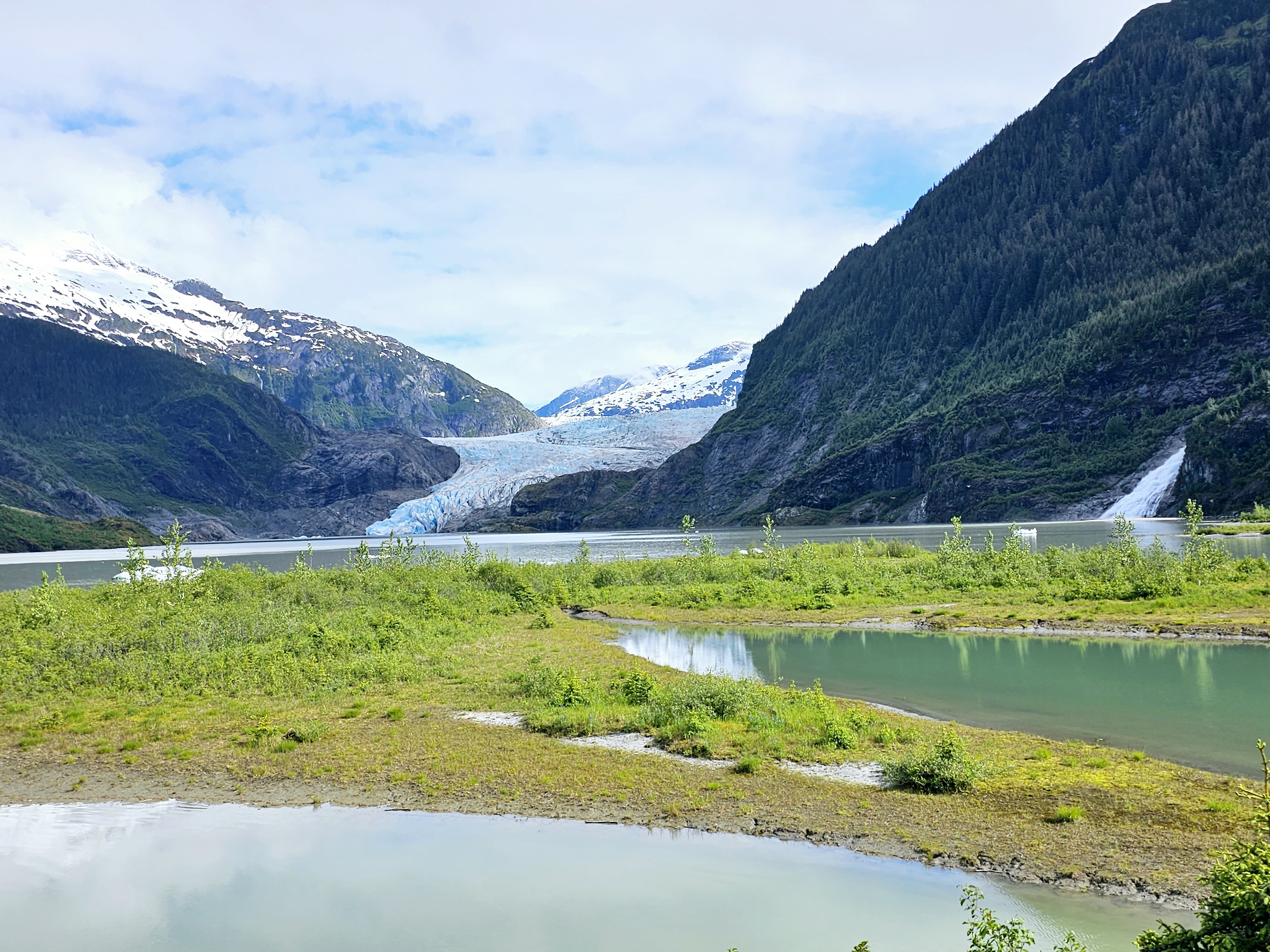
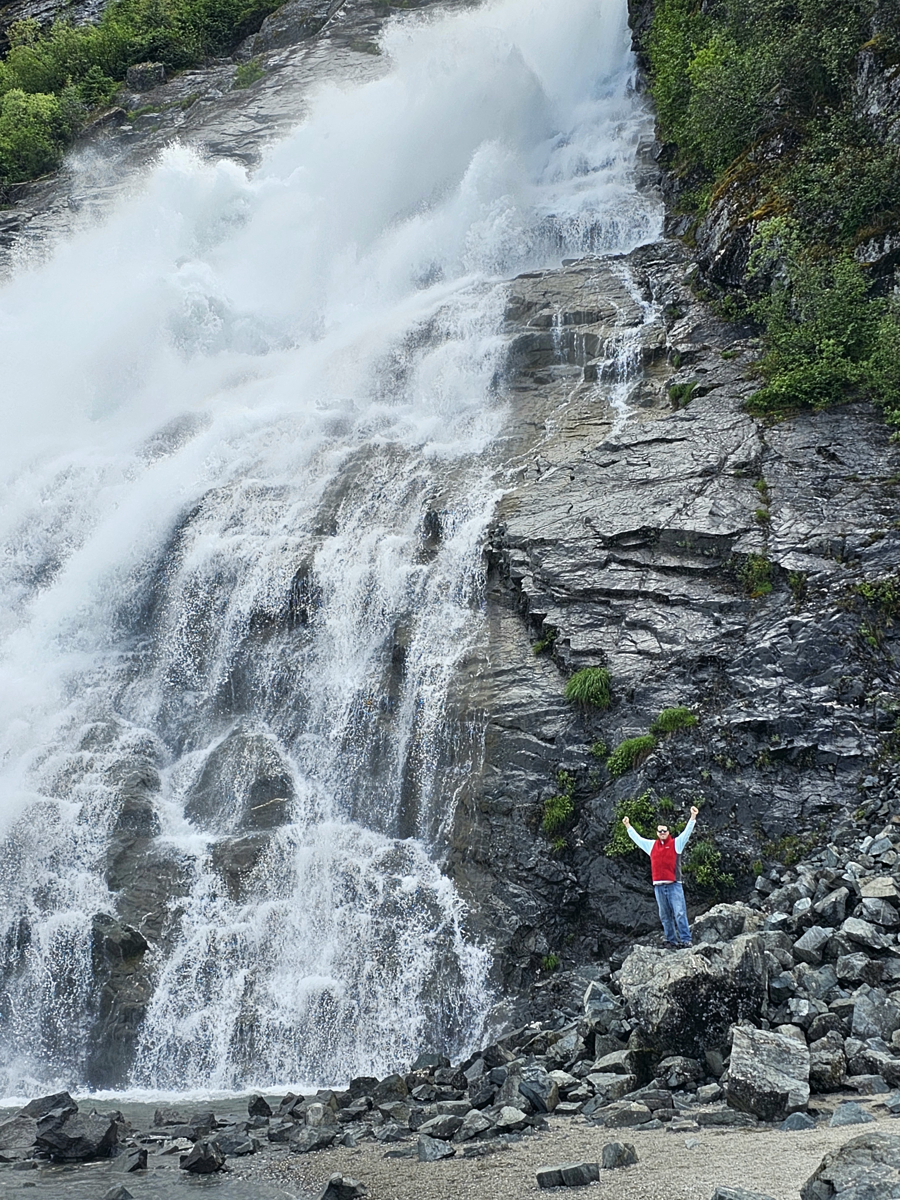
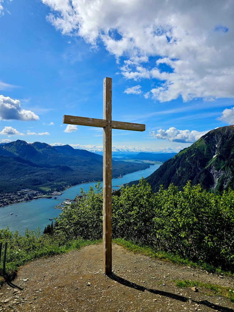
Saturday was the first of three absolutely stunning days! We planned to explore the Mendenhall Glacier, the real Juneau showstopper, and planned accordingly to spend half of the trip in lodging nearby, so this was the day to change locations. The glacier was neat to view, but it has retreated so much that the best view is from the visitor center viewing platform. To access the glacier you need to kayak, as trails only take you to other viewpoints. There is however, one cool feature to hike to: Nugget Falls. This waterfall is pretty impressive! It only exists because of the glacier’s retreat and is found at the end of a pretty easy, mile or so hike. If you want to see the area without a huge crowd, get there early to beat the cruise ship crowd! After adventuring around the we headed back downtown to check out another must do in Juneau: Deckhand Dave’s Fish Taco food truck. Legit, this is a must do in the area! The Sidekick is vegetarian, so while the place is called a ‘fish taco” joint, this is actually a food truck/bar “area” with several options that suited her, while I got shrimp tacos that had been harvested that morning from Skagway! When I say get there at opening at 11 AM, you should! We were there a bit early and still had to wait in line. At 11 the line for the fish taco truck was about 20 deep! Next up was the bigger more strenuous hike: Mt. Roberts. This trail is actually a continuation of the Gold Creek Flume trail we hiked earlier in the trip. This trail leads up the mountain that overlooks the Gastineau Channel above Juneau. There is an aerial tram that also leads up to the mountain from the cruise ship terminal. It is quite pricey at 50 dollars up, but if you hike up, and tram down it’s 10 bucks, or FREE if you spend money at the restaurant/bar/gift shop at the top. Most people do that, and so we did as well. After reaching the tram station, the Sidekick decided to chill at the restaurant and I continued about another half mile or so up the trail to a beautiful scenic spot called Nolan’s cross. This spot is gorgeous in every way! Definitely a highlight for the entire trip! The trail actually goes on for many more miles but this was my ultimate destination, so I met up with the Sidekick and we called it a day to prepare for an early morning.
Mendenhall Glacier. I took this from the short viewpoint trail. If you have accessibility issues, this was a pretty easy spot to get to. Nugget Falls is on the right side here.
The Sidekick got this shot of me in front of the falls!
Totem pole I snapped a pic of on the Mt. Roberts Trail.
View down the channel looking at Juneau on the right and Douglas on the left. Taken by me.
This is Nolan’s Cross on the Mt. Robert’s Trail.
This is the tram up to the mountain. Or rather this was coming down since we hiked up!
Sunday was yet another stunning day! The Sidekick and I hopped on bush plane and flew out to Gustavus, AK to visit Glacier Bay National Park. This is one of the 63 “big” National Parks, and one of 8 found in Alaska. This one requires some hoops to get through, but due to its proximity to Juneau, other than some money, it’s not terribly inaccessible. Follow the link to read the separate entry for this side adventure!
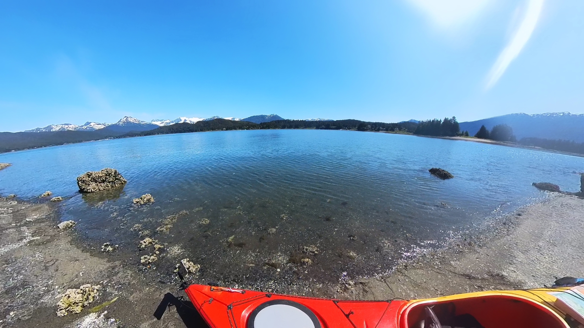
Monday was our final full day in Juneau and it was another day of amazing weather. We rented kayaks for a 4 hour self paddle through Auke Bay. The rental was an ocean kayak. I own one of these myself, it’s about 18 feet long, and they absolutely do not handle like a sit on top or a canoe. I only mention this because the bay is home to active yachts, fishing boats, and pleasure boats. As far as we understood there is no wake-free area in the bay, so attentive navigating is needed to deal with those swells in sub-50 degree water. I am happy to report that the “8 Days Without a Capsize” sign the outfitter displayed did not need to reset when we returned! The kayak trip was a couple miles and took us to an island for a snack and a beer. The tide comes in CRAZY fast here, so our stop was brief before the shore disappeared! After an uneventful return paddle and a low key afternoon, it was early to bed before a midnight wake up call for the airport and this trip was in the books!
Yakin in Auke Bay!
From the island we landed on in Auke bay. We were there for about 15 minutes and had to move the kayak twice from the rising tide
Overall Impressions: I found Juneau to be super cool and a perfect place to visit. I strongly feel a visit here needs to be longer that a mere cruise ship stop. There are definitely enough things to occupy several days and if you have to contend with weather issues, you will want those extra days for sure! Be prepared to open your wallet. Alaska is expensive in general, but getting to Juneau seems to be even more so. I would absolutely love to come back, but I also absolutely want to visit some of the other little towns scattered around, so unless a stop over in Juneau is a part of that trip, I am uncertain that I will make it back here. It’s a beautiful place though, so go check it out if you can!
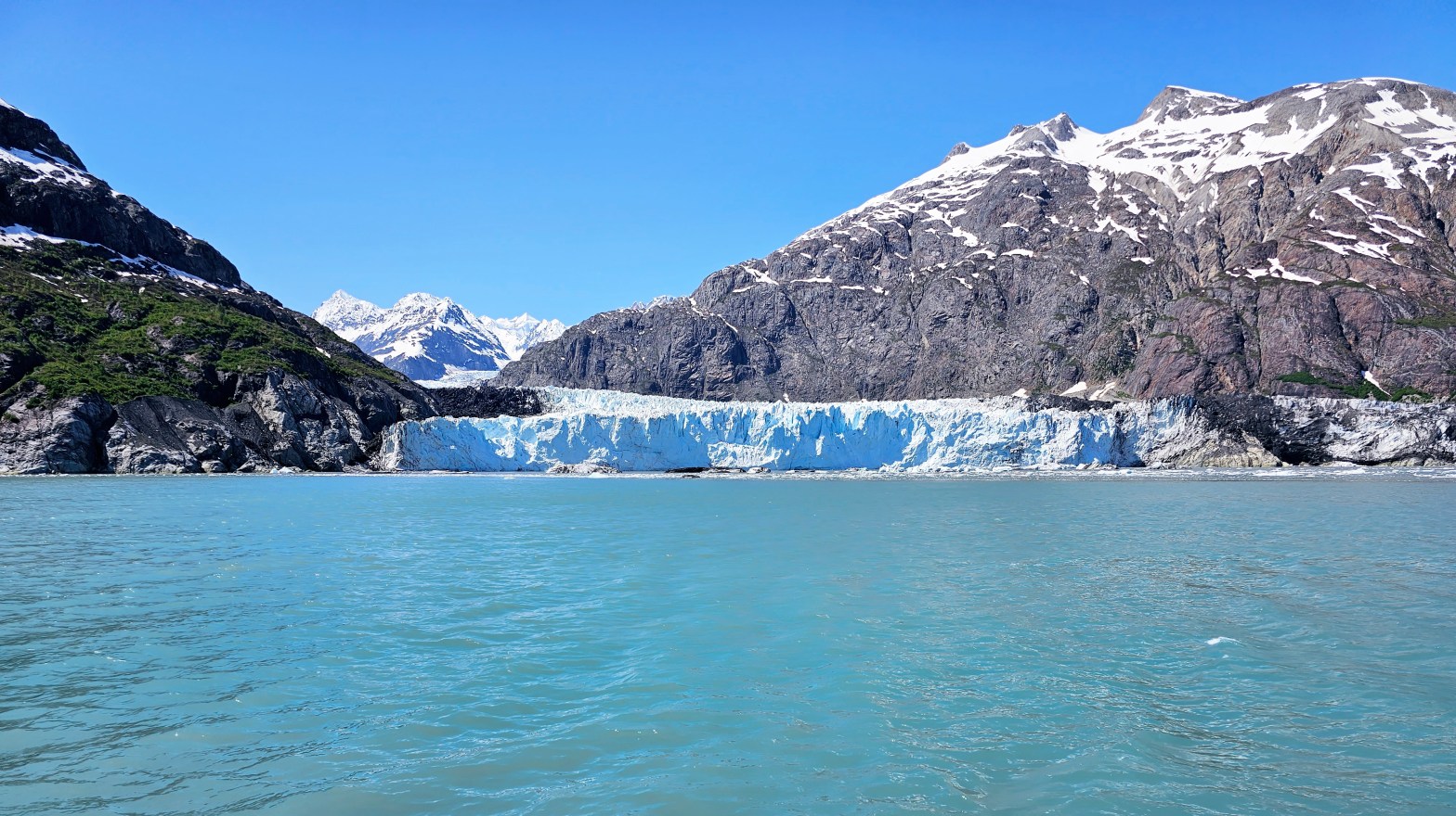
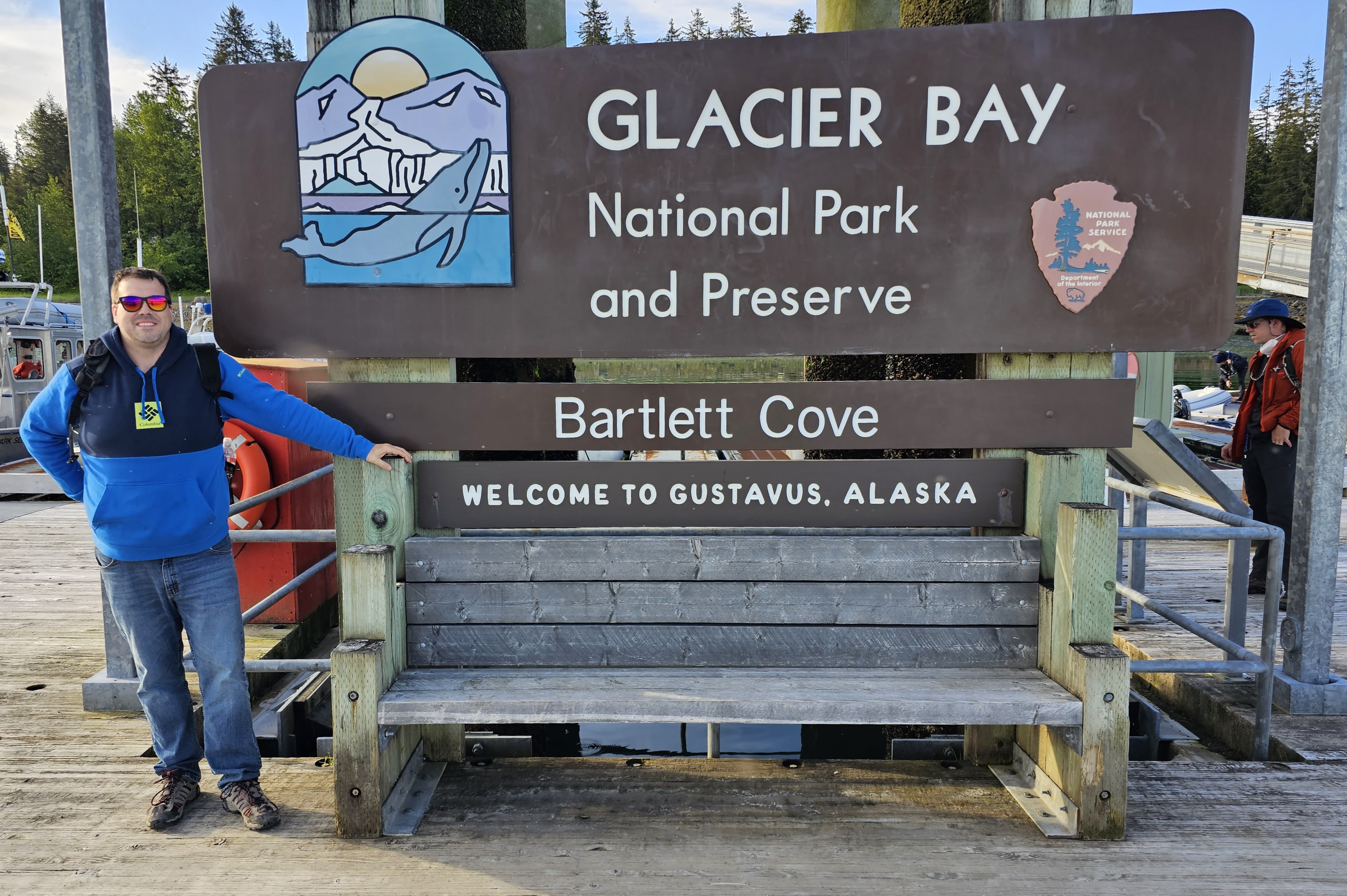
Hey there adventurers! I am a little behind on my posts! There will (hopefully) be a slew of them coming up! Today I begin with the day trip tour the sidekick and I took to Glacier Bay National Park in Alaska earlier this summer! This marks my 34th National Park and my 4th, of 8, Alaskan park. This park is mostly inaccessible and you are not going to find trails or many *easy* activities at all. If you want to see the park you must do it by boat or plane. If you want to *really* see the park, some people take a kayak trip for a few days, camping along the shore as they go. Some people stay at the lodge and do some smaller private charters into the bay. We flew in from Juneau for the day to do the catamaran tour offered by the Glacier Bay Lodge inside the park.
Not visible are the countless skeeters…
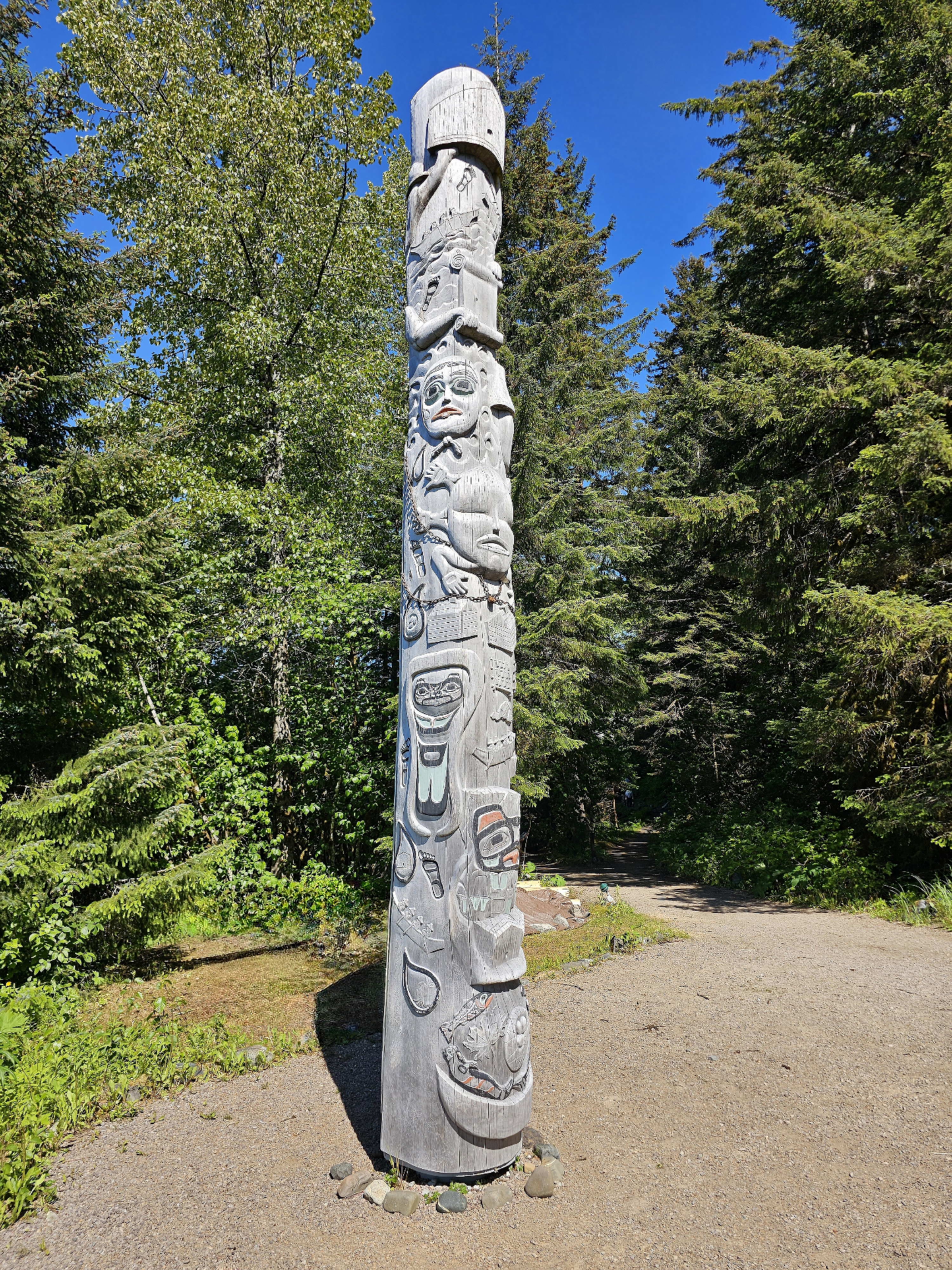
Yaa Naa Néx Kootéeyaa, or the Healing Totem Pole. This was designed and created by Tlingit elders, cultural advisors, and artists. If you look closely, toward the bottom you can see a record of the ice encroaching and destroying the village that used to be here, driving the native Tlingits out. That was only 250 years ago!
Before sharing the highlights I want to definitely plug Alaska Seaplanes, TLC Taxi, and Glacier Bay Lodge and Tours! Most people who experience this National Park do so from the comfort of a large cruise liner as part of a much longer cruise trip through Alaska’s Inner Passage (Note: only certain cruises are allowed by the NPS to enter the National Park, so plan accordingly if you do this). The day I was scheduled to do this day trip ended up being a total rain out. While en route to Juneau, the Sidekick strongly suggested I do my damnedest to reschedule as the days after were all forecast to be awesome. I was going to be doing this on my own, but with how nice the future weather looked, she decided to also come along. Alaska Seaplanes had no problem at all changing the day of my flight. Due to timing, we had to fly one way with them and fly Alaska Airlines back (using points meant free and easy rebooking with Alaska). The Lodge charged me a small 10 percent rebooking fee for the cruise, but that was it (note that this was only possible being more than 72 hours out), and TLC Taxi was able to squeeze me into the new date. The reason the taxi situation was pretty important was due to this guy being the ONLY ride option, the flight options in and out of the town of Gustavus are close to the cruise times, and the “airport” to the cruise boat is about a 30 minute drive…so all pieces needed to work, and they did!
We were in Juneau first, and booked this day trip from there. The tour was 8 hours, the entire trip about 12 hours altogether. The tour cost was average for an Alaskan excursion- about $250 a person. The flight out on Alaska Seaplanes was another $200-ish a person. Miles on Alaska Airlines coming back made that flight free…but I think the cost was like $169 or something if paying dollars. The taxi was about 50 bucks a person round trip. The flight to Gustavus, 60 or so air miles away, was about 30 minutes on an Alaska Seaplanes 8 seater. This being the middle of nowhere Alaska, the only way is by air or, much longer, by boat. The flight was great – beautiful scenery, of course, and soon enough we were back on the ground. Gustavus is the gateway town for the national park boasting a population of about 600. The roads are surprisingly paved and there are *some* services in the town, but generally speaking, it’s a remote town with little life comforts, and that’s ok, we didn’t need that. After deplaning, the driver was waiting at the airport for us and we made it to the boat dock about an hour or so before departure time.
Video I took of the approach and landing in Gustavus.
After a good 30 minutes waiting on the dock, suffering the wrath of Alaska’s state bird (the deet was safely stored back in Juneau…), we were on the boat and off on the cruise. Of course I was stoked – this being another National Park visit! At the moment, the National Park Service only allows this one operator to do this large scale tour, so it is the only option to see the park unless you are looking for a private charter. The weather was AMAZING but I was a bit disappointed that the catamaran only had outdoor standing areas on the back of the vessel, and the top deck giving the 360 degree views is only utilized sparingly, when the vessel is sitting. That being the case, the windows on the vessel were large and mostly uninterrupted and the views were still good.
The Fairweather Range rising off in the distance.
Mt. Fairweather itself. It’s about 70 miles or so away from this vantage point at the dock area.
Here is the path the ship takes from dock to the end of the bay. You can also see the markings of the glacial extent and the year it was there. Notable is that the dock we left from was completely under ice as recently as 1794.
Glacier Bay is the same story as most of the world’s glacial areas: melting and retreating. Only a mere 200 or so years ago natives left the Gustavus area due to the ice being a problem for them. Now, the glacier that carved the bay is some 70 miles north. That is the destination of the tour. Upon setting out the views and scenery are spectacular! At one point the ranger pointed out that Mt. Fairweather was visible and they hadn’t seen it in weeks. This mountain marks the boundary of the US and Canada, is part of the National Park, and is 15,300ish feet in elevation making it the 7th highest peak in the United States! I also got a great view of it from the dock later in the day! Also, the wildlife viewing was awesome! We saw many whales, puffins, golden seals, mountain goats, sea otters, and tons of other birds, including some eagles.
Two whale tails!
Two puffins!
Chillin.
Mom and baby! They were really far away, and this was that telephoto on the phone! It’s not the best, but definitely better than probably any other phone camera!
Lof of chillin animals in Glacier Bay! These are steller sea lions.
More sea lions with otters splashing about!
Short video of some of the wildlife. If you listen carefully you can hear the sea lions! One was being very noisy! He was louder in person than in the video for sure!
The trip up the bay took 3 or 4 hours and once we got to the end of the bay we saw the extent of the glacial retreat. From our vantage point here 2 glaciers were visible. The main draw now is the Margerie Glacier which is the beautiful white and blue tidewater glacier that still reaches the water, coming in from the west. The bay, however, was carved by the Grand Pacific Glacier. This one is also here at the perpendicular, coming from the north However, the ranger on the ship informed us that it has retreated so much that essentially is no longer reaches the bay and the glacier we were actually looking at is one called Ferris, which used to flow into the Grand Pacific but now the entire ice front that is visible is this one. This glacier is dirty and rocky, looking little like the ubiquitous glacier view and more like a dirty levy. The glacial retreat here is shocking and we were informed that it has happened so fast that the land here is rebounding upward at 30 plus mm a year, the fastest of any place on earth. It was mentioned that there is a spot near the docks that used to be at mean sea level in the middle of the last century but is now 5 feet above mean sea level, 75 ish years later.
Margerie Glacier, which is now the main glacier draw.
Closer view of the glacier.
In case you have a great affinity for ice…here’s a super close up!
In this picture you can actually see the dirty part of Margerie Glacier under the green plants. As you move your eye to the right what looks like a dirty hill is actually the terminus of the Ferris Glacier. Until relatively recently this would have been the Grand Pacific Glacier, which has now retreated so much that it is now behind the outflow of Ferris and no longer tidewater.
Short video showing the glaciers at the end of Glacier Bay.
Reid Glacier, another smaller glacier seen from the tour.
Overall Impressions: Beautiful and awesome place! But, more of a hassle and pricier for an experience that can be very similarly had with a lot less hassle and a lot less expense only a few hundred miles away at Kenai Fjords. The NPS is keeping this place pristine and untouched and that’s a great thing! But there are also very few things to do other than this boat tour unless you want to tackle the kayak camping option.
Hey there Adventurers! I promise I will get caught up soon! In the meantime here are a couple pictures from Sequoia and Kings Canyon National Parks. In a few days I will be headed back to Cali! I initially had an 8 day 3 national park trip planned. However, I was feeling uncomfortable being away from my Bark Ranger Bella for so long again, so I shortened to 5 days and 2 parks: Lassen Volcanic and Redwood. Stay tuned for pictures from those parks soon!
This is Kings Canyon taken from Hume Lake Road. The road in the picture goes on a ways but unfortunately, the storms earlier this year wreaked havoc on these two parks and most of the KIngs Canyon Highway is closed for the year. Just getting to this spot was an unexpected perk, however!
Some of the beautiful yellow flowers in the area, complete with a bee!
And these gorgeous purple flowers are around too!
And the star, General Sherman, the world’s largest living thing! (Meanwhile this picture looks amazing on my Samsung but not so good here, I’ll try to figure that out!)
Hey there Adventurers! So I have been a little light on posts recently: My apologies! I assure you there are many coming! The sidekick and I just got back from an awesome trip to Juneau, AK! And we are headed to California in a couple days, and then I am going back to California for a mostly camping/national park trip later in July! In lieu of a proper post, for now (it is in draft form and I don’t think it will finish before the next trip!) I wanted to share a couple pictures from the very recent trip to Juneau and Glacier Bay National Park! Thanks for reading and enjoy!
This first picture is Mt. Fairweather, in Glacier Bay National Park. The summit is the border between the US and Canada. The park ranger on our tour said they hadn’t seen the mountain in a month! This picture is taken roughly 70 miles away, and the mountain is merely the 7th highest peak in Alaska. Which makes it at least 1000 feet taller than every other mountain in the other 49 states! I took this with my new phone and I think the camera on this phone is doing a pretty good job!
And this picture is more of a poignant one. The sidekick and I hiked up this mountain a ways and she stopped at tourist stop a little down below. I continued up this trail on Mt. Roberts in Juneau and found this cool spiritual spot!
There will be more to come soon! Up next is a trip to California with the sidekick. We are visiting Kings Canyon and Sequoia National Parks as well as some LA area exploring! Only a week after that trip finishes I am going back out to Cali and doing a camping trip at the No Cal parks and Crater Lake in Oregon, so stay tuned!
Hey there Adventurer gang! I just want to provide an exciting update about BARK Ranger stuff! The official US Bark Rangers of the United States National Parks page now boasts over 1600 members with an average of 150 interactions every day! Super exciting stuff!
We are also selling a beautiful vinyl sticker of our logo!! Additionally, we are actively pursuing the development of other items in the near future as well! If you are interested you can drop a message in the comments, or you can check out our ebay page. We have two different sizes to choose from!
In case you are wondering: What is this Bark Ranger stuff? BARK is a set of expectations that humans and their dogs (and we have one very well traveled cat in our group!) should follow when experiencing the beautiful outdoors in our beloved national (and state) parks! Some of the parks even offer a “program” of sorts to earn a unique badge or certificate to prove Bark Ranger status! Our amazing group is composed of members who love taking their fur kids to the parks and promoting the program. One of our members even worked with Ninety Six National Historic Park in South Carolina to create their Bark Ranger program! Check it out here! I cannot imagine a more perfect expression of the mission of our group!
If you are a dog lover and a park lover, be sure you join our group! We would love to have you and your knowledge of dog friendly things for the areas you live in or have visited with your pups! The sidekick and I are planning a weekend trip the end of this month to take our girl dogs to Timucuan National Ecological and Historic Preserve near Jacksonville, FL, which has a Bark Program! We are hoping to bring some good first hand info to our group! Stay tuned for the post here for that trip!