Hey there Adventurers! I am super excited to be getting on a plane to Fairbanks, AK here in a few hours! The flight path is Tampa to Seattle (6 hours and change) and the Seattle to Fairbanks (3 hours and change). With a 1 am arrival.
This trip is a very unstructured one with the goal to be seeing the northern lights (the forecast for both lights and weather looks pretty great!) and hiking a great trail in Denali national park (and praying to see the mountain!) but here is the framework and things on the list to think about or do! Monday is all day in the Fairbanks area. Stops to include North Pole and Chena Hot Springs. Tuesday, depending on other things to do in Fairbanks, will entail driving to the airbnb in the wilderness outside of Healy, AK. Between then and Friday AM the plan is to do the Savage Alpine Hike in Denali, see some friends in a dinner theatre show, see the sled dog kennels in Denali, visit Talkeetna, 49th State Brewing, and head up the other side of the Hatcher Pass road! You might remember from my June trip that I went up the Hatcher Pass road, but from the opposite side until the road was closed! This time would be the other direction! Cool stuff! Friday is a back to Fairbanks day and hopefully a nice dinner and a visit to HooDoo Brewing before catching a 3 AM flight back to Tampa!
Stay tuned for some updates! Hopefully I will have some more amazing fall pictures! Thanks for following and if you have any suggestions, drop them below!!
Hey there Adventurers! Here is a fun video of the Alpine Coaster at the Glenwood Caverns Adventure Park in Glenwood Springs, CO! I best most of you have not been on an alpine coaster! This is my first and so far only one! They are not common it seems! Basically, go to top of mountain. Put your seatbelt on. Push off. Finish at the bottom of mountain! Braking is optional and controlled by you. You are solely responsible for your own death. This park is really fun and lots of scary height stuff!
I left my go pro at the bottom of the mountain. So the phone it was!
This was a few years ago and I have been bit remiss on doing videos of some of my previous trips! Although this year has already been epic with trips to Maui, Utah, one trip to Alaska, and one more upcoming to Fairbanks there is nothing else currently on the horizon. I am looking forward to catching up on videos from some of my previous trips this fall! Thanks for reading and following! And please consider joining my new Facebook group, the Bark Rangers of the U.S. National Parks, we are over 500 members now!!!!
Hey there adventurers! Hot on the heels of my epic Alaska adventure, it was time for Bark Ranger Bella to do some exploring! My mother, in Indiana, was closing on a house and moving, so Bella and I went up there, but took some side adventures to and fro! BE SURE TO VISIT AND JOIN Bark Rangers of the U.S. National Parks!
My hometown of Evansville, IN is about 900 miles from my house in St. Petersburg. The drive sucks. There’s no 2 ways about it. It’s 3 hours to even get to Georgia, then another 6 plus to get out of that state, then about 4 more hours from there. At this stage in life, both for me, and for her, it’s a two day trip. This time we stayed the night in Chattanooga, TN on the drive up.
On our way, we stopped for a bit at Cloudland Canyon State Park about 30-45 minutes outside of Chattanooga. This is a really cool spot! It is one of Georgia’s 40 some state parks and I have to say that this is my 4th or 5th and they are all awesome so far! This one definitely has some sketchiness of both drive and area to get to it, but it’s definitely worth the side trip! This park, as the name suggests, features a large canyon. What I didn’t know is the canyon is actually a part of Lookout Mountain. I guess that mountain is actually very long and has many area to explore! Anyway, as with many state parks, this one has on-leash and picking up poo as the only rules! B and I did some hikes and I got some adorable pictures of her in her new hat. She was a hit with the others there! (Of course!).
Ranger Bella inspecting the area in front of the sign.
The Ranger giving the “are you sure we want to go that way” look!
Cloudland Canyon.
I will say that Chattanooga has always been the grungy looking river town that I breezed through many times. This time though, I stopped and looked around, found some breweries, got some decent food, and was quite pleasantly surprised by the town! Chattanooga is SEMI DOG FRIENDLY. They don’t seem to be allowed inside, but many places have outdoor areas for them. I went to two breweries that were able to accommodate us. They were the Chattanooga Brewing Company and also Oddstory Brewing Company. Oddstory told me no dogs inside, but I was ok bringing her in to wait in line to order beer. Heads up. Both breweries were actually really good! The next morning we got up early to catch the sunrise at Raccoon Mountain. As luck would have it, the La Quinta I selected was literally only about 3 miles or so from this great viewpoint. Totally not planned! I didn’t even look up good sunrise locations until I went to bed that night!
Sunrise over Chattanooga from Racoon Mountain.
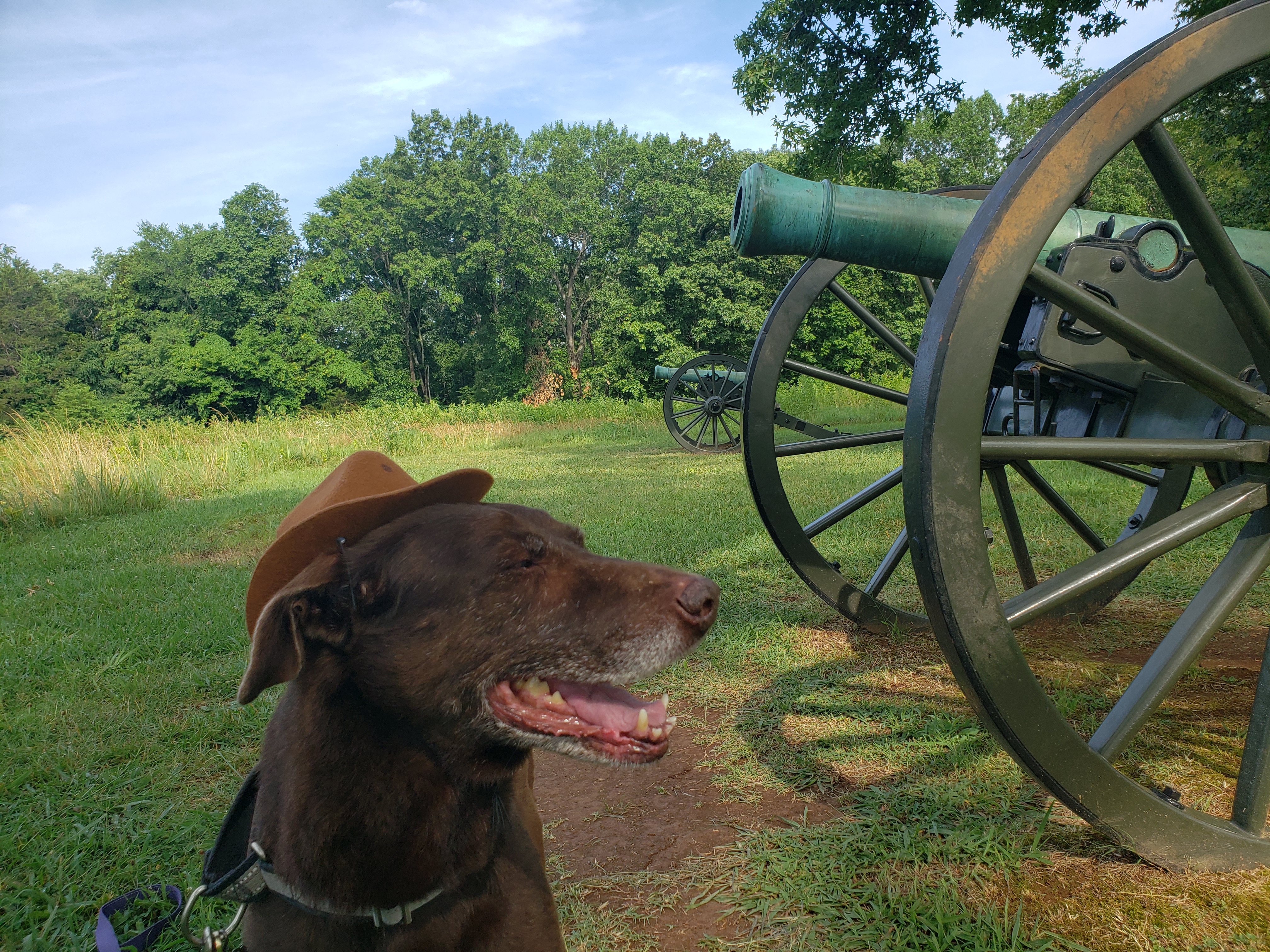
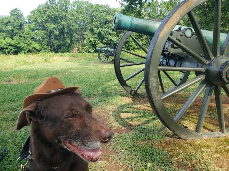
After we finished up with son duties a week later, we were back on the road! This time we planned on driving from Evansville to Macon, GA. Bella and I have stopped over in Macon before. Atlanta is the halfway point, but from Evansville, it’s about 10 or so hours, realistically, to Macon. On our drive down Bark Ranger Papa had some stops in mind! We stopped at Stones River National Battlefield in Murfreesboro, TN. The Bark Ranger inspected some canons and was just cute in general! This park is preserving a battlefield from the civil war. There is no Bark Ranger program at this park, but it is very dog friendly. Per federal regulations, dogs are NOT allowed in federal buildings, which include buildings on National Park grounds. Also, this park has a cemetary. Dogs are NOT allowed within the cemetery either.
The Ranger inspecting the canons at Stones River National Battlefield.
After departing Murfreesboro, we headed back to Lookout Mountain, specifically Chickamauga and Chattanooga National Military Park, also referred to as Point Park. This is also what everyone considers “Lookout Mountain”. It is a tourist trap in every sense of the word. If you know you know: this is where Ruby Falls and Rock City are as well…however, the park itself is a great stop for the Bark Ranger! This park preserves a civil war battlefield area and it offers awesome views of Chattanooga and actually does have quite a bit of hiking in the area. Unfortunately, there is no Bark Ranger program, but dogs are quite fine here other than the usual on leash and not in the visitor center type stuff. The human ranger working the entrance even had treats, which the Bark Ranger happily accepted!
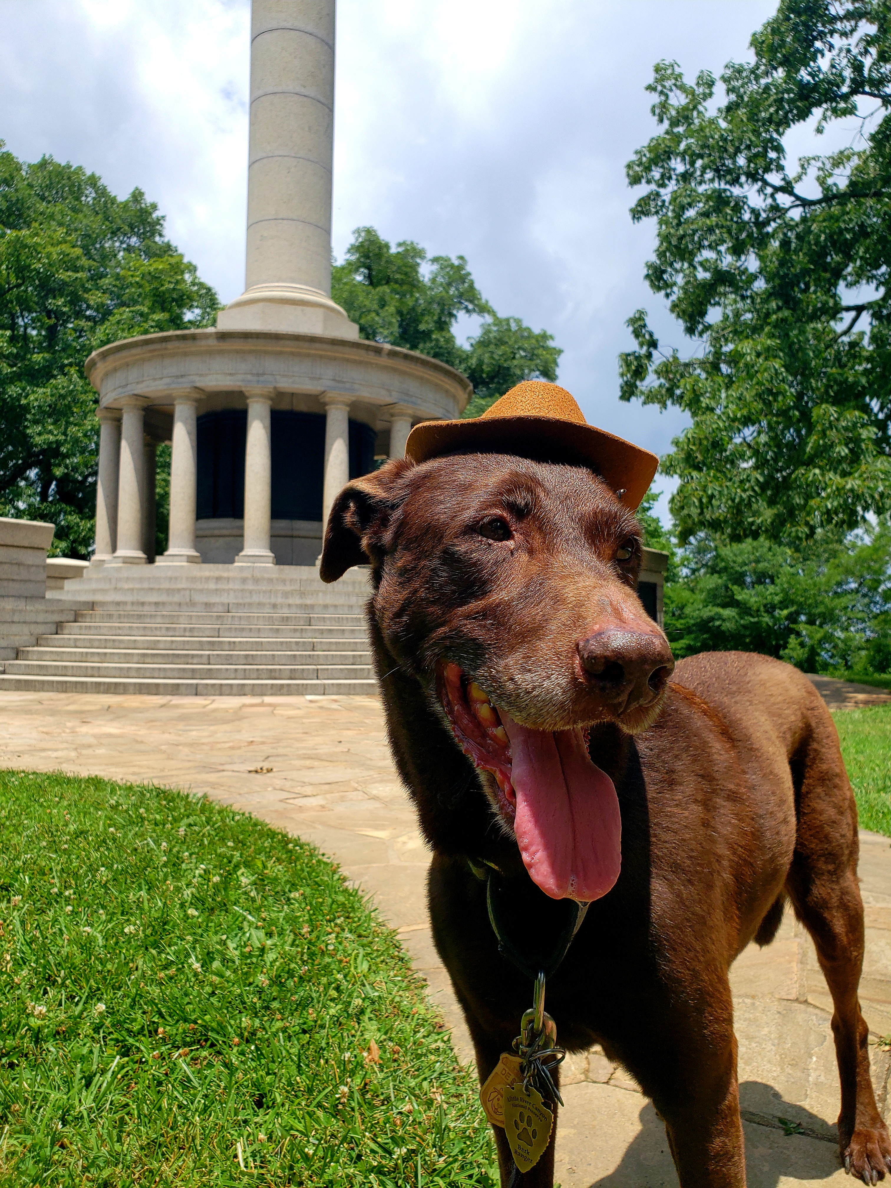
Ranger Bella poses in front of a monument on Lookout Mountain, showing off a couple previously earned Bark Ranger tags!
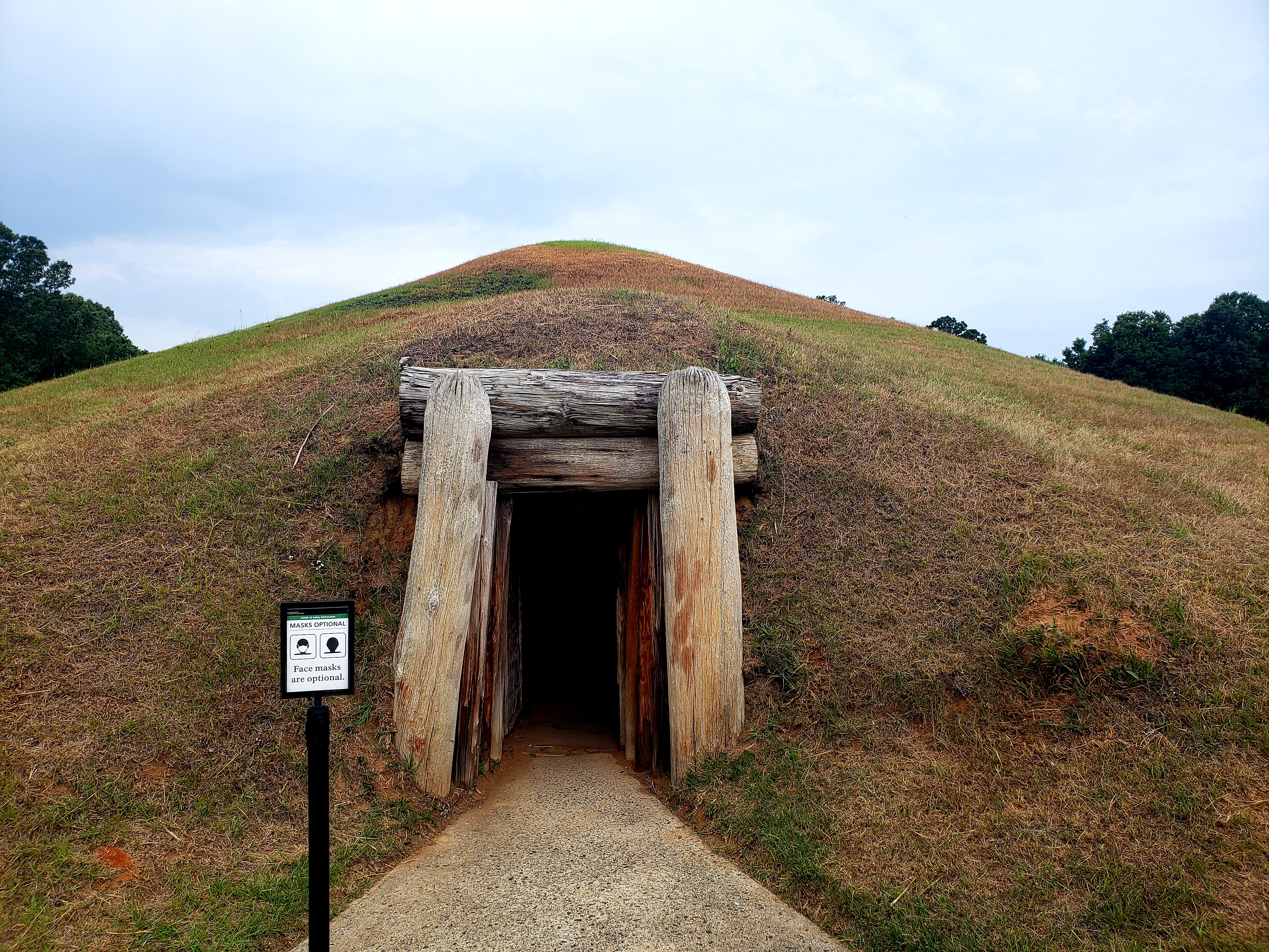
After getting some cute pictures on Lookout Mountain we headed toward Macon, GA. We checked in to our La Quinta and headed toward the Ocmulgee Brewpub. We (I) got an awesome turkey burger and some decidedly Georgia health quality fries (see delicious and dripping in bad stuff) and some great beer. In contrast to St. Pete where dogs are pretty much allowed inside just about anywhere I ever go to, other places, including Georgia are not as cool…it had been raining earlier, and the bar staff told me that usually we’d have to stay outside, but considering the weather, the rules could be bent ;). The next morning we went to the brewery’s namesake park: Ocmulgee Mounds National Historic Park. This place is very interesting! It is basically right in Macon and charts a settled history of thousands and thousands of years, up to nearly modern times, of mound builders. The park is not very large and is extremely dog friendly. They have a bark ranger program! We hiked all the trails, saw all the mounds, then Bella had to go into a cool Earth Lodge, which contains the only, or the oldest original native temple floor in the country. It’s actually really neat. I appreciated that they not only allowed her inside there but that it was “required” for the Bark Ranger tag!
Ranger Bella inspects the grounds leading up to one tallest mound in the park (we were already on top of another mound here).
This is the biggest mound at the site. There is a second mound slightly in front of it to the left. That one was pillaged of dirt to build a nearby railway….
The entrance to the Earth Lodge. Not for tall people!
This floor is 100 percent original. The spot in front looks like a bird if you are the important person sitting looking toward the entrance. The floor in either direction is tiered. If you have a good eye, you can see on the right side two levels. They continue stepping downward all the way to the entrance. On the left side is the same thing. The highest people on each side are the next highest, and the next spots are the next highest, so forth and etc. Also, this bird design is what is on the entrance sign!
Afterward, with a long drive ahead, we departed to go visit the Jimmy Carter National Historic Park in Plains, GA. On the way I discovered there was ANOTHER National Park unit nearby, Andersonville National Historic Site. We stopped there first. This place serves three purposes. Number one: it is an active National Cemetery, and while we were there, there was a funeral occurring. Dogs are not allowed in the cemetery grounds. Number two: it memorializes the dead from a civil war prison camp here. This was a pretty sobering spot – there is a large section where the tombstones, which thankfully are all labeled, are almost touching each other. Apparently, soldiers during the civil war were buried in a mass trench grave at this spot. At least they recorded their names so stones could be put up, even though they might not be in the right spots. And thirdly, there is a large open field which was the location of the inhumane prison that union soldiers were kept in during the civil war. The history here is amazing!
The cemetery is still active, but this section is all old and you will notice how crammed all these headstones are. These were put up after all the deceased soldiers were put into the trench and then covered. They don’t really have any personal space down there, but at least they have a headstone.
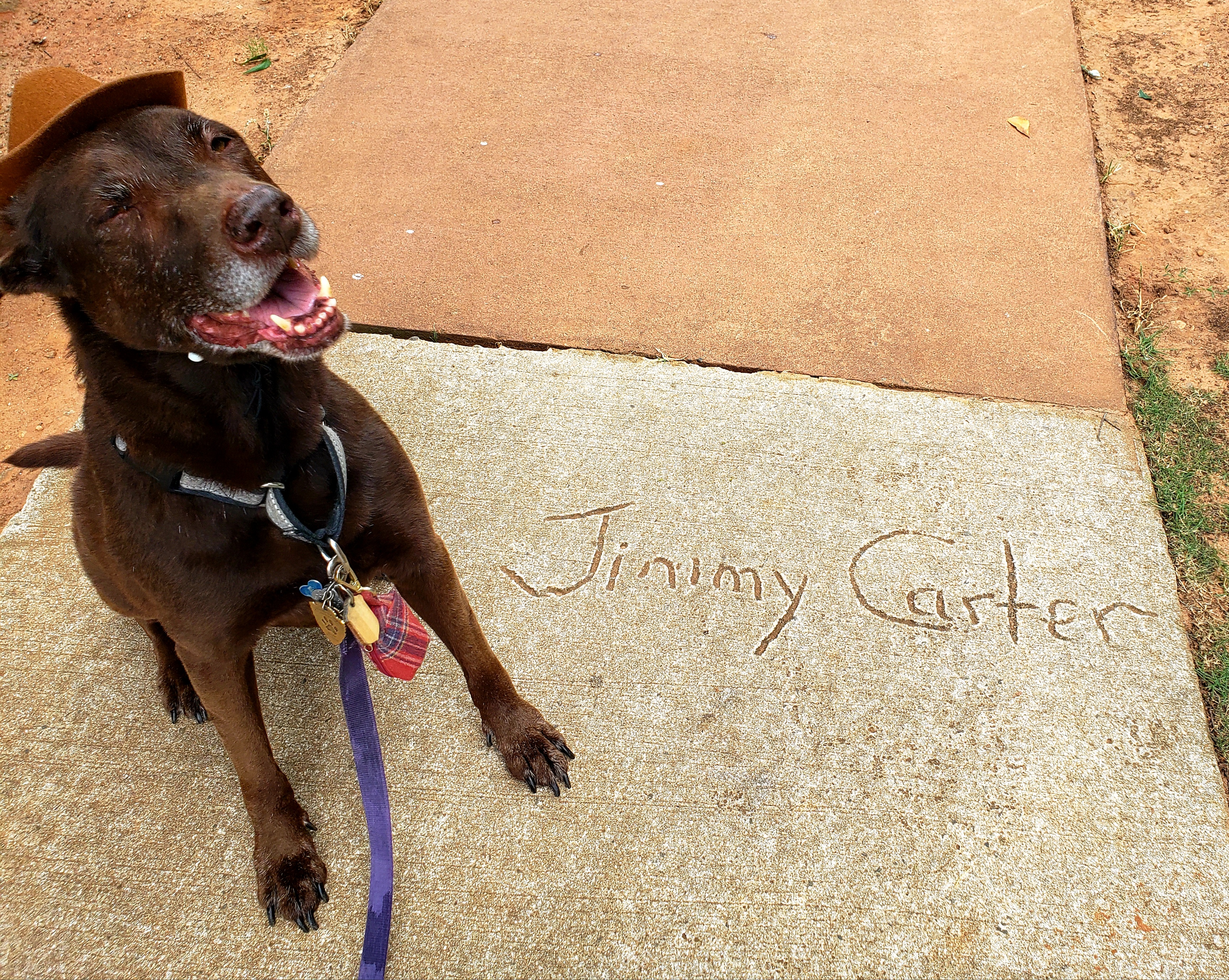
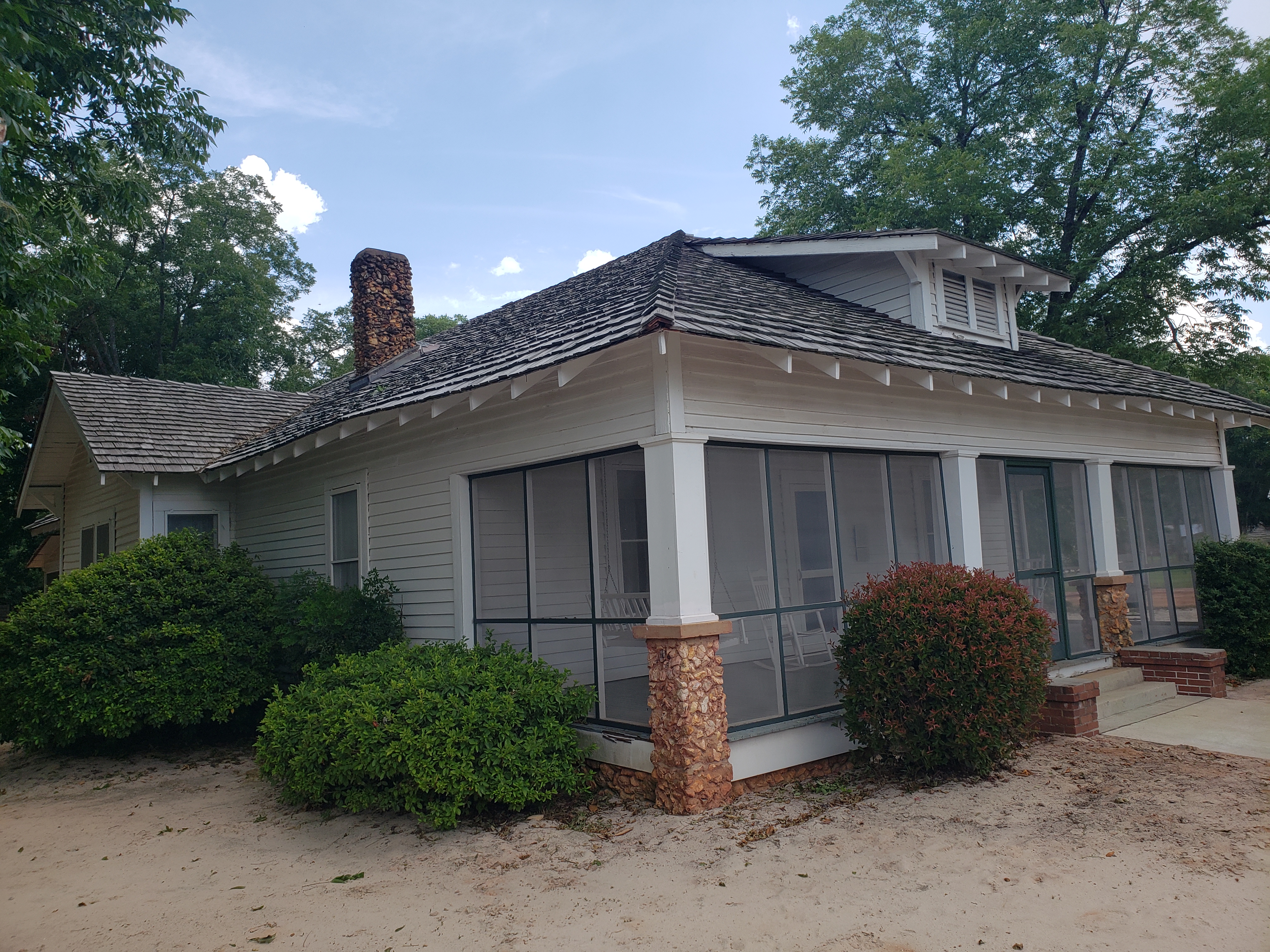
After leaving Andersonville, it was only a 30 minute drive to the Jimmy Carter National Historic Site in Plains, GA. This is an pretty depressed area and the only claim to fame is being the birthplace of President Carter. His old school, his campaign office, and his old home are all part of the national park area. Again, very dog friendly, but no dogs inside the school/museum/visitor center and no bark ranger program, as of now! The farm is entirely dog friendly! The problem here were the bugs, which were driving me and the dog insane! We did as much as we could. It is a working farm of sorts, goats and horses reside there. Jimmy’s childhood house, his tennis court, the barns, etc, are all still here for viewing. The campaign office is interesting, and so is the school, but the dog was in the *turned on and air conditioned* car, so I was only in those spots for a few minutes. Fun fact, Jimmy and Rosalynn still live exclusively in Plains! You can drive on the road by their house, but no stopping! I also saw a mean looking suburban pulling out of a church parking lot. It could have been them! After finishing up in Plains, we departed for Florida.
Jimmy’s boyhood home and farm.
Bella was pretty tired after all of this, and so was I! She has a new bark ranger tag, I got 4 new national park units in and all in all, everything went very well!
Overall Impressions: Pros: Cloudland Canyon was the only outdoorsy spot and was superb. All of the rest were historical in nature and part of the NPS system. I am not as history loving as I used to be, but still, it’s some great history! All of them were very dog friendly, outside of the usual rules. Cons: Only one Bark Ranger tag to be found out of 4 pretty dog friendly national parks sites!
The Adventurer Final Word: 5 Stars! If the Bark Ranger gets to be a part of it, 5 stars!
Hey adventurers! Thanks for checking out this multi-part series on my most recent trip to Alaska! If you made it through all of them, awesome, and thanks!! If not, and you are interested, you can check out the first two parts of the trip here and here and also my entry on Kenai Fjords National park and also Lake Clark National Park!
This entry is picking up right after I departed Girdwood on day 4. I continued back toward Anchorage along the iconic Seward highway, with fantastic and too warm weather. The drive from Girdwood is only about 30-45 minutes – rather short but extremely scenic. For my lodging the next two nights I had selected an Airbnb very near to Merrill Field, the civil aviation field in Anchorage for my needs the following day. After checking into my Airbnb I drove the short distance to the Tent City Taphouse in downtown Anchorage. I definitely recommend this spot! The beer is exclusively local Alaskan from all around the state and the food I had was on point!
The next morning, Day 5, was a big day as I was catching a flight! No, I was not returning home! I was headed to Port Alsworth and Lake Clark National Park! This was an 8 seater plane operated by Lake Clark Air. The plane flew fairly low, but high enough to actually see Denali! We traversed the Lake Clark pass and landed at Port Alsworth, about 100 or so air miles from Anchorage and the only way to actually get to the actual lake. Please feel free to check out the post for my visit to Lake Clark National Park. Afterward we returned to Anchorage and it was only 5 or so, and remember that the sun was not going to set until after 11 PM! I went to 49th State Brewing Company for some beer and some snacks. (The website itself is worth a visit!). I highly recommend this place! Although the Girdwood Brewery is by far the better beer, it’s a small brewery. 49th State is a full restaurant as well. Afterward, I drove around Anchorage a bit. I stopped by the university there, and then managed to make my way all the way up to the local hiking spot, Flat Top Mountain. I wanted to scope out some things as I was thinking about heading there on my last day to hike.
Kayaking in Lake Clark! Super cool experience!
My last full day in Anchorage was a total mystery! I actually slept in a bit, until like 7, and left with no real clue as to what I was doing, and it was awesome! What I ended up doing was heading north out of Anchorage to Palmer. Situated on the Matanuska River a little northeast of Anchorage, Palmer is a decent sized (for Alaska) town that is probably most known for the reindeer farm just outside of town and also for being at one end of the famed road that ascends to Hatcher pass.
Lazy Mountain, near Palmer, AK.
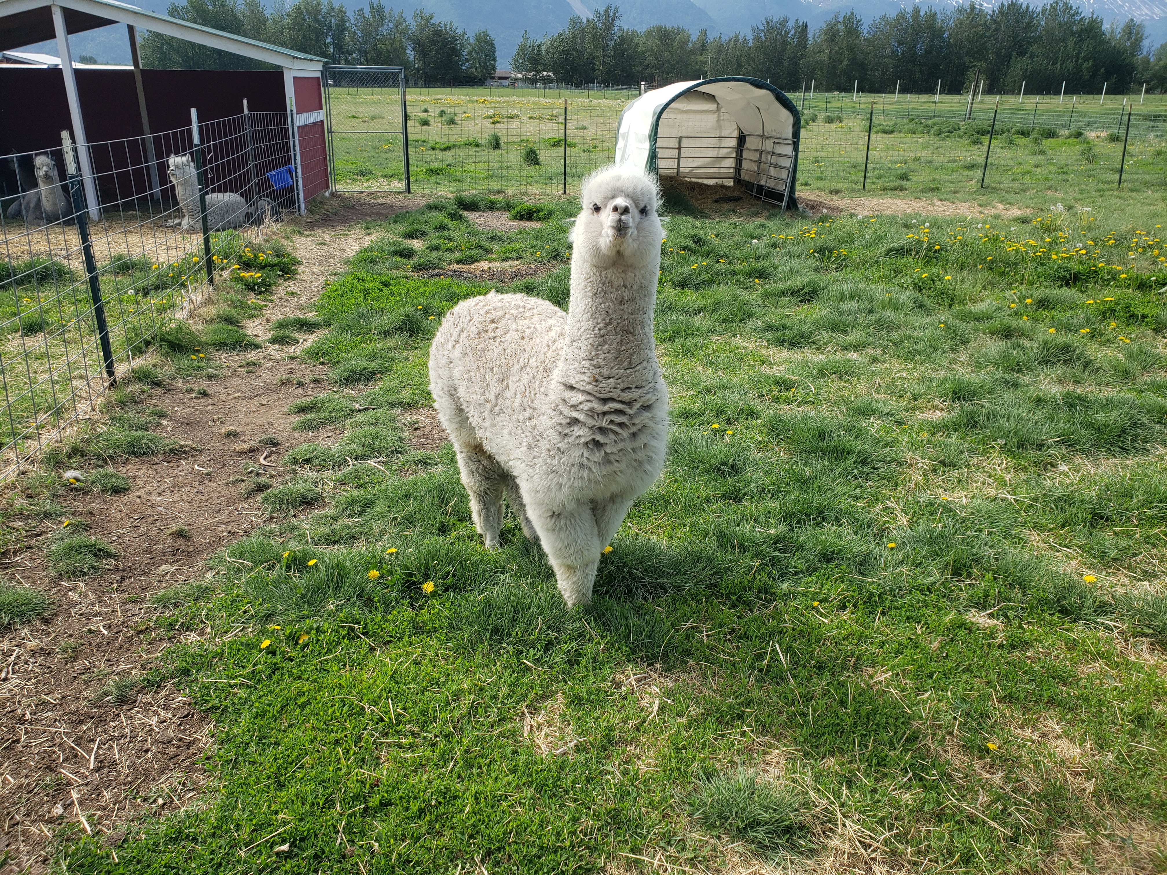
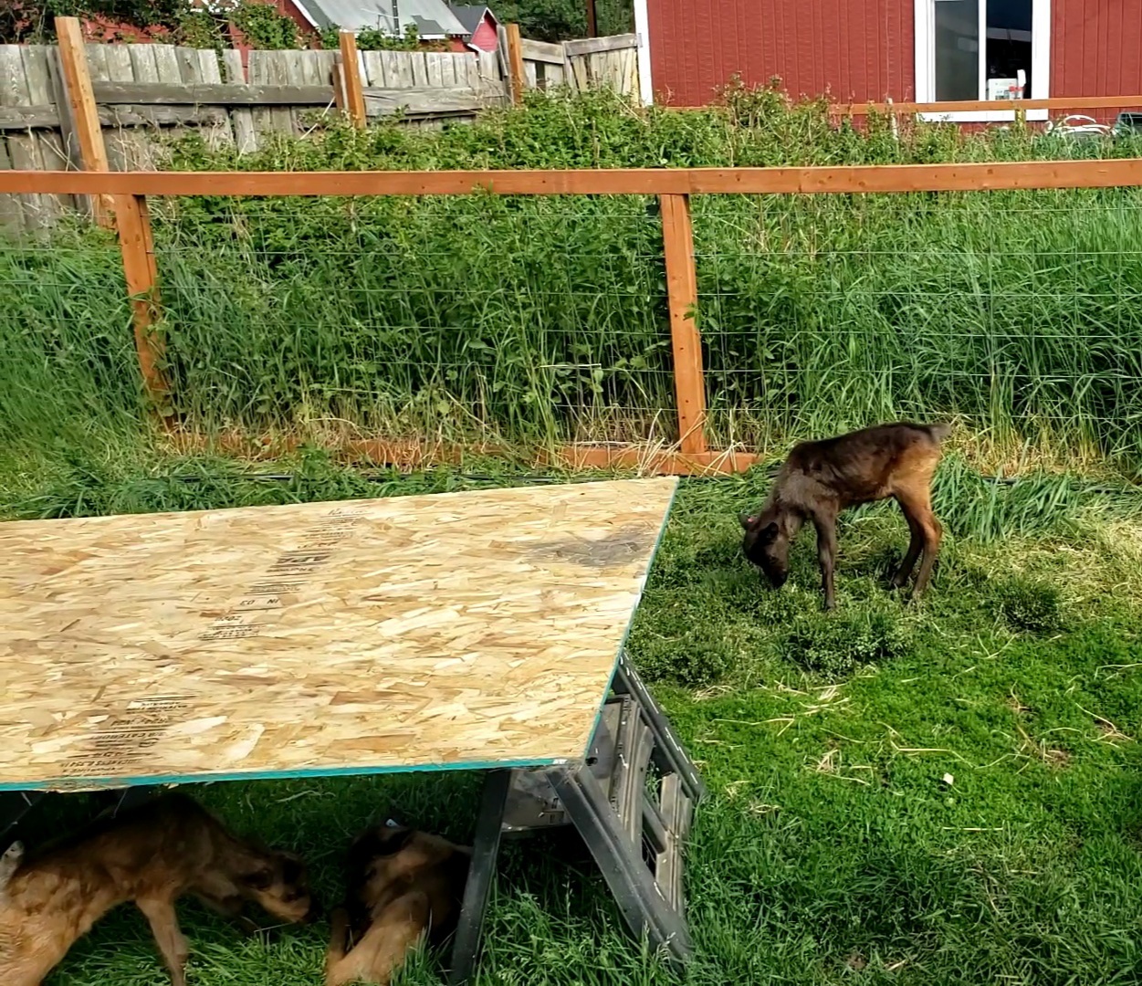
I visited the reindeer farm. It took about an hour, cost about 15 or 20 bucks, and I got to feed a moose! Also, I fed some reindeer, but a moose! This place is worth the money, but probably even more so if you have kids. They have pony rides and bunnies that can be petted, etc. Additionally, there are all kinds of other wildlife: pigs, elk, alpacas (??), highland cows (??), and some other critters. These animals are not “wild.” Like the animals at the Conservation Center, these critters are either injured, abandoned by mom, or in some other state that wild living would be deadly for them.
Cool dude at the reindeer farm!
This guy looked very concerned about the whole thing.
Bullwinkle!
Cuteness! These three little baby reindeer have been rejected by the mother.
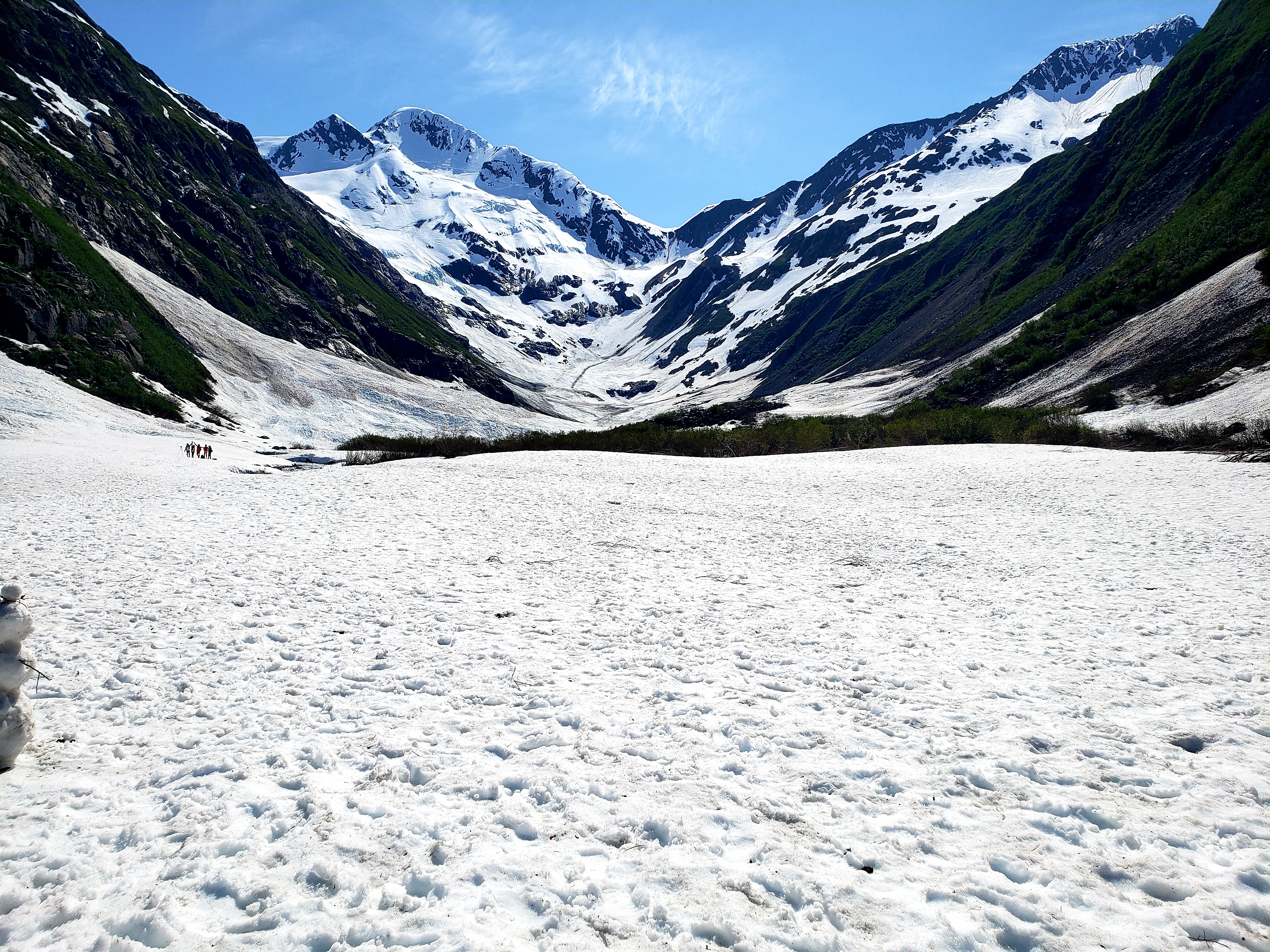
Afterward, I did some recon for my upcoming fall trip! The Sidekick and I will be visiting the Fairbanks and Denali areas in September and we have discussed driving Hatcher Pass. We would be coming from the other side, but I wanted to scope out the road from the Palmer end. This is a super cool drive. It runs next to the little Susitna River and it was raging! This road is known for it’s amazing views, and an old abandoned mine that is now a state historical park that is very popular. As the road ascended there were plenty of pullouts to see some great vistas down the valley! Eventually you come to the end of this part of the road, which leads to some lodges and that old gold mine. From here you can make a turn and head up the unpaved part of the road through the pass. For my visit, this part of the road was under feet of snow and closed! Again, bear in mind the unusual mix (at least to me) of 70 plus degree weather and feet of snow blocking a road!
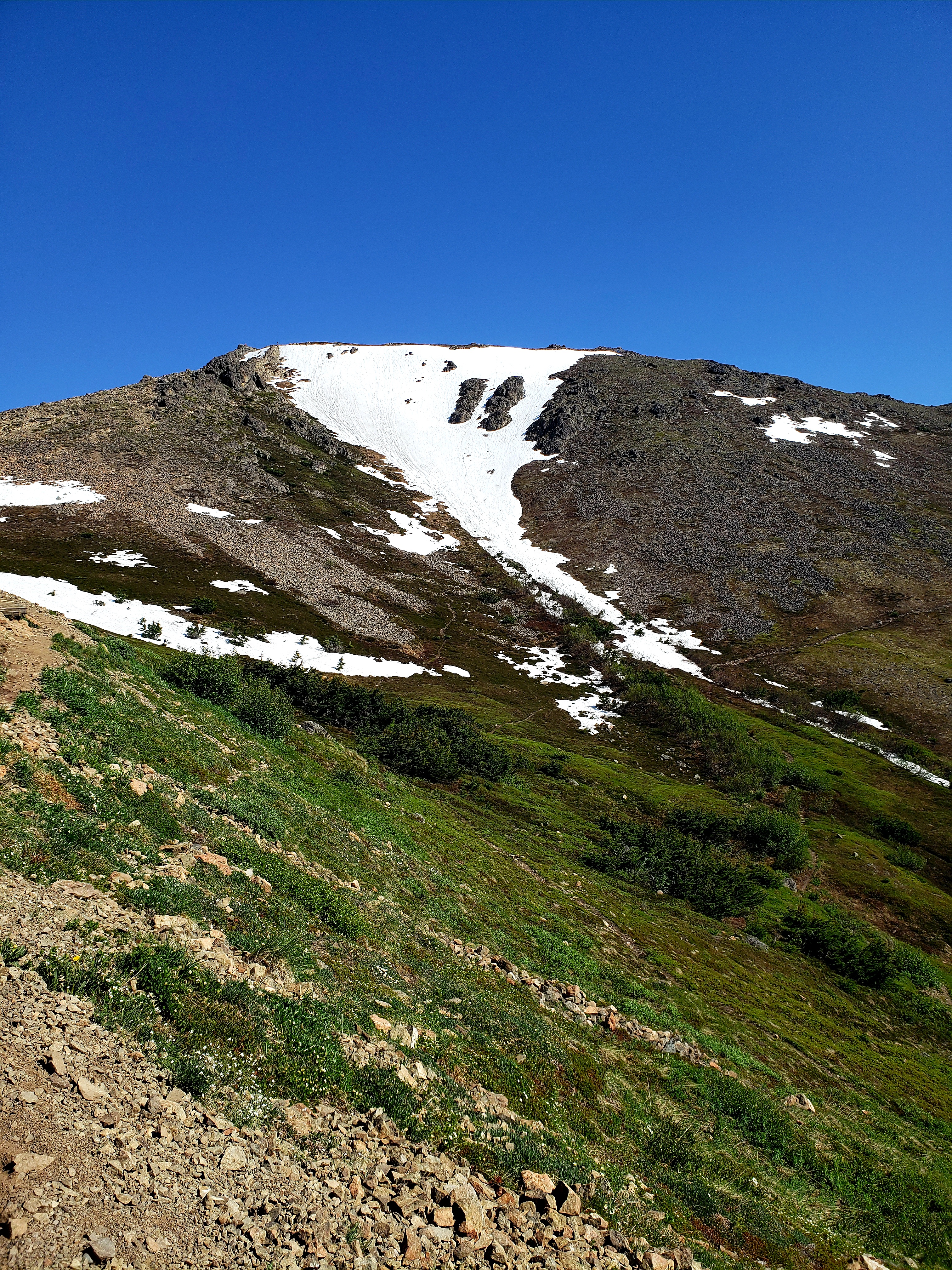
A view from the road leading to Hatcher Pass looking down the Valley below.
After this adventure I drove back down toward Anchorage and stopped at the famed Moose’s Tooth Pub and Pizzeria. This is a place to have a good time, drink good beer, and get really fat! I went here the first trip to Alaska as well…it’s world famous for a reason! After waiting a long little while to get a seat, I was content with a belly full of delicious pizza and beer! Of course, now it was time for a hike! I made my way up to the well known Flat Top Mountain overlooking Anchorage. This trail is rated hard, 3.5 miles round trip with about 1500 feet of elevation gain. My goal was the summit. Seemed reasonable. Parts were in the snow. One part was extremely sketchy, and then I hit a very extended stairway, and I am not a fan of stairs. The first mile of this trail sees about 400 feet of gain. The last half mile is 1000 feet of gain and the last 2 tenths has a gain of 500 feet. And that last part is entirely loose rock scrambling and very steep mixed with parts of the “trail” under a couple feet of snow…I got up there a bit and decided it wasn’t going to be a pleasant or safe experience coming back down, so I turned back short of my goal 😦 However, There were awesome views of Anchorage and the surrounding area, so I would definitely suggest giving it a try, just maybe when half the trail isn’t under snow! After a return stop at 49th Street Brewing company for beer and some chowder I headed off to the direction of the airport.
Flat top mountain from a pretty close vantage point.
Some of the stairs on part of this trail.
More of the stairs leading upward…there were many…
View from my tapout spot, pretty close to the top. If you look at the woman below me you can kind of get a sense of the terrain. Also, there is no actual trail. Just pick your way through loose rocks. And that is after getting through that snow down there.
Near the airport is the Earthquake Park and also Point Woronzof. Those spots seemed like a good wrap to the trip. Earthquake Park is also where my first trip wrapped up, so it seemed a fitting end. One quick aside here before I conclude. The mosquitoes in Alaska are notorious and lovingly referred to as the real Alaska State bird. My first trip did not involve them very much. This trip, up to this point was pretty mosquito free as well. Earthquake Park is a metropolis cesspool of mosquito hell and misery. The park is interesting and is entirely in the woods, in a section of land that fell 30 or more feet during the Good Friday Earthquake. There are info placards spread throughout and I was intending to do a video narration of them. No. The skeeters came for me with a fury that I have actually never ever seen before in my entire life. And that’s saying something coming from a childhood in southwestern Indiana, and an adult life in the swamp that is Florida. And yes, I was covered head to toe in 40 percent DEET. I have since learned from locals that 40 doesn’t do it sometimes…so plan accordingly. THEY CHASED ME OUT OF THE PARK AND BACK INTO MY CAR. Not only that, they ALSO CAME INTO THE CAR . I mean, this is crazy level stuff here. Damn skeeters! And, after watching some planes come in directly overhead at Point Woronzof, that concluded my 2nd visit to the most amazing place in this country!
Overall Impressions: This was an awesome trip. When I first came to Alaska 5 years ago, it was a huge unknown, almost dangerous place. Also, at that time I didn’t really have any clue of how to explore, hike, etc, etc. This time with a lot more experience under my belt I had a blast just ad libbing and not being worried about anything! And, this place is magical in a way that eludes description. There is a rugged beauty here that is so natural, pure, and disconnected that it is easy to forget the rest of the world is still churning on. All pros. No cons.
The Adventurer Final Word: 5 Stars for the entire trip!
Hey Adventurers! This entry will be pretty critter heavy and if you are catching this entry and haven’t caught part 1, and want to, go ahead and check that out here! (This entry will be independent of that one, fyi). I had just arrived in Anchorage, visited Seward and taken a boat tour where this entry picks up. The morning of day 3 I got up super early; the sunrise was like 4.30 AM after all! This was the start of my hiking in the national park.
You can check out my experiences of Kenai Fjords National Park here! It’s a nifty park, rather low attended in the grand scheme of things, but actually one of the most visited in Alaska. The park showcases, of course, some beautiful Fjords and also the famed Exit Glacier.
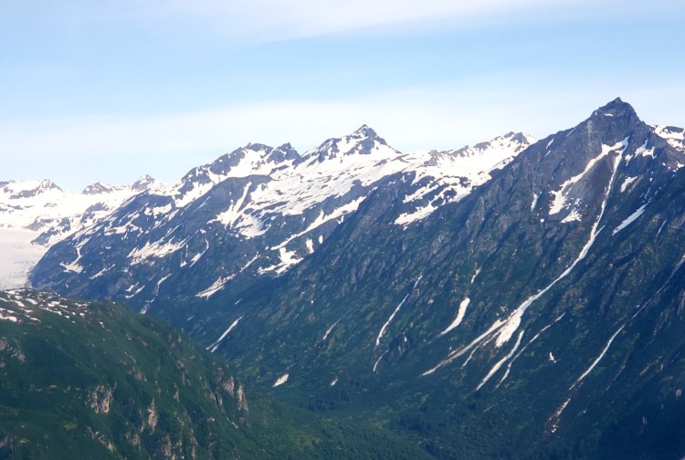
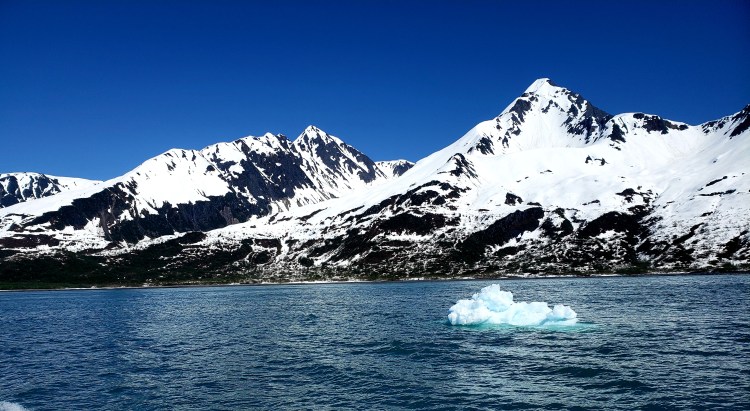
From the Harding Icefield Hike, very early on, in Kenai Fjords National Park, not all that long ago everything behind me was under a thousand feet of ice. And by not that long ago I do mean only a few decades…
After finishing up my hikes at Kenai Fjords I headed back to Seward proper to check out the Alaska Sealife Center. You might have seen this place featured in every episode of Alaska Animal Rescue on Nat Geo or Disney Plus. Wait, what? Am I the only one who watches all the Alaska shows? 😉 This is a neat spot and although small, I’d say it’s a must see! The animals here are injured or sick and the goal is to rehab them and release them back into the wild. They have puffins, other fowl, Alaska fish, seals, sea lions, otters…all kind of cute critters! Did you know sea lions have ears and seals don’t? I didn’t! And I got to get some awesome pictures of one sea lion that I swear knew her picture was being taken and was posing for me! Super cool! Afterward, I stopped by the Seward Brewing Company for a pretzel and some beer. Honestly, this brewery is ranked pretty low in Alaska and the bartender at the alehouse the previous day didn’t speak well of it, but I thought it was ok! Afterward, I drove around a bit and then the magic for this trip really began to happen!
This is 2 year old Mist. I took several pictures of her just like this, on three circle arounds she did. She would swim by very slowly…then sit there and look right at me so I could take pictures. Then, no kidding, she would swim off and circle back around and repeat this. She did it at least three times!
Puffins!
The other side of Resurrection Bay across from Seward has roads and some development. I saw a beach on the map and decided to make a stop. At this point I had been in Alaska for 48 hours and had yet to see any of the desired land based critters! But there it was! Finally, a MOOSE. In a lake. Not close. From the car. Perfect. I snapped my pics and moved on. I meandered my way to that beach. This was not a beach. Maybe in Alaska, but not in Florida. It is more of a tidal area, but it was BUSY. This is a popular fishing area and the peeps were out in droves. And then I saw the bald eagle just chilling on a sand bar off yonder. Unfortunately, my water resistant hiking shoes are only ankle high and there was about 2 feet deep water separating me from a better views of said eagle. So, cold and soaked feet later I was as close as I wanted to get to the bird. And then I noticed about 3 or 4 others started swooping all over this area harassing other birds. They were flying all over the place. How cool!
Yes, a camera would have been better…but it pooped out on the trip! This girl was just chillin on her own. Didn’t see a little one.
I am no wildlife photographer, so this isn’t awesome quality, but still cool to see! There is one eagle chillin, and then at least 3 or 4 more zipping through the skies doing eagle things here!
At this point I was pretty content with wildlife sightings but there were more to come! On the drive back to the main road I found another bald eagle hanging out in some trees. I finished the Seward area with a stop back at the national park both on this evening and the next morning and had some awesome moose and grizzly experiences . All of this and only 2 and a half days!
Large number of eagles make the Seward area home!
Mama here let her newborn get into some trouble then came to the rescue for the hungry calf!
Now I saw these kids very near, about where I am in the picture, to a female moose that had a similar scar marking on her side as the one with the baby the night before. But I saw no baby. These two were in this spot literally 30 seconds later…kinda hoping the circle of life didn’t connect to that baby moose!
After seeing the furry bear kids, I departed Seward and drove up to a place called Cooper’s Landing to check out the brewery there. The beer was quite tasty and had some good food, but other than some lodges and fishing opportunities, this is a pretty small town with not much going on. There is river rafting there however, and I kinda wish I had known that ahead of time, so here it is, heads up! Then I headed toward my next adventures at the Alaska Wildlife Conservation Center and to Portage Lake.
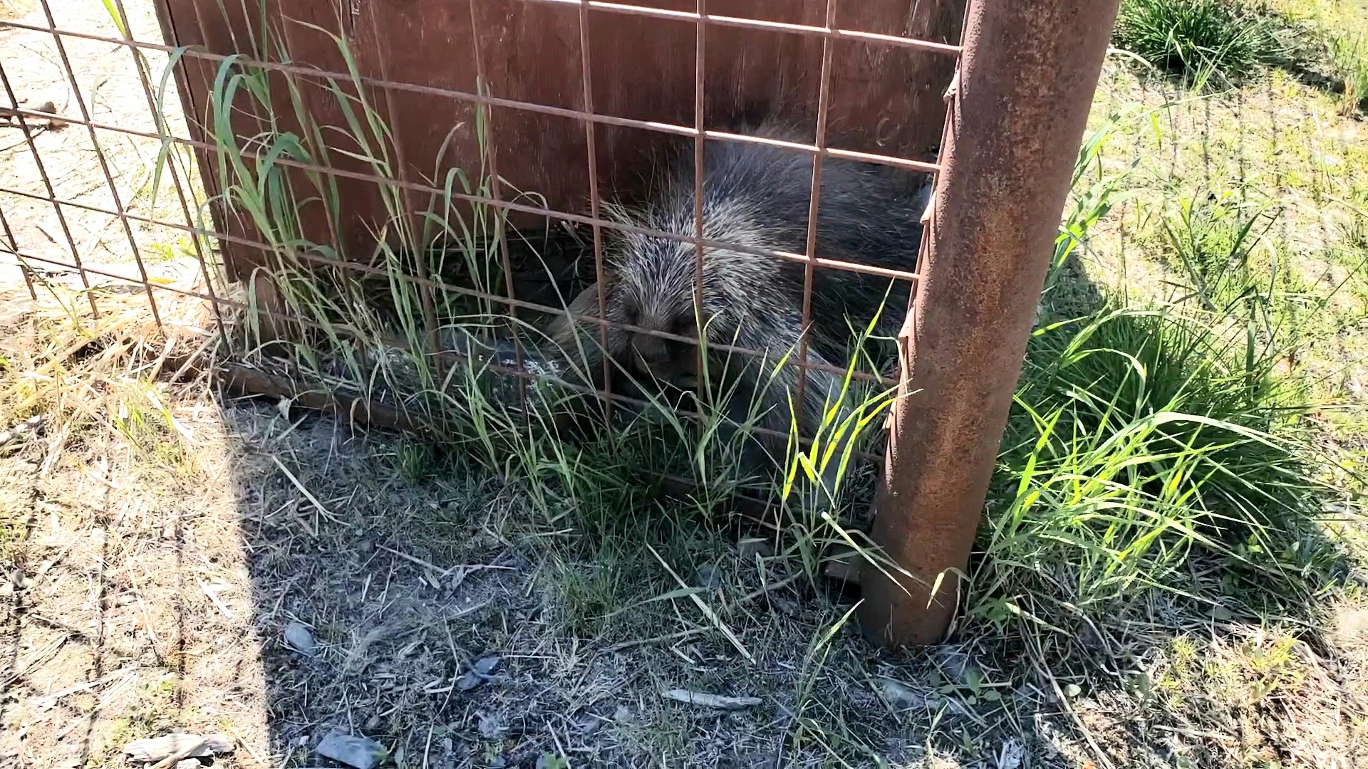
The Alaska Wildlife Conservation Center is another location featured on every episode of that Nat Geo show! The animals here are not to be released. None of these animals would survive in the wild for one reason or another; for instance, the bald eagle here has one wing. Sad, but I am happy that the critters all have a safe spot to live out their days! The location of this place is perfect! It is right off the Seward Highway at the very end of Turnagain Arm. In case you are wondering, they have moose, elk, bison, brown and black bears, musk ox, bald eagle, lynx, black tail deer, porcupine, wolves, and coyotes!
A black tail deer. I didn’t even know this was a thing.
Bison.
Baloo.
This guy and some of his friends are the stars of the place, apparently!
Playing Yogis!
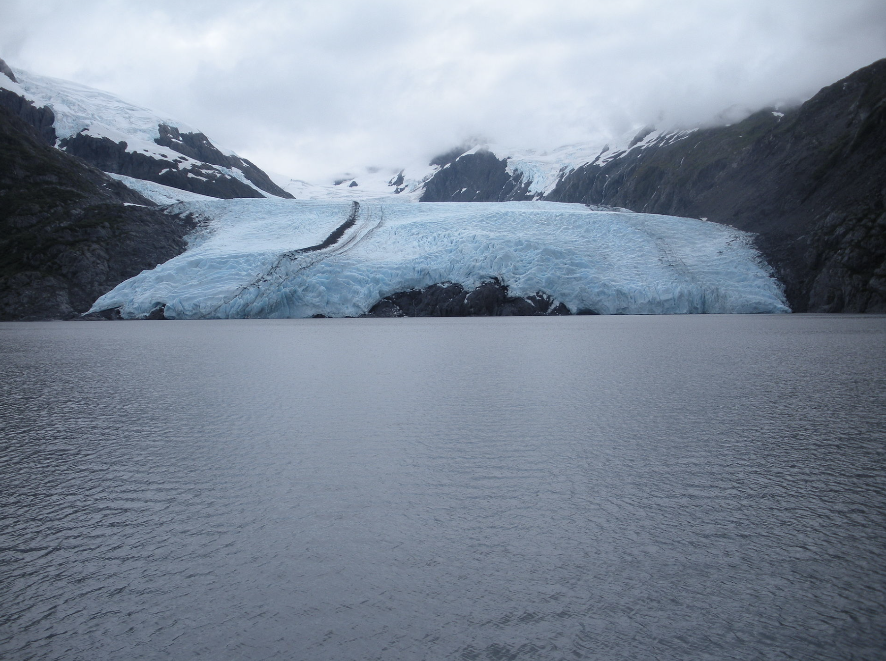
Just past the center is the split in the road that goes off to Portage Lake and Whittier instead of into the Kenai Peninsula. Portage Lake is stunning. It is easily visible from the main road, but there is an offshoot road that goes into a parking area for a lake cruise landing. I did not do that cruise, but I did walk in that area to take in the views of the lake! Near this spot is Byron Glacier. There is a relatively simple and flat hike that follows a creek into a valley where you can see what remains of the glacier that carved this section. Again, despite the extreme warmth of the air, the last bit of this hike was covered in a few feet of snow. I went out as far as I was comfortable, which was not nearly as far as the people out there before me who actually crossed the big creek via snow bridge (at 75 degrees mind you)…but I have some (I think) sense, so I hung back and took in my views from a safe distance. Portage Lake itself is a glacial lake that was not even visible until 100 years ago!
Byron Glacier. I snagged this picture from Wikipedia. The date listed is June, 2009.
In case you can’t see it….That’s Byron Glacier June of 2022, middle left…the retreat from the above picture is not as bad as Portage Glacier. This is my picture. The ground under my feet here…is actually under a few feet of snow. I think the trail technically ends closer to the glacier but I don’t think anyone had done it recently enough to leave any marks…so I just stayed here and viewed!
Portage Glacier, 1958. Courtesy of Wikipedia.
This Portage Glacier, also June 2009, courtesy of Wikipedia.
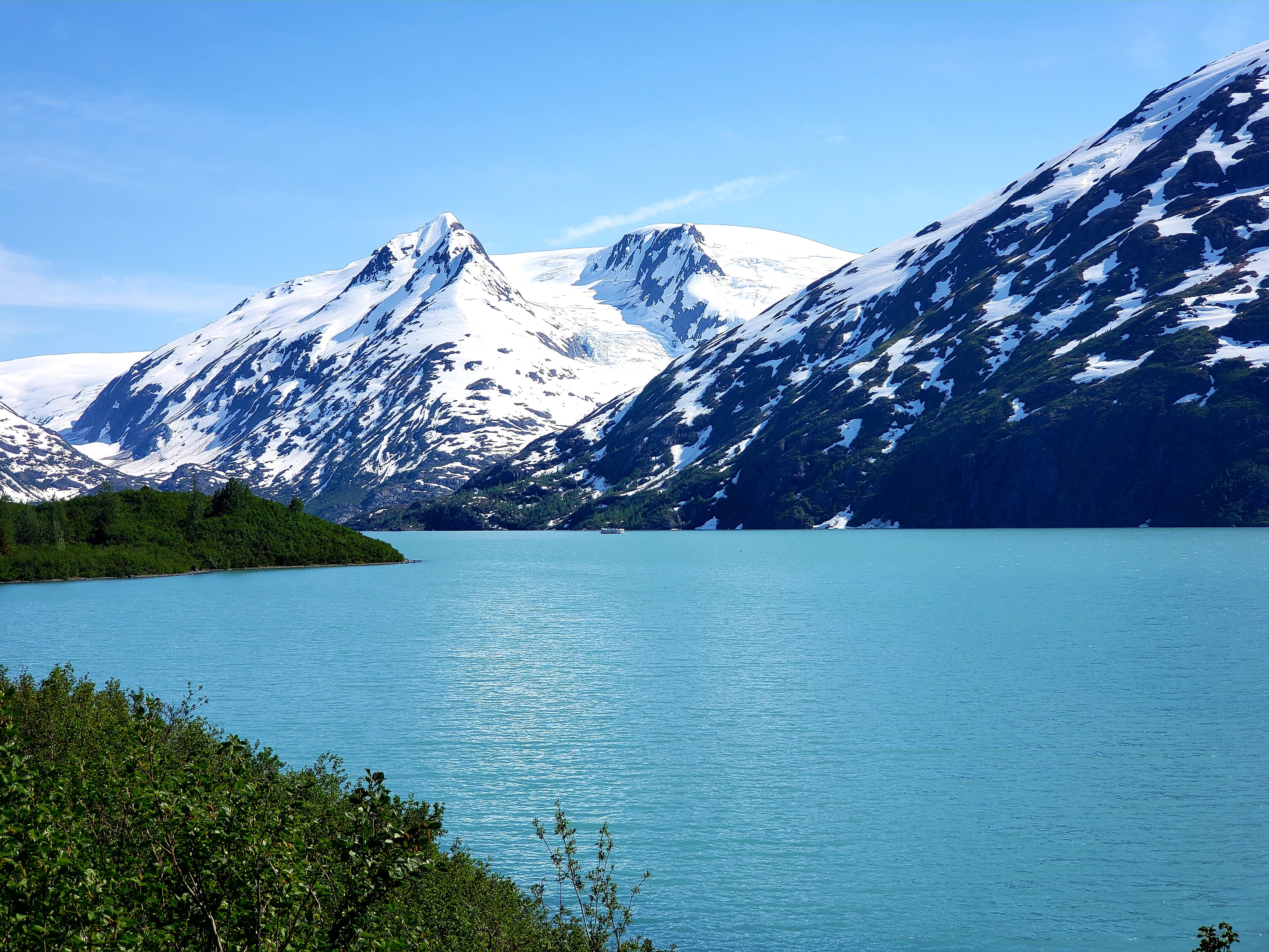
This is the GORGEOUS Portage Lake. Now….you might have trouble seeing the Portage Glacier. It’s actually not even visible anymore unless you take that cruise or hike to it. The “top” part of the lake and between the two mountains is where it now has it’s terminus. This is my picture.
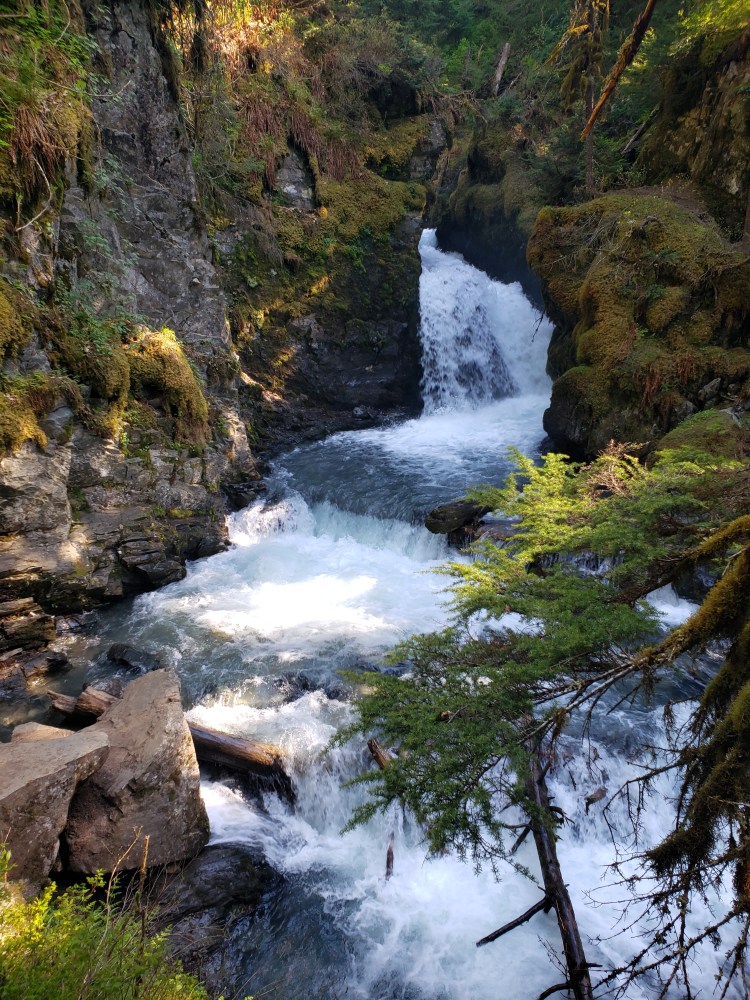
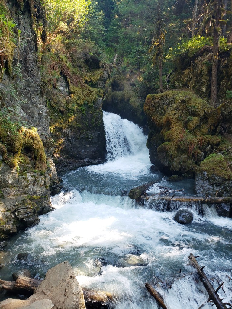
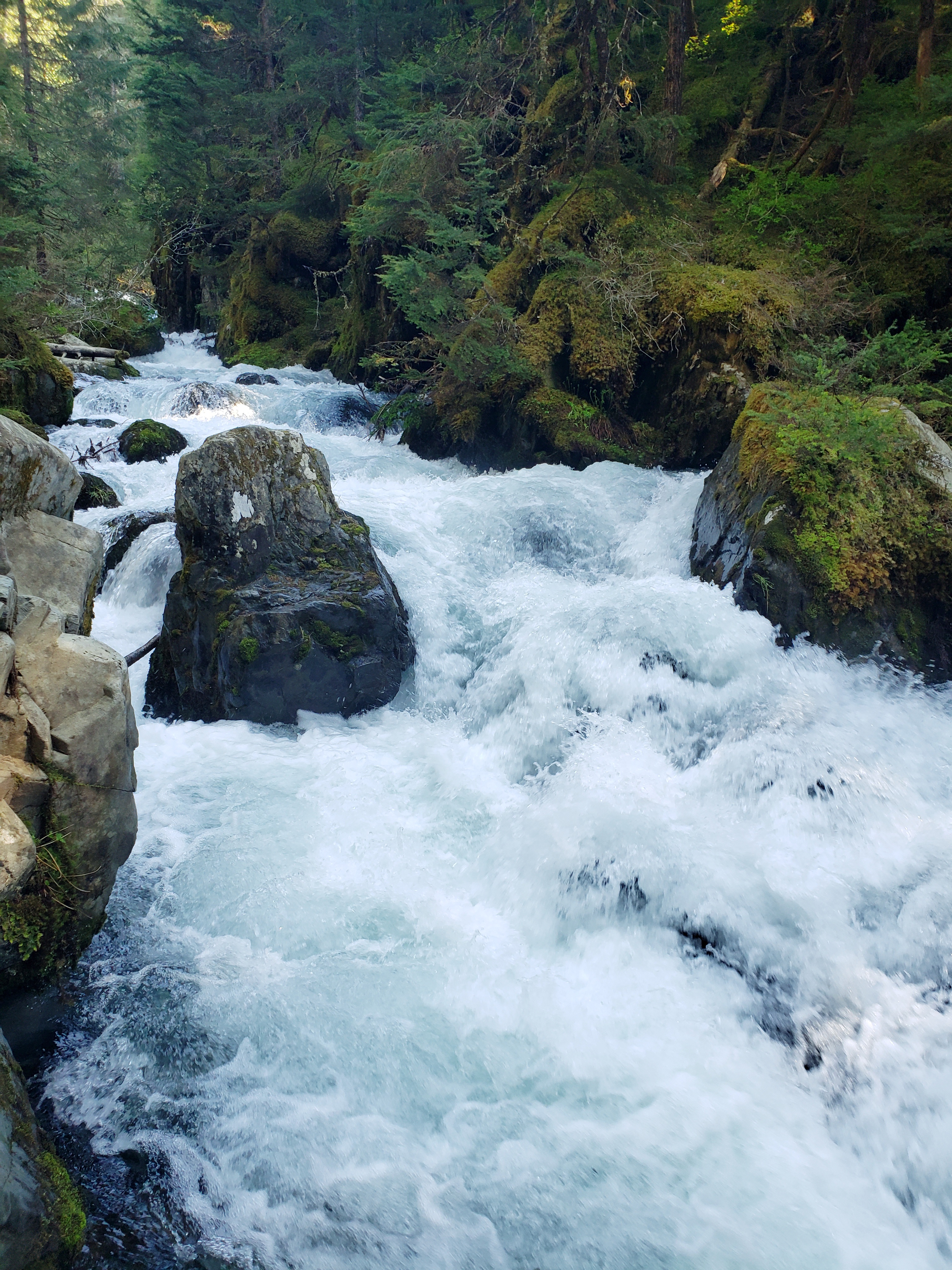
I began the beautiful drive back to Anchorage. I did make another stop in Girdwood for beer, and to repeat a hike from 2017! In 2017 I found a cool waterfall in Girdwood. The hike is pretty steep but not long and has quick and awesome payoffs! This is rainforest land here and the difference in temperature from next to the creek versus only 10 feet away is nuts! Anyway, I highly recommend if you are in Girdwood!
Part of Virgin Creek in Girdwood.
And with that it was back to Anchorage to prepare for the last two days! Stay tuned for part three (I promise the last part!)
Hey there adventurers! I am recently back from my biggest solo adventure yet, and really one of the biggest of them all! When I first went to Alaska in 2017, I was not doing a blog at all other than the pictures I took on my phone and the GoPro videos I took. This trip was shorter but no less amazing and this time I get to really keep track of everything! I also want to take a brief moment to reiterate that there is no more amazing place in this country than Alaska and I don’t think anyone really gets it unless they have been there, so get there and check it out!
This trip is going to end up encompassing 5 (yes 5, and possibly even 6!) parts. I might be a little long winded…but this was another epic trip! You can also read about my excursion to Kenai Fjords National Park and also to Lake Clark National Park during this trip.
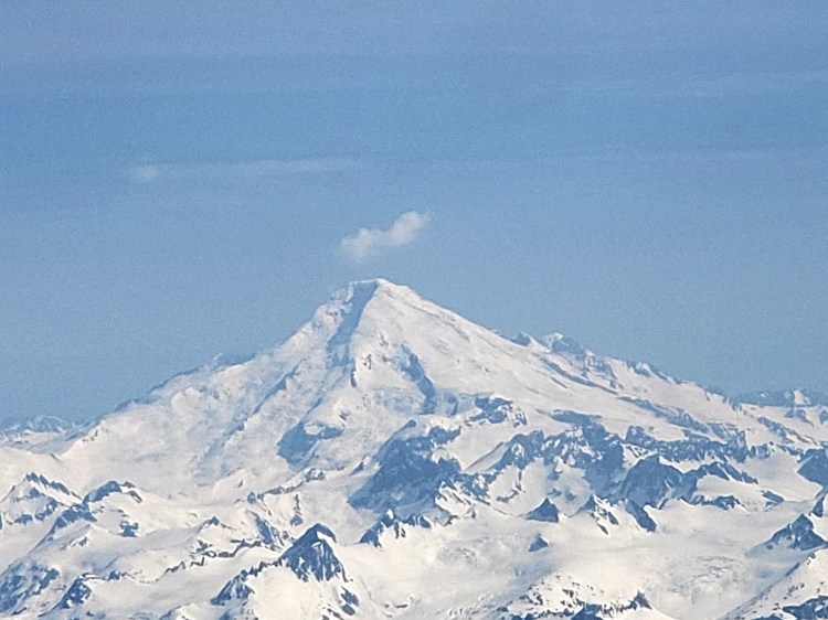
My flight to Anchorage was on the house, courtesy of my Alaska Airlines credit card! The outbound flight pattern was Tampa to Seattle then Seattle to Anchorage. This was an 8 am flight with arrival in Anchorage at around 3 PM. The flights were pleasant on Alaska Airlines. A pattern to Alaska via Seattle is probably the best one, heads up. The plane did pass by Mt. Rainier on the way which was very cool!
National Park 30? No….that doesn’t count!! But still…seeing Mt. Rainier this spectacularly from the plane was not anticipated!
The Seattle to Anchorage leg kept us out over the ocean but the gorgeous snowy coastline was close enough to be seen! Protip, if you are on an Alaska inbound flight that leaves from pretty much anywhere west of Houston you are probably going to want to sit on the side of the plane that will face northeast for this very reason. If you are leaving from Chicago, or Minneapolis you probably want the side that will be facing toward the Pacific. You’re welcome 😉 The really cool part of our flight pattern was that the plane actually flew right over the scenic Seward Highway, and I was actually able to see Girdwood, the town I was staying in that evening, from the sky. Super neat!
The view you can get on the correct side of the plane on the approach to Anchorage. From Seattle, Houston, Dallas, other west locations I am missing, at some point your plane is going to parallel the coast and the other side is an open ocean view instead of snow covered mountains and glaciers!This is actually in the Wrangell-St. Elias areas. This flyover doesn’t count either!
Girdwood, AK from the air! Pretty cool vantage point! The the famed Seward Highway can be seen running along the base of the mountains along the Turnagain Arm.
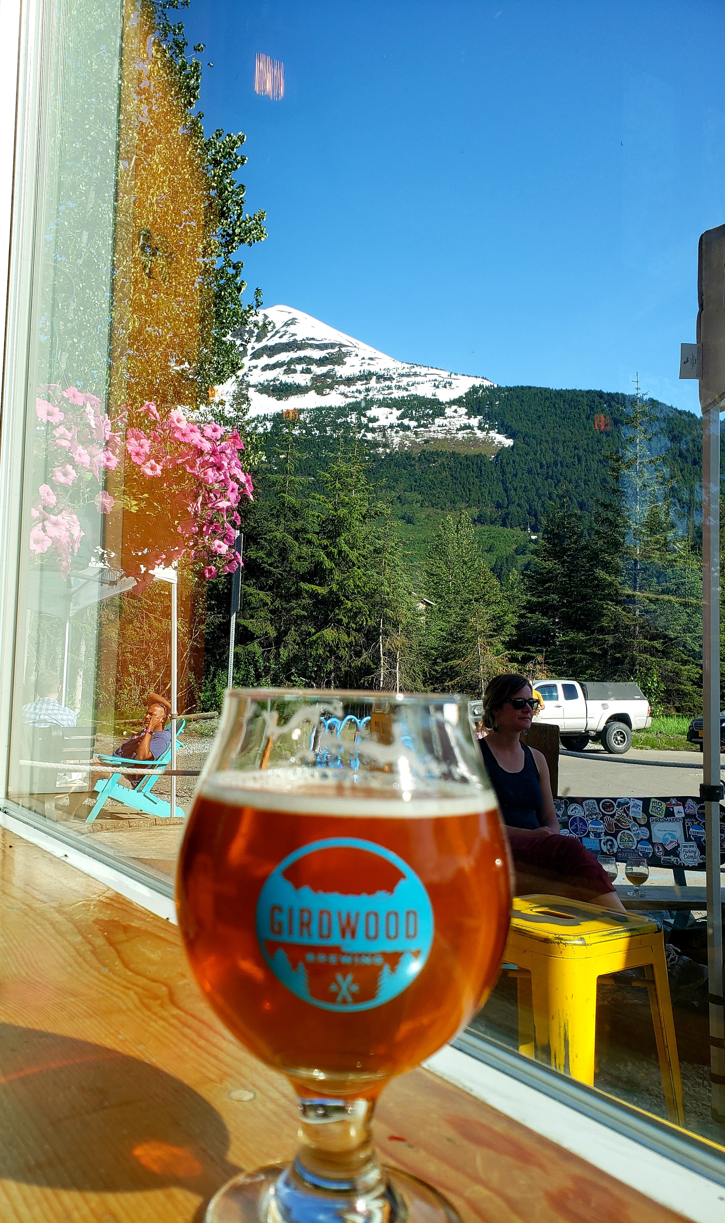
Upon landing I picked up my rental car, picked up my bear spray from Alaska Outdoor Gear, and headed to Midnight Sun Brewing Company I got a couple delicious beers and some tacos and then headed on my way to Girdwood! I have stayed in Girdwood before, and this time I was only staying one evening since it would make my next morning drive 45 minutes faster. I got to my airbnb, a beautiful spot in the mountain woods just outside of town. After unloading I went to my favorite brewery of the trip, the Girdwood Brewing Company. I had flights of 8 of their 9 beers…and they were all good. The 9th was a sour. Sorry sour lovers, it ain’t my thing!
Super pretty view from this brewery! Was hard to get the shot I wanted without interference! What can you do!?
Some fine, fine beers at the Girdwood Brewery!
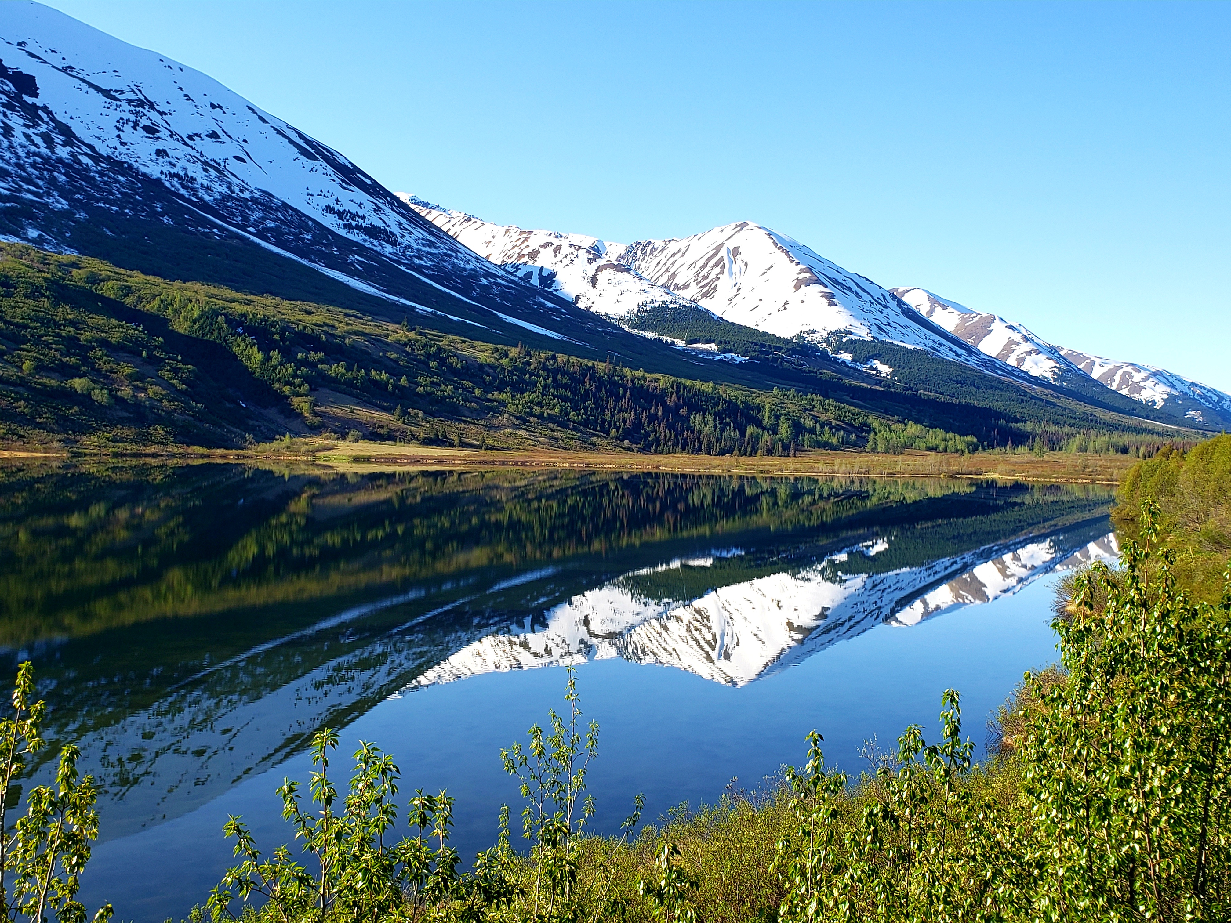
The next morning I got up and drove around Girdwood a bit and then drove the rest of the scenic Seward Highway all the way down to Seward. This is really some of the most stunning, untouched country you will ever find. As this is the only road between Anchorage and the locations in the Kenai Peninsula (Seward, Homer, Whittier, Soldotna, among others), this is a busy road. And, because of the scenic nature which motivates people to stop and take pictures, be smart. There are turnouts aplenty, but if you are driving you need to be really attentive to people stopped on the road and crossing the road, generally doing the wrong things. It’s a legit problem and many people are killed on this highway every year. A bit of a asterisk to the next couple pictures…these were taken on my way to Seward. In the next part, there will be more taken along, or at least very near, to this highway on my trip from Seward.
Very briefly my favorite and best ever picture. Taken with my phone! I believe this is called Summit Lake.
And then, 10 minutes water I stumbled on this. Come on! For record keeping this Lake is called Tern Lake.
You will be hard pressed to find a more beautiful place in the country that this peninsula.
Beautiful spot with the flowers somewhere outside of Seward.
Upon arriving to Seward I boarded a Kenai Fjords Tours Cruise to check out wildlife in Resurrection Bay en route to a glacier viewing within Kenai Fjords National Park. At this point I do need to stop and talk weather. The weather during my entire trip was absolutely STUNNING, and alarmingly warm. I saw very few clouds my entire trip and every day saw high temperatures in the 70s and even low 80s. This is not right and there is something very wrong. Those temperatures are not even normal for the middle of summer. This was the last day of May and the first days of June…The NORMAL temps in Seward this time of year are highs in the mid 50s and lows in the upper 30s to low 40s. Meanwhile, I had to buy sunscreen for this 6 to 7 hour long cruise. That being the case I did bring some cold weather apparel. This is Alaska after all, and I have already done one of these cruises out of Seward in 2017. Despite how hot it was dockside, once we got moving, I was very happy to have my layers because that water is very cold in that wind!
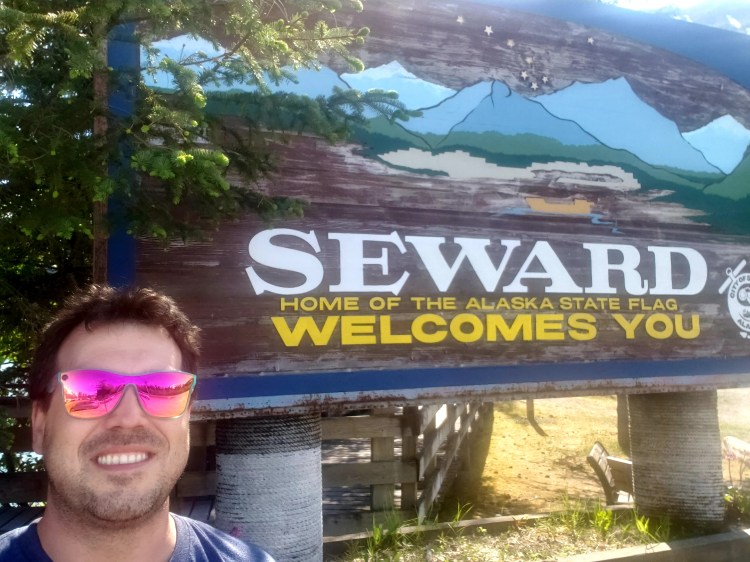
Ok? I mean…it’s a huge tourist destination. It has cruises. It has a national park. It has a world renowned sealife center. It has a famous mountain race. Alaska State Flag. Ok.
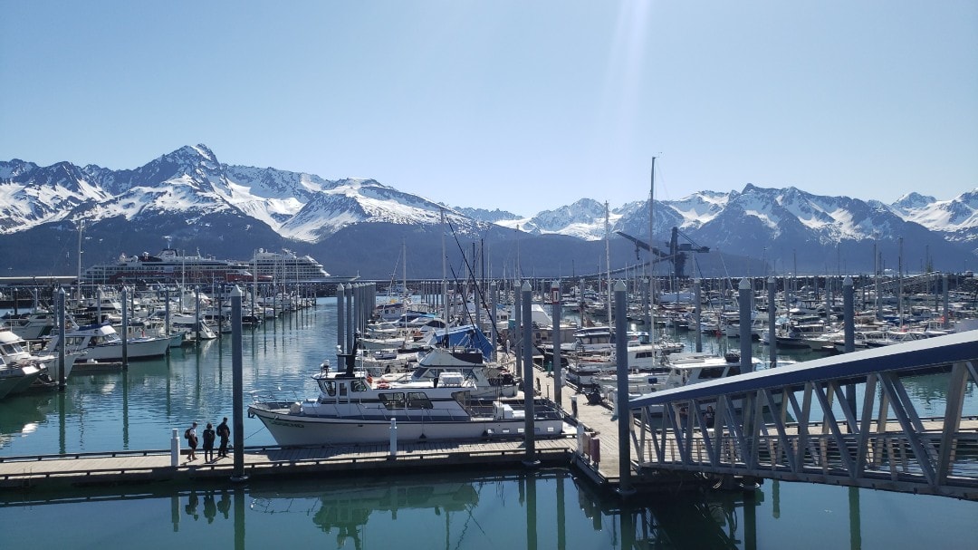
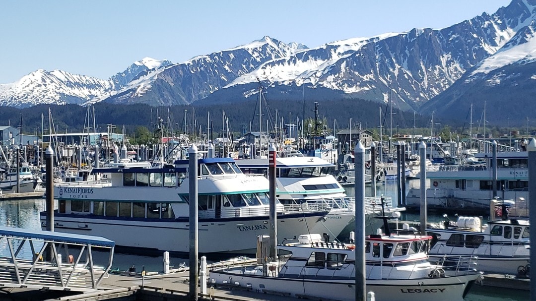
The Seward Marina…but you know, famous for the Alaska State Flag.
The Tanaina is the ship I took for the day cruise.
In an effort to not recount something that I already did (although in proper fashion I typed it up anyway and it was entirely different!) you can read about this cruise and see pictures on my Kenai Fjords entry! Going back to a statement I made about people not “getting” Alaska until they actually go there – a lady about my age sitting next to me was there with a tour group, and told me Alaska was her last state. She said she wasn’t initially all that excited, but at this point she was totally enamored with it and basically said the same thing! She also gave me some tips for Seward – suggesting a stroll along the waterfront of the town. After disembarking from the cruise I did just that! It was probably a mile or two round trip along the shore. Of course, there were spectacular views of the other side of the bay and also of the mountains Seward is built along, Mt. Marathon among others. Not any type of proper hike at all, and it does basically walk right through in town campgrounds, but definitely a nice stroll to take in the bay and the mountains looming above the town! It made the news, even here, of a huge landslide in Seward in early May that totally blocked the road going from Seward into the little community just a mile or so south. Luckily, they had it mostly passable by the time I got there so I drove down and saw how immense that landslide was. For an FYI, that area is called Lowell Point, and there isn’t much going on there! To top off this evening, I stopped at the Seward Alehouse, grabbed some brews, and got some KILLER tacos at the Mexican joint next door, The Lone Chicharron Taqueria. This is the place if you are looking for low key relaxed beer spot and great food – good enough that I went there at least one more time!
A humpback showing off the town of Seward!
This was all just, ahem, about 30 hours into my trip! Stay tuned for the next part!
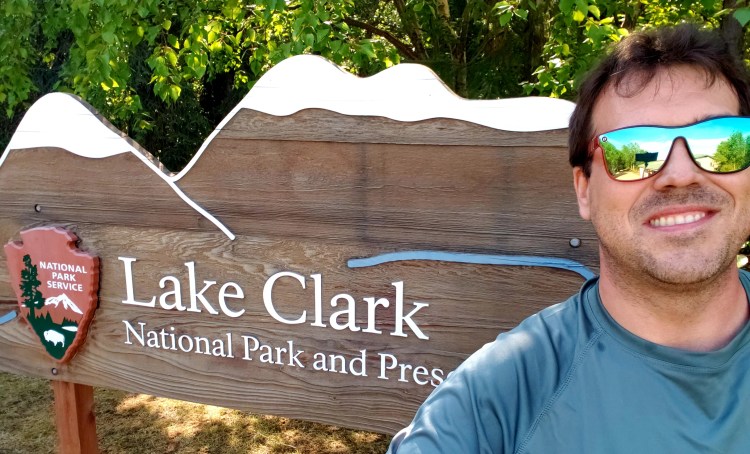
NUMBER THIRTY ONE!???? Holy Cow! Just about 5 years ago I didn’t really even know what the national park scene was all about! If you’d have told me even just 3 years ago that I would now have 31 of the 63 under my belt I would have thought I either won the lottery or married well! But, despite neither of those being true, here we are with number 31: Lake Clark National Park in Alaska.
Nice sign and PROOF!
Alaska has 8 national parks. Three of them are accessible by road (click here for my thoughts on Kenai Fjords, also in this trip, and Denali, from 2017) but the other 5 are…difficult. This one is one of the “difficult ones” but actually isn’t too hard to get to if you have 600 bucks and know what to look for!
Lake Clark is most easily accessible in 1 of 2 ways: by boat from Homer, to the outer shores of the park, or by plane from either Homer or Anchorage, delivering you to a potential variety of spots. Initially, I was gearing up to pay 600 bucks for the boat ride from Homer to the outer shores (Chinitna Bay, specifically) of the National Park to basically watch brown bears digging for clams. The captain told me that it’s a crapshoot on how long the trip ashore is. It is a 5 or 6 hour total tour, but if the majority of tourists want to simply come ashore, snap some pictures of grizzlies for instagram, and then head back out to look for whales, that’s what he does. There is no visitor center there, no signs, no facilities of any kind, just landing on the shore going to a viewing platform and watching the bears. Didn’t sound awesome, but what could I do? The only flight trips I saw at first were for at least an overnight and that one was going to be about 900 bucks per person, based on double occupancy, and I was traveling solo…..sooooo…nope, not in my budget, the boat is was! BUT! After asking around online, I was informed that the same company with the rate I just mentioned, Lake Clark Air, also did a 600 dollar day trip! On their website it is hidden pretty well in custom trips, which is why I didn’t see it! So, after making some phone calls I was booked on Lake Clark Air out of Merrill Field in Anchorage! It was to be a 9ish AM flight to Port Alsworth, the little town right on Lake Clark proper. The flight would take an hour and I would be on the ground until about 5 PM. For the same price as the boat tour, this was a no brainer!
A quick bit of info on Lake Clark National Park. This is a park that, in its entirety, is bigger than the entire state of Hawai’i. Due to its remoteness, however, most people are only able to visit the two ways I describe above. That being the case, one can easily spend several days at some different lodges scattered about in the area, reachable by water taxi or float plane out of Port Alsworth. Truly adventurous people can commission a guide and go backcountry hiking which includes a stop at a cabin built in the last 50 or so years by a guy way out in the middle of the wilderness of what is now the national park. All of these things are prohibitively expensive and probably best done in a decent sized group. So, not for me!
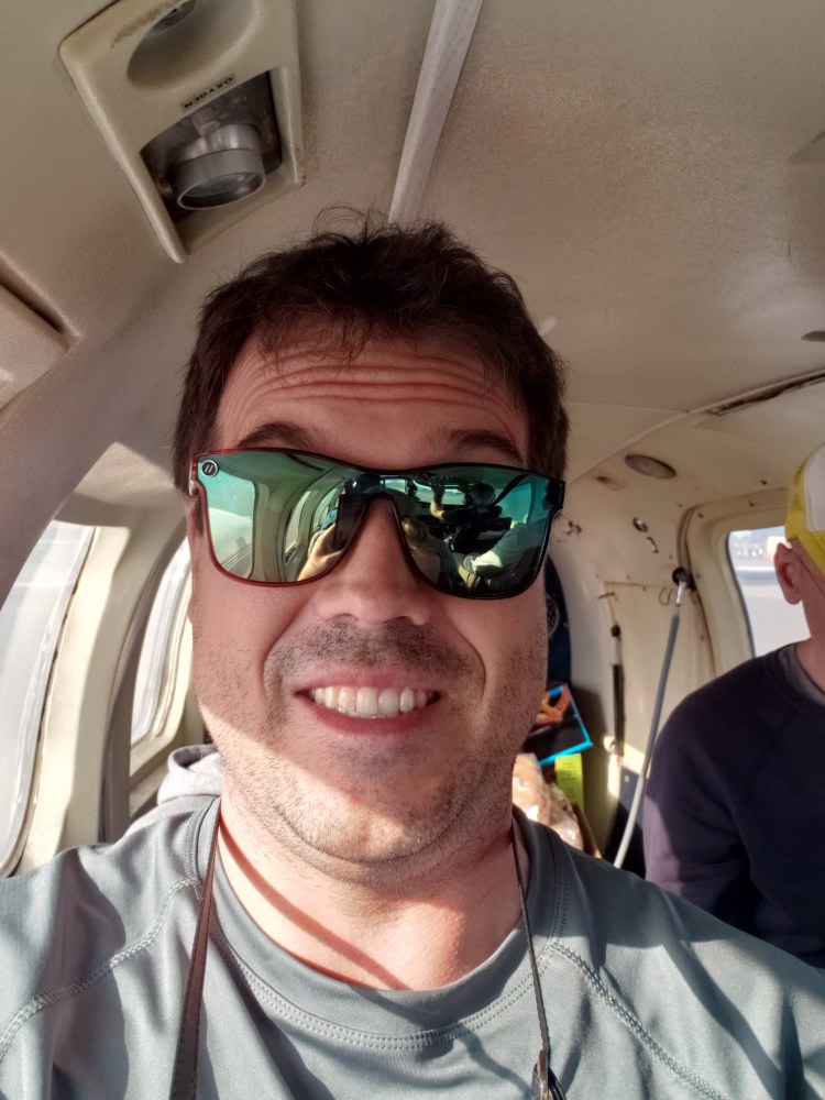
I got to Lake Clark Air hangar around 8 AM, checked in, and soon the little 8 seater Piper took off! The flight path took us high enough to see Denali! That mountain is SOOOO huge and was visible here, at least 130 miles away! Anyway, she wasn’t the focus or even a “maybe I can” on this trip, so it was a pleasant surprise! Our flight was low enough that we traversed the famed Lake Clark Pass below mountaintop height and it was not long that the cirques and glaciers off to the side gave way to the gorgeous Lake Clark under the plane!
If you have never been in this little planes…a fear of flying, a fear of heights, and claustrophobia will not be your friend at all, at all!
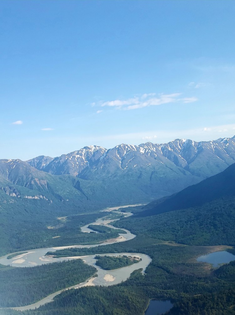
A view looking up a valley from inside the pass.
This is pretty much the pass. We were flying most of this below the mountain tops!
Upon landing in Lake Clark (one of two gravel landing strips, mind you), myself and the other guests were led to where we needed to go for whatever our activities planned to be! Lake Clark Air seems to be a very well organized company! I was the only one that came in that day doing my particular trip and the young man who was my very short term guide took me to find bear spray, get my very large bag lunch that was part of my ticket, and then gave me some directions! There is a lodge here, with several rooms, called The Farm Lodge. It is run by Lake Clark Air and the Alsworth group. To be fair, I honestly think I would like to convince someone to come back with me and stay a night or two there, so nice and rustic it looked, and right on the harbor! Now, there were a couple things that surprised me quite a bit right off the bat. Number one, there was a COFFEE SHOP open all day right there, thank goodness!! Their drinks are cheaper than Starbucks! They actually had wifi available for me at their lodge. Every employee seems to be a local and a lot of them are teens. The town is kind of a weird place. The name Alsworth is the name of the family who basically settled it, and the man I spoke too about the flights was Glenn Alsworth who runs Lake Clark Air and a lot of stuff in the town itself. A lot of the residents are somehow in that family circle. The town has roads, and there are vehicles there! They were all gravel roads and most vehicles were trucks or ATV/OTVs but there were some cars??? as well. There are actually are two long airstrips, as another air operator called Lake and Pen Air operates there as well. This is a place where planes are life, for sure, and planes are parked everywhere. There is also a big Bible retreat called the Tanalian Bible Camp located here as well. The name comes, I presume, from Mt. Tanalian, which looms large over the town.
Looking down the landingstrip I came in on. The plane I was on is the one on the left. The Lake Clark hangar is the near right side.
This is about the first view you see exiting the aircraft. That’s Mt. Tanalian looming at about 4 thousand feet elevation. Port Alsworth is not much above sea level. The harbor here is where the float planes land and depart.
Legit, a busy intersection in the town! This is the road that pretty much connects the Lake Clark area, The Farm Lodge, the town church to the rest of the town.
This picture is looking at the main drag of the town. To get a bearing, this is where the left side road in the previous picture leads out to. Here is where you access the second landing strip, most of the town homes, back in that woodsy area, the legit food truck (????!!!) in the town (the truck is visible next to the larger building on the far left), as well as the post office, the visitor center, and several hangars that looked to be more private planes or for air mechanics, all of which are down the left side of the runway and off to the right of the picture.
Anyway, despite how small the town is, it actually takes a good long while to get from place to place depending on where you need to go! From my landing area I was going to pick up a kayak rental, from Tulchina Adventures, which was all the way at the opposite end of the other landing strip. It was a haul! And to make matters worse, the end of that landing strip is where I thought I was to go, but there was nothing there except a “road” that went down to a pretty fierce looking creek. So I walked about half way back again to the national park visitor center and the ranger told me where that little road met the water there was a side trail leading to a bridge to get where I needed to go… A lot of wasted time here…and when I got my kayak, the lady was extremely polite and friendly, but it is basically a home job situation and then she ATVed the kayak down to the lake edge and I had to walk…probably another quarter mile, and by the time I finally got into the kayak a lot of time had passed!
The Port Alsworth “bridge.” And I am here to tell you, there is no alcohol in the town…it’s not prohibited…just nowhere to get it…this bridge is a good reason to not have it accessible. It is exactly as …sturdy….as it looks! And that water under it is booking, a few feet deep, and very rocky beneath.
In any event I finally got in and started my first evey kayaking trip in a national park! This water was cold and my feet were now soaked getting in…the lake is very rocky and no sand to push off from, but this is a strikingly beautiful lake. There are mountains all around, the water is crystal clear, and you cannot see much of the town at all! The sound of planes is ever present though, but I couldn’t complain as that’s how these people survive!
Looking down Lake Clark.
Pretty awesome pic, if I do say so myself! That’s Mt. Tanalian there looming over Port Alsworth. Beautiful!
Just a quick little clip on the water of this gorgeous area!
Because of the challenges to merely finding the kayak house, I only was on the water for a bit more than an hour. I was allowed to land the kayak in the area very near where my plane came in. This was a blessing since this spot was quite close to the trailhead for the hike I wanted to do : Tanalian Falls. This was a good hike with a KILLER payoff. The hike to this spot is about 4 miles round trip (you can go much much further) with about 800 feet of elevation gain and is rated easy. Honestly, the beginning of the trail is actually not in national park land, and it’s a decently steep ATV trail up to entering national park land and was not that easy. Most of the elevation gain on this trail in that first half mile or so. But, from there the trail is quite pleasant. Again, this is primitive Alaska back country and in town they said the bears are definitely all around the town, so I was on guard, being a solo hiker. I was getting quite a bit uncomfortable about not seeing any people on the hike but finally saw some people closed to the falls! Much sooner than expected I could hear the roar of water indicating my hike was near an end! These falls are SPECTACULAR. I am guessing the water was nuts due to snow melt, but it was really coming down, and the color of the water…amazing! There is also a short hike up a ledge to get to the top view of the falls….the view of this water is insane! This river eventually makes it way out to the lake. Though I had seen some people coming back from the falls, and I would later see a decent amount more headed to the the falls, my time at the falls was entirely solitary. Not one person. Such an amazing spot, and I had it all to myself! Check out the videos, pardon the poor narration, but the pictures don’t really do it justice!
The bottom of Tanalian Falls.
The top of the falls.
The lower view of the falls.
From the top.
Another video from the top, just a different vantage point.
There is actually a food truck in this town…it was not even high priced, and after my hike I stopped there to refill and concluded my ground trip by checking out the area around the park visitor center more. The weather started looking suspicious for the first and only time of my entire trip, and they rushed to get us out ahead of the storm. We went out on a bigger 10 seat Beechcraft, I guess to avoid bad weather. I got to be copilot! The take off was terrifying and I thought we were going to die, especially when the aircraft went from facing forward to being pushed nearly 90 degrees off that direction. Finally we got up and over the storm! Since we were now flying about 18000 feet as opposed to the 2 or 3000 feet coming in, we were well above the pass, which was disappointing, but we also were able to see Redoubt Volcano and the steam coming from the active volcano, which was certainly neat! A neat approach into Anchorage and we were back on the ground at the end of the afternoon and that concluded my brief visit to Lake Clark National Park!
Redoubt Volcano from the plane. No, that’s not a cloud over the cone. Yes, it is an active volcano. This volcano nearly crashed a plane about 20 years ago…eek!
Overall Impressions: A truly beautiful spot, absolutely stunning, and possibly the most beautiful landscape I have ever seen. Remote. Pristine. Not the easiest to get too. And certainly not the easiest on the wallet to fully experience. But just being in remote Alaska, an area that most people never ever get to visit…that’s special.
The Adventurer Final Word: I am giving this one 4.5 stars for the same reason I have that to Kenai Fjords: limited accessibility to probably a place of unequaled beauty on this planet. This visit encompassed, probably by a wide margin, the least amount of any National Park I have seen, but that one 6 hour or so excursion was pretty memorable! I think if I had limitless funds and could have done overnights and water taxis to other parts of the lake, and what not it would be a 5 hands down!
Hey there Adventurers! I am pretty awestruck by the fact that I have now visited nearly half of the National Parks of the United States. The first 20 years of my life in Indiana, my travels took me no further than my grandparent’s old vacation house near my current home in the Tampa Bay area, and mostly no further than Indianapolis, Nashville, or St. Louis. The following 15 years did not do much more for me – trips to weddings or the such in NY, TN, GA – mostly those type of things. But the last five years? In that time span I have been very blessed and fortunate to be able to do and see things that so few people get a chance to!
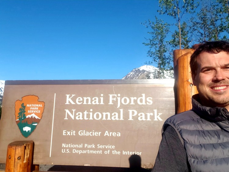
Boring sign, but PROOF!
Kenai Fjords National Park is one of the 8 in Alaska, and one of only three that are accessible by road. This park is one of the lesser visited in the country at a mere 350,000 visitors on average, but is only behind Denali and Glacier Bay in Alaska. The part of this park that you can actually step foot in is accessible only by one road about 7 miles long off of the Seward Highway. This is maybe 6 miles short of Seward proper. The other ways to access the park include taking cruise tours or water taxis into the actual fjords of the park, or by taking a couple different helicopter options, all out of Seward.
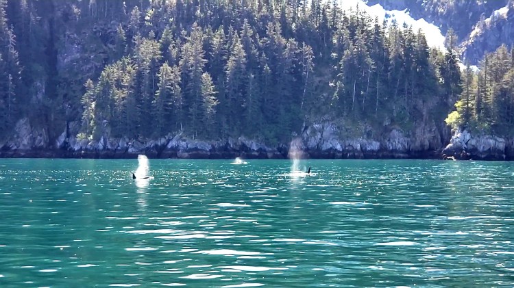
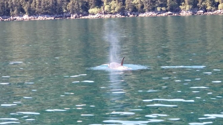
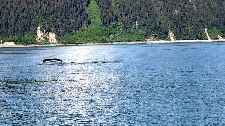
For this trip I had planned to do a cruise and a hike. The helicopter stuff is relatively short and very pricey, like 400 bucks for 30 minutes! The cruise I selected was the Kenai Fjords National Park Tour operated by Kenai Fjord Tours. This is a 6 hour cruise and very much worth the 150 or so dollars! The captain and staff are awesome and explain all the wildlife seen and explain everything relevant to the trip! It was very soon into the tour that we saw our first humpbacks, and not too long after that we saw orcas, bald eagles, and otters. We also saw a lot of golden seals chilling on rocks on the way out!
THREE ORCAS! The captain explained this was a mom and two kids. Dad was around also, but I was unable to get all 4 in one shot! I snagged this off of my phone video!
Another view of one of the orcas, and this one might have been dad. How neat! I am sure all the other critters in the water were not nearly as impressed!
Humpback Whale Tail! I guess you never really see any more of them that this or a bit of their back/blowhole.
Seals. It is a phone after all!
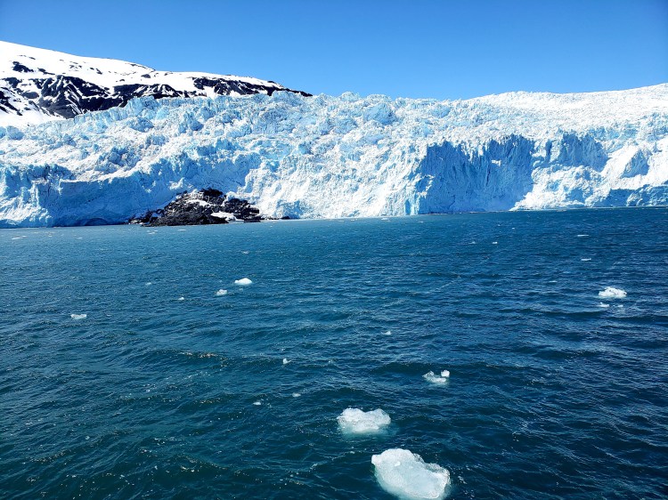
The air was super warm for Alaska, but with the speed of the vessel and the water temperature, when we were moving it was COLD! Even though it was brutally hot in my layers on shore, I was very glad I had them on the boat! Also, the waters were very very choppy, and at the speed this boat was going it was a roller coaster! In any event, we did see a lot of wildlife and we eventually got to our destination, the Aialik Glacier, one of the glaciers that meets the sea at the end of one of the fjords in the park. This was really neat! The captain was super knowledgeable in describing everything and explaining how the glacier was retreating and how they can determine age based on when plant life starts growing again along the moraines (the left over piles of dirt and rock left by glaciers in retreat). The glacier itself didn’t actually look all that impressive on approach but as we got closer it is pretty big! It’s about a mile and a half wide, three and a half miles long up to the icefield and about 400 feet above the water where it meets the sea. Our boat got close enough to hear the cracks of the glacier and many chunks of ice broke off while we were there. The entire bay here was filled with floating ice and the crew even captured chunks and brought them up for for use to touch (spoiler alert: felt like ice from my freezer!). One interesting tidbit is that since the glacier is in retreat, a new island is actually being “born” out of the ice! That’s cool to see! A quick check on wikipedia shows an image in 2009 where none of the new island is visible at all…and you can see how much is now visible in my picture! Alarm bells! The only disappointing thing about this trip was we didn’t see the famous Spire Cove. The crew member I spoke to said it was captain’s discretion based on time and sea conditions. I think we spent too much time looking for whales and it was cut. Booo. But all good, still a fantastic trip!
Aialik Glacier from a bit of distance.
Close up view, and the “birthing” of the new island!
Iceberg, right ahead!
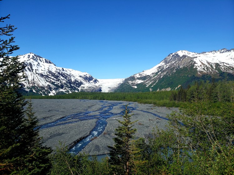
The next day I got up pretty early and went into the park entrance and visitor’s center. The road parallels a glacial outwash basin and the braided rivers running within. The road is about 7 miles long to the park entrance. After the first mile or so there is really nothing at all other than a couple trail heads that are technically part of the national forest there and some access points to the outwash basin. At some point on the drive you can get a good from-a-distance view of the famed Exit Glacier. Alarms bells continue to sound! The last mile or so of the drive into the visitor center parking lot includes signage indicating the glacial extent since about 1890. This glacier has retreated a LOT in a very rapid time frame, more on that shortly.
The drive into the park gives this view! Well, note the entire drive, this part is actually Exit Glacier from afar, but the road parallels this outwash basin the entire way.
This is more of the view. Pano…they aren’t really good for anything I guess!
So, 120 years ago this entire area was under the ice of Exit Glacier. This spot isn’t even to the visitor center yet. And then it is another couple miles from there to the where the glacier currently is.
This park is very pretty, but it is very primitive. There is a visitor center and one bathroom (running water oddly enough!) There are no snacks, drinks, etc to purchase either. Make sure you use the restroom and bring plenty of water. Probably best to come with a full belly as well. This is extreme moose and bear country. Bears have a hell of good nose and I wouldn’t even let food in a car out here! When I got there, the parking lot was filled with my car and 2 others! Eek! I started walking the trail past the visitor center and there was a sign that said there was an injured grizzly in the area and to be smart. It was utterly silent and there were no signs of people anywhere! I actually went down the path a bit and turned back due to being spooked! I was not really sure what to do, but I was going to wait to see some people! When I got to the visitor center again, a tour bus filled with people, including the lady I met on the cruise the previous day, got off. They were only there for like 30 minutes, but I decided to tag along and we all went along the tourist friendly trail.
This trail is pretty accessible and flat. Part of it is even paved if you want to walk that direction (it’s a loop). There is a simple viewing shelter set up that has a view of nothing but brush but if you read the information signs there you can see that the shelter was built in 1987 and at that time the terminus of the glacier was literally right there. Now it’s nowhere near there! The signage indicating the years the glacier reached that particular point continued all along this trail. This entire hike took maybe an hour to explore.
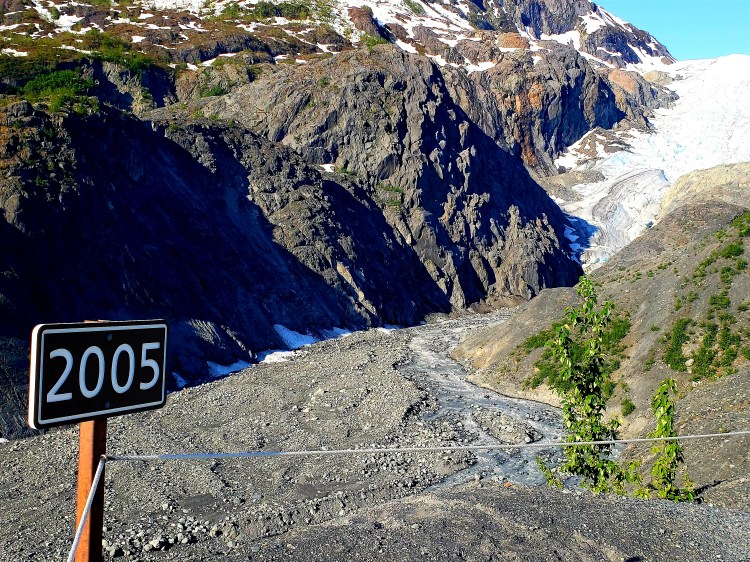
The sun kind of made this not so great of a picture. But for context, maybe 1 mile behind me is the glacier. In front is where this glacier used to be. Even though there are no signs visible here, the spot literally right at the bottom of this picture was where the glacier was in 2000. This entire valley was filled with ice only 100 years ago. That’s insane.
Nuts. In relation to the picture right above, I merely turned around and took this shot. Apparently, I missed a picture of the 2014 sign (I think it was 2014, and it might be in a video somewhere that I missed) but that sign is on that right side rock. And then the distance from there to the bottom of the glacier has happened in 7ish years. This glacier will be gone very soon.
I had a reservation in Seward for the sealife center for around 2 and it was now only about 9.30. There was one other trail, the “legit” trail that leads all the way up to the icefield, called the Harding Icefield. I wasn’t really prepared to do it. The day before someone working the visitor center when I stopped in for some recon (looked like a volunteer) said I would need snow gear, which I didn’t have. However, on this morning, I spoke directly to a ranger. He looked at my trusty Columbia hiking shoes, said they were good enough, make sure I had a hiking pole, and I could make it about halfway to a spot called the Marmut Meadow which gives the best up close views of the glacier at just a little above eye level. This trail….gorgeous vistas. Stunning really. This hike is not easy by any stretch. The entire length that I did was uphill. And eventually you are hiking through some pretty sketchy snow areas. The mileage to this point was about 3.5 miles with 1300 feet of elevation gain. And, because it was in the 70s, it was melting. Of course, the snow is not actually on the ground, it’s on top of bent over plantlife, so your foot can easily go through not only the snow, but then the rest of the way until it hits something hard and stops, which includes things that are not flat and easy on the old legs! Anyway, eventually I made it to that Marmot Meadows spot. I stopped a bit early and didn’t think going further was smart, but then about 10 or 15 people passed me and I saw how they went, so all was good and I continued. The meadow spot was a rock outcrop with great views of the glacier and, I assume, a beautiful meadow under all the snow. I stopped, had a beer, took many pictures and videos and just soaked it in for a moment! From this spot, it was turn around or continue up the mountain to the icefield, which would be about 2 more miles and entirely under snow. Nope. No thanks. The hike down through the snow was not pleasant at all but I made it with no injuries, somehow. And that was it for exploring the park, mostly!
Me, at Marmot Meadows in front of the top of the terminus of Exit Glacier. Some nice fellow hikers offer to take this picture. That vest I am wearing? Absolutely unnecessary. It was super warm … hence the glacier retreating like mad :(.
I did return to the visitor center later that evening, and also early the following morning. Coming back through at about 10 PM I saw a moose running through the outwash and, well, that’s not normal, so I stopped, got out and watched as mama moose apparently decided to be a better mom and was running to rescue her baby who was stuck in the rocks in the rushing river, VERY FAR AWAY, and was in quite a bit of trouble. There were some people across the street at a KOA who were out there as well and we all kinda followed a bit. The mama and baby eventually made their way up to the road right in front of me and I hurried my butt back to my car before mama got annoyed. Then I got some nice pictures from the safety of the car :). The following morning, as I came toward the entrance of the park I saw a moose come out in my rear mirror. I pulled a quick turn around and tried to get a shot, but she went into the brush. I turned around again to go back toward the entrance and it happened! TWO grizzly kids came running out across the road RIGHT IN FRONT OF ME. I got the best national park sign ever with those two, and so made a perfect ending to my adventure in Kenai Fjords National Park!
Baby had a close call with the Circle of Life.
BEST EVER NATIONAL PARK SIGN PICTURE! Hands down!
Overall impressions: It’s Alaska. It’s remote. It’s wild. It’s amazing. Part of the awesomeness of this area is that which is Alaska. The whole area is phenomenal. That being said, you are limited to two hikes, one of which is pretty easy and the other which is pretty hard, and to boat tours. The park is gorgeous to be sure, but you will probably find yourself doing as many or even more things outside the park area than in the park proper. And that’s ok, the whole area is awesome!
The Adventurer Final Word: Giving this one 4.5 stars! It’s phenomenal but a little small in scope of activities for the run of the mill tourist!
Hey adventurers! I am still working on my Alaska entry, but in the meantime I am excited to introduce the new “thing” I alluded to a while back! The Sidekick and I have started a brand new Facebook Group: Bark Rangers of the U.S. National Parks. What you’ll want to do is click on that link and hit the join button! We are looking to create an active and thriving group of people who want to share their pictures, adventures, and info on visits to dog friendly parks (not just national parks, but also national forests, and local parks as well) in the US!
Bark Ranger Bella and I recently hit several spots in the Southeast. I will have a specific post for those shortly but for now I am going to just shares some pics!
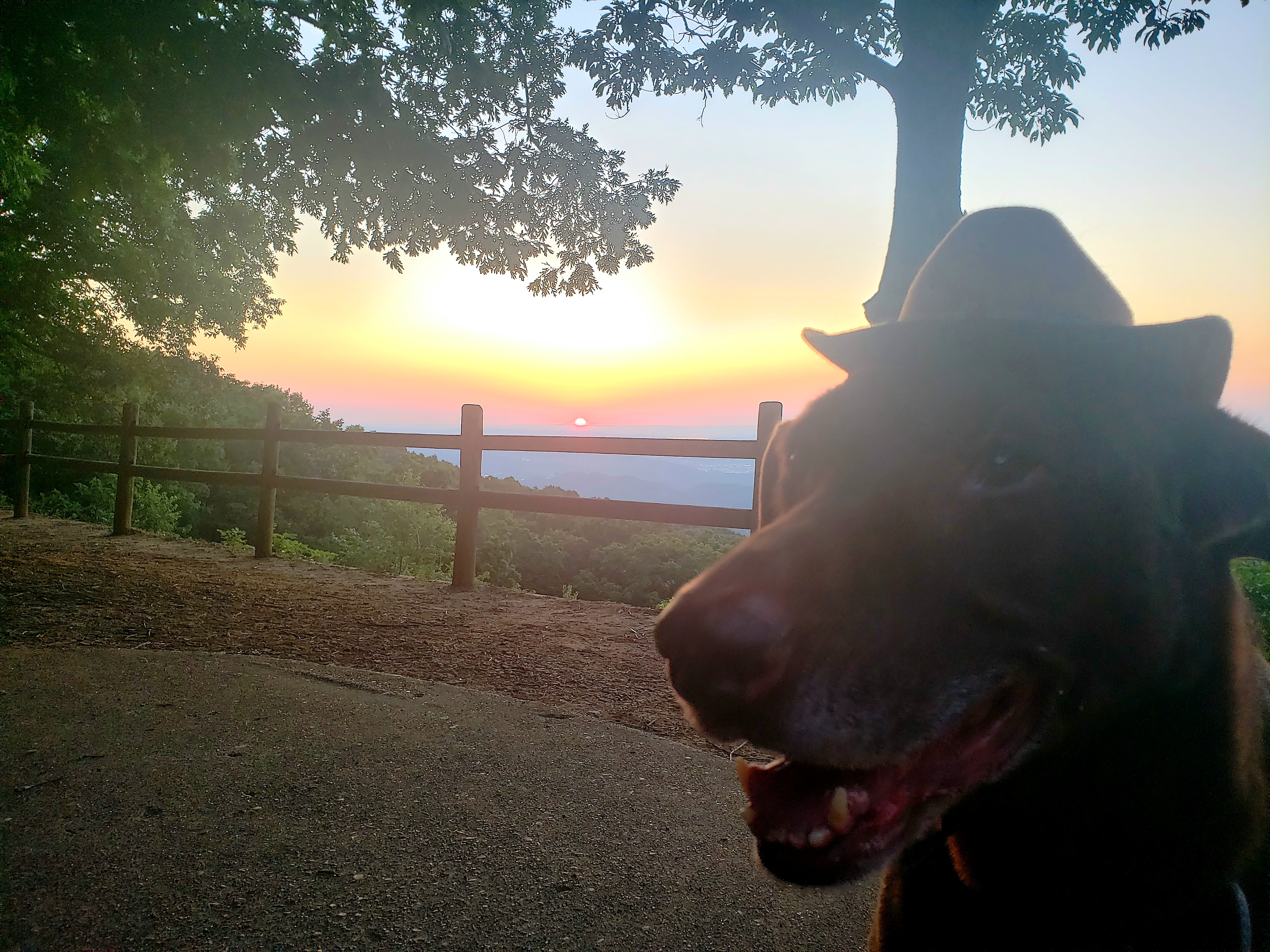
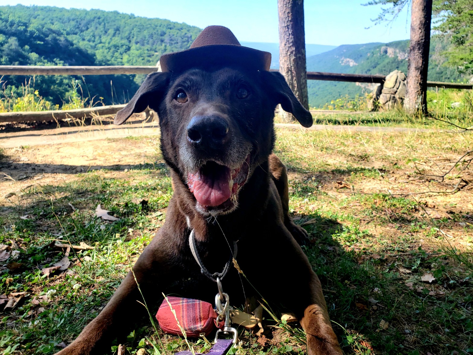
First we checked out Cloudland Canyon State Park. This is a neat place on Lookout Mountain outside of Chattanooga, TN, but technically in Georgia. It surprised me to find out this was on Lookout Mountain, but it’s a very loooong mountain. Anyway, I got a few awesome pics of my baby bark ranger girl! Fyi, she wears her hat like a pro and has no issues with it!
In love with the side eye in this picture!
Full disclosure, this one required a treat!
Stone River National Battlefield. This one is basically in Murfreesboro, TN and protects Civil War battlegrounds.
Chickamauga & Chattanooga National Military Park. This one is on top of Lookout Mountain, overlooking Chattanooga. The specific spot is called Point Park.
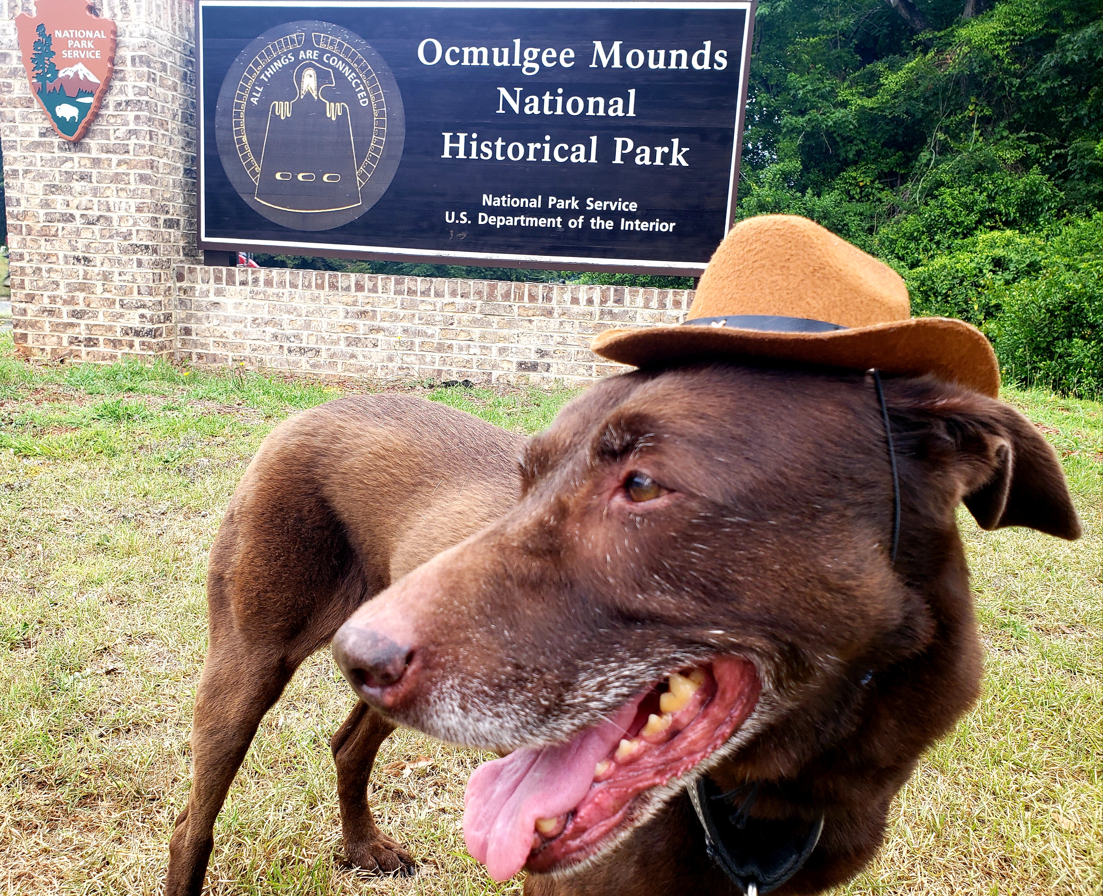
Next up was Ocmulgee Mounds National Historic Site. This is in Macon, GA and protects native mounds and lands dating back more than 10 THOUSAND YEARS.
I like this one, because the sign is super cool. The bird is the same design as the bird sculpted into the clay floor (original) of a structure called the Earth Lodge.
Andersonville National Historic Site. This site located in Andersonville, GA, is the site where 35,000 Union Soldiers were imprisoned, and many buried in what is now an active National Cemetery.
The end of our tour was a stop at the Jimmy Carter National Historic Site in Plains, GA. Bark Ranger Bella was a little tired and both of us were being chased and eaten by bugs…so pictures were not the best of her, BUT I got a cute one of her on a spot that Future President Carter carved his name into concrete at the spot he grew up!
Be sure to go to the new page and join for more info and pictures from people all around the country! See you there!
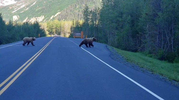
So yesterday’s adventure took us from Seward, eventually back to Anchorage. Here’s a little sample of what happened! Today’s adventure takes me on a bush plane to Lake Clark National Park. I’ll hopefully have an update tomorrow!
Best sign pic yet!A waterfall back in GirdwoodHey bear!The 4 above were all at Portage Lake, near Whittier. The 3 below were all in the same general area, as well!
The three above were all along the Byron Glacier Trail. The glacier is actually above my head and to my left (my right side).